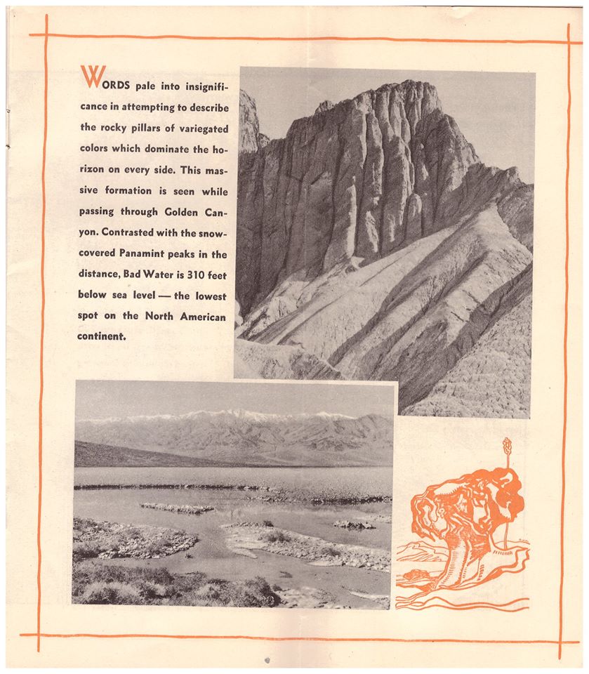
If you’re wondering whether the Mojave Desert is shaped more by nature or human influence, the answer is a combination of both. However, nature has had the predominant role for much longer.
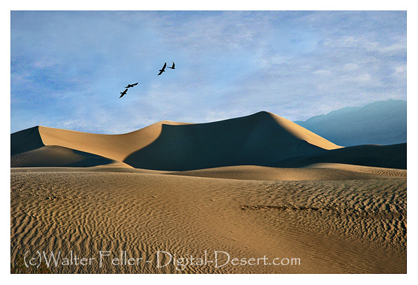
Over millions of years, nature has carved out the Mojave, sculpting its landscapes through the forces of wind and water. It has created mountain ranges, valleys, and ancient lakebeds, setting the stage with extreme temperatures, limited rainfall, and hardy plants and animals that have adapted to survive in this challenging environment. Species like Joshua trees, creosote bushes, bighorn sheep, and sidewinder rattlesnakes have all found a way to thrive in a land where survival is not guaranteed.
In contrast, humans have made their mark in a much shorter timeframe. Indigenous peoples, such as the Chemehuevi and Mojave, lived sustainably in the region, moving with the seasons and utilizing the land’s resources without depleting them. Later, settlers, miners, ranchers, railroad builders, and modern developers added further layers of change. Some areas, like Las Vegas, military installations, and sprawling solar farms, have undergone significant transformation. In contrast, other regions remain relatively untouched, preserving their raw, ancient beauty.
So, is the Mojave a product of nature or nurture? Nature formed it, while humans have made adjustments—sometimes respecting its limits and other times pushing them. Regardless of how much we build or alter the landscape, the desert continues to adhere to its own rules. Flash floods serve as reminders of the power of water, sand dunes shift and reclaim the land, and scorching summer temperatures demonstrate who is truly in charge.
A cloaca is an opening in some animals, like birds, reptiles, and amphibians, where the digestive, urinary, and reproductive systems come together. It’s like a multi-purpose exit, handling waste and reproduction. In most mammals, these functions are separated into different exits, but in animals with a cloaca, everything comes out of the same spot.
Three short, sad notes the Mourning doves call to each other from bunches of thick green leaves in the cottonwood trees. The heat pushes up the canyon, and the bright sun chases the shadows into themselves the way a mirage disappears as you approach.
Boots crunched softly in the thick sand along the trail and spotted lizards dart frantically in the low scrub. The pointed ears of a coyote catch your attention as it leaps over a clump of gray grass to pounce on a squirrel eating a seed. A tortoise marches on steadfastly and fearless in his search for a mate. A cottontail nibbles on a juicy young leaf and listens closely to every scratch and pop.
The late morning finally gives way, and high noon approaches as bold as a bully. The air is clear and hot. The sun burns the back of your hands, bringing salt to your dry lips. Your forehead tingles; you push the brim of your hat back and tilt your head forward a bit to keep your face in the shade.
Nestled in the El Paso Mountains, Cudahy Camp is a historical landmark in the early 20th-century mining industry. From 1923 to 1947, this site was the primary source of pumice used to manufacture ‘Old Dutch Cleanser,’ a widely known cleaning product in the United States. At its peak, the camp employed 12 men who produced 100 tons of pumicite weekly. Today, visitors can explore the remnants of the camp, including concrete foundations and large hollowed-out rooms from the mining operations.
The Evolution of Old Dutch Cleanser
Old Dutch Cleanser’s journey began in 1905 when the Cudahy Packing Company, a meatpacking firm, developed the product to repurpose animal fat. The cleanser, made by combining soap with pumicite, quickly became a household staple due to its effectiveness. The brand’s logo, featuring a Dutch woman chasing dirt with a stick, symbolized cleanliness and helped the product gain widespread recognition.
In the 1920s and 1930s, Old Dutch Cleanser was heavily promoted through advertisements and civic events like “Clean-Up Week,” encouraging community participation in cleaning efforts. These campaigns solidified the product’s place in American homes and contributed to its lasting legacy.
Corporate Changes and Present-Day
In 1955, Purex acquired Old Dutch Cleanser from the Cudahy Packing Company. The brand changed hands again in 1985 when Greyhound Corporation’s Dial division purchased Purex. Despite these transitions, Old Dutch Cleanser remained a trusted cleaning product. It is manufactured by Lavo in Montreal and continues to uphold its reputation for quality (6/2024).
Last Chance Canyon: A Scenic and Historic Site
Last Chance Canyon, part of the El Paso Mountains, is a significant historical and natural site. It offers a unique glimpse into the area’s rich mining history, including the famous Burro Schmidt Tunnel. The canyon features a rugged landscape with geological formations, box canyons, and historical mining sites. This area was heavily mined from the 1890s through the 1920s, with various operations continuing into the late 20th century.
Visitors to Last Chance Canyon can explore the remains of mining camps, such as Bickel Camp and the Holly Ash Mine, alongside the Old Dutch Cleanser mining site. The canyon is also known for its beautiful scenery, including rock-walled sandy canyons and spectacular layered cliffs.
Cultural Significance and Enduring Legacy
Old Dutch Cleanser has significantly impacted American culture, from being featured in popular media to becoming part of civic traditions. Its memorable branding and consistent advertising have made it a recognizable name in household cleaning. The El Paso Mountains and Last Chance Canyon now serve as historical sites, offering a window into the past for those interested in industrial history and heritage.
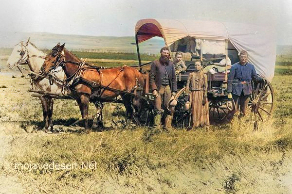
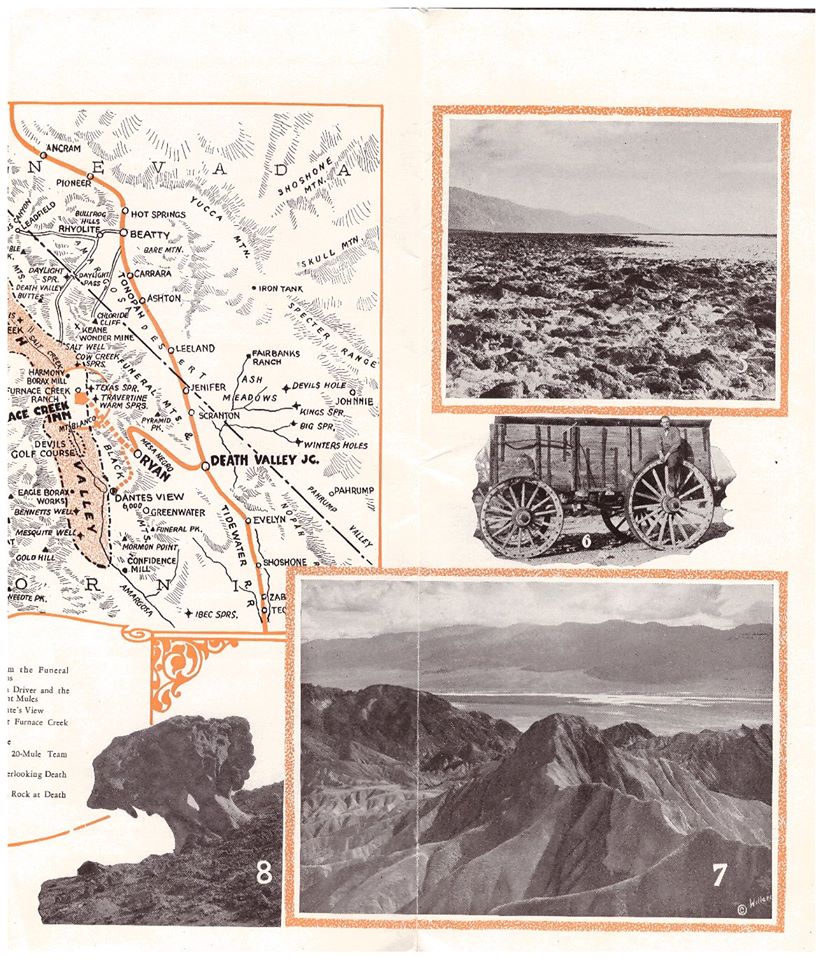
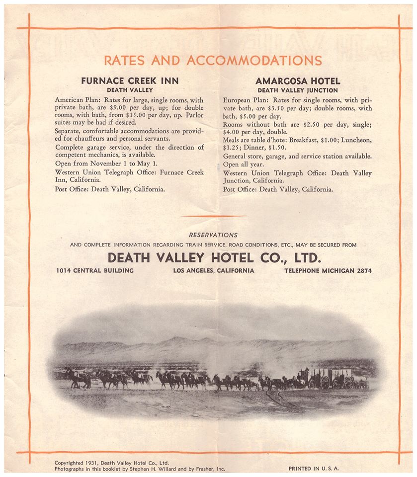
Covered wagons significantly impacted the United States’ westward expansion during the 18th and 19th centuries. These wagons, often called “prairie schooners,” were designed to transport goods and settlers across the North American continent.
Family & covered wagon (prairie schooner)
Key features and uses of covered wagons included:
Design: Covered wagons typically had a wooden frame with a canvas cover. This cover protected the contents from weather elements like rain and sun. The wagon bed was usually made of wood and was about four feet wide by ten feet long.
Cover: The cover was made of canvas or similar durable cloth, stretched over hooped frames, providing shelter and goods for the occupants.
Wheels: The wheels were often large and designed to handle rough terrain. The front wheels were usually smaller than the rear wheels, allowing easier turning.
Draft Animals: Oxen, mules, or horses were commonly used to pull these wagons. Oxen were preferred for their strength and endurance, especially over long distances.
Role in Expansion: Covered wagons were essential for westward migration in the U.S. They carried settlers’ belongings, including tools, food, and sometimes even passengers. These wagons were a vital part of the movement to settle the American West and were commonly seen on trails like the Oregon Trail, the Santa Fe Trail, and the California Trail.
Living Quarters: The covered wagon was a temporary home for many settlers traveling west. Families would cook, eat, sleep, and spend much of their time in or around the wagon during their journey.
Historical Significance: The image of a covered wagon crossing the plains has become an iconic symbol of American frontier life, representing the pioneer spirit, exploration, and the challenges of frontier life.
The use of covered wagons declined with the advent of railroads, which offered a faster and more efficient means of transporting goods and people across the country. However, their legacy remains an integral part of American history and folklore.
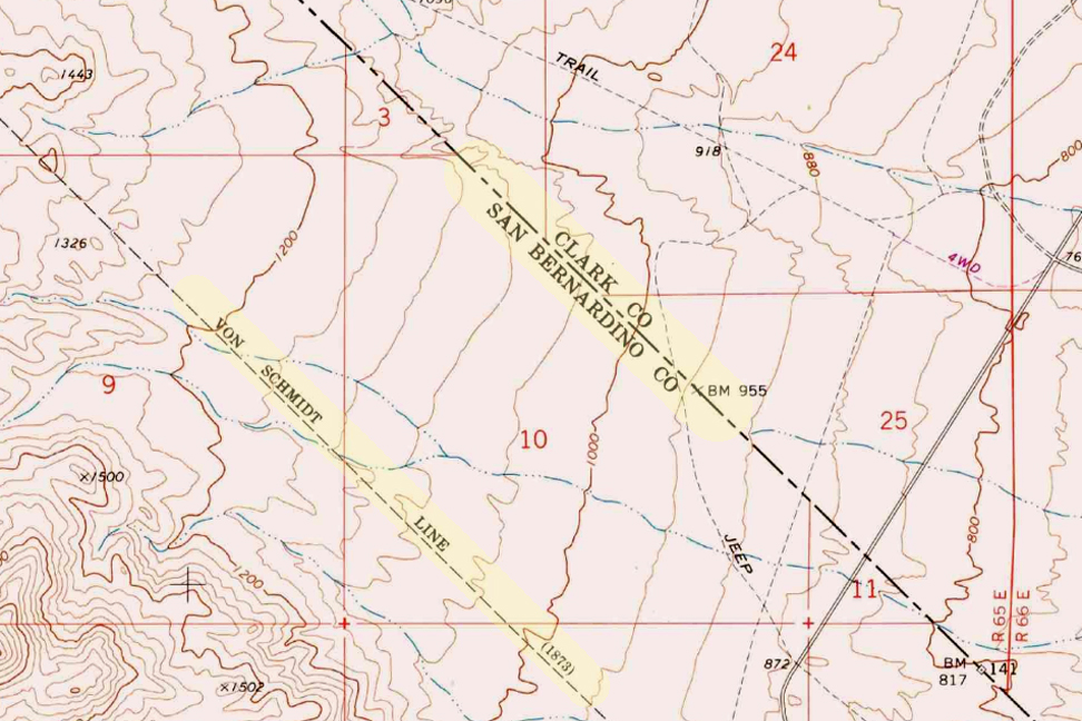
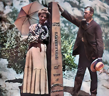
The Von Schmidt boundary, or the Schmidt Line, refers to a historical boundary line in California. It was surveyed and established by Alexey von Schmidt, a Russian engineer, in the 1860s. The purpose of the Von Schmidt boundary was to delineate the border between California and Nevada during a time when there was confusion and disputes over the exact location of the state boundary.
Von Schmidt’s survey helped clarify the boundary and resolve conflicts between California and Nevada. His efforts included placing markers and monuments along the boundary line to make it clear and permanent. The boundary he established still exists today and is the official border between the two states.
The Von Schmidt boundary is of historical significance and has been preserved as a reminder of the surveying and boundary disputes of the past. It is located in the eastern part of California near the Nevada border.
Why was the initial boundary incorrect?
The initial boundary between California and Nevada was incorrect and subject to disputes for several reasons:
Lack of Accurate Surveys: In the early years of California’s statehood and during the Gold Rush era in the mid-19th century, limited resources and technology were available for accurate land surveys. As a result, the initial surveys and boundary markers were not precise.
Rush for Mineral Resources: The discovery of gold and other valuable minerals in the region led to a rapid influx of settlers and miners. This rush created a need for clear land boundaries and property rights. However, the focus was often on extracting resources rather than conducting precise surveys.
Overlapping Claims: Different parties, including miners, settlers, and land speculators, had conflicting claims to land in the region. These overlapping claims added to the confusion regarding the exact location of the state boundary.
Political Disputes: California became a state in 1850, and shortly thereafter, disputes arose over its eastern boundary. Nevada was not established as a separate territory until 1861. Political disagreements and conflicting interpretations of earlier treaties and agreements existed during this period.
Multiple Surveys: Various individuals and surveyors attempted to establish the boundary, but their surveys often differed. This further complicated matters.
Given these factors, there was much uncertainty and disagreement regarding the California-Nevada boundary in the early years. It was only through the efforts of surveyors like Alexey von Schmidt and subsequent legal and political resolutions that the boundary was eventually clarified and accepted. Von Schmidt’s survey work played a crucial role in resolving these disputes and establishing a more accurate boundary line.
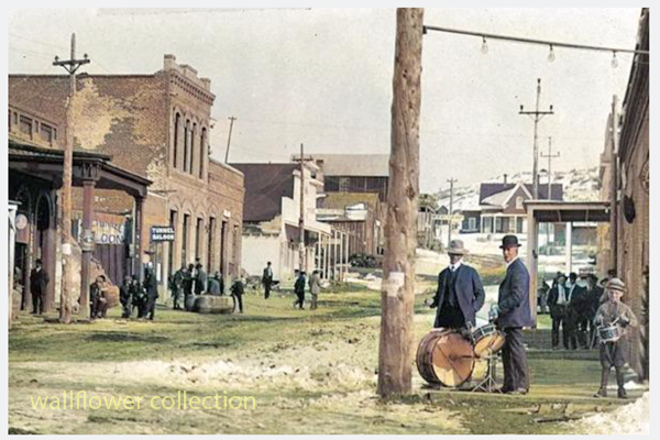
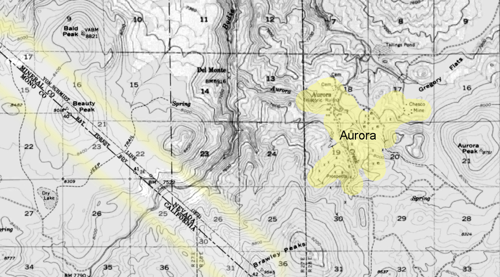
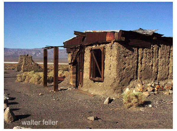
Aurora
Aurora, Nevada 1910
The town of Aurora, Nevada, experienced a move due in part to the boundary disputes between California and Nevada. Aurora was originally founded in the 1860s during the Nevada Silver Rush. At its founding, the exact location of the California-Nevada border was still uncertain and subject to disputes.
Aurora moved to make sure it was in Nevada.
As a result of the boundary disputes and the fact that Aurora’s initial location was close to the border, there were concerns about which state’s jurisdiction the town fell under. Aurora’s residents and businesses moved the town slightly to the east, further into Nevada’s territory, to avoid potential legal and tax issues. This move ensured that Aurora would be firmly within the boundaries of Nevada when the border dispute was eventually resolved.
The relocation of Aurora was a strategic decision made to secure the town’s status as part of Nevada rather than California, given the uncertainties and conflicts related to the state boundary at the time. This move allowed Aurora to thrive as a mining town in Nevada without the legal complications associated with straddling the border.
Is everybody happy?
It’s difficult to determine whether “everybody” is happy, as people’s feelings and satisfaction with their circumstances can vary widely. Happiness is subjective and depends on individual experiences, perspectives, and circumstances.
In the context of the town of Aurora’s relocation due to boundary disputes, it’s possible that the decision to move was made to address specific legal and jurisdictional concerns at the time. The move may have been necessary for the town’s continued growth and prosperity. However, whether every resident or stakeholder was happy with the decision would depend on their perspectives and interests.
In any community or population, there will be a range of opinions and emotions regarding significant decisions like a town’s relocation. Some may have been happy with the move because it resolved legal uncertainties, while others may have been less pleased due to the disruption and changes associated with relocation.
To determine the current happiness or satisfaction of people in a specific context, it would be necessary to conduct surveys or interviews to gather their perspectives and opinions.
The Mojave Desert is known for its rich history of mining and the presence of ghost towns and abandoned mines. Here are some notable ghost towns, sites, and gold and silver mines in the Mojave Desert:
Calico Ghost Town: Located near Barstow, California, Calico is one of the most famous ghost towns in the Mojave Desert. It was a thriving silver mining town in the late 1800s but became abandoned when the silver market declined. Today, it’s a well-preserved tourist attraction.
Rhyolite, Nevada: Rhyolite was once a booming gold mining town in the early 1900s. It had over 5,000 people but was quickly abandoned when the mines played out. You can visit the remains of the town and see the famous “Bottle House” made of glass bottles.
Goldfield, Nevada: Goldfield was another prosperous gold mining town in Nevada. It had a peak population of around 20,000 people in the early 1900s. The Goldfield Hotel and several historic buildings still stand today.
Panamint City, California: This remote ghost town in Death Valley National Park was a silver mining town in the late 1800s. It’s accessible via a challenging hike and offers stunning views of the surrounding desert.
Cerro Gordo, California: Cerro Gordo is an old silver mining town still privately owned. It’s located in the Inyo Mountains and has a well-preserved ghost town, including a general store, bunkhouse, and other structures.
Mines in the Mojave Desert: The Mojave Desert is home to numerous gold and silver mines, many of which are abandoned. These mines contributed to the region’s mining history. Some notable mines include the Tonopah-Belmont Mine, the Desert Queen Mine, and the Goldstone Mine.
Remember that exploring abandoned mines can be dangerous due to unstable structures and the presence of toxic gases. It’s essential to exercise caution and, if needed, seek permission or guidance from local authorities or landowners when visiting these sites. Additionally, some ghost towns and mines may be on private property, so be respectful of any access restrictions.
A long interaction history between people and the challenging desert environment marks the human (historical) geography of the Mojave Desert. Here are key aspects of the human history and settlement patterns in the Mojave Desert:
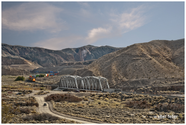
The construction of railroads, such as the Southern Pacific Railroad, was crucial in connecting the Mojave Desert to the broader transportation network.
Railroad towns, including Barstow, developed as important transportation hubs.
The historic Route 66, a major U.S. highway, passed through the Mojave Desert during the mid-20th century, bringing increased traffic, commerce, and tourism to the region.
Establishing national parks and preserves, such as Joshua Tree National Park and the Mojave National Preserve, reflects efforts to conserve the desert’s unique ecosystems and landscapes.
Modern Urbanization and Recreation:
Urban areas on the periphery of the Mojave Desert, such as Las Vegas, have experienced rapid growth.
The desert attracts tourists and outdoor enthusiasts interested in hiking, rock climbing, and stargazing.
Understanding the human history of the Mojave Desert involves recognizing the diverse ways different groups have interacted with the desert environment over time, from indigenous peoples adapting to the harsh conditions to the various waves of exploration, settlement, and economic activities that have shaped the region.
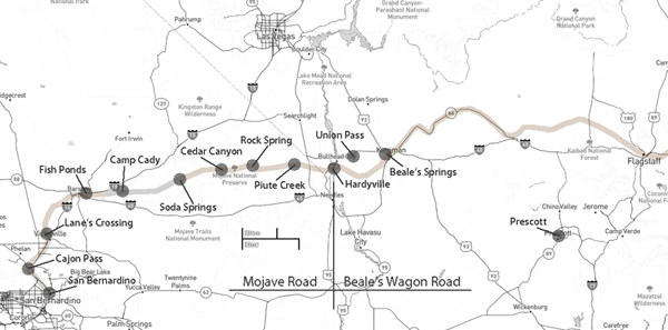
Mojave Road and Beale’s Wagon Road are historic routes in the southwestern United States, particularly in the Mojave Desert region. Here’s some information about each:
The Mojave Road is a historic trail that traverses California’s Mojave Desert. It was a significant route used by Native Americans, Spanish missionaries, and later by American pioneers and traders.
The trail is approximately 138 miles long and extends from the Colorado River near present-day Needles, California, to the Mojave River near present-day Barstow, California.
It was primarily used for transportation and trade between the Colorado River and the coastal settlements in California. The trail passes through varied desert landscapes, including sandy stretches, rocky terrain, and mountainous areas.
Beale’s Wagon Road, named after Edward F. Beale, a military officer and explorer, was a trail developed in the 19th century for the U.S. Army to improve communication and transportation across the arid lands of the American Southwest.
Edward F. Beale surveyed and established the road in the late 1850s. The road ran from Fort Defiance in Arizona to the Colorado River, passing through present-day Arizona and California.
Beale’s Wagon Road was designed to be more reliable and accessible than other trails, facilitating military movement and communication between California and the western territories.
Mojave Road and Beale’s Wagon Road were important in the United States’ westward expansion. Today, these routes attract history enthusiasts, adventurers, and off-road enthusiasts who explore them to experience the challenges faced by those who traveled these paths in the past. Keep in mind that conditions and accessibility of these trails may vary, so it’s important to check for current information and any regulations before embarking on a journey along these historic routes.