A beautiful fence lizard basks in the gentle warmth of early Spring at Tin Can Point. See inset of the Chantry Flat – Mt. Wilson Trails map, below, to see where this point is. As of this writing, a cold wet pacific storm is dropping nearly six days of chilly rain and snow in much of the San Gabriel mountains. Big Santa Anita Canyon dam has received over 5 1/2″ of rain in the last week. Something I just learned recently about these Western Fence lizards is that their populations have the effect of reducing the incidence of Lyme’s disease in the ticks that live in the chaparral, such as found covering much of the slopes of the Big Santa Anita Canyon! Apparently, a protein in the lizard’s blood kills the bacterium in the tick’s gut, which is good news for hikers and even their dogs during the spring and autumn months.
Like most reptiles, Western Fence lizards hibernate, at least for a little while each winter throughout their habitats which are wide-spread throughout California. As for food, these lizards eat spiders and various insects such as mosquitos, beetles and grasshoppers. The females lay several small clutches of eggs (3-17) in the spring, the young emerging in the summer.
On your next hike out from Chantry Flats, watch for for lizards flitting about on the trails and sunning themselves on the myriad stretches of rock. As for the various types of reptiles to be found in the Big Santa Anita, Western Fence lizards are abundant and deserve a place in the sun!
The recent death of Wyatt Earp (Wyatt died January 13, 1929) recalls to mind the part he played in the claim jumping expedition to Searles Lake in October 1910. At the time I was Acting Receiver for the California Trona Company and was in charge of a group of placer mining claims covering some 40,000 acres. The party had been organized at Los Angeles by Henry E. Lee, an Oakland attorney and probably was the best equipped gang of claim jumpers ever assembled in the west. It consisted of three complete crews of surveyors, the necessary helpers and laborers and about 20 armed guards or gunmen under the command of Wyatt Berry Stapp.
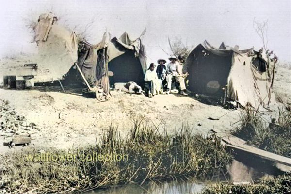
The party of 44 in number, arrived at Searles Lake in seven touring cars and established a camp at the abandoned town of “Slate Range City” about eight miles southeast of the company’s headquarters. On the morning following their arrival we saw some of the surveyors across the lake and our foreman road over and ordered them off the property but they paid no attention to his protest an proceeded to do a very thorough job or surveying and staking.
As I considered it necessary to make some show of force in protecting our claims, I visited the enemy’s camp at sunrise the next day with our whole force of five men who were armed with all the weapons they could collect. It was a very critical moment when we jumped from our wagon and walked up in front of the mess house where the raiders were assembled for breakfast. I stood in the center with my boys on either side of me. There was a shout and men came running from all directions and fearing there might be trouble.
I started right off to explain to the surveyors present that I had only come over to give notice that I was officially and legally in possession of the claims and that they were trespassers.
Before I got very far a tall man with iron grey hair and a mustache pushed his way to the front and in a loud voice demanded why I had come into their camp with armed men. At the same time he grabbed hold of my shotgun held by the boy on my left and attempted to take it away from him. At this attack upon us I drew an automatic and ordered him to let go. He did so and then ran to a building nearby saying “I’ll fix you.” Before he could secure a rifle, however, the cooler headed members of the party surrounded him and calmed him down. Also, you may be sure every effort was made to prevent a fight, as, in spite of our bold being, we were pretty badly scared.
Just as things seemed to have quieted down, one of the excited jumpers accidentally discharged a gun. No one was hurt but, it was a very tense moment for all of us. Having failed to dislodge the enemy the following day I called for a US Marshall and when he arrive the claim jumpers were all arrested and sent home including “Wyatt Berry Stapp”, none other than the famous Marshall Wyatt Stapp Earp.
San Francisco Call, Volume 108, Number 151, 29 October 1910
SODA CLAIMS SEIZED BY BAND 0F ARMED MEN
United States Marshal, Elliott received a telegram yesterday from Deputy Marshal Fred Burling, in Los Angeles, stating that 24 armed-men had seized the properties of the California Trona Company near Johannesberg. A receiver has been placed in charge of the 40,000 acres of soda claims pending the decision of a suit by the Foreign Mines development company against the Trona Company for $200,000.
Deputy Marshal Burling was sent out to serve papers on certain persons alleged to be interfering with the receiver.
Los Angeles Herald, Volume 33, Number 28, 29 October 1910
GUNMEN PROTECT BORAX LAKE PROPERTY
Methods Used in Oil Fields Are Applied to Country Held by Borax Outfit
SEARLES, Cal., Oct. 28. — Borax Lake, located in the northwest corner of San Bernardino County, is again the scene of a claim jumping struggle. A party of armed men, thirty-five in number, with automobiles, led by a man named Splat, of Los Angeles, have entered the property of California Trona company and are surveying and locating over the locations of the Trona company which has just finished assessment work costing $25000.
This is the same property on which Charles Davidson of Oakland perished last June while leading a claim jumping expedition for the same property. The property is now in charge of a receiver of the United States court who notified the jumpers to desist. They replied by show of arms and refused. The United States marshal is now on his way to the scene of trouble.
The automobiles are in charge of Chauffeur M, C. Vorney and are numbered 24145, 32783, 36991, 37404 and 29487.
Names of locators are: H. C. Fursman, W. Hull, R. Wagmire, P. Perkins, H. A. Baker, E. Thompson, D. Smith, T. W. Pack. Witness, E. A. Rasor.
The Foreign Mines and Development company has a mortgage of $250,000 on this property. A sale is pending in |the east, said to be on a $1,000,000 basis.
The Mojave Desert, located in the southwestern United States, is a vast, arid region known for its unique and resilient ecosystems. Its natural history can be divided into several key aspects:
Geology and Geography: The Mojave Desert has varied topography, including valleys, dunes, and mountains. It is home to the famous Death Valley, the lowest and one of the hottest places in North America. The Mojave’s geological history includes volcanic activity, the formation of mountain ranges, and the erosion that created its present landscapes.
Climate: This desert is known for its extreme temperatures and aridity. Its high temperatures vary day and night due to the lack of humidity and sparse cloud cover. Rainfall is scarce and unpredictable, often leading to drought conditions.
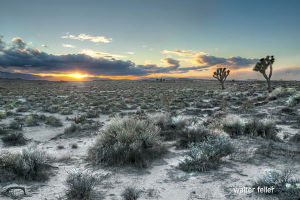
Flora and Fauna: The Mojave Desert supports a range of life adapted to its harsh conditions. Notable plants include the Joshua tree (Yucca brevifolia), symbolic of the Mojave, and various cacti and shrubs adapted to survive with minimal water. Animal life includes reptiles like the desert tortoise, mammals such as the bighorn sheep, and numerous bird species that navigate the challenging environment.
Ecological Dynamics: The ecosystems of the Mojave are shaped by limited water resources and extreme temperatures, leading to unique interactions among species. Plants and animals have evolved various adaptations for survival, including water conservation mechanisms and nocturnal activity patterns.
Human Impact and Conservation: Human activity has significantly impacted the Mojave Desert. Issues include water resource extraction, urban expansion, and the development of renewable energy installations. Conservation efforts are ongoing to protect its biodiversity and landscape, with areas like the Mojave National Preserve established to safeguard habitats and natural features.
Cultural History: The desert has been inhabited by Native American tribes for thousands of years, each with rich cultural histories and connections to the land. More recently, it has played a role in American history through mining, military use, and as a site for artistic and literary inspiration.
The Mojave Desert’s natural history is a complex tapestry of geological, climatic, biological, and human factors, making it a fascinating subject for study and exploration.
The Berkeley Library, specifically the University of California, Berkeley Library, has extensive resources and collections that provide a comprehensive view of California’s history. Here are key aspects related to the history of California as reflected in the Berkeley Library’s collections:
Early History and Colonization: The library holds materials on the early exploration and colonization of California, including the impact of Spanish missions, the lives of Native Californian tribes, and the region’s integration into the Spanish empire and later Mexico.
Gold Rush and Statehood: There is a wealth of information on the California Gold Rush of 1849, which was a pivotal event in American history, drawing thousands to the state and leading to California’s rapid admission to the Union in 1850.
Economic and Social Development: The library’s collections cover the development of California’s economy, including the rise of the agricultural, entertainment, and technology sectors. It also houses materials on social movements, immigration, and the diverse cultures that have shaped California.
Environmental History: Given California’s diverse ecosystems, the Berkeley Library has significant resources on the environmental history of the state, including water use and management, conservation efforts, and the impact of human activities on the landscape.
Political History: The collections include materials on California’s political history, from its early days as a part of Mexico, through its statehood, and into its role as a trendsetter in American politics, including the Progressive Era, civil rights movements, and contemporary political issues.
University of California History: As part of the UC system, the Berkeley Library also has materials on the history of the University of California and its role in the educational and cultural development of the state.
These collections are used by researchers, students, and the public to study and understand the complex history of California. The Berkeley Library serves as a vital resource for those looking to explore the many facets of California’s past and its impact on the present and future.
The region’s earlier history includes the town of Carrara, established to support marble quarrying, which began in 1904. Despite initial optimism, the marble’s quality and economic factors led to the quarry and the town’s decline.
The “Elizalde Cement Plant” in Nevada has historical significance. It was established in the early 20th century to supply cement for Hoover Dam construction. The Elizalde Company built the plant and operated when the American Southwest underwent significant industrial and infrastructure development.
After the completion of the Hoover Dam, the demand for cement decreased, leading to the plant’s closure. The remnants of the Elizalde Cement Plant now stand as a testament to the region’s industrial history, attracting historians and enthusiasts interested in the area’s development and the broader story of American industrialization.
The Elizalde Cement Plant, located in Nevada, has a history tied to industrial ambitions and unforeseen setbacks. Incorporated in November 1940 as the Carrara Portland Cement Company, it aimed to produce standard gray and special white cement, utilizing crushed marble from the nearby Carrara quarry.
Incorporated in November 1940 as the Carrara Portland Cement Company, it aimed to produce standard gray and special white cement, utilizing crushed marble from the nearby Carrara quarry. By April 1941, construction was in full swing, with an estimated daily output planned for 80 tons of cement. However, a devastating fire in July 1941 destroyed significant parts of the plant, halting progress. Despite efforts to rebuild and expand, World War II’s fuel rationing ultimately doomed the plant, which never became operational.
By April 1941, construction was in full swing, with an estimated daily output planned for 80 tons of cement. However, a devastating fire in July 1941 destroyed significant parts of the plant, halting progress. Despite efforts to rebuild and expand, World War II’s fuel rationing ultimately doomed the plant, which never became operational.
The Elizalde Cement Plant was supposed to mark a new industrial phase, but it became a relic of unfulfilled industrial aspirations, now an intriguing ruin in the desert landscape.
OpenAI. (2024). ChatGPT (4) [Large language model]. https://chat.openai.comhttps://www.nvexpeditions.com/nye/elizalde.php https://nvtami.com/2023/05/09/ghost-towns-of-beatty/
The 1785 Land Ordinance provided that all federal land would be surveyed into townships six miles square. Townships are subdivided into 36 one-mile-square sections. Sections can be further subdivided into quarter sections, quarter-quarter sections, or irregular government lots. Each township is identified with a township and range designation. Township designations indicate the location north or south of the baseline, and range designations indicate east or west of the Principal Meridian. A meridian is an imaginary line running north to south.
1861 Central Pacific Railroad is incorporated.
1862 President Abraham Lincoln signed the Pacific Railway Act, a law that authorizes the federal government to give land grants and loans to aid construction of the Central Pacific Railroad as the Western part of the Transcontinental Railroad and the Union Pacific as the Eastern part.
1863 Central Pacific begins construction at Sacramento.
1864 The United States Congress passes the Pacific Railway Act of 1864, which doubles the land grant to 20 alternate sections per mile, with a 20 mile checkerboard corridor on each side of the right-of-way.
1865 Central Pacific Railroad establishes a Land Department in Sacramento. Benjamin B. Redding, former mayor of Sacramento, was chosen to lead to design and manage the new organization.
1866 The Pacific Railway Act is amended to allow a railroad to select lands outside of the land grant area in exchange for unavailable land grant land.
1866 The federal government gives Southern Pacific Railroad a land grant to complete the western section of the Atlantic & Pacific line through California via Mojave to Needles.
1867 First land patent is issued to the Central Pacific Railroad by the federal government.
1868 September 25: The Central Pacific Railway owners acquire control of the Southern Pacific Railroad.
1869 The California & Oregon Railroad receives a federal land grant to build a line northward from Davis to connect to the Oregon & California Railroad at the California and Oregon border.
1869 The Central Pacific Railroad begins operating the California & Oregon Railroad.
1869 The Golden Spike ceremony held at Promontory, Utah, marks the completion of the transcontinental railroad between Sacramento, California and Omaha, Nebraska.
1870 California & Oregon Railroad is consolidated with the Central Pacific Railroad, and becomes a branch line of the Central Pacific Railroad.
1871 The federal government gives the Southern Pacific Railroad land grants and loans, allowing it to build to meet the Texas & Pacific at Yuma, California and build from Los Angeles to Colton, California.
1875 The Southern Pacific Railroad opens a land agency in San Francisco. 1876 Jerome Madden, Benjamin Redding’s assistant, became the land agent for Southern Pacific.
1886 Southern Pacific Company assumes control of the Oregon & California Railroad.
1899 The Central Pacific Railroad is reorganized as the Central Pacific Railway in order to pay off its federal debt.
1912 The Southern Pacific Company transfers some of its remaining land assets to Southern Pacific Land Company.
1916 Oregon & California grant lands are returned to the Federal Government.
1927 Southern Pacific purchases the Oregon & California Railroad.
1984 The Southern Pacific Company merges with Santa Fe Industries, parent company of the Atchison, Topeka & Santa Fe Railway, to form Santa Fe Southern Pacific Corporation (SPSF).
1985 The Interstate Commerce Commission (ICC) denies permission for the railroad operations to merge.
1986 Appeal of the ICC ruling fails.
1986 The renamed holding company, the Santa Fe Pacific Corporation, retains all of the non-rail interests of both companies except one. All of the Southern Pacific Railroad California real estate holdings are transferred to a new holding company, Catellus Development Corporation.
1996 The Southern Pacific Railroad is acquired by Union Pacific Railroad and its operations cease.
2005 Catellus Development Corporation is merged into ProLogis, another land development company based in San Francisco. ProLogis remains one of the largest real estate holders in California.
California State Railroad Museum Library and Archives https://oac.cdlib.org/institutions/California+State+Railroad+Museum+Library+and+Archives
Barstow, California. Intermodal freight transport involves the transportation of cargo in an intermodal container or vehicle, using multiple modes of transportation (e.g., rail, ship, and truck) without any handling of the freight itself when changing modes. This system reduces cargo handling, improves security, reduces damage and loss, and allows freight to be transported faster.
Barstow is a significant hub in the intermodal network due to its strategic location along major freight rail lines and highways. It facilitates the transfer of goods between different transportation modes, playing a critical role in the logistics and distribution chain, especially between major ports and inland destinations across the United States.
The history of the Barstow Intermodal facility is closely tied to the development of transportation infrastructure in the Barstow area, which has long been a key junction point for major rail and road routes.
Railway History: Barstow’s role as a transportation hub began with the railroad. The area became a key railway center in the late 19th and early 20th centuries with the arrival of the Atchison, Topeka, and Santa Fe Railway (now part of the BNSF Railway). This established Barstow as a critical point in the transcontinental rail network, facilitating the movement of goods across the country.
Intermodal Development: The concept of intermodal transport—moving goods in the same container or vehicle by multiple forms of transportation—gained popularity in the mid-20th century. Barstow’s strategic location made it a natural choice for developing intermodal facilities. The Barstow Intermodal facility allows for efficient transfer of containers between trains and trucks, optimizing the transport of goods to and from the ports of Los Angeles and Long Beach and across the wider United States.
Economic Impact: Over the years, the intermodal facility has played a significant role in the economic development of Barstow and the surrounding region. It has created jobs, spurred the growth of logistics and support industries, and contributed to the local economy by facilitating efficient and cost-effective transportation of goods.
Expansion and Modernization: The facility has continuously expanded to accommodate the growing demand for intermodal transport. Technology, infrastructure, and equipment investments have enhanced its capacity and efficiency, allowing it to handle larger freight volumes and adapt to changing transportation needs.
The history of Barstow Intermodal reflects the broader trends in transportation and logistics, showcasing the evolution from rail-centric freight movement to integrated, multimodal transport systems that support the dynamic flow of goods in a globalized economy.
Penn Phillips was a real estate developer known for his work in various parts of the United States, including Hesperia, California. Born M. Penn Phillips, he was a prominent figure in the mid-20th century, recognized for developing planned communities. In Hesperia, he was instrumental in transforming the area from a rural community into a more developed suburban area. Phillips was known for his aggressive marketing strategies and development projects that often included building infrastructure and amenities to attract residents and investors to the areas he developed. His impact on Hesperia and other towns he developed is still evident today in the layout and infrastructure of these communities.
What other towns was Penn Phillips involved with developing?
Penn Phillips developed several towns across the United States, particularly in the 1950s and 1960s. Some of the notable towns and communities he developed include:
California City, California: Perhaps his most ambitious project, California City, was intended to be one of the largest cities in California, with Phillips investing heavily in infrastructure and marketing to attract residents and businesses.
Coos Bay, Oregon: Phillips was known for his development work in the Coos Bay area, significantly impacting the local economy and landscape.
Boron, California: Similar to his work in other towns, Phillips aimed to transform Boron into a thriving community through extensive development projects.
Salton City, California: On the shore of the Salton Sea, Phillips attempted to develop Salton City as a resort community, capitalizing on its unique location and potential for tourism.
Phillips’ approach to development often involved buying large tracts of land, creating basic infrastructure, and then promoting the areas aggressively to attract residents and businesses. His legacy is mixed, with some of his projects turning into successful communities, while others, like California City and Salton City, did not fully realize the grand visions he had planned.
Was Phillips and Mendelsohn together in California City?
Yes, Penn Phillips and Nathan Mendelsohn were indeed associated with the development of California City, California. While Penn Phillips was a prominent real estate developer known for his work in various communities, Nathan Mendelsohn, a sociology professor turned developer, was the main force behind California City’s development.
Mendelsohn purchased the land and envisioned a new city that would become a significant community in the Mojave Desert. He planned and developed the infrastructure, plotting streets and laying out residential, commercial, and industrial areas to attract residents and businesses. Penn Phillips, known for his development projects in other areas, was also involved in the real estate development aspect of California City. However, Mendelsohn was the primary developer and driving force behind the city’s creation and initial development.
Their collaboration in the development of California City was part of the larger trend of ambitious planned communities in post-war America, where developers sought to create new cities and communities from scratch in undeveloped areas.
Was Phillips a con man?
Penn Phillips had a reputation that some considered controversial, and some accounts label him as a con man, particularly in his real estate dealings. He was known for his aggressive and sometimes deceptive marketing strategies. Phillips would often sell land in undeveloped areas, promising potential buyers that these would become thriving communities with various amenities and infrastructure. However, in some cases, the promised development and amenities were not fully realized, leaving buyers with worthless plots of land.
For example, in his development projects, Phillips was known to sell plots of land through high-pressure sales tactics, often exaggerating the potential for growth and development. Buyers sometimes found themselves owning land in remote areas with little to no development, far from the bustling communities they were led to expect.
While Phillips was undoubtedly a successful developer in some respects, creating legitimate and thriving communities, his methods and the outcomes of some of his projects led to a mixed legacy. The perception of him as a con man stems from these practices, where the reality did not always meet the expectations he set for his investors and buyers.
Did Newton Bass in Apple Valley ever work with Penn Phillips?
Newton Bass and Penn Phillips were prominent real estate developers in California’s high desert region. Still, they are generally associated with different communities, and no well-documented collaboration exists between them. Newton Bass was one of the key figures in the development of Apple Valley, California, while Penn Phillips was known for his work in places like Hesperia and California City.
Both men were active during the mid-20th century and were instrumental in the development of the Mojave Desert area, but they operated largely independently of each other. Bass, alongside his partner Bud Westlund, developed Apple Valley into a thriving community, promoting it as an ideal place to live with a focus on quality of life and community amenities.
While both Bass and Phillips had similar careers in developing new communities in California’s desert regions, there is no significant historical record of them working together on a development project. Their approaches to development and the communities they built were distinct, reflecting their individual visions for high desert living.
–
Were there any other city developers in the Mojave Desert at the time?
Besides Penn Phillips and Newton Bass, other developers were active in the Mojave Desert area during the mid-20th century. These developers also played significant roles in shaping the region’s landscape and communities:
Bud Westlund: Partnered with Newton Bass in developing Apple Valley; Westlund was instrumental in promoting and building the community alongside Bass. They worked together to create a desirable living environment that attracted residents and businesses to the area.
Ray Ryan: Involved in developing Indio, California, and other areas in the Coachella Valley, Ryan was a notable figure in the real estate and oil industries. His contributions to the region’s development were significant, although controversy and connections to organized crime also marked his career.
Mervyn Dymally: While more known for his political career, Dymally was involved in various development projects in the Mojave Desert region, particularly in the Antelope Valley area. His work in real estate and politics intersected as he contributed to the growth and development of the area.
George Alexander and H.L. Waliser: They were involved in developing Victorville and the surrounding areas. Their efforts helped shape the growth and structure of these communities in the high desert.
These developers, among others, contributed to transforming the Mojave Desert from a sparsely populated area into a region with growing towns and communities. Each brought their unique approach to development, impacting the economic and social landscape of the desert region.
In the Lancaster and Palmdale areas of the Mojave Desert, several developers played significant roles in shaping the growth and development of these communities. Some of the notable figures include:
M. Leroy Gilleland: Gilleland was an early developer in Palmdale, playing a crucial role in its development during the mid-20th century. He was instrumental in promoting the area and attracting residents and businesses.
Tom Carrell: Along with his partner, Carrell was a significant figure in the development of Lancaster. They were responsible for much of the residential and commercial development in the area, contributing to Lancaster’s growth and structure.
Jack Kyser: Kyser was a key player in the economic development of the Antelope Valley, including Lancaster and Palmdale. His efforts in regional planning and economic development helped shape the future of these cities.
Fritz Huntsinger: Involved in industrial and commercial development in Palmdale, Huntsinger played a vital role in the city’s economic growth, contributing to its status as an important industrial and aerospace hub.
These developers, among others, were pivotal in transforming Lancaster and Palmdale into the significant urban centers they are today in the Antelope Valley region. Their contributions included residential, commercial, industrial, and aerospace developments, reflecting the diverse economic base of the area.
The Mormon Battalion was a unique military unit in American history, formed during the Mexican-American War in 1846. It consisted of about 500 Latter-day Saints (Mormons) volunteers. This battalion was the only religiously based unit in United States military history and was recruited to help the U.S. secure new territories in the American West.
The battalion was mustered in at Council Bluffs, Iowa, and marched nearly 2,000 miles to San Diego, California, one of the longest military marches in history. The journey helped to open new wagon routes in the West and was instrumental in the settlement and development of the region. The battalion never engaged in battle but faced hardships like disease, lack of provisions, and challenging terrain.
The Mormon Battalion is significant for its military contribution and impact on the westward expansion and settlement of the United States, particularly in Utah and California. Its members helped to establish communities and build infrastructure in the West after their military service ended.
After their discharge in 1847, members of the Mormon Battalion played a significant role in the history of the Mojave Desert and the broader American West. Their journey and subsequent activities helped to establish and improve trails across the desert, facilitating the movement of people and goods.
Some of the discharged members of the Mormon Battalion, along with other Mormons, were instrumental in developing the Southern Route, also known as the Mormon Road, through the Mojave Desert. This route later became critical for settlers moving to California, especially during the Gold Rush. They improved the trail, making it more passable for wagons, and established supply stations along the way, vital for the survival of travelers crossing the harsh desert environment.
Additionally, these battalion members engaged in early exploratory and settlement activities. They were among the first U.S. citizens to extensively travel through and document the Mojave Desert region. Their efforts contributed to the mapping of the area and provided valuable information about resources and potential settlement sites.
Their work in the Mojave Desert facilitated westward expansion and laid the groundwork for future economic development in the region, including mining, agriculture, and transportation. Through their endeavors, the discharged members of the Mormon Battalion left a lasting legacy in the development of the American Southwest.