Barstow & the National Old Trails Road

Barstow, California, has a significant historical connection to the National Old Trails Road, which was key in developing the American road transportation system. The National Old Trails Road, also known as the Ocean-to-Ocean Highway, was established in the early 20th century and stretched from Baltimore, Maryland, to California, ending in Los Angeles. This road was one of the earliest transcontinental highways and was instrumental in promoting automotive travel and the development of roadside infrastructure across the United States.

Barstow’s Role
/notr/

Barstow emerged as an essential stop along the National Old Trails Road due to its strategic location at the junction of several key routes. It lies at the crossroads of the Mojave River Valley, where the Salt Lake Trail, the Mojave Road, the Old Spanish Trail, and later, the railroad routes converge. This made Barstow a crucial hub for transportation and logistics, connecting the eastern parts of the country with the West Coast.

Development and Impact
/barstow-ca/

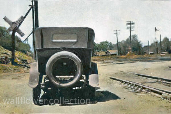
With the rise of the automobile, Barstow became a popular stopover for travelers traveling across the country. The town provided essential services such as lodging, fuel, and vehicle repairs, which helped support its local economy. The presence of the National Old Trails Road also encouraged the development of other infrastructure, including the famed Route 66, which was aligned with parts of the Old Trails Road.

Route 66 and Beyond
/route-66/

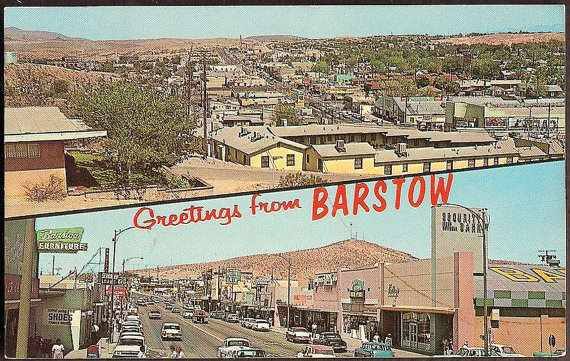
In 1926, with the establishment of the U.S. Highway System, much of the National Old Trails Road was incorporated into U.S. Route 66. Barstow continued to thrive as a key stop along Route 66, attracting tourists and travelers with its diners, motels, and other attractions tailored to the road-tripping public.

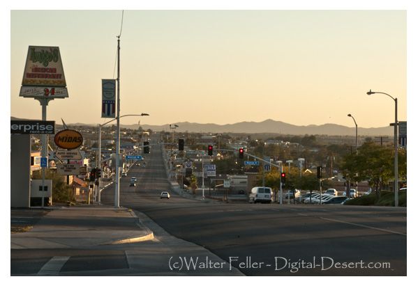
Today, Barstow celebrates its rich transportation history through museums and cultural sites that highlight its role in the era of cross-country travel. The town serves as a gateway to regional attractions and continues to honor the legacy of the National Old Trails Road and Route 66.

Barstow

What would it have been like to live on the edge of the desert wilderness between 1850 and 1870?

Life in the Barstow, Daggett, and Calico area between 1850 and 1870 would have been characterized by the challenges and opportunities of frontier living and the influence of the California Gold Rush.

During this period, the area was an important outpost along the Mojave Road, a major trade route connecting southern California with the rest of the Southwest. Barstow, Daggett, and Calico towns would have seen a steady stream of pioneers, settlers, and traders passing through, seeking respite, supplies, and companionship on their journeys.

Life in the area would have been challenging, as settlers and travelers had to contend with harsh desert conditions, extreme temperatures, and limited resources. The towns would have offered essential services such as food, water, lodging, and blacksmithing, providing a lifeline for those passing through the unforgiving landscape.

The California Gold Rush of the late 1840s and 1850s also impacted the area, as prospectors and miners flocked to California for their fortunes. The discovery of gold and other minerals in the region brought settlers and entrepreneurs to the area, leading to mining camps and boomtowns.

Life in the mining camps and towns would have been marked by hard work, uncertainty, and camaraderie as people came together to build communities and seek their fortunes in the California desert. The mining industry played a central role in shaping the area’s economy and society, with miners facing dangerous working conditions and fluctuations in the market for minerals.

Overall, life in the Barstow, Daggett, and Calico area between 1850 and 1870 would have been characterized by the challenges and opportunities of frontier living. The towns served as vital outposts, providing essential services and support to pioneers and settlers seeking a better life in the American West.

1871 – 1900

The introduction of the railroad to the Barstow, Daggett, and Calico area between 1871 and 1900 would have significantly impacted the region’s life and economy.

The railroad would have facilitated the transportation of goods, materials, and people to and from the mining towns, making it easier to access the area and transport resources in and out. This would have boosted the local economy and helped the mining industry thrive by providing a more efficient means of transportation for the minerals extracted from the mines.

The railroad also brought an influx of new settlers and businesses to the area, further contributing to the growth and development of the towns. The increased connectivity provided by the railroad would have helped the communities in the area become more integrated with the rest of the region and the broader economy.

Life in the mining towns between 1871 and 1900, with the presence of the railroad, would have been marked by increased economic activity, improved infrastructure, and enhanced opportunities for trade and commerce. The towns would have become more connected to the outside world, allowing for exchanging goods, services, and ideas.

The railroad would have also influenced social life in the towns, bringing new cultural influences and experiences to the area. The increased mobility provided by the railroad would have allowed for more interaction between the residents of the mining towns and the wider world, enhancing the diversity and vibrancy of the communities.

Overall, the introduction of the railroad to the Barstow, Daggett, and Calico area between 1871 and 1900 would have been a transformative event, shaping the region’s economy, society, and culture and contributing to the growth and prosperity of the mining towns during this period.

1901 – 1926

Life in the Barstow, Daggett, and Calico areas between 1901 and 1926 would have been influenced by the region’s continued growth and development, as well as by significant historical events and social changes during that time.

  1. Railroad Expansion: The early 20th century saw further expansion of the railroad network in the area, with the Atchison, Topeka, and Santa Fe Railway playing a prominent role. The railroads continued to be a driving force in the local economy, facilitating the transportation of goods, people, and resources to and from the towns.
  2. Mining Industry: The mining industry remained a significant part of the economy during this period, with Calico continuing to produce silver, borax, and other minerals. The town experienced periods of boom and bust as the demand for minerals fluctuated, shaping the livelihoods of the residents in the area.
  3. Cultural and Social Changes: The early 20th century brought about changes in cultural and social norms, with new technologies, entertainment, and modes of transportation becoming more prevalent in the region. The towns would have been influenced by trends in popular culture and the influx of new residents and visitors to the area.
  4. World War I: The impact of World War I would have been felt in the Barstow, Daggett, and Calico areas, with residents likely affected by the war effort, rationing, and economic changes resulting from the conflict. The mining industry may have seen shifts in production and demand during this time.
  5. Prohibition and the Roaring Twenties: The period also saw the implementation of Prohibition in the United States, which may have had varying effects on the towns depending on their adherence to the ban on alcohol. The Roaring Twenties brought about changes in social customs, fashion, and entertainment that would have been reflected in the area’s communities.

Overall, life in the Barstow, Daggett, and Calico areas between 1901 and 1926 would have been a dynamic mix of economic, social, and cultural changes shaped by the continued growth of the region, historical events, and the evolving lifestyles of the people living in the American Southwest during this time.

1927 – 1940

Significant changes in transportation, economic conditions, and social dynamics shaped life in the Barstow, Daggett, and Calico areas between 1926 and 1940. The introduction of the National Old Trails Highway and later Route 66, followed by the onset of the Great Depression, would have had a profound impact on the communities in the region.

  1. Route 66 and Transportation: Establishing Route 66 as a major east-west highway in 1926 would have brought increased traffic, travelers, and commerce through the towns of Barstow, Daggett, and Calico. The highway served as a vital link between the Midwest and the West Coast, providing economic opportunities for businesses along its route.
  2. Impact of the Great Depression: The onset of the Great Depression in 1929 would have brought economic hardship to the area’s residents. The collapse of the economy, widespread unemployment, and financial instability would have affected the towns’ businesses, workers, and families, leading to struggles to make ends meet and maintain their livelihoods.
  3. Mining Industry and Agriculture: The mining industry in Calico and surrounding areas may have been impacted by the economic downturn, with fluctuations in demand for minerals and challenges in maintaining profitability. Agriculture in the region may have also faced challenges due to the Depression, affecting local farmers and growers.
  4. Migration and Transient Population: The economic conditions of the Great Depression may have led to an influx of migrants, transient populations, and “Okies” traveling along Route 66 in search of work and opportunities. The towns along the highway would have seen more transient populations passing through, seeking respite and resources.
  5. Community Support and Resilience: Despite the era’s challenges, the communities in Barstow, Daggett, and Calico would have likely come together to support one another, with local organizations, churches, and charities assisting those in need. Resilience, resourcefulness, and a sense of community would have been key in navigating the difficulties of the Great Depression.

Overall, life in the Barstow, Daggett, and Calico area between 1926 and 1940 would have been characterized by the transformative impact of Route 66, the challenges of the Great Depression, and the resilience of the communities in the face of economic hardship and uncertainty. The towns would have been part of a shifting landscape shaped by changes in transportation, economy, and society during this time period.

1941 – 1970

Life in the Barstow area between 1941 and 1970 would have been marked by significant historical events, economic changes, and social transformations that influenced the development and character of the region during this period. Here are some key aspects of life in the Barstow area between 1941 and 1970:

  1. World War II and Military Presence: The outbreak of World War II in 1941 would have profoundly impacted the Barstow area, as the town’s strategic location and proximity to military installations made it a hub for military activity. The nearby Marine Corps Logistics Base Barstow and the National Training Center at Fort Irwin would have brought a significant military presence to the region, influencing the local economy and community.
  2. Industrial Development: The post-war period saw the growth of industrial development in the region, driven in part by the construction of highways, such as Interstate 15 and Interstate 40, that passed through the Barstow area. The expansion of transportation infrastructure, including railroads and highways, facilitated the movement of goods and people through the region, contributing to economic growth.
  3. Population Growth and Urbanization: The period between 1941 and 1970 would have witnessed population growth and urbanization in the Barstow area as more people moved to the region searching for employment opportunities, particularly in the military, transportation, and logistics sectors. The town of Barstow would have experienced changes in its demographics and urban landscape during this time.
  4. Cultural and Social Changes: The post-war period brought about cultural and social changes in the Barstow area, influenced by trends in popular culture, music, and entertainment. The town would have been impacted by shifts in societal norms, technological advancements, and changing attitudes toward race and gender.
  5. Civil Rights Movement and Social Activism: The Civil Rights Movement of the 1960s would have resonated in the Barstow area as communities grappled with racial inequality, discrimination, and social justice issues. Residents may have participated in civil rights activism, protests, and movements for equality and justice during this period.
  6. Environmental Concerns: The growth of industrial activity and infrastructure in the Barstow area would have raised ecological concerns related to pollution, resource depletion, and land use. In response to these challenges, residents may have become more aware of the need for environmental conservation and sustainability.

Overall, life in the Barstow area between 1941 and 1970 would have been shaped by wartime mobilization, industrial development, population growth, cultural changes, social activism, and environmental considerations. The region would have been part of a dynamic landscape undergoing transformation and evolution in response to historical events and societal shifts during this time.

1971 – 2000

Living in the Barstow area from 1971 to 2000 would have been characterized by continued growth, industry changes, demographic shifts, and evolving social dynamics. Here are some critical aspects of life in the Barstow area during this period:

  1. Military Influence: The presence of military bases, such as the Marine Corps Logistics Base Barstow and the National Training Center at Fort Irwin, would have continued to shape the economy and community of the Barstow area. Military personnel and their families would have been a significant part of the population, contributing to the local economy and culture.
  2. Transportation Hub: Barstow’s strategic location at the intersection of major highways, including Interstate 15 and Interstate 40, would have solidified its role as a transportation hub. The town would have continued to serve as a stop for travelers, truckers, and tourists passing through the area on their way to Southern California destinations.
  3. Industrial and Economic Development: From 1971 to 2000, the Barstow area would have seen further industrial and economic development. The expansion of logistics, transportation, and distribution industries would have created job opportunities and attracted businesses to the region, contributing to local economic growth.
  4. Tourism and Hospitality: Barstow would have become a popular stopping point for tourists visiting attractions such as the Calico Ghost Town, the Mother Road Museum, and Route 66 landmarks. The hospitality industry, including hotels, restaurants, and retail shops, would have flourished to cater to visitors passing through the area.
  5. Environmental Awareness and Conservation: The Barstow area may have experienced increasing awareness of environmental issues and a growing emphasis on conservation and sustainability during the 1971 to 2000 period. Efforts to protect natural resources, preserve desert ecosystems, and promote responsible land use would have become more prominent in the community.
  6. Cultural Diversity and Community Life: The demographic makeup of the Barstow area would have continued to diversify, reflecting immigration, migration, and changes in population trends. Residents would have celebrated cultural diversity through community events, festivals, and activities that showcase different traditions and heritage.
  7. Technological Advancements: Advances in technology, communication, and digital infrastructure would have influenced daily life in the Barstow area. Residents may have experienced improved connectivity, access to information, and changes in how they interact with technology in their personal and professional lives.

Living in the Barstow area from 1971 to 2000 would have been characterized by a mix of military influence, transportation prominence, economic development, tourism opportunities, environmental awareness, cultural diversity, and technological advancements. The town would have continued to evolve and adapt to changing conditions while maintaining its role as a significant community in the high desert region of Southern California.

2001 – 2021

Life in the Barstow area from 2001 to today would have been characterized by further economic development, changes in industry, continued military presence, technological advancements, and ongoing efforts to address social and environmental issues. Here are some critical aspects of life in the Barstow area during this period:

  1. Economic Diversification: The Barstow area would have continued to diversify its economy beyond traditional industries such as transportation and military-related sectors. Efforts to attract new businesses, promote tourism, and support local entrepreneurship would have contributed to the region’s economic growth and job creation.
  2. Renewable Energy Initiatives: The Barstow area may have seen increased focus on renewable energy initiatives, such as solar and wind power projects, as part of efforts to transition towards sustainable energy sources and reduce reliance on fossil fuels. These developments would have created opportunities for green jobs and investment in clean technology.
  3. Infrastructure Improvements: Infrastructure projects, including upgrades to transportation networks, utilities, and public facilities, would have been implemented to support the growing population and economic activities in the Barstow area. Investments in infrastructure would have aimed to enhance connectivity, efficiency, and quality of life for residents.
  4. Military Training and Operations: The Marine Corps Logistics Base Barstow and the National Training Center at Fort Irwin would have continued to play a significant role in the community, providing training and support for military personnel and contributing to the local economy. Military exercises and operations conducted in the region would have influenced daily life for residents.
  5. Education and Healthcare Services: Access to education and healthcare services in the Barstow area would have been a focus of community development efforts. Schools, colleges, and medical facilities would have expanded to meet the needs of a growing population and ensure that residents have access to quality services.
  6. Community Engagement and Social Initiatives: Community organizations, non-profit groups, and local government agencies would have worked together to address social issues, promote inclusivity, and support community well-being. Initiatives related to youth programs, affordable housing, healthcare access, and cultural events would have enriched the social fabric of the Barstow area.
  7. Digital Connectivity and Innovation: Technological advancements in communication, digital infrastructure, and e-commerce would have influenced how residents in the Barstow area connect, access services, and engage with the broader world. Efforts to expand broadband access and promote digital literacy would increase connectivity and provide opportunities for residents.

Overall, life in the Barstow area from 2001 to today would have been shaped by ongoing economic development, infrastructure improvements, renewable energy initiatives, military activities, community engagement, technological advancements, and efforts to address social and environmental challenges. The region would have continued to evolve and adapt to changing conditions while maintaining its unique character and sense of community in the high desert of Southern California.

Barstow Index

Barstow California Area

digital-desert.com › barstow

Barstow Area. Barstow lies in the intersection of the three largest ecosubsections in the Mojave Desert; High Desert Plains & Hills (322Ag), Mojave Valley – …

Barstow, California

digital-desert.com › barstow-ca

Barstow 1890. Barstow is situated at the junction of the California Southern and the A. &. P. Railway, eighty-two miles from San Bernardino and twelve miles …

Kramer Junction (Four Corners) Mojave High Desert

digital-desert.com › kramer-junction-ca

3) Go west on the State Route 58 through Boron, Mojave or California City and up to Tehachapi and over the Southern Sierra. 4) Go east to Barstow. There is food …

Vanyume Indians

mojavedesert.net › vanyume-indians

Mojave Desert Indians – Map. Vanyume Indians. The Vanyume or Beñemé, as Father Garces called them, lived beyond and along much of the length of the Mojave …

Casa del Desierto

digital-desert.com › casa-del-desierto

Casa del Desierto – Harvey House. Barstow Harvey House and train station photo – Casa del Desierto Casa del Desierto: The Spanish for “House of the Desert” In …

Barstow, California – Notes

digital-desert.com › blog

Nov 4, 2023  Today, it remains an essential point of access and commerce for those traveling through the Mojave Desert in Southern California. Post Views: 12.

Goldstone, Barstow California, Mojave Desert

digital-desert.com › goldstone-ghost-town

Goldstone Ghost Town. More of a site than a ghost town, there are only a few scattered foundations and some rubble to be found. The area is now home to NASA’s …

History of Barstow the National Old Trails Road and Route 66

digital-desert.com › barstow-ca › moving-barstow

The Barstow yards are used jointly by the Santa Fe and Union Pacific and handily very considerable volume of the transcontinental traffic. Hence the railroad …

Barstow, Ca Historic Photos

digital-desert.com › barstow-ca › historic-photos

Burton Frasher photos of Barstow, California.

Barstow, California

https://digital-desert.com/barstow-ca/

.

  1. Early Inhabitants: The Barstow area was originally inhabited by Native American tribes, including the Mojave people, for centuries before European settlers arrived.
  2. Railroad History: Barstow’s modern history began with the arrival of the Atchison, Topeka, and Santa Fe Railroad in the late 19th century. The railroad played a significant role in the city’s development, as it was a vital stop on the transcontinental rail line, connecting the eastern United States to the West Coast.
  3. Water Stop and Rail Depot: Barstow served as an important water stop for steam locomotives, providing a place for trains to refill their water tanks in the desert. The city also became a key rail depot and maintenance facility.
  4. Name Change: Originally known as Waterman Junction, the city’s name was changed to Barstow in 1886 in honor of William Barstow Strong, a president of the Santa Fe Railroad.
  5. Route 66: In the early 20th century, Barstow became an integral part of the iconic Route 66, the “Main Street of America,” connecting Chicago to Los Angeles. The city thrived as a popular stopping point for travelers on this historic route.
  6. Military Presence: During World War II, Barstow’s population grew due to the establishment of the Marine Corps Logistics Base Barstow and the nearby Fort Irwin National Training Center, which continue to play significant roles in the local economy.
  7. Modern Times: Barstow remains a transportation center today, situated at the junction of Interstates 15 and 40. It continues to serve as a rest stop for travelers and a transportation and logistics hub for goods moving across the country.
  8. Historical Landmarks: The city has preserved its historical heritage, with several landmarks and museums, including the Route 66 Mother Road Museum and the Western America Railroad Museum, showcasing its rich transportation history.

Barstow’s history is deeply intertwined with the development of transportation networks, from the railroad to Route 66 and modern interstate highways. Today, it remains an essential point of access and commerce for those traveling through the Mojave Desert in Southern California.

The Stoddard Boys

Of all the brother acts operating in and around San Bernardino County during the Mormon period, Few accomplished more for the ultimate benefit of the area than the Stoddard boys, Arvin and Sheldon.

Neither cut an imposing figure. Arvin, the quiet one, was only 5’5″ tall and weighed 135 pounds soaking wet, while Sheldon wasn’t much larger.  But what they lacked in height, they more than made up in spirit.

Arvin, however,   had an imposing ally in his wife Caroline. She was 6 feet tall and weighed well over 200 pounds —  a formidable Amazon and an extremely vocal one too. One is tempted to ask if she carried him across the threshold on their wedding night.

She became Arvin’s mouthpiece and  did not hesitate to make her opinions known, particularly when the chips were down. As their grandson, R. Jackson Stoddard  wrote in the March 1970 issue of the LA Westerners Branding Iron, “For although she followed the will of her husband, in many cases the will of her husband was truly only a reflection of her own wants and desires.”

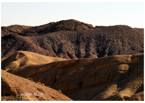
Stoddard Mountain

Today, a stretch of the Mojave Desert between Victorville and Daggett is blanketed with sites bearing the Stoddard’s names. They include the Stoddard Mountains, Stoddard Hills, Stoddard gulch, Stoddard Valley, Stoddard Well and Stoddard Wells Road —  all  directly attributable  to Arvin’s work in the area during the 1850s and 60s.

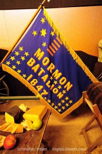
Flag of the Mormon Battailion (note spelling)

There were four Stoddard Brothers at the beginning; Rufus, Albert, Arvin and Sheldon, who were all born in Canada. When their father died in 1838, mother Jane gathered them all up and crossed the United States border, first to Ohio in then to Warsaw, Illinois, where she became hooked on the Mormon religion. When the church made it’s great trek to Salt Lake City in 1847, she and her boys were in the initial contingent.

Rufus was the first of the boys to reach California, arriving in San Diego as a member of the Mormon Battalion. After his group was disbanded in Los Angeles, he remained in the area for almost a year before he rejoining his family at Salt Lake City in 1849.

Sheldon was the next to go. Leaving Salt Lake in 1848, along with  30 other men found for the placer diggings near hang town, they traveled as far as Mountain Meadows with a larger company who hired Capt. Jefferson Hunt to guide them to Los Angeles over the Old Spanish Trail.

At the Meadows they left Hunt’s party and turned west to take what they thought was a shortcut to the gold fields and for the next 17 days blindly followed a false trail without a guide, compass or map to go by.

On the 18th day, hopelessly lost in facing death without water their lives were spared when a sudden rain squall drenched the area.   As Sheldon later wrote, “We caught the water by spreading out our rubber blankets on the ground and drank it with a spoon.”

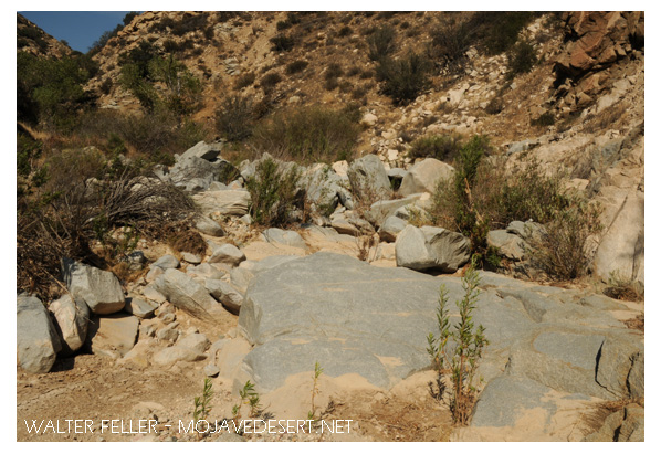
They then turned east on the Muddy River, followed at South until they fortunately encountered Capt. Hunt’s company again and accompanied it up the Mojave River, through Cajon Pass and down to the Chino Ranch.

Crowder Canyon – Old Spanish Trail

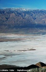
Tragically enough, on the same trip another group of would-be minors left Hunt’s command at Provo, Utah, insisting they also knew a shorter route to the gold fields, only to blunder into Death Valley, where five died before the survivors made it to Los Angeles.

Death Valley

From Chino the party went on to Mariposa, where they broke up to mine, while Stoddard ran a trading post in nearby Carson Valley  for a few months before returning to Salt Lake with a herd of horses and mules.

in March 1851 Sheldon married Jane Hunt, daughter of Capt. Hunt, and the following month they accompanied the first group of Mormon colonizers to the San Bernardino Valley, making temporary camp at Sycamore Grove.

After the Mormons purchased the San Bernardino Rancho that September, and moved down into the valley, Sheldon built the first  log cabin in the settlement on First Street,, west of I Street. His cabin was later moved to and made part of the Westside of this stockade constructed on the present courthouse site as protection against hostile Indians.

For the next 14 years Sheldon Stoddard was engaged in freighting and carrying mail between San Bernardino and Salt Lake City, crossing the Mojave 24 times in all. In 1865 he made one trip to Nevada in Montana with a mule team which covered  over 1300 miles, and took six months to complete.

Arvin Stoddard and his wife also came to San Bernardino with the first Mormon train and lived in the stockade for three years before receiving an urgent message from Mormon leader Brigham Young, authorizing him to investigate a gold strike in the Calico Hills to see if he could ” obtain as much gold as possible to help finance the founding and furtherance of the faith,”  keeping only enough to live on during the venture.

Calico Hills

Arvin and Caroline,  ardent church devotees, packed their wagon and with their poor young children in tow, headed for the hills without hesitation.

Mojave River at Afton Canyon

But before looking for gold, Arvin searched for water to raise crops to feed his family and stock and to flush through sluice boxes used to separate flakes of gold from the desert sand.

One of his more successful wells, known as Stoddard Well, is still flowing today and besides furnishing the family with ample water, also provided an impetus for others to break out a new road on almost a straight line from Lane’s Crossing,  near today’s Oro Grande, to Fish Ponds Station between present-day Barstow and Daggett, thereby saving many miles compared with the old route, which followed the westward band of the Mojave River.

Although it took him almost 8 years of prospecting, Arvin finally struck a rich claim and extracted a sum that Caroline estimated at  $60,000   before calling it quits and lighting out for Salt Lake City to hand to Brigham Young.

But before they reach the Mormon Temple, they were held up by Indians and robbed of all their hard-earned loot, except for a few thousand dollars hidden in Caroline’s underwear.

As her grandson related, “The Indians were neither red nor brown.  they were more white than any Indian she (Caroline)  had ever seen.”  Caroline deduced they were renegade Mormons, acting on behalf of the church, and although her suspicions were never resolved, her once benevolent attitude toward the Mormon hierarchy changed overnight and led to her eventual break with the church.

In 1869 the Arvin Stoddards move to Milford, Utah, where they build a hotel called, naturally, “The  Stoddard House,”  where they lived until Caroline died in 1904.

Sheldon Stoddard remained in San Bernardino for the rest of his life, Rev. and honored by all who knew him for his contributions to the county and state.

Blue Cut – Cajon Pass

After serving as president of the pioneer society, he spent his final years surrounded by old friends like John Brown and Billy Holcomb. They camped and fished together in their mountain retreats and dedicated monuments to the pioneers in Cajon Pass.  he was active up to the day of his death in 1919 at the age of 89.

From:

Heritage Tales 1988
by Fred Holladay
published by the City of San Bernardino Historical and Pioneer Society