Arrowhead Pinnacles

/arrowhead-pinnacles/

Arrowhead Pinnacles is a popular rock climbing area in Southern California’s San Bernardino Mountains. It is known for its unique and challenging rock formations, making it a favorite destination for rock climbers and outdoor enthusiasts.

Here are some key details about Arrowhead Pinnacles:

  1. Location: Arrowhead Pinnacles is situated within the San Bernardino National Forest, near the city of San Bernardino in San Bernardino County, California. It is approximately 80 miles east of Los Angeles.
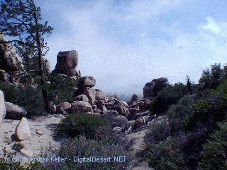
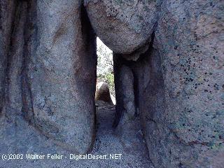
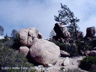
  2. Rock Formations: The area is characterized by a series of granite rock spires and pinnacles, which provide a wide range of climbing opportunities. The granite formations offer a variety of cracks, slabs, and faces for climbers of different skill levels.
  3. Rock Climbing: Arrowhead Pinnacles is primarily known for its rock climbing opportunities. Climbers can find routes that vary in difficulty, from beginner-friendly routes to more advanced and challenging climbs. The granite rocks and scenic surroundings make it a popular destination for traditional and sports climbing.
  4. Access: Access to Arrowhead Pinnacles typically requires a National Forest Adventure Pass for parking. The area is accessible via a short hike from the parking area to the climbing routes. Climbers should check for specific regulations and access updates from the San Bernardino National Forest or local climbing organizations.
  5. Scenic Beauty: Besides rock climbing, Arrowhead Pinnacles offers stunning views of the surrounding San Bernardino Mountains and Lake Arrowhead. The area’s natural beauty attracts climbers, hikers, and nature enthusiasts.
  6. Safety: Climbing at Arrowhead Pinnacles requires proper gear, including ropes, harnesses, helmets, and climbing shoes. Climbers should also be aware of the weather conditions and potential hazards associated with outdoor rock climbing.

As with any outdoor activity, it’s essential for climbers to prioritize safety and adhere to Leave No Trace principles to protect the natural environment. Before visiting Arrowhead Pinnacles, you should check with local climbing organizations or the San Bernardino National Forest for up-to-date information on access, routes, and any seasonal closures or restrictions.

U.S. Highway 395

U.S. 395

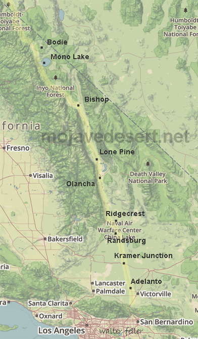
U.S. Highway 395, often simply referred to as Highway 395, is a north-south highway that runs through the western part of the country. It spans approximately 1,300 miles (2,092 kilometers) from southern California to the border of Washington and Canada.

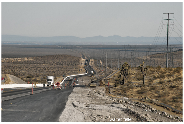
Part of this highway passes through the Mojave Desert in California. The Mojave Desert is known for its arid landscape, unique geological features, and desert flora and fauna. Highway 395 offers travelers the opportunity to experience the beauty and solitude of the Mojave Desert while providing access to various points of interest along the way.

Here are some key points about U.S. Highway 395:

  1. Route: U.S. 395 starts in Southern California and travels north through California, Nevada, Oregon, and Washington before reaching the Canadian border near Laurier, Washington. It roughly follows the eastern side of the Sierra Nevada mountain range.
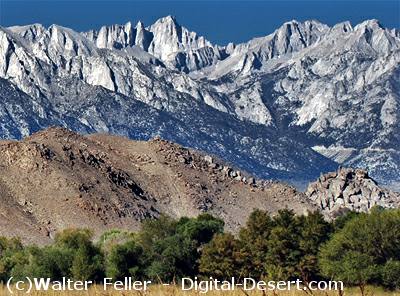
  2. Scenic Route: Highway 395 is renowned for its scenic beauty and passes through a diverse range of landscapes, including deserts, mountain ranges, valleys, and forests. It offers breathtaking views of the Sierra Nevada Mountains, Mono Lake, and the Eastern Sierra.
  3. Recreation: The highway provides access to numerous outdoor recreational opportunities, including hiking, skiing, fishing, camping, and boating in the various natural areas it traverses.
  4. Historical Sites: U.S. 395 also passes by several historical sites and attractions, such as the Manzanar National Historic Site (a former Japanese internment camp during World War II), the Eastern California Museum, and various mining and pioneer heritage sites.

Some notable places and attractions along U.S. Highway 395 in the Mojave Desert region include:

  1. Red Rock Canyon State Park: Located near Ridgecrest, this park features stunning red rock formations and hiking trails.
  2. Alabama Hills: Famous for its distinctive rock formations and used as a filming location for many Western movies.
  3. Manzanar National Historic Site: This site was once a Japanese internment camp during World War II and now serves as a reminder of this important period in American history.
  4. Death Valley National Park: While not directly on Highway 395, it’s a short drive to this famous national park known for its extreme heat, Badwater Basin, and unique desert landscapes.
  5. Lone Pine: A charming town with access to the Eastern Sierra, Mount Whitney, and the Eastern Sierra Visitor Center.
  6. Bishop: A larger town along the highway known for outdoor recreation, including fishing, hiking, and rock climbing.
  7. Mono Lake is a unique and ancient saline lake near Lee Vining with striking tufa towers.

Travelers along U.S. Highway 395 can experience the stark beauty of the Mojave Desert, explore its geological wonders, and access various outdoor recreational opportunities. It’s a popular route for road trips and exploration of California’s eastern Sierra region.

Overall, U.S. Highway 395 is a significant transportation corridor in the western United States, known for its stunning scenery, recreational opportunities, and historical significance. It offers travelers a chance to explore diverse landscapes and experience the beauty of the American West.

Midland Trail

Sierra Highway

Goldfield, Nevada

/goldfield-nv/

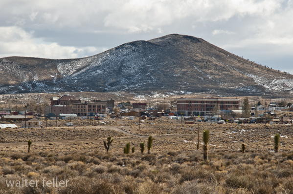
Goldfield, Nevada, is a small town in Esmeralda County, in the southwestern part of the state. It has a rich history, primarily centered around its boom and subsequent decline during the early 20th century.

Here’s a brief overview of the history of Goldfield:

  1. Discovery of Gold: Goldfield’s history began in 1902 when prospector Tom Fisherman and his partner Harry Stimler discovered gold in the area. This discovery led to a rush of prospectors and miners to the region, hoping to strike it rich.
  2. Boomtown: The town of Goldfield quickly grew as miners and entrepreneurs flocked to the area. By 1903, it had become a booming mining town with a rapidly growing population. Goldfield was known for its numerous mines, including the famous Combination Mine.
  3. Infrastructure Development: During its peak, Goldfield saw significant development. The town had hotels, saloons, theaters, banks, and even an opera house. The Goldfield Hotel, constructed in 1907, was one of the most luxurious hotels in the state at the time.
  4. Mining Industry: The mining industry was the lifeblood of Goldfield. The town produced significant gold, silver, copper, and other minerals. It became one of the largest gold-producing towns in Nevada.
  5. Labor Strikes: Goldfield experienced labor strikes and tensions in the early 1900s as miners demanded better working conditions and wages. The labor disputes occasionally turned violent.
  6. Decline: Despite its initial success, Goldfield’s fortunes began to decline in the late 1910s. The ore veins started to run out, and the town’s population dwindled. The decline accelerated during the Great Depression.
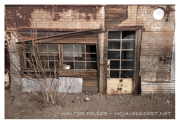
  7. Modern Era: Today, Goldfield is a small, historic town with a much smaller population than its heyday. It is known for its preserved historic buildings, including the Goldfield Hotel, which is rumored to be haunted.
  8. Tourism: In recent years, Goldfield has seen a revival of interest in its history and has attracted tourists interested in the town’s gold rush past.

Goldfield’s history is a classic example of the rise and fall of a mining boomtown in the American West. While it may not have the same prosperity it once enjoyed, its history and architecture continue to captivate those interested in the Old West and the mining industry.

Mojave Desert Human (Historical) Geography

Mojave Desert Geography

A long interaction history between people and the challenging desert environment marks the human (historical) geography of the Mojave Desert. Here are key aspects of the human history and settlement patterns in the Mojave Desert:

  1. Indigenous Peoples:
    • Before European contact, various indigenous groups inhabited the Mojave Desert, including the Mojave, Chemehuevi, and Serrano peoples.
    • These groups adapted to the arid environment, relying on hunting, gathering, and seasonal migrations to exploit available resources.
  2. Spanish Exploration and Missionaries:
    • Spanish explorers and missionaries, including Francisco Garces and Juan Bautista de Anza, ventured into the Mojave Desert in the 18th century.
    • These explorers sought routes to link Spanish missions in California and establish trade connections.
  3. Old Spanish Trail:
    • The Old Spanish Trail, a trade route connecting Santa Fe, New Mexico, to California, passed through the Mojave Desert in the early 19th century.
    • This trail facilitated the exchange of goods and cultural interactions between Spanish settlers and indigenous groups.
  4. American Pioneers and Westward Expansion:
    • During the 19th century, American pioneers and settlers ventured into the Mojave Desert as part of westward expansion.
    • The discovery of gold and other minerals in the region, such as the Calico Mountains, led to mining booms and the establishment of mining towns.
  5. 19th Century Military:
  6. Railroads and Transportation:
    • The construction of railroads, such as the Southern Pacific Railroad, was crucial in connecting the Mojave Desert to the broader transportation network.
    • Railroad towns, including Barstow, developed as important transportation hubs.
  7. Mining and Boomtowns:
    • Mining activities, particularly for silver and borax, flourished in the late 19th and early 20th centuries.
    • Boomtowns like Calico, once a significant silver mining town, experienced periods of rapid growth and decline.
  8. Military Presence:
    • The Mojave Desert has been home to various military installations, including Edwards Air Force Base and the Naval Air Weapons Station China Lake.
    • These installations have played roles in aviation testing, research, and training.
  9. Route 66:
    • The historic Route 66, a major U.S. highway, passed through the Mojave Desert during the mid-20th century, bringing increased traffic, commerce, and tourism to the region.
  10. National Parks and Conservation Efforts:
    • Establishing national parks and preserves, such as Joshua Tree National Park and the Mojave National Preserve, reflects efforts to conserve the desert’s unique ecosystems and landscapes.
  11. Modern Urbanization and Recreation:
    • Urban areas on the periphery of the Mojave Desert, such as Las Vegas, have experienced rapid growth.
    • The desert attracts tourists and outdoor enthusiasts interested in hiking, rock climbing, and stargazing.

Understanding the human history of the Mojave Desert involves recognizing the diverse ways different groups have interacted with the desert environment over time, from indigenous peoples adapting to the harsh conditions to the various waves of exploration, settlement, and economic activities that have shaped the region.

Mojave Desert Physical (Regional) Geography

Mojave Geography

The Mojave Desert, situated in the southwestern United States, has a distinctive physical geography shaped by its unique combination of topography, climate, and ecosystems.

Here is an overview of the physical (regional) geography of the Mojave Desert:

  1. Location:
    • The Mojave Desert spans southeastern California, southern Nevada, southwestern Utah, and northwestern Arizona. It is one of the four major deserts in North America.
  2. Size:
    • The Mojave Desert covers approximately 47,877 square miles (124,000 square kilometers).
  3. Topography:
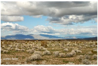
    • The Mojave Desert features a diverse topography with mountain ranges, valleys, and extensive desert plains.
    • Prominent mountain ranges include the Mojave, Providence, New York, and Clark Mountains.
  4. Landforms:
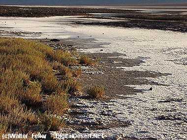
    • Playas: Dry lake beds like Soda Lake and Silver Lake are common in the Mojave Desert.
    • Mesas and Buttes: Flat-topped plateaus and isolated hills are scattered across the landscape.
    • Dunes: Notable dunes include the Kelso Dunes and Eureka Dunes, among North America’s tallest.
  5. Climate:
    • The Mojave Desert has a cold climate characterized by hot summers and mild winters.
    • Summer temperatures often exceed 100°F (38°C), while winter temperatures can drop below freezing, especially at higher elevations.
    • Rainfall is generally low, with most precipitation occurring during the winter months. The desert experiences occasional flash floods during intense rainstorms.
  6. Vegetation:
  7. Wildlife:
  8. Water Sources:
    • Natural water sources are limited, and the Mojave River is one of the few perennial rivers in the region.
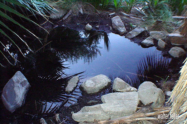
    • Springs and oasis areas, such as Ash Meadows in Nevada, provide critical water sources for both wildlife and human activities.
  9. Human Impact:
    • Human activities in the Mojave Desert include mining, military training areas, and recreational activities.
    • Cities such as Las Vegas, Nevada, and Lancaster, California, are located on the periphery of the Mojave Desert.
  10. Protected Areas:
    • The Mojave National Preserve, Joshua Tree National Park, and portions of Death Valley National Park are examples of protected areas within the Mojave Desert, preserving its unique ecosystems and landscapes.

Understanding the physical geography of the Mojave Desert involves recognizing its diverse landforms, climate extremes, and the adaptations of both flora and fauna to the arid conditions. Additionally, human activities and efforts to preserve the desert’s unique features contribute to the overall regional geography of the Mojave.

Mojave Desert Geography

/geography/

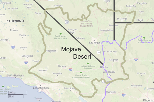
The Mojave Desert is a vast desert in the southwestern United States, primarily in southeastern California, southern Nevada, and parts of Arizona and Utah.

Here are some key geographical features and characteristics of the Mojave Desert:

  1. Location:
    • States: Primarily in California and Nevada, with smaller portions in Arizona and Utah.
    • Extent: The Mojave Desert is part of the larger North American Desert and is the smallest of the four major deserts in the United States.
  2. Size:
    • The Mojave Desert covers approximately 47,877 square miles (124,000 square kilometers).
  3. Topography:
    • The desert’s topography is varied, featuring flat basins, rugged mountains, and expansive valleys.
    • Some prominent mountain ranges include the Providence, New York, and Clark Mountains.
  4. Landforms:
    • Playas: Dry lake beds or playas are scattered throughout the desert.
    • Mesas and Buttes: Flat-topped plateaus and isolated hills dot the landscape.
    • Dunes: The Kelso Dunes and Eureka Dunes are extensive dune fields in the Mojave.
  5. Climate:
    • The Mojave Desert has a typical cold desert climate with hot summers and mild winters.
    • Summer temperatures can exceed 100°F (38°C), while winter temperatures can drop below freezing, especially at higher elevations.
    • Rainfall is generally low, and the desert experiences occasional flash floods during intense rainstorms.
  6. Vegetation:
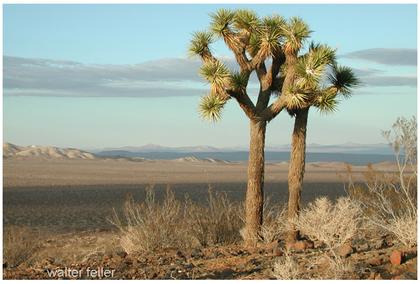
    • The desert is home to various plant species adapted to arid conditions, including Joshua trees, creosote bushes, yuccas, and cacti.
    • Higher elevations may support juniper and pinyon pine forests.
  7. Wildlife:
  8. Human Impact:
    • Human activities in the Mojave Desert include mining, military training areas, and recreational activities.
    • Cities such as Las Vegas, Nevada, and Lancaster, California, are located on the periphery of the Mojave Desert.
  9. National Parks and Protected Areas:

Understanding the geography of the Mojave Desert involves recognizing its diverse terrain, climate, and the various plant and animal species that have adapted to this challenging environment.

Rain & Rain Shadow

Rainshadow Desert

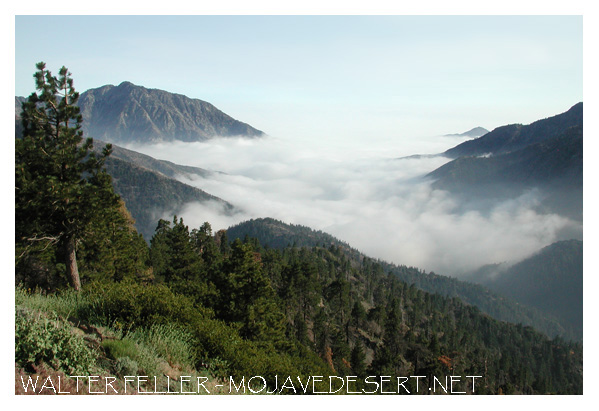
Rain shadow desert. Clouds fill in East San Gabriel Canyon
Inspiration Point, Angeles National Forest

Mojave Desert Rain Shadow

The Mojave Desert rain shadow is a meteorological phenomenon that occurs in the southwestern United States. A rain shadow is an area on the leeward side of a mountain or mountain range that receives significantly less precipitation than the windward side. In the case of the Mojave Desert, this rain shadow effect is primarily influenced by the Sierra Nevada mountain range.

The prevailing westerly winds carry moist air from the Pacific Ocean. As this air rises over the western slopes of the Sierra Nevada, it cools and condenses, leading to precipitation. By the time the air descends on the eastern side of the mountains, it has lost much of its moisture, creating a rain shadow effect.

The Mojave Desert, located east of the Sierra Nevada in California, experiences this rain shadow effect. The descending air on the eastern side of the mountains warms up, leading to a drier and warmer climate in the Mojave Desert compared to the western side of the Sierra Nevada.

As a result, the Mojave Desert is characterized by arid and semi-arid conditions, with lower annual precipitation than the Sierra Nevada’s western slopes. This rain shadow effect plays a significant role in shaping the climate and ecosystem of the region. The Mojave Desert is known for its unique flora and fauna adapted to the arid conditions influenced by the rain shadow effect.

American Desert – The Mojave Desert

Overview. View from shadow mountains near El Mirage The Mojave Desert exists in a rain shadow created by the Transverse Ranges and the Sierra Nevada Mountain …

Panamint Valley

The Mojave Desert – Life at the Extremes

For example, the California portion of the desert often receives as little as 3 cm of rain. The Mojave is considered a rain shadow desert because the …

Natural and Cultural Settings in the California Mojave

Fremont Valley

As mentioned, the Mojave Desert is characterized by its extreme aridity caused by a rain shadow effect. Annual rainfall amounts to around 10 to …

Water in the Mojave Desert

The rain shadow effect is produced by the high mountains on the west, which block the movement of wet winter storms. Artesian Wells · Flash Floods · Intro:: …

Joshua Tree National Park

… rain shadow” effect produced by the high mountains on the west, and 2) the … The Joshua trees serve as a rain gauge in those areas of the desert where no …

Diversity in California

Desert conditions exist in the rain shadow of the mountain ranges. This exceptional variation in landscape features, latitudinal range, geological …

Cajon Pass Physical Attributes

The rain shadow from the San Gabriel Mountains affects vegetation types and water availability in the Mojave Front Country Place. It is a transition zone …

Transverse Ranges

/geomorphic-provinces/transverse-ranges.html

The Transverse Ranges are a group of mountain ranges in Southern California, USA. They run east-west and are characterized by their unique orientation, perpendicular to the typical north-south alignment of most other mountain ranges in North America. The Transverse Ranges play a significant role in the geography and climate of Southern California.

San Gabriel Range
San Bernardino Range

The main Transverse Ranges include:

  1. San Gabriel Mountains: Located northeast of Los Angeles, the San Gabriel Mountains are a prominent part of the Transverse Ranges. They contain several peaks over 10,000 feet, including Mount San Antonio (Mt. Baldy), the highest peak in the range.
  2. San Bernardino Mountains: To the east of the San Gabriel Mountains, the San Bernardino Mountains are another subrange within the Transverse Ranges. They include prominent peaks such as San Gorgonio Mountain, the highest peak in Southern California.

Additional Transverse Ranges (not in project)

  1. Santa Ynez Mountains: Situated to the northwest of Los Angeles, the Santa Ynez Mountains are part of the Transverse Ranges and run parallel to the coast. They contribute to the scenic backdrop of the Santa Barbara area.
  2. Santa Susana Mountains: Located northwest of Los Angeles, the Santa Susana Mountains are a smaller subrange within the Transverse Ranges.
  3. Topatopa Mountains: Situated north of Ventura, the Topatopa Mountains are part of the Transverse Ranges and are known for their distinctive east-west orientation.

Rain Shadow Desert

The Transverse Ranges have a significant impact on the climate of Southern California. They act as a barrier to moist air coming from the Pacific Ocean, causing a rain shadow effect. This results in a drier climate on the leeward (eastern) side of the ranges, contributing to the arid conditions of the inland areas.

History of Shoshone, California

Shoshone is a small unincorporated community located in the southeastern part of Inyo County, California, USA. The history of Shoshone is closely tied to the development of the surrounding region, characterized by its desert landscape and proximity to Death Valley.

  1. Native American Presence: Before European settlers arrived, the area around Shoshone was inhabited by various Native American groups, including the Shoshone people, from whom the town takes its name. The Shoshone were a group of indigenous people who traditionally lived in the Great Basin and surrounding areas.
  2. Exploration and Settlement: In the late 19th century, the California desert attracted prospectors and settlers seeking opportunities. In 1880, George Lane discovered a spring in the area, which led to the establishment of Shoshone as a water stop for the Tonopah and Tidewater Railroad in the early 1900s. This made Shoshone an essential point for transportation and commerce.
  3. Mining and Agriculture: The nearby Dublin Gulch and Funeral Mountains attracted miners seeking gold and other minerals. Mining activities contributed to the growth of Shoshone. Additionally, agriculture, particularly the farming of date palms, became important in the region due to the presence of water from natural springs.
  4. Amargosa Opera House: Marta Becket, a dancer and artist, arrived in Shoshone in the 1960s. She renovated and reopened the Amargosa Opera House in nearby Death Valley Junction, which became a cultural hub for the area. The opera house is known for its unique murals and performances.
  5. Tourism and Recreation: Over the years, Shoshone has become a gateway for tourists exploring Death Valley National Park and the surrounding desert landscapes. The town offers services and amenities for visitors, including accommodations, restaurants, and the Shoshone Museum, which showcases the area’s history.
  6. Environmental and Conservation Issues: The region faces water scarcity and environmental conservation challenges. The delicate desert ecosystem requires careful management, and organizations work to balance development with the preservation of natural resources.

Today, Shoshone remains a small community focusing on tourism and outdoor recreation. Its history reflects the broader patterns of development and economic activities that have shaped the desert regions of California. Visitors to Shoshone can explore its historical sites, enjoy the unique desert landscape, and learn about the area’s rich cultural and natural heritage.

Tejon Indian Reservation

A History of American Indians in California: HISTORIC SITES


Tejon Indian Reservation
Kern County

In the early 1800s, Indians in the interior of California began to feel the effects of trappers and explorers. By mid-century, coastal Indians who moved inland following the breakup of the missions also suffered under the influx of miners and settlers. When the federal government sent Indian agents to write treaties with California Indians, Agent George W. Barbour negotiated the treaties with both interior and coastal Indians in the southern San Joaquin Valley. In return for the promise of goods, annuities, and land, the Indians vacated much of their home land.

In February of 1852, President Millard Fillmore submitted 18 California Indian treaties to the United States Congress for ratification, but the California delegation objected, complaining that the treaties provided too much good land for the Indians. Congress failed to ratify the treaties but did make some provisions for California Indians.

Edward F. Beale was appointed Superintendent of Indian Affairs for California in April 1852. Upon arrival in September, Beale toured the state to determine the status of California Indians. He reported in February 1853 that “our laws and policy with respect to Indians have been neglected or violated. . . . [The Indians] are driven from their homes and deprived of their hunting-grounds and fishing-waters at the discretion of the whites. . . .” Beale requested $500,000 for military reservations where both soldiers and Indians would reside.

Beale hired H. B. Edwards to start farming operations at Tejon and the San Joaquin River. On March 2, 1853, Congress appropriated $250,000 for five reservations, not to exceed 25,000 acres each, to be located on public lands, with good land, wood, and water. In September, Beale expanded the Tejon Farm into the first California reservation.

To gain support for his efforts, Beale named the reservation after Senator William Sebastian, Chairman of the Indian Affairs Committee. The Sebastian Indian Reservation, more commonly known as Tejon Indian Reservation, was located in the southern end of the San Joaquin Valley, “between Tejon Vaquero Headquarters and Canada de las Uvas. . . .” (Latta, 1977:736)

Tejon was located on a Mexican land grant rather than on public land, but Beale argued that no public lands were available and that the unoccupied grant could be purchased if necessary. Beale’s primary reason for choosing Tejon was the presence of mission-trained Indians with agricultural skills, more likely to succeed on a reservation.

Despite substantial opposition, Beale continued to gather Indians and move them to Tejon. In early 1854, he reported 2,500 Indians at Tejon and 2,650 acres under cultivation. Beale’s arguments for a reservation of 75,000 acres failed, and in July 1854, he was replaced by Thomas J. Henley.

When Henley took charge, he noted only 800 Indians, with fewer than 350 present at one time, and only 1,500 acres under cultivation, indicating that numbers of Indians and amount of acreage under cultivation had been inflated. Most of the crops failed that year because of drought. Henley started the Tule River Farm to supplement the reservation’s food, but the Indians still had to gather native foods and the government had to bring in more supplies in order to feed the reservation population. Throughout the reservation’s existence, drought, insects, and crop disease undermined the attempts at farming.

In November of 1856, the reservation was reduced to 25,000 acres. That year, 700 Indians were reported residing on the reservation and 700 acres were under cultivation. By 1859, Henley had been replaced.

In addition to crop failure, the reservation faced loss of the land when the land grant claim was upheld in court. Settlers also encroached on the unsurveyed and unfenced land, allowing cattle and sheep to eat reservation crops. During the 1863 drought year, all the crops were lost except for 30 tons of hay.

Meanwhile, former agent Edward F. Beale had purchased five contiguous ranchos in the Tejon area, including the reservation land, and was raising 100,000 sheep. In 1863, he offered to lease 12,000 acres to the government for a dollar an acre, but withdrew the offer when he found that the government planned to move Owens River Indians there. He noted that he had made the offer only because Indians already on the reservation were his friends.

Jose Pacheco, a Tejon leader, wrote to General Wright on April 16, 1864, “I should not have troubled you with this letter, Dear General, did I not think the agents here had wronged us. You and our great father at Washington do not know how bad we fare, or you would give us food or let us go back to our lands where we can get plenty of fish and game. I do not think we get the provisions intended for us by our Great Father; the agents keep it from us, and sell it to make themselves rich, while we and our children are very poor and hungry and naked.” (Sacramento Union, April 28, 1964)

The reservation was ordered closed in June 1864, and on July 11, Austin Wiley wrote, “I have the honor to inform you that all the Indians on the Tejon Farm and in the vicinity of Fort Tejon, some two hundred in number, have been removed from there to the Tule River farm.” Wiley noted that there was no food for the Indians at Tejon.

Shortly thereafter, D. N. Cooley, Commissioner of Indian Affairs, summarized the reasons for the reservation’s failure: “The lack of legal title to the land severely restrained investment in construction and development, leaving the reserve and the Indians on it in a state of constant uncertainty. The ideal of converting Indians from food gathering to settled agriculture was never realized.”

(Note: Unless otherwise specified, all above quotes are from government reports as cited in California Department of Parks and Recreation reference document No. 169, “Tejon Indian Reservation.”)

https://www.nps.gov/parkhistory/online_books/5views/5views1h92.htm