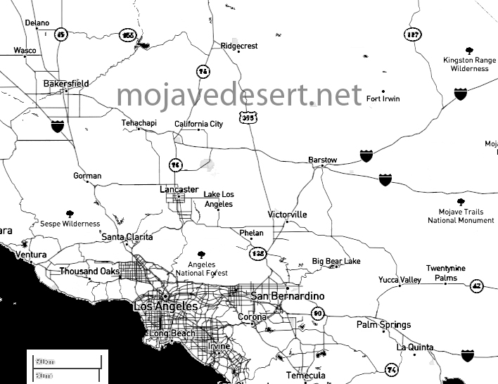
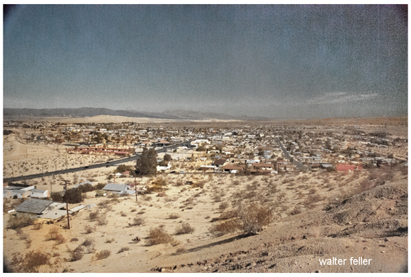
The name “Twentynine Palms,” referring to the city in California, indeed lacks a hyphen, which might seem unusual given the norm in English to hyphenate compound numbers from twenty-one through ninety-nine. The reason for this absence of a hyphen in “Twentynine Palms” is more historical and conventional than grammatical.
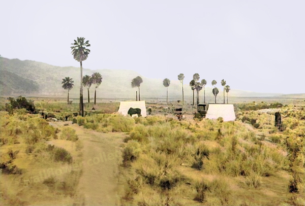
The city’s name comes from the original designation of the area by the Oasis of Mara, where it was noted by early settlers or possibly by surveyors that there were twenty-nine palm trees at the site. This naming convention stuck, and the specific styling of “Twentynine” without a hyphen became the city’s official name. Over time, this styling was retained in official documents, signage, and local usage, making it the standard spelling.
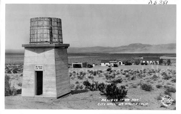
In-place names, especially hyphens, can vary widely and are often dictated by tradition or local preference rather than strict grammatical rules. Once a name is established and recognized in official records, it tends to remain unchanged to preserve historical consistency and identity. This is why “Twentynine Palms” remains without a hyphen, reflecting its unique history and how it was originally named.
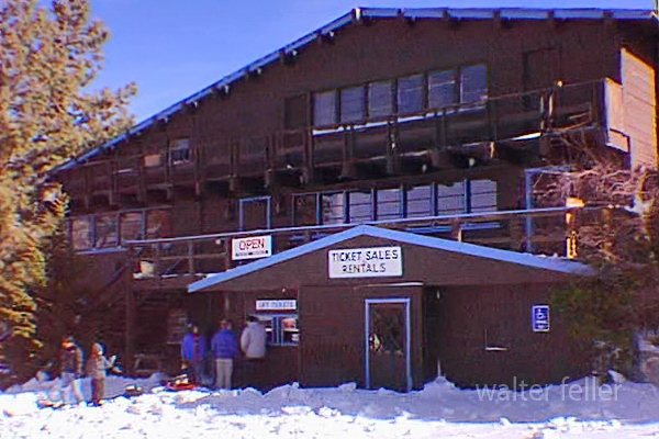
Mountain High North, previously known as Ski Sunrise, is part of the Mountain High Resort in Wrightwood, California. This area of the resort has its own unique characteristics and offerings. Here’s an overview:
Ski Sunrise – 1996
Mountain High North, previously known as Ski Sunrise, is part of the Mountain High Resort in Wrightwood, California. This area of the resort has its own unique characteristics and offerings. Here’s an overview:
Mountain High North, with its focus on beginner-friendly slopes, snow play, and tubing, plays a crucial role in the overall appeal of Mountain High Resort. It caters to a segment of visitors looking for a more relaxed, family-oriented snow experience in the proximity of Los Angeles.
Ancient Lake Cahuilla, or Lake LeConte, was a prehistoric lake in California and northern Mexico. This lake was significantly larger than the current Salton Sea in the same region. It existed in the Salton Basin, a low-lying area of the Colorado Desert.
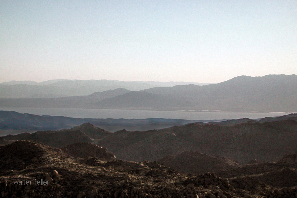
The formation of Lake Cahuilla was due to the Colorado River changing its course at various times in history. The river flowed into the Salton Basin, creating a large freshwater lake. The size and existence of the lake fluctuated over centuries, depending on the river’s course and the climate.
Lake Cahuilla was significant in several ways:
The remnants of Lake Cahuilla, like beach ridges and other geological features, are still visible in the landscape, providing a glimpse into this prehistoric body of water’s vastness and significance.
The timeline of Lake Cahuilla’s existence spans several thousand years, with filling and drying periods corresponding to changes in the course of the Colorado River and regional climate conditions. Here’s a general overview of its timeline:
The timeline of Lake Cahuilla is a subject of ongoing scientific study, with new research continually refining our understanding of its history and the factors that influenced its formation and disappearance.
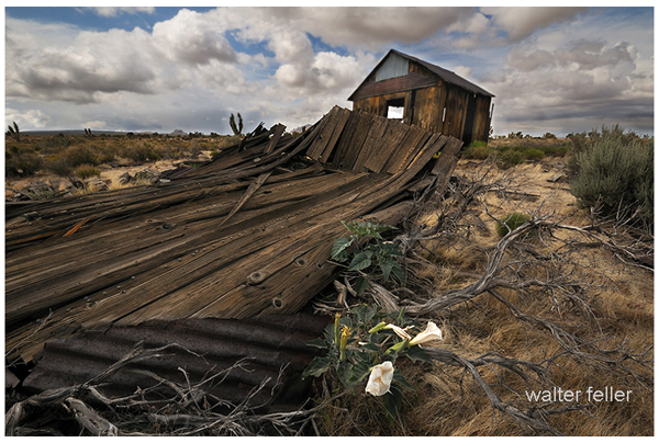
Koehn Lake and the nearby ghost town of Saltdale have a rich history intertwined with the salt industry in California. Koehn Lake, situated in the Fremont Valley of the Mojave Desert in eastern Kern County, California, is a dry and seasonally endorheic lake, occasionally becoming a closed basin without outflow. The lake is approximately 5 miles long and 3 miles wide at its widest point.
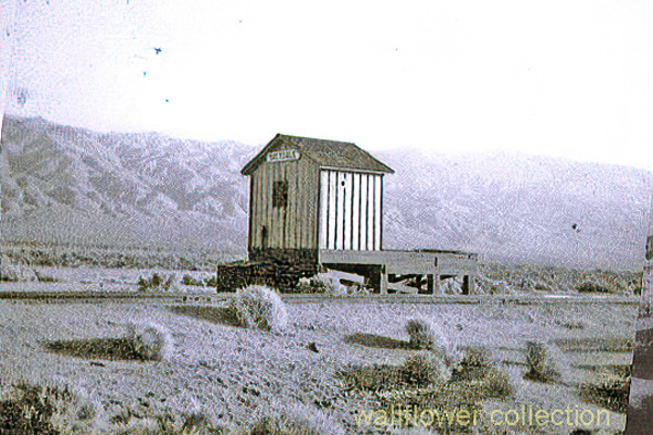
Saltdale, founded in 1915, owes its origins to the salt harvesting operations from Koehn Dry Lake. The town had a post office operating from 1916 to 1950. The history of salt production in the area began in earnest in 1914 with the operations of the Consolidated Salt Company. This was further expanded with the involvement of the Fremont Salt Company from 1919 to 1927, which also utilized solar evaporation of surface brine for salt production.
The salt industry in this region has undergone several changes in ownership and production methods over the years. In the early 20th century, salt production fluctuated considerably, largely dependent on rainfall and storm runoff to supply water for brine formation. Modern techniques involve pumping brine from wells and channeling it to ponds for evaporation, a process that takes about four months to form approximately 6 inches of salt.
Saltdale, during its peak, had a diverse community, including managers, skilled workers, and their families, as well as common laborers, often Latino Catholics. The town had facilities like a company store, a post office, a school, and a service station. Saltdale’s school, under the guidance of notable teachers, played a significant role in community life, including efforts towards “Americanization” by encouraging English language use and cultural integration.
However, Saltdale faced challenges due to its remote location and the fluctuations in the salt industry. The town experienced isolation, difficulties in accessing law enforcement and medical care, and was impacted by the economic conditions of the time, including the Great Depression.
The decline of Saltdale was marked by the eventual abandonment of the town by the 1970s. The salt operations also evolved, with less need for manpower due to modernization. Today, Saltdale stands as a ghost town, with the remnants of its past slowly eroding away in the salty landscape.
Koehn Lake, apart from its salt mining history, has also been used for various other purposes. At its northern end, there are evaporation ponds from the salt mining operation, and the rail siding at the former townsite of Saltdale has been used for offloading explosives. The area around the lake has also been used for testing by the Reaction Research Society and for a desert test track by Honda Motors. In 2014, it was notably the area where Virgin Galactic’s experimental spaceship disintegrated.
The history of Koehn Lake and Saltdale provides a unique glimpse into the industrial and community life of early 20th-century California, highlighting the challenges and adaptations of a community built around a natural resource.
The Mojave Indians are a Native American tribe indigenous to the southwestern United States, primarily in the Mojave Desert region, which spans parts of California, Nevada, Arizona, and Utah. They have a rich ethnography and ethnohistory characterized by their unique cultural practices, social organization, and historical interactions with European settlers.
Here are some key aspects of the Mojave Indians’ ethnography and ethnohistory:
The ethnography and ethnohistory of the Mojave Indians provide valuable insights into the history and culture of this indigenous group in the American Southwest. Researchers and historians continue to study and document their traditions to preserve their cultural heritage for future generations.
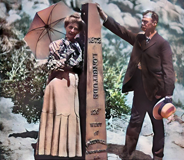
(1873)
The Von Schmidt boundary, or the Schmidt Line, refers to a historical boundary line in California. It was surveyed and established by Alexey von Schmidt, a Russian engineer, in the 1860s. The purpose of the Von Schmidt boundary was to delineate the border between California and Nevada during a time when there was confusion and disputes over the exact location of the state boundary.
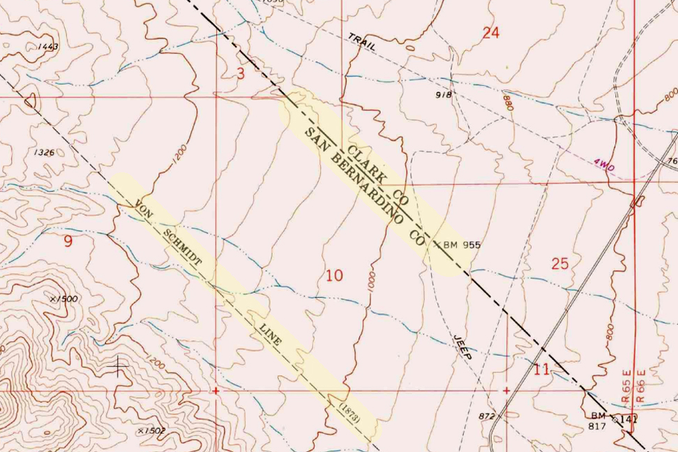
Von Schmidt’s survey helped clarify the boundary and resolve conflicts between California and Nevada. His efforts included placing markers and monuments along the boundary line to make it clear and permanent. The boundary he established still exists today and is the official border between the two states.
The Von Schmidt boundary is of historical significance and has been preserved as a reminder of the surveying and boundary disputes of the past. It is located in the eastern part of California near the Nevada border.
Why was the initial boundary incorrect?
The initial boundary between California and Nevada was incorrect and subject to disputes for several reasons:
Given these factors, there was much uncertainty and disagreement regarding the California-Nevada boundary in the early years. It was only through the efforts of surveyors like Alexey von Schmidt and subsequent legal and political resolutions that the boundary was eventually clarified and accepted. Von Schmidt’s survey work played a crucial role in resolving these disputes and establishing a more accurate boundary line.
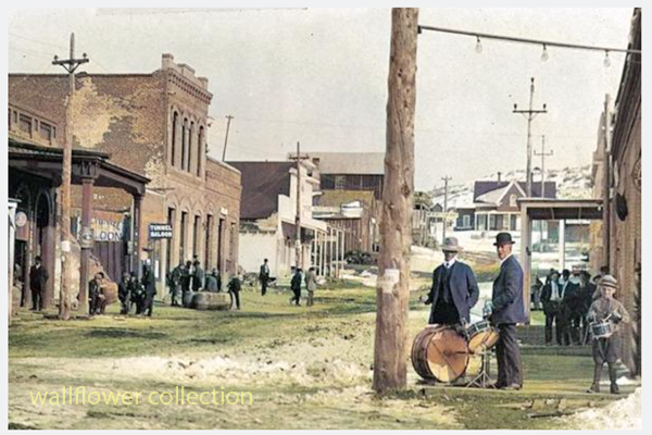
The town of Aurora, Nevada, experienced a move due in part to the boundary disputes between California and Nevada. Aurora was originally founded in the 1860s during the Nevada Silver Rush. At its founding, the exact location of the California-Nevada border was still uncertain and subject to disputes.
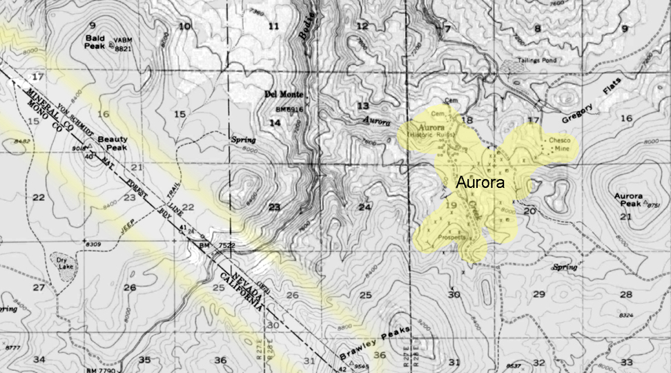
As a result of the boundary disputes and the fact that Aurora’s initial location was close to the border, there were concerns about which state’s jurisdiction the town fell under. Aurora’s residents and businesses moved the town slightly to the east, further into Nevada’s territory, to avoid potential legal and tax issues. This move ensured that Aurora would be firmly within the boundaries of Nevada when the border dispute was eventually resolved.
The relocation of Aurora was a strategic decision made to secure the town’s status as part of Nevada rather than California, given the uncertainties and conflicts related to the state boundary at the time. This move allowed Aurora to thrive as a mining town in Nevada without the legal complications associated with straddling the border.
It’s difficult to determine whether “everybody” is happy, as people’s feelings and satisfaction with their circumstances can vary widely. Happiness is subjective and depends on individual experiences, perspectives, and circumstances.
In the context of the town of Aurora’s relocation due to boundary disputes, it’s possible that the decision to move was made to address specific legal and jurisdictional concerns at the time. The move may have been necessary for the town’s continued growth and prosperity. However, whether every resident or stakeholder was happy with the decision would depend on their perspectives and interests.
In any community or population, there will be a range of opinions and emotions regarding significant decisions like a town’s relocation. Some may have been happy with the move because it resolved legal uncertainties, while others may have been less pleased due to the disruption and changes associated with relocation.
To determine the current happiness or satisfaction of people in a specific context, it would be necessary to conduct surveys or interviews to gather their perspectives and opinions.
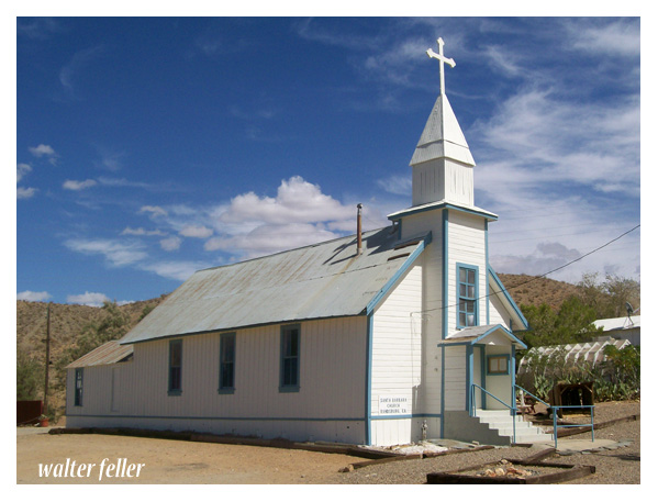
The history of the Tecopa and Shoshone area in California is closely tied to the region’s Native American heritage and the later development spurred by mining and tourism. Here’s a brief overview of the history of this area:
Overall, the history of Tecopa and Shoshone, CA, reflects the area’s development from its Native American roots through mining and the growth of tourism, all while showcasing the rugged beauty of the Mojave Desert and its natural resources.
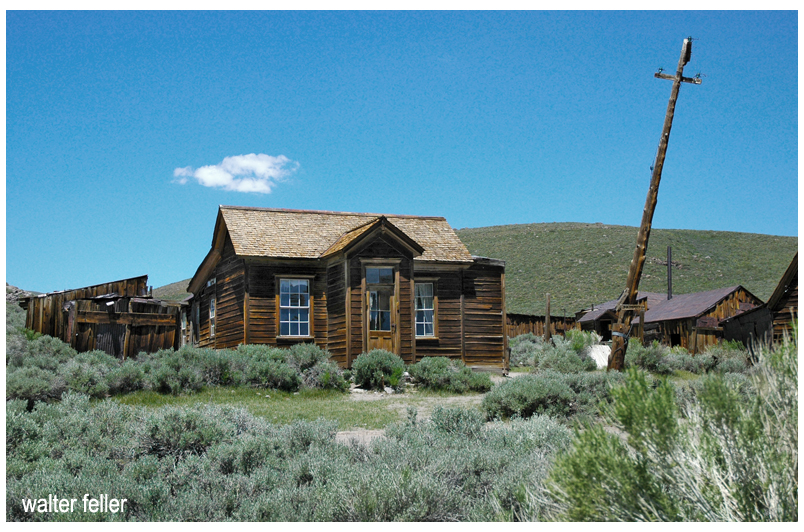
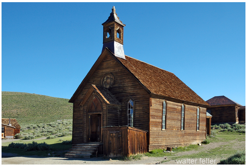
Bodie Ghost Town is not only known for its well-preserved historical buildings but also for its legends and stories that have contributed to its reputation as a haunted and mysterious place.
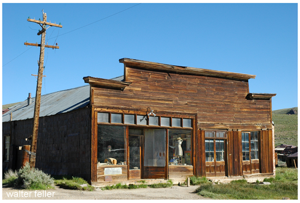
Here are some of the legends associated with Bodie:
It’s important to note that these legends are part of the folklore and mystique surrounding Bodie Ghost Town. While they add to the town’s allure, they are not verified historical facts. Nonetheless, they contribute to the intrigue and mystique of Bodie, making it a captivating destination for those interested in history and the supernatural. Visitors can enjoy these stories while exploring the well-preserved remnants of the past in this iconic ghost town.
Bodie and Mojave Desert ghost towns are examples of abandoned settlements in the Western United States. Still, they are located in different regions and have distinct historical and geographical contexts.
Here’s how Bodie ghost town compares to Mojave Desert ghost towns
In summary, while Bodie Ghost Town and Mojave Desert ghost towns share the common theme of being abandoned settlements in the American West, they differ in their locations, historical backgrounds, climates, and levels of preservation. Each ghost town has its unique story and charm, showcasing the diversity of the history and landscapes of the Western United States.
While Bodie Ghost Town and Mojave Desert ghost towns differ, they also share similarities due to their historical significance as abandoned settlements in the American West.
Here are some commonalities between them:
In summary, Bodie Ghost Town and Mojave Desert ghost towns share several similarities in their historical origins, economic activities, architectural heritage, cultural significance, and appeal as tourist destinations. However, it’s important to recognize that each ghost town has unique characteristics and history that make it special.