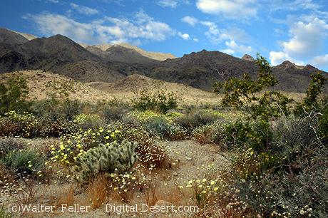
The Mojave Desert offers a variety of unique and exciting activities. Here are ten of the most popular places:
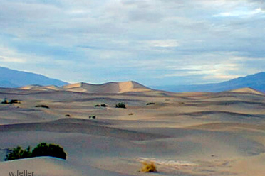
Death Valley National Park: Known for its extreme temperatures and stunning landscapes, it features attractions like Badwater Basin, the lowest point in North America, and the Mesquite Flat Sand Dunes.
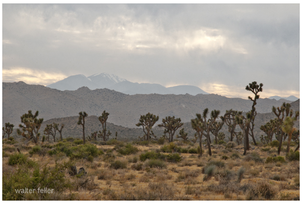
Joshua Tree National Park: Famous for its unique Joshua trees, it offers rock climbing, hiking, and stargazing opportunities amidst a surreal desert landscape. .
Mojave Road: This historic off-road trail takes you through the heart of the Mojave Desert, offering a challenging adventure with historical landmarks and diverse desert scenery.
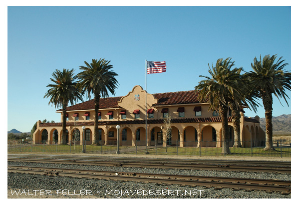
Kelso Depot Visitor Center: Located in the Mojave National Preserve, this historic train depot provides insight into the region’s rail history and is a gateway to exploring the preserve.
Mojave National Preserve: With over 1.6 million acres, the preserve offers numerous trails, including the Kelso Dunes and the Hole-in-the-Wall Rings Trail. .
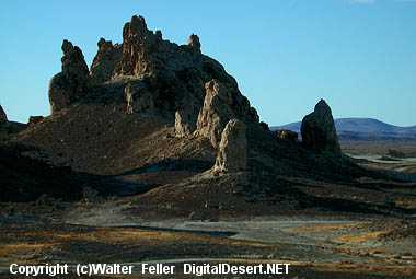
Trona Pinnacles: These unique tufa formations, formed underwater over 10,000 years ago, are popular for photography and off-road exploration. .
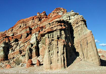
Red Rock Canyon State Park: Known for its vibrant rock formations and scenic desert cliffs, this park offers hiking, camping, and wildlife viewing opportunities. .
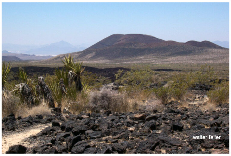
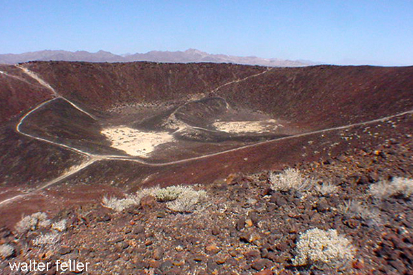
Amboy Crater: A dormant volcanic cinder cone, Amboy Crater provides a moderately challenging hike with rewarding views from the top. .
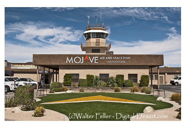
Mojave Air and Space Port: This hub for aerospace innovation offers public tours showcasing historic aircraft and cutting-edge aerospace technology. .
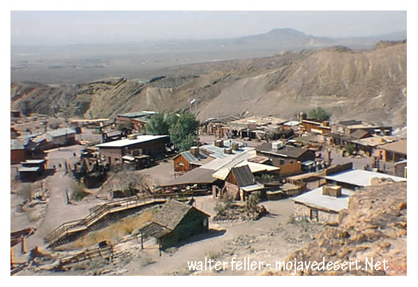
Visit Calico: A restored mining town from the Silver Rush era, Calico offers a glimpse into the past with its preserved buildings, mine tours, and reenactments. .
These activities highlight the diverse attractions and experiences the Mojave Desert offers, from natural wonders to historical sites.
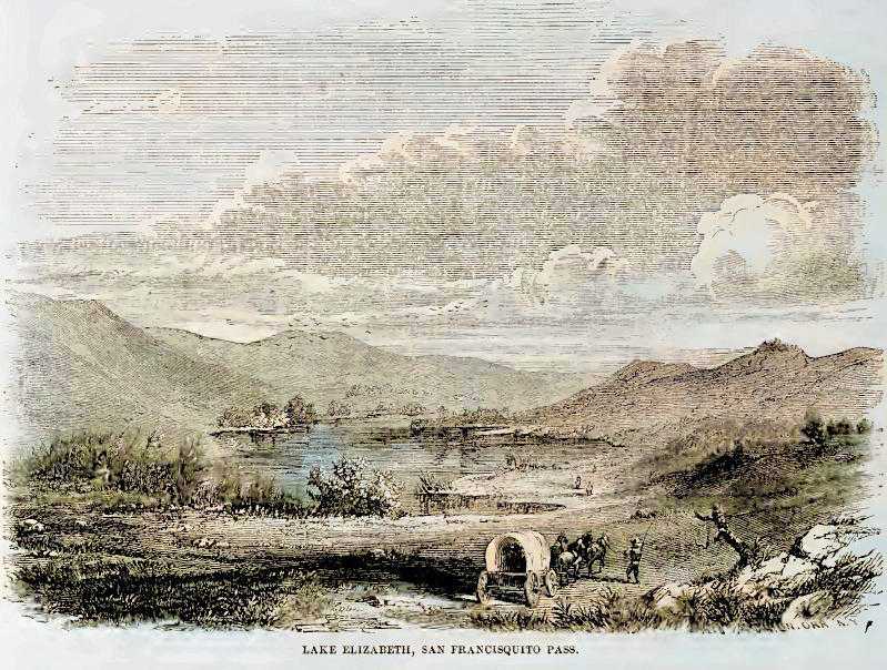
Elizabeth Lake, located in the Sierra Pelona Mountains of Los Angeles County, California, is enveloped in folklore and legend, making it one of the most intriguing spots in the Mojave Desert region. The most prominent legend associated with Elizabeth Lake involves mysterious and terrifying creatures.
The Myth of the Monster
According to local lore, Elizabeth Lake is home to a monster described as a massive, dragon-like creature. This legend dates back to the early Spanish settlers and the indigenous people before them. The beast, often called the “Elizabeth Lake Monster,” has wings, a long tail, and a fearsome appearance. Accounts of sightings have persisted through the centuries, often varying in detail but maintaining the core elements of a menacing beast.
Historical Accounts
In the mid-19th century, stories of the monster were popular among ranchers and settlers. Some tales suggest that the creature could fly, and its wingspan was so large that it cast a shadow over the entire lake. These stories contributed to the lake’s reputation as a place to be feared.
Explanations and Speculation
Several theories attempt to explain the legend of Elizabeth Lake. Some suggest that the stories originated from large birds or other wildlife sightings. Others believe that the lake’s mysterious aura and the eerie atmosphere could have fueled imaginations, leading to the creation of the monster legend.
Modern Interest
Today, Elizabeth Lake remains a site of curiosity for locals and visitors. While no concrete evidence of the monster’s existence has ever been found, the legend remains part of the area’s cultural heritage. The picturesque lake attracts nature enthusiasts and those intrigued by its storied past.
Conclusion
The Legend of Elizabeth Lake is a captivating part of Mojave Desert folklore. Whether rooted in real events or purely a product of imagination, the stories of the Elizabeth Lake Monster add a layer of mystique to this serene and beautiful spot in California.
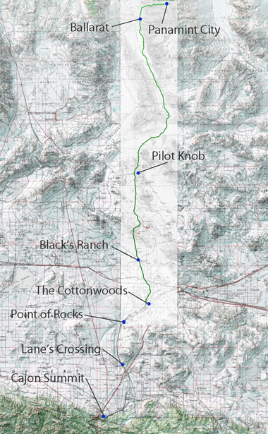
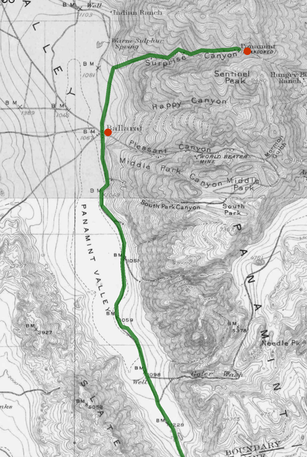
Nestled within the rugged landscapes of Eastern California, the Panamint Valley is home to a historical artery that has played a pivotal role in developing the American West—the road to Panamint. Originally trodden by Native Americans and later transformed by the ambitions of silver miners, this route not only facilitated economic booms but also bore witness to the ebbs and flows of fortune. The road to Panamint is a testament to the region’s mining era, epitomizing the broader transportation infrastructure development crucial for westward expansion.
Historical Background
The Panamint Valley, framed by the arid peaks of the Panamint Range, was first utilized by the Shoshone Native Americans, who traversed these harsh landscapes following seasonal migration patterns and trade routes. The discovery of silver in 1872 marked a turning point for the valley. News of silver attracted droves of prospectors, catalyzing the establishment of mining camps and the nascent stages of the road. This road would soon become the lifeline for a burgeoning settlement, later known as Panamint City.
Development of the Road
The transformation from a series of Native trails to a fully functional road was propelled by the mining industry’s explosive growth. As prospectors and entrepreneurs flooded the area, the demand for a reliable transportation route skyrocketed. The road to Panamint was quickly carved out of the valley’s rugged terrain, facilitating the movement of people and ore. During the mid-1870s, Panamint City blossomed into a boomtown, with the road being crucial for transporting silver ore to markets beyond the valley. However, as the mines depleted and profits dwindled, the road witnessed the departure of those who had come seeking fortune, leaving behind ghost towns and tales of a fleeting era.
Significance in Regional History
Beyond its economic contributions, the road to Panamint played a significant role in shaping the regional history of Eastern California. It facilitated the integration of remote areas into the state’s broader economic and cultural fabric. Moreover, it was a stage for several historical events, including conflicts between Native Americans and settlers and among competing mining companies. The road connected Panamint with the outside world and helped establish transportation routes that would later support the growth of other regional industries and settlements.
Preservation and Legacy
Today, the road to Panamint is a shadow of its former self, yet it remains an integral part of the cultural heritage of the American West. Efforts have been undertaken to preserve its historical significance, recognizing the road as a physical pathway and a historical document inscribed upon the landscape. It is featured in historical tours, providing insights into the challenges and triumphs of those who once traveled its length in pursuit of silver and survival. The preservation of this road allows contemporary visitors and historians alike to traverse the same paths miners once did, offering a tangible connection to the past.
Conclusion
The road to Panamint encapsulates the spirit of an era driven by the quest for precious metals and the relentless push toward the West. Its historical importance remains a key narrative in understanding how transportation helped shape the economic and cultural landscapes of the American West. As we reflect on its legacy, the road to Panamint continues to offer valuable lessons on resilience and the transient nature of human endeavors.
The Pinto Basin and Mountains, located in Joshua Tree National Park in southern California, are notable for their rugged terrain, diverse geology, and rich history. Here’s an overview of the key aspects of this region:
Geography and Geology
Pinto Basin
Location: The Pinto Basin is in the southeastern part of Joshua Tree National Park.
Terrain: The basin is characterized by broad, sandy expanses interspersed with rocky outcrops and occasional washes.
Geology: The basin’s geology is diverse, with ancient Precambrian rocks, including gneiss and schist, and recent sedimentary deposits. The basin’s alluvial fans are made of materials eroded from the surrounding mountains.
Pinto Mountains
Location: The Pinto Mountains lie to the south of the Pinto Basin.
Elevation: The mountains vary in elevation, with some peaks rising over 3,000 feet above sea level.
Geology: The mountain range comprises various rock types, including granitic and metamorphic rocks, indicative of a complex geological history involving volcanic activity and tectonic movements.
History
Prehistoric and Native American Presence
Pinto Culture: The region is named after the Pinto Culture, an early Native American group that inhabited the area around 8,000 to 10,000 years ago. Artifacts such as stone tools and points have been found, suggesting a hunter-gatherer lifestyle.
Native American Tribes: Various tribes, including the Chemehuevi and Cahuilla, lived in the region, relying on its resources for sustenance.
Historic Era
Mining: In the late 19th and early 20th centuries, the Pinto Basin and Mountains saw sporadic mining activity, primarily for gold and other minerals. Remnants of old mines and mining equipment can still be found in the area.
Homesteading: In the early 20th century, homesteaders attempted to settle in the region, though the harsh desert environment made it challenging.
Flora and Fauna
Flora: The Pinto Basin is home to various desert plant species, including creosote bush, Joshua trees, and ocotillo. The area’s unique ecosystem supports common and rare plant species adapted to the arid conditions.
Fauna: The Pinto Basin’s wildlife includes desert bighorn sheep, coyotes, jackrabbits, and numerous bird species. Reptiles such as lizards and snakes inhabit the area.
Recreation and Attractions
Hiking: The Pinto Basin offers several hiking opportunities, with trails ranging from easy walks to challenging backcountry routes. Popular trails include the Lost Palms Oasis and the Arch Rock Nature Trail.
Scenic Drives: The Pinto Basin Road provides a scenic drive through the basin, offering stunning landscape views and access to various trailheads and viewpoints.
Stargazing: The remote location and minimal light pollution make the Pinto Basin an excellent spot for stargazing and astrophotography.
The Pinto Basin and Mountains are a fascinating area within Joshua Tree National Park, offering visitors a glimpse into the natural and cultural history of the Mojave Desert.
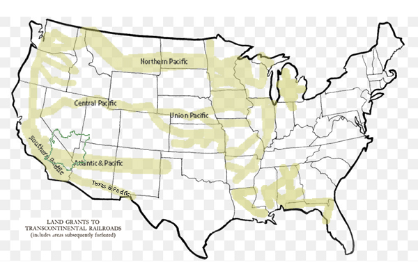
The 1785 Land Ordinance provided that all federal land would be surveyed into townships six miles square. Townships are subdivided into 36 one-mile-square sections. Sections can be further subdivided into quarter sections, quarter-quarter sections, or irregular government lots. Each township is identified with a township and range designation. Township designations indicate the location north or south of the baseline, and range designations indicate east or west of the Principal Meridian. A meridian is an imaginary line running north to south.
1861 Central Pacific Railroad is incorporated.
1862 President Abraham Lincoln signed the Pacific Railway Act, a law that authorizes the federal government to give land grants and loans to aid construction of the Central Pacific Railroad as the Western part of the Transcontinental Railroad and the Union Pacific as the Eastern part.
1863 Central Pacific begins construction at Sacramento.
1864 The United States Congress passes the Pacific Railway Act of 1864, which doubles the land grant to 20 alternate sections per mile, with a 20 mile checkerboard corridor on each side of the right-of-way.
1865 Central Pacific Railroad establishes a Land Department in Sacramento. Benjamin B. Redding, former mayor of Sacramento, was chosen to lead to design and manage the new organization.
1866 The Pacific Railway Act is amended to allow a railroad to select lands outside of the land grant area in exchange for unavailable land grant land.
1866 The federal government gives Southern Pacific Railroad a land grant to complete the western section of the Atlantic & Pacific line through California via Mojave to Needles.
1867 First land patent is issued to the Central Pacific Railroad by the federal government.
1868 September 25: The Central Pacific Railway owners acquire control of the Southern Pacific Railroad.
1869 The California & Oregon Railroad receives a federal land grant to build a line northward from Davis to connect to the Oregon & California Railroad at the California and Oregon border.
1869 The Central Pacific Railroad begins operating the California & Oregon Railroad.
1869 The Golden Spike ceremony held at Promontory, Utah, marks the completion of the transcontinental railroad between Sacramento, California and Omaha, Nebraska.
1870 California & Oregon Railroad is consolidated with the Central Pacific Railroad, and becomes a branch line of the Central Pacific Railroad.
1871 The federal government gives the Southern Pacific Railroad land grants and loans, allowing it to build to meet the Texas & Pacific at Yuma, California and build from Los Angeles to Colton, California.
1875 The Southern Pacific Railroad opens a land agency in San Francisco. 1876 Jerome Madden, Benjamin Redding’s assistant, became the land agent for Southern Pacific.
1886 Southern Pacific Company assumes control of the Oregon & California Railroad.
1899 The Central Pacific Railroad is reorganized as the Central Pacific Railway in order to pay off its federal debt.
1912 The Southern Pacific Company transfers some of its remaining land assets to Southern Pacific Land Company.
1916 Oregon & California grant lands are returned to the Federal Government.
1927 Southern Pacific purchases the Oregon & California Railroad.
1984 The Southern Pacific Company merges with Santa Fe Industries, parent company of the Atchison, Topeka & Santa Fe Railway, to form Santa Fe Southern Pacific Corporation (SPSF).
1985 The Interstate Commerce Commission (ICC) denies permission for the railroad operations to merge.
1986 Appeal of the ICC ruling fails.
1986 The renamed holding company, the Santa Fe Pacific Corporation, retains all of the non-rail interests of both companies except one. All of the Southern Pacific Railroad California real estate holdings are transferred to a new holding company, Catellus Development Corporation.
1996 The Southern Pacific Railroad is acquired by Union Pacific Railroad and its operations cease.
2005 Catellus Development Corporation is merged into ProLogis, another land development company based in San Francisco. ProLogis remains one of the largest real estate holders in California.
California State Railroad Museum Library and Archives https://oac.cdlib.org/institutions/California+State+Railroad+Museum+Library+and+Archives
Penn Phillips was a real estate developer known for his work in various parts of the United States, including Hesperia, California. Born M. Penn Phillips, he was a prominent figure in the mid-20th century, recognized for developing planned communities. In Hesperia, he was instrumental in transforming the area from a rural community into a more developed suburban area. Phillips was known for his aggressive marketing strategies and development projects that often included building infrastructure and amenities to attract residents and investors to the areas he developed. His impact on Hesperia and other towns he developed is still evident today in the layout and infrastructure of these communities.
What other towns was Penn Phillips involved with developing?
Penn Phillips developed several towns across the United States, particularly in the 1950s and 1960s. Some of the notable towns and communities he developed include:
California City, California: Perhaps his most ambitious project, California City, was intended to be one of the largest cities in California, with Phillips investing heavily in infrastructure and marketing to attract residents and businesses.
Coos Bay, Oregon: Phillips was known for his development work in the Coos Bay area, significantly impacting the local economy and landscape.
Boron, California: Similar to his work in other towns, Phillips aimed to transform Boron into a thriving community through extensive development projects.
Salton City, California: On the shore of the Salton Sea, Phillips attempted to develop Salton City as a resort community, capitalizing on its unique location and potential for tourism.
Phillips’ approach to development often involved buying large tracts of land, creating basic infrastructure, and then promoting the areas aggressively to attract residents and businesses. His legacy is mixed, with some of his projects turning into successful communities, while others, like California City and Salton City, did not fully realize the grand visions he had planned.
Was Phillips and Mendelsohn together in California City?
Yes, Penn Phillips and Nathan Mendelsohn were indeed associated with the development of California City, California. While Penn Phillips was a prominent real estate developer known for his work in various communities, Nathan Mendelsohn, a sociology professor turned developer, was the main force behind California City’s development.
Mendelsohn purchased the land and envisioned a new city that would become a significant community in the Mojave Desert. He planned and developed the infrastructure, plotting streets and laying out residential, commercial, and industrial areas to attract residents and businesses. Penn Phillips, known for his development projects in other areas, was also involved in the real estate development aspect of California City. However, Mendelsohn was the primary developer and driving force behind the city’s creation and initial development.
Nat Mendelsohn
Their collaboration in the development of California City was part of the larger trend of ambitious planned communities in post-war America, where developers sought to create new cities and communities from scratch in undeveloped areas.
Was Phillips a con man?
Penn Phillips had a reputation that some considered controversial, and some accounts label him as a con man, particularly in his real estate dealings. He was known for his aggressive and sometimes deceptive marketing strategies. Phillips would often sell land in undeveloped areas, promising potential buyers that these would become thriving communities with various amenities and infrastructure. However, in some cases, the promised development and amenities were not fully realized, leaving buyers with worthless plots of land.
For example, in his development projects, Phillips was known to sell plots of land through high-pressure sales tactics, often exaggerating the potential for growth and development. Buyers sometimes found themselves owning land in remote areas with little to no development, far from the bustling communities they were led to expect.
While Phillips was undoubtedly a successful developer in some respects, creating legitimate and thriving communities, his methods and the outcomes of some of his projects led to a mixed legacy. The perception of him as a con man stems from these practices, where the reality did not always meet the expectations he set for his investors and buyers.
Did Newton Bass in Apple Valley ever work with Penn Phillips?
Newton Bass and Penn Phillips were prominent real estate developers in California’s high desert region. Still, they are generally associated with different communities, and no well-documented collaboration exists between them. Newton Bass was one of the key figures in the development of Apple Valley, California, while Penn Phillips was known for his work in places like Hesperia and California City.
Newt Bass at Hilltop House
Both men were active during the mid-20th century and were instrumental in the development of the Mojave Desert area, but they operated largely independently of each other. Bass, alongside his partner Bud Westlund, developed Apple Valley into a thriving community, promoting it as an ideal place to live with a focus on quality of life and community amenities.
While both Bass and Phillips had similar careers in developing new communities in California’s desert regions, there is no significant historical record of them working together on a development project. Their approaches to development and the communities they built were distinct, reflecting their individual visions for high desert living.
–
Were there any other city developers in the Mojave Desert at the time?
Besides Penn Phillips and Newton Bass, other developers were active in the Mojave Desert area during the mid-20th century. These developers also played significant roles in shaping the region’s landscape and communities:
Bud Westlund: Partnered with Newton Bass in developing Apple Valley; Westlund was instrumental in promoting and building the community alongside Bass. They worked together to create a desirable living environment that attracted residents and businesses to the area.
Ray Ryan: Involved in developing Indio, California, and other areas in the Coachella Valley, Ryan was a notable figure in the real estate and oil industries. His contributions to the region’s development were significant, although controversy and connections to organized crime also marked his career.
Mervyn Dymally: While more known for his political career, Dymally was involved in various development projects in the Mojave Desert region, particularly in the Antelope Valley area. His work in real estate and politics intersected as he contributed to the growth and development of the area.
George Alexander and H.L. Waliser: They were involved in developing Victorville and the surrounding areas. Their efforts helped shape the growth and structure of these communities in the high desert.
These developers, among others, contributed to transforming the Mojave Desert from a sparsely populated area into a region with growing towns and communities. Each brought their unique approach to development, impacting the economic and social landscape of the desert region.
In the Lancaster and Palmdale areas of the Mojave Desert, several developers played significant roles in shaping the growth and development of these communities. Some of the notable figures include:
M. Leroy Gilleland: Gilleland was an early developer in Palmdale, playing a crucial role in its development during the mid-20th century. He was instrumental in promoting the area and attracting residents and businesses.
Tom Carrell: Along with his partner, Carrell was a significant figure in the development of Lancaster. They were responsible for much of the residential and commercial development in the area, contributing to Lancaster’s growth and structure.
Jack Kyser: Kyser was a key player in the economic development of the Antelope Valley, including Lancaster and Palmdale. His efforts in regional planning and economic development helped shape the future of these cities.
Fritz Huntsinger: Involved in industrial and commercial development in Palmdale, Huntsinger played a vital role in the city’s economic growth, contributing to its status as an important industrial and aerospace hub.
These developers, among others, were pivotal in transforming Lancaster and Palmdale into the significant urban centers they are today in the Antelope Valley region. Their contributions included residential, commercial, industrial, and aerospace developments, reflecting the diverse economic base of the area.
Lake Manix is an ancient lake in what is now the Mojave Desert of California, USA. It was part of the ancient Mojave River system, which flowed through the area during periods of the Pleistocene epoch when the climate was wetter than it is today. The presence of this lake is a testament to the dramatically different environmental conditions that prevailed in the region thousands of years ago.
Lake Manix
In its ancient course, the Mojave River fed into Lake Manix, creating a significant water body supporting diverse flora and fauna. This ancient river system was vital for migrating and sustaining animals and possibly early human populations. Over time, Lake Manix eventually dried as the climate became warmer, and the Mojave River’s flow diminished significantly. The remnants of this ancient river system can still be traced in the modern landscape of the Mojave Desert, with the Mojave River now flowing intermittently and largely underground.
Archaeological and geological evidence from the Lake Manix area provides valuable insights into the climatic changes that have occurred over millennia in the Mojave Desert. Studies of sediment deposits, fossil records, and other geological features around the former lake site help scientists reconstruct the paleoenvironmental conditions, offering clues about water availability, vegetation types, and the animals that once inhabited the region.
The transition from a wetter, lake-dominant landscape to the arid desert environment of today highlights the dynamic nature of Earth’s climate and ecosystems. Understanding the history of Lake Manix and the ancient Mojave River system contributes to our knowledge of past climatic shifts. It helps inform current and future conservation efforts in desert ecosystems.
Coyote Arm of Lake Manix
The Coyote arm of Lake Manix refers to a specific portion or segment of ancient Lake Manix, which existed during the Pleistocene epoch in what is now the Mojave Desert of California. This area is particularly interesting to geologists and archaeologists because it provides evidence of the extent of the lake and the environmental conditions that prevailed in the region.
Lake Manix covered a large area and had multiple “arms” or extensions, with the Coyote arm being one of them. These arms were parts of the lake that extended into different valleys or low-lying areas, filled by the ancient Mojave River and its tributaries. The existence of these arms indicates that the lake’s water levels and boundaries changed over time, influenced by climatic fluctuations, precipitation patterns, and river flow dynamics.
Studying the Coyote arm and other parts of Lake Manix helps scientists reconstruct the paleohydrology of the region. By examining sediment layers, fossil remains, and other geological features, researchers can infer past water levels, the timing of lake expansion and contraction, and the habitats around the lake. This information is crucial for understanding how ancient ecosystems responded to climate change and how they supported early human populations and other species.
Evidence from the Coyote arm and similar areas around the former Lake Manix also contributes to our understanding of the broader paleoclimatic patterns in North America. Such studies are part of a larger effort to piece together the history of Earth’s climate and how it has shaped the development of landscapes and ecosystems over geological time scales.
Troy Lake arm of Lake Manix
The Troy Lake arm of Lake Manix represents another significant segment of the ancient Lake Manix, which was a part of the extensive Pleistocene-age lake system in the Mojave Desert, California. Like the Coyote arm, the Troy Lake arm was one of the various extensions or branches of Lake Manix, fed by the ancient Mojave River and its tributaries during a time when the climate was considerably wetter than it is today.
The presence of the Troy Lake arm and other arms like the Coyote arm indicate the region’s complex hydrology and varied topography during the Pleistocene. These arms were essentially the lake’s extensions into surrounding valleys, creating diverse habitats for various plant and animal life. These lake arms’ fluctuating boundaries and water levels, driven by climatic variations, offer valuable insights into past environmental conditions.
Researchers study the Troy Lake arm and focus on sediment deposits, fossilized remains, and other geological indicators to understand the lake’s hydrology, such as water depth, extent, and changes over time. These studies contribute to a broader understanding of how ancient lake systems like Lake Manix responded to glacial and interglacial cycles, influencing precipitation patterns, temperature, and, ultimately, the region’s hydrography.
The research on the Troy Lake arm, alongside other parts of Lake Manix, is crucial for reconstructing past climates and ecosystems. It helps in understanding the challenges faced by early human settlers and the strategies they employed for survival. Moreover, it provides context for current environmental changes and aids in predicting future climatic shifts, especially in desert regions like the Mojave, which are sensitive indicators of broader environmental transformations.
Afton Canyon
/afton-canyon/
Afton Canyon, often called the “Grand Canyon of the Mojave,” is a striking geological feature in California’s Mojave Desert. It is renowned for its dramatic landscape, including steep canyon walls, rare desert waterways, and various wildlife. The formation of Afton Canyon is closely tied to the history of Lake Manix and the ancient Mojave River system.
During the Pleistocene epoch, when Lake Manix existed, it was a significant water body fed by the Mojave River, which carried meltwater from glaciers in the mountains to the north. Over time, the climate became drier, and the lake levels fluctuated. Eventually, Lake Manix breached its natural dam, leading to a catastrophic water outflow. This event was a pivotal moment in the formation of Afton Canyon.
The breach of Lake Manix’s dam caused a massive release of water that carved through the landscape, creating Afton Canyon. Rapid erosion cut deeply into the sediment and rock, forming the canyon’s distinctive steep walls. The force of the water was so powerful that it removed vast amounts of material, shaping the canyon into its present form.
Today, Afton Canyon remains one of the few places in the Mojave Desert where the Mojave River flows above ground, offering a rare glimpse into the water’s erosive power that shaped the landscape. The canyon’s formation is a testament to the dynamic geological processes that have occurred over millennia, driven by climatic shifts and water movement.
The role of Lake Manix in forming Afton Canyon highlights the interconnectedness of geological features within the Mojave Desert. It illustrates how ancient lakes, rivers, and climatic conditions have sculpted the region’s unique landscapes. Afton Canyon’s creation is a prime example of how water, even in arid environments, can be a powerful change agent, carving through the earth to create spectacular natural features.
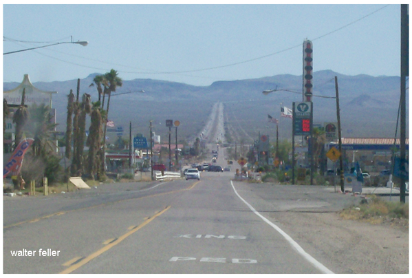
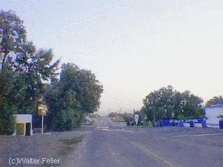
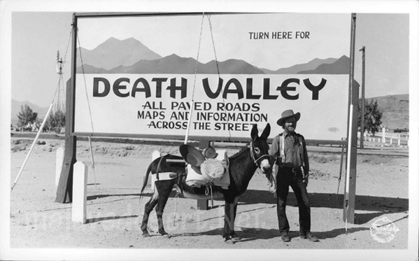
The Baker Grade is a renowned and challenging stretch of the Interstate 15 (I-15) freeway in the Mojave Desert near Baker, California. This freeway segment is characterized by its steep incline and decline over a long distance, presenting a significant test for vehicles, especially during the extreme temperatures in this desert region. The I-15 is a critical highway connecting Southern California, Los Angeles, and San Diego, as well as Las Vegas, Nevada. Further, it extends towards Salt Lake City, Utah, making the Baker Grade a crucial passage for travelers and freight transport.
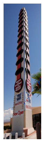
Baker, the small town near this stretch of the I-15, is often cited as the “Gateway to Death Valley,” serving as a critical rest and supply stop for those en route to Death Valley National Park and other destinations in the Mojave Desert. The town is famous for the World’s Tallest Thermometer, a 134-foot tall structure designed to commemorate the highest temperature recorded in Death Valley (134°F in 1913) and symbolize the region’s extreme heat.
The Baker Grade’s significance goes beyond its physical challenge; it is a testament to the engineering and planning required to maintain such a vital artery through one of the most inhospitable terrains in the United States. Travelers navigating this section are advised to ensure their vehicle’s cooling system is in optimal condition, to carry plenty of water, and to be prepared for the possibility of extreme weather conditions, which can range from scorching heat to sudden cold in the winter months.
State Highway 127 to Death Valley
Moreover, the Mojave Desert’s stark, austere beauty offers a unique backdrop for this portion of the I-15. It makes the journey through the Baker Grade memorable for its scenic vistas and physical demands. Despite the challenges it presents, the Baker Grade is an essential component of the southwestern U.S. transportation network, facilitating commerce and travel between California and Nevada.
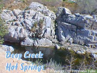
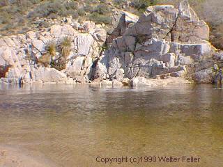
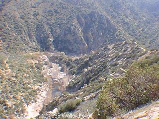
Deep Creek Hot Springs, located near Apple Valley in the Mojave Desert of Southern California, is a popular natural attraction within the San Bernardino National Forest. These hot springs are renowned for their scenic beauty and the therapeutic benefits of the mineral-rich waters. The area around Deep Creek Hot Springs offers a variety of outdoor activities, including hiking, swimming, and wildlife viewing.
Access to Deep Creek Hot Springs is primarily through hiking trails, the most common being the Bradford Ridge Path from the high desert side and the Pacific Crest Trail from the Lake Arrowhead side. The hike to the hot springs is known for its rugged terrain, offering a moderate to challenging trek depending on the path chosen and the hiker’s experience level.
The hot springs themselves are situated along Deep Creek, a tributary of the Mojave River. The area features several pools with varying temperatures, allowing visitors to choose their preferred level of warmth. The surrounding environment is a mix of desert and riparian zones, home to various plant and animal species.
It’s important to note that visiting Deep Creek Hot Springs requires adherence to local regulations and respect for the natural environment. The area is managed by the U.S. Forest Service, which may impose restrictions to protect the habitat and ensure the safety and enjoyment of all visitors. Additionally, due to its remote location and the necessity of hiking to reach the hot springs, visitors should be well-prepared with adequate water, food, and safety gear.