Limber Pine Trees

/a/baden-powell/lp1.html

Limber pine (Pinus flexilis) is a species of pine tree that is native to western North America, particularly the Rocky Mountains and surrounding areas. It is known for its adaptability to harsh mountainous environments and its distinctive characteristics. Here’s some information about limber pine trees:

Physical Characteristics:

Limber Pine

Limber pine is a slow-growing, long-lived species that can take several hundred years to reach maturity. Mature trees can live over 1000 years old. Although Limber pine stands tend to be even-aged, populations also occur in uneven-aged stands and on very harsh sites as widely spaced, isolated individuals. Most trees grow irregularly or in a multi-stemmed form and rarely reach more than 50 feet (15 meters). In high elevations, they sometimes develop krummholz (stunted, twisted shrubs due to wind exposure). Trunks can reach a diameter of 6.5 feet (2 meters). This species is cold- and drought-tolerant. The trees are ectomycorrhizal, have deep taproots, and are very wind-resistant. Limber pine has thin bark.

The needles of limber pine trees are arranged in bundles of five, and they are flexible, giving the tree its common name, “limber.”

The tree’s bark is often scaly and furrowed, varying in color from gray to reddish-brown.

Cone and Seed Production:

Limber pine trees produce both male and female cones. Female cones are larger and take about two years to mature.

The seeds of limber pine trees are large and winged, and they serve as a crucial food source for various wildlife, including birds, squirrels, and bears.

Limber pine trees have a serotinous cone adaptation, meaning their cones remain closed and require the intense heat of a fire to open and release seeds.
This helps the species regenerate after wildfires.

Adaptation:

Limber pine is well-adapted to high-elevation, cold, and windy mountain environments. It can thrive in poor soils and withstand extreme temperature fluctuations.

These trees have a deep root system that helps them access water and nutrients in rocky and challenging soils.

Conservation:

Limber pine trees are vulnerable to various threats, including mountain pine beetle infestations and white pine blister rust, which is a fungal disease.

Conservation efforts are in place to protect and restore limber pine populations. These efforts include monitoring for disease, maintaining genetic diversity, and conducting controlled burns to promote regeneration.

Ecological Significance:

Limber pine trees play a critical role in mountain ecosystems by providing habitat and food for various wildlife species.

The seeds of limber pine are an essential food source for Clark’s nutcrackers, a type of bird. These birds play a role in seed dispersal, helping to regenerate limber pine populations.

Recreational Use:

Limber pine forests are popular among hikers, campers, and outdoor enthusiasts, as they often grow in scenic mountain environments. These forests provide habitat and shade for recreation.

Limber pine trees are an important and iconic component of the mountain ecosystems in western North America. Their adaptability to challenging environments and their role in providing food and habitat for wildlife make them a valuable part of these ecosystems. Conservation efforts are crucial to ensuring the continued health and resilience of limber pine populations in the face of various threats, including disease and climate change.

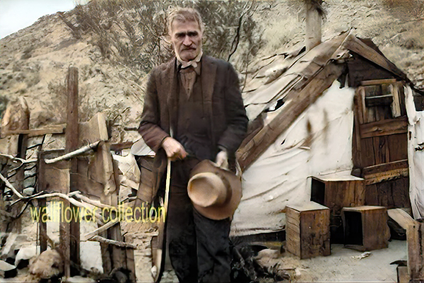
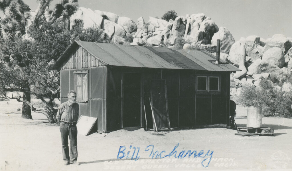
Bill McHaney

Bill McHaney would have been around 73 years old when this photo was taken, and had lived and prospected in the area for over 50 years. Willis Keys noted that he always wore a red or blue bandana, like the one pictured around his neck in this photograph, and would not come out of his cabin without it.

Born in the Midwest, McHaney came to California with the waves of easterners moving west towards the end of the 1870s. Bill and his brother James first arrived in the area in 1879 as members of what local legend says were cattle rustlers who used the area’s isolation to hide stolen cattle until they could be sold. Old timers remember that the higher valleys of the park were covered in tall grass, providing good winter cattle grazing. The McHaneys established a headquarters that included adobe cookhouse, barn and bunkhouse amongst the foothills of what is now the Desert Queen (Keys) Ranch.

McHaney lived and prospected in the area for nearly 60 years. The cabin in the photograph no longer exists, but it is known that William F. (Bill) Keys took over this neighboring homestead when it was abandoned, and likely asked McHaney to stay there to maintain the claim. When McHaney became too ill to take care of himself, the Keys family brought him to their homestead, where he passed in 1937.

Desert Queen Ranch Collection, Willis Keys photo album
https://www.nps.gov/museum/exhibits/jotr/Desert-Peoples/New-Industries/JOTR-40127.html


In 1933, Bill lived in a wickiup in upper Musick Valley, Gold Park, and claimed he had lived there for 35 years. In 1933, his sight was very bad, and shortly before this interview, he had picked up a 10-button rattler, thinking it was a piece of rope. Bill mostly prospected, although at times, he worked for others. He claimed that he and/or his brother first found several of the best early mines.

Notes of an Interview with William H, McHaney
by W, E. Ketcham and W, Egbert Schenck – March 1933
Transcribed by Schenck March 1952

Historic Linguistics

Historical linguistics, also known as diachronic linguistics, is the subfield of linguistics that focuses on the study of how languages change over time. It involves the examination and reconstruction of the evolutionary development of languages, as well as the relationships between different languages and language families. Here are some key concepts and topics related to historical linguistics:

  1. Language Change: Languages constantly evolve, with changes occurring in pronunciation, vocabulary, grammar, and other linguistic features. Historical linguists analyze these changes and attempt to understand the processes behind them.
  2. Sound Change: One of the most common types of language change is sound change, where the pronunciation of words and sounds in a language gradually shifts over time. For example, the English word “knight” was once pronounced with a “k” sound, but that sound has disappeared in modern English.
  3. Comparative Linguistics: Comparative linguistics involves the comparison of languages to identify common origins and relationships. Linguists use the method of the comparative method to reconstruct the common ancestor of related languages, known as a proto-language.
  4. Proto-Languages: A proto-language is a hypothetical, reconstructed language that is believed to be the common ancestor of a group of related languages. For example, Proto-Indo-European is the reconstructed ancestor of the Indo-European language family.
  5. Language Families: Languages are often classified into families based on their historical relationships. The Indo-European, Afroasiatic, and Sino-Tibetan language families are examples of language families that encompass multiple languages with common origins.
  6. Language Evolution: Historical linguists seek to understand the processes that drive language evolution, such as lexical change (the addition and loss of words), grammatical change (changes in word order or verb conjugations), and semantic change (shifts in word meaning).
  7. Etymology: Etymology is the study of the history and origin of words. Historical linguists trace the development of words and their meanings over time, often by examining the historical records and written texts in which these words appear.
  8. Language Contact: Languages can also change through contact with other languages, leading to the borrowing of words, phrases, and even structural features. This is known as language contact or linguistic borrowing.
  9. Language Isoglosses: An isogloss is a geographic boundary that marks the distribution of a particular linguistic feature. Studying isoglosses can provide insights into the history of language change and dialect development.
  10. Language Classification: Historical linguistics is crucial in classifying and organizing languages into language families and subgroups. These classifications help linguists understand the historical connections between languages.

Historical linguistics is an essential field for understanding the rich tapestry of human languages and how they have evolved. It helps us trace the development of languages, reconstruct ancestral languages, and gain insights into the cultural and historical aspects of different language communities.

Joshua Tree National Park Geology

Joshua Tree National Park, located in southeastern California, is known for its unique and stunning geological features. The park’s geology results from a complex history of tectonic activity and erosion. Here are some key aspects of the geology of Joshua Tree National Park:

Rocks and Formations:

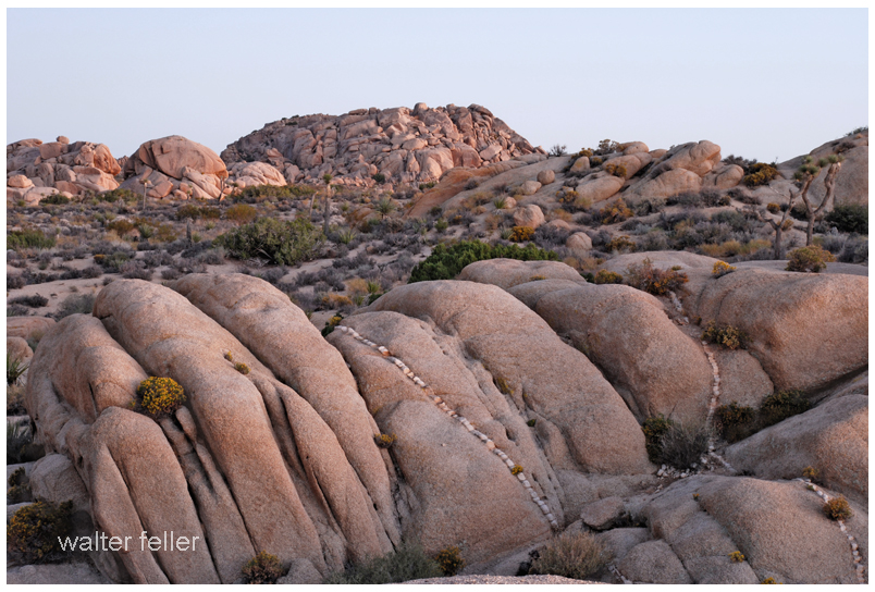
The park is primarily composed of two major types of rocks: granites and monzogranites, which are igneous rocks, and Pinto gneiss, which is a metamorphic rock. These rocks provide the foundation for many of the park’s iconic landscapes.

Faults and Tectonic Activity:

The park is situated at the intersection of the San Andreas Fault and the Pinto Mountain Fault. These fault systems have played a significant role in shaping the landscape over millions of years. The motion along these faults has created uplifts, valleys, and rock fractures.

Uplift and Erosion:

The park’s rugged terrain is the result of the gradual uplift of the rock formations, followed by extensive erosion. Over millions of years, water, wind, and temperature fluctuations have sculpted the rocks into unique shapes and formations throughout the park.

Rock Piles and Boulders:

One of the most recognizable features of Joshua Tree National Park is the abundance of massive boulders and rock piles. These rocks have been exposed through erosion and have unique shapes and textures, making them a popular destination for rock climbers and hikers.

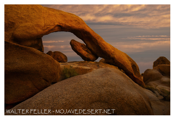
Arch Rock:

Arch Rock is a famous natural arch formation in the park, which erosional forces have created. It’s a popular spot for visitors and photographers.

Wonderland of Rocks:

The Wonderland of Rocks is an area within the park characterized by a maze of large rock formations. It’s a fantastic place for rock climbing and hiking, with numerous granite formations that the elements have sculpted.

Desert Landscape:

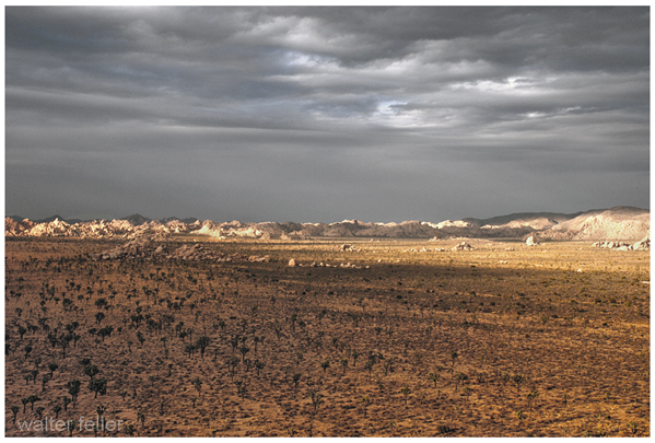
In addition to its distinctive rock formations, Joshua Tree National Park features a diverse desert landscape with unique flora, including the Joshua tree (Yucca brevifolia), which gave the park its name. The park is also home to various cacti, shrubs, and wildlife.

Indian Cove:

Indian Cove is another popular area in the park known for its large boulders and rock formations. It’s a favorite spot for rock climbers and offers a unique camping experience.

Visitors to Joshua Tree National Park can explore its geology through hiking, rock climbing, and scenic drives. The park’s fascinating geological features and stunning desert landscapes make it a must-visit destination for nature enthusiasts and geology enthusiasts alike.

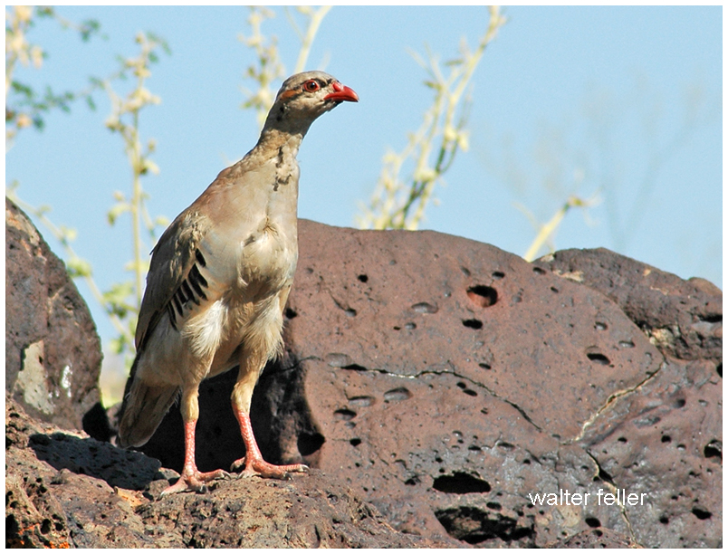
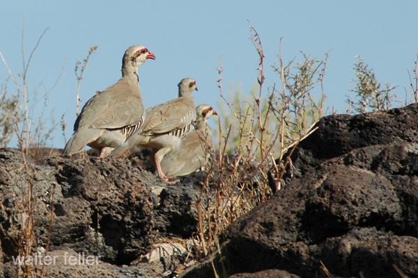
Chukar

Chukars (Alectoris chukar) were introduced to the Mojave Desert in the southwestern United States in the mid-20th century. These introductions were part of efforts to establish populations of chukars for hunting and recreational purposes in the arid regions of the United States. Chukars were brought to the Mojave Desert and other arid areas in the western United States as game birds to provide opportunities for hunters.

The specific dates of these introductions can vary by location, but chukars were likely introduced to the Mojave Desert in the 1940s and 1950s. The birds adapted well to the desert environment and have since established populations in parts of the Mojave Desert, making them a popular game bird for hunting in the region. However, it’s worth noting that their introduction has led to both positive and negative ecological impacts, and they are a subject of interest and concern in terms of their effects on native flora and fauna.

The chukar (Alectoris chukar) is a bird species that belongs to the partridge family and is native to the rocky and hilly regions of South Asia and parts of the Middle East. Chukars have been introduced to various other regions for hunting and have established populations in some parts of the world. Here are some key characteristics and information about chukars:

  1. Physical Description: Chukars are medium-sized game birds with a plump body and relatively short legs. They have distinctive markings, including a barred pattern on their flanks and a black line running from their beak, through the eye, and down the side of the neck. Males and females are similar in appearance, but males tend to have slightly brighter and more vibrant colors.
  2. Range: Chukars are native to various habitats across South Asia, including countries like Pakistan, India, Nepal, and parts of the Middle East, including Iran and Turkey. They have also been introduced to other parts of the world, including North America, New Zealand, and some European countries, as game birds.
  3. Habitat: Chukars prefer arid and rocky habitats like desert canyons, hillsides, and semi-arid landscapes. They are well adapted to living in rugged terrain and can be found at various elevations, from low deserts to high mountains.
  4. Behavior: Chukars are social birds and often gather in coveys, which are groups of individuals. They feed on a variety of seeds, plants, and small insects. Their call is distinctive and sounds like “chukar-chukar-chukar,” which is how they got their common name.
  5. Reproduction: Chukars typically nest in rocky crevices or depressions on the ground. The female incubates the eggs, and the chicks are precocial, meaning they can leave the nest shortly after hatching. Chukar chicks can feed themselves and are raised by the female until they are old enough to fly.
  6. Conservation: Chukars are not considered globally threatened, and their populations are stable in their native range. However, in regions where they have been introduced as game birds, they are subject to hunting regulations to ensure sustainable populations.
  7. Game Birds: Chukars are popular game birds, and they are commonly hunted for sport and their meat. They are often released for hunting purposes in many parts of the world.

Chukars are known for their adaptability to arid and rocky environments and are appreciated by hunters for their challenging behavior and flight patterns. They have become established in various regions due to their introduction to recreational hunting.

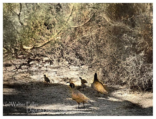
Gambel’s Quail

https://digital-desert.com/wildlife/gambels-quail.html

Gambel’s quail (Callipepla gambelii) is a species of New World quail that is native to the southwestern United States and parts of Mexico. They are named after William Gambel, a 19th-century naturalist who documented various species of North American birds.

Here are some key characteristics and information about Gambel’s quail:

  1. Physical Description: Gambel’s quail are medium-sized birds with a plump, rounded body. They have a distinctive appearance with a prominent topknot or plume on their head, which consists of a black feather with white edges. Males and females look similar, but males are slightly larger and more colorful.
  2. Range: These quail are primarily found in the arid and semi-arid regions of the southwestern United States, including parts of Arizona, New Mexico, Nevada, Utah, Colorado, and California, as well as northern Mexico.
  3. Habitat: They inhabit various desert and semi-desert environments, including shrublands, scrubby areas, and open woodlands. Gambel’s quail is particularly adapted to arid regions and can often be found in areas with brushy cover.
  4. Behavior: These birds are known for their distinctive “ka-KAA” call, which is often heard in the early morning and late evening. They are generally ground-dwelling birds and spend most of their time foraging for seeds, leaves, and insects on the ground. They are social birds and often gather in family groups or coveys, especially during the non-breeding season.
  5. Reproduction: Gambel’s quail breed during the spring and early summer. Nests are typically placed on the ground and are well-hidden. The female incubates the eggs and cares for the chicks after hatching. The chicks are precocial and can leave the nest shortly after hatching.
  6. Conservation: Gambel’s quail populations are generally stable, and they are not considered to be at risk. They have adapted well to human-altered landscapes in some areas and can even be seen in suburban environments.
  7. Game Birds: Gambel’s quail are often hunted for sport and are considered game birds in the regions where they are found. Hunting seasons and regulations are in place to ensure the sustainability of the population.

Gambel’s quail are iconic birds of the American Southwest, and their distinctive appearance and calls make them a popular sight for birdwatchers and nature enthusiasts in their native habitat.

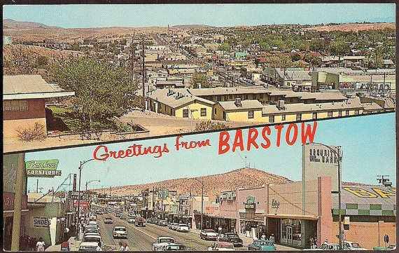
Barstow, California

https://digital-desert.com/barstow-ca/

.

  1. Early Inhabitants: The Barstow area was originally inhabited by Native American tribes, including the Mojave people, for centuries before European settlers arrived.
  2. Railroad History: Barstow’s modern history began with the arrival of the Atchison, Topeka, and Santa Fe Railroad in the late 19th century. The railroad played a significant role in the city’s development, as it was a vital stop on the transcontinental rail line, connecting the eastern United States to the West Coast.
  3. Water Stop and Rail Depot: Barstow served as an important water stop for steam locomotives, providing a place for trains to refill their water tanks in the desert. The city also became a key rail depot and maintenance facility.
  4. Name Change: Originally known as Waterman Junction, the city’s name was changed to Barstow in 1886 in honor of William Barstow Strong, a president of the Santa Fe Railroad.
  5. Route 66: In the early 20th century, Barstow became an integral part of the iconic Route 66, the “Main Street of America,” connecting Chicago to Los Angeles. The city thrived as a popular stopping point for travelers on this historic route.
  6. Military Presence: During World War II, Barstow’s population grew due to the establishment of the Marine Corps Logistics Base Barstow and the nearby Fort Irwin National Training Center, which continue to play significant roles in the local economy.
  7. Modern Times: Barstow remains a transportation center today, situated at the junction of Interstates 15 and 40. It continues to serve as a rest stop for travelers and a transportation and logistics hub for goods moving across the country.
  8. Historical Landmarks: The city has preserved its historical heritage, with several landmarks and museums, including the Route 66 Mother Road Museum and the Western America Railroad Museum, showcasing its rich transportation history.

Barstow’s history is deeply intertwined with the development of transportation networks, from the railroad to Route 66 and modern interstate highways. Today, it remains an essential point of access and commerce for those traveling through the Mojave Desert in Southern California.

Beavertail Cactus

https://mojavedesert.net/cactus/beavertail.html

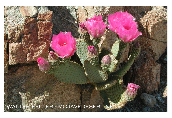
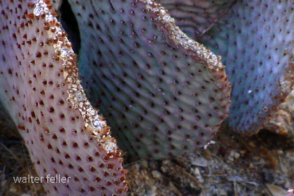
The beavertail cactus, scientifically known as Opuntia basilaris, is a species of prickly pear cactus native to the southwestern United States and parts of northern Mexico. It gets its common name from the shape of its pads, which resemble the broad, flattened tail of a beaver. This cactus is known for its distinctive, bluish-gray, oval or paddle-shaped stems, which are typically covered in tiny, hair-like spines and glochids, which are small, hair-like prickles that can irritate the skin upon contact.

Beavertail cacti produce colorful flowers in shades of pink, magenta, or purple. These flowers often appear at the edges of the pads in the spring and early summer. The fruits of this cactus are edible and are usually red or purple when ripe.

Beavertail cacti are adapted to arid and desert environments and are well-suited to the harsh conditions of their natural habitat. They are drought-tolerant and can store water in their stems to survive periods of water scarcity. These cacti play a role in providing food and habitat for wildlife in their native regions.

In landscaping and gardening, beavertail cacti are often cultivated for their ornamental value, as their unique appearance and vibrant flowers make them attractive additions to xeriscape gardens or desert-themed landscapes. However, it’s essential to handle them with care due to their spines and glochids, which can cause skin irritation.

Like other cacti, the beavertail cactus prefers well-draining soil and requires minimal watering once established. It is important to be mindful of local regulations when collecting or cultivating beavertail cacti, as they are protected in some areas due to their ecological importance and vulnerability to overharvesting.

Mojave or Mohave?

IS WORD “MOJAVE”: J OR H?

Much confusion and argument have arisen from the two spellings of the word “Mojave.” A ruling of the Geographical Board in Washington, D.C., however, a few years ago simplified the problem somewhat. If you are in California, the name of the river, the city, and the desert should be spelled with a “j”: Mojave. If, on the other hand, you happen to be in Arizona, then you must spell the name of the county and the Indian tribe with an “h”: Mohave.

Dr. A.L. Kroeber of the University of California, a noted anthropologist, claims that only the “h” spelling should exist since the word is an Indian one, not Spanish, and was only transliterated by the early Spanish, who gave all “h” sounds a spelling of “j.” The very same problem arose with the greatest Indian tribe of Northern Arizona: should it be Navaho or Navajo?

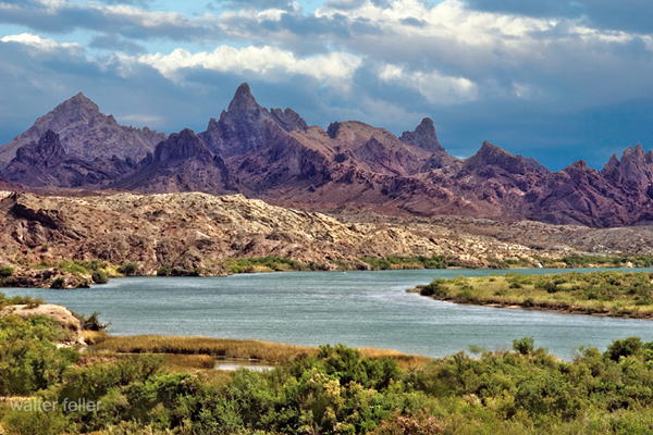
The word Mojave (or Mohave) itself is of Indian origin and is that tribe’s name for “three mountains,” referring to three distinctive landmarks near the present city of Needles, whose name also refers to this geological oddity.

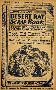
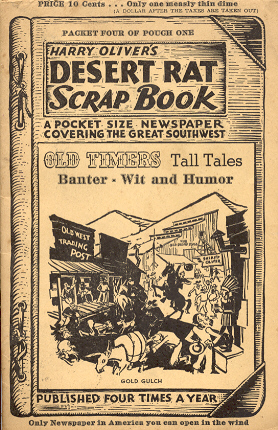
from; Desert Rat Scrapbook
Published by Harry Oliver

Fort Commander, Publisher, Distributor, Lamp Lighter, Editor, Artist, Gardener, Janitor, Owner
A paper that grows on you as you as you turn each page . . . excepting page 5

Pictures are by the author, many of them are woodcuts.

“I Did All but the Spelling.”

Cultural Mojave

The Mojave Desert, located in the southwestern United States, is not only a vast expanse of arid land and rugged beauty but also a region rich in cultural heritage. The Cultural Mojave is a term that encompasses the diverse traditions, art forms, and history of the indigenous peoples and settlers who have called this desert home for centuries.

One of the most prominent aspects of the Cultural Mojave is the Native American heritage. The Mojave people, also known as the Pipa Aha Macav, have inhabited the region for thousands of years and have a deep connection to the land. Their traditional way of life, which includes hunting, gathering, and agriculture, reflects their strong bond with nature. Through their storytelling, music, and art, the Mojave people preserve and pass down their cultural traditions from generation to generation.

Artistic expression plays a significant role in the Cultural Mojave. The desert landscape, with its stark beauty and unique features, has inspired numerous artists over the years. From painters capturing the vibrant colors of the desert sunsets to photographers capturing the vastness of the dunes, the art of the Cultural Mojave reflects the awe-inspiring nature of the region.

Another important aspect of the Cultural Mojave is the history of exploration and settlement. The desert has long been a crossroads for travelers, from Native American trade routes to the westward migration of pioneers during the 19th century. The stories of these intrepid explorers and settlers are woven into the region’s fabric, adding depth and complexity to its cultural identity.

In recent years, the Cultural Mojave has gained attention as a center for alternative and sustainable living. The desert’s remote location and vast open spaces have attracted individuals and communities seeking a simpler and more environmentally conscious way of life. From off-grid living to eco-friendly architecture, the Cultural Mojave is a hub for innovative ideas and practices that promote harmony with the natural world.

It is the spirit of the human spirit that constitutes the Cultural Mojave. It is a place where ancient traditions merge with modern innovations, creating an extraordinary and vibrant cultural tapestry. Whether it’s exploring ancient petroglyphs, attending traditional ceremonies, or simply marveling at the breathtaking landscape, the Cultural Mojave offers a multitude of experiences that celebrate the rich heritage of this extraordinary desert region.

Ecotones Defined

Ecotone is a term used in ecology to describe a transitional zone between two different ecosystems. It is an area where two distinct ecological communities meet and interact, creating a unique and diverse habitat. Ecotones are characterized by a blend of species and environmental conditions from both adjacent ecosystems, resulting in a rich array of biodiversity.

Ecotones can be found in various natural settings, such as where a forest meets a grassland, a river merges with a lake, or a shoreline transitions into a marsh. These transitional zones often display a gradient of species composition, with certain species being more abundant or specialized at specific points along the ecotone.

The dynamics of an ecotone are influenced by the physical and biological processes occurring in both adjacent ecosystems. Factors such as climate, topography, soil type, and water availability can shape the structure and function of the ecotone. As a result, ecotones can exhibit unique microclimates, hydrological patterns, and nutrient cycling dynamics that differ from the surrounding ecosystems.

Ecotones play an essential role in supporting biodiversity and promoting ecological resilience. They serve as corridors or stepping stones for species migration, allowing for gene flow and enhancing genetic diversity. Ecotones also provide habitat for specialized species that are adapted to the unique conditions found within the transitional zone.

Furthermore, ecotones contribute to ecosystem services by providing valuable resources and ecological functions. They can regulate water flow, filter pollutants, and stabilize soil, thus helping to mitigate the impacts of human activities on surrounding ecosystems. Ecotones also offer recreational and educational opportunities, allowing people to appreciate the beauty and ecological significance of these transitional areas.

In conclusion, ecotones are dynamic and complex zones that bridge the gap between two distinct ecosystems. They are characterized by a unique blend of species and environmental conditions, creating a diverse and valuable habitat. Understanding and conserving ecotones is crucial for maintaining biodiversity, promoting ecological resilience, and ensuring the sustainability of our natural environment.

Shoshone, California

https://digital-desert.com/shoshone-ca/

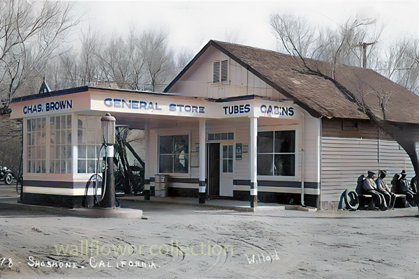
Shoshone, California, is a small unincorporated community in Inyo County, California. Nestled in the southern part of the state, Shoshone is situated in the Mojave Desert near the eastern border of Death Valley National Park. The town was founded in 1910 and has a rich history tied to mining and agriculture.

One of the main attractions in Shoshone is the Shoshone Museum, which showcases the town’s history and the surrounding area. The museum exhibits Native American heritage, mining operations, and early pioneers. Visitors can learn about the Mojave Desert’s wildlife, geology, and plant life.

Outdoor enthusiasts can explore the nearby Death Valley National Park, which is just a short drive away from Shoshone. This vast national park offers a variety of recreational activities like hiking, camping, and birdwatching. With its striking landscapes, including dunes, salt flats, and rugged mountains, Death Valley is a must-visit destination for nature lovers.

Shoshone is a peaceful and quiet community that offers a respite from the hustle and bustle of city life. With its charming small-town atmosphere, visitors can experience a slower pace of life and reconnect with nature. The town has a few accommodations, including a motel and camping facilities, making it an excellent base for exploring the surrounding area.

Whether you’re interested in history, outdoor activities, or simply looking for a peaceful getaway, Shoshone, California, has something to offer. Its unique location near Death Valley National Park and rich history make it a destination worth visiting. So, pack your bags and embark on an adventure to Shoshone, where you can immerse yourself in the desert’s beauty and tranquility.

–

Death Photography

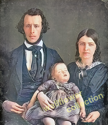
Today, we look at Post-Mortem Photography through a different lens. – w.feller

The practice of death photography in the late 19th century holds a significant place in the history of photography. During this era, capturing post-mortem portraits of deceased loved ones became a common and accepted practice. Death photography, also known as mourning or post-mortem photography, served as a way for families to remember and mourn their departed relatives.

In the 1800s, death was an ever-present aspect of life. Illnesses such as tuberculosis, typhoid fever, and smallpox were prevalent, and mortality rates were high, especially among children. In this context, death photography emerged as a way to preserve the memory of the deceased and create a lasting visual memento.

The process of death photography involved carefully arranging the deceased in lifelike poses, often with family members or close friends surrounding them. The intent was to capture a sense of peace and serenity, presenting the dead as if they were merely sleeping. The use of props, such as books or toys, was used to enhance the illusion of life further.

The technical limitations of photography required long exposure times; the deceased was the most suitable subject for portrait photography, as they could remain still for long, extended periods. As a result, death photography became an integral part of the photographic practices of the time.

Families cherished these photographs, often displayed prominently in homes or carried as keepsakes. They provided a tangible connection to the deceased, allowing grieving individuals to feel closer to their loved ones even after they died. Death photography also played a role in the mourning process, providing a visual representation of the deceased’s final moments and facilitating the grieving process.

The popularity of death photography began to decline in the late 19th century with the introduction of post-mortem embalming techniques and the increasing availability of faster photographic processes. As society’s attitudes towards death and mourning evolved, death photography gradually fell out of favor.

While it may seem strange or macabre to modern sensibilities, it is essential to understand the historical and cultural context in which it existed. Death photography in the 1800s served as a way for people to cope with loss and pay tribute to their departed loved ones, reflecting the customs and beliefs of the time.

Death photography in the 1800s was a significant practice that allowed families to remember and grieve for their deceased relatives. These photographs provided a tangible connection to the departed and played a crucial role in the mourning process. Although the practice has declined over time, it remains an important part of the history of photography. It offers insights into the cultural attitudes towards death and loss during the 19th century.

Leadfield – Summary

https://mojavedesert.net/mining-history/leadfield/index.html

Leadfield, located in Titus Canyon, was promoted by a man who could have sold ice to an Eskimo. He blasted some tunnels and liberally salted them with lead ore and drew up some enticing maps of the area, which lured Eastern promoters into investing money.

The true story of Leadfield is somewhat different from the usual tale of a stock swindle and a dying town.

During the early days of the Bullfrog boom, W. H. Seaman and Curtis Durnford staked nine lead and copper claims in Titus Canyon and came into Rhyolite with ore samples that assayed as high as $40 to the ton. The Death Valley Consolidated Mining Company was incorporated and immediately began a development and promotional campaign.

The Death Valley Consolidated Mining Company ceased operations in 1906 after realizing that the long and arduous trip between its mine and Rhyolite made the shipment of its ore absolutely unprofitable.

In 1924, three prospectors staked out numerous claims on some lead deposits in Titus Canyon. A local promoter named John Salsberry purchased twelve claims from the three prospectors and formed the Western Lead Mines Company.

The young camp was entering the boom stage, and by January 30th, half a dozen mining companies were in operation. The stock of Western Lead Mines Company soared to $1.57 per share.

Eastern California, and especially Inyo County, was long overdue for a mining boom. With the backing of a successful and skilled promoter, Leadfield seemed assured of obtaining the necessary financial support to take it from a prospecting boom camp into a producing mine town.

The Inyo Independent greeted Julian with a glowing description of his character and abilities, but a different endorsement would be printed in later years.

The boom was now on in earnest, with the Western Lead Company employing 140 men and the Titus Canyon Road being completed. The Western Lead Mine produced 8% to 30% lead and seven ounces of silver per ton.

The California State Corporation Commission was not so impressed with the company and raised the righteous indignation of local folk. The local attitude was well summed up by the Owens Valley Herald: “The Commission is using its every endeavor to try and prejudice the people against this latest promotion of Julian’s.”

The paper pointed out that Julian was not trying to swindle anyone and that he had publicly invited any reputable mining engineer worldwide to visit the Leadfield District. The paper concluded that the future of Leadfield seemed very bright.

Julian was not the only promoter singing the praises of the Leadfield District, for numerous other companies were also trying to cash in on the boom. The Western Lead Mines Company, Julian’s pet, led the pack, with one of its tunnels six hundred feet inside the mountain.

The town of Leadfield was trying to keep pace with the boom and announced that a large hotel would soon be built. On March 15th, the first of Julian’s promotional excursions pulled into Beatty, and 340 passengers were served a sumptuous outdoor feast by the proprietor of the local Ole’s Inn.

Lieutenant-Governor Gover of Nevada gave the keynote speech, and Julian gave a speech praising Julian for overcoming the numerous obstacles that modern governmental bureaucracies put in a man’s path. The trip was a big success, and Western Lead stock advanced 25 on the San Francisco market the next day.

Western Lead stock had soared to $3.30 a share by the end of March, and several ore-buying and smelting concerns sent representatives to the district to discuss reduction and smelting rates.

Leadfield continued to develop in the months following the great train excursion. New mining companies opened for business, and the Tonopah & Tidewater Railroad replied that definite plans for a railroad spur into Leadfield had not been made as the present business does not warrant its construction.

The townsite of Leadfield was officially surveyed on April 30th, and the town’s plat was submitted to Inyo County officials for approval. The town was platted on land donated by the Western Lead Company.

The State of California was breathing hard upon Julian’s neck, and the Corporation Commission hauled a brokerage company into court for selling Western Lead stock without a state permit. Expert witnesses testified that the Western Lead Mine was a quite legitimate proposition.

The continued investigations by the state of California hurt the sales of Western Lead stock, and another factor began to take a toll. Julian’s credibility began to shrink, and the company never recovered from the panic that set in.

Julian bought into the New Roads Mining Company, which gave him control of the two largest mines of Leadfield and announced plans to construct a large milling plant at Leadfield.

As summer approached, the Leadfield boom showed no signs of peaking. The California Corporation Commission ordered that sales of Julian’s personal stock in the Western Lead Mines must immediately cease on the Los Angeles stock exchange due to evidence introduced at a hearing.

Despite the heavy blow to Julian’s financial fortunes, developments at Leadfield proceeded, and the Mining Journal printed a long, detailed report on the Leadfield District in July, which helped to restore public confidence.

The mines agreed with the independent experts and continued to work, and the Boundary Cone Mining Company ordered a new 25-horsepower hoist and headframe and increased its workforce to twelve miners.

In late July, the Western Lead Mining Company brought a $350,000 damage suit against the Los Angeles Times and the California Corporation Commission. Still, the suit was quickly thrown out of court for insufficient cause. In August, a new mining company, the Pacific Lead Mines No. 2, was incorporated.

During September and October, drilling and tunneling continued in Leadfield’s mines, but in late October, two events took place that spelled the end of Leadfield. The main tunnel of the Western Lead Mine finally penetrated the ledge but found almost nothing.

At almost the same time, the California Corporation Commission dealt Julian another blow when it halted stock sales in the Julian Merger Mines, Inc. Julian’s empire fell apart. The other mines slowly closed, one after the other, and Leadfield became a ghost town in a matter of months.

The failure of a mining district led to a flurry of lawsuits. In February of 1927, the Western Lead Company removed its heavy machinery and the pipeline to a mine that the company owned in Arizona.

Julian went on to organize the Julian Oil and Royalties Company and was indicted for fraud, but jumped bail and committed suicide.

Leadfield was a ghost town created by C. C. Julian. Still, the existence of lead ore in the district had been known as far back as the Bullfrog boom days of 1905, and the California Corporation Commission allowed companies other than Julian’s to sell their stock.

Julian did not start the Leadfield boom and had plenty of help in supporting the boom once it had started. The citizens of Inyo County, California, and Nye County, Nevada, also supported the mines.

The collapse of Julian’s financial structure came at the worst possible time for Leadfield. Although it seems doubtful that Leadfield had enough ore to support more than a small mining company or two, indications are that without the sudden panic of the fall of 1926, that mine or two could have survived.

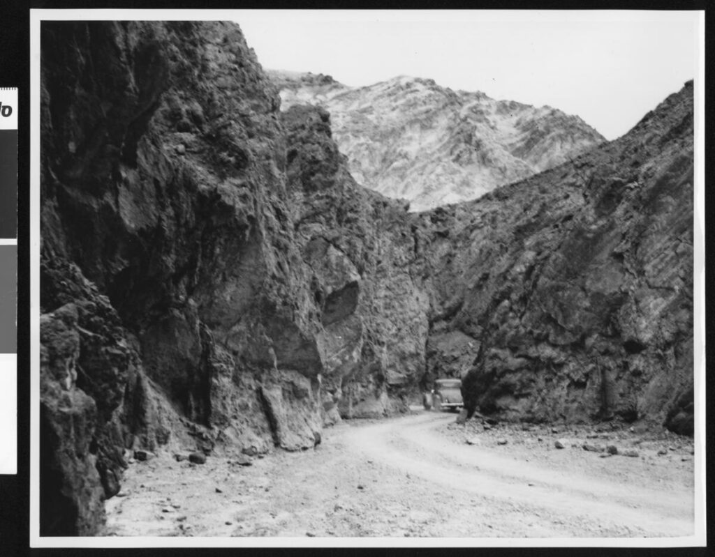
The Titus Canyon Road, an engineering marvel, was built by Julian and cost an estimated $60,000 to build. Without Julian, the road would not have been finished, and today presents one of the most spectacular routes in Death Valley National Park.
Ecosystems of Death Valley

https://digital-desert.com/death-valley-ecosystems/

Death Valley, located in California, is home to a unique and diverse range of ecosystems. Despite its harsh and extreme conditions, this national park supports a surprising variety of plant and animal life. The following are some of the key ecosystems found within Death Valley.

1. Desert Scrub: The dominant ecosystem in Death Valley is the desert scrub, characterized by sparse vegetation and rocky landscapes. Plants such as creosote bushes, desert holly, and Joshua trees have adapted to survive in arid conditions. These plants have deep root systems and waxy leaves to conserve water.

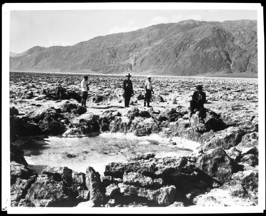
2. Salt Flats: Death Valley is famous for its vast salt flats, known as playas. These white, barren expanses are created by water evaporation, leaving behind mineral deposits. Certain organisms, such as salt-tolerant algae and brine flies, can survive in this environment despite harsh conditions.

3. Badlands: Death Valley’s rugged badlands are formed by erosion, resulting in unique formations of clay-rich soil and sedimentary rocks. The lack of vegetation allows intricate geological formations. These areas are home to reptiles, rodents, and insects that have adapted to extreme temperatures and water scarcity.

4. Oasis: Death Valley surprises visitors with small oases. These are areas where underground water reaches the surface, creating a lush and vibrant habitat. Palm, cottonwood, and various bird species can be found in these isolated pockets of life.

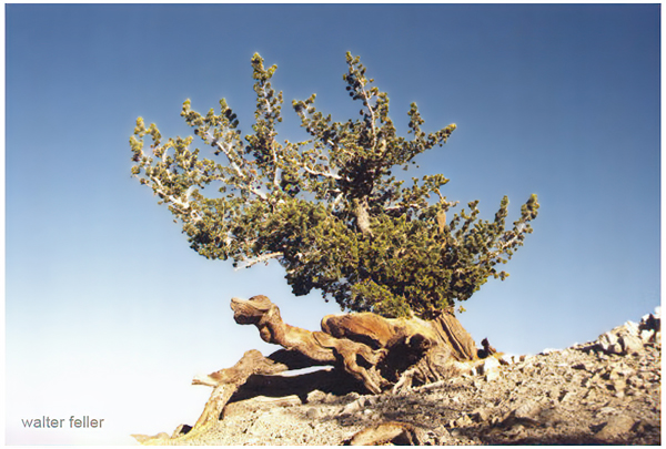
5. Mountains: Death Valley is surrounded by mountain ranges, which provide a contrasting ecosystem to the desert below. These higher elevations offer cooler temperatures and more precipitation, allowing for the growth of coniferous forests. Pinyon pines, junipers, and bristlecone pines thrive in the mountains, providing shelter for various wildlife.

6. Springs and Waterways: Death Valley is home to several natural springs and waterways despite the desert environment. These water sources attract diverse animals, including bighorn sheep, coyotes, and reptiles. The presence of water also supports vegetation growth, such as willows and cattails.

Each of these ecosystems within Death Valley contributes to the region’s overall biodiversity and ecological balance. The park’s extreme conditions have fostered the development of unique adaptations among its plant and animal inhabitants. Exploring these diverse ecosystems is a captivating experience that highlights the resilience of life in the face of adversity.

Zyzzyx Road

Zyzzyx Road (/ˈzɪzɪks/ ZIZ-iks[2]), also called Zyzzyx Rd., is a 2006 American thriller film written, produced and directed by John Penney and starring Katherine Heigl, Leo Grillo, and Tom Sizemore.

The film gained notoriety from its gross ticket sales of only $30 on its opening run, due to its intentionally limited release at a single cinema;[1] it is the lowest-grossing film in U.S. history in terms of box office sales.[3] It also was the film that grossed the lowest opening box office sales, until The Worst Movie Ever! (2011), which ended up with just $11 during its premiere.[4][5]

Plot synopsis[edit]

Grant, a philandering accountant, goes to Las Vegas on a business trip and encounters a seductress, Marissa, and her jealous ex-boyfriend Joey. Grant and Marissa incapacitate Joey, believing they have killed him, and decide to bury him along the eponymous Zyzzyx Road, a rural road off Interstate 15 in California’s Mojave Desert. After digging a grave, they return to find Joey missing from the trunk of Grant’s car. Grant chases Joey through the desert with a shovel, and when he finds him hidden in an abandoned mine, he tells Joey a secret about Marissa.

Cast[edit]

  • Leo Grillo as Grant, an accountant who begins an affair with Marissa
  • Katherine Heigl as Marissa, Grant’s lover and Joey’s ex-girlfriend. John Penney gambled on Heigl’s rising success in Grey’s Anatomy to boost sales. Thora Birch was initially offered the role, but she turned it down.[1]
  • Tom Sizemore as Joey, Marissa’s jealous ex-boyfriend. Grillo “was drawn to his acting chops, and Sizemore’s past actually made him more convincing as a tough-guy villain.” Several actors, including Jason Lee, turned down the role before Sizemore was cast.[1]
  • Yorlin Madera as Truck Driver Bob
  • Nancy Linari (voice) as Brenda

Production[edit]

Principal photography was in the summer of 2005 and lasted 18 days, plus an additional two days for pickup scenes. The film was shot entirely on location in the Mojave Desert, in and around local mines.[6] Sizemore and longtime friend Peter Walton, who worked as Sizemore’s assistant, were arrested during the film’s production for repeatedly failing drug tests while on probation. Sizemore was allowed to resume filming his scenes.[1]

Release and box office gross[edit]

From February 25 to March 2, 2006, Zyzzyx Road was shown once a day, at noon, at the Highland Park Village Theater in Dallas, Texas,[7] in one auditorium rented by the producers for $1,000.[1] The limited release was deliberate: Grillo was uninterested in releasing the film domestically until it underwent foreign distribution, but the film needed to fulfill the U.S. release obligation required by the Screen Actors Guild for low-budget films[1][8] (those with budgets less than $2.5 million that are not for the direct-to-video market).[9]

The strategy had the side effect of making it, at the time, the lowest-grossing film in history; it earned just $30 at the box office, from six patrons paying $5 each for admission.[3] Unofficially, its opening weekend netted $20, with the $10 difference due to Grillo personally refunding two tickets purchased by Sheila Moore, the film’s makeup artist, who saw the film with a friend.[1]

The similarly-named film Zzyzx has mistakenly been cited as the lowest-grossing of all time instead, due to the two films’ similar titles and release in the same month.[10]

Home media[edit]

Zyzzyx Road was released on DVD in 23 countries, including Bulgaria, Indonesia, and Portugal. By the end of 2006, it had earned around $368,000.[1] In the summer of 2012, six years after its original release, GoDigital released the film domestically in digital format because of its better performance internationally. It was released on DVD in North America in September 2010.

References[edit]

  1. ^ Jump up to:a b c d e f g h i j Brunner, Rob (February 16, 2007). “The Strange and Twisted Tale of…The Movie That Grossed $30.00”. Entertainment Weekly. pp. 46–49.
  2. ^ “ZYZZYX Road Movie Trailer”. YouTube. April 1, 2008. Retrieved January 23, 2023.
  3. ^ Jump up to:a b “Zyzzyx Road (2006)”. Box Office Mojo. Retrieved January 2, 2007.
  4. ^ Matt Singer (August 26, 2011). “The Worst Movie EVER!” lives up to its name with epically bad grosses”. IFC. Archived from the original on July 1, 2015. Retrieved September 28, 2011.
  5. ^ “Zyzzyx Road is bested by The Worst Movie Ever!”. Archived from the original on September 26, 2011.
  6. ^ “Leo Grillo Interview”. Katherine Heigl Online. June 10, 2006. Archived from the original on January 21, 2007. Retrieved January 2, 2007 – via kheigl.com.
  7. ^ Strowbridge, C.S. (February 24, 2006). “Little Films Hoping to be Big Fish in Limited Release Pond”. The Numbers News. Nash Information Services, LLC. Retrieved January 2, 2007.
  8. ^ Hayes, Dade (January 4, 2007). “‘Zyzzyx’ earns lowest all-time box office”. Variety.
  9. ^ Ressner, Jeffrey (February 23, 2007). “The New Ishtar”. Time. Archived from the original on February 25, 2007. Retrieved August 4, 2021.
  10. ^ Faraci, Devin (January 10, 2007). “Crisis on infinite Zyzzyx roads”. Chud.com.

China Ranch

https://digital-desert.com/china-ranch/

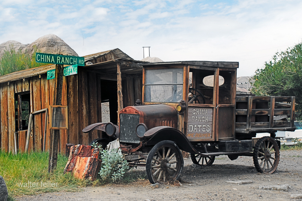
China Ranch is a small oasis nestled near the vast expanse of Death Valley in California. Located just a few miles from the eastern entrance of the national park, it offers a unique and picturesque destination for visitors to explore.

The ranch is renowned for its date farm, which spans over 1,200 acres and produces delicious dates. Dating back to the late 1800s, the farm has operated for several generations and continues to thrive today. Visitors can take guided tours to learn about dates’ history, cultivation, processing, and even sample delectable products.

In addition to the date farm, China Ranch boasts scenic hiking trails that wind through stunning landscapes, such as narrow canyons and towering cliffs. The trails offer breathtaking views of the surrounding desert and provide opportunities to spot unique plant and animal species adapted to the harsh environment.

For those seeking a peaceful retreat, China Ranch offers cozy accommodations in the form of rustic cottages and a charming bed and breakfast. Visitors can relax in the tranquil atmosphere, surrounded by lush gardens and the soothing sounds of nature.

One of the highlights of a visit to China Ranch is exploring the Amargosa River, a rare water source in the arid region. The river meanders through the ranch, providing a refreshing respite from the desert heat. Visitors can enjoy leisurely walks along the riverbanks or birdwatching.

China Ranch is not only a place of natural beauty but also a cultural treasure. The ranch is steeped in history, with remnants of its past visible in the form of old buildings and artifacts. It offers a glimpse into the lives of the early settlers who sought refuge in this secluded oasis.

In conclusion, China Ranch in Death Valley is a hidden gem that offers a unique experience for nature lovers, history enthusiasts, and those seeking a serene escape from the hustle and bustle of daily life. Its stunning landscapes, delicious dates, and rich history make it a destination worth exploring.

ONE TUNNEL . . . ONE LIFETIME

By Paul Hubbard, Randsburg Times    

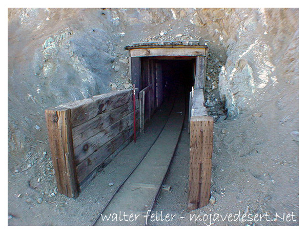
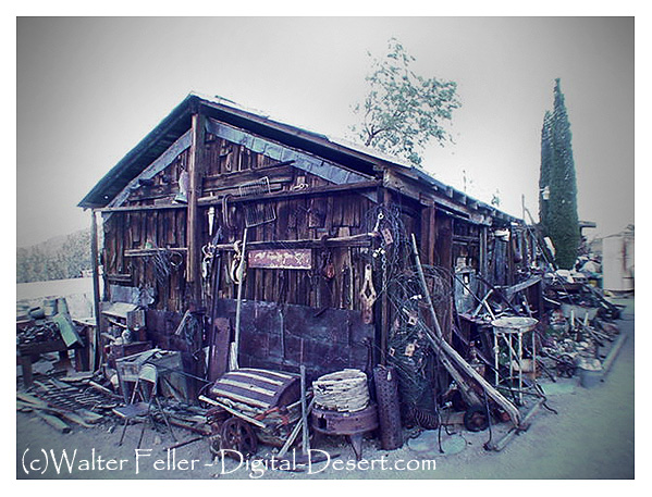
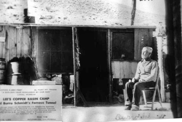
High in the El Paso Range, in the upper reaches of Mesquite Canyon, twelve miles west of Randsburg, in the living exponent of persistence, William Schmidt, better known to desert folks in that area as “Burro” Schmidt, 80-year-old recluse, “Burro” spent forty years of his life accomplishing one thing—hand-drilling a half-mile tunnel entirely through a mountain.

 Over that period, he worked on farms in the Kern River Valley, accumulating “beans” for the winter at his mine. Regularly, he appeared in Johannesburg with his burros and loaded up supplies at the Teagle’s Store each fall. 1937, his tunnel was finished, and the accomplishment received national publicity. Photographs of the tunnel, his burrow, and “Burro” Schmidt appeared in daily press and international mining journals. Single jack and drill steel and “Burro” Schmidt were the combination that did the job — no compressed air or gasoline motors.

As he nears the end of the trail, happy to have completed a lifetime undertaking, he proposes offering his tunnel and the story of mineralogy it tells to a California university. It will be a natural laboratory for the new generations who want to know the story of the rocks. It is a noble gesture from a nobleman of the desert hills.

https://digital-desert.com/burro-schmidt-tunnel/

https://digital-desert.com/burro-schmidt-cabin/

https://mojavedesert.net/people/schmidt.html

https://digital-desert.com/burro-schmidt-cabin/memorial.html

OLD FORT OLIVER

This Story by Jack Smith of the Los Angeles “Times” shows that smart Newsmen can always find a “Pocket Full of Miracles” — At Old Fort Oliver.

Tall Tales for Short Attention Spans

PALM SPRINGS— Harry Oliver, the old desert rat, was listening to the World Series on his radio when we dropped by to see if he had new lies.

Oliver lives out in the desert in a “100-year-old” adobe fort he built about 20 years ago. He calls it Ft. Oliver. The yard is full of rusty old antiques, including Oliver’s 17-year-old dog Whiskers.

Oliver said Whiskers is getting deaf. Oliver bought him a hearing aid. Whiskers swallowed the works. He thought it was a peanut.

“He keeps hearing his old stomach rumbling and thinks it’s thunder,” Oliver said. “He goes in the house to get out of the rain.”

Besides Whiskers Oliver has two bobtail cats, Dot and Comma. “They’re supposed to help me punctuate,” Oliver said. Oliver is the Editor and the entire staff of Harry Oliver’s Desert Rat Scrap Book.

It is printed four times a year on a big piece of paper folded four times. It has two slogans: “Price two bits” and “Only newspaper you can open in the wind.”

The Scrapbook is full of philosophy, wit and facts. A mosquito has 22 teeth; bees tases with their knees. These are facts from the Scrapbook. Dry Camp Blackie would rather have a cat than a TV set. This is philosophy.

We met Dry Camp Blackie. He said hello. He was sitting in the shade outside Ft. Oliver with Whiskers. Blackie sat there all the time we were there and was sitting when we left.

Harry loves and protects all desert creatures. He has a talking crow and used to have a tortoise named Hopalong Pushadee. He died.

Oliver says the buzzards come back to Ft. Oliver every year like the swallows come back to Capistrano.

Oliver has a Ford station wagon which he says he has driven for 33 years without denting a fender or running over a horned toad. He is the inventor of the mule swearing contest where a man gets a prize for cussing out a mule the best, and the lazy dog contest for the laziest dog. The dog and his owner each get a prize.

Oliver has fought for years to save the burros. He also invented thde burro flapjack contest for prospectors and burros. The prospectors have to pack their burros, race 100 yds., unpack, build a fire and cook a flapjack. The first prospector who gets his burro to eat a flapjack gets a prize. I believe the burro does, too.

Oliver talks to his crow and used to talk to Hopalong. He is trying to teach Whiskers to bark in italics. Oliver knows desert weather. Last August he predicted August was going to be as hot as July was all through September. It was. He says in the desert a 6-inch rain means the drops were 6 inches apart.

Oliver is 74-5/12 years young. “After you pass 70 you count your age like children,” he says. “You put in the quarters and halves.” His hair and beard are white but he’s as tough as an old wagon wheel. He says the future is getting here quicker than it used to, though.

Oliver is like old Sky-Eye Jones, who is Oliver’s flying saucer expert. Sky-Eye is 90. He has discovered that every time he lives through March he lives through the whole year, so far.

Oliver says he owes his jokes to his memory and his facts to his imagination. But so what? His paper only costs two-bits.

Harry Oliver – Desert Rat Scrapbook – Klaxo.Net

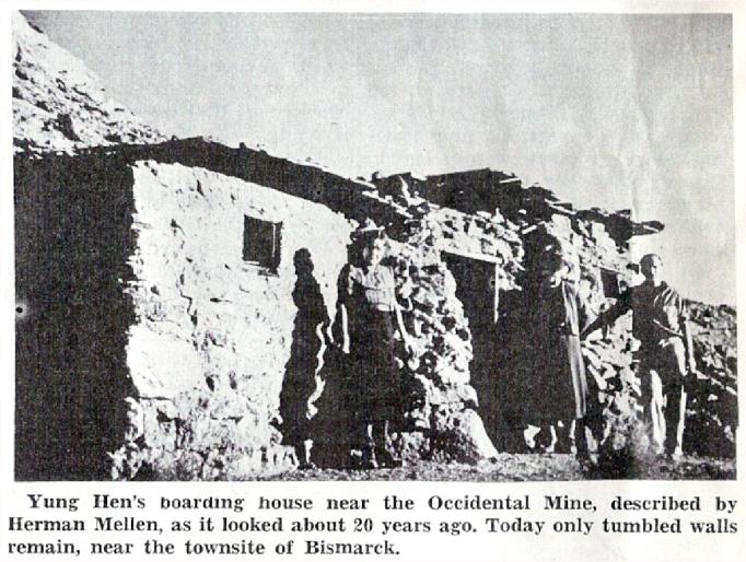
Yung Hen Was a Tough Old Rooster


By Herman F. Mellen

Yung Hen’s Boarding House (1960)

In the beginning, Calico prided itself on being an anti-Chinese camp. But it proved almost impossible to get any but Chinese cooks, so anyone who maintained a mine boarding house or restaurant in the Calicos just about had to hire Chinese help.

Yung Hen-naturally called Young, started as a cook in the Snow­bird mine in Mule Canyon. He was perhaps 50, though it was difficult to judge his age. In fact all of them – wore a long queue. And though they wore levis, they also wore their traditional Chinese blouses. I believe he was Cantonese.

After cooking at several mines, Yung Hen decided to go into busi­ness for himself by starting a res­taurant in Calico. A mass meeting was held to prevent it at which a big Cornish miner arose and gave his solution to the problem: “I tell you, boys, if – we just keep the first one out we’ll never have any trouble with those that come afterward.”

The mass meeting didn’t stop Young Hen, nor did attempts to frighten .him away. Once a group took him out and actually had the rope around his neck, threatening to hang him if he did not leave. He said calmly, “All right, go ahead. Plenty more Chinamen where I come from.”

In time Yung Hen had three or four boarding houses. He spent most of his time in Calico, putting his cousins in the others as managers. In 1885 he bought out the family running the boarding house at the Occidental mine, where I was carpenter. I was loaned to him. He told me what he wanted done, building tables and benches, and moving partitions in adding another room to the building. Then he left me with his two cousins, who were I laughing and skylarking all day long.

One day these boys wanted me to eat with them. They had cooked a dish which they seemed to consider a great delicacy – with a foundation of dried abalones about the size and toughness of rubber boot heels and fully as black. After these had boiled a couple of hours, Chinese cabbage and some sort of small fish, both of which smelled to high heaven, were added and all were boiled another hour. Twenty minutes before serving, two-inch cubes of fat fresh pork were added and cooked just long enough to become nearly transparent. The boys insisted that the stew was velly nice, but I felt I must decline it.

A couple of days after Christmas 1884, a young Irishman known as Scotty, who had been celebrating by imbibing largely on “tarantula juice,” decided to complete the celebration with a turkey dinner. So he flied to Yung Hen’s Calico restaurant and ordered turkey and fixin’s. The two young Chinese boys – cousins or nephews of Yung Hen – set before him all their remaining turkey, largely, scraps and bones.

This so highly offended Scotty that he forgot the spirit of Christ­mas, threw the food at the boy who waited on him, upset the table, and began smashing dishes and furniture. The two Chinese boys grappled with him, trying to put him outside, and in the melee, Scotty lost one shoe, most of one pants leg, and his shirt.

To the glory of old Ireland, he was holding his own until one of the boys rushed into the kitchen, returning with a bucket of almost­boiling water in one hand and a long-handled dipper in the other. A few dippers of water placed where they did the most good and the restaurant and whole camp were too small for friend Scotty. He made what the boys facetiously called a straight shirttail for the mine where he was employed and spent several days nursing various scalded places about his person, the while he cursed the Chinese people in general and the relatives of Yung Hen in particular.

He didn’t receive much sympathy, however, as by then Yung Hen stood well in the camp. A goodly number of prospectors had been grubstaked by him and many a man had eaten on credit with him until he could get a job.

And by that time they had a saying that though he might be a young hen in name he was some tough old rooster by nature.

Calico Print – Harry Oliver – Klaxo.Net

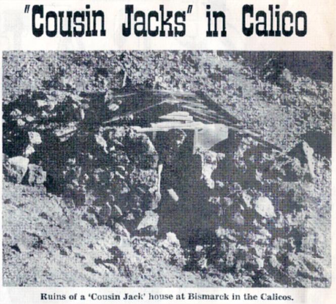
“Cousin Jacks” in Calico

By Herman F. Mellen

Ruins of a ‘Cousin Jack’ house at Bismarck in the Calico Mountains

Most of the small piled rock and semi-dugout dwellings near the mines at Calico were built by Cornish miners, known as “Cousin Jacks,” possibly because about every third person among them was named John and called Jack and because so many of them seemed to be related. They had a great feeling for ties of blood, and when they became prosperous, they would send for their relatives.

I first became acquainted with them at the Garfield mine in Odessa canyon in 1884. About 50 per cent of the working force there, including the mine foreman, was Cornish. They spoke a patois all their own; a mixture of English, Welsh and probably Gaelic, with a few words brought down from the ancient Picts. Their sentence structure was unique which, with their peculiar accent and mode of speaking made it hard for one not acquainted to I understand them. I remember once there was an Englishman in camp, from a county just north of Cornwall and a Cousin Jack criticized his speech, saying, “Why don’t ‘e speaken English like I do?” The Englishman retorted: “You don’t speak English-you gobble!”

And they did gobble, speaking rapidly in a deep guttural. They had many peculiarities of tongue. “Take” was always “taken.” An ore car was always a “wagon” and they never pushed, but would “go forth” with it. They used the third person where we ordinarily use the second, and most of their sentences ended with “you.” “How’s the mother, you?”

I soon caught onto their language, and as they were almost without exception kindly and companionable I men, I enjoyed working with them and learned much from them, both of the trade of mining and their history and beliefs. For example, there were the Tommy Knockers – if that is the way it is spelled. These were the little people who populated the mines. They were in the walls and everywhere, according to the Cousin Jacks. You know, in a mine tunnel more than anywhere else there are mysterious sounds – the natural creaking of timbers and settling of rocks – and of course these were the Tommy Knockers, warning of impending disaster. It was just too bad if you could not understand what they were trying to say, for they might be warning you.

I remember only one characteristic food of the Cousin Jacks – cakes and puddings colored with saffron. I suppose it was all right, but that orange-yellow looked pretty deadly to me. The pudding was made of cut up dried or canned fruit – any kind they happened to have – with just enough flour to hold it together and saffron. This was put in a cloth or sack and boiled.

The Cornishmen did not combine to any extent the calling of miner with that of prospector, as did most other nationalities. They were the best miners as a whole that the world could boast, having followed the trade, father and son, for centuries. The big Cornishman Jack Pascoe was a fine example. Jack was well over six feet in height and every inch a miner, and a great worker. At one time he was hired for a short time to substitute for one of three partners who were doing 400 feet of tunnel in the King mine by contract. Putting in every third shift in the tunnel, Jack raised its roof by a foot and a half every shift he worked, in order to accommodate his great height. When the annoyed contractors protested, his reply was:

   “Dammee, old son, you! Have to maken place for my feet!”

The wavy roof in this tunnel be­came known as Jack Pascoe’s mark.
When I visited it last in 1941, I could tell exactly the number of shifts Jack had worked. 

LIFE IN THE CALICO BOOM

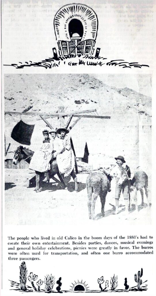
Amusing Themselves in Calico

Stories of life in the days when Calico was booming were collected by Alice Salisbury, from women who had lived in the colorful camp, and printed in the Barstow Printer-Review. Here are some of the memories that Mrs. Salisbury preserved:

Mrs. Lucy B. Lane – I was very happy as a school girl in Calico when the town was in its prime. The thing that bothers me is to have people ask me to describe some of the murders and shootings and brawls that they say must have taken place in a booming silver camp in the ’89s. Only two murders, you know, in the whole course of Calico’s history, and those committed by strangers, one a card-cheating affair, and one a boundary fight.

Mrs. Annie Falconer – of course there weren’t any little plaster saints up there in Calico. The men all thought they had to wash that red dust out of their throats with plenty of liquor and at one time 13 saloons were helping them to do it.

There we were, occupying a plateau only 350 yards long. Private houses, three general stores, two drugstores, a jewelry store run by Mr. Stacy, restaurants, the Palace and later the Cosmopolitan hotels – 20 rooms with lace curtains, those saloons, two dance halls, the town hall, assay offices, the Chinese quarter about 40 strong in the gully just below us to the east – all rubbing elbows goodnaturedly.

Alice La Maintain – Calico’s additions to Main Street were made by extension bridges thrown across those unhandy gullies. At first, tents, cave-dugouts, rough looking houses with tiers of bunks lining the walls sprung up like mushrooms, frame houses built from lumber teamed clear from San Bernardino.

Sarah Kennedy – Water was pumped from wells down on the wa­ter levels and was stored in a huge redwood tank located high above the town and piped by gravity into every house for $1.50 a month.

Fanny Mudgett – Fun? Of course we had fun – nice fun, too. I tell you, Calico was a real home town, not a brawling, shooting, bloody camp. We girls invited our boy friends home and entertained them with “sings” around the cottage organ, or the guitar, or the violin.

I’ve never gone to such nice jolly dances since I left Calico. I can shut my eyes now and hear Bill Nelson’s fiddle playing “The Beautiful Blue Danube!” My brother, Jimmy Mulcahy, Tornado Tim and Whooper Up Mike were all wonders at calling for the square dances.

Mrs. Endora Goodrich – There were some mighty pretty, lively girls up there in Calico, and nice girls were treated mighty respectfully by those “wild” Calico menfolks, but not so respectfully that they didn’t have plenty of lively fun. Who wouldn’t with about three men to every girl?

Mrs. Oliver Connell – We women all took to nursing like ducks to wa­ter. Whenever anyone with or without a family was sick, we all flew in and tried to help things along. When the pneumonia epidemic almost filled up Calico’s cemetery, we had our hands full. Graves were blasted out of rock. That was sad mining for us.
Harry Oliver – Klaxo.Net

THE RICH MINES OF CALICO

A BRIEF HISTORICAL SKETCH OF CALICO

(From Calico Print, Vol. 1, No.1 July 12, 1882)

The Silver King Mining Co., Ltd. Mill 30 Stamps, Calico. The camp’s richest producer, photograph taken about 1883. The Silver King was named for John C. King, Sheriff of San Bernardino County from 1879 to 1882 and uncle of Walter Knott.

The first discovery of mineral made in this fabulously rich mining district was made some seven or eight years ago (1874-75) about three miles northerly from Grape Vine Station (now Barstow) and Waterman & Porter’s mill and about eight miles distant from the rich and extensive mineral belt which surrounds for miles in every direction the promising town of Calico. It was made by an eccentric old man by the name of Lee, who was, it is supposed, killed by Indians whilst on one of his solitary prospecting expeditions some three years ago in the vicinity of Old Woman Springs.

Lee first located on the property now owned by Waterman & Porter upon which they keep a fine ten-stamp mill and a large force of men in constant operation, the mill each day adding to the country’s wealth. This ledge was worked by Lee for a quicksilver mine, and the rich horn silver for which it is so famous was called by him “pencil lead,” he taking the’ native silver for particles of quicksilver. The work, having been abandoned for some two or three years consequent upon the death of Lee, Waterman, and Porter, being out in quest of mining properties, were shown the property by Mr. E. J. Miller, Recorder of the Grape Vine District.

Porter, being a practical miner, on his first visit, recognized the immense value of the property and immediately commenced making locations. This was in the fall of 1880. During that winter and in the spring of 1881, hundreds of locations were made in the immediate vicinity until not a red rock remains but what is well monumented.

Not until the spring of 1881 were there any discoveries made on Cal­ico Mountain. The first was made by Lowery Silver (elsewhere Silva), who is still a resident miner of the district, and was made a short distance north of where the town of Calico is now situated. The first work of any note that was done in what is now Calico District, but then the Grape Vine District (Calico having lately segregated), was some four miles northwesterly from the town on the Consolidated and Pico claims. In March or April last, our worthy under-sheriff, Tom Warden, together with Hues Thomas and others, discovered the wonder of the age, the great “King Mine,” the richest and biggest mine in the State of California.

After these discoveries many others were made and located, among which were the Oriental series by Messrs. Allison, Waldrip, Day and others and subsequently sold to Messrs. Earl & Garnett, of San Francisco. This splendid property, upon which a tramway and mill are soon to be built, is being rapidly developed under the superintendency of Judge James Walsh; while Sam James keeps his weather eye open upon the doings around the famous King Mine. During the fore part of July last the rich deposits of the Burning Moscow were located by J. B. Whitfield, John Peterson and Hieronymas Hartman. This mine is still in active operation, having produced some of the richest hornsilver ore ever found in camp.

Rich locations are still being made each day adding to the number, and the rich finds lately made in the eastern portion of the district have given an impetus to prospecting.

One year ago where Calico now stands there was not a single house, and on Wall street but one camp (Allison’s) and James Parker and Ellie Miller were the sole inhabitants, on the Fourth of July last, and not until Sam James and his party arrived a few days afterward to commence operations on the King Mine was there any show of activity. If one year has made so decided a change what may we not expect during the next 12 months: From present appearances we hazard. the opinion that e’er another year shall have rolled around that our little wooden village will have given place to an active, busy, bustling mining town, second to none in this or any other State or Territory. Surely the richness and number of our mines demand it.

A True Desert Turtle Story

Any of you old Desert Rats want to bet a gallon of good whiskey that the following turtle story ain’t true?

Old Bill Goeglein a retired assayer, now living in Wickenburg, Aiz., is noted for his veracity all over this desert.

In May, 1921, he went to Los Angeles and drove back a new Ford car. About five miles west of Amboy, Calif., he noticed the whole country ahead seemed to be moving and it was. A great migration of turtles was crossing the road ahead. The deep ruts in the road were filled with turtles and hundreds and thousands of them were crossing over them, moving in a northerly direction.

To the south as far as he could see and to the north as far as he could see was a moving mass of turtles spaced a few feet apart. As there seemed no end in sight, he decided to drive through them. He put her into low and ground through turtle meat, blood and guts for a full quarter mile before getting clear of the great migration.

When he arrived at the little filling station at Amboy, he stopped to clean the wheels and fenders of turtle meat. While there a small truck came in with the same experience.

After Old Bill told me this story, I made it a point to ask every old Desert Rat I met if he ever saw anything like this. In time I found an old cow puncher who saw the same thing in southwestern New Mexico. Thousands of turtles were crossing the Southern Pacific tracks and were piled up trying to get over the rails. A number of Indian Squaws were there filling funny sacks with turtles. One old Squaw said that the turtles from all over the desert went to a certain place to lay their eggs. After which they all migrated so as to leave the feed for the young turtles. Sounds reasonable.—John C. Herr, Wickenburg, Ariz.

NEVADA   Bad Men Buried Alone


Harry Oliver’s DESERT RAT SCRAP BOOK   4

The Murphy mine was the only producer of any importance in this district, located on the east flank of the Toiyabe range, about 50 miles south of Austin, but in Nye County. A party of French prospectors wandered into the area in 1863. It was a costly operation, with supplies hauled in from Austin over the summit of the Toiyabes at over 10,000 feet. The Murphy mine is credited with a production of $750,000, but the mine paid no dividends. An enormous mill building, built of brick, and ruins of several stone houses on the side of the canyon above the mill are about all that remain today. Ophir Creek, a small clear stream of tumbling water, is a favorite trout stream, and dozens of fishing parties visit each year.

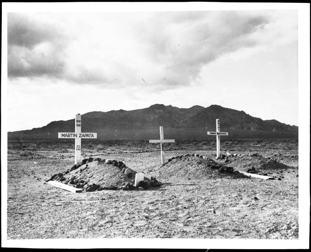
At the mouth of Ophir Canyon, placer gold was discovered a few years ago, but nothing has come of the discovery. On the side hill where the canyon breaks down into Smoky Valley is a small cemetery with perhaps 25 graves, many containing children. Names of most of those buried there are now forgotten. Below the main cluster of mounds are several isolated graves. In one of these a gunman, name now unknown, was buried. “Rutabaga Tom,” and old Indian, still living, tells the following story of this lone grave:

“One bad man, nobody like, buried there, because nobody wants him close to good people. He mean man, killum man just for fun. One time he pick fight with young fellow called Black Bart. They promise fight battle. Each take gun, stand back to back, then walk off thirty steps, but this bad mans he walk only take twenty steps, then he turn quick like rattlesnake striking and shoots at Black Bart. Mebbyso he excited, for he miss target. Black Bart he walk 30 steps, turn, and bad man he is running off. One shot — and he fall — dead. Dead all over. Good people bury bad man all by himself, so he won’t go to happy hunting grounds, with other mans.”—From 50th Anniversary Edition, Tonopah Times Bonanza

What is Borax?

https://mojavedesert.net/glossary/borax.html

Introduction:

Borax, also known as sodium borate or sodium tetraborate, is a versatile compound with various applications across different industries. This overview outlines borax, its chemical composition, properties, and uses in various fields.

Chemical Composition:

Borax is an inorganic compound comprising sodium, boron, oxygen, and water molecules. Its chemical formula is Na2B4O7·10H2O, indicating that each unit of borax contains two sodium atoms (Na), four boron atoms (B), seven oxygen atoms (O), and ten water molecules (H2O).

Physical Properties:

Borax appears as a white, crystalline powder or granules, which are odorless and tasteless. It is soluble in water, and its solubility increases with temperature. Borax has a melting point of approximately 743°C (1369°F) and a boiling point of around 1575°C (2877°F).

Uses:

1. Cleaning and Laundry:

Borax is widely used as a cleaning agent due to its alkaline nature and ability to dissolve grease and dirt. It can be found in many household cleaning products, such as laundry detergents, dish soap, and multipurpose cleaners. Additionally, borax is an effective stain remover and can tackle stubborn stains on clothes and carpets.

2. Pest Control:

Borax is commonly used as an insecticide and a natural pest control agent. Due to its abrasive properties, it can be used to eliminate pests like ants, cockroaches, and silverfish. By disrupting their exoskeletons, borax causes dehydration and eventually leads to their demise.

3. Flame Retardant:

In the textile industry, borax is used as a flame retardant. It can be added to fabrics and materials to reduce flammability, making them safer in fire accidents. Borax releases water molecules when exposed to high temperatures, slowing flame spread.

4. Metallurgy:

Borax has applications in metallurgy, particularly soldering and welding. It acts as a flux, facilitating the removal of oxide layers from metal surfaces, ensuring better soldering or welding material adhesion. Borax also prevents oxidation during soldering or welding.

5. Ceramic and Glass Production:

Borax is an essential ingredient in the production of ceramics and glass. It acts as a flux, reducing the melting point of materials and aiding in the fusion of different components. Borax also improves the durability and strength of ceramics and glass products.

Conclusion:

In conclusion, borax is a versatile compound with numerous applications in various industries. Its chemical composition, physical properties, and unique characteristics make it a valuable ingredient in cleaning products, pest control, flame retardants, metallurgy, and ceramic and glass production. Understanding the uses and properties of borax can provide insights into its importance and contribute to its effective and safe application in different fields.

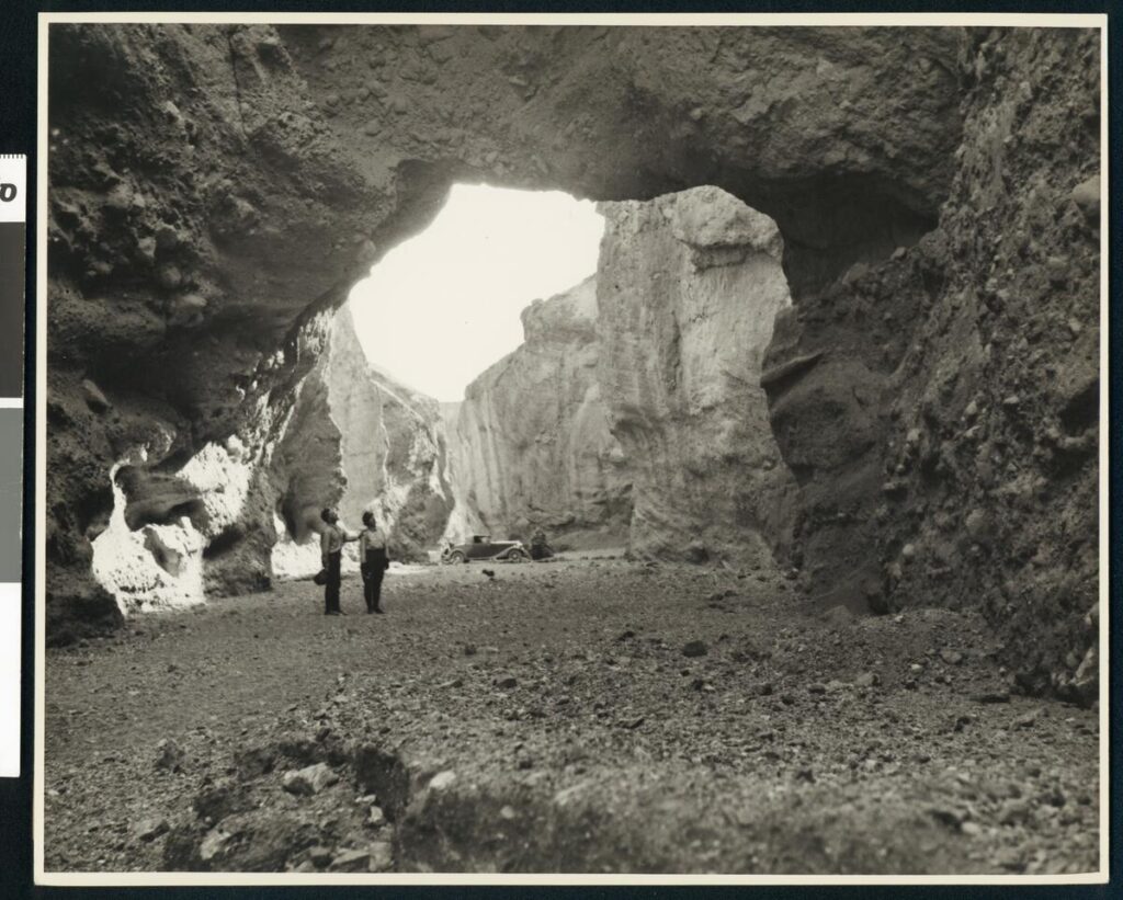
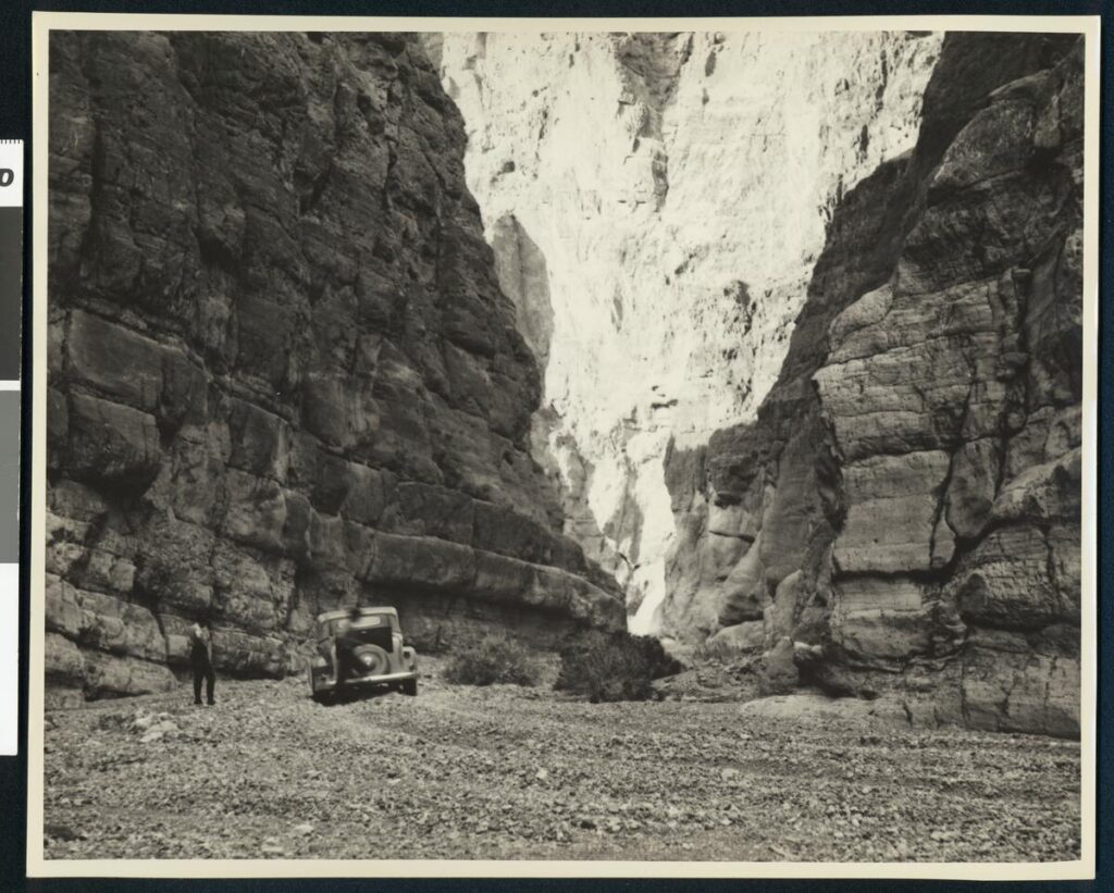
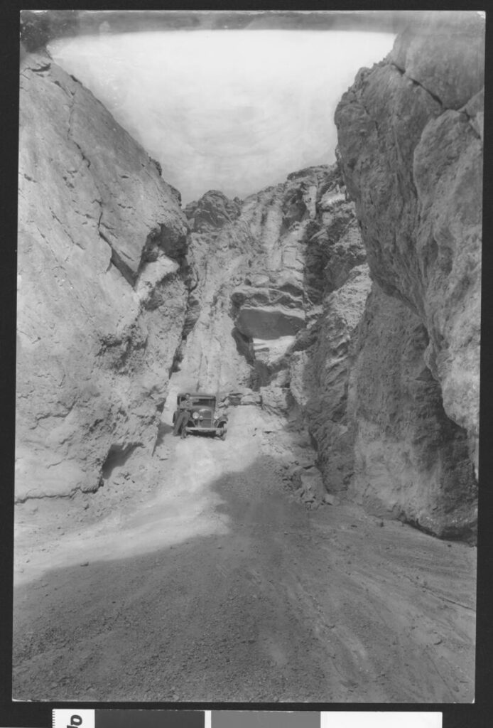
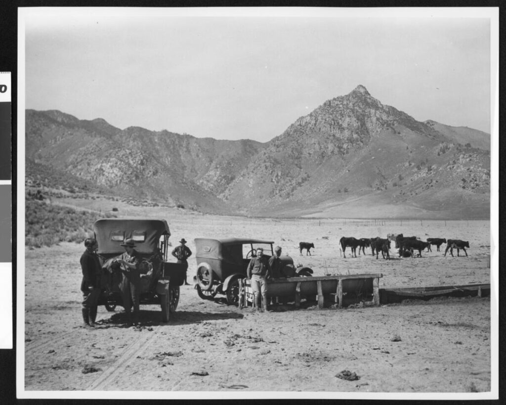
Death Valley Vintage Photos

C.C. Pierce

Old Woman Meteorite

The Old Woman, California, IIAB iron meteorite
Howard PLOTKIN, Roy S. CLARKE, JR., Timothy J. Mc COY,

and Catherine M. CORRIGAN
Department of Mineral Sciences, National Museum of Natural History, Smithsonian Institution, P.O. Box 37012,
Washington, DC 20013-7012, USA

Summary

PAGE 1

DISCOVERY OF THE METEORITE

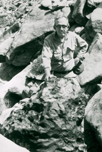
  • Two prospectors found a large dark-colored rock in the Old Woman Mountains in March 1976. They were sure it was a meteorite because they had seen pictures of them in school and museums.
  • The two prospectors and Jack Harwood tried to figure out what to do with their ”Lucky Nugget” find but lacked the funds needed to hire a helicopter.
  • They sent a small chip to the Griffith Observatory, but the curator did not detect nickel and concluded that the specimen was not meteoritic.

PAGE 2

  • Friberg sent a letter to the Smithsonian asking for a value scale for a meteorite, and on August 27, they requested a fragment be sent to them for study. On September 10, they received a reply saying that they would like to conduct an on-site investigation.

TRIP TO THE OLD WOMAN MOUNTAINS

  • Clarke arranged with Friberg to investigate the meteorite near Twentynine Palms, California. He visited the administrative office of the nearby Joshua Tree National Monument to inform officials of his visit and get their permission to go into the field.

PAGE 3

  • Clarke, Friberg, and Harwood traveled to the meteorite site in a 1949 four-wheel drive Power Wagon and hiked up the mountain to reach the meteorite. Clarke took several measurements and photographs, and the group left the meteorite at 5:40.
  • Clarke suspected the meteorite was on federal land and visited the Riverside BLM office on September 23 and 24. He suggested returning to the site with Friberg and BLM officials to determine its location.
  • Clarke went to the BLM office early in the morning and was picked up by a helicopter. They flew to the agreed-upon rendezvous point but found no one there and then flew to the Old Woman Mountains, where Clarke led them to the meteorite.
  • On October 1, Gerald Hillier wrote to Friberg to inform him that the meteorite was located on national resource lands and was, therefore, subject to the jurisdiction of the Federal Government. Friberg went to see a lawyer the same day Clarke wrote this letter.

THE QUESTION OF THE METEORITE’S OWNERSHIP

  • The ownership of meteorites has often been controversial, with the Iowa Supreme Court upholding the landowner Goddard over the finder Winchell and the Oregon Supreme Court upholding the landowner Oregon Iron Company over the finder Hughes.
  • The finders of a meteorite filed a placer mining claim on the land where it was situated. Still, they were notified by the District Manager of the Riverside BLM that meteorites are not locatable since they do not constitute a valuable mineral deposit.

PAGE 4

  • A Smithsonian Curator was told that a meteorite found by Japanese-Americans interned on federal lands in the Utah desert was not subject to mining laws and would be transferred to the Smithsonian Institution under the Antiquities Act.
  • The Smithsonian was granted ownership of the meteorite under the powers of the Antiquities Act, which allowed scientific and educational institutions to gather objects of historic or scientific interest on federal lands.
  • The Antiquities Act granted the three secretaries jurisdiction over objects of historic or scientific interest. It stipulated that all permits granted by the secretaries ”shall be referred to the Smithsonian Institution for recommendation”. The Old Woman meteorite fell under this jurisdiction.

PAGE 5

  • The Smithsonian wanted to transfer the Old Woman meteorite to the National Meteorite Collection. Still, the decision was under heavy fire from lawyers representing the finders and John Wasson, a professor of geochemistry and chemistry at the University of California, Los Angeles.
  • In mid-November, Wasson wrote Clarke and the two California senators, requesting their help keeping the meteorite in southern California. Wasson pointed out that Californians had recently ”lost” the Goose Lake meteorite to the Smithsonian and that the main question was political rather than legal.
  • On December 21, the Director of Administrative Services granted Secretary Ripley’s request to recover the Old Woman Mountains meteorite and transfer it to the Smithsonian Institution.
  • The Smithsonian wanted to transport a meteorite from the mountainside to Washington by helicopter. Still, the Secretary of Defense denied their request, saying they did not utilize military transport when commercial carriers were available.
  • Barry Goldwater and Secretary Ripley wrote to the new Secretary of Defense, Harold Brown, requesting military assistance to remove a meteorite from a mountain. The Marines were authorized to remove the meteorite on June 17.

REMOVAL OF THE METEORITE FROM THE MOUNTAIN

  • Clarke arrived back in California on June 13, 1977, spent the next few days at the Riverside BLM office, and moved to Needles the next day to observe the lift.

PAGE 6

  • A Marine helicopter support team moved a meteorite wedged between two boulders, and a Marine Heavy Helicopter Squadron 363 dropped a 25 m cable down to the Marines, who attached it to the meteorite and gently set it down on a desert road 19 km away.
  • More than 40 representatives of local and national news media, press members, Marines, the meteorite’s three finders, and Wasson were present at the event, and opposing views about the meteorite’s ownership and disposition were strongly voiced.
  • The Old Woman meteorite was taken off the truck and weighed; it was the second-largest meteorite ever found in the United States. Its exposed upper surface was pitted, reminiscent of regmaglypts, and the bottom surface exhibited a thin, irregular coating of caliche.

PAGE 7

THE DISPUTE MOVES TO THE COURTS

  • Removing the meteorite from the Old Woman Mountains only intensified the battle over it. The Smithsonian acquired the meteorite on June 24 while still displayed in California.
  • The Old Woman meteorite had become a cause celebre and was displayed for an additional week at the BLM Riverside office afterwards, it was moved to the San Bernardino County Museum and the Los Angeles County Museum of Natural History.
  • The two discoverers took the matter to court, arguing they owned the meteorite based on their mining claim. The judge denied the temporary restraining order.
  • The Smithsonian was under increasing pressure to keep the meteorite in California. The Los Angeles County Museum of Natural History requested that the Smithsonian cede all presumed titles to the meteorite to their museum.

PAGE 8

  • Pressure was also brought to bear upon Cecil Andrus, the Secretary of the Department of the Interior, to allow the Meteorite to go on permanent display in the Los Angeles County Museum of Natural History.
  • The California Congressional Delegation urged Ripley to speed up arrangements for the meteorite’s permanent display in California. Ripley assured them that a portion of the meteorite would be sent to an appropriate museum in California.
  • Ripley clarified the Smithsonian’s position, pointing out the museum’s long involvement with meteorites and its extensive usage by the national and international scientific community. He assured Wasson that a replica of the meteorite would be sent to an appropriate California museum.
  • The San Bernardino County Museum and the State of California filed a lawsuit on July 20, 1977, against the BLM, the Department of the Interior, Secretary Ripley, et al., seeking a preliminary injunction against removing the meteorite from California.
  • When the matter was before the court, the San Bernardino County Museum requested that the Old Woman meteorite remain in California with an appropriate museum or scientific institution.
  • The Smithsonian received welcome news from the Department of Justice attorney representing the defendants in the Old Woman Mountains meteorite lawsuit.
  • Combined with strong protests from California, Judge Whelan’s ruling quickly prompted Interior Secretary Andrus to grant custody of the Old Woman Meteorite to the state where it was found, turning down a bid by his agency to haul it back to Washington for display.

PAGE 9

  • Andrus’s decision served as a game-changer because it allowed the Smithsonian to transfer the right and title to the meteorite to the museum and allowed the museum to offer to ship the main mass of the meteorite to a California museum after its scientific study.
  • In the weeks that followed, the court-ordered settlement discussions took place. The Smithsonian agreed to a consent decree with the State of California that the United States would negotiate for long-term display of the Old Woman meteorite there.
  • The Department of the Interior supported the Smithsonian’s plan to bring the meteorite to Washington for scientific analysis, but asked that its display and scientific value not be diminished.
  • Attorneys from the three parties met again on October 17, and agreed to a five-member committee that would make the final decision on what cutting, if any, would be done on the meteorite.
  • The California attorneys called for the establishment of a Joint Powers Agreement, under which a three-member committee would investigate the possibility of displaying the meteorite in a museum in California.
  • Judge Whelan denied the State of California’s and San Bernardino County Museum’s motions for preliminary injunction against removal of a meteorite from California and title to it, and vacated and set aside the temporary restraining order to keep the meteorite in California.
  • The Smithsonian met with members of Congress’s staff in January and February of 1978 to explain their plan to send a meteorite from California to Washington for study. The meteorite arrived at the Smithsonian’s National Museum of Natural History on March 8, 1978.

PAGE 10

  • The Smithsonian asked Senator Cranston’s staff to help select a museum for the meteorite, and the staff recommended the Los Angeles County Museum of Natural History.
  • Two other problems soon arose, the San Bernardino County Museum appealed Judge Whelan’s ruling, and John Wasson again stepped forward, claiming that the Smithsonian intended to remove a slice of the meteorite for its study, and that this would seriously detract from the exhibit value of the main mass.
  • Wasson urged that letters be written to Secretaries Andrus and Ripley requesting that no cutting of the meteorite be carried out until the Smithsonian submitted detailed plans, prepared a position paper comparing the scientific and exhibit-related pros and cons of its proposed plan, and invited comments from several curators and iron meteorite researchers.

DEBATE OVER THE CUTTING OF THE METEORITE

  • Clarke sent a letter to 19 individuals in September 1978 asking their views on how the Old Woman meteorite should be studied.
  • Wasson responded to Clarke’s letter by asking the recipients to provide him with a copy of their response to confirm that the amount to be removed seems reasonable from the viewpoint of Californians.
  • Responses to Clarke’s letter were generally favorable to the Smithsonian’s position, with Vagn Buchwald pointing out that Old Woman appeared to be transitional between group IIA and IIB meteorites and that a large cut and polished surface of Old Woman would provide unique data.

PAGE 11

  • The injunction against cutting the meteorite was denied in 1978 and again in 1979, opening the way for its scientific study.
  • Cutting began a week later, on May 29, and the first piece was removed on June 5. It was ground, polished, and etched, and Clarke commented that a major cut was essential.

PAGE 12

THE METEORITE’S RETURN TO CALIFORNIA

  • Although the injunctions against cutting the meteorite were still before the court, the Smithsonian tried to finalize loan arrangements with the Los Angeles County Museum of Natural History. Still, the acting director expressed his ”significant objection” to the Smithsonian’s plan to cut the meteorite.
  • In January 1980, the San Bernardino County Museum and the State of California claimed ownership of the Old Woman meteorite. Still, the U.S. Court of Appeals for the Ninth Circuit dismissed their claims.

METALLOGRAPHIC STRUCTURE OF THE OLD WOMAN METEORITE

  • Old Woman is a highly unusual iron meteorite with two structural types, and the metallographic study of the large slice provides invaluable insights into its formation.
  • The 427.3 kg butt end was divided into a 207 kg butt end and a 174 kg research slice. The research slice was subdivided, producing a thinner complete slice and a partial slice again extensively subsampled. The Old Woman meteorite is a polycrystalline mass with a strongly bimodal distribution. Seven large grains comprise 85% of the surface area and comprise the hexahedral structure within the meteorite.

PAGE 14

  • Within the larger grains of kamacite, the only Fe,Ni metallic phase identified, are schreibersite chains that can reach several cm in length. These schreibersites often exhibit embayments or skeletal morphologies, and are similar to the ungrouped, low-Ni iron Zacatecas (1792) (Buchwald 1975). Throughout the large kamacite regions, small schreibersites are common. Carbide and graphite are extremely rare, although we did find one schreibersite inclusion rimmed by graphite and Fe metal.
  • The entire primary structure is extensive shock modification, including shock melting of troilite-daubreelite-schreibersite inclusions, Neumann banding, and formation of subgrain boundaries within kamacite. A heat-altered zone up to several mm in thickness was observed on sections of the meteorites.
  • Old Woman is a low-Ni, low-P member of group IIAB, with a bulk Ni concentration of 5.86 wt% (5.59 at%), 0.30 wt% P (0.56 at%), and 0.49 wt% Co. Trace element analyses reveal a composition intermediate in the range of IIAB irons.

PAGE 15

  • The Widmanstatten structure in iron meteorites was reviewed by Yang and Goldstein (2005), who proposed three mechanisms for their formation. Old Woman is on the boundary between massive transformation and mechanism V and only slightly below the field for mechanism III in P.
  • Old Woman is not unprecedented in having a bimodal structure, with hexahedral and coarsest octahedral structures evolving in the same mass. This structure is thought to be due to nucleation of austenite crystals on sulfide inclusions.
  • Old Woman could have evolved via the c fi a2 + c fi a + c (mechanism V) or c fi (a + c) fi a + c +ph (mechanism III) pathways into its present polycrystalline state.
  • Old Woman is a hexahedral ferromagnetic iron with abundant schreibersite. It may have formed through the c fi (a + c) fi a + c +ph fi a + ph pathway, which was described by Yang and Goldstein (2005).

PAGE 17

  • Old Woman’s diverse structure may be due to several mechanisms within a single mass, suggesting that further study may yield additional insights.

CONCLUSIONS

  • Old Woman, the largest meteorite in the National Collection of Meteorites, contains transitional textural types that were previously classified as three distinct meteorites. It is now known that these textures are the result of unique combinations of chemistry, nucleation, and cooling history.
  • The authors thank Tim Rose, Pam Henson and Brian Daniels, the Office of the Smithsonian Institution Archives, George S. Robinson, Nicole Lunning, Katrina Jackson, Ed Scott and Ursula Marvin, and the Edward P. and Rebecca Rogers Henderson Endowment for travel and research funding.

PAGE 18

SUPPORTING INFORMATION

  • Marcy Dunn Ramsey’s pencil sketches of the Old Woman meteorite are shown in Fig. S1. The maximum dimension of the meteorite is in the range of 0.8 to 1.0 m.
  • Fig. S2 shows pencil sketches of the find site of the Old Woman meteorite, a deeply pitted iron meteorite that is approximately 1 m across.

William Brewster “Bodie Bill” Godward

Son of William T. Godward and Delcie Pearl Millslagle. “Bill” was the 2 year child old responsible for the 1932 fire in Bodie, California, that destroyed 70% of the town. He was playing with matches behind the Old Sawdust Corner saloon and ignited the building.

He married Dian Dovereaux on Sept. 9, 1949, in Sandusky, Ohio. He worked as an Engineman Third Class in the US Coast Guard.

Bill and his new bride were on their delayed honeymoon when they were involved in a single-car accident on the US 395 near Susanville, California. Bill died from a broken back and injuries he sustained from the accident.
(Findagrave.com)