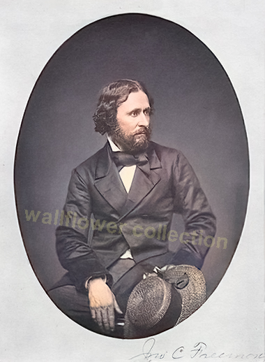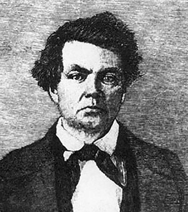
The relationship between John C. Fremont and his chief surveyor, Charles Preuss, was a mixture of professional interdependence and deep personal tension. Both men were indispensable to each other—Fremont as the ambitious public face and commanding officer, Preuss as the trained cartographer and topographic backbone of the expeditions—but their temperaments could hardly have been more different.
John C. Fremont
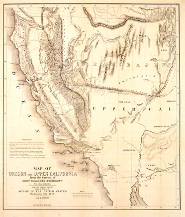
Preuss, a German-born topographer and mapmaker, brought a meticulous scientific discipline and European technical education to Fremont’s ventures. He was responsible for producing the maps that gave Fremont’s reports their authority, accuracy, and ultimate political impact. Fremont depended heavily on Preuss’s precision and methodical fieldwork—his astronomical observations, triangulations, and record-keeping were the foundation upon which Fremont’s reputation as “the Pathfinder” was built.
Charles Preuss
However, the relationship was far from harmonious. Preuss’s surviving diary-often dry, caustic, and skeptical—shows frequent frustration with Fremont’s impulsiveness and his flair for drama. A telling remark from his journal reads, “I feel better because of Fremont’s absence,” reflecting how strained the interpersonal atmosphere could become in the field expeditions of John Fr. Fremont, for his part, maintained formal respect for Preuss’s abilities but rarely mentioned him by name in official correspondence, reinforcing the imbalance between Fremont’s fame and Preuss’s quiet technical role.
Despite their tension, their collaboration was crucial to their success. Preuss translated Fremont’s raw exploration data into accurate maps that guided westward migration and railroad planning for decades. Fremont provided the narrative that captured public imagination, while Preuss provided the empirical skeletonthat made those narratives credible.
In short, theirs was a mutually dependent but uneasy partnership. This partnership combined Fremont’s ambition and charisma with Preuss’s scientific rigor, yielding one of the 19th century’s most influential bodies of cartographic and exploratory work.
“He names mountains and rivers as a poet writes verses, quickly and without measure.” — 1843, eastern Nevada
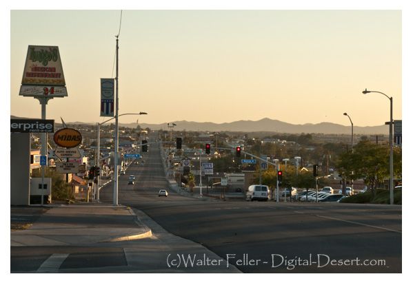
Barstow, California, from the 1870s through the present, with all key details preserved and arranged chronologically:
Barstow stands today at the center of the Mojave Desert’s long story of ranching, mining, railroads, and highways. Its history reflects the layered development of the Mojave River corridor, where water, transportation, and enterprise have drawn people across the desert for more than a century and a half.
In the years following the Civil War, the upper Mojave River region supported a few scattered cattle ranches and wagon stations. Before Barstow existed, the country between Oro Grande and Daggett was known for its open range and desert pastures. Herds were grazed along the Mojave River, using its shallow pools, seeps, and hand-dug wells. During the 1870s and 1880s, ranchers moved stock between the high country of the San Bernardino Mountains and the desert valleys, following trails that paralleled the river. Stations at places such as Lane’s Crossing and Fish Ponds served as watering points for stock and travelers. As the Santa Fe Railroad advanced across the desert, freight access to distant markets encouraged limited agriculture along the riverbanks. By the early 1900s, alfalfa, grain, and small orchards appeared in Victor Valley, and a few experimental plots extended downstream toward Barstow. The Arrowhead Reservoir and Power Company began purchasing riparian tracts between Victorville and Barstow to secure water rights, recognizing that the Mojave River would control the future of settlement. Though the arid climate limited cultivation, these early ranches and farms laid the foundation for the region’s first lasting economy before industry and highway travel arrived.
Barstow’s founding dates to the early 1880s, when the Atlantic & Pacific Railroad, later part of the Atchison, Topeka & Santa Fe system, pushed its line westward from Needles toward Mojave. In 1883, the mainline was completed across the desert, and a division point was established to centralize maintenance, crew changes, and fueling. This camp, called initially Waterman Junction, became the nucleus of Barstow. The town was renamed in 1884 for William Barstow Strong, president of the Santa Fe, and quickly became the railroad’s desert headquarters. Roundhouses, repair shops, and supply depots were built to serve the trains moving freight and passengers across the Mojave.
While Barstow developed as a railroad town, the nearby community of Daggett became the milling and shipping center for the Calico silver mines. The Calico district boomed in the early 1880s, with more than a hundred mines producing ore that was hauled to Daggett for reduction and shipment east. In 1898, a short branch line was built from Daggett to Calico to carry ore directly to the Santa Fe main line. This small spur improved mining transport but did not found Barstow; the town was already well established as a division headquarters long before. Barstow’s location on the main transcontinental line—roughly midway between San Bernardino and Needles—gave it strategic importance that would outlast the mining booms around it.
As the 1890s ended and silver prices dropped, mining declined, but the railroad presence ensured Barstow’s survival. The town expanded with railroad housing, stores, and services for workers and travelers. The Mojave River valley became a modest agricultural district, producing hay, fruit, and dairy products for local use. By 1910, Barstow had schools, churches, and small businesses serving both rail employees and the surrounding ranch country.
In 1911, the Fred Harvey Company constructed the Casa del Desierto, a grand Mission Revival depot and Harvey House that brought elegance and permanence to the desert town. The building served as a hotel, restaurant, and railroad office, offering travelers comfort along the route between Los Angeles and the Colorado River. It quickly became Barstow’s social center and symbol of progress. The Santa Fe expanded its shops, roundhouse, and yards, reinforcing the town’s position as a key maintenance and operating base.
At the same time, the automobile age arrived. The National Old Trails Highway followed the corridor of the railroad, and by the 1920s, U.S. Route 66 brought a steady stream of motorists through town. Gas stations, garages, and cafes appeared along the main street, which paralleled the railroad tracks. Barstow became a vital service stop for travelers crossing the Mojave Desert, bridging two eras of transportation—steam and motor—and transforming from a company town into a crossroads community.
The Great Depression slowed new growth, but Barstow endured. The flow of automobiles along Route 66 kept the economy alive, while the railroad continued to carry freight and passengers across the desert. By the late 1930s, the town’s main street was lined with motor courts, diners, and filling stations.
World War II brought another surge of activity. Barstow’s location on both the Santa Fe main line and Route 66 made it ideal for military supply and logistics. The Marine Corps established the Nebo Depot just west of town, handling ordnance and supplies for the Pacific war effort. Additional facilities at Daggett and Yermo supported troop movements and desert training exercises. Troop trains, fuel convoys, and war freight filled the region, and the population grew rapidly as railroad workers, servicemen, and civilian contractors arrived.
By the late 1940s, Barstow had become the true hub of the Mojave. Mining had faded, but rail, highway, and military operations kept the town busy. Route 66 was in its prime, bringing travelers east and west through a landscape alive with neon lights and the constant hum of engines. Barstow’s economy rested on three pillars: the Santa Fe Railroad, the Marine base, and the steady flow of cross-country traffic.
After the war, the new interstate system reshaped the desert. The Marine Corps Logistics Base at Nebo expanded during the 1950s, and the Yermo Annex was developed for vehicle storage and repair. Together, they became major employers for the region. Barstow’s population grew as families settled near the base, supported by trucking companies, service stations, and small industries. Route 66 reached its height during this period, and Barstow’s main street glittered with motels, diners, and bright neon signs welcoming motorists.
By the late 1960s, however, the new Interstate 15 and Interstate 40 began to bypass the older downtown route. Travel patterns shifted, and many classic roadside businesses declined. Still, the same geography that had favored Barstow from the start—its place at the meeting of routes—kept it alive. The Santa Fe Railroad remained one of the town’s largest employers, operating extensive classification yards. The Marine bases continued their vital supply missions, and long-haul trucking replaced some of the lost highway trade.
Through the 1970s, Barstow adapted to the new interstate era. Truck stops and logistics centers replaced many of the old motor courts. Route 66, though decommissioned later, remained a nostalgic symbol of the town’s mid-century heyday. The Casa del Desierto depot closed in 1973 when passenger rail service declined, but the building survived. Preservation efforts during the 1980s and 1990s restored it as a civic landmark housing the Western America Railroad Museum and the Route 66 Museum offices. The restored depot reopened to the public, honoring the legacy of the Harvey Girls and the long railroad heritage that gave the town its start.
Today, Barstow continues to serve as the crossroads of the Mojave Desert. It stands at the junction of Interstates 15 and 40, serving travelers, truckers, and freight moving between Southern California and the interior West. The BNSF Railway, successor to the Santa Fe, operates one of its largest freight classification yards in town, handling thousands of cars daily. The Marine Corps Logistics Base remains a major employer, linking Barstow to the modern defense and transportation economy.
Though much has changed, the pattern remains the same. The Mojave River still winds below the town, the rails still hum with freight, and the highways still carry travelers across the vast desert plain. Barstow’s story—from cattle ranching and mining to railroads and freeways—reflects the larger history of the Mojave itself: a land shaped by endurance, movement, and the constant meeting of past and present at the desert’s enduring crossroads.
All right, here’s the whole story. No jargon, no technical formatting, just the history of how Lauren Wright and Bennie Troxel shaped our understanding of Death Valley, Tecopa, and the southern Mojave region.
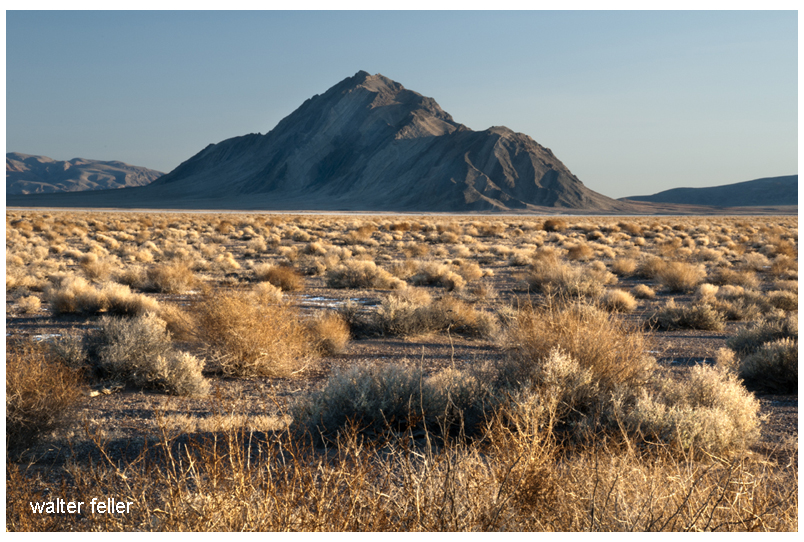
Eagle Mountain
Lauren Wright and Bennie Troxel spent their lives in the desert. Starting in the early 1950s, they mapped the roughest country in Death Valley and beyond. What others called chaos, they patiently untangled, rock by rock. Over the years they became two of the most trusted voices in Basin and Range geology, known for their steady field habits, clean maps, and deep respect for what the land itself could tell them.
They began in Death Valley, working through the twisted terrain east of Badwater and Furnace Creek. There, scattered fault blocks looked like a puzzle someone had shaken apart. Wright and Troxel figured out that this “Amargosa Chaos” wasn’t random at all. It was the result of the crust stretching and tearing at low angles, lifting old rocks and dropping young ones. Their maps from the 1960s and 70s showed that the Valley wasn’t just a crack in the earth, but part of a much larger system in which the crust itself was thinning.
They studied the Furnace Creek and Death Valley fault zones and showed that the sideways, or strike-slip, motion wasn’t as massive as some believed. The land was moving both sideways and downward — sliding, stretching, and rotating all at once. Their careful work stopped wild speculation and grounded future studies in what could actually be seen in the rocks.
Later, when the field began to recognize “detachment faults” — those broad, low-angle breaks deep in the crust — Wright and Troxel were already there. They had mapped them years before anyone had a name for them. Their diagrams of tilted mountain blocks, uplifted footwalls, and sinking basins became the foundation for how geologists now picture the Basin and Range province.
Their influence spread southward, into the Tecopa and Shoshone area. Tecopa Basin, once thought of as just a dried-up lake, became under their framework a living tectonic basin — a place still moving, still changing. The basin sits between the Resting Spring Range on the east and the Nopah Range on the west, both tilted blocks bounded by faults. Wright and Troxel’s regional mapping explained how those ranges rose and the basin sank, all part of the same crustal stretching that shaped Death Valley.
The Resting Spring Range, they showed, is a footwall block lifted on a west-dipping detachment fault. That fault likely channels the hot water that feeds Tecopa’s springs. Across the basin, the Nopah Range tilts the other way, dropping the valley floor between them. The lake beds and alluvial fans that fill the basin record every stage of that movement. Their approach — always linking sediments, structure, and landscape — became the standard way of reading desert basins.
Following their line of thought south, the fault belt continues through Sperry Wash to the Kingston Range. There the crust was pulled so thin that deep rocks rose to the surface. Later researchers would prove the Kingston Range to be a metamorphic core complex, but it was Wright and Troxel’s earlier insight into Death Valley’s structure that pointed the way. They showed that the same forces that opened Death Valley also lifted the Kingston Range and dropped the Tecopa Basin between them.
At the southern edge of this chain lies the Avawatz Mountains, a natural hinge between the stretching Basin and Range and the sliding Mojave block. Wright and Troxel understood this as the turning point — where extension gives way to sideways shear. The Garlock Fault lies just to the south, a great east-west fracture that shifts motion from one style to another. They were among the first to argue that these systems are connected, not separate. The Garlock doesn’t stop Death Valley; it redirects it.
South of the Avawatz, the story continues through Soda and Silver Lakes, the broad dry basins near Baker. These, too, line up along the same fault trend. The Mojave River, flowing northward from the mountains through Barstow, traces that same old scar in the crust. The river’s course isn’t random — it follows a tectonic path carved long before any water ran through it. Every terrace, canyon, and dry lake along its route echoes the same pattern Wright and Troxel mapped farther north.
By the time the river reaches Afton Canyon and the dry sinks of Cronese and Soda Lake, it’s running through the tail end of their structural corridor. The ground here still moves, slowly and quietly, along the Lenwood, Lockhart, and Helendale faults. These smaller strands pick up the motion of the Garlock and pass it westward toward the San Andreas. The Mojave River flows right through the middle of it all — a living reminder of how deep-seated tectonics shape even the surface flow of water.
Wright and Troxel’s gift was not just their data but their way of seeing. They treated the desert as a single, connected organism — every basin, every fault, every dry lake part of the same long rhythm of motion. Where others saw disjointed ranges, they saw a story of continuous transformation, stretching from Furnace Creek to Barstow and beyond.
Their maps still hang in field camps and classrooms, and the Geological Society of America’s Wright–Troxel Award continues to support students studying these same basins. The accuracy of modern GPS and seismic work has only confirmed what they drew by hand half a century ago.
In the end, their legacy is both scientific and human. They showed that patient fieldwork, careful observation, and respect for the land can turn confusion into clarity. Thanks to them, the Mojave and Death Valley are no longer a tangle of broken hills but a single, coherent landscape — one long story written in the language of stone.
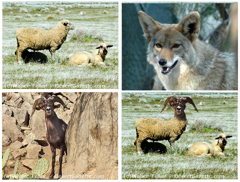
Bill Frakes was a gentleman from Argentina who brought sheep out to his claim at the old Camp Cady along the Mojave River. As soon as he got there, it seemed he had sheep problems. They kept dying. They kept dying because the sheep had coyote problems. The coyotes had issues because they always seemed hungry, and the sheep were so tasty.
Bill Frakes noticed the coyotes rarely messed with the local bighorn sheep. The bighorn would kick the hell out of the coyotes and cause them more coyote problems than the meal was worth–like broken bones, punctured lungs, and death and stuff…
Bill Frakes had an idea on how to solve everyone’s problems–to interbreed the bighorn with the domestic sheep. He would make coyote killers, and Bill Frakes would be on Easy Street raising flocks and flocks of bad-ass sheep.
The details of what happened next are left in the gray fog of best-forgotten history, but there were rumors that several unfortunate and disturbing creatures were tied to a shed, and at night strange animal-like crying and sobbing could be heard.
Bill Frakes’ plan failed miserably with a possible exception; up there in the hills, a hybrid ram is said to have escaped; too ugly to die, too ugly to let itself be seen, the King Mutant Ram’s wailing and moaning can be heard to these very modern times in the mysterious night winds of the Afton Canyon highlands . . .
The End
Fiction inspired by a true event as described in “Daggett, Life in a Mojave Frontier Town,” by Dix Van Dyke – Edited by Peter Wild.