Wright & Troxel

A learning tool

All right, here’s the whole story. No jargon, no technical formatting, just the history of how Lauren Wright and Bennie Troxel shaped our understanding of Death Valley, Tecopa, and the southern Mojave region.
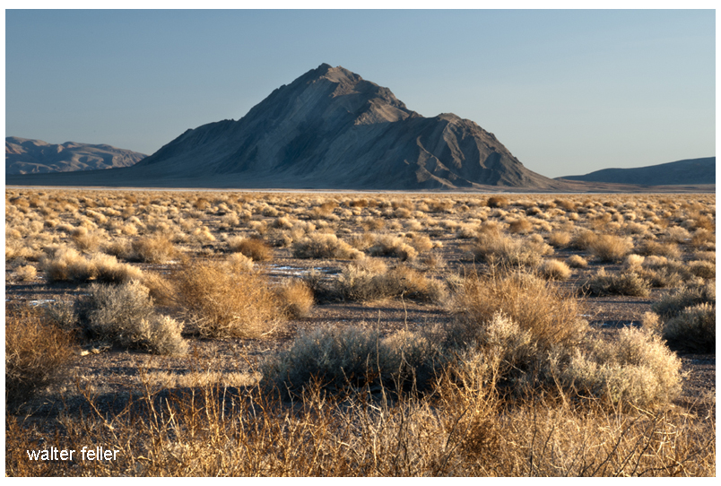
Eagle Mountain

Lauren Wright and Bennie Troxel spent their lives in the desert. Starting in the early 1950s, they mapped the roughest country in Death Valley and beyond. What others called chaos, they patiently untangled, rock by rock. Over the years they became two of the most trusted voices in Basin and Range geology, known for their steady field habits, clean maps, and deep respect for what the land itself could tell them.

They began in Death Valley, working through the twisted terrain east of Badwater and Furnace Creek. There, scattered fault blocks looked like a puzzle someone had shaken apart. Wright and Troxel figured out that this “Amargosa Chaos” wasn’t random at all. It was the result of the crust stretching and tearing at low angles, lifting old rocks and dropping young ones. Their maps from the 1960s and 70s showed that the Valley wasn’t just a crack in the earth, but part of a much larger system in which the crust itself was thinning.

They studied the Furnace Creek and Death Valley fault zones and showed that the sideways, or strike-slip, motion wasn’t as massive as some believed. The land was moving both sideways and downward — sliding, stretching, and rotating all at once. Their careful work stopped wild speculation and grounded future studies in what could actually be seen in the rocks.

Later, when the field began to recognize “detachment faults” — those broad, low-angle breaks deep in the crust — Wright and Troxel were already there. They had mapped them years before anyone had a name for them. Their diagrams of tilted mountain blocks, uplifted footwalls, and sinking basins became the foundation for how geologists now picture the Basin and Range province.

Their influence spread southward, into the Tecopa and Shoshone area. Tecopa Basin, once thought of as just a dried-up lake, became under their framework a living tectonic basin — a place still moving, still changing. The basin sits between the Resting Spring Range on the east and the Nopah Range on the west, both tilted blocks bounded by faults. Wright and Troxel’s regional mapping explained how those ranges rose and the basin sank, all part of the same crustal stretching that shaped Death Valley.

The Resting Spring Range, they showed, is a footwall block lifted on a west-dipping detachment fault. That fault likely channels the hot water that feeds Tecopa’s springs. Across the basin, the Nopah Range tilts the other way, dropping the valley floor between them. The lake beds and alluvial fans that fill the basin record every stage of that movement. Their approach — always linking sediments, structure, and landscape — became the standard way of reading desert basins.

Following their line of thought south, the fault belt continues through Sperry Wash to the Kingston Range. There the crust was pulled so thin that deep rocks rose to the surface. Later researchers would prove the Kingston Range to be a metamorphic core complex, but it was Wright and Troxel’s earlier insight into Death Valley’s structure that pointed the way. They showed that the same forces that opened Death Valley also lifted the Kingston Range and dropped the Tecopa Basin between them.

At the southern edge of this chain lies the Avawatz Mountains, a natural hinge between the stretching Basin and Range and the sliding Mojave block. Wright and Troxel understood this as the turning point — where extension gives way to sideways shear. The Garlock Fault lies just to the south, a great east-west fracture that shifts motion from one style to another. They were among the first to argue that these systems are connected, not separate. The Garlock doesn’t stop Death Valley; it redirects it.

South of the Avawatz, the story continues through Soda and Silver Lakes, the broad dry basins near Baker. These, too, line up along the same fault trend. The Mojave River, flowing northward from the mountains through Barstow, traces that same old scar in the crust. The river’s course isn’t random — it follows a tectonic path carved long before any water ran through it. Every terrace, canyon, and dry lake along its route echoes the same pattern Wright and Troxel mapped farther north.

By the time the river reaches Afton Canyon and the dry sinks of Cronese and Soda Lake, it’s running through the tail end of their structural corridor. The ground here still moves, slowly and quietly, along the Lenwood, Lockhart, and Helendale faults. These smaller strands pick up the motion of the Garlock and pass it westward toward the San Andreas. The Mojave River flows right through the middle of it all — a living reminder of how deep-seated tectonics shape even the surface flow of water.

Wright and Troxel’s gift was not just their data but their way of seeing. They treated the desert as a single, connected organism — every basin, every fault, every dry lake part of the same long rhythm of motion. Where others saw disjointed ranges, they saw a story of continuous transformation, stretching from Furnace Creek to Barstow and beyond.

Their maps still hang in field camps and classrooms, and the Geological Society of America’s Wright–Troxel Award continues to support students studying these same basins. The accuracy of modern GPS and seismic work has only confirmed what they drew by hand half a century ago.

In the end, their legacy is both scientific and human. They showed that patient fieldwork, careful observation, and respect for the land can turn confusion into clarity. Thanks to them, the Mojave and Death Valley are no longer a tangle of broken hills but a single, coherent landscape — one long story written in the language of stone.
Digital-Desert & Mojave Desert .Net

The digital-desert.com and mojavedesert.net sites share the same subject matter and similar structure, dealing with the Mojave Desert and surrounding regions. Both of them provide learning materials, exploration tools, and information on history.

Here are the main parts that make up both sites:

1. Natural History Geology: Rock formations, fissures in the earth (such as the San Andreas Fault), volcanic activity, and desert patterns. Lake systems (e.g., former Lake Manix and dry lakes such as Soda Lake).

Ecology: Plants and animals that live in desert environments include Joshua trees, creosote bushes, desert tortoises, and bighorn sheep. Habitats include sand dunes, salt flats, canyons, and oases.
Climate: Desert weather patterns include very hot temperatures, seasonal rain, and wind events.

2. Human History Native American Culture: Tribes such as the Mojave, Chemehuevi, Serrano and Paiute. Rock art, traditions, and trade routes such as the Old Mojave Trail. Explorers and Pioneers: Tales of explorers like Jedediah Smith, Kit Carson, and Father Garces. Principal routes: Mojave Road, Spanish Trail, and Butterfield Overland Mail. Mining History: Gold, silver, and borax mining expand rapidly. Specific mining towns and operations are Calico, Rhyolite, and Boron. Historic Places and Ghost Towns: Places like Kelso Depot, Ballarat, and Pioneer Town. Old abandoned buildings, stage stops, and rail history.

3. Geography and Exploration Areas and Landmarks: Joshua Tree National Park Death Valley Mojave National Preserve and Rainbow Basin. Special shapes such as the Devil’s Punchbowl, Afton Canyon, and sand hills. Streets and Roads: Route 66, Old Mojave Road, and gorgeous roads. Hiking and driving routes with maps and information. Interactive Maps: Topographic and historical maps depicting routes of exploration and other localities.

4. Cultural Characteristics Towns and Communities: Tales of desert towns such as Barstow, Victorville, Littlerock, and Needles. Key Players: The area called Death Valley housed early settlers and miners, even famous dudes like Roy Rogers. Art and Folklore: Desert-themed art installations, legends (e.g., ghost stories, lost mines) and folklore.

5. Learning and Information Photos and Pictures: Large photo galleries of desert landscapes, animals and abandoned places. Field Guides: Resources for identifying plants and animals. History Timelines: A summary of geological, prehistoric, and modern historical events. Resource Links: References to books, museums and archives for further research.

6. Fun Guides Camping and Hiking: Lists of campgrounds, remote places, and summaries of hiking trails.
Driving Tours: Ideas for a nice road trip with important places to see.
Safety and Preparation: Tips for desert exploration, including hydration, navigation, and safety around wildlife.

While digital-desert.com focuses on exploration and natural beauty through detailed guides and maps, mojavedesert.net often has a more structured historical narrative and cultural focus. Both sites are resources for desert enthusiasts, historians, and educators.

The Story of Inyo

https://mojavedesert.net/history/the-story-of-inyo-chalfant/


“The Story of Inyo” by W.A. Chalfant is a comprehensive history of Inyo County, California, first published in 1922. W.A. Chalfant (1865-1943) was a newspaperman and historian who spent much of his life in the Eastern Sierra region of California. His work is considered one of the seminal histories of this part of California, detailing the early exploration, settlement, and development of Inyo County.

The book covers a wide range of topics, including the area’s indigenous peoples, the impact of European settlement, mining, and economic development, and the natural history and geography of the region. Chalfant’s writing is noted for its detailed research, engaging narrative style, and commitment to telling the stories of the Native American inhabitants and the settlers who came to the area.

Inyo County is a region of great diversity and contrast, home to some of the highest and lowest points in the contiguous United States, including Mount Whitney and Death Valley. This geographic and environmental diversity is reflected in the stories Chalfant tells, from tales of survival and adaptation in harsh landscapes to the boom and bust of mining towns and the ongoing challenges and conflicts over land and water use.

Mono Lake
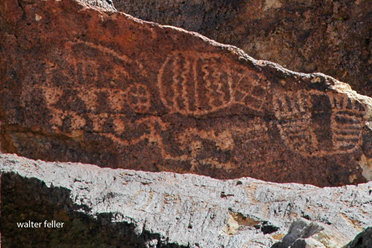
Petroglyphs

“The Story of Inyo” remains an essential resource for historians, geographers, and anyone interested in the American West, offering insights into the complex history of human and environmental interaction in this unique part of California.

https://mojavedesert.net/history/the-story-of-inyo-chalfant/

Ashford Mill

/a/death-valley/ashfordmill/

Ashford Mill in Death Valley, located in California, has a fascinating history that dates back to the early 20th century. It was named after the Ashford brothers, who were prospectors in the area.

Ashford Mill – Death Valley National Park
  1. Discovery of Gold: The story of Ashford Mill begins with the discovery of gold in the Black Mountains of Death Valley. In 1907, two brothers, Harold and Erwin Ashford, staked claims in a canyon known as Golden Canyon.
  2. Operation of the Mill: The Ashford brothers lacked the experience and resources to develop the mine, so they leased it to a businessman, B.W. McCausland. McCausland recognized the need for a mill to process ore and built the Ashford Mill in 1914. The mill was constructed to process gold ore from the Golden Treasure Mine, located about five miles away in the Black Mountains.
  3. Technological Features: The mill was a typical representation of the ore-processing technology of its time. It included structures for crushing, mixing with chemicals, and separating gold from the ore.
  4. Short-Lived Success: Despite the investment in the mill and the initial enthusiasm, the operation was short-lived. The ore from the Golden Treasure Mine was of lower quality than expected, making the operation unprofitable.
  5. Abandonment: By 1915, just a year after its construction, the mill was abandoned as the dreams of profitable gold mining faded. The harsh conditions of Death Valley and the lack of substantial gold findings made it impractical to continue.
  6. Today: The ruins of Ashford Mill stand as a reminder of the brief gold rush in Death Valley. The site is preserved within Death Valley National Park. Visitors can see the remnants of the mill’s foundation and some of the walls, offering a glimpse into the early mining history of the region.

The history of Ashford Mill is a typical example of the boom-and-bust cycle that characterized many mining ventures in the American West during the late 19th and early 20th centuries. It reflects the optimism, hardships, and eventual disappointment those seeking fortune face in this harsh and unforgiving landscape.

/gold-mining/

/death-valley/

Borax Wagons

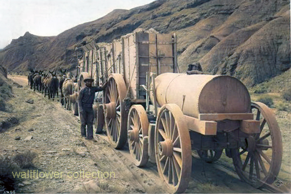
The 20-mule team borax ore wagons used in the late 1800s to transport borax from the mines in Death Valley, California, were quite large and had specific dimensions.

Here are the approximate dimensions for a typical 20-mule team borax ore wagon:

  1. Length: Approximately 30 feet (9 meters)
  2. Width: About 8 feet (2.4 meters)
  3. Height: Around 7 feet (2.1 meters)
  4. Weight: These wagons weighed approximately 7 tons when fully loaded with borax ore.

These massive wagons required a team of 18 mules and two horses to pull them across the harsh desert terrain. They were an iconic part of the borax mining industry in the late 19th century and were crucial in transporting borax to the nearest railroad for distribution.

  1. Two large ore wagons were used to transport the borax ore from the mines in Death Valley to the nearest railroad for shipment. They were massive and could carry a significant amount of borax.
  2. One water tank wagon: There was a specialized tank wagon in addition to the two ore wagons. This wagon carried water for the mules and horses that pulled the wagons. The desert environment of Death Valley was harsh, and providing water for the animals was crucial to their survival during the long and arduous journey.

So, the 20-mule team borax wagons actually consisted of 18 mules and 2 horses pulling two ore wagons and one water tank wagon. These wagons became an iconic symbol of the borax mining industry in the late 19th century.

Borax

20-Mule Teams

Harmony

Saline Valley Salt Tram

/saline-valley/salt-tram/

Photo of tramway tower in Saline Valley

The Saline Valley Salt Tram, also known as the Saline Valley Tramway, is a historic tramway system used to transport salt from the Saline Valley in California, USA. The Saline Valley is located within the Death Valley National Park.

The tramway was constructed in the early 20th century to facilitate the transportation of salt from the salt flats in the Saline Valley to the Owens Valley. The system consisted of cables and tramcars that carried salt over the Inyo Mountains. The salt was then transported to market via the Owens Valley.

The operation of the Saline Valley Salt Tram ceased in the mid-20th century, and the tramway itself has since fallen into disuse and disrepair. The remnants of the tramway, including some of the infrastructure and cables, can still be found in the Saline Valley. The area attracts historians, hikers, and those interested in exploring the remnants of historical infrastructure.

Old Crump

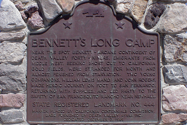
In 1849, a wagon train bound for California split up, with many members opting for a supposed shortcut to the goldfields. The shortcut did not work out, and these intrepid wanderers found themselves stranded, lock, stock, barrel, and four children on the floor of a place called ‘Death Valley.’

Bennett’s Long Camp

Over a month of hardship and waiting had passed while two heroic young men walked to find a way out and return with supplies to bring this band of Lost 49ers to safety. This they did, returning with food, a white horse, and a one-eyed mule. Sadly enough, the white horse had to be abandoned in a dry fall in the Panamint Mountains.

With these heroes returning, they could make their escape. The children were weak, tired, and sick and would not make the trip if they had to walk, so the pioneers sewed several shirts together, making saddlebags to carry them in.

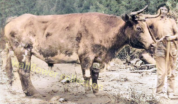
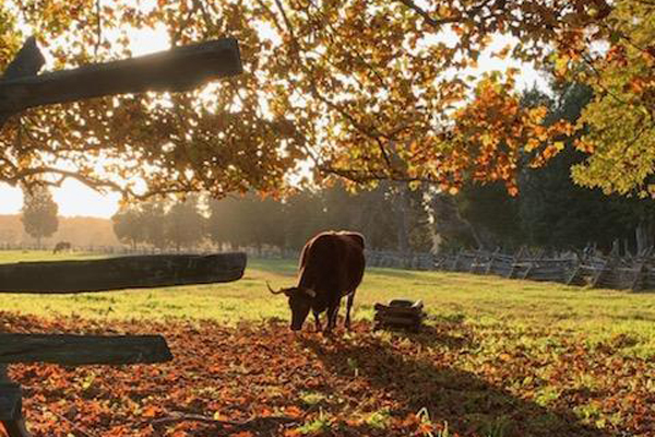
The children were uncomfortable and sick. They cried, but ‘Crump,’ the ox selected to bear this burden, seemed to sense the importance of carrying its cargo as gently as possible, never missing a step, stumbling, or even making a sudden, jarring move.

This ordeal, beginning late in 1849 and finishing up early in 1850, became a distant memory to the party members.

Years later, a much older William Manly, one of the two heroes who saved the emigrants (John Rogers being the other), was walking down a road in the Central Valley. He noticed that over in a shady pasture, there was a fat ox relishing the long, tender blades of grass. Strangely enough, the ox looked vaguely familiar. Sure enough, it was Old Crump, warm and gentle as ever.

Ox in pasture of green grass
Retired beast of burden – NPS photo

Back in 1850, when things settled after their hardship-fraught journey and arrival at their destination, the owner of the ox retired the creature as a reward for its distinguished service, and Crump never worked another day in his life.

Chapter XI – Death Valley in 49
Wm. Lewis Manly

Draft Oxen

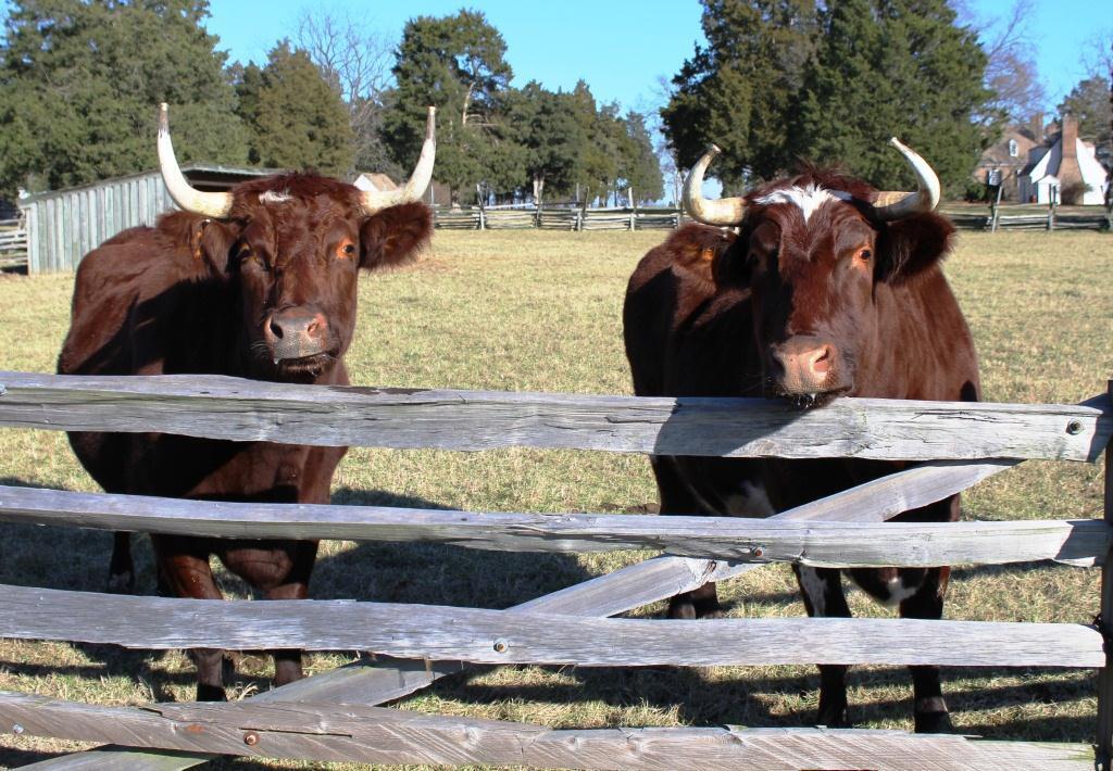
Draft oxen are domesticated cattle trained to work as draft animals, primarily for agricultural purposes. They have been used for centuries in many parts of the world to pull plows, wagons, and other heavy loads. Oxen are typically castrated male cattle, and they are trained to respond to commands from their handlers.

NPS photo of oxen - ox tream
Oxen – NPS photo

Here are some key characteristics and advantages of using draft oxen:

  1. Strength: Oxen are strong animals, capable of pulling heavy loads, plowing fields, and performing other tasks requiring significant physical strength. They are often used for tilling soil and other agricultural activities.
  2. Endurance: Oxen are known for their endurance. They can work long hours, making them suitable for tasks requiring sustained effort, such as plowing large fields or pulling heavy loads over extended distances.
  3. Steadiness and Reliability: Oxen is generally known for its steady and reliable work. They are patient animals and can handle repetitive tasks at a consistent pace.
  4. Adaptability: Oxen are well-adapted to various climates and terrains. They can work in different conditions and are particularly useful in areas where mechanized equipment may not be practical or accessible.
  5. Low Maintenance: Oxen are often considered low-maintenance animals compared to some other draft animals. They can graze on pasture, and their dietary requirements are relatively simple. They also have sturdy hooves, which reduces the need for frequent hoof care.
  6. Draught Power: Oxen have been historically crucial for providing draught power in agriculture. They were widely used before the advent of mechanized farming equipment and are still used in some regions where traditional farming methods persist.
  7. Manure Production: Aside from their work capabilities, oxen also produce manure, which can be used as crop fertilizer. This contributes to the sustainability of agricultural practices.

While draft oxen have been widely used historically, the prevalence of mechanized agriculture has led to a decline in their use in many developed countries. However, in certain regions and for specific purposes, draft oxen continue to be valued for their strength, reliability, and suitability for sustainable and traditional farming practices. Training and working with oxen require skill and patience, as they respond well to positive reinforcement and consistent handling.

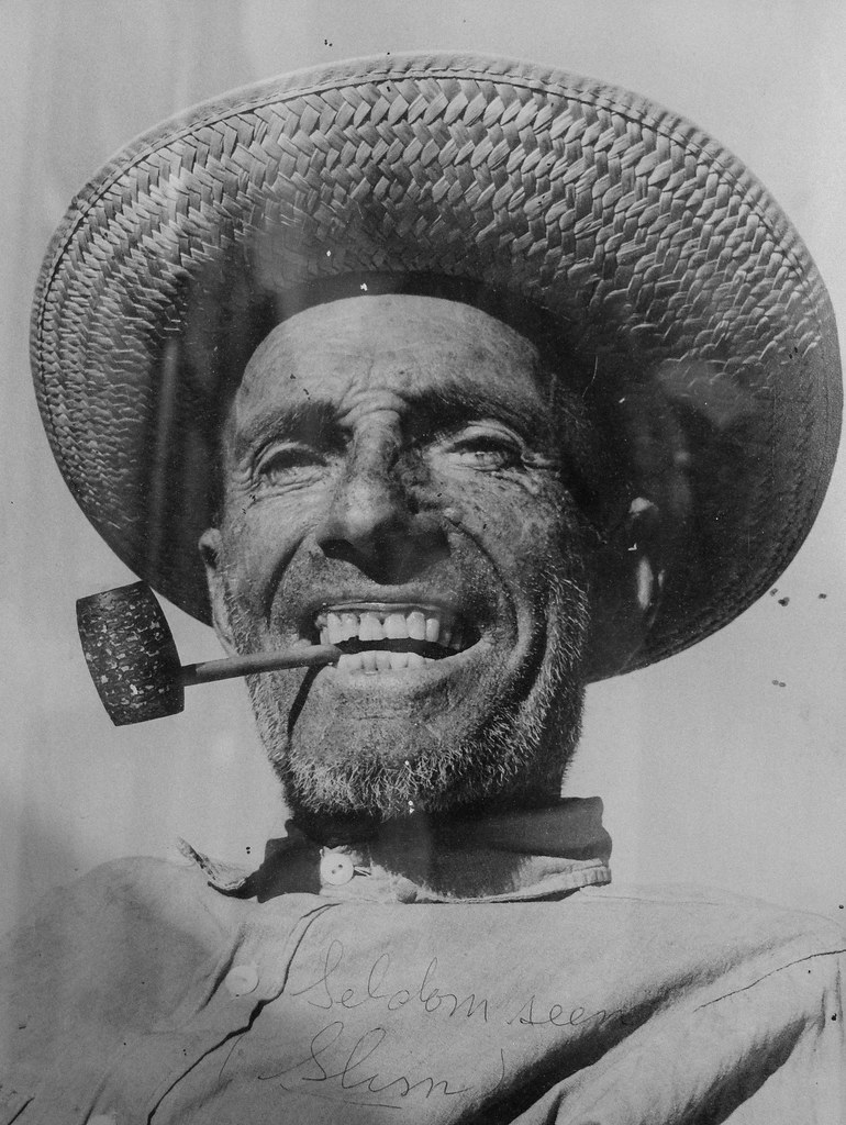
“Seldom Seen Slim”

“Seldom Seen Slim” was a nickname for a man named Charles Ferge, who lived in the Panamint Valley of California. He was known for his reclusive lifestyle and infrequent appearances in town, leading to the nickname “Seldom Seen Slim.” He was a prospector and a colorful character in the region’s history. The nickname reflects his tendency to avoid social interactions and to be rarely seen by others.

He claimed he wasn’t lonely because he was half coyote and half burro!

AKA “Seldom Seen Slim”

“Me lonely? Hell no! I’m half coyote and half wild burro.”

Seldom Seen Slim said these words many times, and they are the epitaph on his grave at Ballarat Cemetery in Ballarat, California.

Seldom Seen Slim, named Charles Ferge by his parents, was born in Illinois in 1881, according to wellfare records. Slim always said, “I got no people, I was born in an orphanage.

Slim came to Ballarat sometime between 1913 and 1917, not long after the town was abandoned by the miners who had been seeking their fortunes in the silver mines of the Panamint Mountains. He became the last resident of Ballarat, now a ghost town. Slim had a reputation as a recluse with a cantankerous side. He didn’t believe in showers or baths because “bathing was a waste of water”. Although, he did make into town for his annual haircut and bath whether he felt he needed it or not!

Slim was a visitor to Trona when the time came to stock up on supplies of tobacco for his corn cob pipe and to replenish his bottle of hooch. His reputation was so widespread that Walter Knott had statues of “Seldom Seen Slim” made and placed in his Knotts Berry Farm and Ghost Town in Buena Park, CA.

Slim was found ailing in his rundown trailer in Ballarat’s ruins and was taken 70 miles to Trona, where he survived only five days. His funeral was in Boot Hill in 1968 and was broadcast on television around the country before cable, as he was the last of a breed of prospectors who spent their lives living on the Mojave Desert in and around Death Valley. He was the first to be buried in the Ballarat cemetery in half a decade. After Slim’s death in 1968, at the age of 80, the United State Department of the Interior approved the naming of a peak in the Panamint Mountains in honor of Charles Ferge. The peak is now named “Slim’s Peak”.

Ref = findagrave

https://www.findagrave.com/memorial/12763141/charles-ferge