A History of American Indians in California:1880-1904


In the 1880s, there was increased public awareness of the problems California Indians were confronting. While the problems were rarely analyzed, many people helped to improve the quality of life for Indians. There was an effort to improve the education of Indians through schools, and to provide them with land to better their economic conditions so that Indians could become full citizens of the United States of America.

In the early 1880s, Helen Hunt Jackson wrote A Century of Dishonor and sent a copy of her book to each United States congressman. She was then appointed to a commission to examine the condition of Indians in Southern California. Her visits resulted in The Report on the Condition and Needs of the Mission Indians of California, by special agents Helen Jackson and Abbot Kinney. The report summarized the problems and concerns of Southern California Indians; many of the conditions outlined in the report, however, were applicable to all California Indians. The report noted that Indians had been continually displaced from their land. She also noted that while many Indians had taken “immoral” paths, others had chosen the responsibilities of herding animals and raising crops. In her report, she also noted that the United States government had done little to right the wrongs of the past. While Jackson did not solve all the problems of Southern California Indians, her work did bring their concerns to the attention of the American public and Congress.

One recurring concern was the lack of education and training necessary for survival in American society. The government, as well as Jackson, saw education as a way of assimilating Indians into the mainstream of United States society. Reports from the Secretary of the Interior and the Bureau of Indian Affairs at that time expressed the goals of the government in relation to the educational process. In 1908, one report stated, “the rooms held three or four each and it was arranged that no two tribes were placed in the same room. This not only helped in the acquirement of English, but broke up tribal and race clannishness, a most important victory in getting Indians toward real citizens.” (Spicer, 1969:235) An earlier report stated, “I can see no reason why a strong government like ours should not govern and control them [Indians] and compel each one to settle down and stay in one place, his own homestead, wear the white man’s clothing, labor for his own support, and send his children to school.” (Spicer, 1969:236) Other people had even stronger ideas. For instance, George Ellis, in his book, The Red Man and the White Man in North America, wrote, “The Indian must be made to feel he is in the grasp of a superior.” (Ellis 1882:572) In opposition to this view, the Indian Rights Association was formed in 1882. This Indian advocate group would play a powerful role in formulating Indian policy in upcoming years.

While the approaches differed, all agreed that education was necessary. “In California, three types of educational programs were established for native peoples. The first was the Federal Government reservation day school. The second type was the boarding school, fashioned after Carlisle. And finally, the nearby public school that allowed Indians to attend began a slow, though steady, increase in popularity among policy makers.” (Heizer, 1978:115) While the public schools seemed the best alternative, most Indians did not have the right to attend these schools until the 1920s.

In 1881, an elementary school system for Indians was established in California. However, the Indians soon recognized that the schools were a threat to their culture, as well as to the tribe as a political unit. “As a result, considerable resistance to the schools developed. Native peoples destroyed the day school at Potrero in 1888, and burned the school at Tule River in 1890. At Pachanga, a Luiseno named Venturo Molido, burned the school and assassinated the school teacher in 1895.” (Heizer, 1978:115) Much of the destruction and violence could have been avoided if the school system and the government had recognized the great importance the Indians placed on being able to maintain their cultural beliefs. In 1891, school attendance was made mandatory. But while attendance was mandatory, there were still Indian children who did not attend.

In 1901, the first Indian hospital in California was established at Sherman Institute in Riverside. Sherman later became a boarding school for Indian children. While hospitals and other facilities improved conditions for California Indians, most Indians were still without homes.

During this period, another major focus was on the acquisition of land for Indians. Probably the most interesting example of the way land was acquired is evidenced by the Yokayo Pomo in 1881: “After collecting nearly $1,000 from their people, the head man selected a 120-acre site near the Russian River and made the down payment. The Yokayo groups prospered; they paid the entire balance owed on their land, and even saved enough to purchase farm machinery shortly thereafter.” (Heizer, 1978:118)

A major tool the government used in trying to assimilate Indians during this time was the General Allotment Act of 1887, also known as the Dawes Act, which appeared to be generally advantageous to Indians. However, the major intent of the act was to break down the role of tribal government. The act itself provided that each Indian living on a reservation would receive a 160-acre allotment of land per family unit, and each single man would receive 80 acres if the reservation had enough land. If there was not enough land, other provisions were made. Indians not residing on a reservation would be entitled to settle on any surveyed or unsurveyed government lands not appropriated. The lands allotted would be held in trust for 25 years by the Bureau of Indian Affairs. If all other provisions of the act were met, that is, if the Indians made use of the lands for agriculture and became self-sufficient, then the land would become the property of the individual. “Native people understood full well the implications of allotment and offered considerable resistance. Nevertheless, the Bureau of Indian Affairs began ordering allotments of various sizes at Rincon, Morongo, and Pala Reservations in 1893. . . . The next year, allotments were begun at Round Valley Reservation. By the turn of the century, 1,614 individual allotments were made among eight reservations in the state.” (Heizer, 1978:117)

Long before the passage of the Dawes Act, people recognized that problems would occur from its implementation. In 1881, Senator Henry Moore Teller of Colorado spoke in opposition to an earlier form of the Allotment Act. Senator Teller concluded, “If I stand alone in the Senate, I want to put upon the record my prophecy in this matter, that when 30 or 40 years shall have passed and these Indians shall have parted with their title, they will curse the hand that was raised professedly in their defense to secure this kind of legislation, and if the people who are clamoring for it understood Indian character and Indian laws, and Indian morals, and Indian religion, they would not be here clamoring for this at all.” (Spicer, 1969:234) The senator would soon be proven correct.

Other Indians, such as the Cupenos from Warner Springs, chose to fight for their lands in the courts. With the assistance of the Indian Rights Association, they began a suit to stop their eviction from their home at the Warner Ranch. In 1888, they won a favorable decision which temporarily stopped their eviction. However, the case was appealed to the United States Supreme Court, and in 1903, the Cupenos were evicted from their home.

Still, other Indians chose to purchase land that was once theirs and reside on it. However, not every transaction was fair. In 1904, the San Francisco Chronicle reported that Indians who bought land from Whites were being dispossessed by the heirs of the granters, who gave no valid titles. “The Northern California Indian Association reported that about 10,000 Indians lived on land to which whites hold title. They were subject to eviction ‘at any time.’ The Indians are recognized for what they are not, usually competent to compete with white men in economic struggle. . . . Congress should buy lands for Indians in locations where they now are and allot them small farms in severalty. . . . It is also asked that their status as to citizenship be satisfactorily established. This petition is now before congress. It should be granted for justice and honesty. . . .” (San Francisco Chronicle, 1904).

The struggle for homes would continue.

https://www.nps.gov/parkhistory/online_books/5views/5views1d.htm

Malki Museum

A History of American Indians in California:HISTORIC SITES


Malki Museum
Riverside County

The Malki Museum is located on the Morongo Indian Reservation on Fields Road near the town of Banning, California. It is constructed of adobe bricks, and is approximately 30′ x 50′ x 12′ in size. Display cases house cultural objects made by Indians from the surrounding area, while the museum grounds include several brush arbors and a botanical garden. Both the museum and its grounds are well attended.

The Malki Museum was constructed in 1965 by the Cahuilla Indians and serves to preserve and enhance Cahuilla Indian lifeways. Its cultural exhibits relate the story of the Cahuillas from the pre-contact period to the present. Malki was also the first home for a publishing company, the Ballena Press, which has expanded its services to include ethnographic and ethnohistoric information and analysis of southwestern tribes.

The Malki Museum was the first Indian controlled and operated museum in California. As such, it is an important example to other Indian groups who are interested in preserving their material culture through a museum. Although the idea of an Indian Museum operated by Indian people seems like an obvious and natural development, it should be remembered that it takes dedicated people to actually accomplish such a task. Malki is a living example of an Indian people’s ability to adapt to the fast-changing circumstances that surround their cultural heritage. It will serve future generations by providing them with a glimpse into the rich and beautiful history of the Cahuilla people.

https://www.nps.gov/parkhistory/online_books/5views/5views1h46.htm

Tejon Indian Reservation

A History of American Indians in California: HISTORIC SITES


Tejon Indian Reservation
Kern County

In the early 1800s, Indians in the interior of California began to feel the effects of trappers and explorers. By mid-century, coastal Indians who moved inland following the breakup of the missions also suffered under the influx of miners and settlers. When the federal government sent Indian agents to write treaties with California Indians, Agent George W. Barbour negotiated the treaties with both interior and coastal Indians in the southern San Joaquin Valley. In return for the promise of goods, annuities, and land, the Indians vacated much of their home land.

In February of 1852, President Millard Fillmore submitted 18 California Indian treaties to the United States Congress for ratification, but the California delegation objected, complaining that the treaties provided too much good land for the Indians. Congress failed to ratify the treaties but did make some provisions for California Indians.

Edward F. Beale was appointed Superintendent of Indian Affairs for California in April 1852. Upon arrival in September, Beale toured the state to determine the status of California Indians. He reported in February 1853 that “our laws and policy with respect to Indians have been neglected or violated. . . . [The Indians] are driven from their homes and deprived of their hunting-grounds and fishing-waters at the discretion of the whites. . . .” Beale requested $500,000 for military reservations where both soldiers and Indians would reside.

Beale hired H. B. Edwards to start farming operations at Tejon and the San Joaquin River. On March 2, 1853, Congress appropriated $250,000 for five reservations, not to exceed 25,000 acres each, to be located on public lands, with good land, wood, and water. In September, Beale expanded the Tejon Farm into the first California reservation.

To gain support for his efforts, Beale named the reservation after Senator William Sebastian, Chairman of the Indian Affairs Committee. The Sebastian Indian Reservation, more commonly known as Tejon Indian Reservation, was located in the southern end of the San Joaquin Valley, “between Tejon Vaquero Headquarters and Canada de las Uvas. . . .” (Latta, 1977:736)

Tejon was located on a Mexican land grant rather than on public land, but Beale argued that no public lands were available and that the unoccupied grant could be purchased if necessary. Beale’s primary reason for choosing Tejon was the presence of mission-trained Indians with agricultural skills, more likely to succeed on a reservation.

Despite substantial opposition, Beale continued to gather Indians and move them to Tejon. In early 1854, he reported 2,500 Indians at Tejon and 2,650 acres under cultivation. Beale’s arguments for a reservation of 75,000 acres failed, and in July 1854, he was replaced by Thomas J. Henley.

When Henley took charge, he noted only 800 Indians, with fewer than 350 present at one time, and only 1,500 acres under cultivation, indicating that numbers of Indians and amount of acreage under cultivation had been inflated. Most of the crops failed that year because of drought. Henley started the Tule River Farm to supplement the reservation’s food, but the Indians still had to gather native foods and the government had to bring in more supplies in order to feed the reservation population. Throughout the reservation’s existence, drought, insects, and crop disease undermined the attempts at farming.

In November of 1856, the reservation was reduced to 25,000 acres. That year, 700 Indians were reported residing on the reservation and 700 acres were under cultivation. By 1859, Henley had been replaced.

In addition to crop failure, the reservation faced loss of the land when the land grant claim was upheld in court. Settlers also encroached on the unsurveyed and unfenced land, allowing cattle and sheep to eat reservation crops. During the 1863 drought year, all the crops were lost except for 30 tons of hay.

Meanwhile, former agent Edward F. Beale had purchased five contiguous ranchos in the Tejon area, including the reservation land, and was raising 100,000 sheep. In 1863, he offered to lease 12,000 acres to the government for a dollar an acre, but withdrew the offer when he found that the government planned to move Owens River Indians there. He noted that he had made the offer only because Indians already on the reservation were his friends.

Jose Pacheco, a Tejon leader, wrote to General Wright on April 16, 1864, “I should not have troubled you with this letter, Dear General, did I not think the agents here had wronged us. You and our great father at Washington do not know how bad we fare, or you would give us food or let us go back to our lands where we can get plenty of fish and game. I do not think we get the provisions intended for us by our Great Father; the agents keep it from us, and sell it to make themselves rich, while we and our children are very poor and hungry and naked.” (Sacramento Union, April 28, 1964)

The reservation was ordered closed in June 1864, and on July 11, Austin Wiley wrote, “I have the honor to inform you that all the Indians on the Tejon Farm and in the vicinity of Fort Tejon, some two hundred in number, have been removed from there to the Tule River farm.” Wiley noted that there was no food for the Indians at Tejon.

Shortly thereafter, D. N. Cooley, Commissioner of Indian Affairs, summarized the reasons for the reservation’s failure: “The lack of legal title to the land severely restrained investment in construction and development, leaving the reserve and the Indians on it in a state of constant uncertainty. The ideal of converting Indians from food gathering to settled agriculture was never realized.”

(Note: Unless otherwise specified, all above quotes are from government reports as cited in California Department of Parks and Recreation reference document No. 169, “Tejon Indian Reservation.”)

https://www.nps.gov/parkhistory/online_books/5views/5views1h92.htm

Fort Tejon Road


Fort Tejon Road refers to a historic route in California that leads to Fort Tejon State Historic Park. Fort Tejon was established in 1854 and served as a military outpost during the turbulent times of the 19th century, addressing issues related to the Gold Rush and conflicts with Native American tribes.

The fort is located in the Grapevine Canyon, part of the Tehachapi Mountains in Kern County. The Fort Tejon Road provides access to the park and passes through scenic landscapes. The area is known for its historical significance and is a popular destination for those interested in California’s history.

1855

Visitors to Fort Tejon State Historic Park can explore the well-preserved buildings, learn about the fort’s history through exhibits, and participate in various events and demonstrations. The park is managed by the California Department of Parks and Recreation and serves as a reminder of the state’s military and cultural history during the mid-19th century.

Desert Studies Center – Zzyzx

/zzyzx/

Main Building – Desert Studies Center

Zzyzx, pronounced “zy-zicks,” is a unique and intriguing place in the Mojave Desert of Southern California, USA. Specifically, it is home to the Desert Studies Center, operated by the California State University (CSU) system. The center serves as a field station for research and education focused on the desert ecosystem.

Here are some key points about Zzyzx and the Desert Studies Center:

  1. Location: Zzyzx is approximately 100 miles northeast of Los Angeles, near Baker, California. The Desert Studies Center is part of the larger California State University system and is used for academic and research purposes.
  2. History: The name “Zzyzx” was given to the area by Curtis Howe Springer, a self-proclaimed medical doctor and radio evangelist who established the Zzyzx Mineral Springs and Health Spa in the 1940s. The name was created to be the last word in English, and Springer intended to use it for marketing purposes. However, in 1974, the Bureau of Land Management (BLM) reclaimed the land, and it became the site for the Desert Studies Center.
  3. Desert Studies Center: The Desert Studies Center is a research and educational facility jointly operated by the California State University system. It provides a base for researchers, students, and educators interested in studying the unique ecology and geology of the Mojave Desert. The center offers facilities for field courses, workshops, and research projects related to desert studies.
  4. Facilities: The Desert Studies Center has dormitories, classrooms, laboratories, and other amenities to support researchers and students. It serves as a hub for scientific exploration and learning about the challenges and adaptations of life in desert environments.
  5. Research: Researchers at the Desert Studies Center focus on various topics, including desert ecology, geology, climate, and biodiversity. The unique characteristics of the Mojave Desert make it an ideal location for studying desert ecosystems and understanding how plants, animals, and microorganisms have adapted to this arid environment.

Visitors to the Desert Studies Center can explore the surrounding Mojave Desert, learn about its flora and fauna, and gain insights into the challenges and opportunities presented by desert ecosystems. It’s a valuable resource for those interested in environmental science, ecology, and desert studies.

Lake Tuendae

Paleontology

PALEONTOLOGY – Mojave Desert – Glossary of Terms and Definitions

mojavedesert.net › glossary › paleontology

The study of fossils and their relation to geologic time. … Paleontology Miocene fossils have been found in the cliffs of Red Rock Canyon. Scientists continue …

Mojave Desert Paleontology

The study of fossils and their relation to geologic time.

Paleontology in Red Rock Canyon

Wrightwood, Ca. Mountain Hardware Wrightwood, Ca. Canyon Cartography · DesertLink. Links to Desert Museums, Grizzly Cafe Family Dining …

Geology of the Mojave River

digital-desert.com › mojave-river › geology

The river flows below the surface for much of its length and only intermittently at the surface. The Mojave River, an arid desert lifeline, supplies water and …

Fossils, Rocks, and Time: Fossils and Rocks

digital-desert.com › paleontology › fossils-rocks

Geology : Paleontology. FOSSILS AND ROCKS. To tell the age of most layered rocks, scientists study the fossils these rocks contain. Fossils provide important …

Red Rock Canyon California State Park

digital-desert.com › red-rock-canyon

Red Rock Canyon State Park, Mojave California, Mojave Desert.

Fossils, Rocks, and Time: The Relative Time Scale

digital-desert.com › paleontology › relative

Geology : Paleontology. THE RELATIVE TIME SCALE. Long before geologists had the means to recognize and express time in numbers of years before the present …

Fossils, Rocks, and Time: The Numeric Time Scale

digital-desert.com › paleontology › numeric

Geologic time scale showing both relative and numeric ages. Ages in millions of years are approximate. Nineteenth-century geologists and paleontologists …

Fossils, Rocks, and Time: Fossil Succession

digital-desert.com › paleontology › succession

Geology : Paleontology. FOSSIL SUCCESSION. Three concepts are important in the study and use of fossils: (1) Fossils represent the remains of once-living …

Fossils, Rocks, and Time: Putting Events in Order

digital-desert.com › paleontology › order

Geology : Paleontology. PUTTING EVENTS IN ORDER. Scientists who study the past try to put events in their proper order. When we discuss events that happened …

Fossils, Rocks, and Time: Table of Contents

digital-desert.com › paleontology › index-frt

Geology : Paleontology. FOSSILS, ROCKS, AND TIME. INTRODUCTION. We study our Earth for many reasons: to find water to drink or oil to run our cars or coal …

FOSSIL – Mojave Desert – Glossary of Terms and Definitions

mojavedesert.net › glossary › fossil

The Fossil Canyon Loop Road is an interesting route for vehicle touring. … Mojave Desert Paleontology The study of fossils and their relation to geologic …

Fossils, Rocks, and Time: Rocks and Layers

digital-desert.com › paleontology › rocks-layers

Geology : Paleontology. ROCKS AND LAYERS. We study Earth’s history by studying the record of past events that is preserved in the rocks. The layers of the …

Mojave Desert – Scavenger

mojavedesert.net › glossary › scavenger

Paleontologists are … Raven – Desert Wildlife. Raven – Raven Also see > Bird: Omnivore : Scavenger: Predator: Diurnal Mammals – Predators Mountain Lion · …

Mojave Desert Geology

digital-desert.com › geology

Paleontology. The scientific study of prehistoric plants and animals in their geologic context. Alluvial material in dry wash. Dry Lake – Playa Desert Varnish …

Red Rock Canyon – Mojave California

digital-desert.com › red-rock-canyon › introduction

Located in the southern El Paso Mountains, these colorful cliffs with their stark beauty and unique features have attracted hikers, geologists, paleontologists, …

Cajon Pass Geology

digital-desert.com › cajon-pass › geology

Pliocene and Pleistocene evolution of the Mojave River, and associated tectonic development of the Transverse Ranges and Mojave Desert, based on borehole …

Dr. Joan S. Schneider

mojavedesert.net › people › schneider-joan

Mojave Desert History > Names in History. Dr. Joan S. Schneider. Photo of Dr Joan Schneider at Joshua Tree National Park Joan S. Schneider, Ph.D.

ANTIQUITIES – Mojave Desert – Glossary of Terms and Definitions

mojavedesert.net › glossary › antiquities

ANTIQUITIES – A general term for archaeological or paleontological resources which are at least 100 years of age and which tangibly represent or have the …

Lake Mead

digital-desert.com › lake-mead

Three of America’s four desert ecosystems–the Mojave, the Great Basin, and the Sonoran Deserts–meet in Lake Mead NRA. As a result, this seemingly barren area …

References – Mojave Preserve – California Mojave Desert

digital-desert.com › mojave-preserve › geology

Hewitt, D.F., 1956, Geology and mineral resources of the Ivanpah quadrangle, California and Nevada: U.S. Geological Survey Professional Paper 275, 172 p.

The Grand Canyon

digital-desert.com › grand-canyon

Grand Canyon National Park, a World Heritage Site, encompasses 1,218,375 acres and lies on the Colorado Plateau in northwestern Arizona. The land is semi-arid …

RELATIVE DATING – Mojave Desert – Glossary of Terms and …

mojavedesert.net › glossary › relative-dating

RELATIVE DATING – A method of dating rock layers by their relationships or proximity to each other. Both archaeologists and paleontologists use relative dating.

Elizabeth Campbell

mojavedesert.net › people › campbell-elizabeth

Elizabeth Campbell. Photo of Elizabeth Campbell, Mojave Desert archeologist. NPS photo – colorized. Elizabeth Warder Crozer was born in August of 1893 into a …

Grand Canyon natural environments

digital-desert.com › grand-canyon › natural

Near the Colorado River, riparian vegetation and sandy beaches prevail. Just above the river corridor a desert scrub community exists complete with a wide …

Kokoweef Caves

mojavedesert.net › desert-fever › kokoweef

Kokoweef and the mysterious river of gold in the Mojave Desert.

Cajon Pass Heritage

digital-desert.com › cajon-pass › cajon-fs-heritage

Heritage resources in the Cajon Pass region of the Mojave Desert.

Mojave Desert – Glossary of Terms and Definitions

mojavedesert.net › glossary

Mojave Desert Glossary. The following definitions may be helpful. In most instances, they may not be specific to, or, all-inclusive of, the Mojave Desert.

Kokoweef

digital-desert.com › kokoweef

If there were what may be trillions of dollars in gold lying at the bottom of an ‘unrediscovered’ river running from the Great Basin under the Mojave Desert to …

Rainbow Basin

digital-desert.com › rainbow-basin

Land ownership status can be found on the “Cuddeback Lake” Desert Access Guide. These BLM maps can be purchased from any California Desert District BLM …

1872 Owens Valley Earthquake

/owens-valley/

The 1872 Owens Valley earthquake was a significant seismic event on March 26, 1872, in Owens Valley, California, USA. The earthquake is estimated to have had a magnitude of 7.4 to 7.9, making it one of the largest historical earthquakes in California.

Some key points about the 1872 Owens Valley earthquake:

  1. Location: The earthquake’s epicenter was near Lone Pine in Owens Valley, in eastern California, near the eastern Sierra Nevada mountain range.
  2. Effects: The earthquake caused extensive damage in the Owens Valley region. The town of Lone Pine suffered the most severe damage, with many buildings collapsing. In addition to the structural damage, the earthquake triggered ground ruptures, creating surface faulting along the eastern Sierra Nevada.
  3. Surface Rupture: The earthquake is notable for the significant surface rupture that occurred along the Owens Valley fault. This rupture extended for about 30 miles (48 kilometers) and displaced the ground horizontally by as much as 15 feet (4.5 meters). This surface rupture remains visible today as a scar on the landscape.
  4. Aftershocks: Numerous aftershocks followed the mainshock, continuing for several months. These aftershocks contributed to ongoing damage and hampered recovery efforts.
  5. Impact on the Landscape: The earthquake caused changes to the landscape, including the formation of new fault scarps and the uplifting of land along the eastern Sierra Nevada. These changes are still studied by geologists today.
  6. Historical Significance: The 1872 Owens Valley earthquake is historically significant in the study of seismic activity in California. It provided valuable data for understanding the behavior of faults and the effects of large earthquakes on the landscape.

It’s worth noting that the Owens Valley region remains seismically active, and scientists continue studying the area to understand future earthquakes’ potential better. The 1872 event serves as a reminder of the seismic hazards associated with the complex fault systems in California.

Lone Pine

Owens Valley

Eastern Sierra Nevada

Mormon Rocks

/mormon-rocks/

The Mormon Rocks, also known as the Rock Candy Mountains, are a series of distinctive sandstone outcrops in the Cajon Pass, a mountain pass in the San Bernardino Mountains of Southern California. The Cajon Pass is a critical transportation corridor connecting the Los Angeles Basin with the Mojave Desert and beyond.
Here are some key points about Mormon Rocks and their significance:

  1. Location: The Mormon Rocks are within the Cajon Pass, traversed by Interstate 15 and several major railroad lines. The rocks are easily visible from the highway, making them a notable geological feature.
  2. Geological Formation: The rocks are sedimentary sandstone and formed through tectonic and erosional processes over millions of years. The distinctive red and white banded appearance is due to iron oxide (hematite) and other minerals.
  3. Cultural Significance: The Mormon Rocks have cultural and historical significance. The area is named after a group of Mormon pioneers who passed through the Cajon Pass in the mid-19th century during their westward migration. The rocks are a prominent landmark in the pass and have been featured in various forms of media.
  4. Recreational Opportunities: The area around Mormon Rocks provides outdoor activities and recreation opportunities. There are trails and viewpoints where visitors can appreciate the geological formations and enjoy scenic views of the surrounding landscape.
  5. Conservation: The Mormon Rocks are part of the San Bernardino National Forest, and efforts are made to preserve and protect the natural and cultural resources in the area.
  6. Railroad Transportation: The Cajon Pass is a crucial route for road and rail traffic. The presence of the rocks adds to the landscape’s visual appeal and has made the pass a notable location for train enthusiasts who enjoy watching trains navigate the steep grades of the pass.

Whether you are interested in geology, history, or simply enjoying scenic landscapes, the Mormon Rocks in the Cajon Pass offer a unique and visually striking destination. If you plan to visit, be sure to follow any posted regulations and respect the natural environment.

Tejon Ranch

/beale-adobe/

The Tejon Ranch, located in California, has a rich and varied history that spans centuries.

Tejon Ranch Headquarters

Here is an overview of its history:

  1. Native American Presence: The area around Tejon Ranch was originally inhabited by Native American communities, including the Kitanemuk people. These indigenous groups had a deep connection with the land, relying on its resources for their sustenance.
  2. Spanish Era: With the arrival of Spanish explorers and missionaries in the 18th century, the Tejon Ranch area became part of the vast landholdings of the Spanish missions and the California missions system. The land was used for cattle ranching and agriculture to support the missions.
  3. Mexican Land Grants: Following Mexico’s independence from Spain in 1821, the Mexican government began granting large tracts of land, including the Tejon Ranch, to private individuals. The Rancho El Tejon was granted to José Antonio Aguirre in 1843.
  4. Gold Rush and Transition: The California Gold Rush of 1848-1855 brought significant changes to the region. The influx of people seeking gold and the economic and political shifts associated with the U.S.-Mexican War led to the end of Mexican land grants. 1852, the U.S. government affirmed the land grant, and Benjamin and James Roberts acquired the Rancho El Tejon.
  5. Ranching and Agriculture: The Tejon Ranch became a center for ranching and agriculture. Cattle ranching, farming, and other activities flourished on the vast expanse of land. The ranch was crucial in supplying beef and other products to growing communities in Southern California.
  6. Treaty of Fort Tejon: In 1854, the U.S. government negotiated the Treaty of Fort Tejon with various Native American tribes, including the Kitanemuk. However, the treaty was not fully implemented, leading to conflicts and struggles for the indigenous people.
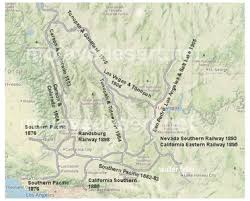
  7. Railroad Development: The Southern Pacific Railroad played a significant role in developing the Tejon Ranch. In the late 19th century, the railroad bypassed the Tehachapi Mountains, where the ranch is located, favoring a route through the nearby Tehachapi Pass. This decision affected the economic growth of the Tejon Ranch region.
  8. 20th Century and Beyond: The Tejon Ranch underwent various ownership and land use changes. In the 20th century, it evolved into a diversified operation involving agriculture, ranching, and commercial activities. The Tejon Ranch Company, established in the early 1900s, was key in managing and developing the property.

Today, the Tejon Ranch remains one of the largest privately-owned ranches in California, known for its conservation efforts, including partnerships with environmental organizations to preserve significant portions of the land as open space. The ranch’s history reflects the broader historical and cultural shifts in California, from indigenous habitation to Spanish colonization, Mexican land grants, and the economic transformations of the 19th and 20th centuries.

E.F. Beale and the Tejon Ranch

Edward Fitzgerald Beale, often referred to as E.F. Beale, played a significant role in the history of the Tejon Ranch.

Tejon Ranch – La Liebre Rancho

Here’s an overview of his connection to the ranch:

  1. Military Career: E.F. Beale was born in 1822 and had a distinguished military career. He served as a lieutenant in the U.S. Navy and later became Superintendent of Indian Affairs in California and Nevada.
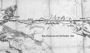
  2. Surveyor and Explorer: In the 1850s, Beale was appointed by the U.S. government to survey and explore a wagon road along the 35th parallel from Fort Defiance in Arizona to the Colorado River. This expedition, known as the Beale Wagon Road, aimed to improve transportation and communication between the East and the newly acquired territories in the West.
  3. Tejon Ranch and the Wagon Road: The Beale Wagon Road passed through the Tejon Ranch, linking Fort Tejon to the Colorado River. Beale recognized the strategic importance of the Tejon Pass for transportation routes and recommended it as a route for the railroad.
  4. Land Acquisition: In 1861, Beale purchased the Rancho El Tejon, which included the Tejon Ranch. He acquired the property from the prominent rancher General Edward Beale Tracy. E.F. Beale engaged in various agricultural and ranching activities on the land.
  5. Conservation and Agriculture: Beale was not only interested in ranching but also in conservation. He introduced various agricultural improvements to the ranch, including cultivating wheat and vineyards. Beale also advocated for land conservation and recognized the need to protect natural resources.
  6. Tejon Ranch Company: In the early 20th century, the Tejon Ranch changed ownership and management. The Tejon Ranch Company was established in 1936, and E.F. Beale’s descendants were involved in the company’s operations.
  7. Legacy: E.F. Beale’s legacy is intertwined with the history of the Tejon Ranch. His contributions to the development of transportation routes, his role in the acquisition of the ranch, and his efforts in both ranching and conservation have left a lasting impact on the region.
Tejon Ranch winter quarters

Today, the Tejon Ranch remains a significant property in California, known for its historical, cultural, and environmental importance. The Tejon Ranch Company continues to manage the property, balancing agricultural activities with conservation initiatives and partnerships to preserve large portions of the land as open space.

A Yucca Moth and its Yucca

https://mojavedesert.net/plants/

The relationship between a yucca moth and a yucca plant is a classic example of mutualism, a symbiotic relationship where both species benefit. Yucca moths and yucca plants have coevolved over millions of years, and their interaction is highly specialized.

  1. Pollination:
    • Yucca Moths: Female yucca moths play a crucial role in pollination. They are equipped with specialized mouthparts called maxillae, which they use to collect and carry pollen. The female moth visits the flowers of the yucca plant to lay her eggs.
    • Yucca Plants: Yucca plants rely on yucca moths for pollination. The female moth collects pollen from one yucca flower and then deposits it on the stigma of another flower while laying her eggs. This ensures cross-pollination, facilitating genetic diversity in the yucca plant population.
  2. Egg-Laying and Larval Development:
    • Yucca Moths: The female moth deposits her eggs inside the ovaries of the yucca flowers. She uses specialized structures called ovipositors, which also transfer the pollen. The eggs hatch into larvae.
    • Yucca Plants: The yucca plant provides a place for the yucca moth to lay eggs, and the developing larvae feed on some of the developing seeds within the yucca fruit. The yucca plant sacrifices a small portion of its seeds to nourish the larvae.
  3. Specificity and Coevolution:
    • The relationship between yucca moths and yucca plants is highly specific. Each species of yucca plant is typically associated with a specific species of yucca moth.
    • This specificity has arisen through coevolution, where the traits of each species have adapted to complement the other. Yucca moths have evolved to be efficient pollinators of yucca plants, while yucca plants have developed features that attract and support yucca moths.
  4. Obligate Mutualism:
    • The relationship is often considered an obligate mutualism, meaning each species depends on the other for reproduction. Yucca moths rely on yucca plants for a place to lay their eggs, and yucca plants rely on yucca moths for effective pollination.
Yucca schidigera

This intricate relationship between yucca moths and yucca plants highlights the fascinating ways organisms can evolve together, developing mutual dependencies crucial for their survival and reproduction.

Yucca brevifolia