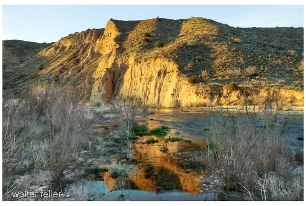
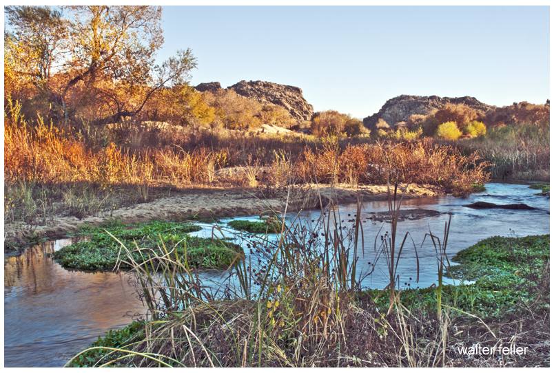
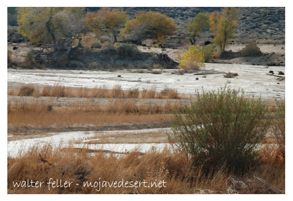
The Mojave River, a hidden gem in the arid landscapes of California, serves as a vital lifeline in the Mojave Desert. This remarkable river spans approximately 110 miles and offers a diverse ecosystem, historical significance, and recreational opportunities for nature enthusiasts and history buffs.
Geography and Formation:
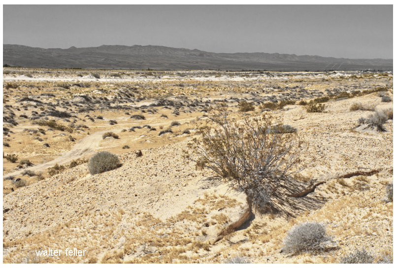
The Mojave River originates in the San Bernardino Mountains and meanders through the Mojave Desert, eventually dissipating into Soda Lake. Its path encompasses various landscapes, including rugged canyons, barren deserts, and lush riparian habitats. The river’s formation can be traced back thousands of years ago when geological processes and the ever-changing climate of the region shaped its course.
Ecological Importance:
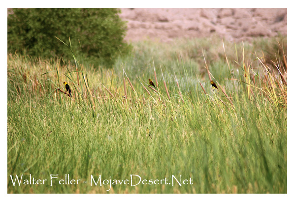
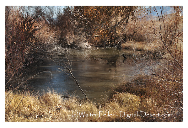
Despite the harsh Mojave Desert conditions, the Mojave River sustains a surprising array of flora and fauna. The river’s riparian zones provide an ideal habitat for a variety of plant species, such as willows, cottonwoods, and mesquite trees. These lush areas attract diverse wildlife, including birds, reptiles, and mammals, seeking refuge in this desert oasis.
Historical Significance:
The Mojave River holds a significant place in the history of California. Native American tribes, such as the Mojave, Serrano, and Chemehuevi, once relied on the river’s resources for sustenance and survival. European explorers, including Spanish missionaries and fur trappers, ventured along its banks, leaving behind a legacy of cultural exchange and exploration.
Moreover, during the mid-1800s, the Mojave River played a crucial role in the development of the Old Spanish Trail and the Mojave Road. These historic trade routes linked the Spanish colonies of California with the eastern United States, facilitating trade and migration.
Recreational Opportunities:
For outdoor enthusiasts, the Mojave River offers a plethora of recreational activities. Hiking trails, such as the Mojave Riverwalk Trail, provide opportunities for exploration, allowing visitors to immerse themselves in desert scenery. Camping facilities and picnic areas along the river’s banks provide the most idyllic setting for a peaceful getaway amidst nature’s tranquility.
Conservation Efforts:
Recognizing the importance of preserving this vibrant ecosystem, numerous conservation organizations and government agencies have worked to protect and restore the Mojave River. These initiatives focus on sustaining river water quality and preserving riparian habitats.
Conclusion:
The Mojave River stands as a testament to the resilience of nature in the face of adversity. Its meandering path through the Mojave Desert provides a lifeline for both wildlife and humans, offering a sanctuary amidst the arid landscapes. Whether you are a nature lover, history enthusiast, or adventure seeker, the Mojave River is a destination that promises a unique and memorable experience. So, embark on a journey to this desert oasis, and let the Mojave River captivate you with its beauty and allure.
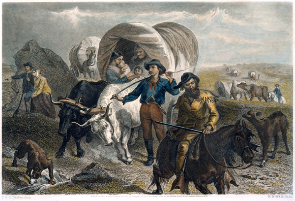
The Salt Lake Route, the Mojave River, and the Safer Passage of 1849
Emigrants crossing the plains / F.O.C. Darley, fecit ; H.B. Hall, Jr. sc.
Walter Van Dyke, a young Cleveland lawyer, joined the 1849 rush to California. Reaching Salt Lake too late to cross the Sierra safely, he turned south with a guided party under Captain Jefferson Hunt. His account records the successful Salt Lake-to-Los Angeles route via the Old Spanish Trail, Santa Clara, the Virgin River, Las Vegas, the Mojave River, and the Cajon Pass. It is valuable for showing the southern road that worked, not the Death Valley disaster.
The California Gold Rush is often remembered as a westward rush: across the plains, over the Sierra Nevada, or around the Horn and through Panama. These routes shaped the classic Forty-niner image: ox-team emigrant, sea passenger, red-shirted miner, speculator, and gold-seeker. Stewart Edward White divided the movement into three channels: the Cape Horn voyage, the overland road, and the Panama route. The overland road drew hardier emigrants, whose property was wagons, livestock, and farm equipment. White also highlighted the heavy price: cholera, failed animals, abandoned wagons, alkali deserts, and exhaustion from the Humboldt and Sierra crossings. The ordeal was a “trial by fire.” Reaching California, in the end, changed the emigrant.
Yet the overland story was a web of routes, decisions, delays, guides, mistakes, and improvisations. The best-known road led to the Humboldt and the Sierra. By 1849, however, lateness changed everything. Those late to Salt Lake faced a hard choice: attempt the Sierra and risk disaster, winter in Utah, or turn south toward Los Angeles on the Old Spanish Trail—a safer but longer route. At this juncture, Van Dyke’s “Overland to Los Angeles, by the Salt Lake Route in 1849” proves valuable, as his party avoided Death Valley by joining Captain Jefferson Hunt’s guided movement south and west toward the Mojave River and Cajon Pass.
Van Dyke started as an ordinary gold seeker. He was recently admitted to the bar in Cleveland. In spring 1849, he joined a company and left for California via Chicago, Iowa, Council Bluffs, the Platte, Fort Laramie, the Sweetwater, and Salt Lake City. His plain, late-life recollection preserves a useful chronology: leaving Chicago on June 6. Crossing the Mississippi on June 18. Leaving the Missouri on July 24. Reaching Salt Lake City on October 8. Then, waiting as the season closed, the Sierra route. Like many emigrants, they were late. However, unlike many, they accepted the consequences. The Donner disaster was a fresh warning that still shaped their choices.
In Salt Lake, Van Dyke’s party learned from Mormons returning from the mines that crossing the Sierra before winter was impossible. While they hesitated, the Pomeroy brothers, Missouri traders, prepared to take livestock and freight wagons to Southern California. Consequently, the emigrants joined them and hired Captain Jefferson Hunt as a guide. This decision put Van Dyke’s party on a different road from most Forty-niners, making their success reliant on guidance, water, forage, and discipline—not speed.
They left Salt Lake on 3 November 1849, heading south along the Wasatch. Near Utah Lake’s south end, they struck the Old Spanish Trail, which Van Dyke calls the northern route between Los Angeles and Santa Fe. This is important: the party did not create a new road, but entered an old corridor of travel, trade, and survival. They passed Spanish Fork, Sevier County, Mountain Meadows, Santa Clara, Virgin, Las Vegas, Mojave River, and Cajon Pass. The route was difficult but clear, with known camps, springs, river bottoms, and a familiar guide.
Van Dyke’s southern-route account should be read with the context provided by Will Bagley in Across the Plains, Mountains, and Deserts. Bagley’s bibliography demonstrates the scale of the overland documentary record: thousands of primary accounts, guidebooks, gazetteers, later wagon-travel sources, and secondary works. However, he warns that the California Trail’s southern route is less represented than the northern and central routes. This gap matters. Because of it, Bagley’s coverage is selective. He directs readers to Harlan Hague and Patricia Etter for more detail. This caution is important: Van Dyke is not just another emigrant reminiscence. For the Mojave and southern-route studies, he is a firsthand witness in a thin documentary field.
The contrast with White’s narrative is sharp. In his “Across the Plains” chapter, White spotlights catastrophic features: the Humboldt Sink, Sierra, broken wagons, dead animals, cholera graves, and emigrant trains collapsing under haste and poor preparation. Van Dyke’s account is different. There are hardships, hunger, snow, poor feed, and exhausted stock, but not disaster. The southern road remained challenging, not easy. The crucial distinction lay in route choice. By turning south, Van Dyke’s party exchanged the Sierra wall for a long desert road with intermittent water, warmer weather after Utah, and a descent through Cajon Pass into Southern California.
The Mojave River was the final desert threshold for Van Dyke’s party. Provisions nearly failed. About a dozen men went ahead for relief. They reached the Mojave River on the second day from the main camp, near present-day Barstow. They followed the Old Spanish Trail up the river to Cajon Pass. This short passage matters: it shows the Mojave River as the practical approach to Southern California. The river led emigrants to the pass and from the desert to the settlement.
The emotional climax is at Cajon Pass. Out of food and aided by moonlight, Van Dyke’s advance party went through the pass at night. They emerged in the valley around four o’clock on February 1. Van Dyke’s memory fixes on the contrast. The day before, they were in a harsh desert. Now, they walked through flowers and wild clover, with fragrant morning air. The passage is conventional–a classic arrival scene–, but its power lies in its geography.
Cajon Pass marked the divide between ordeal and relief.
At Cucamonga Rancho, the advance party found food, milk, and butter. A few days later, they reached Chino Ranch, linked to Colonel Isaac Williams, who had sent relief that season. Soon after, Van Dyke went to Los Angeles with a horse and guide, carrying letters and packages. The rest of the Cleveland party arrived with the train about a week later. The crossing took eight months. All arrived alive and healthy. Van Dyke knew this was rare. He had seen graves along the Platte and Black Hills and knew many had endured worse.
Van Dyke drew a larger lesson from their survival. That winter brought early rains and deep Sierra snow. No ordinary party could have crossed the Sierra. His group traveled from Salt Lake to Southern California with ox teams and heavy wagons, delayed primarily by weakened stock. He used this fact to argue that the Salt Lake-to-Los Angeles corridor was the natural railroad route to the Pacific—lighter grades, fewer snow sheds. This is retrospective route advocacy. However, it is grounded in their successful winter passage when the Sierra route was closed.
White frames what Van Dyke omits: the allure of the mines and San Francisco. White’s world rushes toward gold. It sorts into miners, merchants, teamsters, speculators, lawyers, gamblers, and citizens of a new commonwealth. The Gold Rush was a social furnace as well as a migration. Van Dyke confirms this from the south. In Los Angeles, he found a small Spanish pueblo with little business beyond stock raising. Even southern route emigrants kept moving north. The mines remained the magnet.
The three sources, therefore, work best together. Bagley supplies the research architecture: how to think about diaries, journals, recollections, reminiscences, guidebooks, and the uneven survival of trail records. White gives the broad synthetic frame. The Gold Rush was a migration, ordeal, social leveling, urban explosion, and civic improvisation. Van Dyke gives the local route witness. A Cleveland emigrant who reached Salt Lake too late. He turned south under guidance, followed the Old Spanish Trail, came by the Mojave River and Cajon Pass, and arrived safely in Los Angeles. Used together, these accounts show that the Forty-niner story was not simply a rush to California. It was a series of choices made under pressure. The right road, at the right season, could mean the difference between disaster and survival.
For Death Valley and Mojave work, that distinction is essential. The southern route is often remembered through the dramatic failure of the Death Valley parties. Van Dyke preserves the counterexample: the guided road that worked. His party suffered from hunger, snow, poor forage, and failing cattle. But it did not fall into catastrophe. It stayed with Hunt’s route. They kept to the Old Spanish Trail, used known water corridors, and entered Southern California through Cajon Pass. In that sense, Van Dyke’s account is not merely a reminiscence. It is evidence for the practical geography of survival in 1849.
The better historical question, then, is not simply why some Forty-niners suffered. All suffered in some measure. The sharper question is why some parties survived intact while others broke apart. Timing, leadership, route knowledge, livestock condition, water, forage, and the discipline to abandon the wrong ambition at the right moment–that made the difference. Van Dyke’s party wanted the gold fields. But at Salt Lake, they accepted winter’s terms.
The better historical question, then, is not simply why some Forty-niners suffered. All suffered in some measure. The sharper question is why some parties survived intact while others broke apart. Timing, leadership, route knowledge, livestock condition, water, forage, and the discipline to abandon the wrong ambition at the right moment—that made the difference. Van Dyke’s party wanted the gold fields. But at Salt Lake, they accepted winter’s terms. That decision sent them south, through the Mojave, and into Los Angeles alive.
References
Bagley, Will, ed. Across the Plains, Mountains, and Deserts: A Bibliography of the Oregon-California Trail, 1812-1912. Prepared for the National Park Service, National Trails Intermountain Region. Salt Lake City: Prairie Dog Press, 2015.
Van Dyke, Walter. “Overland to Los Angeles, by the Salt Lake Route in 1849.” Historical Society of Southern California.
White, Stewart Edward. The Forty-Niners: A Chronicle of the California Trail and El Dorado. New Haven: Yale University Press, 1918.
The association between Thomas Long (Pegleg) Smith and Walkara in Cajon Pass centers on the great horse raids of the 1830s-1840s along the Old Spanish Trail.
Walkara, sometimes called Wakara or Chief Walker, led large mounted raiding parties from present-day Utah into Southern California. These expeditions targeted Californio ranchos and mission herds, especially around San Luis Obispo, San Gabriel, and inland Southern California. The stolen horses were then driven eastward through the Mojave Desert and across Cajon Pass toward Utah and New Mexico.
Pegleg Smith was one of several Anglo mountain men tied to this trade network. Contemporary and later sources repeatedly connect him with Walkara’s operations, though historians debate whether he directly participated in raids or mainly acted as trader, guide, and broker. James Beckwourth and Old Bill Williams are usually mentioned alongside him.
Cajon Pass mattered because it was the principal gateway between the Los Angeles basin and the Mojave Desert. Large bands of stolen horses moved through the pass on their way east. Some traditions claim thousands of horses crossed there during Walkara’s biggest expeditions.
The raids became so notorious that local geographic names in and around Cajon Pass were later linked to them. Horsethief Canyon and Little Horsethief Canyon are traditionally associated with Walkara’s raiders and their escape routes into the desert.
An important detail often missed is that this was not random outlawry in the modern sense. The horse trade formed part of a large transregional economy running along the Old Spanish Trail. California horses had enormous value in the Rockies and Great Basin. Walkara built a disciplined mounted raiding system, while men like Pegleg Smith connected Native raiding networks with Anglo and Mexican trading systems.
By the mid-1840s, Californio authorities and local militia figures such as Benjamin Davis Wilson pursued these raiding bands through Cajon Pass and into the Mojave, though with limited success.
Combined timelines of Victorville, Hesperia & Apple Valley, CA.
Pre-1800s: Indigenous Presence and Trade
The Serrano and Vanyume tribes lived along the Mojave River, relying on the river’s intermittent flow for food and trade.
Trails used by these tribes would later become parts of the Mojave Road, Old Spanish Trail, and Salt Lake Road.
1850s–1870s: Pioneer Waystations and Early Ranching
1858: Aaron G. Lane establishes Lane’s Crossing on the Mojave River (present-day Oro Grande/Victorville area), offering rest and resupply to travelers heading west.
Lane is considered the first permanent American settler along the Mojave River.
Summit Valley, near present-day Hesperia, sees increased grazing by early ranchers.
The Summit Valley Massacre (1866): A conflict between settlers and Native groups over livestock thefts and land disputes—an often overlooked but significant local tragedy.
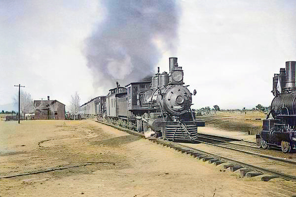
1880s: Railroads and Town Foundations
1885: The California Southern Railroad, part of the Atchison, Topeka and Santa Fe system, reaches the High Desert.
A telegraph and railroad station named Victor is established, later renamed Victorville in 1901 to avoid confusion with Victor, Colorado.
Jacob Nash Victor, the railroad manager, is the town’s namesake.
The Hesperia Land and Water Company, led by James G. Howland, promotes Hesperia. It lays out plans for an agricultural colony and resort town, though irrigation plans fall short.
1900s–1930s: Modest Growth and Agriculture
Hesperia experiments with vineyards, orchards, and dairy farms, but water shortages and harsh conditions hinder success.
Victorville grows as a railroad shipping center and stopover for travelers crossing the desert.
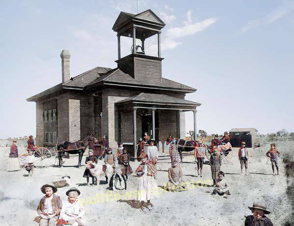
The Victor Elementary School District is formed in 1906.
Early buildings still visible include the Hesperia Schoolhouse (Main St. and C Ave.).
1940s: War Changes Everything
1941: Victorville Army Airfield (later George Air Force Base) is established on the western edge of Victorville.
The base brings thousands of military personnel, rapid infrastructure growth, and federal investment.
Apple Valley remains mostly desert ranchland, but interest grows due to its mild climate and open space.
1948–1950s: Apple Valley Booms
1948: Apple Valley Inn opens, built by Newt Bass and Bud Westlund to attract investors and wealthy land buyers.
Stars like Bob Hope, Marilyn Monroe, John Wayne, and President Eisenhower stayed at the inn.
Murray’s Dude Ranch (founded earlier, 1920s–30s): One of the few Black-owned resorts in the country. It hosted African American guests during segregation and was used in Black-cast Western films.
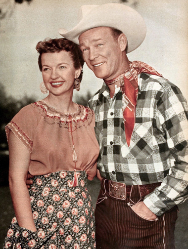
Roy Rogers and Dale Evans purchase a ranch in Apple Valley and become its most notable residents, eventually opening Roy Rogers’ Apple Valley Inn.
1950s–1960s: Expansion and Identity
Hesperia Inn and the Hesperia Golf & Country Club try to rekindle resort dreams. Jack Dempsey, the former boxing champion, lends his name to a museum at the inn.
Victorville grows with new housing and infrastructure to support the military population.
Route 66 runs right through Old Town Victorville, lined with diners, motels, and neon signs.
1970s–1980s: Steady Growth and Cultural Legacy
Apple Valley becomes a desirable retirement destination, marketing itself as a “Better Way of Life.”
Civic leaders like Bud Westlund and Newton Bass help shape the town’s modern layout and community services.
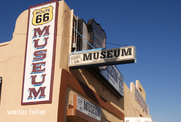
The California Route 66 Museum opens in Victorville in a former café, preserving the highway’s local legacy.
1992–2000s: Transformation and Reinvention
1992: George Air Force Base closes under federal military restructuring, dealing a blow to Victorville’s economy.
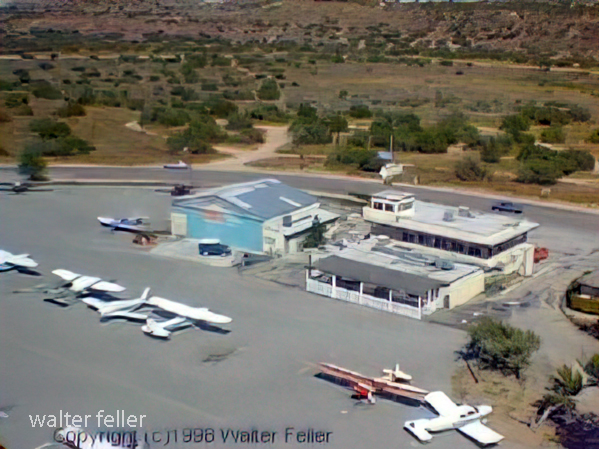
The base is repurposed into Southern California Logistics Airport (SCLA), an international freight and aerospace hub.
Apple Valley, Hesperia, and Victorville begin to urbanize, growing into commuter towns for the Inland Empire and the Los Angeles area.
2000s–Present: Modern Challenges and Historic Preservation
Victor Valley College, founded in 1961, continues to serve the region.
Old Town Victorville Revitalization Project aims to preserve the historic downtown.
Apple Valley promotes its Western heritage through the Happy Trails Highway and events honoring Roy Rogers and Dale Evans.
Hesperia Lake Park, Silverwood Lake, and local trails draw new visitors and recreation seekers.
The earliest desert people were not simply residents; they were formed by the land itself. Groups such as the Mojave people and Southern Paiute lived within a system defined by scarcity, timing, and precision.
Water determined everything. Springs, washes, and seasonal flows organized movement. Knowledge was practical and inherited, not optional. A person needed to know where to go, when to move, and how to use what was available.
This produced a distinct human type:
Memory-based knowledge of place
Endurance and adaptability
Careful use of limited resources
Cultural continuity is tied directly to the landscape
The desert was not something to overcome. It was something to understand.
2) Transitional figure: The crosser and builder
In the 19th century, a different kind of person entered the desert: traders, soldiers, freighters, miners, ranchers, and surveyors. Routes like the Old Spanish Trail carried people across the region rather than within it.
These individuals did not have generations of accumulated knowledge, but they still had to respect the desert’s limits. Many adapted quickly; others did not last.
Their traits were different:
Practical, experience-driven learning
Willingness to take risks
Dependence on known routes and water points
Early shift toward ownership, extraction, and control
They began reshaping the desert, but they had not yet escaped its authority.
3) Industrial desert people: Workers of the corridor
With the arrival of large-scale infrastructure, the desert produced a different kind of person. Railroads such as the Atchison, Topeka, and Santa Fe Railway and the Southern Pacific Railroad, followed by highways like Route 66, transformed the region into a corridor.
The people of this phase were workers tied to systems: railroad crews, station agents, mechanics, miners, motel owners, and military personnel.
Their relationship to the desert shifted:
Less reliance on natural water and terrain knowledge
Greater reliance on infrastructure
Identity tied to function (rail hub, highway stop, base town)
Continued toughness, but within organized systems
The desert still mattered, but it mattered indirectly. The system stood between the person and the land.
4) Contemporary condition: Layered and divided identities
Today, desert populations are not uniform. In places like Victorville and Apple Valley, people of many types coexist, often with very different relationships to the land.
These include:
Long-time residents with inherited knowledge
Commuters tied to outside economies
Logistics and warehouse workers are connected to national systems
A) The Mojave River spine (Colorado River → eastern Mojave springs → Mojave River corridor → Cajon Pass → San Bernardino/LA)
Mojave Indian Trail; Mojave River Trail; Mojave Road; Old Spanish Trail (where it drops into/uses Mojave River and related desert crossings); Beale’s Wagon Road (in its CA desert segment); Brown’s Toll Road (as the Cajon gateway upgrade); plus the generic “Wagon Roads” label when you’re talking about the 19th-century wagonable evolution of the same line.
The idea is simple: reliable water spacing and a workable pass dictated the alignment. The Mohave Trail conceptually underlies the later Mojave Road, and the NPS explicitly treats the Mojave Road through Mojave National Preserve as a branch of the Old Spanish National Historic Trail. Beale’s route description also ties his Mojave Desert segment to the Mojave Trail/Old Spanish Trail network, then notes the junction with the Mormon Road at the Mojave River. Brown’s Toll Road is best understood as “the Cajon Pass switch” that made the desert–coast connection more serviceable (toll/improvement era), not a whole new long-distance corridor by itself.
B) The LA ↔ Salt Lake “southern route” family (good-roads era branding laid over older travel)
Salt Lake Road; Old Spanish Trail (northern route pieces); Arrowhead Trails Highway; and again “Wagon Roads” as the pre-auto baseline.
This is the family that turns into the famous LA–Las Vegas–Salt Lake motor corridor in the auto-trails era. The BLM’s Arrowhead Trails Highway page is blunt about the lineage: the proposed/marketed auto route followed the late-19th-century “Old Mormon Road” and the earlier Old Spanish Trail. The Arrowhead Trail’s “association/branding layer” starts in 1916 (organized/incorporated that year) and is essentially a named-trail wrapper on that corridor.
C) “Good Roads” transcontinental overlays (names that often ride on top of existing roads, then feed into numbered highways)
National Old Trails; Midland Trail; Route 66 (as the numbered successor in the Southwest); and sometimes Arrowhead Trails Highway where it shares pavement with the NOTR in Southern California.
The key point: these aren’t necessarily new alignments end-to-end; they’re promotional/organizational systems that sign and improve what counties and states already had. FHWA and other summaries describe the National Old Trails Road Association as one of the early major named-trail movements (founded 1912). In the West, big stretches of the NOTR were later folded into US 66, which was established/commissioned in 1926 (signing followed). The Midland Trail is another early signed transcontinental auto trail (signed by 1913) that overlaps conceptually with the named-trails era rather than replacing everything on the ground.
D) The Sierra/Eastern Sierra north–south family (LA ↔ Mojave ↔ Owens Valley and beyond)
Sierra Highway / El Camino Sierra.
This one is its own long corridor family, and it intersects the desert east–west systems at junction towns rather than duplicating them. It’s commonly framed as an early 20th-century promoted route (established/advertised early, with later highway rebuilds) connecting Los Angeles into the Eastern Sierra.
E) The Tejon/Tehachapi gateway family (LA Basin ↔ San Joaquin Valley crossings)
Fort Tejon Road; Ridge Route.
Think “northbound exit from the LA Basin” rather than “Mojave crossing.” The Los Angeles–Fort Tejon Road is described as a successful wagon road solution over/near the Tehachapi barrier, completed in 1855. The Ridge Route is the early engineered state highway-era answer (opened 1915) that finally made that link paved and direct in the automobile age.
F) San Bernardino/San Gabriel mountain connectors (coast ↔ mountain communities, not trans-desert corridors)
Rim of the World Drive; Angeles Crest Scenic Drive (Angeles Crest Highway); Van Dusen Road.
These are “mountain access projects” more than “interregional desert crossings.” Rim of the World Drive is documented as opening in 1915 to connect San Bernardino with Big Bear through the range. Angeles Crest Highway construction begins in 1929 and the completed through-route opens much later (mid-20th century). Van Dusen Road sits here as an earlier wagon-road era Big Bear/Holcomb access line tied to the 1860–61 gold rush logistics (often described as a wagon road built in 1861).
West Side Road (Death Valley); Road to Panamint; Eichbaum’s Toll Road (same as “Eichbaum Toll Road”).
This family is its own ecosystem: borax-era freight roads, mining camp supply lines, then purpose-built access to resorts/tourism. NPS frames the borax era as transport over “primitive roads” (1883–1889). The Eichbaum Toll Road is well-documented as a 1925–26 build from near Darwin to Stovepipe Wells (i.e., a deliberate west-side entry improvement). “Road to Panamint” is best treated as the umbrella for the Panamint Valley/Skidoo/Rhyolite road-pushing phase in the 1906–1907 window and its successors; NPS history material and HAER/other documentation talk explicitly about wagon-road development and the Rhyolite–Skidoo road beginning in 1906 and being in use by 1907. West Side Road is the park backroad line on the valley floor’s west side (modern status aside), squarely in the “Death Valley internal access” bucket.
In the early 1850s, long wagon trains of Mormon pioneers crept down from the high desert into the mouth of Cajon Pass, hoping to reach the fertile San Bernardino Valley beyond. They soon found themselves at a natural choke point – a narrow ravine called Coyote Canyon, now known as Crowder Canyon – where sheer rock walls and a jumbled creek bed made passage nearly impossible. The first wagons through had to be disassembled: wheels removed and rolled by hand, cargo shifted onto a mule’s back, and wagon beds dragged piece by piece over the worst boulders. Early travelers remembered this grueling process, and the Mormon settlers who followed in 1851 likely endured the same ordeal to get their covered wagons through the upper Cajon Pass.
But adversity often sparks ingenuity. Not long after, some enterprising pioneers scouted a detour a few miles to the west of the treacherous canyon. There, a high spine of land offered a way around the worst narrows. This route ran along a slender ridge – a true hogback that rose above the canyon – and though it added a few extra miles, it spared travelers from having to lug their wagons through Coyote Canyon’s rock-strewn gauntlet. The Mormon colonists heading to Southern California in those years eagerly embraced this alternate path. In fact, by the early 1850s, they had established a wagon trail atop that ridge, which would later be known as the Mormon Hogback in honor of the many Latter-day Saint families who had blazed it.
In 1850, a veteran freighter named William T. B. Sanford took it upon himself to hack a rough wagon road along this western Cajon route. Sanford’s road departed the old Spanish Trail near present-day Victorville, climbed onto the flanks of Baldy Mesa, and then edged down through the West Cajon Valley, eventually descending toward a cluster of towering sandstone outcrops. Those pale rocks marked a kind of gateway at the foot of the hogback trail. They would later be known as the Mormon Rocks – named for the Mormon pioneers who camped beneath them after braving the ridge and finally emerging into the open Cajon wash.
Traveling the Mormon Hogback was still a heart-pounding adventure. The ridge was narrow and the drop-offs unforgiving; in places, the trail was scarcely wider than a wagon itself. The ascent to the summit was so steep that teams often had to “double up,” hitching multiple teams of oxen or mules to a single wagon. One contemporary account describes wagons needing as many as 32 mules in harness to tug a heavy load up the incline. On the way back down, drivers would lock their wagon wheels and skid the first several yards, the wooden rims dragging like sleds to slow the descent. The air filled with the shouts of teamsters and the groan of brake chains as each wagon inched along the hogback’s crest. It was perilous, yes, but for a time, this high road was the only practical way for settlers and supply wagons to get through Cajon Pass intact.
Despite these dangers, the ridge route quickly became the preferred wagon road. Sanford and others made further upgrades over the years. In 1855, workers even cut into the mountainside to create a new alignment about a mile and a half west of the original track. This was known as the Sanford Cutoff, which bypassed the most challenging section of the hogback. The grades were gentler than before, though still outrageously steep – some stretches tilted at a 30% incline, straining both beast and brake. Nevertheless, from the mid-1850s up until 1861, virtually every wagon train bound to or from Southern California chose to tackle the Mormon Hogback via Sanford’s route rather than risk the old rocky canyon. For the Mormon settlers in particular, this ridge road was a vital lifeline, allowing them to bring wagons loaded with families, lumber, and provisions into their new settlements without having to unload and reassemble everything at Cajon Pass.
The reign of the Mormon Hogback came to an end in the 1860s. In 1861, a local pioneer named John Brown Sr. partnered with two associates to finally tame the original canyon route itself. Capitalizing on a surge of travelers during a nearby gold rush, Brown’s company widened and improved the old trail through Crowder (Coyote) Canyon, smoothing out the worst boulders and drop-offs. They built a proper wagon road right through Cajon Pass’s eastern narrows and set up toll gates to collect fees from anyone using this new shortcut. Travelers gladly paid a few dollars rather than face the old hogback or haul their wagons apart again. With the opening of John Brown’s toll road – shorter and far less harrowing – the Mormon Hogback’s importance swiftly faded. The new turnpike through the canyon became the main gateway between the desert and the coast. Before long, even stagecoaches and mail wagons were rumbling through Crowder Canyon instead of teetering along the ridge.
Although the wagon ruts along the Mormon Hogback have long since faded into the brush, its legacy remains etched in the landscape and lore of Cajon Pass. The very name “Mormon Rocks” for those sandstone sentinels is a reminder of the emigrants who passed that way in the 1850s. Modern highways and railroads now carry traffic through Cajon Pass, roughly tracing the corridors that pioneers like the Mormons and John Brown once opened up. In fact, the historic Mormon wagon trail itself wound through the same valley of curious rock formations that visitors see today. Next time you drive north from San Bernardino and glimpse the weathered cliffs and crags of Cajon Pass, imagine a line of canvas-topped wagons winding down a dusty mountain ridge. That was the Mormon Hogback – a vital, if temporary, wagon road born of necessity and determination, now a nearly forgotten chapter of the westward migration to Southern California.
The digital-desert.com and mojavedesert.net sites share the same subject matter and similar structure, dealing with the Mojave Desert and surrounding regions. Both of them provide learning materials, exploration tools, and information on history.
Here are the main parts that make up both sites:
1. Natural History Geology: Rock formations, fissures in the earth (such as the San Andreas Fault), volcanic activity, and desert patterns. Lake systems (e.g., former Lake Manix and dry lakes such as Soda Lake).
Ecology: Plants and animals that live in desert environments include Joshua trees, creosote bushes, desert tortoises, and bighorn sheep. Habitats include sand dunes, salt flats, canyons, and oases. Climate: Desert weather patterns include very hot temperatures, seasonal rain, and wind events.
2. Human History Native American Culture: Tribes such as the Mojave, Chemehuevi, Serrano and Paiute. Rock art, traditions, and trade routes such as the Old Mojave Trail. Explorers and Pioneers: Tales of explorers like Jedediah Smith, Kit Carson, and Father Garces. Principal routes: Mojave Road, Spanish Trail, and Butterfield Overland Mail. Mining History: Gold, silver, and borax mining expand rapidly. Specific mining towns and operations are Calico, Rhyolite, and Boron. Historic Places and Ghost Towns: Places like Kelso Depot, Ballarat, and Pioneer Town. Old abandoned buildings, stage stops, and rail history.
3. Geography and Exploration Areas and Landmarks: Joshua Tree National Park Death Valley Mojave National Preserve and Rainbow Basin. Special shapes such as the Devil’s Punchbowl, Afton Canyon, and sand hills. Streets and Roads: Route 66, Old Mojave Road, and gorgeous roads. Hiking and driving routes with maps and information. Interactive Maps: Topographic and historical maps depicting routes of exploration and other localities.
4. Cultural Characteristics Towns and Communities: Tales of desert towns such as Barstow, Victorville, Littlerock, and Needles. Key Players: The area called Death Valley housed early settlers and miners, even famous dudes like Roy Rogers. Art and Folklore: Desert-themed art installations, legends (e.g., ghost stories, lost mines) and folklore.
5. Learning and Information Photos and Pictures: Large photo galleries of desert landscapes, animals and abandoned places. Field Guides: Resources for identifying plants and animals. History Timelines: A summary of geological, prehistoric, and modern historical events. Resource Links: References to books, museums and archives for further research.
6. Fun Guides Camping and Hiking: Lists of campgrounds, remote places, and summaries of hiking trails. Driving Tours: Ideas for a nice road trip with important places to see. Safety and Preparation: Tips for desert exploration, including hydration, navigation, and safety around wildlife.
While digital-desert.com focuses on exploration and natural beauty through detailed guides and maps, mojavedesert.net often has a more structured historical narrative and cultural focus. Both sites are resources for desert enthusiasts, historians, and educators.
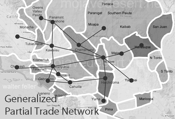
The Mojave Desert, an expansive arid region spanning southeastern California and parts of Nevada, Arizona, and Utah, is more than just a vast, desolate landscape. It is a land imbued with a rich cultural history, much of which is etched into the ancient Indian trails that crisscross its terrain. These trails are a deep connection to the land possessed by the indigenous peoples who once called this desert home.
Historical Significance
.
The Indian trails of the Mojave Desert were primarily created and used by Native American tribes such as the Mojave, Chemehuevi, and Southern Paiute. These tribes utilized the trails for various purposes, including trade, communication, and seasonal migration. The network of trails facilitated the exchange of goods like pottery, shells, foodstuffs, and obsidian, linking the Mojave Desert with coastal and inland regions. This trade network was integral to the economy and culture of the tribes, allowing for the spread of ideas, technologies, and cultural practices.
The trails were not merely utilitarian. They often held spiritual and cultural significance, following natural landmarks and water sources. Sacred sites, ceremonial grounds, and essential gathering places were often along these trails. This cultural layer adds depth to understanding these pathways, illustrating how they were interwoven with the people’s social and spiritual lives.
The Old Spanish Trail
One of the most notable trails is the Old Spanish Trail, which later became a significant route for Spanish explorers and settlers in the 18th and 19th centuries. Blazed initially by Native Americans, this trail stretched from Santa Fe, New Mexico, to Los Angeles, California. The Spanish utilized these established paths to connect their colonial holdings, facilitating trade and the movement of people and goods. The trail highlights the continuity of use by various cultures over centuries, transforming from an indigenous trade route to a significant conduit of colonial expansion.
The Old Spanish Trail was a challenging route, traversing some of the harshest landscapes in North America. Its use by both Native Americans and later Spanish settlers underscores the adaptability and resourcefulness required to navigate the Mojave Desert.
Adaptation to the Desert Environment
The Indian trails of the Mojave Desert showcase the adaptive strategies of Native Americans to the harsh desert environment. The tribes identified and utilized natural springs and seasonal water sources, ensuring safe passage across the expansive and often unforgiving terrain. These water sources were crucial, as they provided the necessary hydration points along the trails. Knowledge of these water sources was passed down through generations, often guarded closely as essential survival information.
The trails frequently ran along the base of mountain ranges and through passes, providing more accessible routes than the open desert. These paths took advantage of the natural topography to offer shade, easier walking conditions, and strategic viewpoints. The trails also connected various ecological zones, allowing the tribes to exploit various resources, from desert plants to mountain game.
Cultural Legacy
Today, the Indian trails of the Mojave Desert are an integral part of the region’s cultural heritage. Many of these trails are preserved and studied by archaeologists and historians, offering insights into the historical movements and lifestyles of the indigenous populations. Modern-day hikers, historians, and cultural enthusiasts retrace these paths, gaining a deeper understanding of the rich history and enduring legacy of the Native American tribes who first navigated the vast Mojave Desert.
Preservation efforts are crucial in maintaining these historic routes. Many trails are threatened by modern development, off-road vehicle use, and natural erosion. Organizations dedicated to preserving Native American heritage work tirelessly to document and protect these trails, ensuring they remain a living testament to the ingenuity and resilience of the desert’s original inhabitants.
Contemporary Relevance
In recent years, interest has been resurgent in these ancient trails. Educational programs, guided tours, and cultural heritage projects aim to bring the stories of these paths to a broader audience. Indigenous groups also play a vital role in these efforts, sharing their knowledge and perspectives to preserve and respect the trails as sacred cultural sites.
The trails also offer lessons in sustainable living and environmental stewardship. The indigenous peoples of the Mojave Desert thrived in a harsh environment through a deep understanding of the land and its resources. Their trails remind us of the importance of living in harmony with nature, an increasingly relevant lesson today.
Conclusion
The Indian trails of the Mojave Desert are more than just paths across the sand; they are the veins of a rich cultural heritage, connecting the past with the present. They tell stories of trade, migration, survival, and spiritual journeying etched into the desert’s landscape. As we explore and preserve these trails, we honor the legacy of the Native American tribes that first navigated the Mojave Desert, ensuring that their stories and knowledge continue to inspire and educate future generations.
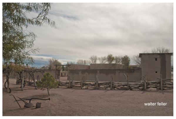
The Mormon Fort in Las Vegas, Nevada, is a historic site that holds significance in the region’s history. It is also known as the Old Mormon Fort State Historic Park. The fort represents the birthplace of Las Vegas and is considered the first permanent, non-native settlement in the Las Vegas Valley.
Here are some key points about the Mormon Fort:
Establishment: The fort was established by a group of Mormon missionaries led by William Bringhurst in 1855. They were sent to the area to establish a way station along the Old Spanish Trail.
Purpose: The Mormons built the fort to provide a place for travelers and settlers to rest and replenish supplies as they journeyed through the region. It served as a crucial stop for those traveling between Salt Lake City and Southern California.
Abandonment: Due to conflicts with local Native American tribes and other challenges, the Mormons abandoned the fort in 1857.
Later History: The fort had various uses over the years, including serving as a ranch and a military post. In the early 20th century, efforts were made to preserve and restore the site.
State Historic Park: Today, the Old Mormon Fort is a state historic park managed by the Nevada Division of State Parks. It offers visitors a glimpse into the area’s past, featuring reconstructed adobe buildings and interpretive exhibits.
Location: The Mormon Fort is located in downtown Las Vegas, near the intersection of Las Vegas Boulevard and Washington Avenue.
Visitors to the Mormon Fort can explore the historic structures, learn about the early pioneers who settled in the area, and gain insights into the challenges faced by the original inhabitants. The site provides a contrast to the modern development of Las Vegas and highlights its historical roots.