Tulare Lake – Vanished

Many folks interested in Mojave Desert history are aware that in 1776, Francisco Tomás Hermenegildo Garcés was the first non-native American to cross the Mojave from the Mojave Indian villages near Needles at the Colorado River to the Mission San Gabriel near Los Angeles, California.  Trapper and explorer Jedediah Smith also crossed the Mojave in 1826 and in 1827.

Tulare Lake – 1874

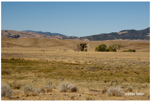
Not so well known is that when they left the mission at San Gabriel, both men made their way north to the San Joaquin Valley and the shore of Tulare Lake.   In tracking the paths of both men concerning our modern geography, it is soon discovered that this lake does not seem to exist.

What happened to Tulare Lake?

The answer to this mystery of a disappearing lake is simple yet inelegant and predictable:

At the onset of American settlement in the area in the late 1840s, the lake was the largest body of fresh water west of the Great Lakes. Its destruction by the late 1800s because of diking and water diversion for irrigation was one of the most dramatic signs of a major theme in the state’s history: the rapid transformation of the wild California landscape into one dominated almost completely by human action.

From Report of the Board of Commissioners on the Irrigation of the San Joaquin, Tulare, and Sacramento Valleys of the State of California.

Tulare Lake Satellite Overlay 2018

So, now you know.

Butterfield Overland Stage Mail Route

The Butterfield Overland Mail Route was a historic transportation route in the mid-19th century that played a crucial role in connecting the eastern and western parts of the United States.

Butterfield Overland Stage Route
(Oxbow Route)

Here are some key points about the Butterfield Overland Mail Route:

  1. Establishment: The Butterfield Overland Mail Company was awarded a government contract in 1857 to establish and operate a stagecoach and mail route between St. Louis, Missouri, and San Francisco, California. The purpose of the route was to improve communication and transportation between the two coasts, especially in light of the California Gold Rush.
  2. Route: The route covered approximately 2,800 miles and passed through eight present-day states: Missouri, Arkansas, Oklahoma, Texas, New Mexico, Arizona, California, and Oregon. It traversed various terrains, including deserts, mountains, and plains.
  3. Frequency and Duration: The Butterfield Overland Mail Company operated its stagecoaches twice a week in each direction, and the journey took about 25 days to complete. This significantly improved travel time compared to other methods available at the time.
  4. Stations and Stops: The company established a series of stations along the route to facilitate the long and arduous journey, spaced about 20-30 miles apart. These stations provided fresh horses, food, and accommodations for passengers and drivers. Some of these stations eventually became important settlements in their own right.
  5. Challenges: The route faced numerous challenges, including harsh weather conditions, difficult terrain, and the threat of attacks from Native American tribes. The company had to implement security measures to protect passengers and mail.
  6. End of Operations: The Butterfield Overland Mail Route faced financial difficulties exacerbated by the onset of the Civil War. 1861, the service was suspended, and the stagecoaches and stations were abandoned. The route became less relevant as the transcontinental railroad was completed after the Civil War, offering faster and more reliable transportation.
  7. Legacy: While the Butterfield Overland Mail Route was relatively short-lived, its legacy persists. The route contributed to the United States’s westward expansion and shaped the development of communities along its path. Some old stations have been preserved as historic sites, and portions of the route have been designated the “Butterfield Overland Mail Route.”

The Butterfield Overland Mail Route remains an important chapter in the history of westward expansion and transportation in the United States during the mid-19th century.

https://mojavedesert.net/stagecoaches/

https://mojavedesert.net/mojave-desert-indians/

https://digital-desert.com/historic-roads/

  1. Butterfield Overland Mail (or Oxbow Route):
    • The Butterfield Overland Mail was a stagecoach and mail delivery service that operated from 1857 to 1861. It was a vital communication and transportation link between the eastern and western United States.
    • The route covered approximately 2,800 miles, connecting St. Louis, Missouri, and San Francisco, California. It passed through several states, including Missouri, Arkansas, Texas, New Mexico, Arizona, and California.
    • The term “Oxbow” might not be directly associated with the Butterfield Overland Mail but could be a local or regional name for a section of the route or a specific location along the way.
  2. Overland Stage Route:
    • The Overland Stage Route, on the other hand, generally refers to the network of stagecoach routes that existed in the western United States during the 19th century. These routes were crucial for mail delivery, transportation of passengers, and freight.
    • The most famous of these stagecoach lines was the Butterfield Overland Mail, but there were other stage lines as well, such as the Central Overland California and Pikes Peak Express Company (C.O.C. & P.P.), which operated a route known as the “Pony Express.”

19th Century Military

https://mojavedesert.net/military/

Camp Cady – 1863, Rudolph D’Heureuse

The 19th century was a period of significant expansion and change in the United States, and the military played a crucial role in securing and maintaining control over newly acquired territories. The Mojave Desert was part of this expansion in the southwestern United States. Here are some key points about the military in the Mojave Desert during the 19th century:

  1. Mexican-American War (1846-1848): The Treaty of Guadalupe Hidalgo 1848 ended the Mexican-American War and ceded a large portion of territory, including the Mojave Desert, to the United States. The U.S. Army played a central role in the conquest and occupation of these new territories.
  2. California Gold Rush (1848-1855): The discovery of gold in California in 1848 led to a massive influx of settlers and prospectors. This increased population in the region and the military was tasked with maintaining order, protecting settlers from Native American resistance, and resolving conflicts among different groups.
  3. Mormon Pioneer Expeditions: In the mid-19th century, Mormon pioneers, led by Brigham Young, established a series of settlements in what is now Utah and the surrounding areas, including parts of the Mojave Desert. The military presence was important for maintaining peace and resolving disputes between the settlers and other groups.
  4. Butterfield Overland Mail Route: In the late 1850s, the Butterfield Overland Mail Company established a stagecoach route through the Mojave Desert, connecting the eastern and western coasts. The U.S. Army protected the mail coaches and stations along the route.
  5. Civil War (1861-1865): During the Civil War, many military forces were withdrawn from the western frontier to participate in the conflict. This temporarily reduced the military presence in the Mojave Desert. Additionally, the Confederate Army briefly invaded Arizona and New Mexico territories, which included parts of the Mojave Desert.
  6. Indian Wars: The 19th century saw conflicts between the U.S. military and various Native American tribes in the Mojave Desert region. The military was involved in efforts to control and relocate Native American populations.
  7. Fort Mojave: Established in 1859, Fort Mojave played a significant role in the military’s presence in the Mojave Desert. It served as a base for operations against local Native American tribes and protected settlers and travelers.
  8. Railroad Construction: The late 19th century also saw the construction of railroads through the Mojave Desert. The military played a role in ensuring the security of railroad workers and the transportation of goods.

Overall, the military presence in the Mojave Desert during the 19th century was shaped by the expansion of the United States, the Gold Rush, conflicts with Native American tribes, and the development of transportation routes across the region.

Randsburg Railway

https://mojavedesert.net/railroads/randsburg-railway/

Randsburg Railway refers to a historic narrow-gauge railway that once operated in and around the town of Randsburg, California, in the United States. Randsburg is a small mining town located in the Mojave Desert, and the railway played a significant role in the transportation of minerals and people in the late 19th and early 20th centuries.

The Randsburg Railway was primarily built to serve the mining industry, carrying gold, silver, and other valuable minerals from the mines in the area to nearby processing facilities. The railway also provided a means of transportation for the town’s residents and visitors.

The railway was initially constructed in 1896, connecting Randsburg with the Southern Pacific Railroad at Kramer Junction. The tracks covered about 12 miles and used narrow-gauge equipment. The Southern Pacific Railroad acquired the Randsburg Railway in 1897, and it became part of their system. This connection with the Southern Pacific allowed for the efficient transportation of ore and other goods to wider markets.

Over the years, the mining industry in Randsburg declined, and as a result, the railway’s importance diminished. The line was eventually abandoned in the mid-1930s. Today, Randsburg is a small, historic town that attracts tourists interested in its mining heritage and the remnants of the railway, which can still be seen in the area.

The Randsburg Railway is a part of the rich history of mining and transportation in the American West. It serves as a reminder of the challenges and opportunities that existed in the region during the late 19th and early 20th centuries.

Mormon Fort, Las Vegas, Nevada

https://digital-desert.com/mormon-fort/

The Mormon Fort in Las Vegas, Nevada, is a historic site that holds significance in the region’s history. It is also known as the Old Mormon Fort State Historic Park. The fort represents the birthplace of Las Vegas and is considered the first permanent, non-native settlement in the Las Vegas Valley.

Here are some key points about the Mormon Fort:

  1. Establishment: The fort was established by a group of Mormon missionaries led by William Bringhurst in 1855. They were sent to the area to establish a way station along the Old Spanish Trail.
  2. Purpose: The Mormons built the fort to provide a place for travelers and settlers to rest and replenish supplies as they journeyed through the region. It served as a crucial stop for those traveling between Salt Lake City and Southern California.
  3. Abandonment: Due to conflicts with local Native American tribes and other challenges, the Mormons abandoned the fort in 1857.
  4. Later History: The fort had various uses over the years, including serving as a ranch and a military post. In the early 20th century, efforts were made to preserve and restore the site.
  5. State Historic Park: Today, the Old Mormon Fort is a state historic park managed by the Nevada Division of State Parks. It offers visitors a glimpse into the area’s past, featuring reconstructed adobe buildings and interpretive exhibits.
  6. Location: The Mormon Fort is located in downtown Las Vegas, near the intersection of Las Vegas Boulevard and Washington Avenue.

Visitors to the Mormon Fort can explore the historic structures, learn about the early pioneers who settled in the area, and gain insights into the challenges faced by the original inhabitants. The site provides a contrast to the modern development of Las Vegas and highlights its historical roots.

Roads West

Mojave Road and Beale’s Wagon Road are historic routes in the southwestern United States, particularly in the Mojave Desert region. Here’s some information about each:

  1. Mojave Road:
    • The Mojave Road is a historic trail that traverses California’s Mojave Desert. It was a significant route used by Native Americans, Spanish missionaries, and later by American pioneers and traders.
    • The trail is approximately 138 miles long and extends from the Colorado River near present-day Needles, California, to the Mojave River near present-day Barstow, California.
    • It was primarily used for transportation and trade between the Colorado River and the coastal settlements in California. The trail passes through varied desert landscapes, including sandy stretches, rocky terrain, and mountainous areas.
  2. Beale’s Wagon Road:
    • Beale’s Wagon Road, named after Edward F. Beale, a military officer and explorer, was a trail developed in the 19th century for the U.S. Army to improve communication and transportation across the arid lands of the American Southwest.
    • Edward F. Beale surveyed and established the road in the late 1850s. The road ran from Fort Defiance in Arizona to the Colorado River, passing through present-day Arizona and California.
    • Beale’s Wagon Road was designed to be more reliable and accessible than other trails, facilitating military movement and communication between California and the western territories.

Mojave Road and Beale’s Wagon Road were important in the United States’ westward expansion. Today, these routes attract history enthusiasts, adventurers, and off-road enthusiasts who explore them to experience the challenges faced by those who traveled these paths in the past. Keep in mind that conditions and accessibility of these trails may vary, so it’s important to check for current information and any regulations before embarking on a journey along these historic routes.

Scotty

“Death Valley” Scotty, whose full name was Walter E. Scott, was a colorful and legendary figure associated with Death Valley, a desert valley located in Eastern California. Scotty gained fame in the early 20th century for his claims of owning a gold mine in Death Valley and for his flamboyant personality.

Scotty’s story is closely tied to his relationship with wealthy Chicago businessman Albert Johnson. In the early 1900s, Scotty convinced Johnson to invest in his supposed gold mine, even though there was little evidence to support the existence of significant gold deposits. Despite the skepticism of others, Johnson continued to finance Scotty’s ventures, and the two became unlikely friends.

With his charismatic and theatrical personality, Scotty became a well-known character, and his antics and stories helped attract attention to Death Valley. He was known for his cowboy attire, tall tales, and his ability to charm people.

Scotty’s gold mine claims were largely exaggerated, and there is little evidence that he ever discovered a significant amount of gold. The financial arrangement between Scotty and Johnson remained a subject of speculation and mystery.

After Johnson died in 1948, it was revealed that much of the financing had come from Johnson himself, and Scotty had not been as successful in the mining business as he claimed. Despite the deceptive aspects of his story, Scotty remained a beloved figure in Death Valley folklore, and his former home, Scotty’s Castle, is a popular tourist attraction in Death Valley National Park.

The legacy of “Death Valley” Scotty is a mix of fact and fiction, blending the mystique of the Old West with a touch of showmanship and exaggeration.

“Seldom Seen Slim”

“Seldom Seen Slim” was a nickname for a man named Charles Ferge, who lived in the Panamint Valley of California. He was known for his reclusive lifestyle and infrequent appearances in town, leading to the nickname “Seldom Seen Slim.” He was a prospector and a colorful character in the region’s history. The nickname reflects his tendency to avoid social interactions and to be rarely seen by others.

He claimed he wasn’t lonely because he was half coyote and half burro!

AKA “Seldom Seen Slim”

“Me lonely? Hell no! I’m half coyote and half wild burro.”

Seldom Seen Slim said these words many times, and they are the epitaph on his grave at Ballarat Cemetery in Ballarat, California.

Seldom Seen Slim, named Charles Ferge by his parents, was born in Illinois in 1881, according to wellfare records. Slim always said, “I got no people, I was born in an orphanage.

Slim came to Ballarat sometime between 1913 and 1917, not long after the town was abandoned by the miners who had been seeking their fortunes in the silver mines of the Panamint Mountains. He became the last resident of Ballarat, now a ghost town. Slim had a reputation as a recluse with a cantankerous side. He didn’t believe in showers or baths because “bathing was a waste of water”. Although, he did make into town for his annual haircut and bath whether he felt he needed it or not!

Slim was a visitor to Trona when the time came to stock up on supplies of tobacco for his corn cob pipe and to replenish his bottle of hooch. His reputation was so widespread that Walter Knott had statues of “Seldom Seen Slim” made and placed in his Knotts Berry Farm and Ghost Town in Buena Park, CA.

Slim was found ailing in his rundown trailer in Ballarat’s ruins and was taken 70 miles to Trona, where he survived only five days. His funeral was in Boot Hill in 1968 and was broadcast on television around the country before cable, as he was the last of a breed of prospectors who spent their lives living on the Mojave Desert in and around Death Valley. He was the first to be buried in the Ballarat cemetery in half a decade. After Slim’s death in 1968, at the age of 80, the United State Department of the Interior approved the naming of a peak in the Panamint Mountains in honor of Charles Ferge. The peak is now named “Slim’s Peak”.

Ref = findagrave

https://www.findagrave.com/memorial/12763141/charles-ferge

Boomtown Historical Context and Characteristics

Rush to Claim Wealth: The news of these discoveries led to a rush of people trying to claim their share of the newfound wealth. Prospectors and miners flocked to the region in search of fortunes.

Randsburg c. 1897 – C.W. Tucker – photo

Discovery of Gold and Silver: These booms were triggered by the chance discovery of large deposits of gold and silver in the respective areas. The presence of valuable minerals was the catalyst for the rapid development of these towns.

Leadfield (2003)

Explosive Growth of Boomtowns: The growth of these towns was explosive and often chaotic. They quickly developed into rowdy boomtowns characterized by a fast-paced, often disorderly expansion.

Promoters and Flimflam Men: Alongside serious promoters who saw the economic potential of these towns, there were also flashy con artists and tricksters looking to take advantage of the mining boom for their gain.

Arrival of Various Groups: As these towns grew, they attracted a diverse group of people, including merchants, teamsters, camp followers, schoolteachers, wives, and children. The influx of residents and services accompanied the rapid development.

Development of Farms and Ranches: The growth of these mining towns also led to the development of nearby farms and ranches. These agricultural activities provided food and resources to sustain the booming population.

Hope for Quick Riches: Many who flocked to these mining towns were motivated by the hope of striking it rich quickly. The prospect of finding valuable minerals and becoming wealthy was a powerful draw.

Values of the Old West: The people who settled in these towns held traditional values associated with the Old West, including a strong emphasis on personal freedom, independence, hard work, and the ability to endure the harsh conditions and challenges of the natural environment.

Cook Bank – Rhyolite, Nevada

Like many others in the Old West, these mining booms followed a pattern of rapid growth, economic opportunity, and social change, often accompanied by a degree of lawlessness and volatility. Over time, these towns could thrive or decline depending on the success of mining operations and economic factors, and their histories reflect the larger story of the American frontier and the pursuit of wealth and opportunity.

Mojave Road

/mojave-road/

Soda Springs – 1863

The Mojave Road, also known as the Old Mojave Road or the Mojave Trail, is a historic trade route and wagon road that traverses the Mojave Desert in the southwestern United States. Native American tribes originally used it for trade, and it later became an important transportation route for European settlers and traders during the 19th century.

Here are some key points about the Mojave Road:

Location: The Mojave Road runs through the Mojave Desert, primarily in what is now California and Nevada. It stretches from the Colorado River in the east to the San Bernardino Mountains in the west, covering approximately 140 miles (225 kilometers).

History: The road has a long history, with Native American tribes using it for centuries for trade and travel. In the 19th century, it became an essential route for early explorers, settlers, and traders moving through the desert.

Water Sources: One of the challenges of traveling the Mojave Road was the scarcity of water sources. Travelers had to rely on natural springs and wells, many of which were marked along the route to aid navigation.

Military Use: During the 19th century, the U.S. Army used the Mojave Road as a military supply route and for communication between the southern California coast and the interior of the Southwest. The road played a role in the U.S. government’s efforts to control the region.

Historic Sites: Along the Mojave Road, there are several historic sites and landmarks, including the Mojave National Preserve, the Mojave River, the Kelso Depot, and the Fort Piute ruins.

Recreation: Today, the Mojave Road is a popular route for off-road enthusiasts, hikers, and history buffs. Travelers can explore the historic route and experience the natural beauty of the Mojave Desert.

Preservation: Efforts have been made to preserve and maintain the Mojave Road as a historic and recreational route. The Mojave Road Guide, written by historian Dennis G. Casebier, is a valuable resource for those interested in traveling the road.

Please note that road conditions and accessibility may vary, so if you plan to explore the Mojave Road, it’s essential to do thorough research and be well-prepared for the journey. Always check for current information and obtain any necessary permits if required.