Nevada History: XXVII SOME NEVADA TRAGEDIES From James G. Scrugham, Nevada: The Narrative of the Conquest of a Frontier Land (1935), vol. I
The Story of Mouse
One of the wildest frontier lands left in the United States is embraced in the southern tip of the State of Nevada, between the confluence of the Virgin and Colorado rivers and the site of the great Boulder dam project construction.
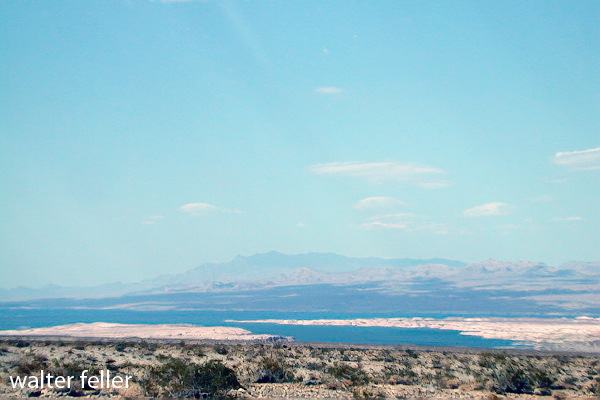
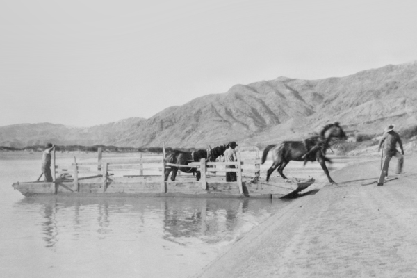
Bonelli Landing – Lake Mead
Some thirty-five years ago (123 years in 2023), this area was the scene of one of the most remarkable man hunts ever taking place within the state’s confines. This thrilling drama’s chief actors were eight: three Pahute Indians and five white men.
The leading character was an Indian named “Mouse” by his fellow tribesmen, of his habit of hiding out in the brush and his sly and silent movements. Although of a retiring and surly disposition, he was a good worker and possessed a crafty and intelligent mind.
The next character in importance and interest was one “Red Eye,” the most skilled Indian tracker of his tribe. He derived his name from bloodshot flecks which were always visible in the whites of his eyes, and was well-liked by the white men on account of his loyalty and industry as a ranch hand.
The third Indian character was a fierce old Indian woman who proved to be the Nemesis of the story, stirred to heroic action by the theft of a large and much-prized cabbage from her garden.
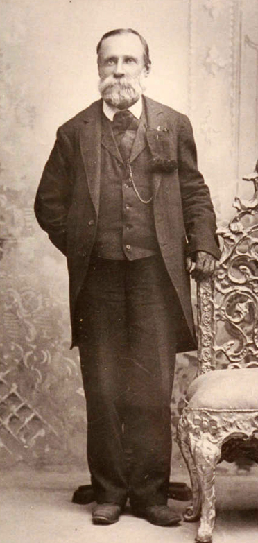
Daniel Bonelli – Huntington Library
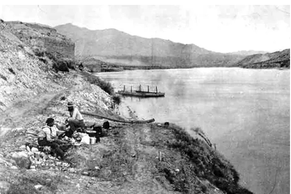
Of the white actors, the most important was Daniel Bonelli, a famous pioneer settler of the early days. He conducted a hay and vegetable ranch near the junction of the Virgin and Colorado Rivers. Also, he operated a ferry over the latter stream connecting with the main trail south through Arizona. He employed a large number of white men and Indians to assist in his livestock, farming, and ferrying enterprises, among whom was a strong, fearless cowpuncher named George Sherwood, who later appears prominently in the story.
Other white men who figured notably in the tragedy were two young prospectors, Davis and Stearns, who were searching for placer gold on the bars of the Colorado River. These men were accompanied by an elderly prospector k, Majorreenowalt, whose chief function was to serve as camp tender.
The story begins at Bonelli’s ranch on the Colorado River. The place was then on the main line of travel between Oregon, Idaho, Utah, and the rich mining camps of Pioche and Delamar on the north to points in Arizona, Mexico, and elsewhere in the south. A continual stream of travelers passed, many of whom were fugitives from justice-seeking oblivion in distant, isolated places.
Bonelli’s Ferry
Others were nomads seeking the warmth of southern climes in winter and the coolness of the highlands of the north in the summer. In addition to revenues derived from his voyage over the Colorado and sale of hay and supplies to passersby, Bonelli also made extensive trade in meat and produce with the flourishing mining camps at El Dorado Canyon, Chloride, Gold Basin, and a score of other places.
In the operation of his ranch, Bonelli employed several Indian hands, including Mouse and Red Eye.
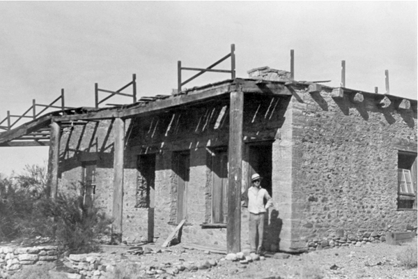
The Bonelli Home in Rioville (Bonelli Landing)
On a spring evening in 1896, when the story begins, the Indian Mouse somehow secured a quantity of whisky that he drank. Under the alcoholic stimulant, his naturally vicious disposition had no restraint, and Mouse started a promiscuous shooting at the other Indians in the camp. They fled to the main ranch and informed Bonelli that Mouse was on a killing rampage, and their lives had only been saved by the bad aim of the drunken aggressor.
Bonelli and some of his ranch hands then went to the Indian camp and disarmed the crazed Mouse, locking him in an adobe outhouse for the night. The next morning the Indian had become sober and appeared entirely docile. However, Bonelli, knowing the disposition of Mouse, gave him his discharge and ferried him over to the Arizona side; after returning to the man, his gun and ammunition were taken away the previous evening.
From Bonelli’s Ferry, the Indian went to a mining camp called White Hills and worked a few days cutting Joshua trees for fuel. Becoming tired of the labor, he stole a horse and set out for one of his old haunts at Indian Springs, some eighty miles away at the foot of the Charleston Mountains.
Mouse attempted to cross the Colorado River back to Nevada at a point opposite the old trail up the Las Vegas Wash, evidently intending to obtain food supplies at the Las Vegas ranch en route to his destination.
Just before he reached the Nevada shore, his horse became so deeply mired in the quicksands that he could not be extricated. Mouse was compelled to leave the struggling animal, and he made his way up the river toward a prospector’s camp, which he sighted on the Arizona shore. This camp was occupied at the time by the three men mentioned above, Davis, Stearns, and Major Greenowalt, who were prospecting for placer gold in the river bars. They had a small boat which they used for the purpose and accommodatingly crossed the river to meet the Indian when he signaled to them.
After being fed by the prospectors, who were obviously tenderfeet in the country, the crafty Mouse aroused their interest by relating the story of a fictitious ledge of gold-bearing quartz, which he claimed to have discovered in an almost inaccessible canyon, some ten miles back from the camp.
Early the following day, accompanied by Davis and Stearns, the Indian started for the scene of the alleged find, Greenowalt remaining at the river location. Davis and Stearns were never again seen alive.
The next morning the scene of the story shifts back to the Bonelli ranch, some twenty miles further up the river from the prospectors’ camp.
Among the horses on the place were two handsome gray geldings, half-brothers five and six years old, which Bonelli had bought from a band of well-bred horses being driven from northern Nevada to the Arizona market. These animals were the best in the place, but one was a much better saddle horse than the other, owing to a more tractable disposition.
During the time Mouse worked on the ranch, he was familiar with the horses and their characteristics. On the morning in question, when the ranch hands went into the fields to harness the stock, the best gray horse was found to be missing. This caused no particular excitement until it was found that his bridle was also gone.
Speedily circling the fields in search of tracks, the buckaroos discovered where the lost horse had been led out toward the Virgin River by a man wearing leather boots, who mounted at the bank before plunging into the stream. A hasty inspection of the shorelines revealed no place where the rider could have come out from the river. A general alarm was sounded, and all hands set out to find the trail of the thief. After a couple of hours’ delay, the outcoming tracks were finally located on the opposite side, more than a half mile above where the stolen animal had entered the water. The extraordinary effort made to throw pursuers off the track indicated that the horse stealer was a person of some skill and experience who had gained a probable ten or twelve-hour start on possible pursuers. However, Bonelli acted promptly. He armed two of his best riders with Winchester rifles and instructed them to stay with the trail until they recovered the horse or killed the thief.
The pursuing posse followed the tracks up the sandy shores of the Rio Virgin until they reached the Bitter Springs Wash, the drainage channel for a great range of territory to the west of the Virgin.
At the head of this wash are springs of bitter waters that will support life, although hardly palatable enough for human consumption. Here the crafty Mouse, for he was the thief, left the bottom of the wash where trailing was easy and took to the dolomitic limestone banks where vegetation and the soft ground were scanty, and no imprints were made. However, the very hardness of the ground defeated the purpose of the Indian thief. The rough limestone caused the horse’s hoofs to bleed, leaving a plain track for the pursuers to follow.
All through the long afternoon and in the moonlit evening, the Bonelli buckaroos followed the trail. About ten o’clock at night, while going over a steep declivity covered with loose lime shale, one of the horses missed his footing and started both riders and their steeds to slide into the precipitous gulch below. When the descent was stopped, both horsemen were so exhausted from the efforts of the day that they dismounted and unsaddled their animals, leaving their bridles on.
Both men wrapped themselves in their saddle blankets and took turns sleeping through the remainder of the night. On the following morning, they were up at the first peep of dawn, ready to resume the trail. However, it was found that the horse who had missed his footing was so badly bruised and cut that he could hardly walk, and the trailers decided to go back to the Bonelli ranch for reinforcements.
On arriving home early in the afternoon and reporting their adventures, the master of the ranch immediately detailed George Sherwood, his ranch foreman, and Red Eye, the skilled Indian tracker, to follow the thief to the end. From the information available, Sherwood and Red Eye decided that the horse thief was heading for the Las Vegas ranch, seventy-five miles away, as that was the nearest food and water available.
Pushing their horses to the utmost, the trailers arrived at their destination the second evening after leaving the Bonelli ranch. Then it was found that the Indian Mouse had arrived the night before on foot, wearing leather boots, with a story of having killed his crippled horse in the Muddy range at a point near where the first pair of pursuers had lost the bloody trail the day before.
It then became obvious that Mouse was the thief and that the lost horse was dead; otherwise, he would have been brought in for water. As further evidence of the guilt of the Indian, he had silently slipped away in the night soon after the ranchmen fed him, and his tracks indicated that he had made directly for the rugged fastnesses of the Charleston Mountains, some thirty miles away.
A successful pursuit was impossible, so after two days’ rest, Sherwood and Red Eye started on their return to the Bonelli place to inform their employer of the identity of the criminal. Arriving at the foot of the Las Vegas Wash, where Mouse had lost his first stolen horse in the quicksands of the Colorado River a few days before, Sherwood and his companion saw a flock of buzzards circling around and eating the remains of the animal, which projected from the quicksand.
As night was approaching, they rode up the river to a point opposite the prospectors’ camp.
Here Major Greenowalt rowed over and informed them that his partners had left five days before with an Indian named Mouse, who was to show them the location of a rich gold ledge. The Major was greatly disturbed by the protracted absence of his companions, as they had only carried food and water for a one-day trip.
On hearing the Major’s story, both Sherwood and Red Eye became apprehensive that the surly Mouse, with whom they were well acquainted, had added murder to his crime of horse theft.
The next morning they rode back to the home ranch and reported their information and suspicions to Mr. Bonelli.
The aroused ranch owner immediately organized a posse that went down the river to seek the missing men. Again the indomitable Red Eye took up the trail over rough and hard ground.
After two days of tedious tracking, Red Eye finally led the posse to the foot of a steep declivity where the mutilated bodies of Davis and Stearns were discovered. The boots had been removed from the feet of Stearns, accounting for the boot tracks made by Mouse when he had stolen the gray gelding at the Bonelli ranch.
Reconstructing the tragedy, Mouse appeared to have taken the lead until he enticed the two prospectors to the lonely place where the bodies were found. There he suddenly turned and vented his blood lust against the white race by shooting both Davis and Stearns.
The bodies of the unfortunate gold seekers were carried down to the river, then transported 100 miles in skiffs to Needles, California, from whence the remains were shipped back to relatives in the East.
With his dastardly acts fully revealed, Mouse became a hunted outcast, to be killed on sight. Even his tribal compatriots were in terror of him and sought his extermination as a crazed killer.
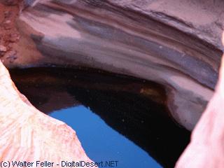
Mouse Tank – Valley of Fire
For two years, the murderer remained at large, living on seeds, nuts, and rodents and making an occasional raid on a prospectors camp for flour, bacon, and beans. There was found evidence of where Mouse had killed a wild mustang at a water hole and made jerky of the meat.
Finally, there came an end to this bold and much-feared outlaw. In the course of his wanderings, he came to a mountain overlooking a narrow valley where some of his fellow tribesmen had a little truck garden by a water hole. He descended in the night and stole some corn and cabbage to assuage his hunger.
This act led to his undoing. The cabbage belonged to an astute old squaw, who picked up the trail and followed it enough to identify it as belonging to Mouse from certain peculiarities of gait with which she was familiar.
Returning to the camp, the old squaw set up a hue and cry, which brought about the speedy organization of a well-armed posse to endeavor to capture the murderer. Red Eye, the tracker, led the hot pursuit. Day and night continued the chase through the flaming red sandstones of the Valley of Fire, then up the Meadow Valley Wash to Cave Springs and back again toward the Muddy River.
Bonelli had relays of men to provide food and water for the pursuers, as he was determined that the miscreant should not again escape.
The track was lost and found, then lost and found again. Mouse used every concealment art, but the tireless Red Eye never gave up the trail.
After nearly two weeks of hide and seek, the posse cornered Mouse early one morning at a lonely water hole on a gypsum flat near the Muddy River. Here the outlaw made his last stand.
Cursing and screaming, Mouse exchanged shot for shot with his pursuers. However, his pistols were no match for the high-powered rifles of the posse. The savage murderer finally fell, with his body literally riddled with bullets. Thus was avenged the deaths of Davis and Stearns, and the whole countryside felt relief from the sinister shadow of the Indian Mouse.
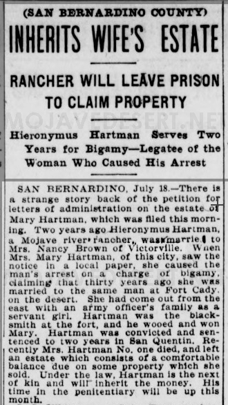
(SAN BERNARDINO COUNTY) INHERITS WIFE’S ESTATE RANCHER WILL LEAVE PRISON TO CLAIM PROPERTY
Hieronymus Hartman Serves Two Years for Bigamy-Legatee of the Woman Who Caused His Arrest
SAN BERNARDINO, July 18 1902.-There is a strange story back of the petition for letters of administration on the estate of Mary Hartman, which was filled this morning. Two years ago, Hieronymus Hartman, a Mojave river rancher, married Mrs. Nancy Brown of Victorville. When Mrs. Mary Hartman of this city saw the notice in a local paper, she caused the man’s arrest on a charge of bigamy. claiming that thirty years ago, she was married to the same man at Fort Cady. on the desert. She had come out from the east with an army officer’s family as a servant girl. Hartman was the blacksmith at the fort and wooed and won Mary. Hartman was convicted and sentenced to two years in San Quentin. Recently Mrs. Hartman #1 died and left an estate with a comfortable balance due on some property she sold. Under the law, Hartman is the next of kin and will inherit the money. His time in the penitentiary will be up this month.
(Read by Judge Rex B. Goodcell at the dedication of Camp Cajon July 4, 1919, and by William M. Bristol at the dedication of Live Oak Park by the Chamber of Commerce of northern San Diego County, July 17, 1920.)
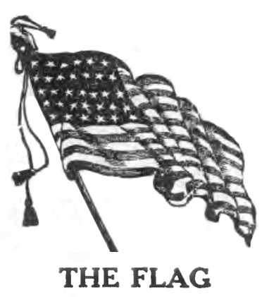
The Flag by Charles L. Frazer
Hats off, ye men! Now lift the flag on high: Break out its folds and let them proudly fly As from its staff on this our natal day There floats the banner none may take away.
Its streaming lines, its starry field of blue Are caught by winds that long have known them true: And rising, falling, with exquisite grace, They kiss each other in a fond embrace.
Flag of our own, we give thee to the breeze: Thrice hail on land, thrice hail on bounding seas: On armored deck, o’er valley, peak and crag. Wave on, and on, our own beloved flag!
Thrice-hallowed flag, one moment thou shalt be Half-masted for those Sons of Liberty Who, over seas or on the swelling flood Have re-baptized thee with a nation’s blood.
Our hero dead! No matter how they fell. In camp, at sea> on crimson fields of hell; They gave their all our pledged faith to keep, Tis ours to pay them homage as they sleep.
Courtesy Austin Daily Herald
Peace to their ashes; let us write each name In fadeless glory on the roll of fame: And unborn freemen shall their valor tell Soldier, and sailor, fare, O fare thee well! * * * *
Flag of the free, beloved on land and main. May treason never thy escutcheon stain; Defeat—the battle lost—were better far Than that dishonor dim one single star.
Aye, better that thy stars forever set; And God, and men» and angles thee forget. Than that thy name should ever used be To bind one shackle on humanity.
But thou, O flag, shalt not thine honor yield! Not by one thread, or star upon thy shield I Through calm and storm undaunted shalt thou ride. And all thy deathless principles abide.
Courtesy Santa Fe New Mexican
O, Thou Who boldest in Thy guilding hand ‘ The veiled future of this mighty land. Keep Thou our flag, and may it ever be Triumphant in the cause of liberty!
Then fly, proud flag, from thine exalted place; Shine on. ye stars, by God’s eternal grace! With faith undimmed we dedicate anew Ourselves to thee—the Red, the White, the Blue.
The following text has been adapted from a history of San Bernardino County by John Brown Jr. first published in 1922 describing the celebration of the opening of Camp Cajon.
The content has not been changed other than scan errors corrected and minor grammar changes to improve readability by modern standards.
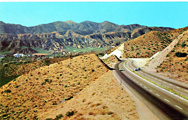
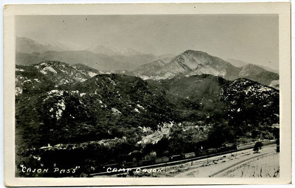
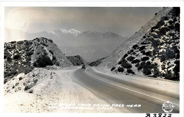
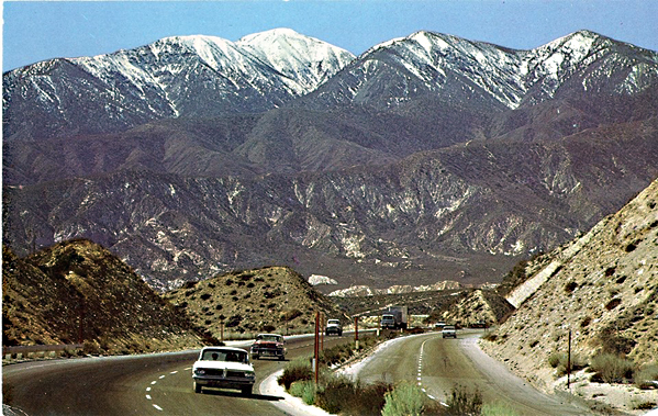
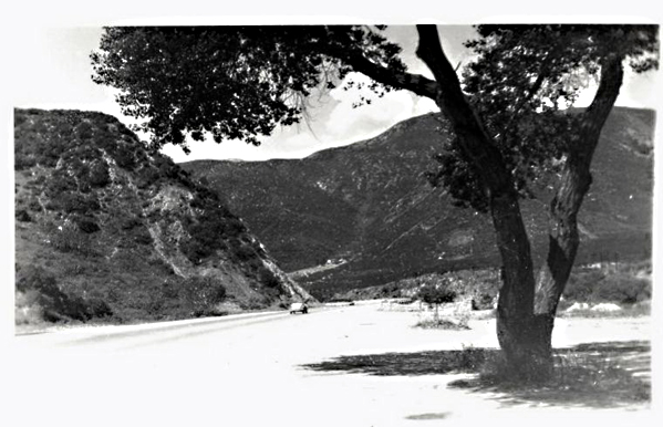
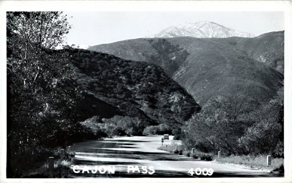
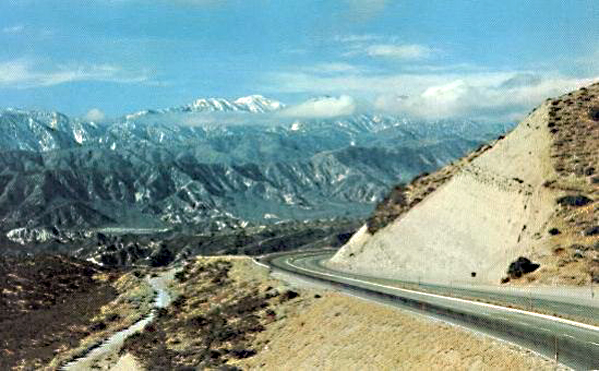
On the north and east of San Bernardino Valley are the San Bernardino Mountains and beyond them the vast Mojave Desert. Through this high mountain range is a natural gap—a parting of the heights—a winding, tortuous passage, dividing the mountains and uniting the white sands on the north with the green lands of the south.
Looking south from the desert rim toward San Bernardino
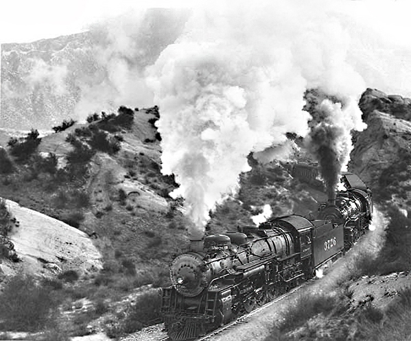
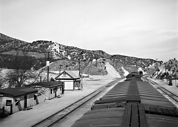
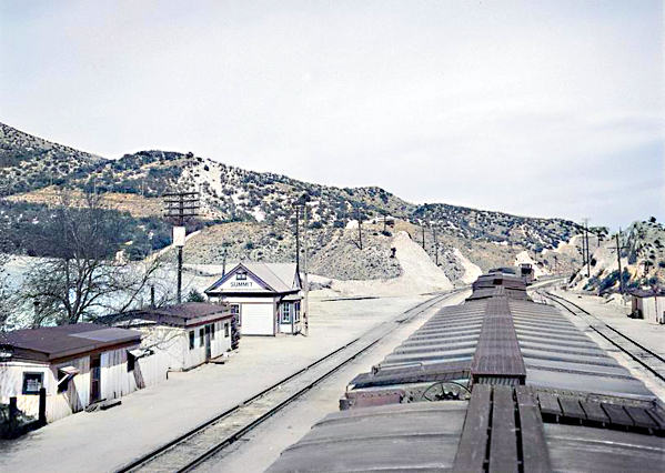
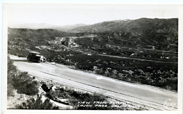
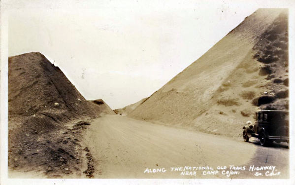
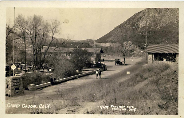
This is Cajon Pass. Cajon—pronounced cah-hone with the second syllable strongly accented—is the Spanish word for “box.” Because a portion of the defile is walled by high cliffs, the early Spaniards christened a portion of it “Paso del Cajon”—Box Pass. Through this pass comes the National Old Trails Highway, now paved from San Bernardino to Summit, a distance of 26 miles. It parallels the long abandoned and almost obliterated Santa Fe Trail over which, in 1849, and in the early ’50s, the Pioneers came to lay the foundations for a Southland empire.
Bennett’s Long Camp – Death Valley National Park
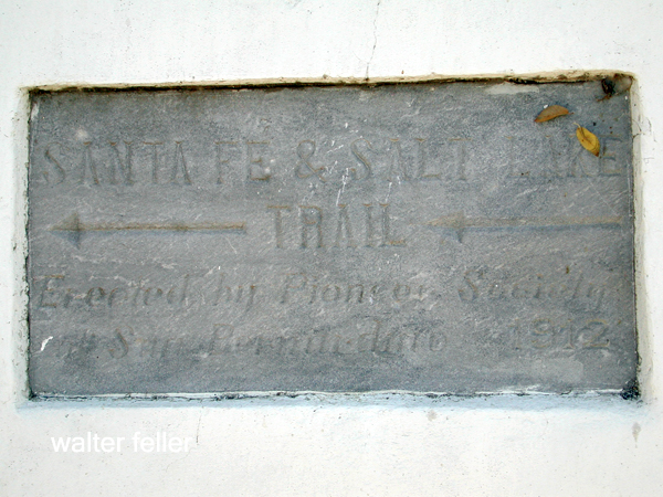
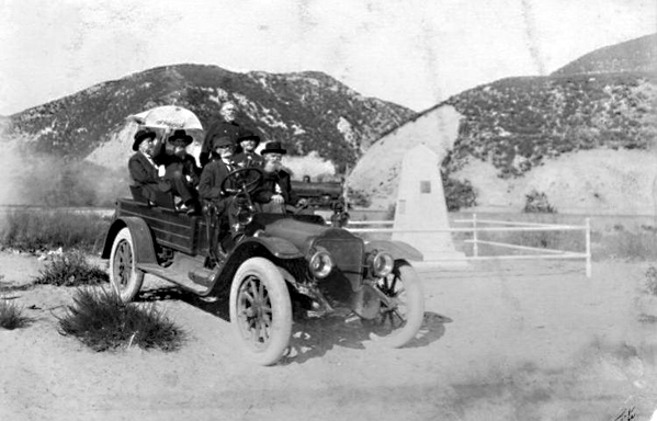
At the point in the Pass where the old trail from Salt Lake joined the one from Santa Fe there stands a tall monument, erected in honor of those hardy adventurers. It was built in 1917 by the survivors of the Forty-Niners and their descendants and was dedicated on December 23 of the same year.
Santa Fe & Salt Lake Trail plaque
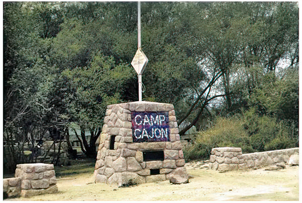
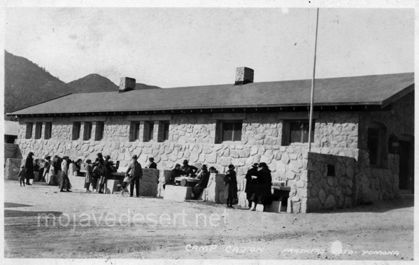
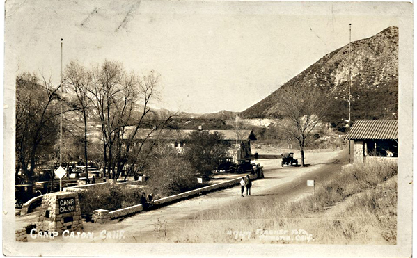
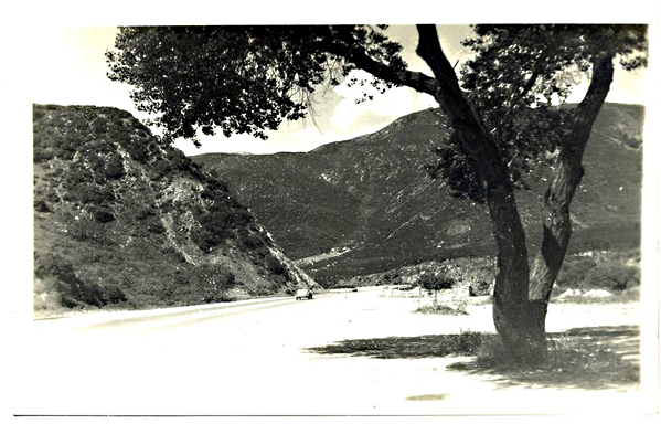
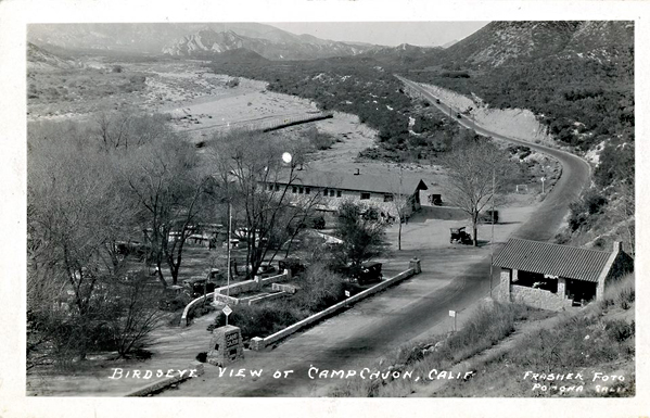
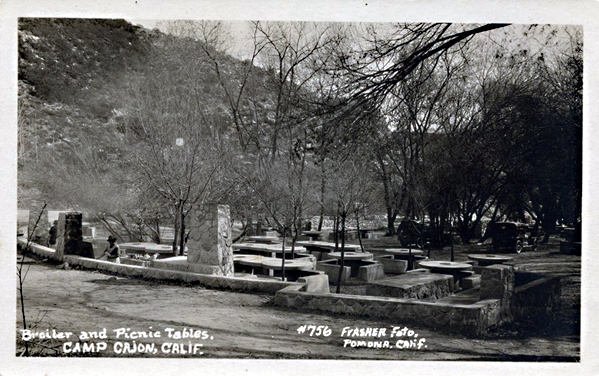
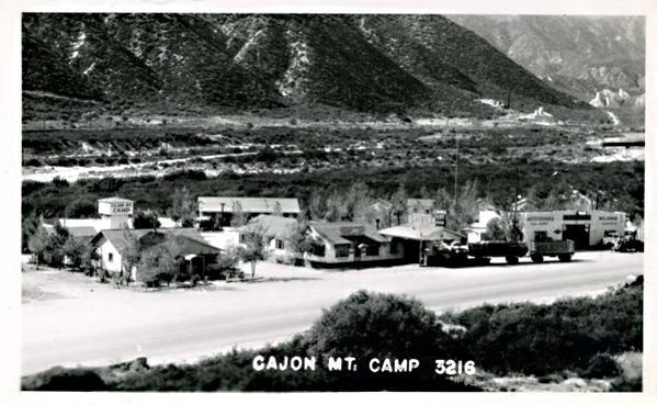
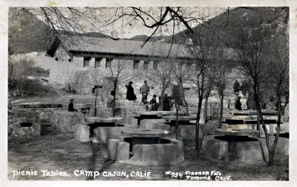
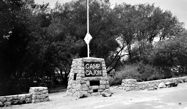
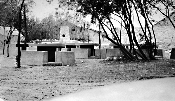
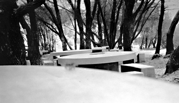
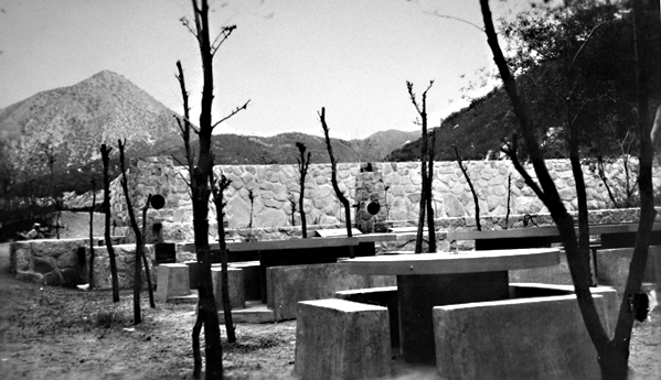
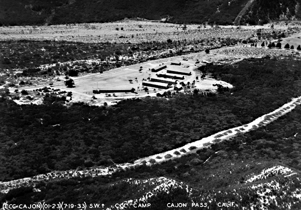
A short distance northward from the monument, and just 20 miles from San Bernardino is Camp Cajon, a welcome station for the incoming motor traveler, which an eastern writer has termed “California’s Granite Gate.” It, too, is a monument dedicated to the present and the future as the pioneers’ monument is to the past. Camp Cajon is the conception of William M. Bristol, orange grower, poet, and dreamer of Highland, 25 miles southeastward. Mr. Bristol first dreamed of his dream of Camp Cajon at the dedication of the Pioneers’ Monument.
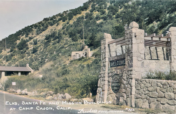
Welcome to Camp Cajon
Thirty years before, Mrs. J. C. Davis, a Wisconsin woman, had spent a winter in California and returned home, wrote, and published a poem entitled “The Overland Trail,” a graphic pen picture of the old trail as seen from the windows of a modern Pullman car. Mr. Bristol was present at the dedication of the monument for the purpose of reading this poem as a part of the formal program. It is an interesting fact that Mrs. Davis had returned to California and was residing at Devore, at the southern portal of the Pass, Without knowing that she was to contribute in any way to the ceremonies of the day, she was taken into the Bristol family car and was present to hear her poem unexpectedly read nearly a third of a century after it was written.
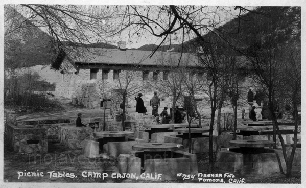
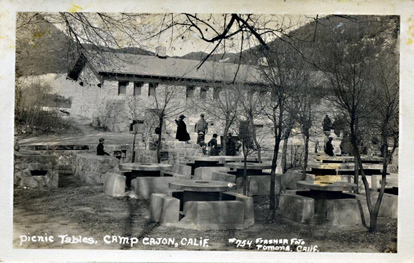
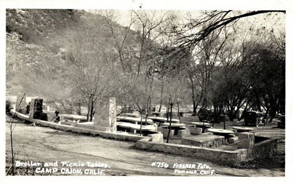
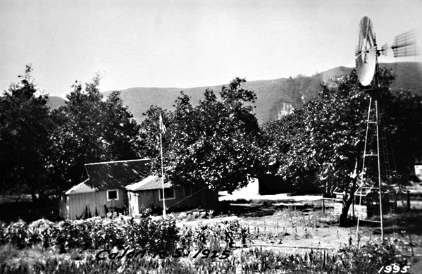
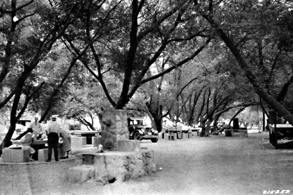
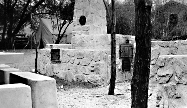
At the close of the ceremonies, the throng adjourned to the willow grove, where Camp Cajon now stands, and, sitting on the sandy ground, at a picnic dinner, It was then and there that the need for permanent conveniences for such an occasion occurred to Mr. Bristol, and on that day he began the formulation of the plans for making his dream come true. In May 1919, he pitched his tent in the willow grove, then a jungle, intending to take a two months’ vacation from his orange grove, and build a dozen concrete dining tables, each with benches of the same massive and indestructible type. That was the extent of his original dream. But so enthusiastically was his innovation received by the world at large, and especially by Southern California, that his vacation was stretched to two years; and when he finally resigned as director and returned to his home, there were fifty-five tables instead of the dozen, besides numerous other structures not contemplated in the original plans. He was not only an architect but an artisan, much of the actual work of construction being done by himself, personally, the ornamental mosaics of dark and white stone and the hundred or more metal tablets on the tables and buildings being his own handiwork. A wealth of beautiful blue granite boulders near at hand inspired and aided in the building of various structures which promise to stand for all time.
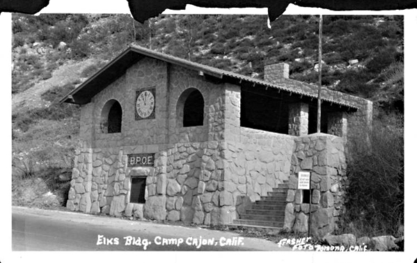
Perhaps the most elaborate structure at the camp is the Elks’ outpost clubhouse, erected by all the Elks’ lodges of Southern California at a cost of several thousand dollars and dedicated to loyal Elks of the world. It affords conveniences for serving a meal to half a hundred people, and, standing and facing upon California’s most popular transcontinental highway, it also proclaims that the order stands ready to meet and greet all comers to the Southland. Across its face, in a beautiful mosaic of dark and white stone are the initials, “B. P. O. E.,” and above this in the same artistic stonework, is the Elks’ clock, with its hands pointing to the mystic hour of eleven. Below is a metal tablet carrying the entire text of -Arthur Chapman’s poem, “Out Where the West Begins.” Elsewhere is a double tablet carrying John S. McGroarty’s favorite poem, “Just California.” And on the camp, flag column is four stanzas of Charles L. Frazer’s poem. “The Flag.” Each table and stove, each broiler and barbecue pit carry a tablet with an inscription and the name of the donor.
Perhaps the spirit of Camp Cajon is best and most briefly expressed in two tablets that read. “To the desert-weary traveler,” and “To the stranger within our gates.”
The following is the list of tables, stoves, and so on, with donors and the main part of inscriptions:
Twenty miles to San Bernardino, the Gate City, and home of the National Orange Show.
Thirty miles to Redlands and famous Smily Heights.
Twenty-three miles to Colton, the Hub City, where industry reigns.
Twenty-five miles to East Highlands, the Buckle of the Citrus Belt.
Twenty-three miles to Highland, gateway to City Creek, and Rim of the World.
Thirty-five miles to Mirage Valley, where things grow without irrigation.
Twelve miles to Sheepcreek, a watered and fertile valley.
Ten miles to Baldy Mesa, where things grow without irrigation.
Forty-five miles to Chino, where everything grows.
Twenty-three miles north to Adelanto, the transformed desert.
Twenty miles to Apple Valley, where apples keep the doctor away.
Twenty-three miles to Lucerne Valley, a land of abundant shallow water.
Sixty-one miles to Barstow, the metropolis of Mojave Valley.
Seventy miles to Santa Ana, the county seat of Orange County.
At the south portal of Caion Pass, Devore, the home of the muscat grape.
Twenty miles to Del Rosa, beneath the Arrowhead.
Twenty miles to Arrowhead Hot Springs, the hottest springs known.
Twenty miles to Rialto’s orange grove.
Twenty-three miles to Fontana, the largest orange grove in the world.
Twenty-five miles to Bloomington, orange, and lemon empire.
Thirty-five miles to beautiful Etiwanda, home of the grape and the lemon.
Thirty-five miles to Cucamonga with its peaches, grapes, and “welcomes.”
Forty miles to Ontario, the model city. offers opportunity.
Thirty-five miles oceanward to Upland, and Euclid Avenue.
To all nature lovers, by the employees of the State Hospital at Patten.
Dedicated to checker players by the family of John Andreson, Sr., a pioneer of 1850. To the “Stranger within our gates,” by the family of David H. Wixom.
The “West to the East ever calls,” Hiram Clark and family.
Dedicated to the people of Needles by George E. Butler.
Dedicated to the people of Cloverdale, Michigan, by Mrs. Chas. H. Schaffer of Marquette, Mich.
To commemorate the visit of the Brooklyn Daily Eagle, dedication tour, April 28, 1920.
In honor of Fred T. Perris, who, in 1884, led the iron horse through Cajon Pass.
To the Pioneers of San Bernardino Valley, by Native Sons who have gone afield. (Judge B. F. Bledsoe, Paul Shoup, and others).
To our Pioneers, by Arrowhead Parlor, Native Sons.
To the Trailmakers, by officers and men of Santa Fe.
To Highway Builders, by officers and men of Santa Fe. Redlands Rotary Club, with Rotary emblem.
Riverside Rotary Club, with Rotary emblem.
San Bernardino Rotary Club, with double table, and international Rotary emblem.
“The groves were God’s first temples,” by W. M. Parker.
“Now good digestion wait on appetite, and health on both,” by A. C. Denman. Jr.
“To the desert-weary traveler,” by W. J. Hanford.
A bake-oven, dedicated to the baking public, by W. j. Hanford.
A family broiler, dedicated to the broiling public, by C. G. Lundholm.
A pump, dedicated to the “drinking public,” by W. D. Anderson. A community broiler, “Max Aron bids you broil your steak.”
A big range. Orange County.
One barbecue pit. dedicated to the “barbecuing public.” by W. J. Curtis, J. W. Curtis, Henry Goodcell, Rex B. Goodcell, Herman Harris, John Andreson, Jr. Joseph E. Rich, W. E. Leonard, E. E. Katz and Mrs. F. I. Towne.
Flag column, erected by the Native Sons of Illinois, as a tribute to the State of their adoption.
“I love you, California.” Column, its mosaics, and tablets, the handiwork of F. M. Bristol, contributed by him.
Flag pole, gift of J. B. Gill, formerly Lieutenant-governor of Illinois.
Large tablet carrying four stanzas, Chas. L. Frazer’s poem, “The Flag.”
Elevation 3,002 feet.
HISTORY OF SAN BERNARDINO AND RIVERSIDE COUNTIES by JOHN BROWN, Jr. Editor for San Bernardino County THE WESTERN HISTORICAL ASSOCIATION — 1922
Max Stroebel, who was to become known as the Father of Orange County, acting as agent for a syndicate bought 50,000 acres of land encompassing much of what makes Hesperia today. Purchasing the land was in anticipation of a railroad which was not to be for nearly 15 years, far too long for the investors. The land was sold at a loss and became the property of a German Temperance Colony.
Seventy-five years in California; a history of events and life in California
CHAPTER XV Indian Insurrections and Treachery
OCCASIONALLY the Indians who had been at the Missions, and had become well informed in regard to the surrounding neighborhood and the different ranches in the vicinity, would desert the Missions, retreat to their old haunts and join the uncivilized Indians. At times they would come back with some of the wild Indians to the farms, for the purpose of raiding upon them, and capturing the domesticated horses. They would come quietly in the night, and carry off one or two caponeras of horses, sometimes as many as five or six, and drive them back to the Indian country for their own use.
In the morning a ranchero would discover that he was without horses for the use of the ranch. He would then borrow some horses from his neighbor, and ten or twelve men would collect together and go in pursuit of the raiders. They were nearly always successful in overtaking the thieves and recovering their horses, though oftentimes not without a fierce fight with the Indians, who were armed with bows and arrows, and the Californians with horse carbines. At these combats the Indians frequently lost some of their number, and often as many as eight or ten were killed. The Californians were sometimes wounded and occasionally killed. Once in a while, but very seldom, the Indians were successful in eluding pursuit, and got safely away with the horses, beyond recovery.
In the early part of ’39, nearly all the saddle horses belonging to Captain Ygnacio Martinez, at the rancho Pinole, were thus carried off by the Indians, and his son Don José Martinez, (whose niece I afterward married), with eight or ten of his neighbors, went in pursuit of them, and though they succeeded in recovering the animals, they lost one of their number, Felipe Briones, who was killed by an arrow. The fight on that occasion was exceedingly severe, and the Indians became so incensed, and their numbers increased so much, that the little party deemed it too hazardous to continue the fight, and retreated, taking with them the recovered horses, but were compelled to leave the body of Briones on the field. Two days afterward the party went back and recovered it, but found it terribly mutilated. Some eight or ten of the Indians were killed by the Californians in that fight.
Juan Prado Mesa was the comandante of the San Francisco Presidio, and frequently left his post to go in campaigns against the Indians with part of his command. He was always considered a successful Indian fighter. He was a brave and good man. On one occasion he was wounded with an arrow, which ultimately carried him to his grave. He was blessed with a large family. I became very well acquainted with him, and he frequently furnished me with fine saddle horses and a vaquero to make my business circuit around the bay. He was under the immediate command of General Vallejo, with whom he was intimate, and sometimes he confided to me secret movements of the government. The Californians were early risers. The ranchero would frequently receive a cup of coffee or chocolate in bed, from the hands of a servant, and on getting up immediately order one of the vaqueros to bring him a certain horse which he indicated, every horse in a caponera having a name, which was generally bestowed on account of some peculiarity of the animal. He then mounted and rode off about the rancho, attended by a vaquero, coming back to breakfast between eight and nine o’clock.
This breakfast was a solid meal, consisting of carne asada (meat broiled on a spit), beefsteak with rich gravy or with onions, eggs, beans, tortillas, sometimes bread and coffee, the latter often made of peas. After breakfast, the ranchero would call for his horse again, usually selecting a different one, not because the first was fatigued, but as a matter of fancy or pride, and ride off again around the farm or to visit the neighbors. He was gone till twelve or one o’clock, when he returned for dinner, which was similar to breakfast, after which he again departed, returning about dusk in the evening for supper, this being mainly a repetition of the two former meals. Although there was so little variety in their food from one day to another, everything was cooked so well and so neatly and made so inviting, the matron of the house giving her personal attention to everything, that the meals were always relished.
When the rancheros thus rode about, during the leisure season, which was between the marking time and the matanza or killing time, and from the end of the matanza to the spring time again, the more wealthy of them were generally dressed in a good deal of style, with short breeches extending to the knee, ornamented with gold or silver lace at the bottom, with botas (leggings) below, made of fine soft deerskin, well tanned and finished, richly colored, and stamped with beautiful devices (these articles having been imported from Mexico, where they were manufactured), and tied at the knee with a silk cord, two or three times wound around the leg, with heavy gold or silver tassels hanging below the knee. They wore long vests, with filagree buttons of gold or silver, while those of more ordinary means had them of brass. They wore no long coats, but a kind of jacket of good length, most generally of dark blue cloth, also adorned with filagree buttons. Over that was the long serape or poncho, made in Mexico and imported from there, costing from $20 to $100, according to the quality of the cloth and the richness of the ornamentation. The serape and the poncho were made in the same way as to size and cut of the garments, but the former was of a coarser texture than the latter, and of a variety of colors and patterns, while the poncho was of dark blue or black cloth, of finer quality, generally broadcloth. The serape was always plain, while the poncho was heavily trimmed with gold or silver fringe around the edges, and a little below the collars around the shoulders.
They wore hats imported from Mexico and Peru, generally stiff; the finer quality of softer material — vicuña, a kind of beaver skin obtained in those countries. Their saddles were silver-mounted, embroidered with silver or gold, the bridle heavily mounted with silver, and the reins made of the most select hair of the horse’s mane, and at a distance of every foot or so there was a link of silver connecting the different parts together. The tree of the saddle was similar to that now in use by the Spaniards and covered with the mochila, which was of leather. It extended beyond the saddle to the shoulder of the horse in front and back to the flank, and downwards on either side, halfway between the rider’s knee and foot. This was plainly made, sometimes stamped with ornamental figures on the side and sometimes without stamping. Over this was the coraza, a leather covering of finer texture, a little larger and extending beyond the mochila all around, so as to cover it completely. It was elaborately stamped with handsome ornamental devices.
Behind the saddle, and attached thereto, was the anqueta, of leather, of half-moon shape, covering the top of the hindquarters of the horse, but not reaching to the tail; which was also elaborately stamped with figures and lined with sheep skin, the wool side next to the horse. This was an ornament, and also a convenience in case the rider chose to take a person behind him on the horse.
Frequently some gallant young man would take a lady on the horse with him, putting her in the saddle in front and himself riding on the anqueta behind.
The stirrups were cut out of a solid block of wood, about two and a half inches in thickness. They were very large and heavy. The strap was passed through a little hole near the top. The tapadera was made of two circular pieces of very stout leather, about twelve to fifteen inches in diameter, the outer one a little smaller than the inner one, fastened together with strips of deer skin called gamuza, the saddle strap passing through two holes near the top to attach it to the stirrup; so that when the foot was placed in the stirrup the tapadera was in front, concealed it, and protected the foot of the rider from the brush and brambles in going through the woods.
This was the saddle for everyday use of the rancheros and vaqueros, that of the former being somewhat nicer and better finished. The reins for everyday use were made of deer or calfskin or other soft leather, cut in thin strips and nicely braided and twisted together, and at the end of the reins was attached an extra piece of the same with a ring, which was used as a whip. Their spurs were inlaid with gold and silver, and the straps of the spurs worked with silver and gold thread.
When thus mounted and fully equipped, these men presented a magnificent appearance, especially on the feast days of the Saints, which were celebrated at the Missions. Then they were arrayed in their finest and most costly habiliments, and their horses in their gayest and most expensive trappings. They were usually large, well-developed men, and presented an imposing aspect. The outfit of a ranchero and his horse, thus equipped, I have known to cost several thousand dollars. The gentleman who carried a lady in this way, before him on a horse, was considered as occupying a post of honor, and it was customary when a bride was to be married in a church, which was usual in those days, for a relative to take her before him in this fashion on his horse to the church where the ceremony was to be performed. This service, which involved the greatest responsibility and trust on the part of the gentleman, was discharged by him in the most gallant and polite manner possible.
On the occasion of my marriage, in 1847, the bride was taken in this way to the church by her uncle, Don José Martinez. On these occasions the horse was adorned in the most sumptuous manner, the anqueta and coraza being beautifully worked with ornamental devices in gold and silver thread. The bride rode on her own saddle, sometimes by herself, which was made like the gentleman’s but a little smaller, and without stirrups, in place of which a piece of silk—red, blue, or green—perhaps a yard wide and two or three yards long, joined at the two ends, was gracefully hung over the saddle, puffed like a bunch of flowers at the fastening, and hung down at one side of the horse in a loop, in which the lady lightly rested her foot.
The ladies were domestic and exceedingly industrious, although the wealthier class had plenty of Indian servants. They were skillful with their needles, making garments for their families, which were generally numerous. The women were proficient in sewing. They also did a good deal of nicer needlework of fancy kinds—embroidery, etc.—in which they excelled, all for family use. Their domestic occupations took up most of their time.
Both men and women preserved their hair in all its fullness and color, and it was rare to see a gray-headed person. A man fifty years of age, even, had not a single gray hair in his head or beard, and I don’t remember ever seeing, either among the vaqueros or the rancheros or among the women, a single bald-headed person. I frequently asked them what was the cause of this remarkably good preservation of their hair, and they would shrug their shoulders, and say they supposed it was on account of their quiet way of living and freedom from worry and anxiety.
The native Californians were about the happiest and most contented people I ever saw, as also were the early foreigners who settled among them and intermarried with them, adopted their habits and customs, and became, as it were, a part of themselves. Among the Californians, there was more or less caste, and the wealthier families were somewhat aristocratic and did not associate freely with the humbler classes; in towns, the wealthy families were decidedly proud and select, the wives and daughters especially. These people were naturally, whether rich or poor, of a proud nature, and though always exceedingly polite, courteous, and friendly, they were possessed of a native dignity, an inborn aristocracy, which was apparent in their bearing, walk, and general demeanor. They were descended from the best families of Spain and never seemed to forget their origin, even if their outward surroundings did not correspond to their inward feeling. Of course, among the wealthier classes, this pride was more manifest than among the poorer.
In my long intercourse with these people, extending over many years, I never knew of an instance of incivility of any kind. They were always ready to reply to a question, and answered in the politest manner, even the humblest of them; and in passing along the road, the poorest vaquero would salute you politely. If you wanted any little favor of him, like delivering a message to another rancho, or anything of that sort, he was ready to oblige and did it with an air of courtesy and grace and freedom of manner that were very pleasing. They showed everywhere and always this spirit of accommodation, both men and women. The latter, though reserved and dignified, always answered politely and sweetly, and generally bestowed upon you a smile, which, coming from a handsome face, was charming in the extreme. This kindness of manner was no affectation, but genuine goodness, and commanded one’s admiration and respect.
I was astonished at the endurance of the California women in holding out, night after night, in dancing, of which they never seemed to weary, but kept on with an appearance of freshness and elasticity that was as charming as surprising. Their actions, movements, and bearing were as full of life and animation after several nights of dancing as at the beginning, while the men, on the other hand, became wearied, showing that their powers of endurance were not equal to those of the ladies. I have frequently heard the latter ridiculing the gentlemen for not holding out unfatigued to the end of a festival of this kind.
The rancheros and their household generally retired early, about eight o’clock, unless a valecito casaro (little home party) was on hand when this lasted till twelve or one. They were fond of these gatherings, and almost every family had some musician of its own, music and dancing were indulged in, and a very pleasant time was enjoyed. I have attended many of them and always was agreeably entertained. These parties were usually impromptu, without formality, and were often held for the entertainment of a guest who might be stopping at the house. The balls or larger parties were of more importance and usually occurred in the towns. On the occasion of the marriage of a son or daughter of a ranchero they took place on the rancho, the marriage being celebrated amid great festivities, lasting several days.
Fandango was a term for a dance or entertainment among the lower classes, where neighbors and others were invited in, and engaged themselves without any great degree of formality. The entertainments of the wealthy and aristocratic class were more exclusive in character; invitations were more carefully given, more formality observed, and of course, more elegance and refinement prevailed. An entertainment of this character was known as a baile.
In November 1838, I was a guest at the wedding party given at the marriage of Don José Martinez to the daughter of Don Ygnacio Peralta, which lasted about a week, dancing being kept up all night with a company of at least one hundred men and women from the adjoining ranchos, about three hours after daylight being given to sleep, after which picnics in the woods were held during the forenoon, and the afternoon was devoted to bullfighting. This program was continued for a week when l myself had become so exhausted for want of regular sleep that I was glad to escape.
The bride and bridegroom were not given any seclusion until the third night.
On this occasion Doña Rafaela Martinez, wife of Dr. Tennent, and sister of the bridegroom, a young woman full of life and vivacity, very attractive and graceful in manner, seized upon me and led me on to the floor with the waltzers. I was ignorant of waltzing up to that moment. She began moving around the room with me in the waltz, and in some unaccountable manner, perhaps owing to her magnetism, I soon found myself going through the figure with ease. After that, I had no difficulty in keeping my place with the other waltzers and was reckoned as one of them. I waltzed with my fascinating partner for a good portion of the night.
During this festivity, Don José Martinez, who was a wonderful horseman, performed some feats which astonished me. For instance, while riding at the greatest speed, he leaned over his saddle to one side, as he swept along, and picked up from the ground a small coin, which had been put there to try his skill, and then went on without slackening his speed.
Some years after that I was visiting him, and while we were out taking a ride over his rancho, we came to an exceedingly steep hill, almost perpendicular; at the top was a bull quietly feeding. He looked up and said, “Do you see that bull?” “Yes,” said I. “Now,” said he, “we will have some fun. I am going up there to drive him down and lasso him on the way.” It seemed impossible owing to the steepness of the declivity. Nevertheless, he did it, rode up to the top, started the bull down at full speed, and actually lassoed the animal on the way, threw him down, and the bull at once commenced rolling down the steep side of the hill, over and over, until he reached the bottom, José following on his horse and slackening up the riata as he went along. He was a graceful rider.
After many years of happiness with his excellent wife, during which they were blessed with six or eight children, Don José Martinez became a widower. A few years after this he married an English lady, a sister of Dr. Samuel J. Tennent, who was then living at Pinole ranch, and who married a sister of Don José Martinez. Dr. Tennent lived on a portion of the ranch inherited by his wife. The marriage of Don José to a lady outside of his own countrywoman was rather an unusual occurrence among the Californians. The marriage proved a happy one, and half a dozen children resulted therefrom. This lady is now living in San Francisco (1889).
Don José Martinez had the largest kind of heart, and if anyone called at his house who was in need of a horse, he was never refused, and the people of the surrounding country were constantly in receipt of favors at his hands. If one wanted a bullock and had no means to pay for it, he would send out a vaquero to lasso one and bring it in and tie it to a cabestro (a steer broken for that purpose), so that the man could take it home, and told him he might pay for it when convenient, or if not convenient, it was no matter. So with a horse which he might furnish, it didn’t matter whether the animal was returned or not. This generosity was continual 70 and seemed to have no limit. At his death, which occurred in 1864, his funeral was attended by a vast concourse of people from all the surrounding country, who came in wagons, buggies, and carriages to the number of several hundred vehicles, such was the high appreciation in which he was held by the community.
I never saw such respect paid to the memory of any other person. If true generosity and genuine philanthropy entitle a man to a place in the kingdom of Heaven, I am sure that Don José Martinez is received there as one of the chief guests.
Seventy-five years in California; a history of events and life in California http://www.loc.gov/resource/calbk.025
Don Antonio Maria Lugo, of Los Angeles, was genial and witty, about eighty years of age, yet active and elastic, sitting on his horse as straight as an arrow, with his reata on the saddle, and as skillful in its use as any of his vaqueros. He was an eccentric old gentleman. He had a wife aged twenty or twenty-two—his third or fourth. In 1846 I visited him. After cordially welcoming me, he introduced me to his wife, and in the same breath, and as I shook hands with her, said, in a joking way, with a cunning smile, “ No se enamore de mi joven esposa.” (Don’t fall in love with my young wife.) He had numbers of children, grandchildren, and great-grandchildren. Los Angeles was largely populated from his family. Referring to this circumstance, he said to me, quietly, “ Don Guillermo, yo he cumplido mi deber a mi pais.” (Don Guillermo, I have fulfilled my duty to my country)
William Heath Davis – “Seventy-five Years in California”
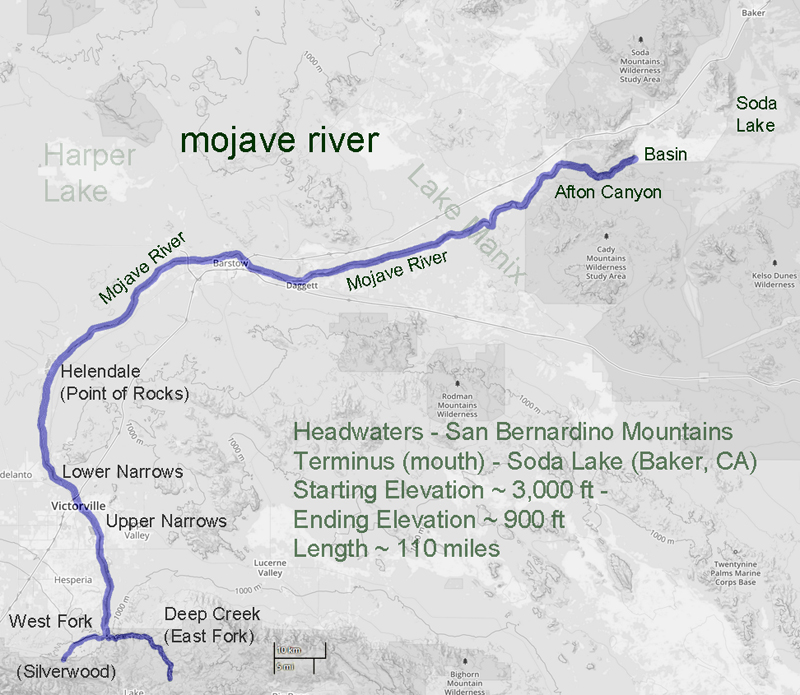
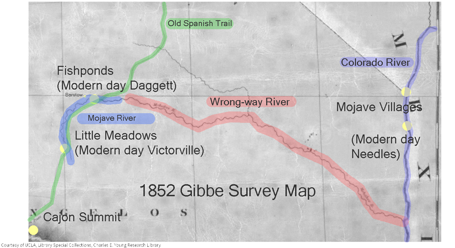
In 1852 a survey was made of the southwestern edge of the Mojave Desert. The Old Spanish Trail # had become a wagon road bringing thousands of pioneers to the west and developed as a supply route between Los Angeles and Salt Lake City. The survey was as accurate as any at that time and followed the trail from near the top of the Cajon Pass to a point where the trail leaves the Mojave River near Fishponds. The trail to Salt Lake continues north as we know it, but the river flowing east on this map bears southeast and empties into the Colorado River. At the time it was thought the Mojave (spelled Mohahve on the map) River followed this course. It did not. There was no Mojave Road in 1852 and not many Americans had traversed that portion of the desert. As we now know the Mojave River cuts through Afton Canyon and then disappears into the sink of the Mojave before it reaches Soda Lake.
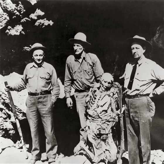
Standing second from the left is Frank Waite, chief of police in Las Vegas for many years. Waite was a member of the posse that initially searched for Queho.
Subject: – – Mummified remains of an Indian renegade known as Queho. Many years previous to when this photo was taken in the early 1940s, Queho is said to have killed and robbed a number of individuals in the Searchlight, Nevada area. Unsuccessful efforts were made to apprehend Queho.
In the early 1940s, the men pictured here on the left and right were exploring an area along the Colorado River when they saw a cave in the cliffs above the river. they climbed up to the cave and Queho’s remains were found. Research had established that the remains were Queho’s because several of the artifacts he had stolen from people in Searchlight accompanied the remains.
Queho’s remains were turned over to the Palm Mortuary in Las Vegas when a question arose as to who would pay for the expenses of keeping Queho there and his burial. Roland Wiley, district attorney for Clark County, Nevada, at the time, suggested that the remains be turned over to the Elks Lodge, where for a number of years they were exhibited on the Heldorado grounds during Heldorado days in a glass display case with some of the stolen artifacts.
Queho’s remains were stolen from the Elks on 2 occasions, and each time they were recovered. Jim Cashman, head of the Las Vegas Elks at the time, grew tired of worrying about the theft of Queho’s remains so they were moved to a building belonging to Dobie Doc Caudil near the Tropicana Hotel.
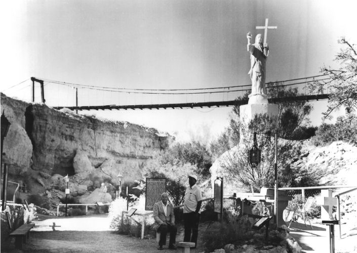
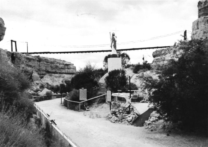
Subject: A view of the suspension bridge and the statue of Christ at Cathedral Canyon, Pahrump Valley, Nevada, in the late 1980s. The statue, carved of rock, is a small replica of the Christ of the Andes installed in the Andes Mountains on the border between Argentina and Chile in the early part of the 20th century. The replica was made by an artist from Ajijic, a small town south of Guadalajara, Mexico. Wiley constructed the suspension bridge about 1973. In 1989, approximately 1,000 people a month visited Cathedral Canyon. Roland Wiley is seated in the picture; the man standing in the white shirt is unidentified.
Roland Wiley purchased Queho’s remains from Dobie Doc for $100 and buried them near Cathedral Canyon, located on Wiley’s ranch in Pahrump Valley overlooking his Hidden Hills airstrip, in concrete and steel so they could not be easily stolen again. Wiley believed the Indian deserved a decent burial and buried popcorn with the remains to accompany Queho on his journey.
On February 21, 1940, the banner headline in the Las Vegas Review-Journal— BODY OF INDIAN FOUND— recalled for many in the town memories of the first murder the dead Indian had committed, thirty years earlier at Timber Mountain, just a few miles fromSearchlightin the McCullough Range. . . .
Keep on Steppin’ — The man who walked 481 miles to see a sick friend
. . . At our home he [Shorty Harris] lay on his back for weeks, fed with a spoon. Always talking of putting another town on the map. Always losing a million dollars a day. He was miraculously but slowly recovering when an Associated Press dispatch bearing a Lone Pine date made front page headlines with an announcement of his death.
Though the report was quickly corrected, his presence at our house brought reporters, photographers, old friends, and the merely curious. At the time the Pacific Coast Borax Company’s N.B.C. program was featuring stories based on his experiences over a nation-wide hook-up. Among the callers also were moguls of mining and tycoons of industry who had stopped at the Ballarat cabin to fall under the spell of his ever ready yarns.
Pete Harmon
Among these guests, one stands out.
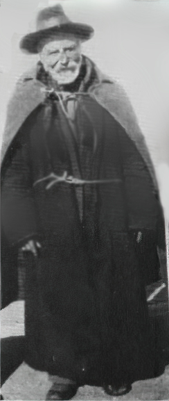
It was a hot summer day when I saw on the lawn what appeared to be a big bear, because the squat, bulky figure was enclosed in fur. Answering the door bell I looked into twinkling eyes and an ingratiating smile. “They told me in Ballarat that Shorty Harris was here.” I invited him in.
“I’ll just shed this coat,” he said, stripping off the bearskin garment. “… sorta heavy for a man going on 80.” He laid it aside. “It’s double lined. Fur inside and out. You see, I sleep in it. Crossed three mountain ranges in that coat before I got here. May as well take this other one off too.” He removed another heavy overcoat, revealing a cord around his waist. “Keep this one tied close. Less bulky….”
Under a shorter coat was a heavy woolen shirt and his overalls concealed two pairs of pants. He went on: “I was with Shorty at Leadville. My name’s Pete Harmon. We ought to be rich—both of us. Why, I sold a hole for $2500 in 1878. Thought I was smart. They’ve got over $100,000,000 outa that hole. I was at Bridgeport when I heard Shorty was sick, so I says, ‘I’ll just step down to Ballarat and see him.’ (The ‘step’ was 298 miles.) When I got there Bob Warnack tells me he’s in Los Angeles. When I get there they tell me he’s with you. So I just stepped out here.”
He had “stepped” 481 miles to see his friend.
Shorty Harris
I ushered him in and left them alone. After an hour I noticed Pete outside, smoking. I went out and urged him to return and smoke inside, but he refused. “It’s not manners,” he insisted.
Later I happened to look out the window and saw him empty the contents of a small canvas sack into his hand. There were a few dimes and nickels and two bills. He unfolded the currency. One was a twenty. The other, a one. He put the coins in the sack and came inside. A few moments later, from an adjacent room I heard his soft, lowered voice: “Shorty, I’m eatin’ reg’lar now and got a little besides. I reckon you’re kinda shy. You take this.”
“No—no, Pete. I’m getting along fine….”
I fancy there was a scurry among the angels to make that credit for Pete Harmon.
Late in the afternoon, Pete donned his coats. “I’d better be going. I’ve got a lotta things on hand. A claim in the Argus. When the money comes in, well—I always said I was going to build a scenic railroad right on the crest of Panamint Range. Best view of Death Valley. It’ll pay. How far is it to San Diego?”
“A hundred and forty miles….”
“Well, since I’m this far along I’ll just step down and see my old partner. Take care of Shorty….” And down the road, he went.
With humility I watched his passage, hoping that the good God would go with him and somehow I felt that of all those with fame and wealth or of high degree who had gone from that house, none had left so much in my heart as Pete.
Adapted from;
Chapter XVII
Shorty Frank Harris
Title: Loafing Along Death Valley Trails
       A Personal Narrative of People and Places

Author: William Caruthers
Los Angeles Herald Examiner Photo Collection Howell, E. Bruce – 1974
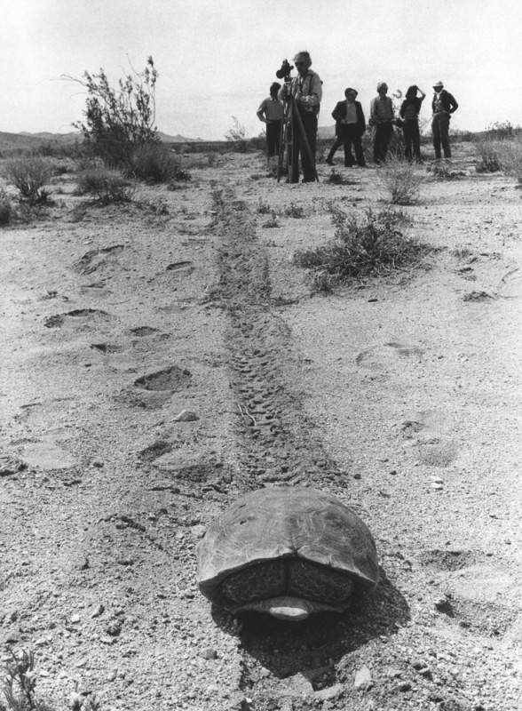
Photograph caption dated April 3, 1974 reads, “Shy desert tortoise curls up inside his shell on top of a groove left in desert sand by motorcycle on the Stoddard Valley off-road vehicle racing area of Barstow. Already legally protected as an endangered species, environmentalists and scientists say the threat is heightened along with other desert life by off-road vehicle activities.”
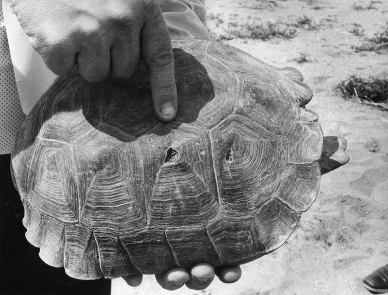
Photograph caption dated April 3, 1974 reads, “Environmentalist group that recently toured the Mojave Desert to show evidence of damage done by indiscriminate use of off-road vehicle say they believe holes on this live desert tortoise shell were caused by bullets.”
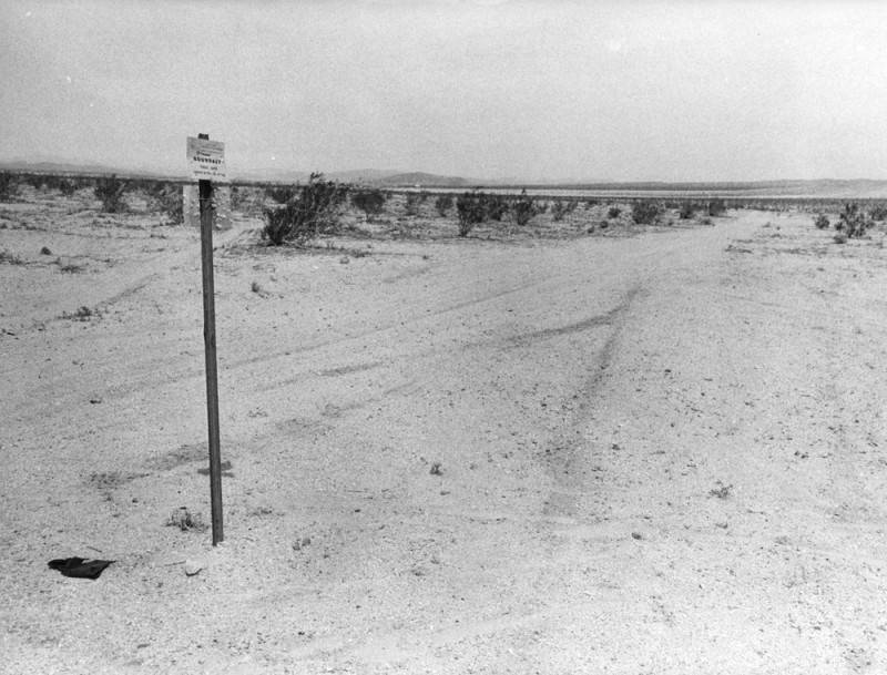
Photograph caption dated April 3, 1974 reads, “Tiny marker planted in Mojave Desert at Stoddard Valley, marks U.S. Bureau of Land Management boundary separating approved off-road vehicle race course from a restricted area. Heavy tire tracks on both sides of marker indicate that such markers are virtually ignored, except by desert visitors with guns, who have riddled them with bullets.”
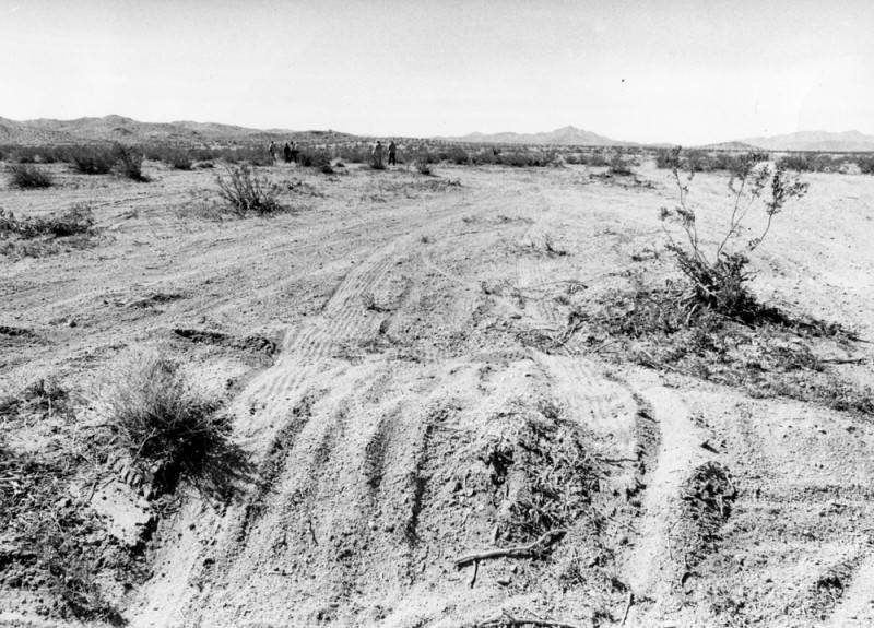
Photograph caption dated April 3, 1974 reads, “Stoddard Valley on Mojave Desert near Barstow, despite its vast openness is a continuous maze of off-road vehicle tire tracks. Federal plan for managing off-road vehicle use on desert has left it open for off-road vehicle races and closed other areas. But environmentalists and scientists say regulations for restricted areas are too vague and open to this kind of damage.”
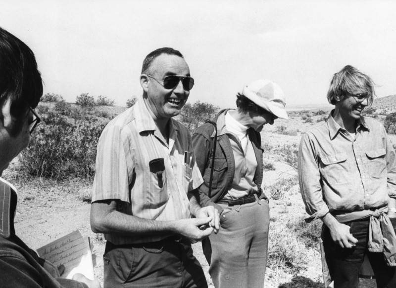
Photograph caption dated April 3, 1974 reads, “These people seek to defend the vast Mojave Desert from a federal program that regulates off-road vehicles. They claim regulations are vague, unenforceable, and could open the desert to extensive off-road vehicle damage. From left are UC Riverside professors Bill Mayhew, zoology; Sylvia Broadbent, anthropology; and Richard E. Gutting, Jr., attorney for Environmental Defense Fund.”
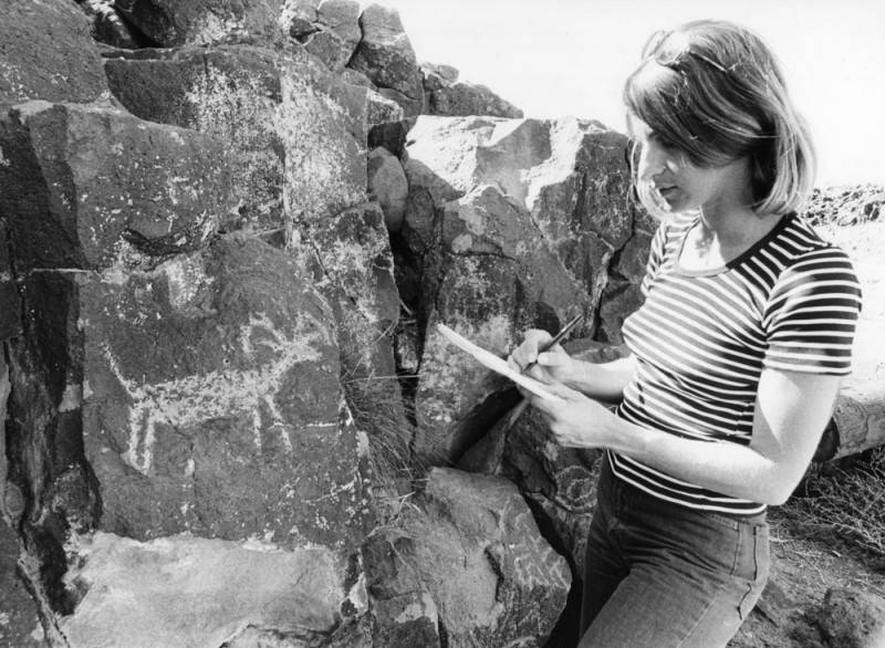
Photograph caption dated April 3, 1974 reads, “Judith Winder, staffer for Environmental Defense Fund, sketches petroglyph of longhorn sheep from rock in Inscription Canyon.”
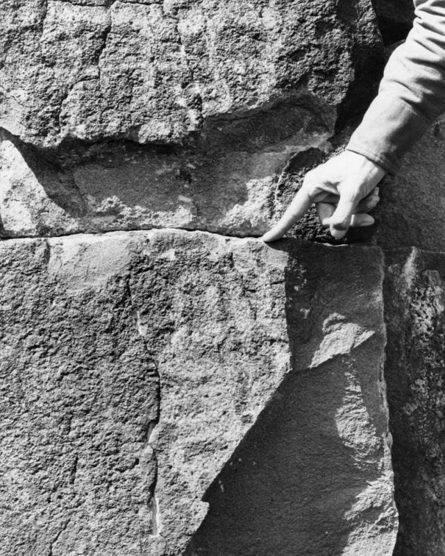
Photograph caption dated April 3, 1974 reads, “Hand of UC Riverside anthropology professor, Sylvia Broadbent, points out recent chisel mark at bottom of a chipped out section of volcanic rock which had an ancient Indian carving on it. Such damage to antiquities, which is widespread in the Mojave Desert is illegal. This damage was in Inscription Canyon near Barstow.”
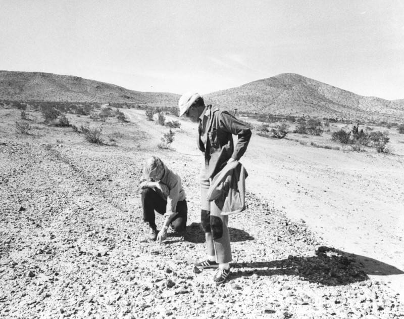
Photograph caption dated April 3, 1974 reads, “Richard E. Gutting, Jr., kneeling, attorney for Environmental Defense Fund, and UC Riverside anthropology professor Sylvia Broadbent, examine off-road vehicle dislocation of ‘desert pavement,’ a dark, rocky covering on desert floor which takes thousands of years to form but is important to the natural balance of desert life. Light swath was made by off-road vehicle race.”
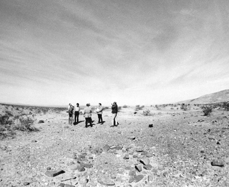
Photograph caption dated April 3, 1974 reads, “Off-road vehicle race course touring party gathers at scene of ancient Indian sleeping circle (foreground), a circular formation of larger rocks in midst of small ones, which anthropologists say were foundations for shelters built by prehistoric Indians. All such sites, they assert, should be protected.”
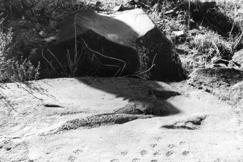
Photograph caption dated April 3, 1974 reads, “Not just ordinary boulders, these, according to Dr. Sylvia Broadbent, UC Riverside anthropology professor, who said there is no question that the slightly concave rock in the upper half of photo was worn that way by ancient Indians grinding grain and marks on the surface of the rock in the lower photo were also made by the same Indians.”
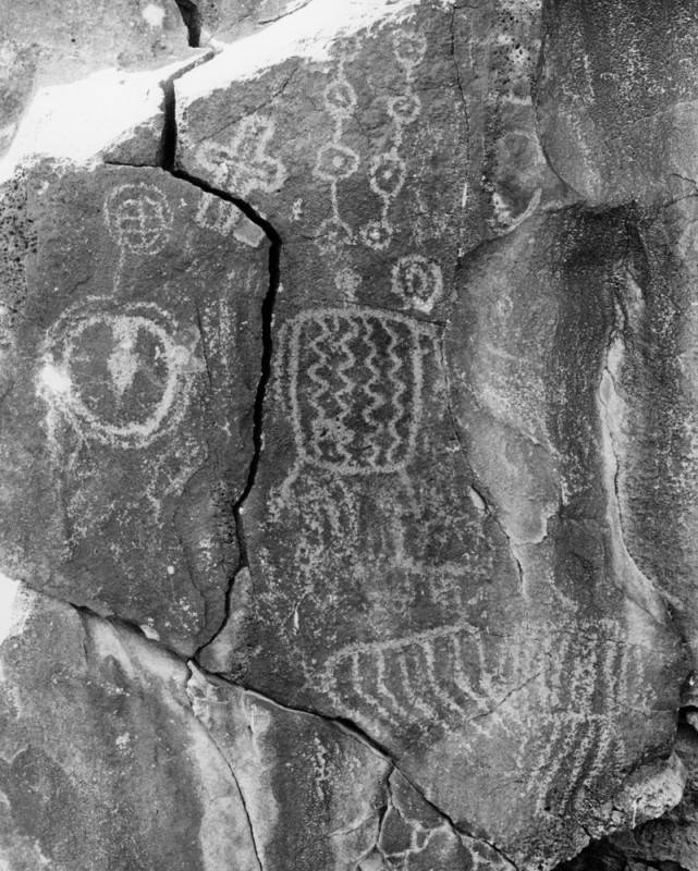
Photograph caption dated April 3, 1974 reads, “Petroglyphs, ancient Indian rock art, abound on the walls of Inscription Canyon near Barstow. Archaeologists look upon them as valuable keys to unlocking the secrets of prehistoric peoples who inhabited the vast Mojave Desert, but complain they are being destroyed by desert visitors at an alarming rate.”
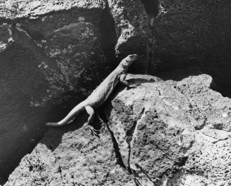
Photograph caption dated April 3, 1974 reads, “He calls the Mojave Desert ‘home.’ Desert lizard suns itself on dark, porous volcanic rock in Inscription Canyon. Same rocks are covered with ancient Indian petroglyphs, and rock art carvings, indicating the canyon may have been where Indians trapped and captured longhorn sheep and other desert game. The entire canyon is falling victim to vandals and souvenir hunters.”
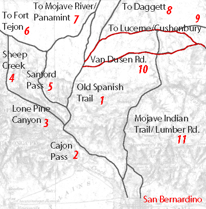
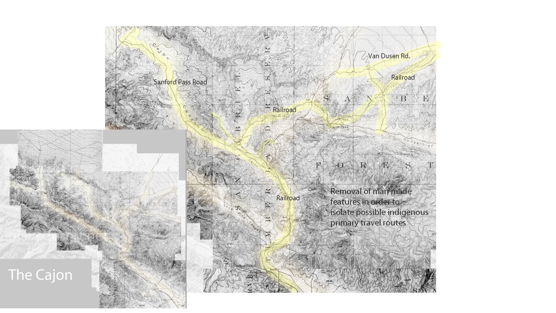
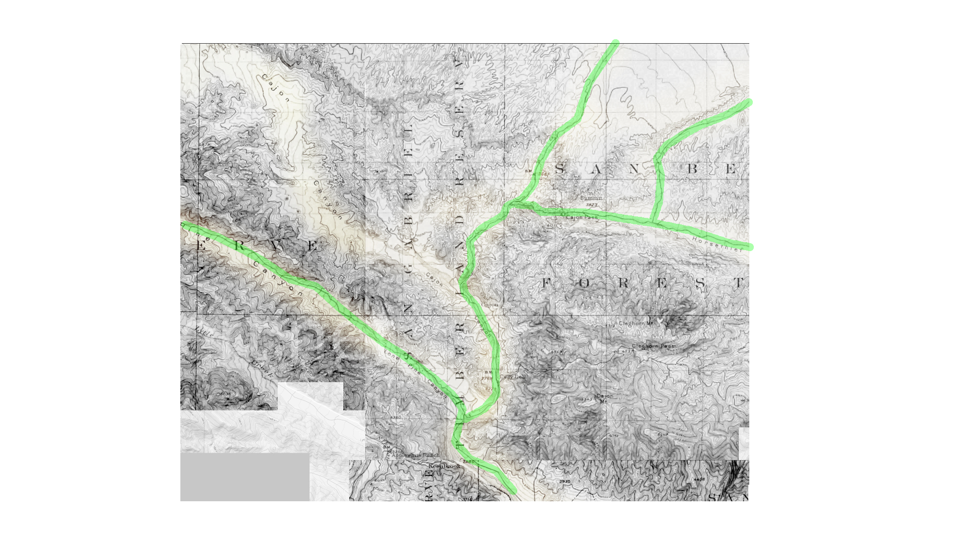
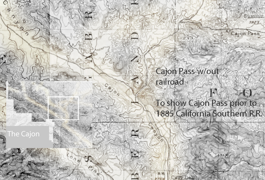
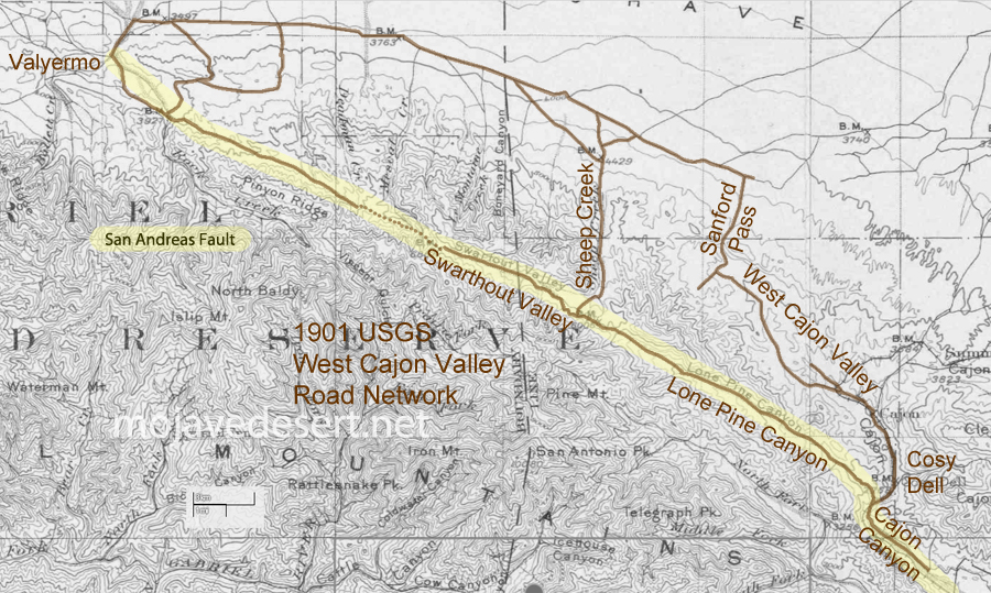
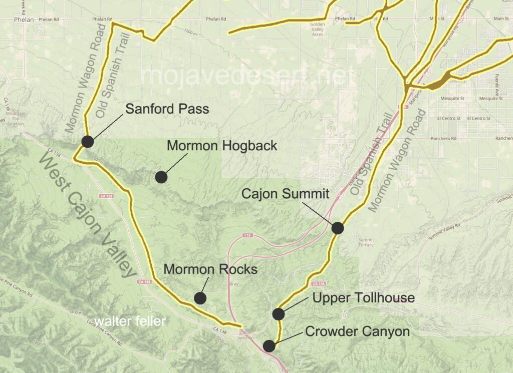
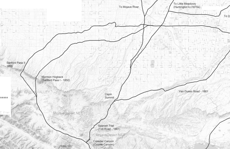
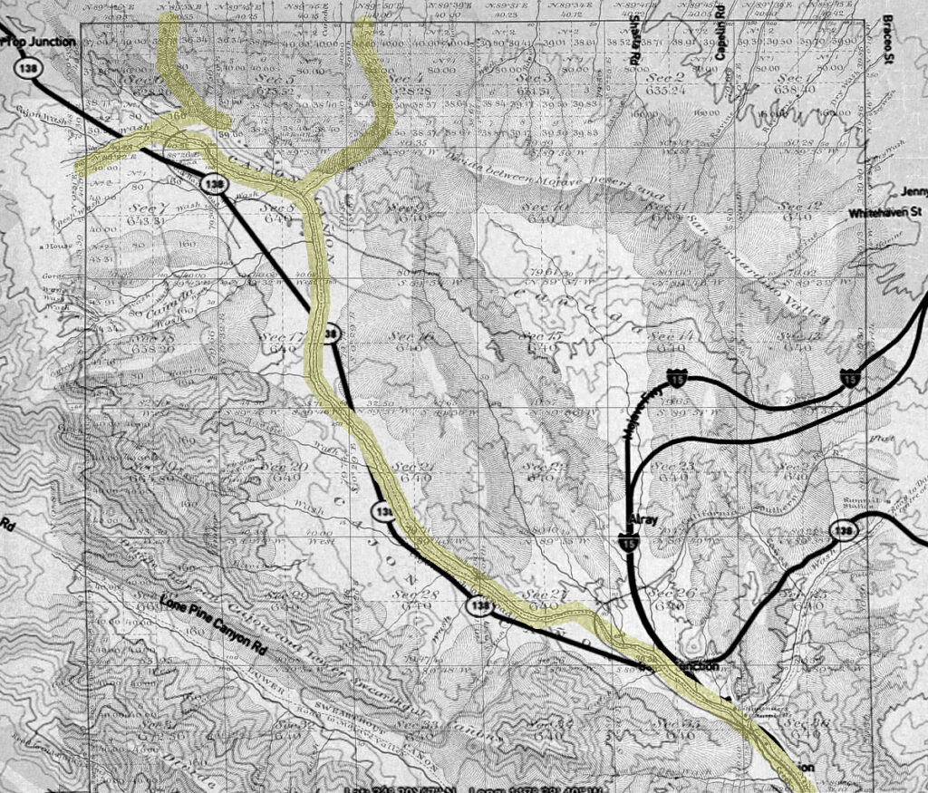
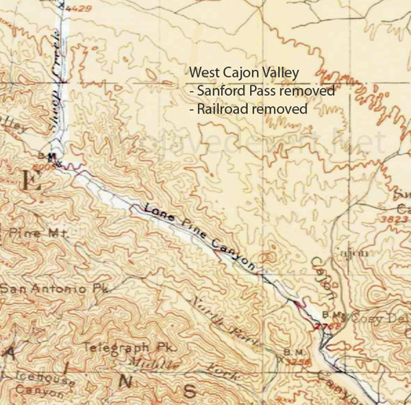
1 – Old Spanish Trail/Indian trail (1827) 2 – Cajon Pass (Lower) – Indian trail 3 – Lone Pine Canyon – Indian trail 4 – Sheep Creek – Indian trail 5 – Sanford Pass (c.1854-57) 6 – Fort Tejon – Indian trail 7 – to Mojave River – Indian trail 8 – to Daggett (c.1855) 9 – Lucerne/Cushenbury Lumber road 10 – Van Dusen/Holcomb Valley Road – (1862) 11 – Mojave Indian trail (c.1776, 1826)
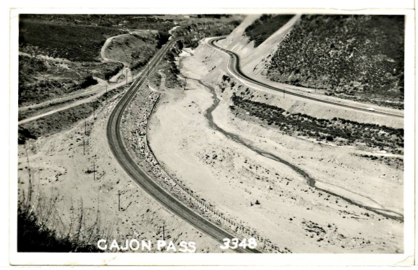
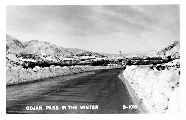
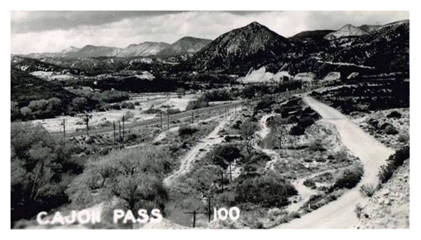
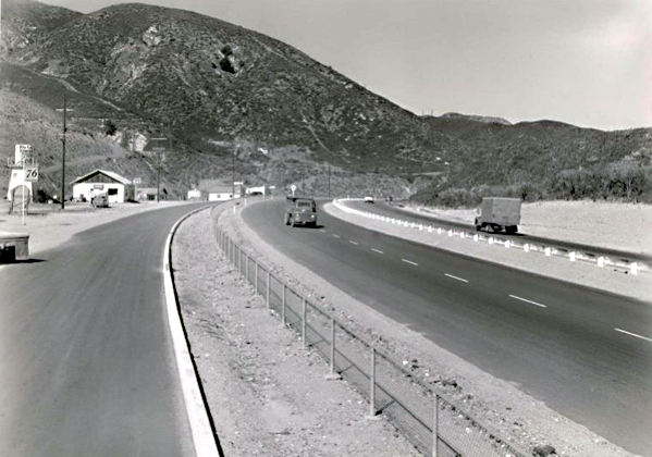
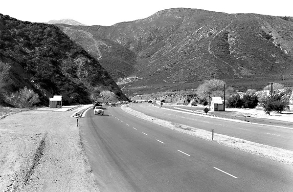
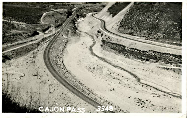
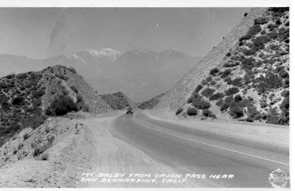
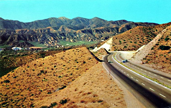
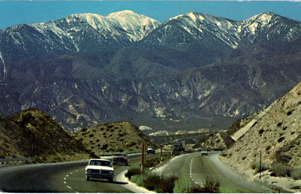
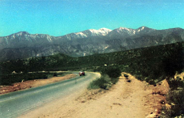
Vintage photos of the man-made features of the Cajon Pass. Assorted photographers, subjects, and eras, including Route 66, National Old Trails Road, Railroad, etc. . .
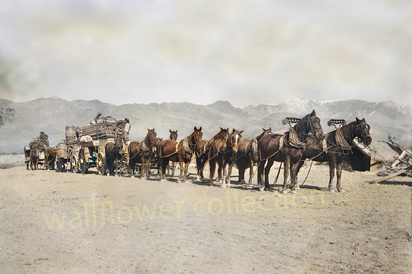
10-horse freight outfit – R. & J. Reynolds collection
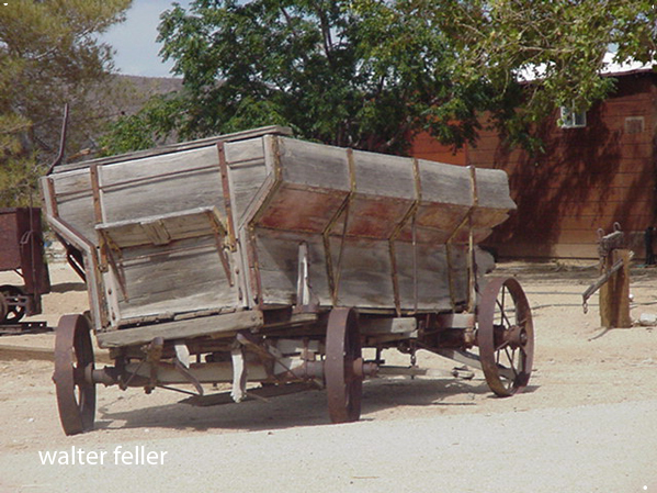
“Freighting” became an important occupation. The man who wished to engage in it must be a considerable capitalist, for the heavy wagons, constructed especially for the purpose, were expensive, and strong, well-broken mules were required. Eight, ten, twelve, and sometimes eighteen or twenty mules or horses were used as motive power for the “outfit.” The wagons were carefully packed, and often carried thousands of dollars worth of merchandise. The driving of one of these “freighters” over the mountains and deserts required forethought, prompt action, and good judgment. There was always danger from the Utes. Apaches and other Indians. The heat and the cold, the alkali dust, the blinding glare of the sun upon the desert sands, thirst and hunger—all of these tested to the uttermost the physical and mental powers of the teamsters.
Ingersoll’s century annals of San Bernadino County, 1769-1904
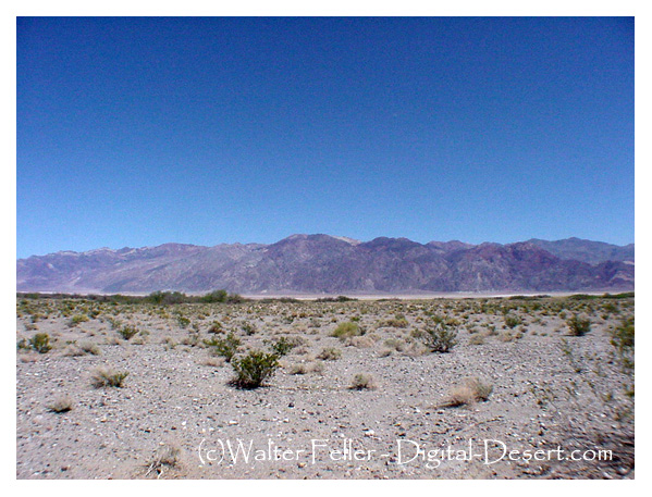
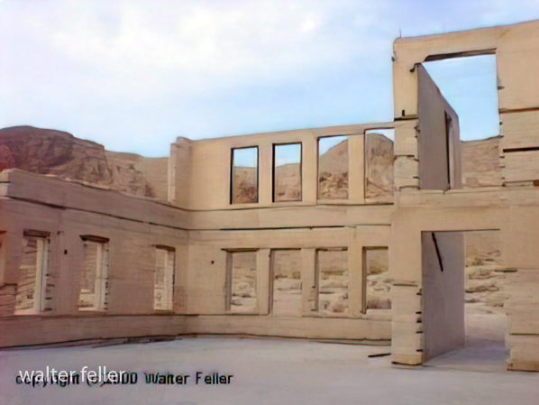
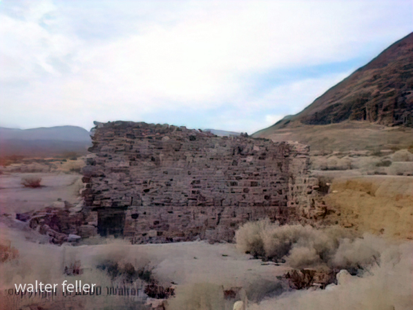
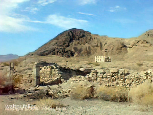
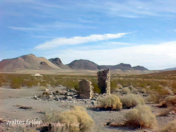
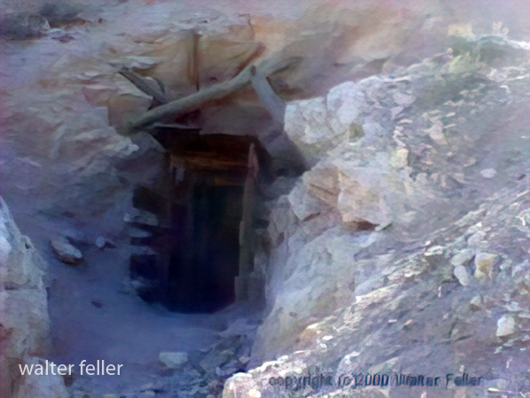
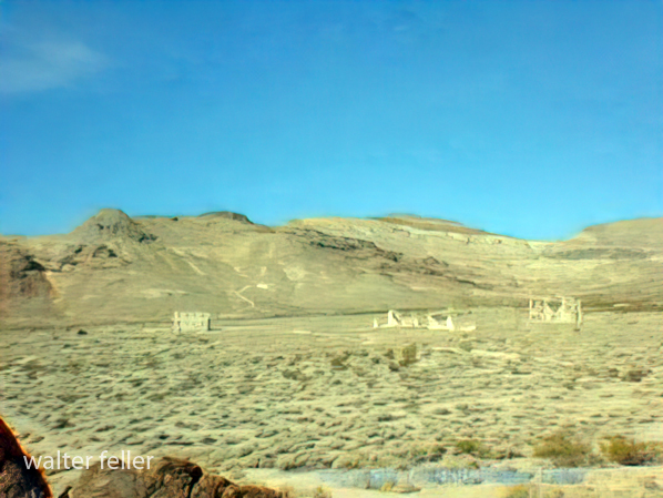
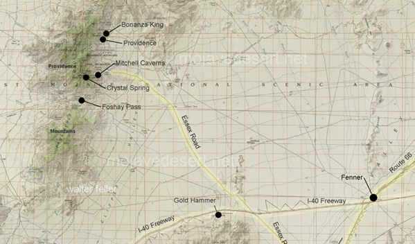
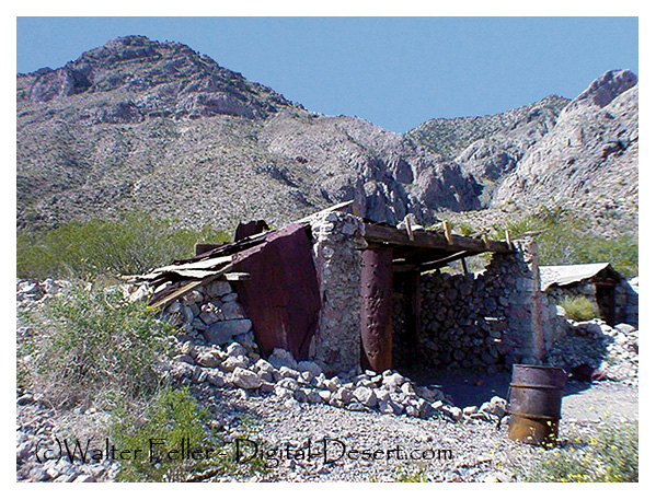
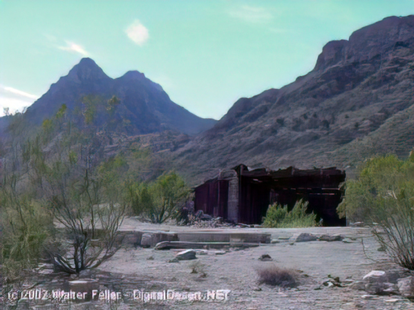
These photos were shot in 2003 with a Sony Mavica digital camera. Unfortunately, the original full-size (still low resolution) photos were lost. These images have been recovered from 320×240 images that were posted on the Digital-Desert website.
“In the spring of 1880, George Goreman and P. Dwyer, prospectors from Ivanpah, discovered rock that assayed from $640 to $5,000 a ton in silver. Their discovery, about 15 miles south of the old Macedonia District, was the birth of the Bonanza King Mine.”
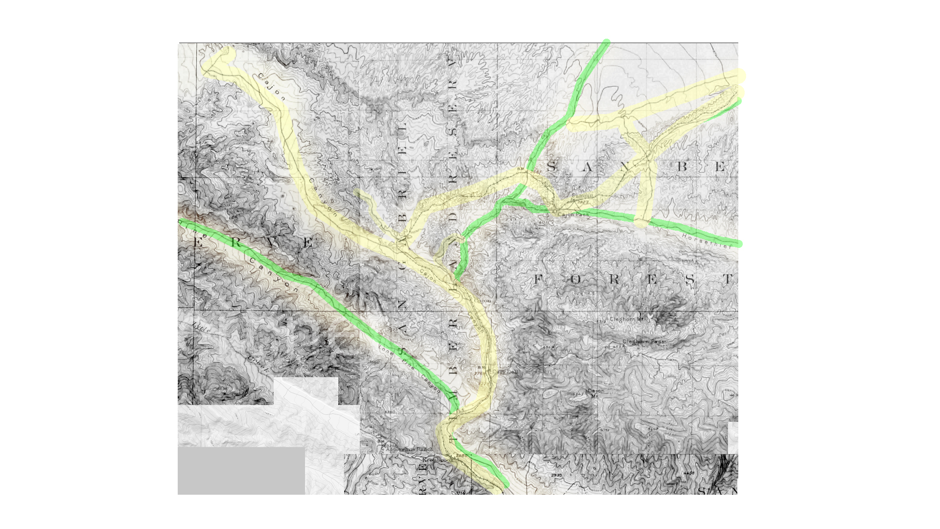
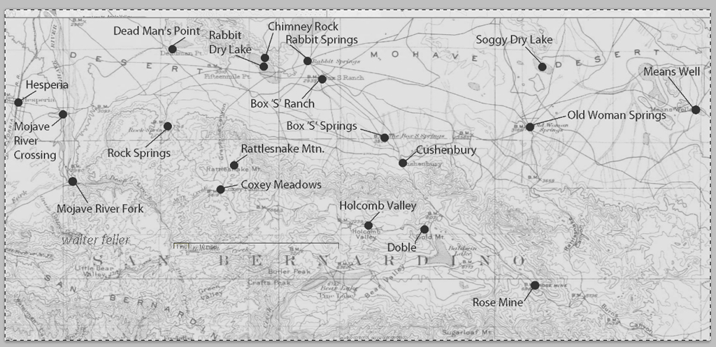
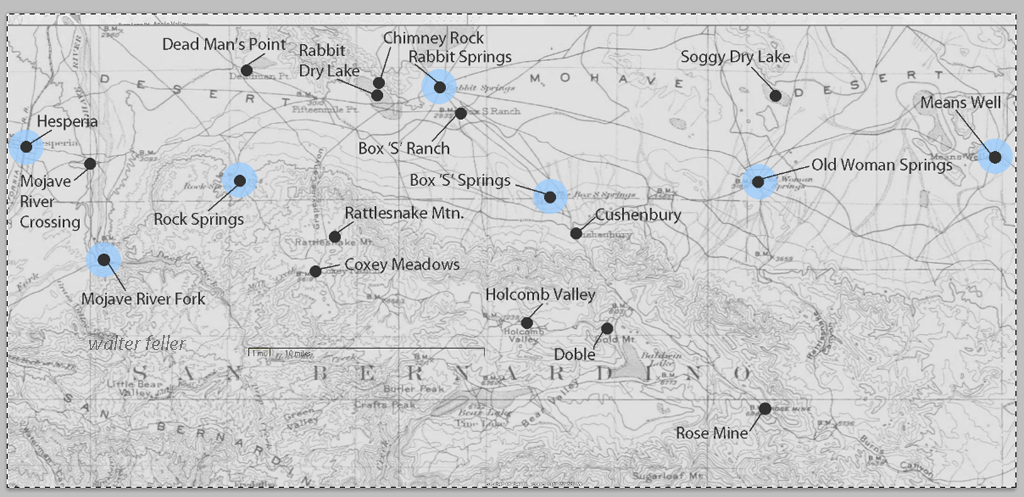
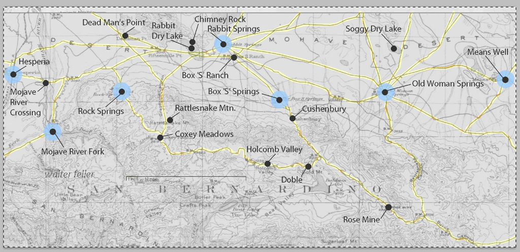
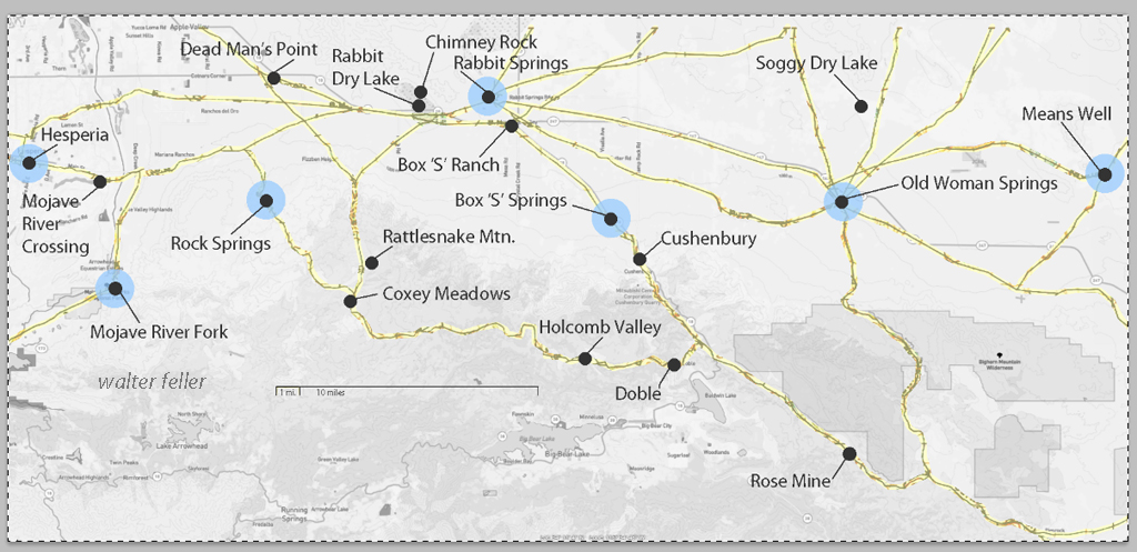
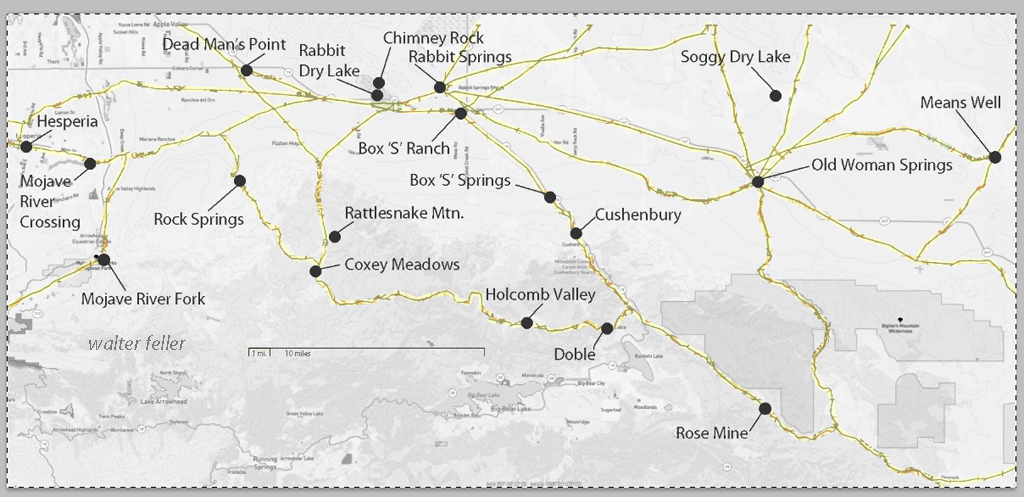
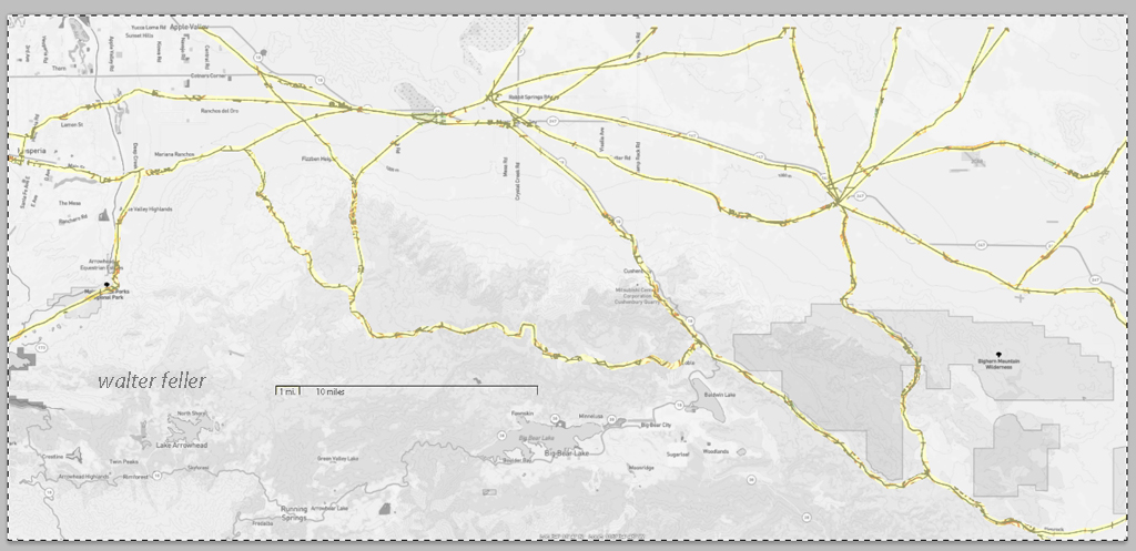
These maps are based on a USGS 1901 base map and overlay onto a current street map. This series was developed to show how the dependence on potable water for man or beast shaped the transportation network in the late 19th Century.
This map identifies various geographic locations, general features, and roads throughout the Lucerne & Johnson valleys as it was in 1901.
The blue marks show reliable water and rest stops as would be used by travelers and teamsters. These water stops are roughly 10 miles apart as the roads go.
The generalized trails connecting the water and rest stops are highlighted. A few redundant and miscellaneous trails have been purposely omitted for clarity.
This map has had the 1901 base map replaced with a current street map.
This map has had the water node locations removed.
Finally, the 1901 trails have been highlighted and the location labels removed for clarity in showing the relationship between the roads then and now.
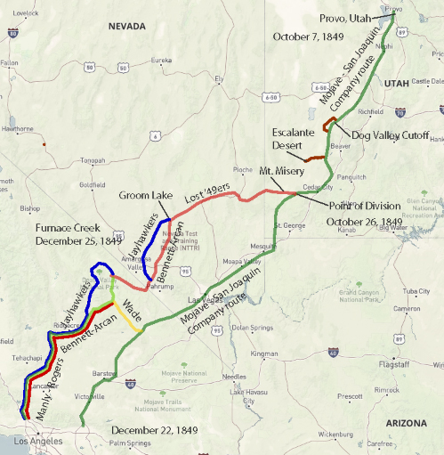
Jefferson Hunt’s Mojave San Joaquin Company, a wagon train made up of anxious gold seekers and settlers frustrated by a late start across the desert in late 1849 join with Captain Hunt to be guided across the Mojave Desert along the new southern route. Tensions rise with a wrong venture into the Escalante Desert and at a point east of Enterprise, and north of Mountain Meadows, Utah, anarchy ensues and the train breaks up into two factions; those who will become lost and those who will go on as planned. Of the 107 wagons in this once large party, only seven wagons remain.
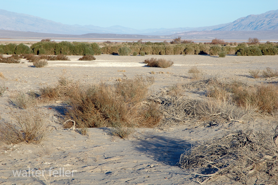
Furnace Creek, Death Valley National Park
On December 22, 1849, the ‘Mojave Sand-walking Company,’ as it became known, arrived in San Bernardino, California. At the same time the remaining ‘Lost ’49ers,’ about one-quarter of those who broke away originally, were entering the desolate Death Valley and would be celebrating Christmas Day near what we know as Furnace Creek.
Marl Springs is a historical site located in the Mojave Desert National Preserve in California. The area has significance due to its role as a water source for travelers and settlers in the desert region. Here’s a brief history of Marl Springs:
Native American Presence: The Mojave Desert has a long history of Native American habitation. The Chemehuevi and Mojave people were among the indigenous groups living in the area. These Native American communities deeply understood the desert environment and its resources.
Exploration and Early Settlement: In the 19th century, the Mojave Desert attracted explorers, pioneers, and prospectors seeking new opportunities. The Mojave Road, a route through the Mojave Desert, and Marl Springs became a crucial water source for travelers along this route.
Military Use: During the mid-1800s, the U.S. Army established a military presence in the Mojave Desert. With its reliable water source, Marl Springs was a strategic location for military operations and a resting point for troops moving through the region.
Mining Activity: Like many areas in the Mojave Desert, Marl Springs saw mining activity during the late 19th and early 20th centuries. Prospectors sought minerals such as gold and silver in the surrounding hills, contributing to the region’s development.
Railroad Expansion:The railroad‘s arrival led to changes in transportation patterns, reducing the importance of some stagecoach routes. However, Marl Springs retained significance for those traveling by road or seeking water in the desert.
Mojave Desert National Preserve: In 1994, the preserve was established to protect the unique desert ecosystem and preserve its cultural and historical resources. Marl Springs is now part of this national preserve, allowing visitors to explore its historical remnants and appreciate its role in the region’s past.
Today, Marl Springs stands as a testament to the challenges and opportunities the Mojave Desert presents, showcasing the intersection of natural resources, human history, and the development of transportation routes in the American West.
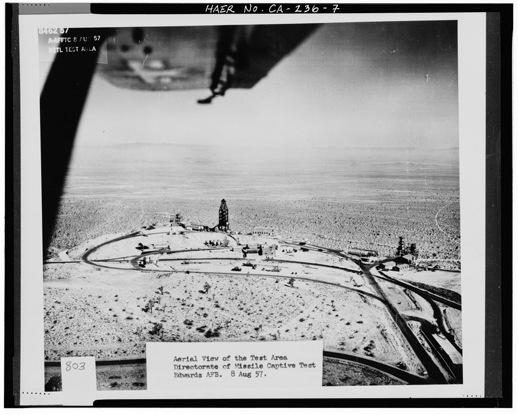
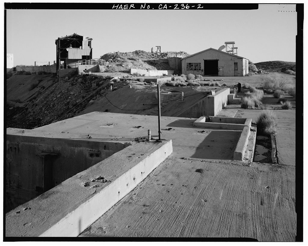
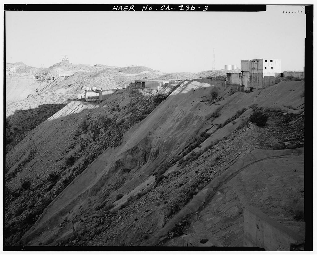
Documentation compiled after 1968 (see full notes below gallery)
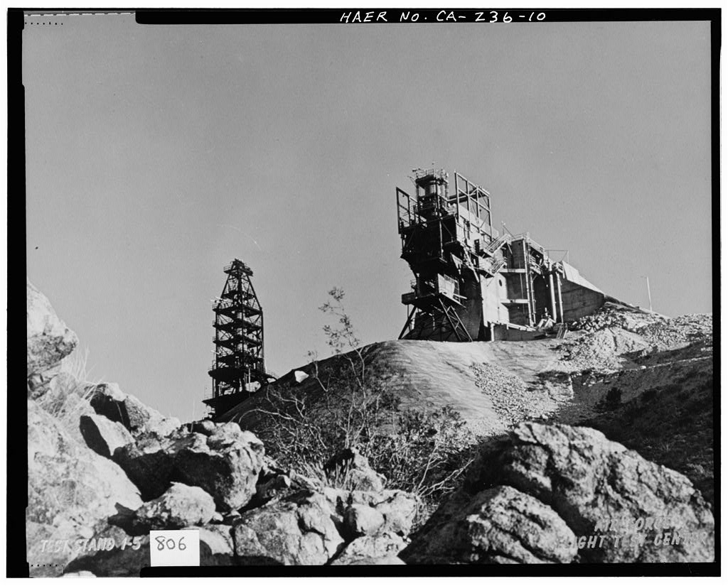
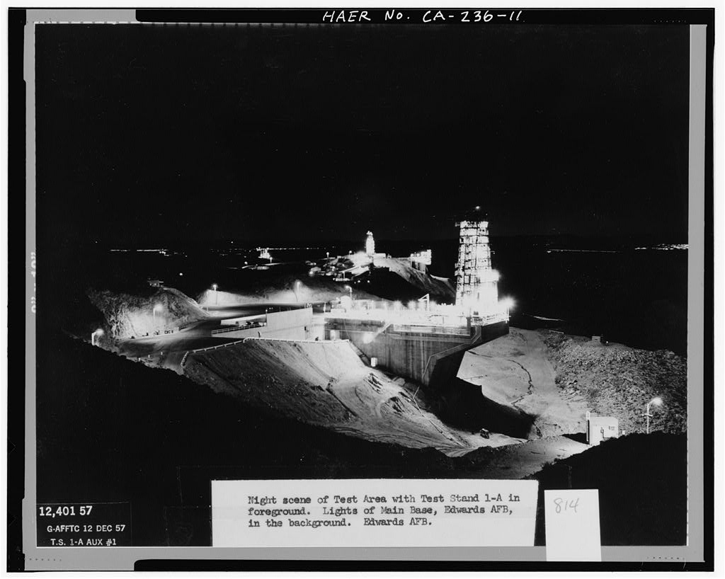
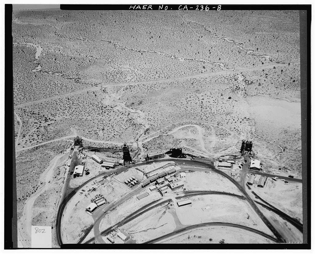
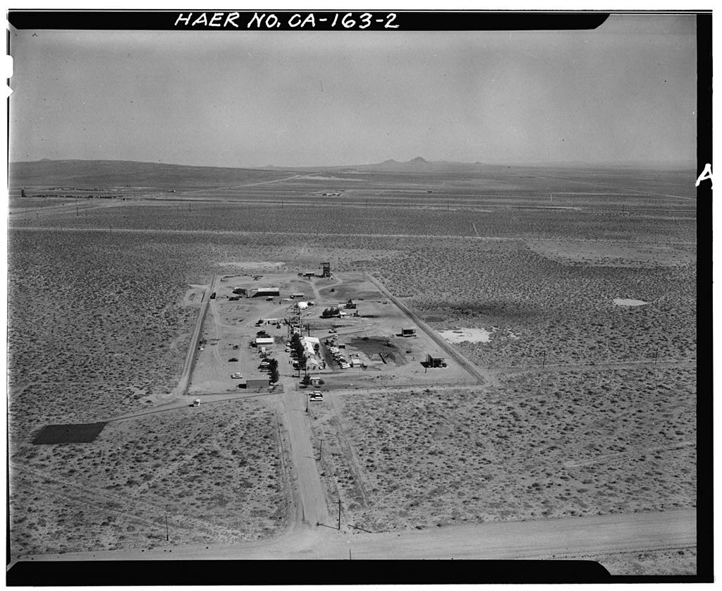
Air Force Rocket Propulsion Laboratory (site)
Significance: Since its inception, the AFRL has been devoted to the advancement of rocket technology in support of U.S. military weapons and space flight superiority. Unlike any other facility associated with rocket systems research, design, testing, and evaluation (RDT&E), the AFRL provided facilities for all aspects of systems development and supported some aspect of the evolution of each of the significant rocket and missile systems developed between the Cold War era and the present.
Test Area 1-100 played an exceptionally important role in the development of the Minuteman missile program and in the RDT&E of performing “hot-firings” from underground missile silos. Air Force engineers at the AFRL developed the technology for achieving a successful hot-firing and designed the first silo facility in the United States that could perform this function. The ability to hot-fire the Minuteman missile was one of its most influential features because it reduced the launch time to 30 minutes or less, which put the United States on par with Soviet launch capabilities.
Test Area 1-115 was the first testing facility constructed at the AFRL and was exceptionally important in the advancement of both Air Force and contractor testing and evaluation of four nationally significant missile programs and generations of intermediate rocket programs. Early tests at Test Area 1-115 of the rocket-assisted takeoff (RATO) system reflect the AFRL’s early association with the Air Force Flight Test Center, whereas later tests of the Atlas, Thor, Titan, and Bomarc programs illustrate the AFRL’s exceptionally important role in the advancement of the U.S. Cold War race for technological superiority.
Test Area 1-125 is a unique facility at the AFRL because it originally was built for and by the National Aeronautics and Space Administration (NASA) as the F-1 production test facility. Although NASA had other testing facilities across the United States, the ability to construct three test stands capable of testing engines with 2 million pounds of thrust and use the RDT&E facilities of the AFRL proved to be a valuable asset to the success of the Apollo/Saturn V program.
Test Area 1-120 provided the Air Force and industry with testing facilities that played an exceptionally important role in the advancement of nationally significant missile programs. Test Stand 1-A originally was constructed to accommodate a fully assembled Atlas intercontinental ballistic missile (ICBM). It supported that program until an accident damaged the stand’s superstructure. After the launch of Sputnik and the ensuing focus on the Apollo Saturn V program, new construction and existing facilities were turned over to NASA and Rocketdyne to perfect the E-1 and F-1 engines.
The superstructure of Test Stand 1-A was rebuilt to accommodate the Rocketdyne F-1 engine, which eventually propelled the Saturn V lunar rocket.-
Survey number: HAER CA-236- Building/structure dates: 1948-1967 Initial Construction
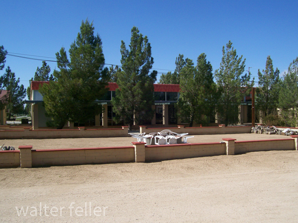
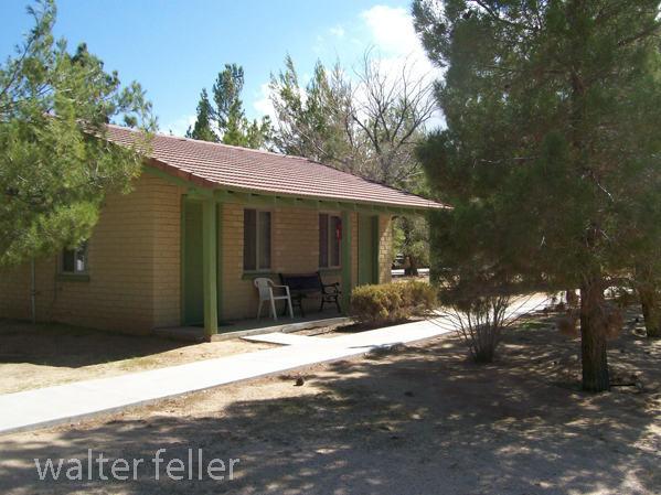
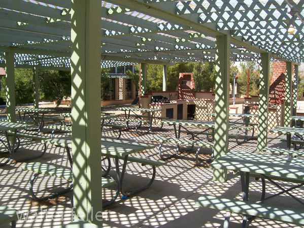
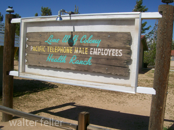
Over 15 million people were killed during World War I (1914-1918), and a countless number of people were injured. The use of poison gas as a weapon caused many of these deaths and injuries. Suffering from the effects of poison gas during some returning Pacific Telephone and Telegraph employees were unable to obtain hospitalization or other care. The Southern California Telephone Company in Los Angeles began working to provide care and lodging for these recuperating veterans. By 1924 the Lone Wolf Colony was established.
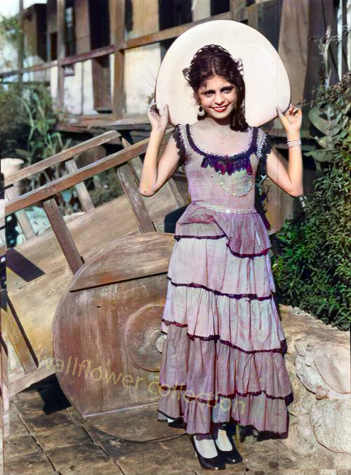
The pretty senorita is standing next to a carreta, a two-wheeled cart pulled by mules to haul freight in early Spanish and Mexican California. The carreta could be built quickly and inexpensively. Four-wheeled wagons in Southern California were a rarity if there were any at all until the first ones rolled in through the Cajon Pass in 1849 driven by Mormon pioneers.
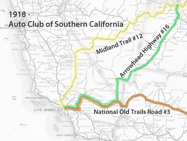
This map shows the three main trails across the Mojave Desert; the Midland Trail, Arrowhead Trail, and the National Old Trails Road. These roads at the time were unpaved and varied in condition and the skills involved to navigate them.
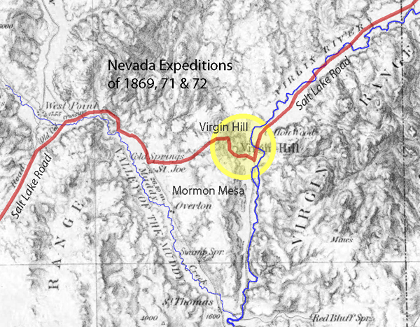
There were two equally onerous obstacles along the Salt Lake Wagon Road that early-on pioneers had to overcome; on the east end of the trail, there was Virgin Hill at Mormon Mesa and the Virgin River. To the west, the challenge was the Cajon Pass.
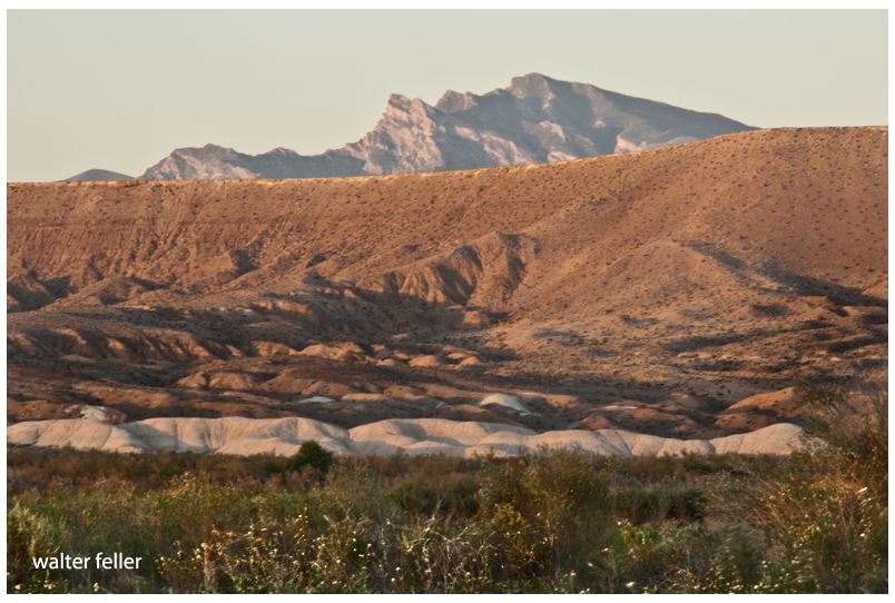
Virgin Hill was a 360-foot change in elevation in only .6 miles (1 foot rise every 9 feet). Teams would have to be doubled up to pull loads over the rocky vertical sections of the steep trail.
from; SOME FORGOTTEN HEROES AND THEIR PLACE IN AMERICAN HISTORY BY E. ALEXANDER POWELL – 1922
As we ride westward across the mountain ranges to the Pacific with all the ease and luxury a twentieth-century limited train affords, few of us can imagine that those very ranges, now tunneled and spanned, once constituted barriers that the Spaniards in California never dreamed would be passed by trappers, prospectors, or settlers from the United States. This is the story of one of the first who dared to do that seemingly impossible thing —who risked the anger of the Spanish authorities in California, and on his return found the pass and blazed the trail across the Sierras, which later became the overland route to California.
About the word frontiersman, there is a pretty air of romance. The very mention of it conjures up a vision of lean, sinewy, brown-faced men, in fur caps and moccasins and fringed buckskin, slipping through virgin forests or pushing across sun-scorched prairies—advance guards of civilization. Hardy, resolute, taciturn figures, they have passed silently across the pages of our history and we shall see their kind no more. To them we owe a debt that we can never repay—nor, indeed, have we even publicly acknowledged it. We followed by the trails which they had blazed for us; we built our towns in those rich valleys and pastured our herds on those fertile hillsides which theirs were the first white men’s eyes to see.
The American frontiersman was never a self-seeker. His discoveries he left as a heritage to those who followed him. In almost every case he died poor and, more often than not, with his boots on. David Livingstone and Henry M. Stanley, the two Englishmen who did more than any other men for the opening up of Africa, lie in Westminster Abbey, and thousands of their countrymen each year stand reverently beside their tombs. To Cecil Rhodes, another Anglo-African pioneer, a great national memorial has been erected on the slopes of Table Mountain. Far, far greater parts in the conquest of a wilderness, the winning of a continent, were played by Daniel Boone, James Bowie, Kit Carson, Davy Crockett; yet how many of those who today enjoy the fruits of the perils they faced, the hardships they endured, know much more of them than as characters in dime novels, can tell where they are buried, can point to any statues of monuments which have been erected to their memories?
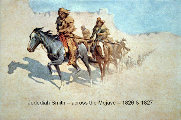
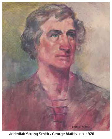
There are nearly three million people in the State of California, and most of them boast of it as “God’s own country.” They have more State pride than any people that I know, yet I would be willing to wager almost anything you please that you can pick a hundred native sons of California, and put to each of them the question, “Who was Jedediah Smith ?” and not one of them would be able to answer it correctly. The public parks of San Francisco and Los Angeles and San Diego and Sacra mento have innumerable statues of one kind and another, but you will find none of this man with the stern old Puritan name; they are starting a hall of fame in California, but no one has proposed Jedediah Smith as deserving a place in it. Yet to him, perhaps more than to any other man, is due to the fact that California is Ameri can; he was the greatest of the pathfinders; he was the real founder of the Overland Trail; he was the man who led the way across the ranges. Had it not been for the trail he blazed and the thousands who followed in his footsteps the Sierra Nevada might still mark the line of our frontier.
The westward advance of the population which took place during the first quarter of the nineteenth century far exceeded the limits of any of the great migrations of mankind upon the older continents. The story of the American onset to the beckoning West is one of the wonder-tales of history. Over the natural waterway of the great northern lakes, down the road to Pittsburg, along the trail which skirted the Potomac, and then down the Ohio, over the passes of the Cumberland into Tennessee, round the end of the Alleghanies into the Gulf States, up the Missouri, and so across the Rockies to the headwaters of the Columbia, or southwestward from St. Louis to the Spanish settlements of Santa Fe, the hardy pioneers poured in an ever-increasing stream, carrying with them little but ax, spade, and rifle, some scanty household effects, a small store of provisions, a liberal supply of ammunition, and unlimited faith, courage, and enterprise.
During that brief period, the people of the United States extended their occupation over the whole of that vast region lying between the Alleghanies and the Rockies—a territory larger than all of Europe, without Russia—annexed it from the wilderness, conquered, subdued, improved, cultivated, civilized it, and all without one jot of governmental assistance. Throughout these years, as the frontiersmen pressed into the West, they continued to fret and strain against the Spanish boundaries. The Spanish authorities, and after them the Mexican, soon became seriously alarmed at this silent but resistless American advance, and from the City of Mexico orders went out to the provincial governors that Americans venturing within their jurisdiction should be treated, whenever an excuse offered, with the utmost severity. But, notwithstanding the menace of Mexican prisons, of Indian tortures, of savage animals, of thirst and starvation in the wilderness, the pioneers pushed westward and ever westward, until at last their further progress was abruptly halted by the great range of the Sierra Nevada, snow-crested, and presumably impassable, which rose like a titanic wall before them, barring their farther march.
It was at about the time of this halt in our westward progress that Captain Jedediah Smith came riding onto the scene. You must picture him as a gaunt-faced, lean-flanked, wiry man, with nerves of iron, sinews of rawhide, a skin-like oak-tanned leather, and quick on his feet as a catamount. He was bearded to the ears, of course, for razors formed no part of the scanty equipment of the frontiersman, and above the beard shone a pair of very keen, bright eyes, with the concentrated wrinkles about their corners that come of much staring across sun-swept spaces. He was sparing of his words, as are most men who dwell in the great solitudes, and, like them, he was, in an unorthodox way, devout, his stern and rugged features as well as his uncompromising scriptural name betraying the grim old Puritan stock from which he sprang. His hair was long and black and would have covered his shoulders had it not been tied at the back of the neck by a leather thong. His dress was that of the Indian adapted to meet the requirements of the adventuring white man: a hunting-shirt and trousers of fringed buckskin, embroidered moccasins of elk hide, and a cap made from the glossy skin of a beaver, with the tail hanging down behind.
On hot desert marches, and in camp, he took off the beaver-skin cap and twisted about his head a bright bandanna, which, when taken with his gaunt, unshaven face, made him look uncommonly like a pirate. These garments were by no means fresh and gaudy, like those affected by the near-frontiersmen you see on motion picture screens; instead, they were very soiled and much worn and greasy and gave evidence of having done twenty-four hours’ duty a day for many months at a stretch. Hanging on his chest was a capacious powder-horn, and in his belt was a long, straight knife, very broad and heavy in the blade—a first cousin of that deadly weapon to which James Bowie was in after years to give his name; in addition, he carried a rifle, with an altogether extraordinary length of the barrel, which brought death to any living thing within a thousand yards on which its foresight rested. His mount was a plains-bred pony, as wiry and unkempt and enduring as himself. Everything considered, Smith could have been no gentle-looking figure, and I rather imagine that, if he were alive and ventured into a Western town today, he would probably be arrested by the local constable as an undesirable character. I have now sketched for you, in brief, bold outline, as good a likeness of Smith as I am able with the somewhat scanty materials at hand, for he lived and did his pioneering in the days when frontiersmen were as common as traffic policemen are now, added to which the men who were familiar with his exploits were of a sort more ready with their pistols than with their pens.
The dates of Smith’s birth and death are not vital to this story, and perhaps it is just as well that they are not, for I can find no record of when he came into the world, and only the Indian warrior who wore his scalp lock at his waist could have told the exact date on which he went out of it. It is enough to know that, as the nineteenth century was passing the quarter mark, Smith was the head of a firm of fur-traders, Smith, Jackson & Sublette, which had obtained from President John Quincy Adams permission to hunt and trade to the heart’s content in the region lying beyond the Rocky Mountains. It would have been much more to the point to have obtained the permission of the Mexican governor-general of the Californias, or of the great chief of the Comanches, for they held practically all of the territory in question between them.
Those were the days whose like we shall never know again, when the streams were alive with beaver, when there were more elk and antelope on the prairies than there are cattle now, and when the noise made by the moving buffalo herds sounded like the roll of distant thunder. They were the days when a fortune, as fortunes were then reckoned, awaited the man with a sure eye, a body inured to hardships, and unlimited ammunition. What the founder of the Astor fortune was doing in the Puget Sound country, Smith and his companions purposed to do beyond the Rockies; and, with this end in view, established their base camp on the eastern shores of the Great Salt Lake, not far from where Ogden now stands. This little band of pioneers formed the westernmost outpost of American civilization, for between them and the nearest settlement, at the junction of the Mississippi and Ohio Rivers, stretched thirteen hundred miles of savage wilderness. Livingstone, on his greatest journey, did not penetrate half as far into unknown Africa as Smith did into unknown America, and while the English explorer was at the head of a large and well-equipped expedition, the American was accompanied by a mere handful of men.
In August 1826, Smith and a small party of his hunters found themselves in the terrible Painted Desert, that God-forsaken expanse of sand and lava where the present states of Arizona, Utah, and Nevada meet. Water, there was none, for the streams had run dry, and the horses and pack-mules were dying of thirst and exhaustion; the game had entirely disappeared; the supplies were all but finished—and five hundred miles of the most inhospitable country in the world lay between them and their camp on the Great Salt Lake. The situation was perilous, indeed, and a decision had to be made quickly if any of them were to get out alive.
“What few supplies we have left will be used up before we get a quarter way back to the camp,” said Smith. “Our only chance—and I might as well tell you it’s a mighty slim one, boys—is in pushing on to California.” “But California’s a good four hundred miles away,” expostulated his companions, “and the Sierras He between, and no one has ever crossed them.”
“Then I’ll be the first man to do it,” said Smith. “Besides, I’ve always had a hankering to learn what lies on the other side of those ranges. Now’s my chance to find out.”
” I reckon there ain’t much chance of our ever seeing Salt Lake or California either,” grumbled one of the hunters, “and even if we do reach the coast the Mexicans’ll clap us into prison.” “Well, so fur’s I’m concerned,” said Smith decisively, “I’d rather be alive and in a Greaser prison than to be dead in the desert. I’m going to California or die on the way.” History chronicles few such marches. Westward pressed the little troop of pioneers, across the sun-baked lava-beds of southwestern Utah, over the arid deserts and the barren ranges of southern Nevada, and so to the foot-hills of that great Sierran range which rears itself ten thousand feet skyward, forming a barrier which had theretofore separated the fertile lands of the Pacific slope from the rest of the continent more effectually than an ocean. The lava-beds gave way to sand wastes dotted with clumps of sage-brush and cactus, and the cactus changed to stunted pines, and the pines ran out in rocks, and the rocks became covered with snow, and still, Smith and his hunters struggled on, emaciated, tattered, almost barefooted, lamed by the cactus spines on the desert, and the stones on the mountain slopes, until at last, they stood upon the very summit of the range and, like that other band of pioneers in an earlier age, looked down on the promised land after their wanderings in the wilderness. No explorer in the history of the world, not Columbus, nor Pizarro, nor Champlain, nor De Soto, ever gazed upon land so fertile and so full of beauty. The mysterious, the jealously guarded, the storied land of California lay spread before them like a map in bas-relief. Then the descent of the western slope began, the transition from snow-clad mountain peaks to hillsides clothed with subtropical vegetation amazing the Americans by its suddenness. Imagine how like a dream come true it must have been to these men, whose lives had been spent in the less kindly climate and amid the comparatively scanty vegetation of the Middle West, to suddenly find themselves in this fairyland of fruit and flowers!
“It is, indeed, a white man’s country,” said Smith prophetically, as, leaning on his long rifle, he gazed upon the wonderful panorama which unrolled itself before him. “Though it is Mexican just now, sooner or later it must and shall be ours.”
Heartened by the sight of this wonderful new country, and by the knowledge that they must be approaching some of the Mexican settlements, but with bodies sadly weakened from exposure, hunger, and exhaustion, the Americans slowly made their way down the slope, crossed those fertile lowlands which are now covered with groves of orange and lemon, and so, guided by some friendly Indians whom they met, came at last to the mission station of San Gabriel, one of that remarkable chain of outposts of the church founded by the indefatigable Franciscan, Father Junipero Serra. The little company of worn and weary men sighted the red-tiled roof of the mission just at sunset.
I doubt if there was a more astonished community between the -oceans than was the monastic one of San Gabriel when this band of ragged strangers suddenly appeared from nowhere and asked for food and shelter. “You come from the South—from Mexico?” queried the father superior, staring, half-awed, at these gaunt, fierce-faced, bearded men who spoke in a strange tongue.
“No, padre,” answered Smith, calling to his aid the broken Spanish he had picked up in his trading expeditions to Santa Fe, “we come from the East, from the country beyond the great mountains, from the United States. We are Americans,” he added a little proudly.
“They say they come from the East,” the brown-robed monks whispered to each other. “It is impossible. No one has ever come from that direction. Have not the Indians told us many times that there is no food, no water in that direction, and that, moreover, there is no way to cross the mountains? It is, indeed, a strange and incredible tale that these men tell. But we will offer them our hospitality in the name of the blessed St. Francis, for that we withhold from no man; but it is the part of wisdom to despatch a messenger to San Diego to acquaint the governor of their coming, for it may well be that they mean no good to the people of this land.”
Had the good monks been able to look forward a few score years, perhaps they would not have been so ready to offer Smith and his companions the shelter of the mission roof. But how were they to know that these ragged strangers, begging for food at their mission door, were the skirmishers for a mighty host which would one day pour over those mountain ranges to the eastward as the water pours over the falls at Niagara; that within rifle-shot of where their mission stood a city of a million souls would spread itself across the hills; that down the dusty Camino Real, which the founder of their mission had trudged so often in his sandals and woolen robe, would whirl strange horseless, panting vehicles, putting a mile a minute behind their flying wheels; that twin lines of steel would bring their southernmost station at San Diego within twenty hours, instead of twenty days, of their northernmost outpost at Sonoma; and that over this new land would fly, not the red-white-and-green standard of Mexico, but an alien banner of stripes and stars?
The four years which intervened between the collapse of Spanish rule in Mexico and the arrival of Jedediah Smith at San Gabriel were marked by political chaos in the Californias. When a governor of Alta California rose in the morning he did not know whether he was the representative of an emperor, a king, a president, or a dictator. As a result of these perennial disorders, the Mexican officials ascribed sinister motives to the most innocent episodes. No sooner, therefore, did Governor Echeandia learn of the arrival in his province of a mysterious party of Americans than he ordered them brought under escort to San Diego for examination. Though those present probably did not appreciate it, the meeting of Smith and Echeandia in the palace at San Diego was a peculiarly significant one.
There sat at his ease in his great chair of state the saturnine Mexican governor, arrogant and haughty, ruffled and gold-laced, his high-crowned sombrero and his velvet jacket heavy with bullion, while in front of him stood the American frontiersman, gaunt, unshaven, and ragged, but as cool and self-possessed as though he was at the head of a conquering army instead of a forlorn hope. The one was as truly the representative of passing as the other was of a coming race. Small wonder that Echeandia, as he observed the hardy figures and determined faces of the Americans, thought to himself how small would be Mexico’s chance of holding California if others of their countrymen began to follow in their footsteps.
He and his officials cross-examined Smith as closely as though the frontiersman was a prisoner on trial for his life, as, in a sense, he was, for almost any fate might befall him and his companions in that remote corner of the continent without anyone being called to account for it. Smith described the series of misfortunes that had led him to cross the ranges; he asserted that he desired nothing so much as to get back into American territory again, and he earnestly begged the governor to provide him with the necessary provisions and permit him to depart. His story was so frank and plausible that Echeandia, with characteristic Spanish suspicion, promptly disbelieved every word of it, for why he argued, should any sane man make so hazardous a journey unless he were a spy and well paid to risk his life? For even in those early days, remember, the Mexicans had begun to fear the ambitions of the young republic to the eastward. So, despite their protests, he ordered the Americans to be imprisoned—and no one knew better than they did that, once, within the walls of a Mexican prison, there was small chance of their seeing the outside world again. Fortunately for the explorers, however, it so happened that there were three American trading-schooners lying in San Diego harbor at the time, and their captains, determined to see the rights of their fellow countrymen respected, joined in a vigorous and energetic protest to the governor against this high handed and unjustified action. This seems to have frightened Echeandia, for he reluctantly gave orders for the release of Smith and his companions, but ordered them to leave the country at once, and by the same route by which they had come.
When the year 1827 was but a few days old, therefore, the Americans turned their faces northward, but instead of retracing their steps in accordance with Echeandia’s orders, they crossed the coast range, probably through the Tejon Pass, and kept on through the fertile region now known as the San Joaquin Valley, in the hope that by crossing the Sierra farther to the northward they would escape the terrible rigors of the Colorado desert. When some three hundred miles north of San Gabriel they attempted to recross the ranges, but a feat that had been hazardous in midsummer was impossible in midwinter, and the entire expedition nearly perished in the attempt. Several of the men and all the horses died of cold and hunger, and it was only by incredible exertions that Smith and his few remaining companions, terribly frozen and totally exhausted, managed to reach the Santa Clara Valley and Mission San Jose.
So slow was their progress that the news of their approach preceded them and caused considerable disquietude to the monks. Learning from the Indians that he and his followers were objects of suspicion, Smith sent a letter to the father superior, in which he gave an account of his arrival at San Gabriel, of his interview with the governor, of his disaster in the Sierras, and of his present pitiable condition. “I am a long way from home,” this pathetic missive concludes, “and am anxious to get there as soon as the nature of the case will permit. Our situation is quite unpleasant, being destitute of clothing and most of the necessaries of life, wild meat being our principal subsistence. I am, reverend father, your strange but real friend and Christian brother, Jedediah Smith.” As a result of this appeal, the hospitality of the mission was somewhat grudgingly extended to the Americans, who were by this time in the most desperate condition.
Hardships that would kill ordinary men were but unpleasant incidents in the lives of the pioneers, however, and in a few weeks they were as fit as ever to resume their journey. But, upon thinking the matter over, Smith decided that he would never be content if he went back without having found out what lay still farther to the northward, for in him was the insatiable curiosity and the indomitable spirit of the born explorer. But as his force, as well as his resources, had become sadly depleted, he felt it imperative that he should first return to Salt Lake and bring on the men, horses, and provisions he had left there. Accordingly, leaving most of his party in camp at San Jose, he set out with only two companions, recrossed the Sierra at one of its highest points (the place he crossed is where the railway comes through today), and after several uncomfortably narrow escapes from landslides and from Indians, eventually reached the camp on the Great Salt Lake, where he found that his people had long since given him and his companions up for dead.
Breaking camp on a July morning, in 1827, Smith, with eighteen men and two women, turned his face once more toward California. To avoid the snows of the high Sierras, he chose the route he had taken on his first journey, reaching the desert country to the north of the Colorado River in early August. It was not until the party had penetrated too far into the desert to retreat that they found that the whole country was burnt up. For several days they pushed on in the hope of finding water. Across the yellow sand wastes, they would sight the sparkle of a crystal lake and would hasten toward it as fast as their jaded animals could carry them, only to find that it was a mirage.
Then the horrors preliminary to death by thirst began: the animals, their blackened tongues protruding from their mouths, staggered and fell, and rose no more; the women grew delirious and babbled incoherent nothings; even the hardiest of the men stumbled as they marched, or tried to frighten away by shouts and gestures the fantastic shapes which danced before them. At last, there came a morning when they could go no farther. Such of them as still retained their faculties felt that it was the end—that is, all but Jedediah Smith. He was of the breed which does not know the meaning of defeat because they are never defeated until they are dead. Loading himself with the empty water bottles, he set out alone into the desert, determined to follow one of the numerous buffalo trails, for he knew that sooner or later it must lead him to the water of some sort, even if to nothing more than a buffalo-wallow.
Racked with the fever of thirst, his legs shaking from exhaustion, he plodded on, under the pitiless sun, mile after mile, hour after hour, until, struggling to the summit of a low divide, he saw the channel of a stream in the valley beneath him. The expedition was saved. Stumbling and sliding down the slope in his haste to quench his intolerable thirst, he came to a sudden halt on the riverbank. It was nothing but an empty watercourse into which he was staring—the river had run dry! The shock of such a disappointment would have driven most men mad. Only for a moment, however, was the veteran frontiersman staggered; he knew the character of many streams in the West—that often their waters run underground a few feet below the surface, and in a moment he was on his knees digging frantically in the soft sand. Soon the sand began to grow moist, and then the coveted water slowly began to filter upward into the little excavation he had hollowed.
Throwing himself flat on the ground, he buried his burning face in the muddy water—and as he did so a shower of arrows whistled about him. A war party of Comanches, unobserved, had followed and surrounded him. He had but exchanged the danger of death by thirst for the even more dreadful fate of death by torture. Though struck by several of the arrows, he held the Indians off until he had filled his water-bottles; then, retreating slowly, taking advantage of every particle of cover, as only a veteran plainsman can, blazing away with his unerring rifle whenever an Indian was incautious enough to show himself, Smith succeeded in getting back to his companions with the precious water. With their dead animals for breastworks, the pioneers succeeded in holding the Indians at bay for six-and-thirty hours, but on the second night the redskins, heavily reinforced, rushed them in the night, ten of the men and the two women being killed in the hand-to-hand fight which ensued, and the few horses which remained alive being stampeded. I rather imagine that the women were shot by their own husbands, for the women of the frontier always preferred death to capture by these fiends in paint and feathers.
How Smith, calling to his assistance all his craft and experience as a plainsman, managed to lead his eight surviving companions through the encircling Indians by night, and how, wounded, horseless, and provisionless as they were, he succeeded in guiding them across the ranges to San Bernardino , is but another example of this forgotten hero’s courage and resource. Having lost everything that he possessed, for the whole of his scanty savings, had been invested in the ill-fated expedition, Smith, with such of his men as were strong enough to accompany him, set out to rejoin the party he had left some months previously at Mission San Jose. Scarcely had he set foot within that settlement, however, before he was arrested and taken under escort to Monterey, where he was led before the governor, who, he found to his surprise and dismay, was no other than his old enemy of San Diego, Don Jose Echeandia.
This time nothing would convince Echeandia that Smith was not the leader of an expedition that had territorial designs on California, and he promptly ordered him to be taken to prison and kept in solitary confinement as a dangerous conspirator. Thereupon Smith resorted to the same expedient he had used so successfully and begged the captains of the American vessels in the harbor of Monterey for protection. So forcible were their representations that Echeandia finally agreed to release Smith on his swearing to leave California for good and all.
To this proposal Smith willingly agreed and took the oath required of him, but, upon being released from prison, was astounded to learn that the governor had given orders that he must set out alone—that his hunters would not be permitted to accompany him. His and their protestations were disregarded. Smith must start at once and unaccompanied. He was given a horse and saddle, provisions, blankets, a rifle—and nothing more. It was a sentence of death that Echeandia had pronounced on this American frontiersman, and both he and Smith knew it. Without having committed any crime—unless it was a crime to be an American—Jedediah Smith was driven out of the territory of a supposedly friendly nation and told that he was at perfect liberty to make his way across two thousand miles of wilderness to the nearest American outpost—if he could.
Striking back into that range of the Sierras which lies southeast of Fresno, Smith succeeded in crossing them for the fourth time, evidently intending to make his way back to his old stamping-ground on the Great Salt Lake. Our knowledge of what occurred after he had crossed the ranges for the last time is confined to tales told to the settlers in later years by the Indians. While emerging from the terrible Death Valley, where hundreds of emigrants were to lose their lives during the rush to the goldfields a quarter of a century later, he was attacked at a water-hole by a band of Indians.
For many years afterward the Comanches were wont to tell with admiration how this lone paleface, coming from out of the setting sun, had knelt behind his dead horse and held them off with his deadly rifle all through one scorching summer’s day. But when nightfall came they crept up silently under cover of the darkness and rushed him. His scalp was highly valued, for it had cost the lives of twelve Comanche braves.
But Jedediah Smith did not die in vain. Tales of the rich and virgin country which he had found beyond the ranges flew as though with wings across the land; soon other pioneers made their way over the mountains by the trails which he had blazed; long wagon- trains crawled westward by the routes which he had taken; strange bands of horsemen pitched their tents in the valleys where he had camped. The mission bells grew silent; the monk in his woolen robe and the caballero in his gold-laced jacket passed away; settlements of hardy, energetic, nasal-voiced folk from beyond the Sierras sprang up everywhere. Then one day a new flag floated over the presidio in Monterey—a flag that was not to be pulled down. The American republic had reached the western ocean and thus was fulfilled the dream of Jedediah Smith, the man who showed the way.
from; SOME FORGOTTEN HEROES AND THEIR PLACE IN AMERICAN HISTORY BY E. ALEXANDER POWELL – 1922