Combined timelines of Victorville, Hesperia & Apple Valley, CA.
Pre-1800s: Indigenous Presence and Trade
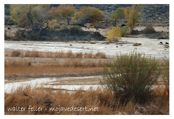
The Serrano and Vanyume tribes lived along the Mojave River, relying on the river’s intermittent flow for food and trade.
Trails used by these tribes would later become parts of the Mojave Road, Old Spanish Trail, and Salt Lake Road.
1850s–1870s: Pioneer Waystations and Early Ranching
1858: Aaron G. Lane establishes Lane’s Crossing on the Mojave River (present-day Oro Grande/Victorville area), offering rest and resupply to travelers heading west.
Lane is considered the first permanent American settler along the Mojave River.
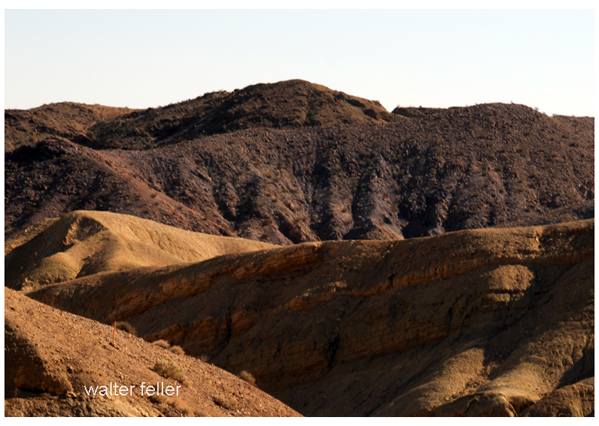
Summit Valley, near present-day Hesperia, sees increased grazing by early ranchers.
The Summit Valley Massacre (1866): A conflict between settlers and Native groups over livestock thefts and land disputes—an often overlooked but significant local tragedy.
1880s: Railroads and Town Foundations
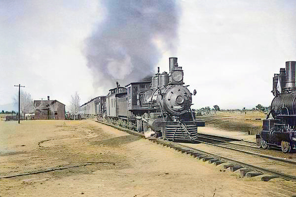
1885: The California Southern Railroad, part of the Atchison, Topeka and Santa Fe system, reaches the High Desert.
A telegraph and railroad station named Victor is established, later renamed Victorville in 1901 to avoid confusion with Victor, Colorado.
Jacob Nash Victor, the railroad manager, is the town’s namesake.
The Hesperia Land and Water Company, led by James G. Howland, promotes Hesperia. It lays out plans for an agricultural colony and resort town, though irrigation plans fall short.
1900s–1930s: Modest Growth and Agriculture
Hesperia experiments with vineyards, orchards, and dairy farms, but water shortages and harsh conditions hinder success.
Victorville grows as a railroad shipping center and stopover for travelers crossing the desert.
The Victor Elementary School District is formed in 1906.
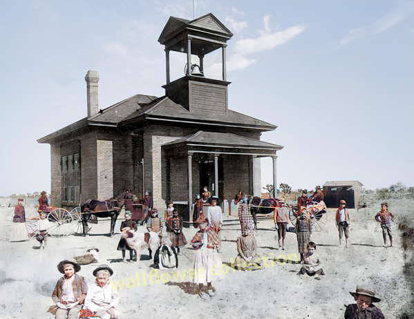
Early buildings still visible include the Hesperia Schoolhouse (Main St. and C Ave.).
1940s: War Changes Everything
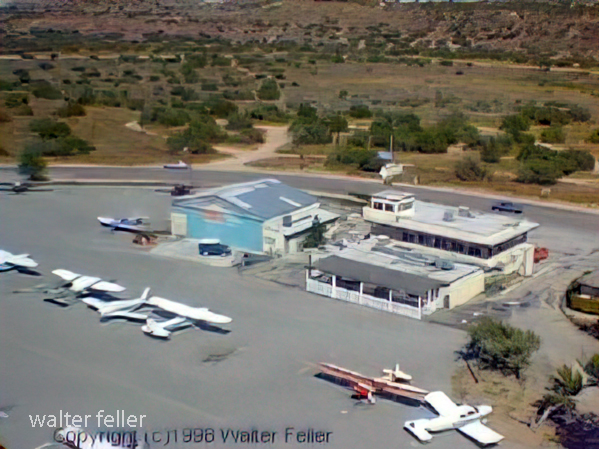
1941: Victorville Army Airfield (later George Air Force Base) is established on the western edge of Victorville.
The base brings thousands of military personnel, rapid infrastructure growth, and federal investment.
Apple Valley remains mostly desert ranchland, but interest grows due to its mild climate and open space.
1948–1950s: Apple Valley Booms
1948: Apple Valley Inn opens, built by Newt Bass and Bud Westlund to attract investors and wealthy land buyers.
Stars like Bob Hope, Marilyn Monroe, John Wayne, and President Eisenhower stayed at the inn.
Murray’s Dude Ranch (founded earlier, 1920s–30s): One of the few Black-owned resorts in the country. It hosted African American guests during segregation and was used in Black-cast Western films.
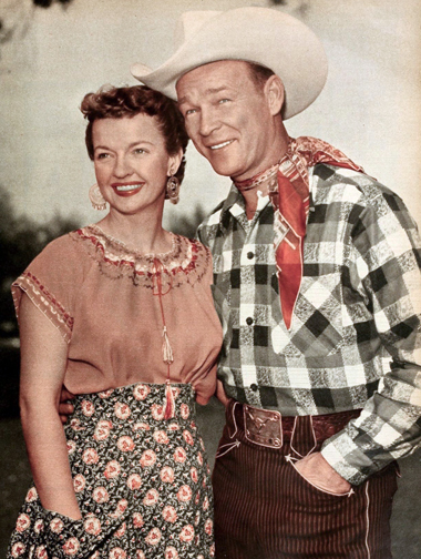
Roy Rogers and Dale Evans purchase a ranch in Apple Valley and become its most notable residents, eventually opening Roy Rogers’ Apple Valley Inn.
1950s–1960s: Expansion and Identity
Hesperia Inn and the Hesperia Golf & Country Club try to rekindle resort dreams. Jack Dempsey, the former boxing champion, lends his name to a museum at the inn.
Victorville grows with new housing and infrastructure to support the military population.
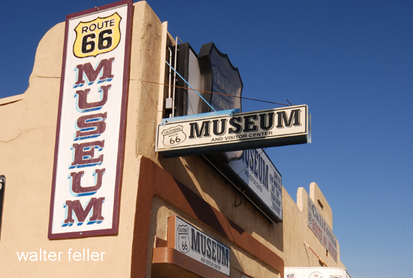
Route 66 runs right through Old Town Victorville, lined with diners, motels, and neon signs.
1970s–1980s: Steady Growth and Cultural Legacy
Apple Valley becomes a desirable retirement destination, marketing itself as a “Better Way of Life.”
Civic leaders like Bud Westlund and Newton Bass help shape the town’s modern layout and community services.
The California Route 66 Museum opens in Victorville in a former café, preserving the highway’s local legacy.
1992–2000s: Transformation and Reinvention
1992: George Air Force Base closes under federal military restructuring, dealing a blow to Victorville’s economy.
The base is repurposed into Southern California Logistics Airport (SCLA), an international freight and aerospace hub.
Apple Valley, Hesperia, and Victorville begin to urbanize, growing into commuter towns for the Inland Empire and the Los Angeles area.
2000s–Present: Modern Challenges and Historic Preservation
Victor Valley College, founded in 1961, continues to serve the region.
Old Town Victorville Revitalization Project aims to preserve the historic downtown.
Apple Valley promotes its Western heritage through the Happy Trails Highway and events honoring Roy Rogers and Dale Evans.
Hesperia Lake Park, Silverwood Lake, and local trails draw new visitors and recreation seekers.
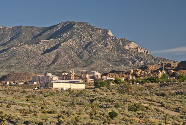
Mountain Pass, California, is an unincorporated community in San Bernardino County near the Nevada border along Interstate 15. It lies on the south flank of the Clark Mountain Range at about 4,730 feet in elevation. Before its transformation into a rare earth mining hub, Mountain Pass was part of a high desert rangeland used for cattle grazing and seasonal travel.
In the late 1800s, ranchers from Ivanpah and the Mojave River region grazed cattle along the area’s sparse grasslands and natural springs. By the early 1900s, a few homesteads, corrals, and line camps appeared, but permanent settlement was limited due to aridity and isolation. The nearest centers of activity were Cima and Ivanpah, tied to the Union Pacific line.
During the 1920s and 1930s, open-range ranching declined as highway construction and mineral exploration expanded. U.S. Highway 91, built through Mountain Pass in the 1930s, connected Barstow and Las Vegas and reshaped movement across the desert. Prospectors began testing local outcrops for copper, fluorspar, and uranium.
In 1949, while searching for uranium, geologists discovered bastnasite—a mineral rich in rare earth elements. By 1952, Mountain Pass Mine was in production, marking the shift from ranching to mineral extraction. The mine’s bastnasite ore, containing about 7% rare-earth oxides, proved exceptionally rich. Throughout the 1960s, 1970s, and 1980s, Mountain Pass supplied most of the world’s rare earth elements, which are critical for electronics and defense.
Environmental concerns and global competition, particularly from China, led to a decline in the 1990s. A series of wastewater pipeline spills and stricter regulations led to the closure in 2002. Molycorp reopened the site in 2010 but went bankrupt in 2015. MP Materials acquired it in 2017 and restarted production, now emphasizing on-site recycling and domestic refining. Mountain Pass currently produces 10–15 percent of global rare earth supply and remains the only major U.S. operation of its kind.
Timeline:
Late 1800s – Early cattle grazing begins between the Clark and Mescal Ranges. 1890s–1910s – Small ranchers and homesteaders establish corrals and wells near Cima and Ivanpah. 1920s – Ranching continues; U.S. Highway 91 construction increases access. 1930s–1940s – Grazing declines; mineral prospecting grows. 1949 – Bastnasite discovered while prospecting for uranium. 1952 – Mountain Pass Mine begins rare earth production. 1960s–1980s – Peak years; mine supplies most of the world’s rare earth elements. 1980s–1990s – Environmental issues and foreign competition led to a decline. 2002 – Mine ceases operations. 2010 – Molycorp reopens the mine. 2015 – Molycorp declares bankruptcy. 2017 – MP Materials resumes production. 2020s – Expansion of domestic processing and magnet manufacturing.
Mountain Pass stands as a symbol of changing desert economies—from open-range cattle country to strategic mineral industry—each era leaving its own traces: windmills, corrals, and open pits scattered across the Mojave’s high desert plain.
Big Bear, California, began as Yuhaaviatam homeland, later drawing gold seekers, ranchers, and dam builders. From Holcomb Valley’s 1860 rush to a four-season resort, its story blends natural beauty, resource ingenuity, and mountain tradition.
Prehistory • The Big Bear Valley has been inhabited for thousands of years by the Yuhaaviatam (Serrano) people, who live in seasonal villages and call the area “Yuhaaviat,” meaning “Pine Place.”
1845 • Benjamin Davis Wilson leads a posse into the San Bernardino Mountains in pursuit of raiders. The group encounters numerous grizzly bears and kills several, naming the area “Big Bear Valley.”
1850s • Early trappers and cattlemen moved through the San Bernardino Mountains. The valley remains largely remote and unsettled.
1860 • William F. “Bill” Holcomb discovers gold in Holcomb Valley, triggering a rush that brings hundreds of miners and creates mining camps such as Belleville, Union Town, and Clapboard Town.
1861–1862 • The Holcomb Valley boom peaks; San Bernardino County’s population surges. Belleville nearly becomes the county seat but loses to San Bernardino by two votes.
1863–1865 • Decline of the first gold boom as surface gold plays out. Miners leave, and the valley returns to quiet ranching and logging activity.
1870s • Elias J. “Lucky” Baldwin acquires mining claims around Baldwin Lake and forms the Gold Mountain Mining Company. A second wave of mining begins, centered on the Baldwin Mine.
1884 • Frank Elwood Brown, a Redlands citrus grower, constructs the first Bear Valley Dam, a single-arch granite structure. The reservoir created by this dam was named Big Bear Lake.
1890s • Big Bear’s role shifts from mining to recreation. Hunters, anglers, and early tourists begin to visit the mountain lake area. Lodges and cabins start to appear.
1903 • Lower-valley growers formed the Bear Valley Mutual Water Company to manage the reservoir and water rights.
1910–1912 • A new multiple-arch dam, designed by John S. Eastwood, replaces Brown’s dam, raising the lake level by about 20 feet and greatly expanding its capacity.
1920s • Roads improve, and the automobile brings increased tourism. The town of Pineknot develops on the lake’s south shore with lodges, stores, and resorts.
1930s • Winter recreation grows. Early ski runs are cut, and lodges cater to both summer and winter visitors. • 1938 – Pineknot officially changes its name to Big Bear Lake.
1940s • Big Bear becomes a year-round resort. During World War II, mountain roads were used for military transport training, but the area remained largely a recreation destination.
1950s • Big Bear Alpine Zoo opens as a rehabilitation center for injured wildlife (1959). • Ski development accelerates with lifts at Snow Summit.
1960s • Tourism and second-home construction expand rapidly. • The Big Bear Valley Historical Society was founded in 1967.
1970s • The community continues to grow, balancing tourism with environmental concerns.
1980 • The City of Big Bear Lake was incorporated on November 28.
1980s • Alpine Slide at Magic Mountain opens (1983). • Ongoing improvements in highways and infrastructure make Big Bear a popular four-season resort.
1990s • Big Bear becomes known for altitude training by professional athletes, including world-class boxers.
2000s–Present • Tourism, recreation, and environmental stewardship define the region. • The old 1884 dam remains a historical landmark, sometimes visible during low water levels. • Big Bear preserves its mountain-resort heritage while serving as a gateway to the San Bernardino National Forest.
Big Bear and the Digital Desert are closely related through geography, ecology, history, and human development. The Digital Desert’s broader Mojave focus naturally overlaps with Big Bear’s transitional mountain-desert setting in several key ways:
Geographic Connection Big Bear sits at the top of the Santa Ana River watershed, where mountain snowmelt begins the river’s underground journey to Southern California hills and valleys.
Ecological Transition Zone The region bridges montane and desert biomes. Pinyon-juniper woodlands, chaparral, and Joshua tree habitats meet higher-elevation conifer forests. This gradation provides examples of how altitude, temperature, and moisture shape plant and animal communities—central themes within the Digital Desert’s ecological framework.
Historical Ties Figures like William Holcomb and Lucky Baldwin tie Big Bear’s mining story to other desert mineral ventures, including Holcomb Valley’s influence on later Mojave mining booms. Trails from Big Bear connected to routes leading toward Lucerne Valley, Johnson Valley, and beyond—pathways that also appear throughout Mojave Desert exploration and settlement history.
Water and Infrastructure The Bear Valley dams (1884 and 1912) represent early Southern California water engineering that parallels other Digital Desert themes such as aqueducts, irrigation systems, and the transformation of desert hydrology. Big Bear’s water storage directly supported the agricultural valleys below, tying mountain runoff to desert life.
Cultural and Recreational Link Both Big Bear and the Mojave represent frontier landscapes turned into recreation destinations. The same pioneer spirit that shaped desert communities like Apple Valley or Hesperia carried over into Big Bear’s tourism development—cabins, roads, and storytelling built around rugged independence and mountain allure.
Interpretive Relationship Within the Digital Desert framework, Big Bear serves as a high-elevation counterpart—a living case study for water origins, ecological transition, and cultural continuity. It connects the snow-fed headwaters to the dry basins below, showing the mountain-desert system as one continuous, interdependent landscape.
Ecological Description
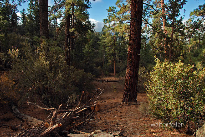
Big Bear Valley lies high in the San Bernardino Mountains, about 6,700 to 7,000 feet above sea level, forming a broad mountain basin surrounded by rugged granite peaks and forested ridges. The valley stretches roughly east–west, framed by Butler Peak and Delamar Mountain to the north, and Sugarloaf Mountain, Gold Mountain, and the San Gorgonio massif to the south and east.
The valley floor is relatively flat, a remnant of ancient glacial and erosional processes, with Big Bear Lake occupying its central depression. Originally a meadowed valley with creeks and marshes, it became a permanent lake after the Bear Valley Dams were built. The soils are derived from decomposed granite, supporting open forests and meadows interspersed with boulder-strewn slopes.
Ponderosa pine, Jeffrey pine, white fir, and incense cedar dominate the higher slopes. At the same time, black oak, manzanita, and chaparral fill the lower edges in sheltered meadows and along streams, willows and alders grow, creating rare wetland habitats for species such as the mountain yellow-legged frog and bald eagle.
The climate is alpine-mediterranean—cold, snowy winters and warm, dry summers—marked by dramatic seasonal shifts. Snowmelt feeds Big Bear Creek and Baldwin Lake, the latter a seasonal alkali flat on the eastern edge of the valley.
Ecologically, Big Bear Valley forms the upper boundary of the Mojave Desert drainage system. It captures mountain precipitation that ultimately seeps underground toward Lucerne and the Mojave River basin, linking the high forest to the desert below.
Timeline References
Big Bear Valley Historical Museum. “History of Big Bear Valley.” Big Bear Valley Historical Society, Big Bear City, CA.
BigBear.com. “Dam: The Creation of Big Bear Lake.” Big Bear Visitors Bureau.
BigBearCabins.com. “About Big Bear: A History.” Big Bear Cabins Travel Guide.
BigBearVacations.com. “A History of Big Bear.” Big Bear Vacations Blog.
San Bernardino County Museum Archives. “Mining and Settlement in the San Bernardino Mountains.”
Eastwood, John S. “The Multiple-Arch Dam of Bear Valley.” Engineering Record, 1912.
U.S. Forest Service. “San Bernardino National Forest: Ecological Subsections and Watershed Overview.”
Bear Valley Mutual Water Company. “Early Development and Water Rights History.”
Langenheim, Jean H., and P. H. Osman. “Vegetation and Ecology of the San Bernardino Mountains.” University of California Publications in Botany, 1959.
California Department of Fish and Wildlife. “Baldwin Lake Ecological Reserve Management Plan.”
San Bernardino Valley Water District. “Hydrologic History of the Bear Valley and Mojave River System.”
Wikipedia contributors. “Big Bear Lake, California.” Wikipedia, The Free Encyclopedia.
Wikipedia contributors. “Big Bear Valley Historical Museum.” Wikipedia, The Free Encyclopedia.
Brown, F. E. “The First Bear Valley Dam and the Redlands Water System.” Redlands Historical Society Papers, 1884–1905.
U.S. Geological Survey. “Geology and Hydrology of the Big Bear Lake Region, San Bernardino County, California.” Professional Paper Series.
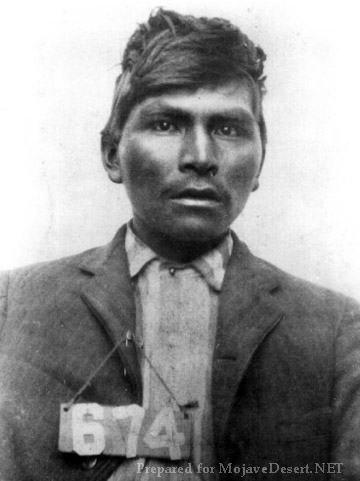
The story of Willie Boy is one of the most haunting and complex episodes in the history of the California desert. It begins in the early autumn of 1909, when a young Chemehuevi-Paiute man named Willie Boy falls deeply in love with Carlota, the daughter of a respected tribal elder. Their romance, set in the desert landscapes around Banning and Twentynine Palms, was as ill-fated as any tragic ballad of the Old West, and it ended in bloodshed, loss, and a manhunt that became part of American legend.
Willie Boy was about twenty-eight years old, a Chemehuevi from the Southern Paiute people, raised near the Colorado River but often working for white ranchers in the San Gorgonio Pass area. He was a quiet man, by most accounts, known for his skill as a runner and his ability as a capable worker. Carlota was sixteen, the daughter of William and Maria Mike, who lived with their people at the Oasis of Mara, now part of Joshua Tree National Park. Their families knew each other, but Chemehuevi tradition forbade marriage between cousins, which made the match impossible in the eyes of her father.
When Willie Boy and Carlota ran off together, they defied both cultural law and parental authority. They were brought back once, but they met again later that year when the Mike family traveled to Banning for the fall fruit harvest. The reunion of the two lovers set the final tragedy in motion. One evening in late September 1909, Willie Boy went to the Mike family’s camp near the Gilman Ranch to ask for Carlota’s hand. Her father, a strong-willed and traditional man, refused him flatly. Some say the older man reached for a gun, others that Willie Boy had brought one and lost his nerve. There was a struggle, a shot, and when the dust settled, William Mike lay dead. Whether the shooting was deliberate or accidental has never been settled.
Knowing that the white authorities would come for him, Willie Boy fled into the desert with Carlota. They rode and walked across the dry country east of Banning, following faint trails and water holes that only local people knew. When Maria Mike discovered her husband’s body at dawn, she reported the killing to the sheriff. Within hours, a posse had formed, led by Riverside County Sheriff Frank Wilson and his deputy Ben de Crevecoeur. With them were a handful of local ranchers and two Native trackers, John Hyde and Segundo Chino.
The chase that followed quickly became a national story. Newspapers painted Willie Boy as a savage outlaw, “a drunken Piute renegade” who had killed in a jealous rage and carried off a helpless girl. The language was raw, racist, and designed to sell papers. Reporters wrote that the “bloodthirsty Indian” might even threaten President Taft, who happened to be visiting Riverside that week. This hysteria turned a local tragedy into a full-blown legend.
Meanwhile, Willie Boy and Carlota pressed deeper into the Mojave. They moved mostly at night, hiding by day in the arroyos and canyons. Willie Boy’s endurance was remarkable; he could travel fifty miles across rough ground in a day. But they were running low on food and water, and the posse was relentless.
At some point during the pursuit, Carlota was killed. Her body was found later, shot through the back. Early newspaper reports said Willie Boy had murdered her so she would not slow him down. That version fit the outlaw story perfectly, but later investigations suggest otherwise. The coroner’s report showed she was shot from long range, likely by a posse member who mistook her for Willie Boy. She was wearing his coat at the time. Decades later, oral histories from the Chemehuevi confirmed that this is what their elders always believed: that the white men killed Carlota by mistake, then blamed her lover to save face.
After Carlota’s death, the posse pressed on. The final confrontation came at Ruby Mountain, near what is now Landers. Willie Boy took a defensive position among the rocks. As the posse approached, he opened fire, deliberately aiming for their horses rather than their riders. One deputy, Charlie Reche, was wounded in the arm. The standoff lasted all day until the lawmen pulled back to tend to the injured. At sunset, they heard a single gunshot from the mountain. They assumed Willie Boy had turned the gun on himself. When they returned a few days later, they found a badly decomposed body lying near a rifle and declared the manhunt over. They burned the remains on the spot rather than carrying them out of the desert.
That cremation left no evidence. No one could later prove that the body was Willie Boy’s, and none of the posse’s surviving photographs show a face that can be identified. This gap opened the door to one of the enduring mysteries of the story. Among the Chemehuevi, Paiute, and Cahuilla people, the belief persisted that Willie Boy escaped. They said he traveled north through the desert and eventually settled with relatives near Pahrump, Nevada, living quietly until tuberculosis took him years later. Segundo Chino, one of the trackers on the posse who later married Maria Mike, is said to have admitted that the posse never actually caught Willie Boy.
The events deeply shook the Chemehuevi community. They left their traditional home at the Oasis of Mara, afraid that William Mike’s restless spirit might bring misfortune. For many years, they refused to speak of the tragedy. In that silence, white writers filled the void. The newspapers portrayed Willie Boy as a villain and the manhunt as a piece of frontier nostalgia.
Half a century later, journalist Harry Lawton rediscovered the tale. Working from old newspaper clippings and interviews with surviving posse members, he published Willie Boy: A Desert Manhunt in 1960. His book treated the story as both history and myth, but it still leaned toward the posse’s version. The novel won awards and inspired the 1969 film Tell Them Willie Boy Is Here, directed by Abraham Polonsky and starring Robert Blake and Robert Redford. The film gave the story a tragic, modern edge and questioned some of the old assumptions, but it also cemented certain inaccuracies in popular memory.
In the 1990s, historians James Sandos and Larry Burgess revisited the story in The Hunt for Willie Boy: Indian-Hating and Popular Culture. They demonstrated how racism and sensationalism influenced the original reports and concluded that many of the most colorful details were fabricated. They agreed that Carlota was almost certainly killed by the posse, not by Willie Boy, but they accepted that he probably died on Ruby Mountain.
A generation later, Native historian Clifford Trafzer went further. Drawing on oral histories from Chemehuevi and Cahuilla elders, he argued that the man the posse burned was not Willie Boy at all. In the stories told by his people, Willie Boy survived the chase, lived for years among the Paiute in Nevada, and died quietly of illness. Trafzer’s work reframed the legend as a Native tragedy rather than a Western adventure.
For the Chemehuevi and other desert people, the story of Willie Boy and Carlota is more than a love story gone wrong. It represents the collision of two worlds: traditional tribal law and the laws of the new American order. It marks the loss of a way of life and the pain of a community forced into silence.
Today, the tale continues to echo across the desert. Artists and filmmakers have attempted to retell the story from the Native perspective. In 2016, Cahuilla artist Lewis de Soto created an installation in Twentynine Palms called Carlota, giving voice to the young woman whose story had long been overshadowed. In 2022, Jason Momoa produced The Last Manhunt, a film made in collaboration with the Chemehuevi that depicts the event as the tribe remembers it.
Whether Willie Boy died on Ruby Mountain or escaped into the Nevada desert may never be known. What is certain is that his story reveals how quickly truth can be twisted by fear and prejudice, and how long it can take for those who were silenced to be heard again.
The Willie Boy saga began as a local tragedy, became a legend through the press, and has endured as a window into the uneasy meeting of cultures in the desert. It reminds us that history is not fixed in stone, but lives in the voices of those who tell it, and that sometimes the best we can do is listen to all of them.
In the early 1990s, Rancho Lucerne was introduced as an ambitious master-planned development for Lucerne Valley. The proposal covered nearly 1,400 acres and envisioned 4,257 homes, a 27-hole golf course, and commercial amenities. A Draft Environmental Impact Report was released in 1993, and early grading even took place near the high school. To its backers, Rancho Lucerne promised to transform the valley from a quiet agricultural community into a suburban center.
But the project unraveled almost as quickly as it appeared. The financier behind Rancho Lucerne was charged with embezzlement, money dried up, and by 2001 the plan was abandoned. What remained was a scar of disrupted desert soil, a reminder of what might have been.
At first glance, this collapse may have seemed like a failed opportunity for growth. In reality, it became a turning point that preserved Lucerne Valley’s traditional identity. Without Rancho Lucerne, the valley avoided the massive shift toward suburban sprawl. Instead, it stayed closer to its roots—scattered ranch homes, small farms, alfalfa fields, and open desert stretching to the horizon. Growth continued on a modest, individual scale, with new homes built one lot at a time rather than through sweeping developments.
The deeper reason for resistance lay in water. Lucerne Valley relies on its underground aquifer, a fragile supply that has always been stretched between farms, families, and the desert ecosystem. A project of Rancho Lucerne’s scale—thousands of houses and a golf course—would have drawn heavily from this source. For many locals, that alone made the project unsustainable. By failing, Rancho Lucerne spared the valley from a major new demand on its water, leaving space for the slower pace of development that better fits the desert.
Even today, when the project resurfaces in planning discussions, conservation groups such as the Morongo Basin Conservation Association push back, citing water, wastewater, air quality, traffic, cultural resources, and environmental justice. The mood of the community leans strongly against large-scale development. Rancho Lucerne has become a kind of cautionary tale: a reminder that the valley’s future is best secured by honoring its agricultural heritage and protecting its limited resources.
Looking back, the unbuilt project didn’t just fade into history—it helped define the community’s values. By collapsing, Rancho Lucerne reinforced the belief that Lucerne Valley’s strength lies not in suburban expansion but in its rural heart, where water, land, and tradition are treated as treasures too rare to gamble away.
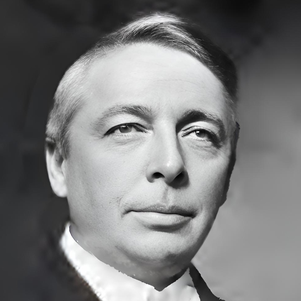
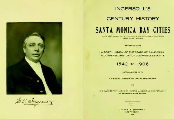
Luther A. Ingersoll was a journalist, editor, and historian active in Southern California in the late 19th and early 20th centuries. He is best known for compiling and publishing Ingersoll’s Century Annals of San Bernardino County, 1769–1904, a substantial local history volume released in 1904. This book is a detailed chronicle of San Bernardino County, California, combining early exploration, settlement, economic development, and biographical sketches of prominent citizens.
Here are a few key points about Luther A. Ingersoll:
Background: Not much is readily available about his early life, but he appears to have had a background in journalism and was active in publishing and historical writing.
Editor and Publisher: He worked in various editorial capacities and likely contributed to or edited newspapers in California. His writing style shows familiarity with both narrative history and biographical journalism.
Century Annals (1904): This was his best-known work and a common reference source for researchers studying early San Bernardino County. The book includes:
Explorations and Spanish mission history.
Rancho and pioneer development.
Biographical sketches (often based on submitted family or self-authored accounts).
Civic and institutional growth, including railroads, mining, and agriculture.
Methodology: Ingersoll’s work reflected the historiographical style of his time—often celebratory, biographically focused, and boosterish. Still, it captured primary recollections and early records that might otherwise have been lost.
Legacy: Despite some historical inaccuracies or omissions, Century Annals remains one of the foundational regional histories for San Bernardino County and is still cited in local historical studies.
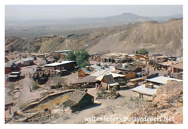
Calico Ghost Town is a fascinating destination that offers a glimpse into the past, specifically the boom-and-bust era of the American West. Here’s a detailed look at what makes Calico Ghost Town a popular attraction:
History of Calico Ghost Town
Founding and Boom Era: Calico was founded in 1881 during the California silver rush. At its peak, the town boasted over 500 mines and produced millions of dollars worth of silver ore.
Decline: By the mid-1890s, silver prices had plummeted, leading to the decline of mining activities. Calico was largely abandoned by the early 20th century, becoming a true ghost town.
Attractions and Activities
Mine Tours:
Maggie Mine: This is one of the few mines in Calico that is safe for tourists to enter. Visitors can take a self-guided tour to learn about the mining techniques and see the remnants of the silver extraction process.
Calico Odessa Railroad: A narrow-gauge train ride that offers a scenic tour of the town and the surrounding mining areas, providing insights into the town’s mining history.
Historical Buildings:
Lane’s General Store: Restored to its 1880s appearance, this general store offers a variety of souvenirs and historical artifacts.
Schoolhouse: A replica of the original schoolhouse where children of miners once studied. It now serves as a museum displaying educational artifacts from the era.
Lil’s Saloon: A typical Old West saloon where visitors can enjoy refreshments and imagine the lively atmosphere of Calico during its heyday.
Living History and Reenactments:
Gunfight Shows: Regularly scheduled reenactments of gunfights and skirmishes typical of the Wild West, performed by actors in period costumes.
Ghost Tours: Evening tours that delve into the spookier side of Calico’s history, sharing ghost stories and legends associated with the town.
Shops and Craft Demonstrations:
Blacksmith Shop: Demonstrations of traditional blacksmithing techniques, with the opportunity to purchase handmade metal items.
Pottery and Leather Shops: Artisans demonstrate their crafts, offering unique, handmade goods for sale.
Special Events:
Calico Days: An annual festival celebrating the town’s history with parades, live music, and old-fashioned games.
Ghost Haunt: A Halloween-themed event featuring haunted attractions and spooky activities for all ages.
Natural Surroundings
Hiking Trails: Various trails around Calico offer hiking opportunities with views of the desert landscape and remnants of old mining operations.
Desert Flora and Fauna: The area is home to unique desert plants and wildlife, complementing the historical attractions.
Visitor Information
Accessibility: Calico Ghost Town is easily accessible from major highways and offers ample parking for visitors.
Facilities: The site includes picnic areas, restrooms, and camping facilities for those wishing to extend their visit.
Significance
Educational Value: Calico Ghost Town serves as an important educational resource, teaching visitors about the history of mining, the lifestyle of early settlers, and the economic forces that shaped the American West.
Preservation: The town has been designated a California Historical Landmark and is maintained by the San Bernardino County Regional Parks system, ensuring its preservation for future generations.
Calico Ghost Town offers a unique blend of history, entertainment, and education, making it a must-visit destination for anyone interested in the rich heritage of the Mojave Desert and the American West.
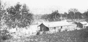
When our family moved to Devore in 1948, Glen Helen was home to Doc and Belle Davis, but in 1952 it became a County working farm growing all kinds of crops, from potatoes to asparagus. Hereford and Angus cattle ranged on many acres of pasture, and 50 acres were planted to alfalfa. Horses were used to round up and rope cattle.
Prisoners that did the farm work were trucked in from the Chino Men’s Prison, and the farm overseer was Tony Gianinni. Two of his three children, Carl and Paula, became our playmates.
According to Carl (Gianinni) Durling, Glen Helen Farm consisted of about 1,300 sprinkler-irrigated acres out of 2000, some 800 acres dry farmed, and leased grazing land brought the total to 4,000 acres of useable land.
BEFORE MY DAY
Early records call the place Glen Hellen. One of the “l”s was dropped from Hellen between 1888 and 1900. Many rumors exist about the origin of the name, but there is no official reason for the name Glen Helen.
George and Sarah Martin were listed in the 1870 census as owning 2,700 acres of land at the lower end of Cajon Pass worth about $10,000. They had purchased it in 1864 when it was on the delinquent tax list. Mrs. Foote and Jesse Martin were also associated with Glen Helen.
They shared their abode with military men, private citizens, and newspaper reporters, among others who traveled through. During the Civil War, a Union Post under the command of Col. William Hoffman, called Camp Cajon, was located at Martin’s Ranch.
Reportedly, up to 2,360 acres of the Muscupiabe Rancho went directly to the Martins. Names of Hancock and Wilson and Muscoy Water Company have also been associated with the property. And John and Nettie Cole co-owned part of it with Wilson in the late 1800s for a Jersey breeding farm.
When George Martin died in 1874, his oldest son, Archibald, started selling the Martin property. However, the name Martin’s Ranch clung to the property through several other owners. One of those owners apparently threw some lavish parties that were attended by people from town, as well as county residents.
Another son of George and Sarah, Samuel Martin, built his home at the foot of the Mojave Trail near Cable Canyon in 1873. A third son, George, is also listed in the 1887 County Directory as living in the “Martin’s District,” which covered lower Cajon Pass, the Devore area, and the Verdemont area. In 1882, Samuel Martin sold 300 acres to Julius Meyer, who developed much of Verdemont.
In the early 1900s, the Terribilini brothers ran a dairy on Glen Helen, and then the property passed into the hands of the Muscoy Water Company. John Terribilini married Lily Bubier, whose family also lived in that area, and moved up the dirt road, now paved and called Glen Helen Road.
In 1926 the Muscoy Water Co. sold its Glen Helen holdings to Jonas and Roof, who formed the Muscoy Syndicate. By 1930 the Syndicate owned 5640 acres of irrigable land with only 3000 irrigated. G.S. Towne bought back the Muscoy Water Company in 1936, and in 1948 the Muscoy Water Co. sold 2,079 acres of Glen Helen to San Bernardino County. Its extensive water ditch had not been used in years, the whole plan having been destroyed by the flood of 1938.
During this time, Doc and Belle Davis lived at Glen Helen until the county decided to start its farm. Also, Gene and Liz Grogan and their children Susan and Nick lived there in 1969-70 because Billy and Thelma Beardsley had moved their horse training stables to Glen Helen, and Liz worked for them. Thelma was also the music director for County Schools. After Glen Helen became a park, the Grogans moved onto Cajon Blvd., where Liz, a vocal county government watchdog, could keep her horses.
Look for more on Glen Helen!
Photo 1—A view of Martin’s Ranch circa 1870, later Glen Helen. Photo found in the San Bernardino County Archives.
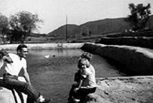
Photo 2—Tony Gianinni and his children check the Glen Helen reservoir in the early 1950s. Photo sent via e-mail by Carl Gianinni Durling.
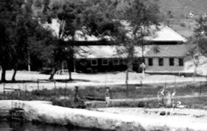
Photo 3—The Glen Helen barn housed the cattle and horses in 1952. Photo via e-mail from Carl (Gianinni) Durling.
Of all the brother acts operating in and around San Bernardino County during the Mormon period, Few accomplished more for the ultimate benefit of the area than the Stoddard boys, Arvin and Sheldon.
Neither cut an imposing figure. Arvin, the quiet one, was only 5’5″ tall and weighed 135 pounds soaking wet, while Sheldon wasn’t much larger. But what they lacked in height, they more than made up in spirit.
Arvin, however, had an imposing ally in his wife Caroline. She was 6 feet tall and weighed well over 200 pounds — a formidable Amazon and an extremely vocal one too. One is tempted to ask if she carried him across the threshold on their wedding night.
She became Arvin’s mouthpiece and did not hesitate to make her opinions known, particularly when the chips were down. As their grandson, R. Jackson Stoddard wrote in the March 1970 issue of the LA Westerners Branding Iron, “For although she followed the will of her husband, in many cases the will of her husband was truly only a reflection of her own wants and desires.”
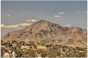
Stoddard Mountain
Today, a stretch of the Mojave Desert between Victorville and Daggett is blanketed with sites bearing the Stoddard’s names. They include the Stoddard Mountains, Stoddard Hills, Stoddard gulch, Stoddard Valley, Stoddard Well and Stoddard Wells Road — all directly attributable to Arvin’s work in the area during the 1850s and 60s.
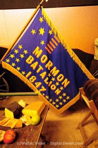
Flag of the Mormon Battailion (note spelling)
There were four Stoddard Brothers at the beginning; Rufus, Albert, Arvin and Sheldon, who were all born in Canada. When their father died in 1838, mother Jane gathered them all up and crossed the United States border, first to Ohio in then to Warsaw, Illinois, where she became hooked on the Mormon religion. When the church made it’s great trek to Salt Lake City in 1847, she and her boys were in the initial contingent.
Rufus was the first of the boys to reach California, arriving in San Diego as a member of the MormonBattalion. After his group was disbanded in Los Angeles, he remained in the area for almost a year before he rejoining his family at Salt Lake City in 1849.
Sheldon was the next to go. Leaving Salt Lake in 1848, along with 30 other men found for the placer diggings near hang town, they traveled as far as Mountain Meadows with a larger company who hired Capt. Jefferson Hunt to guide them to Los Angeles over the Old Spanish Trail.
At the Meadows they left Hunt’s party and turned west to take what they thought was a shortcut to the gold fields and for the next 17 days blindly followed a false trail without a guide, compass or map to go by.
On the 18th day, hopelessly lost in facing death without water their lives were spared when a sudden rain squall drenched the area. As Sheldon later wrote, “We caught the water by spreading out our rubber blankets on the ground and drank it with a spoon.”
They then turned east on the Muddy River, followed at South until they fortunately encountered Capt. Hunt’s company again and accompanied it up the Mojave River, through Cajon Pass and down to the Chino Ranch.
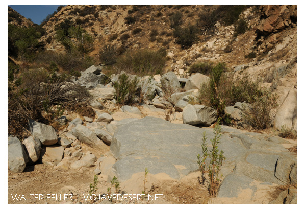
Crowder Canyon – Old Spanish Trail
Tragically enough, on the same trip another group of would-be minors left Hunt’s command at Provo, Utah, insisting they also knew a shorter route to the gold fields, only to blunder into Death Valley, where five died before the survivors made it to Los Angeles.
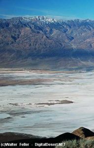
Death Valley
From Chino the party went on to Mariposa, where they broke up to mine, while Stoddard ran a trading post in nearby Carson Valley for a few months before returning to Salt Lake with a herd of horses and mules.
in March 1851 Sheldon married Jane Hunt, daughter of Capt. Hunt, and the following month they accompanied the first group of Mormon colonizers to the San Bernardino Valley, making temporary camp at Sycamore Grove.
After the Mormons purchased the San Bernardino Rancho that September, and moved down into the valley, Sheldon built the first log cabin in the settlement on First Street,, west of I Street. His cabin was later moved to and made part of the Westside of this stockade constructed on the present courthouse site as protection against hostile Indians.
For the next 14 years Sheldon Stoddardwas engaged in freighting and carrying mail between San Bernardino and Salt Lake City, crossing the Mojave 24 times in all. In 1865 he made one trip to Nevada in Montana with a mule team which covered over 1300 miles, and took six months to complete.
Arvin Stoddard and his wife also came to San Bernardino with the first Mormon train and lived in the stockade for three years before receiving an urgent message from Mormon leader Brigham Young, authorizing him to investigate a gold strike in the Calico Hills to see if he could ” obtain as much gold as possible to help finance the founding and furtherance of the faith,” keeping only enough to live on during the venture.
Calico Hills
Arvin and Caroline, ardent church devotees, packed their wagon and with their poor young children in tow, headed for the hills without hesitation.
Mojave River at Afton Canyon
But before looking for gold, Arvin searched for water to raise crops to feed his family and stock and to flush through sluice boxes used to separate flakes of gold from the desert sand.
One of his more successful wells, known as Stoddard Well, is still flowing today and besides furnishing the family with ample water, also provided an impetus for others to break out a new road on almost a straight line from Lane’s Crossing, near today’s Oro Grande, to Fish Ponds Station between present-day Barstow and Daggett, thereby saving many miles compared with the old route, which followed the westward band of the Mojave River.
Although it took him almost 8 years of prospecting, Arvin finally struck a rich claim and extracted a sum that Caroline estimated at $60,000 before calling it quits and lighting out for Salt Lake City to hand to Brigham Young.
But before they reach the Mormon Temple, they were held up by Indians and robbed of all their hard-earned loot, except for a few thousand dollars hidden in Caroline’s underwear.
As her grandson related, “The Indians were neither red nor brown. they were more white than any Indian she (Caroline) had ever seen.” Caroline deduced they were renegade Mormons, acting on behalf of the church, and although her suspicions were never resolved, her once benevolent attitude toward the Mormon hierarchy changed overnight and led to her eventual break with the church.
In 1869 the Arvin Stoddards move to Milford, Utah, where they build a hotel called, naturally, “The Stoddard House,” where they lived until Caroline died in 1904.
Sheldon Stoddard remained in San Bernardino for the rest of his life, Rev. and honored by all who knew him for his contributions to the county and state.
Blue Cut – Cajon Pass
After serving as president of the pioneer society, he spent his final years surrounded by old friends like John Brown and Billy Holcomb. They camped and fished together in their mountain retreats and dedicated monuments to the pioneers in Cajon Pass. he was active up to the day of his death in 1919 at the age of 89.
From:
Heritage Tales 1988 by Fred Holladay published by the City of San Bernardino Historical and Pioneer Society