Cudahy Camp, Old Dutch Cleanser, and the Wonders of Last Chance Canyon

Cudahy Camp: A Glimpse into the Past

Nestled in the El Paso Mountains, Cudahy Camp is a historical landmark in the early 20th-century mining industry. From 1923 to 1947, this site was the primary source of pumice used to manufacture ‘Old Dutch Cleanser,’ a widely known cleaning product in the United States. At its peak, the camp employed 12 men who produced 100 tons of pumicite weekly. Today, visitors can explore the remnants of the camp, including concrete foundations and large hollowed-out rooms from the mining operations.

The Evolution of Old Dutch Cleanser

Old Dutch Cleanser’s journey began in 1905 when the Cudahy Packing Company, a meatpacking firm, developed the product to repurpose animal fat. The cleanser, made by combining soap with pumicite, quickly became a household staple due to its effectiveness. The brand’s logo, featuring a Dutch woman chasing dirt with a stick, symbolized cleanliness and helped the product gain widespread recognition.

In the 1920s and 1930s, Old Dutch Cleanser was heavily promoted through advertisements and civic events like “Clean-Up Week,” encouraging community participation in cleaning efforts. These campaigns solidified the product’s place in American homes and contributed to its lasting legacy.

Corporate Changes and Present-Day

In 1955, Purex acquired Old Dutch Cleanser from the Cudahy Packing Company. The brand changed hands again in 1985 when Greyhound Corporation’s Dial division purchased Purex. Despite these transitions, Old Dutch Cleanser remained a trusted cleaning product. It is manufactured by Lavo in Montreal and continues to uphold its reputation for quality (6/2024).

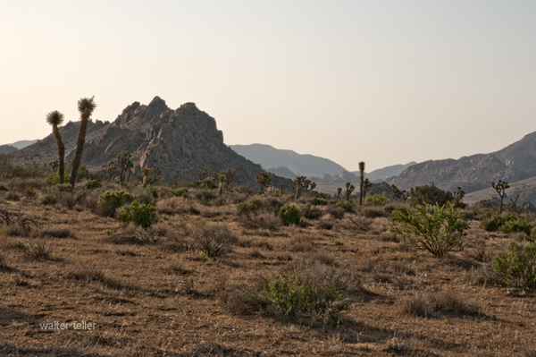
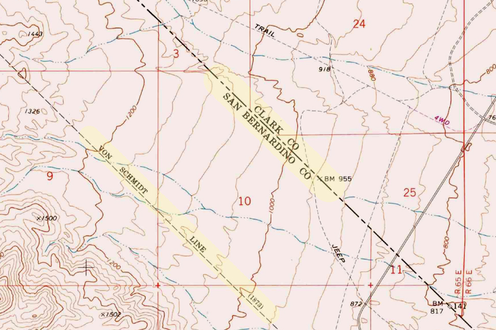
Last Chance Canyon: A Scenic and Historic Site

Last Chance Canyon, part of the El Paso Mountains, is a significant historical and natural site. It offers a unique glimpse into the area’s rich mining history, including the famous Burro Schmidt Tunnel. The canyon features a rugged landscape with geological formations, box canyons, and historical mining sites. This area was heavily mined from the 1890s through the 1920s, with various operations continuing into the late 20th century.

Visitors to Last Chance Canyon can explore the remains of mining camps, such as Bickel Camp and the Holly Ash Mine, alongside the Old Dutch Cleanser mining site. The canyon is also known for its beautiful scenery, including rock-walled sandy canyons and spectacular layered cliffs.

Cultural Significance and Enduring Legacy

Old Dutch Cleanser has significantly impacted American culture, from being featured in popular media to becoming part of civic traditions. Its memorable branding and consistent advertising have made it a recognizable name in household cleaning. The El Paso Mountains and Last Chance Canyon now serve as historical sites, offering a window into the past for those interested in industrial history and heritage.

For more details, you can visit the Old Dutch Cleanser history page and read about the Cudahy Camp and Last Chance Canyon online.

.

#2 – Joshua Tree National Park

Park Features

  1. Unique Flora and Fauna: The park is renowned for its namesake Joshua Trees (Yucca brevifolia), which give the landscape an otherworldly feel. It also has various desert plants and animals, including cacti, wildflowers, bighorn sheep, and desert tortoises.
  2. Stunning Landscapes: The park’s diverse landscapes include rugged mountains, stark desert plains, and unique rock formations. These features provide breathtaking views and excellent opportunities for photography.
  3. Recreational Activities: Joshua Tree NP is a haven for outdoor enthusiasts. Popular activities include hiking, rock climbing, camping, and stargazing. The park’s clear skies and lack of light pollution make it an excellent spot for astronomy.
  4. Rock Climbing: The park is a world-class destination for rock climbers, offering thousands of climbing routes of varying difficulty. The unique granite rock formations attract climbers from all over the globe.
  5. Cultural and Historical Significance: The park has a rich cultural history, with evidence of human habitation dating back over 5,000 years. Visitors can explore historical sites, including remnants of old mines, homesteads, and Native American petroglyphs.
  6. Accessibility: Its proximity to major urban centers like Los Angeles, San Diego, and Las Vegas makes it an accessible destination for both day-trippers and longer visits.
  7. Varied Ecosystems: Joshua Tree NP spans the convergence of two distinct desert ecosystems—the Mojave and the Colorado Deserts. This unique positioning offers a variety of environments within the park, each with its own distinct flora and fauna.

These factors, combined with the park’s natural beauty and recreational opportunities, make Joshua Tree National Park a popular destination for nature lovers, adventurers, and tourists alike.

The Von Schmidt Boundary

(1873)

The Von Schmidt boundary, or the Schmidt Line, refers to a historical boundary line in California. It was surveyed and established by Alexey von Schmidt, a Russian engineer, in the 1860s. The purpose of the Von Schmidt boundary was to delineate the border between California and Nevada during a time when there was confusion and disputes over the exact location of the state boundary.

Von Schmidt’s survey helped clarify the boundary and resolve conflicts between California and Nevada. His efforts included placing markers and monuments along the boundary line to make it clear and permanent. The boundary he established still exists today and is the official border between the two states.

The Von Schmidt boundary is of historical significance and has been preserved as a reminder of the surveying and boundary disputes of the past. It is located in the eastern part of California near the Nevada border.

Why was the initial boundary incorrect?

The initial boundary between California and Nevada was incorrect and subject to disputes for several reasons:

  1. Lack of Accurate Surveys: In the early years of California’s statehood and during the Gold Rush era in the mid-19th century, limited resources and technology were available for accurate land surveys. As a result, the initial surveys and boundary markers were not precise.
  2. Rush for Mineral Resources: The discovery of gold and other valuable minerals in the region led to a rapid influx of settlers and miners. This rush created a need for clear land boundaries and property rights. However, the focus was often on extracting resources rather than conducting precise surveys.
  3. Overlapping Claims: Different parties, including miners, settlers, and land speculators, had conflicting claims to land in the region. These overlapping claims added to the confusion regarding the exact location of the state boundary.
  4. Political Disputes: California became a state in 1850, and shortly thereafter, disputes arose over its eastern boundary. Nevada was not established as a separate territory until 1861. Political disagreements and conflicting interpretations of earlier treaties and agreements existed during this period.
  5. Multiple Surveys: Various individuals and surveyors attempted to establish the boundary, but their surveys often differed. This further complicated matters.

Given these factors, there was much uncertainty and disagreement regarding the California-Nevada boundary in the early years. It was only through the efforts of surveyors like Alexey von Schmidt and subsequent legal and political resolutions that the boundary was eventually clarified and accepted. Von Schmidt’s survey work played a crucial role in resolving these disputes and establishing a more accurate boundary line.

Aurora

Aurora, Nevada 1910

The town of Aurora, Nevada, experienced a move due in part to the boundary disputes between California and Nevada. Aurora was originally founded in the 1860s during the Nevada Silver Rush. At its founding, the exact location of the California-Nevada border was still uncertain and subject to disputes.

As a result of the boundary disputes and the fact that Aurora’s initial location was close to the border, there were concerns about which state’s jurisdiction the town fell under. Aurora’s residents and businesses moved the town slightly to the east, further into Nevada’s territory, to avoid potential legal and tax issues. This move ensured that Aurora would be firmly within the boundaries of Nevada when the border dispute was eventually resolved.

The relocation of Aurora was a strategic decision made to secure the town’s status as part of Nevada rather than California, given the uncertainties and conflicts related to the state boundary at the time. This move allowed Aurora to thrive as a mining town in Nevada without the legal complications associated with straddling the border.

Is everybody happy?

It’s difficult to determine whether “everybody” is happy, as people’s feelings and satisfaction with their circumstances can vary widely. Happiness is subjective and depends on individual experiences, perspectives, and circumstances.

In the context of the town of Aurora’s relocation due to boundary disputes, it’s possible that the decision to move was made to address specific legal and jurisdictional concerns at the time. The move may have been necessary for the town’s continued growth and prosperity. However, whether every resident or stakeholder was happy with the decision would depend on their perspectives and interests.

In any community or population, there will be a range of opinions and emotions regarding significant decisions like a town’s relocation. Some may have been happy with the move because it resolved legal uncertainties, while others may have been less pleased due to the disruption and changes associated with relocation.

To determine the current happiness or satisfaction of people in a specific context, it would be necessary to conduct surveys or interviews to gather their perspectives and opinions.

U.S. Highway 395

U.S. 395

U.S. Highway 395, often simply referred to as Highway 395, is a north-south highway that runs through the western part of the country. It spans approximately 1,300 miles (2,092 kilometers) from southern California to the border of Washington and Canada.

Part of this highway passes through the Mojave Desert in California. The Mojave Desert is known for its arid landscape, unique geological features, and desert flora and fauna. Highway 395 offers travelers the opportunity to experience the beauty and solitude of the Mojave Desert while providing access to various points of interest along the way.

Here are some key points about U.S. Highway 395:

  1. Route: U.S. 395 starts in Southern California and travels north through California, Nevada, Oregon, and Washington before reaching the Canadian border near Laurier, Washington. It roughly follows the eastern side of the Sierra Nevada mountain range.
  2. Scenic Route: Highway 395 is renowned for its scenic beauty and passes through a diverse range of landscapes, including deserts, mountain ranges, valleys, and forests. It offers breathtaking views of the Sierra Nevada Mountains, Mono Lake, and the Eastern Sierra.
  3. Recreation: The highway provides access to numerous outdoor recreational opportunities, including hiking, skiing, fishing, camping, and boating in the various natural areas it traverses.
  4. Historical Sites: U.S. 395 also passes by several historical sites and attractions, such as the Manzanar National Historic Site (a former Japanese internment camp during World War II), the Eastern California Museum, and various mining and pioneer heritage sites.

Some notable places and attractions along U.S. Highway 395 in the Mojave Desert region include:

  1. Red Rock Canyon State Park: Located near Ridgecrest, this park features stunning red rock formations and hiking trails.
  2. Alabama Hills: Famous for its distinctive rock formations and used as a filming location for many Western movies.
  3. Manzanar National Historic Site: This site was once a Japanese internment camp during World War II and now serves as a reminder of this important period in American history.
  4. Death Valley National Park: While not directly on Highway 395, it’s a short drive to this famous national park known for its extreme heat, Badwater Basin, and unique desert landscapes.
  5. Lone Pine: A charming town with access to the Eastern Sierra, Mount Whitney, and the Eastern Sierra Visitor Center.
  6. Bishop: A larger town along the highway known for outdoor recreation, including fishing, hiking, and rock climbing.
  7. Mono Lake is a unique and ancient saline lake near Lee Vining with striking tufa towers.

Travelers along U.S. Highway 395 can experience the stark beauty of the Mojave Desert, explore its geological wonders, and access various outdoor recreational opportunities. It’s a popular route for road trips and exploration of California’s eastern Sierra region.

Overall, U.S. Highway 395 is a significant transportation corridor in the western United States, known for its stunning scenery, recreational opportunities, and historical significance. It offers travelers a chance to explore diverse landscapes and experience the beauty of the American West.

Midland Trail

Sierra Highway

Mormon Fort, Las Vegas, Nevada

https://digital-desert.com/mormon-fort/

The Mormon Fort in Las Vegas, Nevada, is a historic site that holds significance in the region’s history. It is also known as the Old Mormon Fort State Historic Park. The fort represents the birthplace of Las Vegas and is considered the first permanent, non-native settlement in the Las Vegas Valley.

Here are some key points about the Mormon Fort:

  1. Establishment: The fort was established by a group of Mormon missionaries led by William Bringhurst in 1855. They were sent to the area to establish a way station along the Old Spanish Trail.
  2. Purpose: The Mormons built the fort to provide a place for travelers and settlers to rest and replenish supplies as they journeyed through the region. It served as a crucial stop for those traveling between Salt Lake City and Southern California.
  3. Abandonment: Due to conflicts with local Native American tribes and other challenges, the Mormons abandoned the fort in 1857.
  4. Later History: The fort had various uses over the years, including serving as a ranch and a military post. In the early 20th century, efforts were made to preserve and restore the site.
  5. State Historic Park: Today, the Old Mormon Fort is a state historic park managed by the Nevada Division of State Parks. It offers visitors a glimpse into the area’s past, featuring reconstructed adobe buildings and interpretive exhibits.
  6. Location: The Mormon Fort is located in downtown Las Vegas, near the intersection of Las Vegas Boulevard and Washington Avenue.

Visitors to the Mormon Fort can explore the historic structures, learn about the early pioneers who settled in the area, and gain insights into the challenges faced by the original inhabitants. The site provides a contrast to the modern development of Las Vegas and highlights its historical roots.