Needle’s Eye

Inyo Canyon, Death Valley National Park

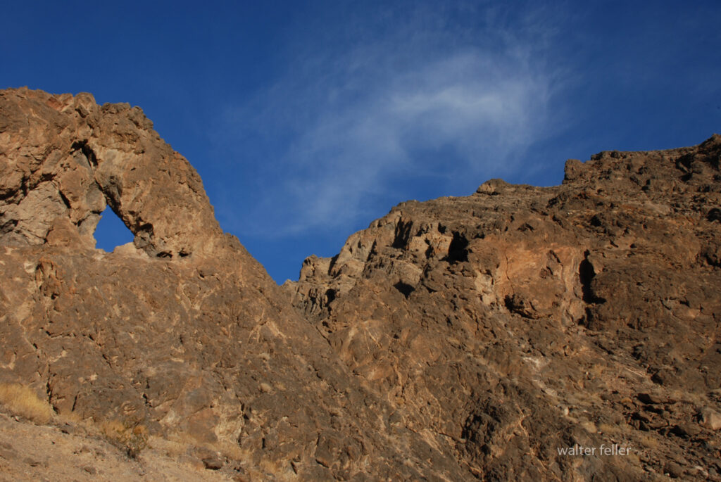
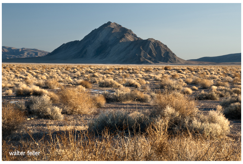
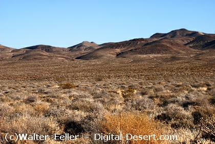
The Needle’s Eye is a narrow rock portal in the upper section of Inyo Canyon on the west side of the Funeral Mountains. It sits in a remote tributary draining toward the lower end of Death Valley. The feature is a natural window carved into steep canyon walls where erosion exploited weaker zones in the bedrock, leaving a tight, vertical opening that frames the sky from the canyon floor. The canyon itself is a classic debris-cut gash through Paleozoic formations associated with the Inyo Mountains and the Cottonwood block uplift.

Travel to the Needle’s Eye follows old miner and prospector routes up Inyo Canyon toward workings scattered along the western flank of the range. The canyon exhibits evidence of washouts, slumping, and boulder chutes, which were produced by cloudbursts and winter runoff. Side slopes exhibit talus fans and dryfalls that mark intervals of rapid erosion. The rock types shift from limestone and dolomite to more resistant quartzites in the upper reaches, with the Needle’s Eye forming at a contact of contrasting hardness.

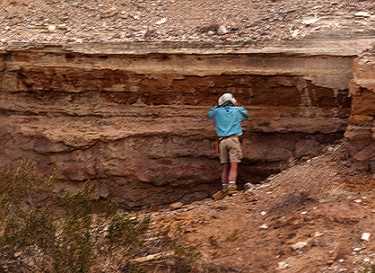
Human activity in Inyo Canyon dates back to early prospecting waves in the late 1800s and early 1900s. Small diggings, adits, and tent camps once dotted the margins of the canyon. Miners used the route as an access path while searching for lead, silver, and other minerals typical of the Cottonwood and Inyo belts. No permanent settlement survived the lack of water, rugged terrain, and unreliable ore bodies. Occasional surveyors and desert wanderers later described the canyon’s narrow rock door as a striking landmark.

The Needle’s Eye fits naturally into the region’s long tradition of desert travel through constrained bedrock points. It shares similar features with those found elsewhere in the Mojave, where travelers have passed through tight clefts or rock windows while following natural drainages. The spot also marks a transition between lower alluvial slopes and the more rugged upper canyon, giving it prominence on foot routes. Today, it offers a quiet reminder of past use and the steady work of water and gravity shaping the canyon.

References

Burchfiel, B. C., and Davis, G. A. 1981. Mojave Desert and Inyo Mountains tectonic studies. Geological Society of America Bulletin.
Hunt, C. B. 1975. Death Valley: Geology, Ecology, Archaeology. University of California Press.
McAllister, J. F. 1956. Geology of the Furnace Creek Quadrangle, Death Valley, California. USGS Professional Paper 354.
Nolan, T. B. 1928. Geology of the Inyo Range and the White Mountains. University of Nevada Bulletin.
Storz, J. 1970s. Desert Magazine articles on Death Valley side canyons and miner routes.
Wright, L. A., et al. 1974. Geology of the Death Valley region. California Division of Mines and Geology Special Report series.
USGS. 1988. Geologic Map of the Death Valley Region, California and Nevada. Miscellaneous Investigations Map I-1933.
NPS. Death Valley National Park Backcountry and Wilderness Access Guides (Inyo Canyon section).
NPS. 1994–present. Death Valley National Park administrative files on backcountry routes and cultural resource surveys.
Stovall, H. 1930s–1940s. Notes of prospecting and travel in the Inyo and Cottonwood Mountains (archival field notebooks cited in regional mining histories).

Mojave Trough

In the Cultural Resource Overview for the Amargosa–Mojave Basin Planning Units (Warren et al., 1980), the study divides the region into four core planning units—each representing a major physiographic and cultural zone within the central Mojave Desert. These units form the backbone of what the Bureau of Land Management termed the Amargosa–Mojave Basin Planning Units, encompassing roughly 2.7 million acres between Death Valley and the Mojave River region.

Here’s the list with concise descriptions:


1. Bitterwater Planning Unit
Located along the southern margin of Death Valley National Monument, this unit includes the Silurian Valley, Salt Springs Hills, and parts of the Avawatz Mountains. It forms the northernmost segment of the Mojave Trough system and includes ancient playa remnants that preserve Lake Manly’s southern extensions.

2. Owlshead/Amargosa Planning Unit
Covers the Owlshead Mountains, Amargosa River Valley, and adjoining Funeral Range area. It bridges the Death Valley drainage to the north and the Mojave Basin to the south, containing key pluvial lake basins and rich archaeological deposits from the Lake Mojave and Pinto periods.

3. Kingston Planning Unit
Centered on the Kingston Range and Shadow Valley, this unit encompasses higher-elevation terrain with pinyon-juniper woodlands and evidence of upland seasonal use by prehistoric groups. It marks the ecological transition between the Mojave lowlands and the Great Basin uplands.

4. Mojave Basin Planning Unit
The largest and most southerly unit, it includes the Mojave River corridor, Cady and Soda Mountains, Broadwell and Soda Lakes, and the Cronese Basin. It serves as the principal connective trough between the Mojave River drainage and the Amargosa system, historically linking inland desert populations and later Euro-American travel routes.


Each of these planning units was chosen to represent a complete ecological cross-section—from valley floor to mountain rim—allowing researchers to analyze how prehistoric and historic populations adapted across environmental gradients. In your core project framework, these correspond to the hydrologic and cultural corridors that also define your Mojave River and Ancient Lake Systems project—linking Lake Mojave, Lake Manix, and the upper Amargosa–Death Valley chain through shared geology, hydrology, and cultural continuity.

Note: I am not a geologist, but a retired technician using AI to synthesize and connect information from established research and field studies.Walter Feller

Ripples

Ripples on sand dunes are small, wave-like patterns formed by the movement of wind over loose sand. They’re the desert’s way of recording the wind’s rhythm and direction. Here’s how they form and what they tell us:

Formation
When wind blows across a dune, it lifts and rolls grains of sand. Larger grains bounce or “saltate” a short distance before landing, while finer grains are carried farther or fall into the spaces between larger ones. This process builds tiny ridges at right angles to the wind. As the wind keeps blowing, the ridges migrate slowly downwind, maintaining their spacing and shape.

Types

  1. Impact ripples – The most common type, with crests spaced a few centimeters apart. They result from grain collisions and are typically found on dune slopes and interdune flats.
  2. Climbing or shadow ripples – Form on the sheltered side of obstacles, showing where the wind slowed down.
  3. Mega-ripples – Much larger, sometimes meters apart, often formed when coarse sand or gravel mixes with finer material, requiring stronger winds to move.

Clues and meaning

  • The direction of the ripples shows prevailing wind direction.
  • Their spacing and symmetry reveal wind strength and sand grain size.
  • On ancient dunes now turned to sandstone, preserved ripples tell geologists about wind patterns millions of years old.

Desert dune ripples are among the most distinctive and telling features of arid landscapes. They form as the wind sculpts loose sand into repeating ridges, each a miniature record of air movement and sediment behavior.

Formation
Wind moves sand grains through a process called saltation — grains bounce, skip, and roll across the surface. When these moving grains strike others, they dislodge more sand and create a pattern of alternating ridges (crests) and troughs. Each ridge marks a zone where grains accumulate; each trough is where grains are eroded. As the wind continues to blow, the ripple pattern slowly migrates downwind, maintaining roughly the same spacing.

Characteristics

  • Orientation: Ripples usually run at right angles to the prevailing wind direction.
  • Spacing: The crests are typically spaced 2 to 15 centimeters apart, depending on grain size and wind strength.
  • Height: Most rise only a centimeter or two above the troughs, though larger “mega-ripples” can be several decimeters high.
  • Grain sorting: Coarser grains tend to collect on the crests, while finer grains settle in the troughs. This sorting gives the ripples a distinct texture and sometimes subtle color banding.

Environmental meaning
Ripple patterns can indicate wind direction, consistency, and even recent changes in weather. A smooth, uniform ripple field suggests steady winds, while irregular or intersecting ripples reveal variable gusts or shifting directions. Over time, larger dune forms — such as crescents, stars, or linear ridges — develop atop these smaller ripple patterns, each scale reflecting a distinct balance of wind strength and sand supply.

Ripple spacing on desert dunes can indeed serve as a natural indicator of local wind speed. The relationship isn’t direct, but it follows clear physical patterns rooted in how wind energy moves sand grains.

  1. Basic principle
    The distance between ripple crests depends on the size of the sand grains and the strength of the wind. Stronger winds carry sand grains higher and farther before they land again, producing wider ripple spacing. Weaker winds result in closer, finer ripples.
  2. Typical scale
  • Light winds (around 3–5 meters per second) create small ripples with crests only a few centimeters apart.
  • Moderate winds (5–8 m/s) form broader ripples, 10–15 centimeters apart.
  • Strong winds (above 8 m/s) can generate “mega-ripples” or coarser patterns with spacing up to half a meter or more, especially when mixed grain sizes are present.
  1. The role of grain size
    Fine sand moves more easily and produces smaller ripples under the same wind speed. Coarser sand resists movement, so the same wind must work harder, leading to larger spacing. Because of this, researchers often measure both grain diameter and ripple wavelength to infer relative wind energy.
  2. Practical use
    Field geologists and geomorphologists photograph ripple fields and measure crest-to-crest distances to estimate average wind velocity and dominant direction over recent days. In planetary science, this same principle helps interpret Martian winds from rover photographs of ripple patterns on dunes.

Would you like me to provide an example calculation illustrating how ripple wavelength is related to wind speed and grain size in a desert study?

Here is a simple, field-style example using rule-of-thumb ranges that tie ripple spacing to wind speed, assuming typical desert sand conditions.

Given

  • Median grain size (d50): 0.25 mm (fine to medium quartz sand)
  • Observed ripple spacing (crest to crest): 12 cm
  • Terrain: open, dry, well-sorted dune slope

Step 1. Check that the ripples are normal impact ripples

  • Height a centimeter or two, evenly spaced, crests at right angles to the wind, no obvious gravel lag. If so, proceed.

Step 2. Use the practical spacing bands for d50 around 0.2–0.3 mm

  • Spacing 3–6 cm usually forms in light winds ~3–5 m/s.
  • Spacing 8–15 cm usually forms in moderate winds ~5–8 m/s.
  • Spacing 20–50 cm usually needs stronger winds >8 m/s and/or mixed/coarser grains (mega-ripple tendency).

Step 3. Read off the band

  • Your 12 cm spacing falls squarely in the 8–15 cm band.
  • Estimated near-surface wind (a meter or two above ground): about 6–7 m/s, with gusts likely above that.

Step 4. Sanity checks and adjustments

  • Finer sand (e.g., d50 ~0.18 mm) would shift the same spacing toward a slightly higher wind estimate; coarser sand (d50 ~0.35 mm) would shift it lower.
  • If you see patches of pebble or coarse-sand lag on ripple crests, bump the estimate upward a bit (coarse grains require stronger winds).
  • If intersecting ripple sets are present, winds have recently shifted; use the freshest, sharpest set.

Quick alternate example

  • d50 = 0.22 mm, spacing = 4 cm -> estimate ~4–5 m/s.
  • d50 = 0.30 mm, spacing = 28 cm with some granules on crests -> estimate ~9–11 m/s and classify as tending toward mega-ripples.

Limits

  • These are back-of-the-envelope field estimates. Moisture, armoring by coarse grains, and unsteady gusts can all bias the spacing. For tighter work, measure grain size in a small sample, record multiple spacings (n >= 20), and note recent gust conditions.

Reference list for desert dune ripple formation, spacing, and wind-speed relationships:

  1. Bagnold, R. A. (1941). The Physics of Blown Sand and Desert Dunes. Methuen, London.
    A classic foundational text that describes saltation, ripple mechanics, and wind-sand interaction.
  2. Sharp, R. P. (1963). “Wind Ripples.” Journal of Geology, 71(5), 617–636.
    Defines ripple types and presents measurements of wavelength versus wind velocity and grain size.
  3. Fryberger, S. G., & Schenk, C. J. (1988). “Pinstripe Lamination: A Distinctive Feature of Modern and Ancient Eolian Sediments.” Sedimentary Geology, 55, 1–15.
    Explains how ripple migration records wind variability in dune stratification.
  4. Lancaster, N. (1995). Geomorphology of Desert Dunes. Routledge.
    Comprehensive review of dune and ripple processes, field data, and global desert examples.
  5. Nickling, W. G., & Neuman, C. M. (2009). “Aeolian Sediment Transport.” In Geomorphology of Desert Environments (2nd ed., pp. 517–555). Springer.
    Details the physical basis of particle movement and empirical relationships linking ripple spacing to wind shear velocity.
  6. Andreotti, B., Claudin, P., & Douady, S. (2002). “Selection of Grain Size and Dune Morphology.” Physical Review Letters, 90(14), 144301.
    Theoretical modeling of ripple and dune wavelength scaling with wind shear stress.
  7. Rubin, D. M., & Hunter, R. E. (1987). “Bedform Alignment in Directionally Varying Flows.” Science, 237(4812), 276–278.
    Demonstrates how ripple patterns shift under variable wind directions.

Note: I am not a geologist, but a retired technician using AI to synthesize and connect information from established research and field studies.

Wright & Troxel

A learning tool

All right, here’s the whole story. No jargon, no technical formatting, just the history of how Lauren Wright and Bennie Troxel shaped our understanding of Death Valley, Tecopa, and the southern Mojave region.

Eagle Mountain

Lauren Wright and Bennie Troxel spent their lives in the desert. Starting in the early 1950s, they mapped the roughest country in Death Valley and beyond. What others called chaos, they patiently untangled, rock by rock. Over the years they became two of the most trusted voices in Basin and Range geology, known for their steady field habits, clean maps, and deep respect for what the land itself could tell them.

They began in Death Valley, working through the twisted terrain east of Badwater and Furnace Creek. There, scattered fault blocks looked like a puzzle someone had shaken apart. Wright and Troxel figured out that this “Amargosa Chaos” wasn’t random at all. It was the result of the crust stretching and tearing at low angles, lifting old rocks and dropping young ones. Their maps from the 1960s and 70s showed that the Valley wasn’t just a crack in the earth, but part of a much larger system in which the crust itself was thinning.

They studied the Furnace Creek and Death Valley fault zones and showed that the sideways, or strike-slip, motion wasn’t as massive as some believed. The land was moving both sideways and downward — sliding, stretching, and rotating all at once. Their careful work stopped wild speculation and grounded future studies in what could actually be seen in the rocks.

Later, when the field began to recognize “detachment faults” — those broad, low-angle breaks deep in the crust — Wright and Troxel were already there. They had mapped them years before anyone had a name for them. Their diagrams of tilted mountain blocks, uplifted footwalls, and sinking basins became the foundation for how geologists now picture the Basin and Range province.

Their influence spread southward, into the Tecopa and Shoshone area. Tecopa Basin, once thought of as just a dried-up lake, became under their framework a living tectonic basin — a place still moving, still changing. The basin sits between the Resting Spring Range on the east and the Nopah Range on the west, both tilted blocks bounded by faults. Wright and Troxel’s regional mapping explained how those ranges rose and the basin sank, all part of the same crustal stretching that shaped Death Valley.

The Resting Spring Range, they showed, is a footwall block lifted on a west-dipping detachment fault. That fault likely channels the hot water that feeds Tecopa’s springs. Across the basin, the Nopah Range tilts the other way, dropping the valley floor between them. The lake beds and alluvial fans that fill the basin record every stage of that movement. Their approach — always linking sediments, structure, and landscape — became the standard way of reading desert basins.

Following their line of thought south, the fault belt continues through Sperry Wash to the Kingston Range. There the crust was pulled so thin that deep rocks rose to the surface. Later researchers would prove the Kingston Range to be a metamorphic core complex, but it was Wright and Troxel’s earlier insight into Death Valley’s structure that pointed the way. They showed that the same forces that opened Death Valley also lifted the Kingston Range and dropped the Tecopa Basin between them.

At the southern edge of this chain lies the Avawatz Mountains, a natural hinge between the stretching Basin and Range and the sliding Mojave block. Wright and Troxel understood this as the turning point — where extension gives way to sideways shear. The Garlock Fault lies just to the south, a great east-west fracture that shifts motion from one style to another. They were among the first to argue that these systems are connected, not separate. The Garlock doesn’t stop Death Valley; it redirects it.

South of the Avawatz, the story continues through Soda and Silver Lakes, the broad dry basins near Baker. These, too, line up along the same fault trend. The Mojave River, flowing northward from the mountains through Barstow, traces that same old scar in the crust. The river’s course isn’t random — it follows a tectonic path carved long before any water ran through it. Every terrace, canyon, and dry lake along its route echoes the same pattern Wright and Troxel mapped farther north.

By the time the river reaches Afton Canyon and the dry sinks of Cronese and Soda Lake, it’s running through the tail end of their structural corridor. The ground here still moves, slowly and quietly, along the Lenwood, Lockhart, and Helendale faults. These smaller strands pick up the motion of the Garlock and pass it westward toward the San Andreas. The Mojave River flows right through the middle of it all — a living reminder of how deep-seated tectonics shape even the surface flow of water.

Wright and Troxel’s gift was not just their data but their way of seeing. They treated the desert as a single, connected organism — every basin, every fault, every dry lake part of the same long rhythm of motion. Where others saw disjointed ranges, they saw a story of continuous transformation, stretching from Furnace Creek to Barstow and beyond.

Their maps still hang in field camps and classrooms, and the Geological Society of America’s Wright–Troxel Award continues to support students studying these same basins. The accuracy of modern GPS and seismic work has only confirmed what they drew by hand half a century ago.

In the end, their legacy is both scientific and human. They showed that patient fieldwork, careful observation, and respect for the land can turn confusion into clarity. Thanks to them, the Mojave and Death Valley are no longer a tangle of broken hills but a single, coherent landscape — one long story written in the language of stone.

The Bouse Formation:

A Window into the Prehistoric Hydrology of the Lower Colorado River

The Bouse Formation is a geological deposit found in parts of southwestern Arizona, southeastern California, and southern Nevada. Dating back to the Pliocene epoch, approximately 5 to 3 million years ago, this formation consists of fine-grained sediments such as marl, limestone, siltstone, and claystone. It provides crucial insights into the environmental history of the lower Colorado River and its transition from a series of ancient water bodies to the modern river system that defines the region today.

Composition and Depositional Environment

The Bouse Formation primarily comprises calcareous sediments, which indicate deposition in aquatic environments. The presence of marl and limestone suggests that these deposits formed in a setting rich in calcium carbonate, likely influenced by water chemistry changes over time. Interbedded silt and clay layers point to periodic shifts in sediment input, possibly linked to fluctuating water levels or varying sources of sediment.

The nature of the Bouse deposits has led to significant debate over their origin. Some researchers propose that the formation represents a marine incursion when the Gulf of California extended farther inland. This hypothesis is supported by the presence of marine fossils, such as foraminifera, which typically inhabit saltwater environments. However, another widely discussed interpretation suggests that the Bouse Formation was deposited in a series of freshwater to brackish lakes that existed before the modern Colorado River carved its path. In this scenario, the river may have initially flowed into these isolated basins, forming temporary lakes before fully integrating into a continuous drainage system.

Fossil Evidence and Hydrological Implications

One of the most intriguing aspects of the Bouse Formation is its fossil content, which includes both marine and freshwater microfossils. This mix of species suggests that environmental conditions shifted over time, either due to changes in water source or gradual transitions between marine and non-marine settings. The presence of diatoms, ostracods, and other aquatic organisms provides valuable data for reconstructing the region’s paleohydrology.

The Bouse Formation also plays a role in understanding the ancient course of the Colorado River. Some researchers believe that the formation represents the earliest phase of the river’s integration into the Gulf of California. Others argue that before the modern river fully developed, a system of large lakes existed, gradually draining as the river’s course evolved. These interpretations have significant implications for understanding water flow patterns, sediment transport, and landscape evolution in the region.

Connection to Broader Geological History

The study of the Bouse Formation is closely tied to the broader history of the American Southwest, particularly in relation to the Mojave Desert and its ancient lake systems. Similar to the now-extinct Lake Manix, which was part of the Mojave River’s prehistoric flow, the Bouse deposits suggest a period when water played a much more prominent role in shaping the landscape. Understanding these ancient hydrological processes helps geologists piece together the story of how the Southwest transitioned from a wetter, lake-dominated environment to the arid desert we see today.

Conclusion

The Bouse Formation remains a subject of ongoing scientific investigation, as its origins and implications continue to be debated. Whether formed by marine incursions or freshwater lakes, its sediments hold valuable clues about the past hydrology of the lower Colorado River. As researchers uncover more details, the Bouse Formation will remain a critical piece in reconstructing the prehistoric landscape of the region, offering insights into the forces that shaped the modern desert Southwest.

Summary

The Bouse Formation, dating back 5 to 3 million years ago, consists of calcareous sediments found in Arizona, California, and Nevada. It provides key insights into the ancient hydrology of the lower Colorado River. Debate surrounds its origin, with theories of marine incursions or freshwater lakes. Fossil evidence suggests shifting environments, linking it to broader geological changes in the American Southwest.

Owens Valley*

Owens Valley happens to be one of the most singular and interesting places in the United States. It is located in the western part of the continent – between the Sierra Nevada and the Inyo Mountains. This valley forms part of the geomorphic province of Basin and Range, characterized by mountains and valleys as unique features resulting from the process of Earth crust movement.

Geomorphology: The Shape of the Land

The Owens Valley lies within crust of the Basin and Range province, which is famous for its “horst and graben” structure. Consider the crust of the earth to be rifting apart: the surface breaks, and some blocks go down while others rise up. This process forms a pattern of highs and lows. Owens Valley is one of these low areas, known as a “graben,” while surrounding mountains are the high areas known as “horsts.” The elevation of the valley varies from about 3000 to 6000 feet and includes flat and gently sloping areas.

Erosion, the wearing away of rocks and soil by water and wind, and deposition combine in the process whereby these materials are laid down in new places. Through such continuous action, an alluvial fan—the fan-shaped deposit of soil and rocks at the base of the mountains—and a basin fill, or a layering of sediments on the floor of the valley, form over time.

Soil and Vegetation: Life on the Land

Soils in Owens Valley vary considerably. On the alluvial fans, Torrifluvents and Torriorthents soils are well drained and support a wide variety of plant life. Elsewhere in the basin-fill areas, the soils may be poorly drained and these areas may support different kinds of plants. There is even dune sand in places!

The vegetation of Owens Valley differs according to soil and location. You might find plants such as saltbush and greasewood that are tolerated on salty soils in the areas of basin fill. On the alluvial fans, there were plants like shadscale and hop-sage that could stand the drier conditions. Higher up on the fans, there is black bush with sagebrush. South of Owens Lake, creosote bush is the predominant plant.

Climate: Hot and Dry

Long-term temperatures and rainfall—Owens Valley has a hot and dry climate. Average annual precipitation, or the amount of rain that falls in an average year, is only about 4 to 8 inches. Most of this rain falls during the winter months. The mean annual temperature varies from 55° to 65° F. Because it is so dry, plants and animals must be tough in order to survive with little water.

Water: The Lifeline

Water plays a major role in the Owens Valley way of life. Along the middle of this long valley runs the Owens River, which furnishes water to many plants, animals, and people. Centuries ago, Owens Lake used to overflow periodically and send water to the neighboring valleys. Nowadays, so much of the Owens River water is exported to Los Angeles that Owens Lake is virtually dry.

Conclusion

Owens Valley is a place both fascinating in geology and ecology. Distinct landform, variety of soils, and flora hardiness testify to the ability of life to adapt to the rigors of heat and dryness. Understanding Owens Valley would help us recognize the sensitive links between land, water, plants, and animals that give this part of the world its special identity.

*AI

Comparative Geomorphology

Here’s a comparison between the geomorphology of the Funeral Mountains – Greenwater Valley subsection and the second geomorphological description:

Geomorphology
Funeral Mountains and Greenwater Valley

  • Landforms: Steep to very steep mountains and valleys, with very gently to moderately sloping alluvial fans, nearly level basin floors, and dry lake beds.
  • Orientation: Mountains align north-south or north-northwest.
  • Elevation Range: About 1,000 feet to 6,703 feet on Pyramid Peak, with many peaks over 5,000 feet.
  • Geomorphic Processes: Mass wasting, fluvial erosion and deposition, and eolian deflation and deposition.

Geomorphology

Geomorphology is the scientific study of landforms and the processes that shape them, including their origin, evolution, and spatial distribution.

Geomorphology
Lucerne and Johnson Valleys

  • Landforms: Steep mountains, moderately steep hills, gently to moderately sloping pediments and alluvial fans, nearly level basin floors, and dry lake beds. Presence of “badlands” on eroded Miocene nonmarine sedimentary rocks.
  • Orientation: The hills’ general orientation is less straightforward than the major faults, which trend northwest.
  • Elevation Range: About 1,600 feet up to 4,873 feet in the Granite Mountains, 5,525 feet in the West Ord Mountains, 6,309 feet in the East Ord Mountains, and 5,878 feet in the Rodman Mountains.
  • Dry Lake Beds: Includes Lucerne, Soggy, Melville, Galway, Emerson, and Deadman Lake.
  • Geomorphic Processes: Mass wasting, fluvial erosion and deposition, and eolian deflation and deposition.
Greenwater Valley, Death Valley National Park

Comparison

  • Landforms: Both regions feature steep mountains and valleys, alluvial fans, basin floors, and dry lake beds. However, the second description includes pediments and mentions “badlands,” which are not noted in the Funeral Mountains – Greenwater Valley description.
  • Orientation: The Funeral Mountains – Greenwater Valley mountains align north-south or north-northwest, while the hills in the second description have a less clear orientation than the major northwest-trending faults.
  • Elevation Range: The Funeral Mountains – Greenwater Valley has a broader elevation range, reaching higher peaks (up to 6,703 feet), whereas the second area reaches 6,309 feet in the East Ord Mountains.
  • Dry Lake Beds: The second description specifies several large dry lake beds by name, which are not mentioned in the Funeral Mountains – Greenwater Valley description.
  • Geomorphic Processes: Both regions experience similar geomorphic processes, including mass wasting, fluvial erosion and deposition, and eolian deflation and deposition.

In summary, while both regions share common geomorphic features and processes, they differ in specific landform characteristics, elevation ranges, and the presence of features such as “badlands” and named dry lake beds.

Geologic Diversity

When someone mentions they are a geologist, it’s easy to assume that all geologists do the same thing. However, geology is a diverse and multifaceted field, encompassing a wide range of specialties. Each geologist may focus on different aspects of the Earth’s structure, materials, processes, and history. Here’s a more detailed look at the various types of geology and the distinct roles that geologists might have:

Types of Geology

  1. Structural Geology: Geologists in this field study the architecture and processes responsible for the deformation of the Earth’s crust. They analyze faults, folds, and rock formations to understand tectonic movements and stress patterns.
  2. Petrology: Petrologists examine the origin, composition, and structure of rocks. They specialize in:
    • Igneous Petrology: Focuses on rocks formed from magma or lava.
    • Sedimentary Petrology: Studies rocks formed by the accumulation of sediments.
    • Metamorphic Petrology: Investigates rocks transformed by heat and pressure.
  3. Mineralogy: Mineralogists study minerals, including their structure, properties, classification, and distribution. They identify and analyze mineral compositions in various geological contexts.
  4. Geochemistry: Geochemists explore the chemical composition of Earth materials and the chemical processes occurring within and on the Earth’s surface. They study element cycles and mineral interactions.
  5. Geomorphology: Geomorphologists study landforms and the processes that shape them. They analyze erosion, weathering, and sediment deposition to understand landscape evolution.
  6. Sedimentology: Sedimentologists focus on sediments and sedimentary rocks, including their formation, transport, and deposition. They study sedimentary environments like rivers, lakes, and oceans.
  7. Paleontology: Paleontologists study fossils and ancient life forms to understand the history of life on Earth. They analyze fossil records to reconstruct past ecosystems and evolutionary trends.
  8. Volcanology: Volcanologists study volcanoes, volcanic processes, and volcanic rocks. They monitor volcanic activity and assess eruption risks.
  9. Seismology: Seismologists study earthquakes and the propagation of seismic waves through the Earth. They analyze seismic data to understand earthquake mechanics and predict future events.
  10. Geophysics: Geophysicists use physical methods to study the Earth’s interior and its physical properties. They specialize in:
    • Seismic Geophysics: Uses seismic waves to map the Earth’s interior.
    • Magnetic Geophysics: Studies the Earth’s magnetic field and anomalies.
    • Gravitational Geophysics: Examines variations in the Earth’s gravitational field.
  11. Hydrogeology: Hydrogeologists study groundwater, its distribution, movement, and quality. They analyze aquifers and manage water resources.
  12. Engineering Geology: Engineering geologists apply geological knowledge to construction and environmental management engineering practices. They assess ground stability and risks for infrastructure projects.
  13. Environmental Geology: Environmental geologists focus on human interaction and the geological environment. They address natural hazards and resource management to mitigate environmental impacts.
  14. Economic Geology: Economic geologists study materials for financial and industrial purposes, such as minerals, oil, and gas. They explore and develop natural resources.
  15. Planetary Geology: Planetary geologists study the geology of other celestial bodies, such as moons, planets, and asteroids. They analyze surface features and geological processes beyond Earth.

Each type of geologist brings unique expertise to their field, contributing to a comprehensive understanding of the Earth’s dynamic systems. Understanding these distinctions helps us appreciate geologists’ specialized skills and knowledge of various challenges and projects.

Summary

Geology is a diverse field with various specialties. Structural geologists study Earth’s crust deformation, while petrologists focus on rock origins and types. Mineralogists analyze minerals, and geochemists explore Earth’s chemical processes. Geomorphologists study landforms, sedimentologists examine sediments, and paleontologists investigate fossils. Volcanologists monitor volcanic activity, seismologists study earthquakes, and geophysicists use physical methods to probe Earth’s interior. Hydrogeologists focus on groundwater, engineering geologists apply geology to construction, and environmental geologists manage natural hazards. Economic geologists explore resources like minerals and oil, and planetary geologists study celestial bodies. Each specialty offers unique insights into Earth’s processes and history.

Dune Saltation

Dune saltation is a key process in the formation and movement of dunes. It involves the hopping or bouncing movement of sand grains across the surface, driven by wind. Here’s a detailed explanation:

Dune Saltation Process

  1. Initiation: Wind speeds reach a threshold where they can lift sand grains from the ground. This threshold varies depending on the size and weight of the grains, as well as the wind speed and direction.
  2. Lift-off: Sand grains are lifted into the air by the wind. The initial lift is usually caused by the impact of other grains, which creates a chain reaction.
  3. Transport: Once airborne, the grains are carried by the wind. They travel a short distance before falling back to the ground due to gravity.
  4. Impact: When the grains land, they can dislodge other grains, causing them to lift off and continue the saltation process. This impact also leads to the erosion and smoothening of the surface.
  5. Repetition: The cycle of lift-off, transport, and impact continues, causing the sand grains to move in a series of short hops or bounces.

Factors Influencing Saltation

  • Wind Speed: Higher wind speeds increase the distance and height of saltation.
  • Grain Size: Smaller grains are more easily lifted and carried by the wind, while larger grains require stronger winds.
  • Surface Conditions: Smooth surfaces allow for easier saltation, while rough surfaces can trap grains and reduce movement.
  • Moisture: Moisture in the sand can cause grains to stick together, inhibiting saltation.

Impact on Dune Formation

  • Dune Shape: Saltation contributes to the growth and movement of dunes. The continuous movement of sand grains causes dunes to migrate toward the prevailing wind.
  • Sorting of Grains: Saltation can lead to sorting grains by size, transporting finer grains further than coarser ones.
  • Erosion and Deposition: Saltation causes erosion and deposition, shaping the landscape and forming various dune structures, such as crescent-shaped barchan and linear dunes.

Understanding dune saltation is crucial for studying desert geomorphology and predicting changes in dune landscapes.

Dune saltation is the wind-driven process where sand grains are lifted, transported, and deposited in a series of hops. Wind lifts grains into the air, which then travel short distances before falling back, dislodging other grains upon impact. This cycle causes sand to move and shapes dunes. Wind speed, grain size, surface conditions, and moisture influence saltation. Higher wind speeds and smaller grains increase movement, while moisture and rough surfaces reduce it. Saltation contributes to dune formation, migration, and sorting of grains by size, playing a crucial role in desert geomorphology.

#6 – Trona Pinnacles: A Unique Geological Wonderland

/trona-pinnacles/

The Trona Pinnacles, located in the California Desert National Conservation Area near the town of Trona, offer a striking landscape of unusual tufa formations rising dramatically from the desert floor. Here’s an expanded look at what makes the Trona Pinnacles a popular destination:

Geological Significance

  • Formation: The Trona Pinnacles are composed of tufa, a type of limestone that forms in alkaline lake waters. These formations were created 10,000 and 100,000 years ago when the area was submerged under the prehistoric Searles Lake.
  • Structure: The site features over 500 pinnacles, ranging from small spires to large towers that reach up to 140 feet. These formations vary in shape and size, creating a surreal and otherworldly landscape.

Attractions and Activities

  1. Exploring the Pinnacles:
    • Self-Guided Tours: Visitors can explore the pinnacles at their own pace, walking among the formations and marveling at their unique shapes and textures. The area is open for hiking and offers numerous trails and pathways.
    • Interpretive Signs: Informational signs throughout the site provide insights into the geological history of the pinnacles, explaining how they were formed and their significance.
  2. Photography:
    • Landscape Photography: The Trona Pinnacles are a favorite subject for photographers due to their striking appearance and the dramatic contrasts between the tufa towers and the surrounding desert. The light at sunrise and sunset casts a magical glow on the formations, enhancing their visual appeal.
    • Astrophotography: The remote location and dark skies make the Trona Pinnacles an excellent spot for stargazing and astrophotography. The formations provide unique foregrounds for night sky photography, including stunning views of the Milky Way.
  3. Off-Roading and Vehicle Access:
    • Off-Road Trails: The area around the Trona Pinnacles is accessible by dirt roads suitable for high-clearance and four-wheel-drive vehicles. Off-road enthusiasts can enjoy exploring the rugged terrain and discovering hidden viewpoints.
    • Scenic Drives: For those who prefer a more leisurely visit, scenic drives through the area offer beautiful views of the pinnacles and the surrounding desert landscape.
  4. Camping:
    • Primitive Camping: The Bureau of Land Management (BLM) allows primitive camping near the Trona Pinnacles. Campers can set up their tents or park their RVs in designated areas, providing a unique opportunity to experience the pinnacles up close, especially during sunrise and sunset.
    • Stargazing: Camping overnight offers a chance to enjoy the clear desert skies, which are perfect for stargazing and experiencing the tranquility of the desert.
  5. Filming and Events:
    • Film Location: The Trona Pinnacles have been used as a backdrop for numerous movies, TV shows, and commercials due to their otherworldly appearance. Productions like “Star Trek V: The Final Frontier” and “Planet of the Apes” have featured scenes shot at the pinnacles.
    • Special Events: Occasionally, the area hosts special events such as photography workshops, stargazing parties, and off-road vehicle rallies, providing unique opportunities for visitors to engage with the site.

Visitor Information

  • Location and Access: The Trona Pinnacles are about 20 miles east of Ridgecrest, California. The access road to the pinnacles is a graded dirt road off Highway 178, which can be rough in places but is generally passable for most vehicles.
  • Facilities: The Trona Pinnacles do not have developed facilities. Visitors should come prepared with their water, food, and supplies. Portable toilets are sometimes available, but it’s best to be self-sufficient.

Best Times to Visit

  • Spring and Fall: These seasons offer mild temperatures, making it the best time for outdoor activities such as hiking and camping. Springtime may also bring wildflower blooms, adding color to the landscape.
  • Winter: Winter can be a good time to visit if you prefer cooler weather, but be prepared for cold nights. The clear winter skies are excellent for stargazing.

Conservation and Preservation

  • Protected Area: The Trona Pinnacles are managed by the Bureau of Land Management as part of the California Desert National Conservation Area. Efforts are made to preserve the site’s unique geological features and natural beauty.
  • Responsible Tourism: Visitors are encouraged to practice Leave No Trace principles, respecting the delicate desert environment and minimizing their impact on the land and formations.

Nearby Attractions

  • Searles Valley Minerals: The nearby town of Trona is known for its mineral processing facilities. The Searles Valley Minerals plant conducts an annual Gem-O-Rama event, where visitors can collect various minerals and crystals from the Searles Lake deposits.
  • Death Valley National Park: Located to the east, Death Valley National Park offers additional opportunities for exploring diverse desert landscapes, unique geological features, and historic sites.

Educational and Interpretive Programs

  • Guided Tours and Talks: Occasionally, the BLM or local organizations may offer guided tours and interpretive talks about the geology and natural history of the Trona Pinnacles, providing deeper insights into the site’s formation and significance.

The Trona Pinnacles offer a unique and memorable experience for visitors interested in geology, photography, outdoor adventure, and the natural beauty of the Mojave Desert. Whether exploring the pinnacles on foot, capturing their striking forms with a camera, or simply soaking in the serene desert atmosphere, the Trona Pinnacles provide an extraordinary destination for all who visit.

/trona-ca/