/trona-pinnacles/
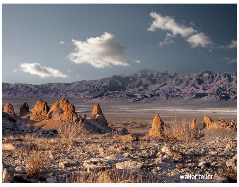
The Trona Pinnacles, located in the California Desert National Conservation Area near the town of Trona, offer a striking landscape of unusual tufa formations rising dramatically from the desert floor. Here’s an expanded look at what makes the Trona Pinnacles a popular destination:
Geological Significance
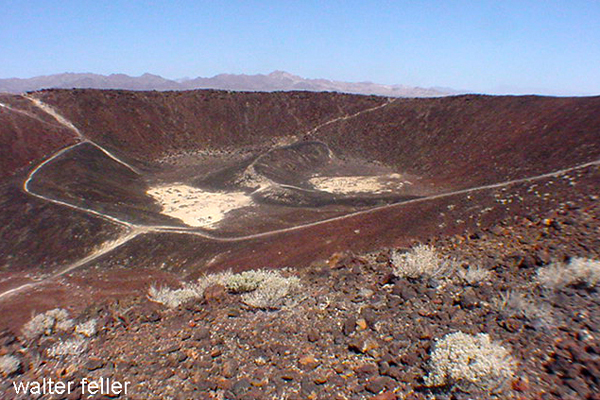
- Formation: The Trona Pinnacles are composed of tufa, a type of limestone that forms in alkaline lake waters. These formations were created 10,000 and 100,000 years ago when the area was submerged under the prehistoric Searles Lake.
- Structure: The site features over 500 pinnacles, ranging from small spires to large towers that reach up to 140 feet. These formations vary in shape and size, creating a surreal and otherworldly landscape.
Attractions and Activities
- Exploring the Pinnacles:
- Self-Guided Tours: Visitors can explore the pinnacles at their own pace, walking among the formations and marveling at their unique shapes and textures. The area is open for hiking and offers numerous trails and pathways.
- Interpretive Signs: Informational signs throughout the site provide insights into the geological history of the pinnacles, explaining how they were formed and their significance.
- Photography:
- Landscape Photography: The Trona Pinnacles are a favorite subject for photographers due to their striking appearance and the dramatic contrasts between the tufa towers and the surrounding desert. The light at sunrise and sunset casts a magical glow on the formations, enhancing their visual appeal.
- Astrophotography: The remote location and dark skies make the Trona Pinnacles an excellent spot for stargazing and astrophotography. The formations provide unique foregrounds for night sky photography, including stunning views of the Milky Way.
- Off-Roading and Vehicle Access:
- Off-Road Trails: The area around the Trona Pinnacles is accessible by dirt roads suitable for high-clearance and four-wheel-drive vehicles. Off-road enthusiasts can enjoy exploring the rugged terrain and discovering hidden viewpoints.
- Scenic Drives: For those who prefer a more leisurely visit, scenic drives through the area offer beautiful views of the pinnacles and the surrounding desert landscape.
- Camping:
- Primitive Camping: The Bureau of Land Management (BLM) allows primitive camping near the Trona Pinnacles. Campers can set up their tents or park their RVs in designated areas, providing a unique opportunity to experience the pinnacles up close, especially during sunrise and sunset.
- Stargazing: Camping overnight offers a chance to enjoy the clear desert skies, which are perfect for stargazing and experiencing the tranquility of the desert.
- Filming and Events:
- Film Location: The Trona Pinnacles have been used as a backdrop for numerous movies, TV shows, and commercials due to their otherworldly appearance. Productions like “Star Trek V: The Final Frontier” and “Planet of the Apes” have featured scenes shot at the pinnacles.
- Special Events: Occasionally, the area hosts special events such as photography workshops, stargazing parties, and off-road vehicle rallies, providing unique opportunities for visitors to engage with the site.
Visitor Information
- Location and Access: The Trona Pinnacles are about 20 miles east of Ridgecrest, California. The access road to the pinnacles is a graded dirt road off Highway 178, which can be rough in places but is generally passable for most vehicles.
- Facilities: The Trona Pinnacles do not have developed facilities. Visitors should come prepared with their water, food, and supplies. Portable toilets are sometimes available, but it’s best to be self-sufficient.
Best Times to Visit
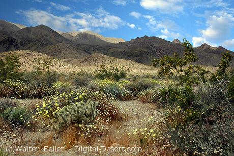
- Spring and Fall: These seasons offer mild temperatures, making it the best time for outdoor activities such as hiking and camping. Springtime may also bring wildflower blooms, adding color to the landscape.
- Winter: Winter can be a good time to visit if you prefer cooler weather, but be prepared for cold nights. The clear winter skies are excellent for stargazing.
Conservation and Preservation
- Protected Area: The Trona Pinnacles are managed by the Bureau of Land Management as part of the California Desert National Conservation Area. Efforts are made to preserve the site’s unique geological features and natural beauty.
- Responsible Tourism: Visitors are encouraged to practice Leave No Trace principles, respecting the delicate desert environment and minimizing their impact on the land and formations.
Nearby Attractions
- Searles Valley Minerals: The nearby town of Trona is known for its mineral processing facilities. The Searles Valley Minerals plant conducts an annual Gem-O-Rama event, where visitors can collect various minerals and crystals from the Searles Lake deposits.
- Death Valley National Park: Located to the east, Death Valley National Park offers additional opportunities for exploring diverse desert landscapes, unique geological features, and historic sites.
Educational and Interpretive Programs
- Guided Tours and Talks: Occasionally, the BLM or local organizations may offer guided tours and interpretive talks about the geology and natural history of the Trona Pinnacles, providing deeper insights into the site’s formation and significance.
The Trona Pinnacles offer a unique and memorable experience for visitors interested in geology, photography, outdoor adventure, and the natural beauty of the Mojave Desert. Whether exploring the pinnacles on foot, capturing their striking forms with a camera, or simply soaking in the serene desert atmosphere, the Trona Pinnacles provide an extraordinary destination for all who visit.