Stagecoach relay stations and accommodations were vital for the stagecoach travel system, especially during the 18th and 19th centuries. These stations were strategically located along stagecoach routes to ensure efficient travel and the well-being of passengers, horses, and drivers.
Relay Stations
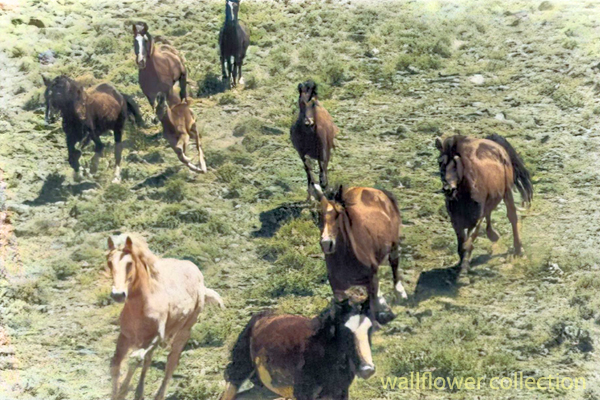
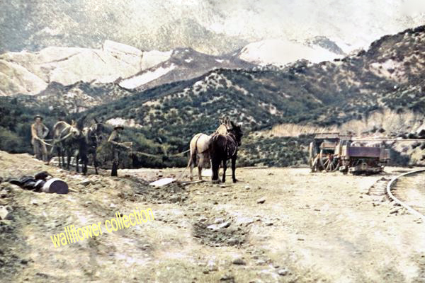
Relay stations, also known as “staging posts” or “stage stops,” were positioned every 10 to 20 miles along the route. Their primary purpose was to provide fresh horses for the stagecoach, as they would be exhausted after traveling long distances. At these stations, tired horses were replaced with rested ones, ensuring the stagecoach could maintain a steady pace without long delays.
Key features of relay stations included:
- Stables: For housing and caring for horses.
- Feed and Water: Ample supplies of food and water for the horses.
- Blacksmith Services: For shoeing horses and making necessary repairs to the stagecoach.
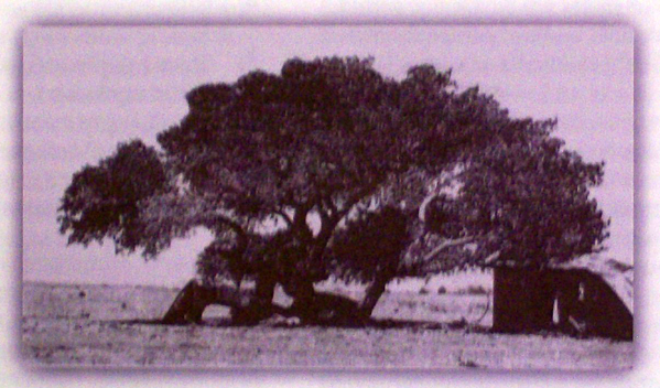
- Shelter: Basic accommodations for passengers if they need a brief rest.
Accommodations
Beyond just relay stations, more substantial accommodations were often provided at larger intervals or significant points along the route. These accommodations varied widely, ranging from simple inns to more elaborate hotels, depending on the route’s location and prominence.
Key features of stagecoach accommodations included:
- Sleeping Quarters: Rooms for passengers to rest overnight, often shared with other travelers.
- Dining Facilities: Meals were provided, typically hearty and designed to sustain travelers for the next leg of their journey.
- Lounge Areas: Common rooms where passengers could relax, socialize, and recover from the journey.
- Washrooms: Basic facilities for washing up, although these were often quite rudimentary by modern standards.
- Repair Services: Facilities to fix any damage to the stagecoach or passenger belongings.
The Experience
Traveling by stagecoach was often uncomfortable and tiring. Roads could be rough, and the constant need to change horses meant frequent stops. However, relay stations and accommodations provided necessary breaks and a chance for passengers to stretch their legs, eat, and rest. These stops were crucial for the safety and efficiency of the stagecoach system, making long-distance travel more manageable during this era.
Despite the hardships, stagecoach travel was an essential part of life, enabling communication, commerce, and transportation across vast distances before the advent of the railroad and the automobile.
Overview of Desert Stagecoach Lines Before Railroads
Before railroads revolutionized transportation, stagecoaches were a critical means of public transport across the desert regions. Here are some key stage lines and their operations:
- Goldfield Stage (1905): This stage provided transportation services in the Goldfield area.
- Applewhite’s Stage: This stage used a three-bench buggy to transport miners from Calico to town for business and lodging.
- Arizona Overland Mail (1866-1868): Initially, it was a weekly mail service from Camp Drum to Prescott, Arizona, which later became twice-weekly. It overcame significant challenges, including Indian troubles.
- Barnwell to Death Valley Route: A daily stage route from Barnwell to Manse, Nevada, that remained crucial for travelers and miners even after the completion of the Salt Lake Railroad.
- Barnwell to Searchlight Stage Line: Operated until 1906 when the Barnwell & Searchlight Railroad commenced.
- Black Canyon Stage Station: A stop for the Panamint Transportation Company along the Black Canyon route.
- Brooklyn Well: A stage stop on the Dale to Amboy route, providing necessary water and rest.
- Butterfield Overland Stage Company (1858-1860): A major mail route running from Missouri to California, passing through the Mojave Desert.
- Calico Stage Line (1): Operated between Daggett and Calico from 1885 to 1887 using a six-horse Concord Coach.
- Calico Stage Line (2): Provided twice-daily trips between Calico and Daggett with improved coaches and horses.
- California Southern Stage Line: Connected Calico with Barstow and San Bernardino.
- Cottonwood Stage Station: A notable station that was raided in 1875 by Cleovaro Chavez’s gang.
- Crackerjack Auto Transit Company (1907): Introduced auto-stage services between Silver Lake and Crackerjack.
- Daggett & Skidoo Stage Line: Operated through Black Canyon.
- Dale to Amboy Stage Line (1903-1916): Known as the Buckboard Stage, this line included lunch in its $5 fare.
- Death Valley Chug Line (1907): An auto-stage operated by “Alkali Bill” Brong, transporting passengers around Death Valley.
- Domingo Stage & Freight (1887): Ran from Providence to Fenner, primarily hauling ore.
- Goldstone-Los Angeles Auto Stage: Provided bi-weekly trips between Los Angeles and Goldstone.
- Harrison’s Calico Express Line (1882): Connected San Bernardino with Calico, taking a day and a half each way.
- Huntington Stage: The first public transport service between San Bernardino and Calico.
- Livingstone & Cahill Stage Line: Operated between Barstow, Daggett, and Calico.
- Mecham’s Panamint Stage (1874): Charged $30 for a one-way trip from San Bernardino to Panamint.
- Nipton & Searchlight Stage Line (1910): Transported passengers and freight between Searchlight and the railroad at Nipton.
- Orange Blossom Mining & Milling Company Stage Line (1908): Served the Orange Blossom mines and camp.
- Panamint Transportation Company (1873-1874): Ran from San Bernardino to Panamint City, a challenging and critical route for the time.
- Perew Auto Stage (1905): An innovative auto-stage line from Manvel to Searchlight.
- Pioneer Stage (1890s): Charged $2 for a 5-mile trip from Manvel into Vanderbilt.
These stagecoach lines were essential in connecting remote areas and facilitating commerce, mail delivery, and passenger transport before the widespread advent of railroads. They navigated rough terrain, faced threats from bandits, and dealt with challenging weather conditions to keep the region connected.