The Quiet Disappearance of History in the Digital Age

The internet was once treated as a kind of open archive – a distributed record of human activity where information, once published, was expected to remain accessible. That expectation has proven unreliable. Increasingly, history online is not being preserved. It is being lost, displaced, edited, or buried.

This is not a single process. It is the result of several overlapping forces, some structural, some deliberate.

The most basic cause is decay. The internet is not built like a library; it is built like a marketplace. Content exists so long as it generates value, whether through traffic, advertising, or institutional relevance. When that value declines, maintenance stops. Domains expire, file structures change, images disappear, and links break. Over time, entire layers of information collapse into what is now commonly called “link rot.” What appears stable is often temporary.

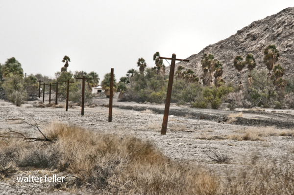
This alone accounts for a significant portion of historical loss. Independent websites, early digital archives, and personal research pages – once the backbone of the early web – are particularly vulnerable. These were often maintained by individuals or small groups without long-term institutional support. When the creator moves on, retires, or dies, the site often follows.

A second force is centralization. Over the past two decades, much of the internet’s content has migrated from independent domains into large, privately controlled platforms. Social media, hosting services, and content networks now hold vast amounts of material that once would have existed in open, self-managed spaces. These platforms are not designed for permanence. They are governed by changing policies, legal exposure, and commercial priorities. Content can be removed, hidden, or deprioritized without warning. When a platform declines or shifts direction, the historical material contained within it can disappear just as quickly.

A third factor is legal pressure. Preservation is not always aligned with ownership. Copyright law, licensing restrictions, and institutional control limit what can be archived and how it can be shared. Organizations dedicated to preservation operate within increasingly narrow constraints, while deletion remains straightforward. The imbalance is structural: it is easier to remove information than to preserve it.

A fourth force is institutional revision. Governments, agencies, and organizations routinely update their public-facing material. This has always been true, but digital systems accelerate the process and obscure the record of change. Earlier versions are often overwritten rather than preserved. What remains is not necessarily a complete record, but the most recent version deemed acceptable.

The National Park Service provides a clear modern example of this process in action. As one of the primary interpreters of American history at the landscape level, the NPS shapes how millions of visitors understand the past. Its role extends beyond land management into narrative construction – deciding how events, people, and places are presented.

Under directives to remove or revise material considered “disparaging,” park staff were asked to review interpretive content addressing subjects such as slavery, Indigenous displacement, civil rights struggles, and other difficult aspects of American history. The term itself was vague, but its application was concrete. Content could be flagged not because it was inaccurate, but because it presented the past in a way that conflicted with a preferred narrative.

This does not require wholesale deletion to be effective. A paragraph rewritten, a label softened, a reference removed, or a subject narrowed can significantly alter interpretation. In some cases, exhibits were modified or removed. In others, language was adjusted to reduce emphasis on conflict or injustice. The sites themselves remain unchanged, but the meaning attached to them shifts.

This is not a new phenomenon. Institutions have always shaped historical narratives. What is different is the speed and invisibility of the process. A webpage can be revised instantly. An earlier version can disappear without a trace unless it has been independently archived. The revision becomes the record.

There is also a more subtle mechanism at work: burial. Even when historical material is not deleted, it can be effectively lost beneath the volume of modern content. The contemporary web is saturated with low-value, automated, and algorithmically amplified material. Search systems prioritize engagement, recency, and optimization. Older, less structured, or less commercially viable sources are pushed down, becoming increasingly difficult to locate. In practice, obscurity can function as a form of erasure.

Taken together, these forces produce a fundamental shift. The internet is no longer a reliable long-term repository of history. It is a dynamic system where information persists only if it is actively maintained, protected, and surfaced.

This has implications beyond convenience. Historical understanding depends on continuity – the ability to trace ideas, events, and places across time. When earlier records disappear or are altered without context, that continuity breaks. What remains is not necessarily false, but it is incomplete.

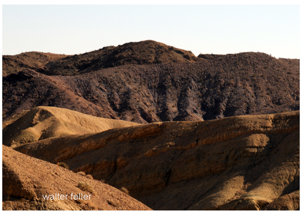
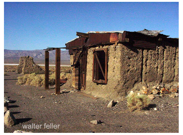
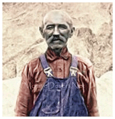
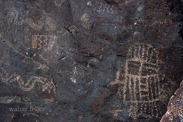
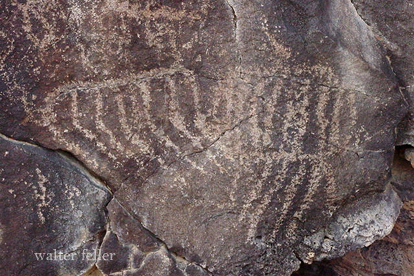
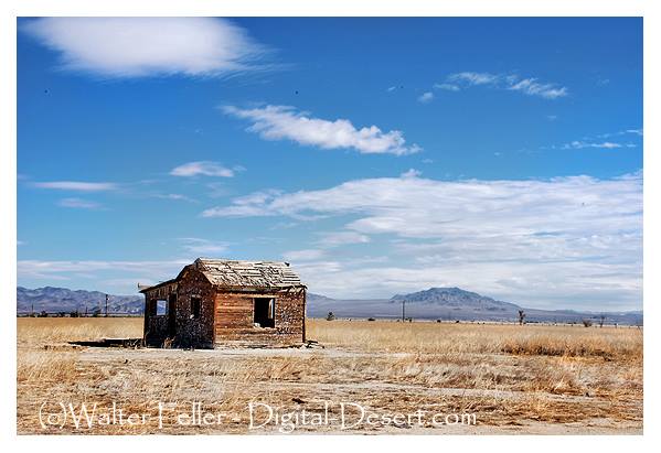
In this environment, independent archives, local history projects, and personally maintained research collections take on increased importance. They function as deliberate acts of preservation within a system that does not naturally preserve. Small sites, scanned documents, field notes, and long-form research – often overlooked in favor of larger platforms – frequently contain the most durable records.

The earlier web operated more like a network of homesteads, each site maintained as a personal or institutional record. The modern web operates more like a commercial grid, where content is inventory and visibility is negotiated through algorithms and policy. The shift is not inherently malicious, but it is consequential.

History is not disappearing from the internet in a single, coordinated act. It is being lost through neglect, reshaped through policy, constrained by law, and buried under volume. The effect, however, is similar. Without active effort, the record narrows.

What remains, increasingly, is what someone chose to keep.

Intrusion

The idea of “intrusion” in the Mojave Desert is less straightforward than it first appears. On the surface, the landscape feels vast, empty, and available—an open field where one might expect solitude and personal dominion. Spend enough time out there, learn its routes, its quiet places, its rhythms, and it is easy to begin thinking of certain areas as your own. Not in a legal sense, but in a lived, experiential one. Familiarity builds attachment, and attachment can drift into a sense of claim.

But the Mojave resists that kind of ownership.

What feels like an intrusion is often just an overlap. The same qualities that draw you in—remoteness, stark beauty, a sense of separation from the rest of the world—draw others as well. Old mining roads, dry lake crossings, washes, and ridgelines are not random; they are part of a long-standing network of movement. Indigenous travelers, explorers, freighters, prospectors, ranchers, off-roaders, and hikers—all have used and continue to use these same pathways. What seems like a private discovery is often a rediscovery of something that has been in circulation for generations.

This creates a tension between expectation and reality. The expectation is solitude, perhaps even exclusivity. The reality is that the desert is a shared system, and access—whether formal or informal—is part of its structure. When someone else shows up in a place you’ve come to think of as yours, it can feel like a disruption, even a violation. But in most cases, they are participating in the same pattern you are: moving through a landscape that has never belonged to any single user.

There is also a practical dimension to this. The Mojave is not just open space; it is a network of limited resources. Water sources, shade, reliable routes—these are scarce and widely known, whether through maps, word of mouth, or simple observation. People tend to converge on the same nodes because there are only so many viable options. What feels like an intrusion is sometimes just inevitability.

Attempts to control or exclude others rarely hold up over time. The desert is too large, the access points too numerous, and the traditions of movement too deeply rooted. Fences can be built, routes can be obscured, and information can be withheld, but none of these measures fully resolve the issue. They often create more friction than they prevent.

A more durable approach is to shift the frame. Instead of treating the desert as something to possess, it can be understood as something to participate in. That means recognizing that others will be present, even in places that feel remote, and adjusting expectations accordingly. Solitude becomes something you find in moments rather than something you permanently secure.

In practice, this often leads to quieter strategies. People who spend a great deal of time in the desert learn where and when others are likely to appear. They seek out less obvious routes, travel at off-peak times, or move deeper into areas that require more effort to reach. They do not eliminate intrusion; they work around it.

In the end, the Mojave does not reward attempts at control. It favors those who understand its scale, its history, and its shared nature. The space you find there is real, but it is never exclusively yours—and trying to make it so usually works against the very experience you’re looking for.

Synthesis of Research Access

The Mojave System organizes a vast body of desert research into a unified, accessible framework. By linking geography, history, ecology, and human activity across corridors, basins, and nodes, it provides structured entry points for exploration, interpretation, and deeper study of the Mojave Desert landscape.

“Mojave System”

They immediately see:

  • Top 100 Nodes
  • Corridor Network
  • Basin & Hydrology
  • System Diagrams

This tells them:

“This is a working tool.”

Step 2 — Start With a Node (BARSTOW)

They search or click:

Barstow

Now the node page is more advanced than Tier 1.

Node: Barstow (Tier 2 View)

Includes:

  • Type: Corridor Convergence Node
  • Connected Corridors:
    • Mojave River Corridor
    • 35th Parallel Corridor
    • Cajon Pass Corridor
  • Linked Nodes:
    • Daggett
    • Afton Canyon
    • Needles
  • Functional Role:
    • rail classification hub
    • highway junction
    • desert logistics center

Now they’re not just reading—they’re seeing relationships.

They click:

Trace Corridor


https://www.route66roadtrip.com/images/photos-california/route-66/map-route66-needles-to-barstow-california.jpg
https://www.americanroads.us/forum_files/ACSC_227A_Danby-Needles_1934_300dpi.jpg
https://d9-wret.s3.us-west-2.amazonaws.com/assets/palladium/production/s3fs-public/thumbnails/image/Mojave-River_thumbnail.png

4

They open:

“35th Parallel Corridor (Needles – Barstow – Mojave)”

Now they see:

  • Node chain:
    • Needles -> Goffs -> Essex -> Ludlow -> Daggett -> Barstow
  • Infrastructure layers:
    • railroad (1883)
    • Route 66
    • I-40
  • Function:
    • transcontinental movement

They notice:

Daggett + Afton Canyon appear tied to water

They click:

View Basin / Hydrology

Step 4 — Basin & Hydrology Layer (This is your edge)

https://d9-wret.s3.us-west-2.amazonaws.com/assets/palladium/production/s3fs-public/thumbnails/image/Mojave-River_thumbnail.png
https://digital-desert.com/natural-mojave-river/320-manix.gif
https://pubs.usgs.gov/fs/fs-122-01/fig2.gif

4

They open:

“Lake Manix & Mojave River System”

Now they see:

  • ancient lake (Lake Manix)
  • overflow event
  • formation of Afton Canyon
  • subsurface river flow

Key realization:

“Afton Canyon exists because the lake breached—and the river still follows that path.”

Now Barstow, Daggett, and Needles are no longer random:

  • Barstow = corridor convergence
  • Daggett = water + rail junction
  • Afton Canyon = forced water outlet

This is deep structural understanding.


Step 5 — Cross-System Comparison

Now they test the system.

They ask:

“Is this similar to Tecopa / Death Valley?”

They click:

Tecopa Basin

They see:

  • Lake Tecopa overflow
  • Amargosa River
  • connection into Death Valley

Now they recognize a pattern:

“Closed basin -> overflow -> corridor formation”

This is advanced understanding most people never reach.


Step 6 — System Diagram (Validation)

They open:

Mojave System Map

They now visually confirm:

  • basins
  • corridors
  • nodes

Everything they just learned lines up.


Step 7 — Outcome

At the end of this session, the user now understands:

  • why Barstow exists
  • why Afton Canyon is where it is
  • how water shaped transportation
  • how basins control movement

That is not casual knowledge.
That is working knowledge.

Hexagonal Geometry in Nature and Spatial Systems

Hexagonal geometry appears repeatedly in both natural systems and human-designed spatial models. From honeycombs and basalt columns to mapping grids and ecological simulations, the hexagon emerges because it balances efficiency, symmetry, and structural stability. This recurring pattern is strong evidence of underlying physical and mathematical principles that govern how matter organizes itself.

Understanding why hexagons appear so often requires examining three related factors: tessellation of space, structural efficiency, and directional symmetry.


Geometric Foundations

A regular hexagon contains six equal sides and six interior angles.

120^\circ

Three hexagons meeting at a point form a complete circle around that vertex:

120 + 120 + 120 = 360 degrees

This property allows hexagons to tile a surface perfectly without gaps or overlaps. Only three regular polygons can accomplish this:

  • Equilateral triangles
  • Squares
  • Hexagons

Among these, hexagons provide the most efficient enclosure of space for a given perimeter.


The Honeycomb Efficiency Principle

One of the most famous examples of a hexagonal structure appears in bee honeycombs.

Worker bees construct wax cells that store honey and house larvae. The hexagonal shape is not arbitrary; it is the most efficient way to divide a plane into equal storage cells while minimizing the amount of construction material.

Mathematically, this principle is known as the Honeycomb Conjecture, which was proven in 1999 by the mathematician Thomas Hales. The theorem demonstrates that a hexagonal tiling encloses the maximum area for a given perimeter among regular tilings.

For bees, this efficiency means:

  • Less wax is required for construction
  • stronger structural walls
  • maximum storage volume

The result is a highly optimized natural architecture.


Basalt Columns and Cooling Lava

Hexagonal patterns also appear in geological formations created by cooling lava flows. Famous examples include Devil’s Postpile in California and the Giant’s Causeway in Northern Ireland.

When lava cools, it contracts. The contraction produces internal stress that eventually fractures the rock. These fractures propagate outward simultaneously from many points.

Physical systems tend to minimize stress energy, and the most stable crack geometry forms junctions with angles near 120 degrees. As fractures spread through the cooling lava, polygonal columns develop, often forming hexagonal cross-sections.

This process creates striking landscapes composed of tall basalt pillars, many of which are six-sided.


Soap Films and Foam Geometry

Another example of a hexagonal structure occurs in foams and soap bubbles.

Thin films between bubbles rearrange themselves to minimize surface energy. The rules governing these surfaces are described by Plateau’s laws. When bubbles pack together in two dimensions, the boundaries often form hexagonal patterns because this configuration balances the surface tension.

The same principle occurs in:

  • soap bubble clusters
  • cellular foams
  • liquid films

The hexagonal pattern represents a stable compromise between competing surface forces.


Insect Compound Eyes

Many insects possess compound eyes made up of hundreds or thousands of visual units called ommatidia. These units pack together in a hexagonal arrangement.

Hexagonal packing allows the maximum number of lenses to fit within a curved surface while minimizing gaps between units. The arrangement produces nearly uniform visual coverage across the insect’s field of view.

This pattern appears in:

  • bees
  • dragonflies
  • flies
  • many crustaceans

The hexagonal structure improves optical efficiency and spatial coverage.


Snowflakes and Crystal Symmetry

Snowflakes demonstrate another form of hexagonal geometry. The structure of ice crystals is determined by the arrangement of water molecules in a hexagonal lattice.

As snow crystals grow in cold clouds, molecules attach along preferred directions determined by this lattice structure. The result is the familiar six-fold symmetry seen in snowflakes.

While individual snowflakes develop complex branching forms, their fundamental geometry remains hexagonal.


Hexagonal Grids in Spatial Modeling

Hexagonal patterns are not only natural; they are also useful in human-designed systems.

Hexagonal grids are widely used in:

  • ecological modeling
  • wildfire spread simulations
  • geographic information systems
  • military mapping
  • strategy games

Unlike square grids, hexagonal grids distribute movement directions evenly around each cell. Every neighboring cell lies at the same distance from the center.

This property reduces distortion when modeling radial expansion, such as:

  • spread of fire
  • animal movement
  • water flow
  • diffusion processes

The hex grid, therefore, approximates a circular spread more accurately than square grids.


Directional Symmetry

Square grids produce four primary directions separated by right angles. Diagonal movement introduces distance distortion.

Hexagonal grids provide six directions evenly spaced around a point, each separated by 60 degrees. This more balanced geometry helps simulate natural processes in which movement spreads uniformly outward.

In many scientific simulations, hex grids therefore produce results closer to real-world spatial patterns.


Why Hexagons Reappear in Nature

Across many different systems, hexagons emerge because they balance several competing demands:

Efficient packing
Hexagons fill space while enclosing large areas relative to their perimeter.

Energy minimization
Physical systems often settle into configurations that reduce internal stress or surface energy.

Directional balance
Six directions distribute forces or movement more evenly than four.

Structural stability
Hexagonal networks resist deformation while maintaining flexibility.

These advantages make the hexagon a recurring solution in both natural structures and engineered systems.


Conclusion

The hexagon is not simply a geometric curiosity. It represents a natural solution to problems involving packing, efficiency, and structural balance. From the wax architecture of honeybees to volcanic basalt columns and the molecular symmetry of snow crystals, hexagonal patterns arise wherever physical systems seek stability and efficiency.

Because of these properties, the same geometry that shapes natural landscapes also appears in modern scientific models and mapping systems. The hexagon stands as one of the most elegant and practical shapes in both mathematics and the natural world.

The Lost Horse Mine & Johnny Lang

Joshua Tree National Park

The Lost Horse Mine is one of the best-known historic mining sites in what is now Joshua Tree National Park and was among the most productive mining operations in the region. Its history combines documented mining development with one of the park’s most persistent desert legends, the story of Johnny Lang. Together, the mine and the man form an important part of Joshua Tree’s cultural landscape, linking frontier prospecting, small-scale gold mining, and the hard conditions of desert life in the late nineteenth and early twentieth centuries.

Like many mining stories in the California desert, the origins of Lost Horse Mine are tied to both opportunity and legend. According to park history, Johnny Lang acquired the mining rights in the 1890s after a chain of events involving horse theft, cattle rustling, and the rough frontier conditions of the area. The episode gave the mine its memorable name and became part of local lore. Whether every detail of the story can be proven matters less than the fact that it became inseparable from the site’s identity.

Lang and his associates first developed the claim with a small two-stamp mill. In these early years, mining in the Joshua Tree region was difficult and uncertain. Water was scarce, transportation was expensive, and fuel had to be secured to run machinery. Most desert claims never produced enough ore to justify the effort. Lost Horse Mine was one of the exceptions.

The operation entered a more productive phase after J.D. Ryan bought out the original owners in 1895. Ryan expanded the works, installed a steam-powered ten-stamp mill, and improved the mine’s efficiency. Water was brought in through a pipeline from a spring near Ryan’s ranch, and nearby pinyon and juniper were heavily cut for fuel to power the mill. The mine’s success came at a visible cost to the landscape, and some of that environmental mark remained long afterward.

Between 1894 and 1931, Lost Horse Mine produced approximately 10,000 ounces of gold and 16,000 ounces of silver, making it one of the few truly successful mines in the Joshua Tree region. In modern terms, that output has often been estimated at roughly $5 million. For a desert mine in such an isolated setting, it was a substantial achievement and a clear indication of how unusual Lost Horse was among the many short-lived claims of the region.

Johnny Lang remained tied to the mine even after his direct role in its early development faded. In park tradition, he appears as both prospector and cautionary figure, a man drawn deeper into the desert by gold, suspicion, and loss. Stories grew around him, including accounts that he stole amalgam from the operation and later returned to search for gold he had hidden near the mill site. These stories belong to the legendary side of the Lost Horse narrative, but they have long shaped how visitors remember the place.

By the early twentieth century, the richest ore had been worked out, and activity slowed. The main productive phase ended after the ore-bearing vein was lost, and later efforts failed to restore the mine’s earlier success. In 1931, rising gold prices prompted the reworking of old tailings, but this marked the end rather than a revival of the operation.

Lang’s final years added still more to the legend. He reportedly returned to the Lost Horse area after the mine’s productive life had largely passed, living in isolation and continuing to prospect in the surrounding country. In 1925, he died alone in the desert, an ending that fixed his place in local memory and deepened the mystery surrounding the supposed cache of hidden gold that later treasure seekers sought to find.

Today, the mill and its associated structures remain among the most important mining remnants in Joshua Tree National Park. The preserved ten-stamp mill stands as a rare and tangible link to the park’s mining era and to the boom-and-bust cycle that defined so many western ventures. Lost Horse Mine is also a popular hiking destination, reached by a trail that follows the old road once used to haul ore and supplies.

More than a ruined mine, Lost Horse is a place where documented history and desert legend meet. It preserves the story of one of Joshua Tree’s most successful mining operations while also keeping alive the memory of Johnny Lang, whose name remains permanently tied to the mine and to the enduring fascination of the desert gold rush.

The name Lost Horse Mine comes from a story associated with Johnny Lang, the early prospector who staked the claim. According to the traditional account preserved in park history and local desert lore, Lang discovered the mine while searching for a missing horse.

In the early 1890s, Lang was grazing cattle in the desert country north of what is now Indio. One morning, he noticed that one of his horses had wandered away. Following the tracks into the rocky uplands of what later became known as Lost Horse Valley, he eventually came upon a camp occupied by the McHaney Gang, a group reputed to be horse thieves and cattle rustlers. When Lang asked about the missing horse, the men warned him to leave.

As the story goes, Lang continued exploring the surrounding hills after leaving the camp. During this time, he encountered a prospector named “Dutch” Frank Diebold, who showed him a piece of rich, gold-bearing ore. Lang recognized the potential value of the find and purchased the mining rights for $1,000. When he filed the claim, the episode of the missing horse provided the name, and the property became known as the Lost Horse Mine.

Whether every detail of the story is historically verifiable is uncertain. Like many frontier mining stories, the tale blends documented events with local legend. What is clear is that the name Lost Horse was already in use by the time the claim was formally developed in the 1890s, and the story of Lang’s missing horse became the accepted explanation for the name.

The valley where the mine lies eventually took the same name, becoming Lost Horse Valley, and the story remains one of the enduring pieces of folklore attached to Joshua Tree National Park’s mining history.

Johnny Lang’s life ended quietly and rather tragically in the desert country around the mine that made him famous.

After losing control of the Lost Horse Mine in the late 1890s, Lang remained in the area and continued to prospect in the hills around Lost Horse Valley and the nearby canyons. According to accounts preserved in park history and local tradition, he occasionally returned to the old mine site and lived in abandoned structures, such as the cookhouse, for periods. He never discovered another profitable claim.

Lang became something of a solitary figure in the desert during his later years. Local rancher and miner Bill Keys, who lived nearby at what is now known as Keys Ranch, later recalled seeing Lang from time to time and even purchasing small pieces of gold bullion from him. These stories helped fuel the long-running legend that Lang had hidden some of the gold he had taken from the Lost Horse operation somewhere in the area.

In January 1925, Lang reportedly left a note saying he was going out to get supplies and would return soon. He never came back. Weak from age, exposure, and the harsh winter conditions of the desert, he died while traveling on foot a short distance from the mine.

About two months later, Bill Keys discovered Lang’s body near the old road leading toward Lost Horse Valley. Keys notified the county authorities and buried Lang where he was found. The burial site was later disturbed by treasure hunters who believed Lang might have been buried with a map to hidden gold, and during one of those disturbances, his skull was reportedly stolen.

Lang’s lonely death added to the legend surrounding the Lost Horse Mine. Stories of a hidden cache of stolen gold persisted for years afterward, though no confirmed discovery was ever made.

Today, Johnny Lang is remembered primarily through the story of the Lost Horse Mine in Joshua Tree National Park, where the mill ruins and the surrounding valley still bear the name associated with the missing horse and the prospector who followed its tracks into the desert.

Levels of History (DRAFT)

A Mojave Regional Perspective

Oral history and word of mouth sit at the most intimate level. This is where interviews, remembered events, family stories, miner recollections, ranch accounts, and “what people around here said” belong. These are not weak sources; they are simply different sources. They preserve lived experience, but they must be marked as memory, testimony, or tradition rather than treated automatically as settled fact.

Family and genealogy history is the next layer. This works especially well on your sites for desert families, settlers, ranchers, mining people, storekeepers, road builders, and local civic figures. In your system, genealogy matters most when it connects a family to place, movement, land use, occupation, or continuity across generations.

Local and community history is one of your core operating levels. This is where places like Apple Valley, Goodsprings, Barstow, Littlerock, Boron, Pearblossom, or Lucerne Valley live as communities rather than just dots on a map. It includes schools, churches, inns, cemeteries, road junctions, stores, clubs, folklore, preservation fights, and the memory of ordinary people.

Regional history is probably the true center of gravity for both sites. The Mojave Desert is not just a collection of towns. It is a region with shared constraints and patterns: aridity, routes, mining belts, rail corridors, military geography, basin-and-range structure, ecological transitions, and a distinct cultural imagination. This is where your corridor logic, basin overlays, and node system become especially powerful. Regional history lets you connect Camp Cady to the Mojave Road, Barstow to rail convergence, Apple Valley to the Mojave River corridor, and Joshua Tree to wider desert systems.

State history is still important, but more as a framing layer than a primary one. California and Nevada state structures matter because they shape land law, water law, transportation planning, parks, counties, and preservation regimes. In your project, state history is most useful when it explains why a regional or local pattern took the form it did.

National history enters when the Mojave intersects larger U.S. processes – westward expansion, railroad building, federal land management, military occupation, highway development, wartime industry, conservation law, and tourism. But your sites usually should not begin here. They should arrive here after grounding the subject.

International or world history is the outer ring. It matters when the Mojave is tied to bigger systems: Spanish colonial networks, Mexican-era movement, global mining capital, transoceanic migration, climate history, wartime logistics, or worldwide desert studies. Useful, yes – but not the everyday scale of your project.

So if I were to adapt this specifically for Digital-Desert / MojaveDesert.net, I would rank the historical levels like this:

  1. Oral / memory / testimony
  2. Family / genealogy
  3. Site-core history
  4. Community / local history
  5. Corridor history
  6. Basin / landscape history
  7. Regional Mojave history
  8. State context
  9. National context
  10. International context

That version fits your actual architecture better than the standard textbook ladder.

Just as important, your sources also fall into levels. For your work, I would sort them this way:

Memory sources:
interviews, oral accounts, family recollections, folklore, local tradition

Material/local evidence:
photos, buildings, ruins, artifacts, cemeteries, inscriptions, maps, site visits

Documentary sources:
newspapers, county records, land patents, census schedules, mining records, railroad timetables, diaries, military reports

Interpretive sources:
local histories, scholarly books, agency reports, geology papers, ethnographies, historical syntheses

That gives you a good method rule:

The closer the source is to lived experience, the more valuable it is for texture and local meaning.
The closer the source is to formal documentation, the more useful it is for chronology, attribution, and verification.
The best pages on your sites usually combine both.

So in relation to your two domains, I would say this plainly:

Digital-Desert.com is strongest when it builds on oral, local, corridor, and regional history.
MojaveDesert.net is strongest when it organizes those same layers into a broader structural and interpretive framework.
Neither site needs to chase “national history” as its main identity. Their evidence lies in showing how the Mojave’s local realities connect to wider systems.

A practical label set for page-building could be:

Memory
Family
Site-core
Community
Corridor
Basin
Regional
State context
National context
Global context

That would fit your architecture far better than a generic school-history list.

12 Petroglyph Corridor Nodes

(Mojave–Great Basin system) * DRAFT *

A petroglyph corridor is a stretch of landscape where rock art sites appear repeatedly along a natural travel route. Instead of a single isolated panel or canyon full of carvings, the imagery is distributed along a pathway that people used for movement across the desert.

In practical terms, a petroglyph corridor is a travel landscape marked by symbolic sites.

Format
Node | Region Belt | Corridor Intersection | Node Type | Motif Emphasis | Significance

  1. Coso Petroglyph Field
    Region Belt: Eastern Sierra–Great Basin frontier
    Corridor Intersection: Owens Valley corridor / eastern Mojave uplands
    Node Type: Major ceremonial core
    Motif Emphasis: Bighorn sheep, hunters, anthropomorphs
    Significance: One of the largest rock art landscapes in North America and the primary symbolic center of the Coso corridor.
  1. Little Petroglyph Canyon
    Region Belt: Coso Range
    Corridor Intersection: Coso canyon travel routes
    Node Type: Canyon site-core
    Motif Emphasis: Sheep imagery and hunting scenes
    Significance: Dense petroglyph concentration marking a heavily traveled volcanic canyon corridor.
  1. Renegade Canyon
    Region Belt: Coso Range
    Corridor Intersection: Coso canyon system
    Node Type: Canyon ceremonial node
    Motif Emphasis: Hunters, patterned-body anthropomorphs
    Significance: Major interpretive canyon central to debates over Coso symbolism and ceremonial activity.
  1. Sheep Canyon
    Region Belt: Coso Range
    Corridor Intersection: Hunting landscape corridor
    Node Type: Specialized hunting node
    Motif Emphasis: Bighorn sheep
    Significance: Strongly associated with hunting geography and ritual interpretations tied to sheep imagery.
  1. Grapevine Canyon
    Region Belt: Mojave–Colorado corridor
    Corridor Intersection: Lower Colorado River travel routes
    Node Type: Major corridor anchor
    Motif Emphasis: Rectilinear geometric forms
    Significance: Key node connecting Mojave rock art with lower Colorado River cultural traditions.
  1. Sloan Canyon
    Region Belt: Southern Nevada–Mojave margin
    Corridor Intersection: Las Vegas basin travel routes
    Node Type: Canyon corridor node
    Motif Emphasis: Abstract geometric motifs
    Significance: Important transition node linking Basin and Range traditions with Mojave landscapes.
  1. Black Canyon (Pahranagat)
    Region Belt: Southern Great Basin
    Corridor Intersection: Pahranagat Valley–White River travel route
    Node Type: Valley corridor node
    Motif Emphasis: Anthropomorphic figures
    Significance: Core location of the Pahranagat Representational Style.
  1. Pahranagat Valley Wetlands
    Region Belt: Southern Great Basin
    Corridor Intersection: Basin travel routes
    Node Type: Water-source corridor node
    Motif Emphasis: Mixed imagery across nearby sites
    Significance: Wetland basin likely served as a staging area for travel and symbolic marking.
  1. Mojave River – Afton Canyon
    Region Belt: Central Mojave Desert
    Corridor Intersection: Mojave River travel corridor
    Node Type: Water corridor node
    Motif Emphasis: Mixed Mojave petroglyph forms
    Significance: One of the few natural passageways through the central Mojave Desert terrain.
  1. Newberry Mountains Ritual Complex
    Region Belt: Central Mojave
    Corridor Intersection: Cross-desert routes between Mojave River and eastern desert
    Node Type: Ritual landscape node
    Motif Emphasis: Ceremonial deposits and symbolic associations
    Significance: Key ritual comparison site tied to bighorn symbolism.
  1. Mojave National Preserve Lava Fields
    Region Belt: Eastern Mojave Desert
    Corridor Intersection: Basin margin travel routes
    Node Type: Distributed rock art field
    Motif Emphasis: Mixed abstract and representational motifs
    Significance: Petroglyph clusters associated with springs and lava landscapes.
  1. Lagomarsino Canyon
    Region Belt: Western Great Basin
    Corridor Intersection: Basin-to-basin travel routes
    Node Type: Monumental abstract node
    Motif Emphasis: Circles, grids, abstract motifs
    Significance: One of the largest rock art concentrations in the Great Basin.

Mojave Desert System Index

The Mojave Desert System Index serves as the master reference page for the entire project. Its purpose is to let a reader see, on one page, how the Mojave landscape, corridors, nodes, and site-cores fit together. It acts as a structural guide rather than a narrative article.

The index begins with the regional framework.

The Mojave Desert occupies a broad interior region of the southwestern United States bounded by the Sierra Nevada to the west, the Transverse Ranges to the south, the Colorado River to the east, and the Great Basin to the north. Within this landscape, mountain uplifts, basin systems, river corridors, and transportation routes have shaped both the physical environment and the patterns of human settlement.

The following index organizes the Mojave Desert into its major structural components.


Primary Geographic Framework

These features define the physical structure of the Mojave Desert landscape.

Mountain systems
San Bernardino Mountains
San Gabriel Mountains
Tehachapi Mountains
Providence Mountains
Granite Mountains
Piute Range
Clark Mountain

Major basin systems
Victor Valley
Lake Manix basin
Soda Lake basin
Silver Lake basin
Cronese basin
Ivanpah Valley
Death Valley basin

These landforms control drainage, sediment movement, and ecological patterns across the region.


Major River and Drainage Systems

Water is the dominant organizing force in Mojave geography.

Mojave River
Amargosa River
Owens River (northern margin influence)
Colorado River

The Mojave River forms the largest internal drainage system of the desert, flowing from the San Bernardino Mountains toward the Soda Lake basin.


Transportation Corridors

Travel routes through the Mojave follow the natural pathways created by mountains, valleys, and water sources.

Cajon Pass corridor
Mojave River corridor
35th Parallel corridor (Needles–Barstow–Mojave)
Daggett–Las Vegas corridor
Tehachapi–Mojave corridor

These corridors guided Indigenous travel, wagon roads, railroads, Route 66, and modern highways.


Primary Nodes (Level 1)

These locations organize the major systems of the Mojave.

Cajon Pass
Barstow
Needles
Mojave
Tehachapi Pass
Mojave River
Afton Canyon
Soda Lake
Ivanpah Valley
Kelso Dunes
Providence Mountains
Granite Mountains

These nodes appear on the Mojave system map and anchor the regional structure.


Regional Zones

To simplify exploration, the Mojave can be divided into six geographic zones.

Cajon Gateway and Upper Mojave Zone
Mojave River Corridor Zone
Barstow Transportation Hub Zone
Kelso Basin and Providence Mountains Zone
Eastern Mojave Springs and Mojave Road Zone
Colorado River Gateway Zone

Each zone contains its own cluster of site-cores and landscape features.


Top Site-Core Locations

These locations represent the most important interpretive anchors across the Mojave Desert.

Cajon Summit
Mormon Rocks
Barstow Yard
Casa del Desierto
Daggett Depot area
Camp Cady
Lane’s Mojave River Crossing
Afton Canyon Narrows
Soda Lake shore
Zzyzx
Kelso Depot
Kelso Dunes
Hole-in-the-Wall
Mitchell Caverns
Cima Dome
Teutonia Peak
Piute Springs
Fort Piute
Ludlow townsite
Needles depot (El Garces)

Each of these sites illustrates an important component of Mojave geography, geology, or transportation history.


System Navigation Structure

The Mojave Desert system can be explored using the following hierarchy.

Regional Zones
→ Corridor Systems
→ Primary Nodes
→ Site-Core Locations

This layered structure reflects how geography, hydrology, transportation, and settlement patterns developed across the Mojave Desert.


Significance

The Mojave Desert System Index provides a unified framework for understanding the region. By organizing landscapes, corridors, and historic sites within a single structure, the index allows readers to navigate the Mojave as an interconnected system rather than a collection of isolated places.

Benefit: 10/10.
This page becomes the master orientation guide for the entire Mojave project.

Hindrance: 2/10.
As the project grows, the index may need occasional updates to include additional nodes or site-cores, but its core structure should remain stable.

Lucerne Valley History

Range One East and Raising the Dust

The early history of Lucerne Valley has been preserved in large part through two closely related books: Range One East and Raising the Dust. Together, these works provide an important record of desert homesteading, agriculture, and daily life during the early settlement period of the Victor Valley region.

Lucerne Valley occupies a high desert basin north of the Mojave River and at the foot of the San Bernardino Mountains. During the late nineteenth and early twentieth centuries, the area was still largely an undeveloped desert, visited mainly by ranchers, prospectors, and travelers moving along routes between the Mojave Desert and the mountain communities. Permanent settlement increased during the homestead era, when families began attempting agriculture in the basin despite its arid conditions.

A central figure in this early history was F. J. Gobar, who settled in the Rabbit Springs area. In 1912, he gave the valley its modern name, “Lucerne Valley,” inspired by lucerne—another name for alfalfa—which he believed could be cultivated successfully there. (Swarthout History – CA, n.d.) The Gobar family experimented with crops and water development, helping demonstrate that farming could be attempted in the valley if irrigation wells were developed. (California – Cult Resources Mojave Western, 1978)

Much of this early period is described in Range One East, written by Virginia C. Hemphill-Gobar and published in 1972. (Hemphill-Gobar, 1972) The book documents the lives of settlers who attempted to build farms and ranches in Lucerne Valley during the early twentieth century. Drawing on family records, oral histories, and local recollections, Hemphill-Gobar describes the challenges of desert homesteading—scarce water, isolation, and the difficulty of establishing a reliable agricultural base in an arid landscape.

The title of the book refers to the Public Land Survey System designation “Range One East,” a six-mile-wide column of survey townships east of the San Bernardino Meridian. (Public Land Survey System, 2024) Much of the land in Lucerne Valley was described using the township-and-range system, and Hemphill-Gobar used that framework to organize the valley’s geography and the locations of early homesteads.

While Range One East presents a broader settlement history, the companion work Raising the Dust provides a more personal perspective. The book records the recollections of Julian Smith Gobar, who grew up in the region during the early years of settlement. His stories describe daily life in the Mojave Desert—working cattle, farming experiments, desert travel, and the colorful characters who populated the small communities scattered across the high desert.

Together, the two books complement each other. Range One East documents the development of the community and settlers’ efforts to establish farms and ranches in Lucerne Valley. Raising the Dust, by contrast, captures the personal experiences of those who lived through that period, preserving memories of the hardships, humor, and independence that characterized desert life.

Although neither work was written as an academic study, both have become valuable historical sources. They preserve details about early settlement, agriculture, and everyday life that are often absent from official records. Cultural resource studies, local historians, and researchers examining the development of Lucerne Valley frequently cite these books because they document firsthand accounts of the region’s formative years.

Through the combined efforts of Virginia C. Hemphill-Gobar and Julian Smith Gobar, the early history of Lucerne Valley—its homesteads, ranches, and pioneering families—was preserved for later generations. Their books remain an important window into the era when settlers first attempted to transform a remote Mojave Desert basin into a farming community.

The early history of Lucerne Valley has been preserved in large part through two closely related books: Range One East and Raising the Dust. Together, these works provide an important record of desert homesteading, agriculture, and daily life during the early settlement period of the Victor Valley region.

Lucerne Valley occupies a high desert basin north of the Mojave River and at the foot of the San Bernardino Mountains. During the late nineteenth and early twentieth centuries, the area was still largely an undeveloped desert, visited mainly by ranchers, prospectors, and travelers moving along routes between the Mojave Desert and the mountain communities. Permanent settlement increased during the homestead era, when families began attempting agriculture in the basin despite its arid conditions.

A central figure in this early history was F. J. Gobar, who settled in the Rabbit Springs area. In 1912, he gave the valley its modern name, “Lucerne Valley,” inspired by lucerne—another name for alfalfa—which he believed could be cultivated successfully there. The Gobar family experimented with crops and water development, helping demonstrate that farming could be attempted in the valley if irrigation wells were developed.

Much of this early period is described in Range One East, written by Virginia C. Hemphill-Gobar and published in 1972. The book documents the lives of settlers who attempted to build farms and ranches in Lucerne Valley during the early twentieth century. Drawing on family records, oral histories, and local recollections, Hemphill-Gobar describes the challenges of desert homesteading—scarce water, isolation, and the difficulty of establishing reliable agriculture in an arid landscape.

The title of the book refers to the Public Land Survey System designation “Range One East,” a six-mile-wide column of survey townships east of the San Bernardino Meridian. Much of the land in Lucerne Valley was described using the township-and-range system, and Hemphill-Gobar used that framework to organize the valley’s geography and the locations of early homesteads.

While Range One East presents a broader settlement history, the companion work Raising the Dust provides a more personal perspective. The book records the recollections of Julian Smith Gobar, who grew up in the region during the early years of settlement. His stories describe daily life in the Mojave Desert—working cattle, farming experiments, desert travel, and the colorful characters who populated the small communities scattered across the high desert.

Together, the two books complement each other. Range One East documents the development of the community and settlers’ efforts to establish farms and ranches in Lucerne Valley. Raising the Dust, by contrast, captures the personal experiences of those who lived through that period, preserving memories of the hardships, humor, and independence that characterized desert life.

Although neither work was written as an academic study, both have become valuable historical sources. They preserve details about early settlement, agriculture, and everyday life that are often absent from official records. Cultural-resource studies, local historians, and researchers examining the development of Lucerne Valley frequently cite these books because they record firsthand knowledge of the region’s formative years.

Through the combined efforts of Virginia C. Hemphill-Gobar and Julian Smith Gobar, the early history of Lucerne Valley—its homesteads, ranches, and pioneering families—was preserved for later generations. Their books remain an important window into the era when settlers first attempted to transform a remote Mojave Desert basin into a farming community

Telegraph

The First Information Highway

Telegraph poles along the side of the T&T RR roadbed.

Across the Mojave Desert, distance has always been the central challenge, fundamentally shaping the region’s social and economic development. Before the introduction of the telegraph and other forms of rapid communication, travelers, soldiers, and traders moved slowly between scattered springs, river crossings, and mountain passes. Messages traveled only as fast as the horses or wagons carrying them. In this landscape, information lagged behind events, leaving settlements, mining camps, and transportation routes isolated for days. This persistent isolation highlights the importance of the telegraph’s arrival. In this essay, I will examine how the emergence and spread of the telegraph transformed communication in the Mojave, tracing its gradual development, its integration into the transportation and mining infrastructure, and its broader role in connecting the region to the economic and administrative systems of the American West.

The telegraph’s arrival in the nineteenth century transformed communication in the Mojave. As wires were laid alongside railroads and travel routes, the region’s first network emerged—turning settlements and stations into nodes that instantly transported news, business, and personal messages across vast distances. In this way, the once-remote Mojave became part of a coordinated economic and transportation landscape.

Telegraph room, Kelso Depot

The telegraph lines were more than a technological milestone—they turned the desert’s corridors into channels for movement and information, connecting towns from Needles to Barstow and Mojave as part of a regional network.
To understand this transformation, note that the telegraph’s spread across the Mojave was not a single event but a gradual process spanning several decades. Initially, communication lines traced existing corridors: first, military roads in the mid-nineteenth century; then stage routes; and finally, most decisively, railroads beginning in the 1870s. With each advance, as the wire reached new parts of the Mojave, the effective distance shrank. Consequently, remote stations, mining camps, depots, and river crossings could now report conditions, request supplies, transmit orders, and relay market news in near real time.

Before the telegraph—throughout the early to mid-1800s—communication across the Mojave depended entirely on physical travel. Messages were moved by rider, wagon, stage, or military courier over routes such as the Mojave Road and the Salt Lake Road. Later in the century, they traveled along the wagon corridors tied to San Bernardino, Fort Mojave, and the Colorado River crossings. As a result, delay, uncertainty, and isolation were the norm. For example, a storm, a washout, a hostile encounter, or a shortage of animals could disrupt message delivery for days. In a region where water, distance, and timing mattered, that limitation was severe.

In 1861, the construction of the first transcontinental telegraph line marked a major turning point in American communications, but this initial line bypassed the Mojave. Only after the Civil War, as settlement, military use, mining, and rail transport expanded in the region during the late 1860s and 1870s, did the Mojave begin to develop its own telegraph lines. (Editors, 2009) In the desert Southwest, telegraph lines thrived where regular travel and economic support made maintenance feasible.

Against this backdrop, by the 1870s and 1880s, railroads became the main builders of telegraph infrastructure in the Mojave. As tracks crossed the desert, telegraph poles inevitably followed, since the railroad needed wire as much as rails. To dispatch trains efficiently over long single-track stretches, rapid communication between stations, sidings, yards, and division points became vital. In this way, telegraph offices at depots and section stations became the desert railroad’s nervous system, turning what was once open distance into a managed corridor.

This approach was exemplified by the Southern Pacific’s advance into the greater Mojave in the 1870s. Rail stations were not just stops for passengers and freight; they were communication nodes. A station agent might also serve as a telegraph operator, sending orders, reporting shipments, relaying delays, and linking local businesses to regional markets. Settlements with rail stops often gained telegraphic relevance as well.

The Mojave corridor’s transformation accelerated in 1883, when the Atlantic & Pacific Railroad—later controlled by Santa Fe—completed its line from Needles to Mojave. This milestone marked a decisive moment in regional communication (Atlantic and Pacific Railroad records, 1889-1893, n.d.). With the railroad came a continuous telegraph, linking Colorado River gateways, desert sidings, supply hubs, and western connections. As a result, towns such as Needles, Fenner, Cadiz, Ludlow, Barstow, and Mojave gained new significance—they became points in an interconnected network, not just locations on a map.

As a result of these shifts, Barstow’s later importance rested partly on this logic. As lines converged and railroad functions intensified, so did telegraph traffic. Train movements, freight, maintenance orders, livestock, mining output, and commercial messages all depended on the wire. Telegraphy made Barstow a control point, not just a stopover. The same applied, more modestly, to smaller stations, whose importance stemmed from siding capacity, water supply, or As the route developed into a major rail corridor after 1901, its telegraph infrastructure expanded, and places such as Daggett and the line toward Las Vegas became part of a communications spine linking Southern California with the Great Basin and the interior West (Guide to the San Pedro, Los Angeles & Salt Lake Railroad Company Records, 2024). In turn, the wire made the entire corridor legible to managers, dispatchers, and officials.

As rail and telegraph lines expanded, mining districts also benefited, though typically only indirectly at first. Mines needed access to a telegraph office, whether at their own camp, a nearby rail station, or a supply town—not a full regional grid. In the Mojave, camps often rose and fell too quickly for elaborate infrastructure, but more durable districts spread communication from the railheads. As one mining superintendent observed in an 1882 report, “With the wire to hand, news of strikes or shipments is sent in minutes, not weeks.” Telegraphy enabled ore buyers, investors, freighters, smelters, and operators to coordinate activities far faster than before. The telegraph was an economic multiplier; however, it did not create mineral wealth, but accelerated extraction and speculation.

Beyond its economic impact, the telegraph fundamentally reshaped the exercise of governance in the desert by enabling authorities to coordinate and intervene over long distances far more effectively than before. Sheriffs, military officers, railroad managers, and commercial entities gained the ability to transmit orders, directives, and requests for aid almost instantaneously, enabling more proactive, coordinated responses to emergencies and routine matters alike. The telegraph enabled the rapid management of crises such as accidents, conflicts, floods, labor disputes, supply shortages, and equipment failures. In a region where low population density and vast expanses had previously hindered centralized oversight and delayed administrative actions, the telegraph facilitated more timely decision-making and remote supervision. In effect, telegraphy became not just a technical advance but a core administrative instrument that altered patterns of authority and governance in the Mojave Desert. (Schwoch, n.d.)

Socially, the telegraph drew isolated desert communities into a broader world, fostering new cultural connections and a sense of participation in national affairs. Telegraph offices not only provided access to newspapers, commodity prices, railroad schedules, political news, and personal messages, but also exposed residents to broader currents of information and social change. The resulting increase in awareness allowed Mojave inhabitants to engage more actively with markets, politics, and news beyond their immediate environment. However, it is important to recognize that these benefits were not experienced equally by all residents. Some individuals and communities, particularly those unable to afford telegraph services or lacking easy access to the wire, may have found themselves left further behind as information and economic opportunities flowed to more connected settlements. Although expensive and specialized compared to mail, the telegraph’s symbolic value was enormous, representing technological progress and integration with modern society. (Schwoch, 2019) Nevertheless, while a desert station with a telegraph key was no longer truly remote, those without such infrastructure could remain marginalized—demonstrating that technological advancement could both connect and divide communities within the Mojave. In this sense, the telegraph’s integration sometimes reinforced social and economic disparities, complicating the narrative of universal connectedness and belonging to the broader American experience.

By the early twentieth century, telegraph service across the Mojave had become routine but remained crucial. It laid the groundwork for later advances like telephones and radio, proving that main corridors were channels of information as significant as the rails.

The development of the telegraph across the Mojave can be divided into three clearly defined stages. The first stage, prior to the 1860s, was characterized by a pre-wire desert that relied entirely on courier communication, with messages delivered by riders or wagons. The second stage, spanning the mid to late nineteenth century, marked a transition, as growing military, commercial, and transportation demands increased the need for more rapid communication, prompting the initial spread of telegraph lines along established routes. The third stage began in the 1870s and extended into the early 1900s, when the expansion of railroads led to the widespread installation of telegraph lines along the main transportation corridors of the desert, making telegraphic communication a standard feature of the Mojave (Axotl, 2025). While the telegraph did not conquer the Mojave by itself, its expansion demonstrated a new order: the desert was transformed from a space merely traversed into one constantly monitored, coordinated, and integrated.

By the early twentieth century, telegraph offices at railroad depots relayed train orders and freight movements, connecting desert settlements with distant cities and enabling coordination with markets and administrative centers beyond the desert.

Although later technologies—such as the telephone, radio, and digital communication—replaced the telegraph’s practical role, it is important to remember that the system it created marked a turning point in the region’s history. The telegraph bound the Mojave Desert into the economic and administrative framework of the American West and enabled information to travel as quickly as railroads carried people and goods.

Seen in this light, the telegraph poles that once lined the desert rail corridors represented far more than mere infrastructure. They signaled a profound transformation in the region’s social and economic fabric, marking the Mojave’s entry into the networks that shaped the modern American West.

Alongside the development of railroads and roads, the telegraph fundamentally redefined the meaning of distance and isolation in the desert. By enabling near-instantaneous communication, it not only connected settlements but also facilitated new forms of economic coordination, administrative oversight, and social engagement. Ultimately, the arrival of the telegraph was not simply a technological change: it reimagined the Mojave as part of a broader, interconnected world, demonstrating how technological innovations can reshape both the lived experience and future possibilities of even the most remote regions.