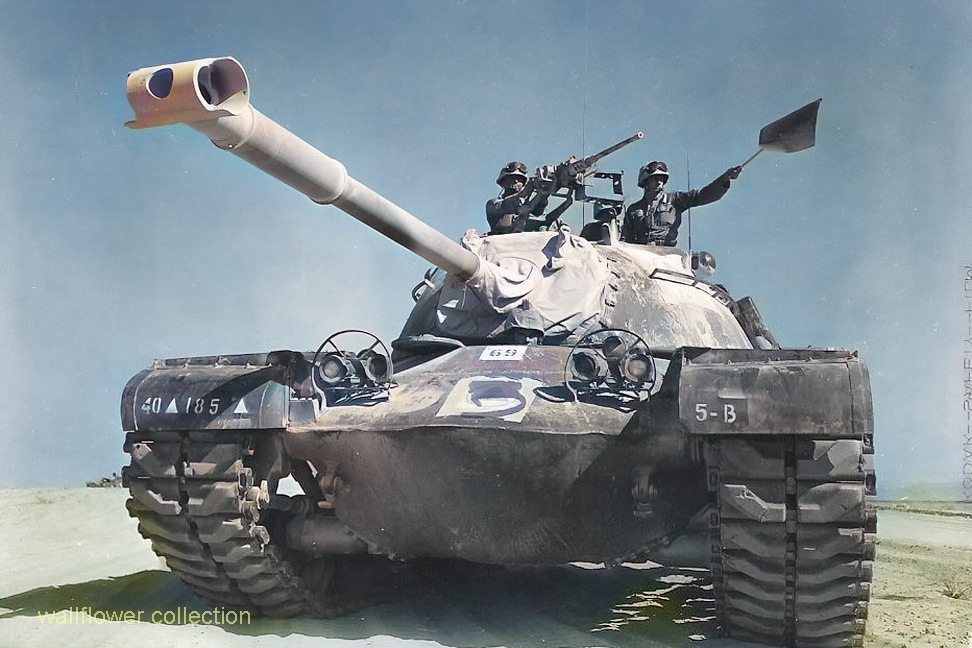
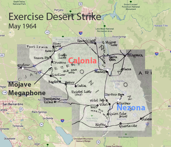
In May 1964, the United States conducted Exercise Desert Strike, one of the most extensive military exercises during the Cold War. It involved over 100,000 military personnel. The primary objectives were to evaluate operational readiness, test conventional and nuclear forces integration, and improve command and control capabilities. The exercise was carried out in multiple phases, beginning with conventional warfare tactics and escalating to simulated nuclear warfare. This tested the troops’ adaptability and response to high-stress scenarios.
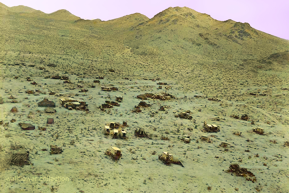
Remote Calzona Camp – Colorized
Despite meticulous planning and rigorous training, the exercise was marred by the tragic loss of 24 men. This underscores the inherent dangers and high stakes of large-scale military operations.
Map showing war zone
Key outcomes of Exercise Desert Strike included a comprehensive assessment of the U.S. military’s strengths and weaknesses. In addition, it validated cutting-edge technologies and significantly improved communication and nuclear warfare strategies. The exercise profoundly impacted subsequent military strategies, contributing to Cold War-era defense policies and nuclear deterrence.
Exercise Desert Strike remains a crucial event in armed forces history, highlighting the importance of preparedness and realistic training in maintaining national security. This exercise’s legacy continues to influence military planning and operations, proving the critical role military exercises have in safeguarding the nation. The fatalities during the exercise are a poignant reminder of the sacrifices made to pursue military excellence and national security.
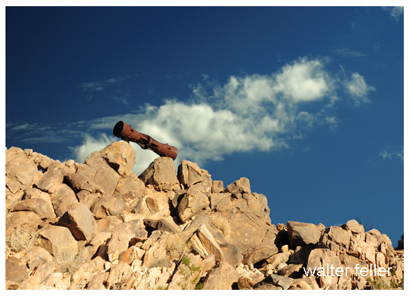
A lasting relic of this period is a megaphone mounted on a rocky hill, symbolizing Exercise Desert Strike’s monumental legacy. This relic is a powerful reminder of the sacrifices necessary to defend our beautiful country. It represents the enduring commitment to national defense and the high price of freedom. It embodies the spirit of vigilance and dedication that inspires and guides military preparedness and strategic planning today.
The Mojave Desert offers a variety of unique and exciting activities. Here are ten of the most popular places:
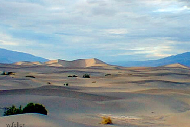
Death Valley National Park: Known for its extreme temperatures and stunning landscapes, it features attractions like Badwater Basin, the lowest point in North America, and the Mesquite Flat Sand Dunes.
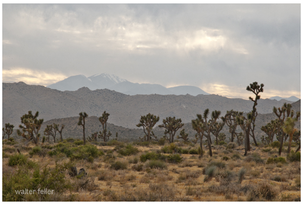
Joshua Tree National Park: Famous for its unique Joshua trees, it offers rock climbing, hiking, and stargazing opportunities amidst a surreal desert landscape. .
Mojave Road: This historic off-road trail takes you through the heart of the Mojave Desert, offering a challenging adventure with historical landmarks and diverse desert scenery.
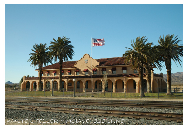
Kelso Depot Visitor Center: Located in the Mojave National Preserve, this historic train depot provides insight into the region’s rail history and is a gateway to exploring the preserve.
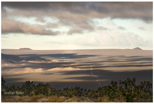
Mojave National Preserve: With over 1.6 million acres, the preserve offers numerous trails, including the Kelso Dunes and the Hole-in-the-Wall Rings Trail. .
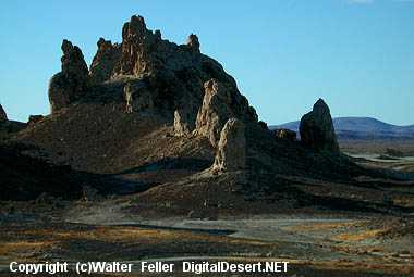
Trona Pinnacles: These unique tufa formations, formed underwater over 10,000 years ago, are popular for photography and off-road exploration. .
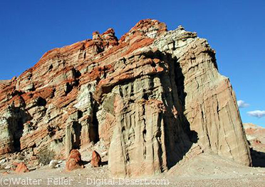
Red Rock Canyon State Park: Known for its vibrant rock formations and scenic desert cliffs, this park offers hiking, camping, and wildlife viewing opportunities. .
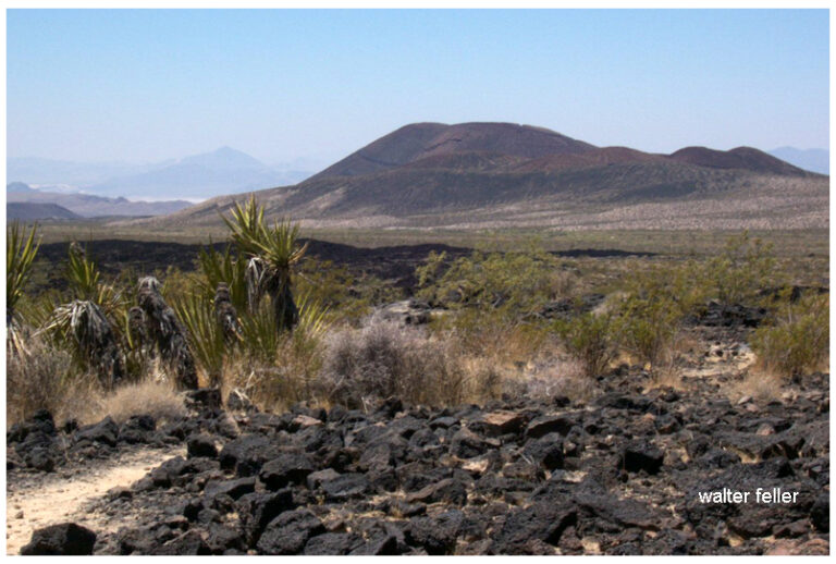
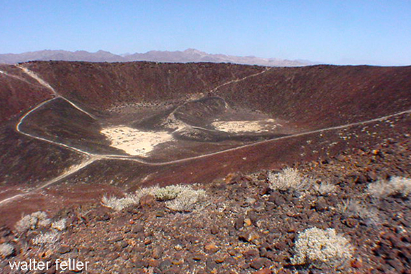
Amboy Crater: A dormant volcanic cinder cone, Amboy Crater provides a moderately challenging hike with rewarding views from the top. .
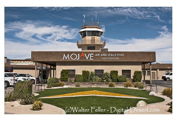
Mojave Air and Space Port: This hub for aerospace innovation offers public tours showcasing historic aircraft and cutting-edge aerospace technology. .
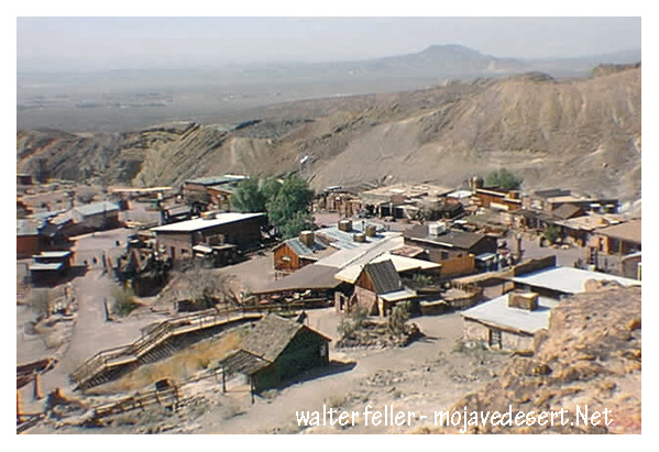
Visit Calico: A restored mining town from the Silver Rush era, Calico offers a glimpse into the past with its preserved buildings, mine tours, and reenactments. .
These activities highlight the diverse attractions and experiences the Mojave Desert offers, from natural wonders to historical sites.
Barstow, California, has a significant historical connection to the National Old Trails Road, which was key in developing the American road transportation system. The National Old Trails Road, also known as the Ocean-to-Ocean Highway, was established in the early 20th century and stretched from Baltimore, Maryland, to California, ending in Los Angeles. This road was one of the earliest transcontinental highways and was instrumental in promoting automotive travel and the development of roadside infrastructure across the United States.
Barstow emerged as an essential stop along the National Old Trails Road due to its strategic location at the junction of several key routes. It lies at the crossroads of the Mojave River Valley, where the Salt Lake Trail, the Mojave Road, the Old Spanish Trail, and later, the railroad routes converge. This made Barstow a crucial hub for transportation and logistics, connecting the eastern parts of the country with the West Coast.
With the rise of the automobile, Barstow became a popular stopover for travelers traveling across the country. The town provided essential services such as lodging, fuel, and vehicle repairs, which helped support its local economy. The presence of the National Old Trails Road also encouraged the development of other infrastructure, including the famed Route 66, which was aligned with parts of the Old Trails Road.
In 1926, with the establishment of the U.S. Highway System, much of the National Old Trails Road was incorporated into U.S. Route 66. Barstow continued to thrive as a key stop along Route 66, attracting tourists and travelers with its diners, motels, and other attractions tailored to the road-tripping public.
Today, Barstow celebrates its rich transportation history through museums and cultural sites that highlight its role in the era of cross-country travel. The town serves as a gateway to regional attractions and continues to honor the legacy of the National Old Trails Road and Route 66.
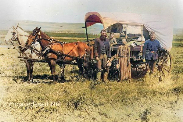
Covered wagons significantly impacted the United States’ westward expansion during the 18th and 19th centuries. These wagons, often called “prairie schooners,” were designed to transport goods and settlers across the North American continent.
Family & covered wagon (prairie schooner)
Key features and uses of covered wagons included:
Design: Covered wagons typically had a wooden frame with a canvas cover. This cover protected the contents from weather elements like rain and sun. The wagon bed was usually made of wood and was about four feet wide by ten feet long.
Cover: The cover was made of canvas or similar durable cloth, stretched over hooped frames, providing shelter and goods for the occupants.
Wheels: The wheels were often large and designed to handle rough terrain. The front wheels were usually smaller than the rear wheels, allowing easier turning.
Draft Animals: Oxen, mules, or horses were commonly used to pull these wagons. Oxen were preferred for their strength and endurance, especially over long distances.
Role in Expansion: Covered wagons were essential for westward migration in the U.S. They carried settlers’ belongings, including tools, food, and sometimes even passengers. These wagons were a vital part of the movement to settle the American West and were commonly seen on trails like the Oregon Trail, the Santa Fe Trail, and the California Trail.
Living Quarters: The covered wagon was a temporary home for many settlers traveling west. Families would cook, eat, sleep, and spend much of their time in or around the wagon during their journey.
Historical Significance: The image of a covered wagon crossing the plains has become an iconic symbol of American frontier life, representing the pioneer spirit, exploration, and the challenges of frontier life.
The use of covered wagons declined with the advent of railroads, which offered a faster and more efficient means of transporting goods and people across the country. However, their legacy remains an integral part of American history and folklore.
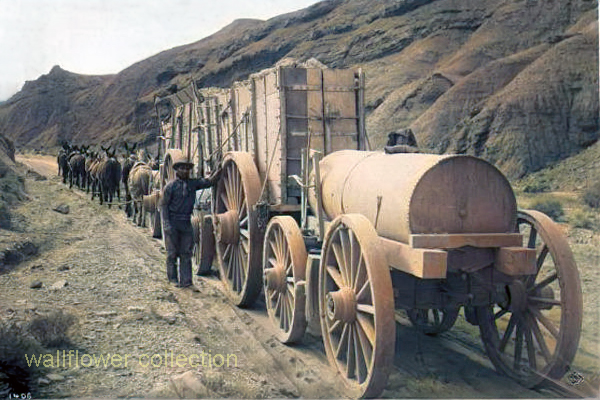
The 20-mule team borax ore wagons used in the late 1800s to transport borax from the mines in Death Valley, California, were quite large and had specific dimensions.
Here are the approximate dimensions for a typical 20-mule team borax ore wagon:
Length: Approximately 30 feet (9 meters)
Width: About 8 feet (2.4 meters)
Height: Around 7 feet (2.1 meters)
Weight: These wagons weighed approximately 7 tons when fully loaded with borax ore.
These massive wagons required a team of 18 mules and two horses to pull them across the harsh desert terrain. They were an iconic part of the borax mining industry in the late 19th century and were crucial in transporting borax to the nearest railroad for distribution.
Two large ore wagons were used to transport the borax ore from the mines in Death Valley to the nearest railroad for shipment. They were massive and could carry a significant amount of borax.
One water tank wagon: There was a specialized tank wagon in addition to the two ore wagons. This wagon carried water for the mules and horses that pulled the wagons. The desert environment of Death Valley was harsh, and providing water for the animals was crucial to their survival during the long and arduous journey.
So, the 20-mule team borax wagons actually consisted of 18 mules and 2 horses pulling two ore wagons and one water tank wagon. These wagons became an iconic symbol of the borax mining industry in the late 19th century.
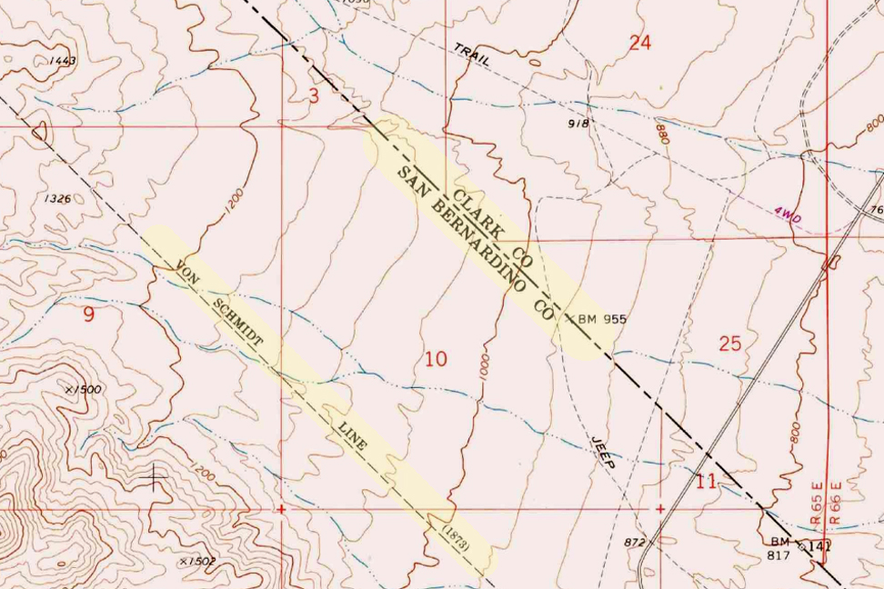
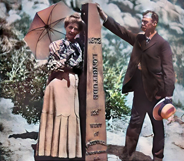
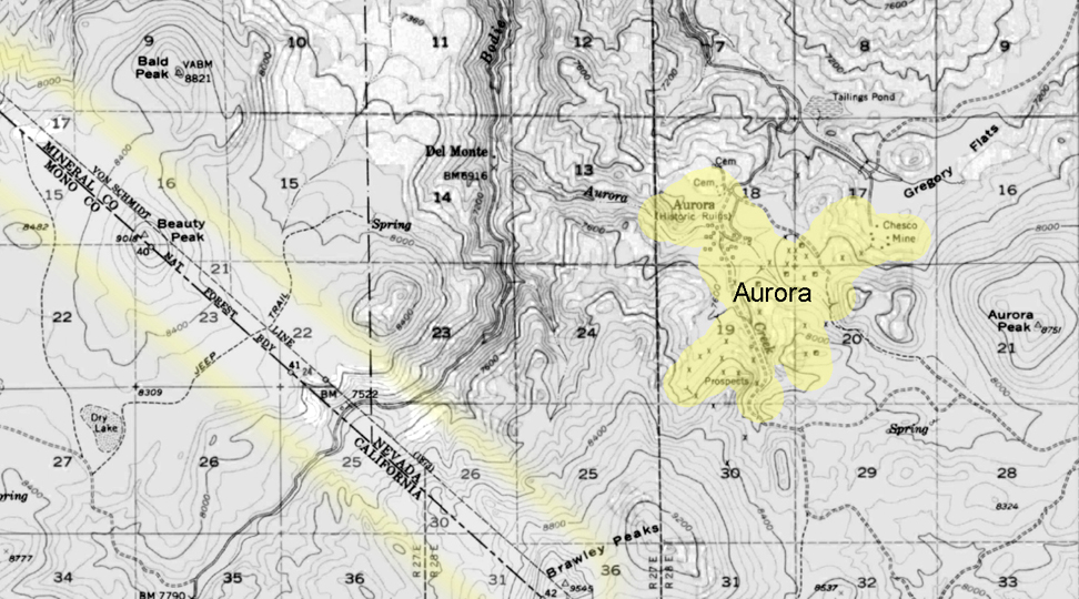
The Von Schmidt boundary, or the Schmidt Line, refers to a historical boundary line in California. It was surveyed and established by Alexey von Schmidt, a Russian engineer, in the 1860s. The purpose of the Von Schmidt boundary was to delineate the border between California and Nevada during a time when there was confusion and disputes over the exact location of the state boundary.
Von Schmidt’s survey helped clarify the boundary and resolve conflicts between California and Nevada. His efforts included placing markers and monuments along the boundary line to make it clear and permanent. The boundary he established still exists today and is the official border between the two states.
The Von Schmidt boundary is of historical significance and has been preserved as a reminder of the surveying and boundary disputes of the past. It is located in the eastern part of California near the Nevada border.
Why was the initial boundary incorrect?
The initial boundary between California and Nevada was incorrect and subject to disputes for several reasons:
Lack of Accurate Surveys: In the early years of California’s statehood and during the Gold Rush era in the mid-19th century, limited resources and technology were available for accurate land surveys. As a result, the initial surveys and boundary markers were not precise.
Rush for Mineral Resources: The discovery of gold and other valuable minerals in the region led to a rapid influx of settlers and miners. This rush created a need for clear land boundaries and property rights. However, the focus was often on extracting resources rather than conducting precise surveys.
Overlapping Claims: Different parties, including miners, settlers, and land speculators, had conflicting claims to land in the region. These overlapping claims added to the confusion regarding the exact location of the state boundary.
Political Disputes: California became a state in 1850, and shortly thereafter, disputes arose over its eastern boundary. Nevada was not established as a separate territory until 1861. Political disagreements and conflicting interpretations of earlier treaties and agreements existed during this period.
Multiple Surveys: Various individuals and surveyors attempted to establish the boundary, but their surveys often differed. This further complicated matters.
Given these factors, there was much uncertainty and disagreement regarding the California-Nevada boundary in the early years. It was only through the efforts of surveyors like Alexey von Schmidt and subsequent legal and political resolutions that the boundary was eventually clarified and accepted. Von Schmidt’s survey work played a crucial role in resolving these disputes and establishing a more accurate boundary line.
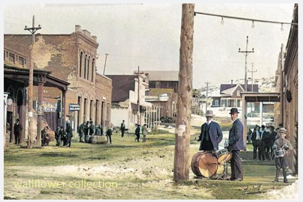
Aurora
Aurora, Nevada 1910
The town of Aurora, Nevada, experienced a move due in part to the boundary disputes between California and Nevada. Aurora was originally founded in the 1860s during the Nevada Silver Rush. At its founding, the exact location of the California-Nevada border was still uncertain and subject to disputes.
Aurora moved to make sure it was in Nevada.
As a result of the boundary disputes and the fact that Aurora’s initial location was close to the border, there were concerns about which state’s jurisdiction the town fell under. Aurora’s residents and businesses moved the town slightly to the east, further into Nevada’s territory, to avoid potential legal and tax issues. This move ensured that Aurora would be firmly within the boundaries of Nevada when the border dispute was eventually resolved.
The relocation of Aurora was a strategic decision made to secure the town’s status as part of Nevada rather than California, given the uncertainties and conflicts related to the state boundary at the time. This move allowed Aurora to thrive as a mining town in Nevada without the legal complications associated with straddling the border.
Is everybody happy?
It’s difficult to determine whether “everybody” is happy, as people’s feelings and satisfaction with their circumstances can vary widely. Happiness is subjective and depends on individual experiences, perspectives, and circumstances.
In the context of the town of Aurora’s relocation due to boundary disputes, it’s possible that the decision to move was made to address specific legal and jurisdictional concerns at the time. The move may have been necessary for the town’s continued growth and prosperity. However, whether every resident or stakeholder was happy with the decision would depend on their perspectives and interests.
In any community or population, there will be a range of opinions and emotions regarding significant decisions like a town’s relocation. Some may have been happy with the move because it resolved legal uncertainties, while others may have been less pleased due to the disruption and changes associated with relocation.
To determine the current happiness or satisfaction of people in a specific context, it would be necessary to conduct surveys or interviews to gather their perspectives and opinions.
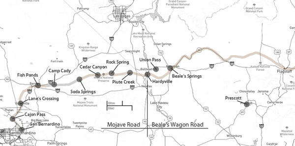
Mojave Road and Beale’s Wagon Road are historic routes in the southwestern United States, particularly in the Mojave Desert region. Here’s some information about each:
The Mojave Road is a historic trail that traverses California’s Mojave Desert. It was a significant route used by Native Americans, Spanish missionaries, and later by American pioneers and traders.
The trail is approximately 138 miles long and extends from the Colorado River near present-day Needles, California, to the Mojave River near present-day Barstow, California.
It was primarily used for transportation and trade between the Colorado River and the coastal settlements in California. The trail passes through varied desert landscapes, including sandy stretches, rocky terrain, and mountainous areas.
Beale’s Wagon Road, named after Edward F. Beale, a military officer and explorer, was a trail developed in the 19th century for the U.S. Army to improve communication and transportation across the arid lands of the American Southwest.
Edward F. Beale surveyed and established the road in the late 1850s. The road ran from Fort Defiance in Arizona to the Colorado River, passing through present-day Arizona and California.
Beale’s Wagon Road was designed to be more reliable and accessible than other trails, facilitating military movement and communication between California and the western territories.
Mojave Road and Beale’s Wagon Road were important in the United States’ westward expansion. Today, these routes attract history enthusiasts, adventurers, and off-road enthusiasts who explore them to experience the challenges faced by those who traveled these paths in the past. Keep in mind that conditions and accessibility of these trails may vary, so it’s important to check for current information and any regulations before embarking on a journey along these historic routes.
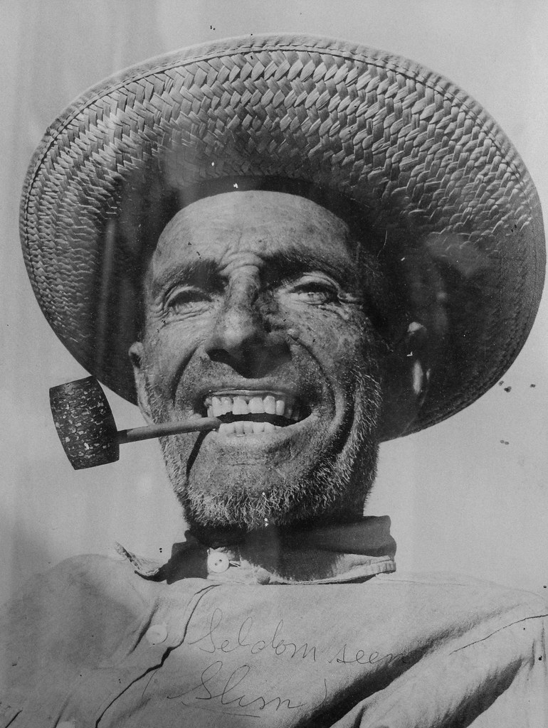
“Seldom Seen Slim” was a nickname for a man named Charles Ferge, who lived in the Panamint Valley of California. He was known for his reclusive lifestyle and infrequent appearances in town, leading to the nickname “Seldom Seen Slim.” He was a prospector and a colorful character in the region’s history. The nickname reflects his tendency to avoid social interactions and to be rarely seen by others.
He claimed he wasn’t lonely because he was half coyote and half burro!
Seldom Seen Slim said these words many times, and they are the epitaph on his grave at Ballarat Cemetery in Ballarat, California.
Seldom Seen Slim, named Charles Ferge by his parents, was born in Illinois in 1881, according to wellfare records. Slim always said, “I got no people, I was born in an orphanage.
Slim came to Ballarat sometime between 1913 and 1917, not long after the town was abandoned by the miners who had been seeking their fortunes in the silver mines of the Panamint Mountains. He became the last resident of Ballarat, now a ghost town. Slim had a reputation as a recluse with a cantankerous side. He didn’t believe in showers or baths because “bathing was a waste of water”. Although, he did make into town for his annual haircut and bath whether he felt he needed it or not!
Slim was a visitor to Trona when the time came to stock up on supplies of tobacco for his corn cob pipe and to replenish his bottle of hooch. His reputation was so widespread that Walter Knott had statues of “Seldom Seen Slim” made and placed in his Knotts Berry Farm and Ghost Town in Buena Park, CA.
Slim was found ailing in his rundown trailer in Ballarat’s ruins and was taken 70 miles to Trona, where he survived only five days. His funeral was in Boot Hill in 1968 and was broadcast on television around the country before cable, as he was the last of a breed of prospectors who spent their lives living on the Mojave Desert in and around Death Valley. He was the first to be buried in the Ballarat cemetery in half a decade. After Slim’s death in 1968, at the age of 80, the United State Department of the Interior approved the naming of a peak in the Panamint Mountains in honor of Charles Ferge. The peak is now named “Slim’s Peak”.