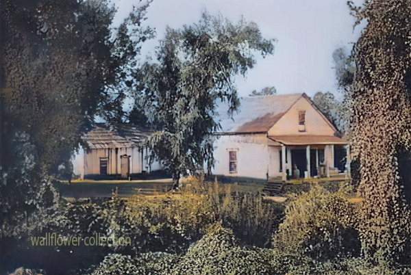
“Shea Desert Castle Sold,” Los Angeles Times, 25 Mar 1935 (colorized)
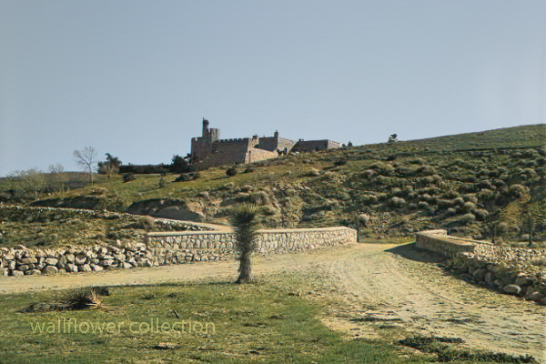
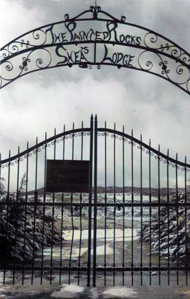
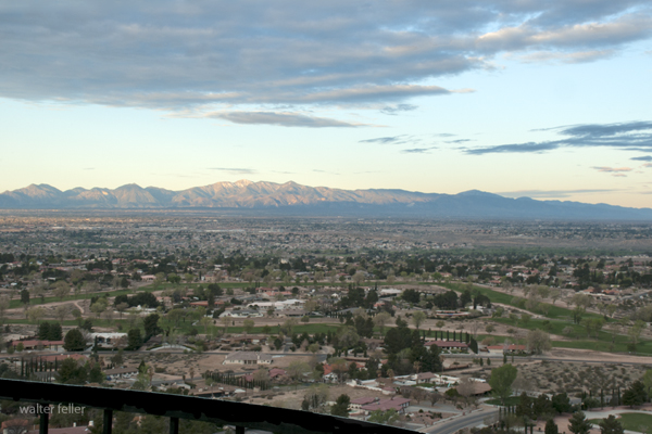
Richard Peter Shea built Shea’s Castle in 1924, also known as Sky Castle or Castle Ranch.
1929’s stock market crash bankrupted Shea. Shea’s wife died, the bank took over the castle, and Shea committed suicide.
Over the years, the property has changed hands and been used as a filming location.
Trigger, Roy Rogers’ horse, was trained on the property.
It is now a private residence.
The massive granite structure, built by R. P. Shea, was sold to three Beverly Hills women in 1935. The “castle” boasts many unique design elements that remain untouched after the purchase. This photograph appears with the article, “Shea Desert Castle Sold,” Los Angeles Times, 25 Mar 1935: 19.CAPTIONText from negative sleeve: Shae’s [sic] Castle nitrates
Handwritten on negative: Shae’s [sic] Castle 3-16-35 Text from newspaper caption: “Dream Home” in Mojave Desert Passes Into New Hands; A massive granite structure in the Mojave Desert, built ten years ago as a “dream home” of R. P. Shea, yesterday, passed into the hands of new owners. So incongruous is its setting that many believe they are beholding a mirage when they see the $175,000 castle.
Skidoo came to life because of fog. When Harry Ramsey and a man called One-eye Thompson lost their way on a road leading to the new boom camp of Harrisburg, they stopped to rest near a log lying against an outcropping of rock. When the fog lifted, the rock turned out to be gold. This was back in 1905. In deciding upon a name for the town that sprung up, a numerologist associated a popular expression of the day, 23-Skidoo, with the fact that a Rhyolite man named Bob Montgomery had successfully piped water from Telescope Peak 23 miles away and suggested the name Skidoo. So it became.
Downtown Skidoo. Death Valley National Park
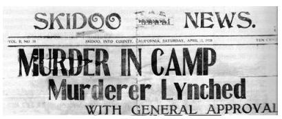
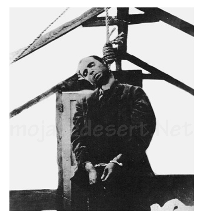
Old-timers say the camp produced over a million dollars worth of gold ore between its discovery and its demise some 20 years later. Skidoo’s chief claim to fame, however, was not its riches. Rather, it was an infamous lynching of a scoundrel named Joe Simpson in 1908.
On a tour to the ghost town of Skidoo in 1962, we were privileged to be accompanied by an 87-year-old gentleman named George Cook. The interesting thing about Mr. Cook was that it was he who pulled on the rope at the lynching. His participation had only recently been divulged to a few intimate friends—after all others involved had passed on to their rewards, or whatever.
Joe “Hooch” Simpson
“Joe Simpson,” Mr. Cook told us, ‘was a would-be villain who had killed a man at Keeler after shooting-up Jack Gun’s Saloon in Independence the preceding year. He’d somehow gotten off and drifted to Skidoo where he became a partner with Fred Oakes in the Gold Seal Saloon. Across the street was Jim Arnold’s Skidoo Trading Company.
“Arnold was a friendly, well-liked man and had always been on good terms with Simpson, but Simpson became drunk and abusive one April morning and decided to hold up a bank situated in part of Arnold’s Skidoo Trading Company. Apprehended, his gun was taken away and hidden by the deputy sheriff, but a little later Simpson found his weapon and returned to the store to shoot Jim Arnold. He then turned on two other men who had come to the rescue, but his aim was poor and both escaped. Eventually, Simpson was overpowered and placed under guard in the deputy sheriff’s cabin. Unfortunately,” Mr. Cook lamented, “the popular Jim Arnold died that night.”
Skidoo went wild with indignation. After Arnold’s funeral, which the entire camp attended, a group went to the improvised jail, led the prisoner out at the end of a rope, and hanged him to the nearest telephone pole. When Sheriff Nailor from Independence arrived, after a hazardous trip over rough roads via Tonopah and Rhyolite, he made the now famous statement, “It’s the best thing that ever happened to Inyo County; it saved us $25,000!”
But this wasn’t the end. Several spectators had forgotten their cameras and wanted pictures of the hanging. So, Joe Simpson’s body was obligingly strung up again, this time from the ridgepole of the tent where he was “laid out.” News of this gruesome encore spread and the lynching won everlasting fame. In his private narrative of the event, George Cook added a factor never before related: “Joe was dead before we got the rope around his neck; he died of a heart attack (from fright) and was already gone when dragged to the telephone pole scaffold.”
It was also he, George Cook confessed, who assisted Dr. MacDonald in removing the head from Simpson’s corpse. The doctor, it seems, had once performed an operation on Simpson s nose and wanted to make a further medical study of the case. Going at night, they performed the severance at the lonely prospect hole where Simpson’s body had been tossed. (No one in Skidoo would give him a decent burial, so great was the indignation at his senseless crime). The skull was exhibited for a period in a showcase at Wildrose, but later disappeared.
The remainder of the skeleton resisted oblivion, however. Years later when George Cook returned to Skidoo to work in the mill, an agitated prospector appeared one day to report a headless skeleton of a man who’d evidently been murdered. Because Cook was the only old-timer around at the time, he was consulted. Indeed a crime had been committed sometime, he agreed, but of the details, he had conveniently forgotten.
Last year George Cook passed away. Small in stature, religious, mild-tempered, and given to writing sentimental verse, he was the antithesis of our Western idea of a vigilante. The role forced upon him by his acute anger over the murder of a friend bothered this good man to the end of his days. His belief that Simpson did not expire at his hand appeared to be a real comfort. And, perhaps he was right. We cannot disagree, for George Cook was there.
Much interesting history is connected with the now-defunct Skidoo. Following its early boom, the town was deserted for a period, then, under new management, the mine and mill reopened during the 1930s and a period of production occurred. The old wild days never returned, however, and its fame as a mining camp still rests upon the lynching incident —to which we add, “Joe Simpson did not die because of a rope and a telephone pole. He died of a heart attack!”
by Myrtle Nyles – November 1964 – Desert Magazine
Editor’s Note: This is but one version of this story, and it is worth saying that it has generated many other versions and stories through its telling.
In January 1906 two wandering prospectors, John Ramsey and John (One-Eye) Thompson were headed towards the new gold strike at Harrisburg. Along the way a blinding fog came in and the two camped near Emigrant Spring for fear of getting lost. …More …
In the 1880s, there was increased public awareness of the problems California Indians were confronting. While the problems were rarely analyzed, many people helped to improve the quality of life for Indians. There was an effort to improve the education of Indians through schools, and to provide them with land to better their economic conditions so that Indians could become full citizens of the United States of America.
In the early 1880s, Helen Hunt Jackson wrote A Century of Dishonor and sent a copy of her book to each United States congressman. She was then appointed to a commission to examine the condition of Indians in Southern California. Her visits resulted in The Report on the Condition and Needs of the Mission Indians of California, by special agents Helen Jackson and Abbot Kinney. The report summarized the problems and concerns of Southern California Indians; many of the conditions outlined in the report, however, were applicable to all California Indians. The report noted that Indians had been continually displaced from their land. She also noted that while many Indians had taken “immoral” paths, others had chosen the responsibilities of herding animals and raising crops. In her report, she also noted that the United States government had done little to right the wrongs of the past. While Jackson did not solve all the problems of Southern California Indians, her work did bring their concerns to the attention of the American public and Congress.
One recurring concern was the lack of education and training necessary for survival in American society. The government, as well as Jackson, saw education as a way of assimilating Indians into the mainstream of United States society. Reports from the Secretary of the Interior and the Bureau of Indian Affairs at that time expressed the goals of the government in relation to the educational process. In 1908, one report stated, “the rooms held three or four each and it was arranged that no two tribes were placed in the same room. This not only helped in the acquirement of English, but broke up tribal and race clannishness, a most important victory in getting Indians toward real citizens.” (Spicer, 1969:235) An earlier report stated, “I can see no reason why a strong government like ours should not govern and control them [Indians] and compel each one to settle down and stay in one place, his own homestead, wear the white man’s clothing, labor for his own support, and send his children to school.” (Spicer, 1969:236) Other people had even stronger ideas. For instance, George Ellis, in his book, The Red Man and the White Man in North America, wrote, “The Indian must be made to feel he is in the grasp of a superior.” (Ellis 1882:572) In opposition to this view, the Indian Rights Association was formed in 1882. This Indian advocate group would play a powerful role in formulating Indian policy in upcoming years.
While the approaches differed, all agreed that education was necessary. “In California, three types of educational programs were established for native peoples. The first was the Federal Government reservation day school. The second type was the boarding school, fashioned after Carlisle. And finally, the nearby public school that allowed Indians to attend began a slow, though steady, increase in popularity among policy makers.” (Heizer, 1978:115) While the public schools seemed the best alternative, most Indians did not have the right to attend these schools until the 1920s.
In 1881, an elementary school system for Indians was established in California. However, the Indians soon recognized that the schools were a threat to their culture, as well as to the tribe as a political unit. “As a result, considerable resistance to the schools developed. Native peoples destroyed the day school at Potrero in 1888, and burned the school at Tule River in 1890. At Pachanga, a Luiseno named Venturo Molido, burned the school and assassinated the school teacher in 1895.” (Heizer, 1978:115) Much of the destruction and violence could have been avoided if the school system and the government had recognized the great importance the Indians placed on being able to maintain their cultural beliefs. In 1891, school attendance was made mandatory. But while attendance was mandatory, there were still Indian children who did not attend.
In 1901, the first Indian hospital in California was established at Sherman Institute in Riverside. Sherman later became a boarding school for Indian children. While hospitals and other facilities improved conditions for California Indians, most Indians were still without homes.
During this period, another major focus was on the acquisition of land for Indians. Probably the most interesting example of the way land was acquired is evidenced by the Yokayo Pomo in 1881: “After collecting nearly $1,000 from their people, the head man selected a 120-acre site near the Russian River and made the down payment. The Yokayo groups prospered; they paid the entire balance owed on their land, and even saved enough to purchase farm machinery shortly thereafter.” (Heizer, 1978:118)
A major tool the government used in trying to assimilate Indians during this time was the General Allotment Act of 1887, also known as the Dawes Act, which appeared to be generally advantageous to Indians. However, the major intent of the act was to break down the role of tribal government. The act itself provided that each Indian living on a reservation would receive a 160-acre allotment of land per family unit, and each single man would receive 80 acres if the reservation had enough land. If there was not enough land, other provisions were made. Indians not residing on a reservation would be entitled to settle on any surveyed or unsurveyed government lands not appropriated. The lands allotted would be held in trust for 25 years by the Bureau of Indian Affairs. If all other provisions of the act were met, that is, if the Indians made use of the lands for agriculture and became self-sufficient, then the land would become the property of the individual. “Native people understood full well the implications of allotment and offered considerable resistance. Nevertheless, the Bureau of Indian Affairs began ordering allotments of various sizes at Rincon, Morongo, and Pala Reservations in 1893. . . . The next year, allotments were begun at Round Valley Reservation. By the turn of the century, 1,614 individual allotments were made among eight reservations in the state.” (Heizer, 1978:117)
Long before the passage of the Dawes Act, people recognized that problems would occur from its implementation. In 1881, Senator Henry Moore Teller of Colorado spoke in opposition to an earlier form of the Allotment Act. Senator Teller concluded, “If I stand alone in the Senate, I want to put upon the record my prophecy in this matter, that when 30 or 40 years shall have passed and these Indians shall have parted with their title, they will curse the hand that was raised professedly in their defense to secure this kind of legislation, and if the people who are clamoring for it understood Indian character and Indian laws, and Indian morals, and Indian religion, they would not be here clamoring for this at all.” (Spicer, 1969:234) The senator would soon be proven correct.
Other Indians, such as the Cupenos from Warner Springs, chose to fight for their lands in the courts. With the assistance of the Indian Rights Association, they began a suit to stop their eviction from their home at the Warner Ranch. In 1888, they won a favorable decision which temporarily stopped their eviction. However, the case was appealed to the United States Supreme Court, and in 1903, the Cupenos were evicted from their home.
Still, other Indians chose to purchase land that was once theirs and reside on it. However, not every transaction was fair. In 1904, the San Francisco Chronicle reported that Indians who bought land from Whites were being dispossessed by the heirs of the granters, who gave no valid titles. “The Northern California Indian Association reported that about 10,000 Indians lived on land to which whites hold title. They were subject to eviction ‘at any time.’ The Indians are recognized for what they are not, usually competent to compete with white men in economic struggle. . . . Congress should buy lands for Indians in locations where they now are and allot them small farms in severalty. . . . It is also asked that their status as to citizenship be satisfactorily established. This petition is now before congress. It should be granted for justice and honesty. . . .” (San Francisco Chronicle, 1904).
A History of American Indians in California:HISTORIC SITES
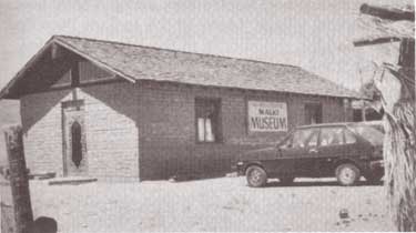
Malki Museum Riverside County
The Malki Museum is located on the Morongo Indian Reservation on Fields Road near the town of Banning, California. It is constructed of adobe bricks, and is approximately 30′ x 50′ x 12′ in size. Display cases house cultural objects made by Indians from the surrounding area, while the museum grounds include several brush arbors and a botanical garden. Both the museum and its grounds are well attended.
The Malki Museum was constructed in 1965 by the Cahuilla Indians and serves to preserve and enhance Cahuilla Indian lifeways. Its cultural exhibits relate the story of the Cahuillas from the pre-contact period to the present. Malki was also the first home for a publishing company, the Ballena Press, which has expanded its services to include ethnographic and ethnohistoric information and analysis of southwestern tribes.
The Malki Museum was the first Indian controlled and operated museum in California. As such, it is an important example to other Indian groups who are interested in preserving their material culture through a museum. Although the idea of an Indian Museum operated by Indian people seems like an obvious and natural development, it should be remembered that it takes dedicated people to actually accomplish such a task. Malki is a living example of an Indian people’s ability to adapt to the fast-changing circumstances that surround their cultural heritage. It will serve future generations by providing them with a glimpse into the rich and beautiful history of the Cahuilla people.
A History of American Indians in California: HISTORIC SITES
Tejon Indian Reservation Kern County
In the early 1800s, Indians in the interior of California began to feel the effects of trappers and explorers. By mid-century, coastal Indians who moved inland following the breakup of the missions also suffered under the influx of miners and settlers. When the federal government sent Indian agents to write treaties with California Indians, Agent George W. Barbour negotiated the treaties with both interior and coastal Indians in the southern San Joaquin Valley. In return for the promise of goods, annuities, and land, the Indians vacated much of their home land.
In February of 1852, President Millard Fillmore submitted 18 California Indian treaties to the United States Congress for ratification, but the California delegation objected, complaining that the treaties provided too much good land for the Indians. Congress failed to ratify the treaties but did make some provisions for California Indians.
Edward F. Beale was appointed Superintendent of Indian Affairs for California in April 1852. Upon arrival in September, Beale toured the state to determine the status of California Indians. He reported in February 1853 that “our laws and policy with respect to Indians have been neglected or violated. . . . [The Indians] are driven from their homes and deprived of their hunting-grounds and fishing-waters at the discretion of the whites. . . .” Beale requested $500,000 for military reservations where both soldiers and Indians would reside.
Beale hired H. B. Edwards to start farming operations at Tejon and the San Joaquin River. On March 2, 1853, Congress appropriated $250,000 for five reservations, not to exceed 25,000 acres each, to be located on public lands, with good land, wood, and water. In September, Beale expanded the Tejon Farm into the first California reservation.
To gain support for his efforts, Beale named the reservation after Senator William Sebastian, Chairman of the Indian Affairs Committee. The Sebastian Indian Reservation, more commonly known as Tejon Indian Reservation, was located in the southern end of the San Joaquin Valley, “between Tejon Vaquero Headquarters and Canada de las Uvas. . . .” (Latta, 1977:736)
Tejon was located on a Mexican land grant rather than on public land, but Beale argued that no public lands were available and that the unoccupied grant could be purchased if necessary. Beale’s primary reason for choosing Tejon was the presence of mission-trained Indians with agricultural skills, more likely to succeed on a reservation.
Despite substantial opposition, Beale continued to gather Indians and move them to Tejon. In early 1854, he reported 2,500 Indians at Tejon and 2,650 acres under cultivation. Beale’s arguments for a reservation of 75,000 acres failed, and in July 1854, he was replaced by Thomas J. Henley.
When Henley took charge, he noted only 800 Indians, with fewer than 350 present at one time, and only 1,500 acres under cultivation, indicating that numbers of Indians and amount of acreage under cultivation had been inflated. Most of the crops failed that year because of drought. Henley started the Tule River Farm to supplement the reservation’s food, but the Indians still had to gather native foods and the government had to bring in more supplies in order to feed the reservation population. Throughout the reservation’s existence, drought, insects, and crop disease undermined the attempts at farming.
In November of 1856, the reservation was reduced to 25,000 acres. That year, 700 Indians were reported residing on the reservation and 700 acres were under cultivation. By 1859, Henley had been replaced.
In addition to crop failure, the reservation faced loss of the land when the land grant claim was upheld in court. Settlers also encroached on the unsurveyed and unfenced land, allowing cattle and sheep to eat reservation crops. During the 1863 drought year, all the crops were lost except for 30 tons of hay.
Meanwhile, former agent Edward F. Beale had purchased five contiguous ranchos in the Tejon area, including the reservation land, and was raising 100,000 sheep. In 1863, he offered to lease 12,000 acres to the government for a dollar an acre, but withdrew the offer when he found that the government planned to move Owens River Indians there. He noted that he had made the offer only because Indians already on the reservation were his friends.
Jose Pacheco, a Tejon leader, wrote to General Wright on April 16, 1864, “I should not have troubled you with this letter, Dear General, did I not think the agents here had wronged us. You and our great father at Washington do not know how bad we fare, or you would give us food or let us go back to our lands where we can get plenty of fish and game. I do not think we get the provisions intended for us by our Great Father; the agents keep it from us, and sell it to make themselves rich, while we and our children are very poor and hungry and naked.” (Sacramento Union, April 28, 1964)
The reservation was ordered closed in June 1864, and on July 11, Austin Wiley wrote, “I have the honor to inform you that all the Indians on the Tejon Farm and in the vicinity of Fort Tejon, some two hundred in number, have been removed from there to the Tule River farm.” Wiley noted that there was no food for the Indians at Tejon.
Shortly thereafter, D. N. Cooley, Commissioner of Indian Affairs, summarized the reasons for the reservation’s failure: “The lack of legal title to the land severely restrained investment in construction and development, leaving the reserve and the Indians on it in a state of constant uncertainty. The ideal of converting Indians from food gathering to settled agriculture was never realized.”
(Note: Unless otherwise specified, all above quotes are from government reports as cited in California Department of Parks and Recreation reference document No. 169, “Tejon Indian Reservation.”)
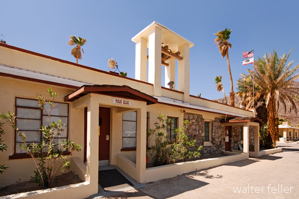
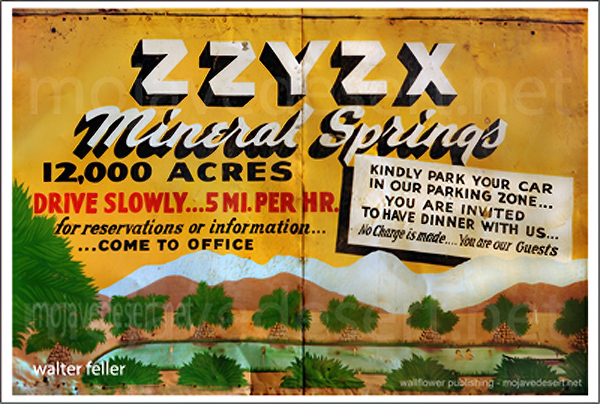
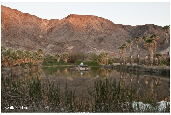
Zzyzx, pronounced “zy-zicks,” is a unique and intriguing place in the Mojave Desert of Southern California, USA. Specifically, it is home to the Desert Studies Center, operated by the California State University (CSU) system. The center serves as a field station for research and education focused on the desert ecosystem.
Here are some key points about Zzyzx and the Desert Studies Center:
Location:Zzyzx is approximately 100 miles northeast of Los Angeles, near Baker, California. The Desert Studies Center is part of the larger California State University system and is used for academic and research purposes.
History: The name “Zzyzx” was given to the area by Curtis Howe Springer, a self-proclaimed medical doctor and radio evangelist who established the Zzyzx Mineral Springs and Health Spa in the 1940s. The name was created to be the last word in English, and Springer intended to use it for marketing purposes. However, in 1974, the Bureau of Land Management (BLM) reclaimed the land, which became the site of the Desert Studies Center.
Desert Studies Center: A research and educational facility jointly operated by the California State University system. It provides a base for researchers, students, and educators interested in studying the unique ecologyand geology of the Mojave Desert. The center offers facilities for field courses, workshops, and research projects related to desert studies.
Facilities: The Desert Studies Center has dormitories, classrooms, laboratories, and other amenities to support researchers and students. It serves as a hub for scientific exploration and learning about the challenges and adaptations of life in desert environments.
Research: Researchers at the Desert Studies Center focus on various topics, including desert ecology, geology, climate, and biodiversity. The unique characteristics of the Mojave Desert make it an ideal location for studying desert ecosystems and understanding how plants, animals, and microorganisms have adapted to this arid environment.
Visitors to the Desert Studies Center can explore the surrounding Mojave Desert, learn about its flora and fauna, and gain insights into the challenges and opportunities presented by desert ecosystems. It’s a valuable resource for those interested in environmental science, ecology, and desert studies.
The Tejon Ranch, located in California, has a rich and varied history that spans centuries.
Tejon Ranch Headquarters
Here is an overview of its history:
Native American Presence: The area around Tejon Ranch was originally inhabited by Native American communities, including the Kitanemuk people. These indigenous groups had a deep connection with the land, relying on its resources for their sustenance.
Spanish Era: With the arrival of Spanish explorers and missionaries in the 18th century, the Tejon Ranch area became part of the vast landholdings of the Spanish missions and the California missions system. The land was used for cattle ranching and agriculture to support the missions.
Mexican Land Grants: Following Mexico’s independence from Spain in 1821, the Mexican government began granting large tracts of land, including the Tejon Ranch, to private individuals. The Rancho El Tejon was granted to José Antonio Aguirre in 1843.
Gold Rush and Transition: The California Gold Rush of 1848-1855 brought significant changes to the region. The influx of people seeking gold and the economic and political shifts associated with the U.S.-Mexican War led to the end of Mexican land grants. 1852, the U.S. government affirmed the land grant, and Benjamin and James Roberts acquired the Rancho El Tejon.
Ranching and Agriculture: The Tejon Ranch became a center for ranching and agriculture. Cattle ranching, farming, and other activities flourished on the vast expanse of land. The ranch was crucial in supplying beef and other products to growing communities in Southern California.
Treaty of Fort Tejon: In 1854, the U.S. government negotiated the Treaty of Fort Tejon with various Native American tribes, including the Kitanemuk. However, the treaty was not fully implemented, leading to conflicts and struggles for the indigenous people.
Railroad Development: The Southern Pacific Railroad played a significant role in developing the Tejon Ranch. In the late 19th century, the railroad bypassed the Tehachapi Mountains, where the ranch is located, favoring a route through the nearby Tehachapi Pass. This decision affected the economic growth of the Tejon Ranch region.
20th Century and Beyond: The Tejon Ranch underwent various ownership and land use changes. In the 20th century, it evolved into a diversified operation involving agriculture, ranching, and commercial activities. The Tejon Ranch Company, established in the early 1900s, was key in managing and developing the property.
Today, the Tejon Ranch remains one of the largest privately-owned ranches in California, known for its conservation efforts, including partnerships with environmental organizations to preserve significant portions of the land as open space. The ranch’s history reflects the broader historical and cultural shifts in California, from indigenous habitation to Spanish colonization, Mexican land grants, and the economic transformations of the 19th and 20th centuries.
E.F. Beale and the Tejon Ranch
Edward Fitzgerald Beale, often referred to as E.F. Beale, played a significant role in the history of the Tejon Ranch.
Tejon Ranch – La Liebre Rancho
Here’s an overview of his connection to the ranch:
Military Career: E.F. Beale was born in 1822 and had a distinguished military career. He served as a lieutenant in the U.S. Navy and later became Superintendent of Indian Affairs in California and Nevada.
Surveyor and Explorer: In the 1850s, Beale was appointed by the U.S. government to survey and explore a wagon road along the 35th parallel from Fort Defiance in Arizona to the Colorado River. This expedition, known as the Beale Wagon Road, aimed to improve transportation and communication between the East and the newly acquired territories in the West.
Tejon Ranch and the Wagon Road: The Beale Wagon Road passed through the Tejon Ranch, linking Fort Tejon to the Colorado River. Beale recognized the strategic importance of the Tejon Pass for transportation routes and recommended it as a route for the railroad.
Land Acquisition: In 1861, Beale purchased the Rancho El Tejon, which included the Tejon Ranch. He acquired the property from the prominent rancher General Edward Beale Tracy. E.F. Beale engaged in various agricultural and ranching activities on the land.
Conservation and Agriculture: Beale was not only interested in ranching but also in conservation. He introduced various agricultural improvements to the ranch, including cultivating wheat and vineyards. Beale also advocated for land conservation and recognized the need to protect natural resources.
Tejon Ranch Company: In the early 20th century, the Tejon Ranch changed ownership and management. The Tejon Ranch Company was established in 1936, and E.F. Beale’s descendants were involved in the company’s operations.
Legacy: E.F. Beale’s legacy is intertwined with the history of the Tejon Ranch. His contributions to the development of transportation routes, his role in the acquisition of the ranch, and his efforts in both ranching and conservation have left a lasting impact on the region.
Tejon Ranch winter quarters
Today, the Tejon Ranch remains a significant property in California, known for its historical, cultural, and environmental importance. The Tejon Ranch Company continues to manage the property, balancing agricultural activities with conservation initiatives and partnerships to preserve large portions of the land as open space.
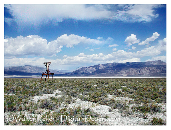
The Saline Valley Salt Tram, also known as the Saline Valley Tramway, is a historic tramway system used to transport salt from the Saline Valley in California, USA. The Saline Valley is located within the Death Valley National Park.
The tramway was constructed in the early 20th century to facilitate the transportation of salt from the salt flats in the Saline Valley to the Owens Valley. The system consisted of cables and tramcars that carried salt over the Inyo Mountains. The salt was then transported to market via the Owens Valley.
The operation of the Saline Valley Salt Tram ceased in the mid-20th century, and the tramway itself has since fallen into disuse and disrepair. The remnants of the tramway, including some of the infrastructure and cables, can still be found in the Saline Valley. The area attracts historians, hikers, and those interested in exploring the remnants of historical infrastructure.
The Mojave Desert in the southwestern United States is home to several ghost towns and abandoned sites that reflect the region’s history of mining, ranching, and other activities.
Located near Barstow, California, Calico is one of the most famous ghost towns in the Mojave Desert. It was a silver mining town in the 1880s and 1890s. Today, Calico is a county park and tourist attraction with preserved buildings and mining equipment.
Near Death Valley in Nevada, Rhyolite was a bustling gold mining town in the early 20th century. It had a population of several thousand people at its peak. The town had schools, banks, and even an opera house. However, it declined rapidly, and now visitors can explore the ruins of its former glory.
In California near the Panamint Mountains, Ballarat was a supply town for the nearby mines in the early 20th century. It is known for its association with the infamous outlaw Charles Manson, who briefly stayed in the area.
Although technically not in the Mojave Desert (in the Eastern Sierra region), Bodie is worth mentioning. This well-preserved ghost town was a gold mining boomtown in the late 19th century. It’s now a state park; visitors can explore the abandoned buildings and artifacts.
Nestled in the Panamint Range of California, Panamint City was a silver mining town that thrived in the late 19th century. The town’s remote location contributed to its decline and was abandoned by the early 20th century. The site is accessible by hiking, and some structures remain.
Cima is a small ghost town in the Mojave National Preserve in California. It was a mining and railroad town in the early 20th century. While most of the buildings are gone, the area still has some remnants of its past.
Ivanpah:
Ivanpah, located in California, was a mining town that saw activity in the late 19th and early 20th centuries. Today, only a few structures remain, including stamp mill ruins.
Cima Ghost Town
Exploring these ghost towns and abandoned sites provides a fascinating glimpse into the history of the Mojave Desert and the people who once inhabited these remote areas. Keep in mind that some of these sites may be on private land or protected areas, so it’s essential to respect any restrictions and regulations in place.
A chapter from Senator Harry Reid’s book “Searchlight: The Camp That Didn’t Fail”
On February 21, 1940, the banner headline in the Las Vegas Review-Journal— BODY OF INDIAN FOUND— recalled for many in the town memories of the first murder the dead Indian had committed thirty years earlier at Timber Mountain, just a few miles from Searchlight in the McCullough Range.
On a cool fall day in October 1910, Harriett and John Reid were on their way, via horse-drawn wagon, to work at their mine—she manned the horse-operated hoist, and he mined the ore. They could see an Indian approaching them, carrying a .30-.30 Winchester rifle and traveling at a very fast pace. The Reids stopped, as did the Indian, whom they recognized as Queho, an acquaintance who worked at various menial jobs throughout the Searchlightarea. They exchanged greetings and after a brief visit went their separate ways. Later, the Reids and everyone else in the area learned that Queho had been hurrying down from Timber Mountain, where he had been cutting wood for J.W. Woodworth, a timber and firewood contractor. Woodworth had refused to pay Queho, who then flew into a rage and beat the man to death with one of the timbers he had cut. This murder was the beginning of an odyssey that took thirty years to play out.
Searchlight, Nevada
Queho soon struck again, this time near the river in Eldorado Canyon, at the Gold Bug Mine, which was partially owned by Frank Rockefeller, brother of John D. Rockefeller. A short time afterward, Queho admitted to Canyon Charlie, an Indian elder almost a hundred years old, that he had killed the mine’s night watchman, his former employer. The second murder occurred on the route between the Crescent area, where the woodcutter was killed, and the river.
Cottonwood Cove
Local lawmen, who viewed Queho as little more than an ignorant savage, thought that catching him would be child’s play. They couldn’t have been more wrong. The clever Indian stole a horse from a man named Cox and eluded the law.
A large manhunt was organized to apprehend the Indian outlaw. It was assumed that Queho would be easy to track, since he dragged one leg as a result of an earlier injury. James Babcock, an operator of the Eldorado mine and a lawyer educated in Washington, D.C., led the search party. He was accompanied by a contingent of Las Vegas lawmen, including Ike Alcock, as well as Indian trackers and an Indian agent named DeCrevecoeur. One of the pursuers was overheard remarking that Queho’s chances of living a long and happy life were very slim. The manhunt extended more than 200 miles, ranging from Crescent to Nipton and even coursing toward Pahranagat Valley, nearly 150 miles to the north. The pursuers gave up the search when supplies ran out and they grew weary. At that point the lawmen began to suspect that maybe this Indian was cunning and smart, not quite the “dumb” savage they had thought.
Queho was subsequently blamed for a number of murders that he did not commit. The first was the murder of James Patterson. The newspaper headline read, MAN KILLED BY QUEHO STILL ALIVE. Patterson hadn’t been killed by the Indian or anyone else—as was evident when he turned up alive and unharmed. But in the course of looking for Patterson, the search party found another man whom Queho had shot.
The press closely followed Queho’s escapades. A reward of $500 was offered for the Indian’s capture, and Nevada’s only member of Congress announced that the federal government should assist in the capture of this madman.
In March 1911 it was reported that two men on the Arizona side of the river, just below Searchlight, watched Queho beat a white man to death on the opposite side. The prospectors were powerless to help, as they had no way to cross the river; they were also unarmed and feared that Queho was armed and would attack them. By this time fear gripped the entire region.
It was believed that the best method for apprehending Queho was to enlist the Piutes in the search, which was the standard operating procedure at the time. Whites regularly abused and harassed the Indians, and if an Indian committed a crime, the white community would force the Indians to produce someone to answer for the crime. To fail in this responsibility meant great distress for the Indians because it led to further harassment by the whites.
In the hills below Searchlight, about five miles from the river, one of the Du Pont heirs to the chemical fortune of the Eastern United States was encamped. He was an outcast from his famous family. At the urging of voices that only he could hear, he began digging a tunnel through one of the volcanic mountains with a pick and shovel. He started the tunnel in 1896, even before gold was discovered in Searchlight, and eventually extended it nearly 2,000 feet through the solid volcanic rock. Du Pont was always friendly to the Indians who came by his camp and often shared his provisions with them. But shortly after the murders of Woodworth and the Gold Bug watchman, some of Du Pont’s supplies disappeared, and Queho was said to be the culprit. The newspaper editorialized that the federal government owed a responsibility to the people of Searchlight to intercede in this Indian affair. It wrote: “A good Indian is a dead Indian.”
Most still believed Queho would be caught, that with both Indians and whites on his trail victory was assured. The Las Vegas Age newspaper headlined an article with QUEHO THE BAD INDIAN IS IN A BAD FIX. In a subsequent edition the paper said that civilians and bad whiskey had turned Queho into the killer he was. The paper also observed: “It is very probable that Mr. Queho’s days are numbered considering those after him.”
The posse was large and well equipped, as all other hunting and tracking parties had been. At this point it was believed that Queho had come back to the river. Alcock wrote to Constable Colton in Searchlight, informing him that he was on the trail of Queho, as he had recently found fresh tracks at Cow Wells, near Searchlight. Queho was also reported to have been seen in the town itself at least once. The posse came up empty-handed.
In 1912 Fred Pine, while hunting near Timber Mountain, came upon Queho, who was armed with his ever-present Winchester. The men exchanged greetings. Pine asked Queho if he would like one of his sandwiches. Queho accepted, and in return offered, Pine one of his dried rats or chipmunks. Pine finally turned to leave, expecting at any moment to be shot in the back, but nothing happened.
The Queho legend began to grow. Several manhunts were organized—all public, all ending in failure. The Searchlight newspaper ceased publication, so news about the comings and goings of the fugitive was no longer so sensationalized. Though some believed he had been killed by other Indians, occasional sightings were reported. There were even rumors that he had a girlfriend around Searchlight named Indian Mary. Others reported having seen him in Searchlight. Murl Emery told people that he had seen Queho several times. Searchlight residents indicated that some contact was maintained with him over the next twenty-five years.
Mouth of Eldorado Canyon
Seven years later, in the winter of 1919, the peace of the countryside was again shattered when Maude Douglas was murdered in her home at the Techatticup Mine in Eldorado Canyon. She heard a noise in the dead of night, walked into the kitchen to investigate, and was felled by a shotgun blast. On the floor was spilled cornmeal that the intruder had been trying to take from the cupboard. The trail from the cabin showed tracks of a man with a noticeable limp, like Queho’s.
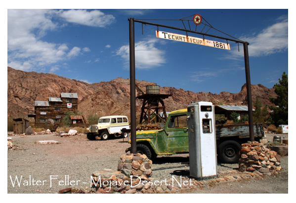
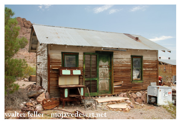
Techatticup Mine – Nelson, Nevada
Mrs. Douglas was married and had two children of her own, as well as the responsibility for two other small youngsters, Bertha and Leo Kennedy. Leo, who was only four years old at the time of the murder, later said that Maude had been killed by Arvin Douglas, the man of the house. There is no corroborating evidence to support that claim, especially in view of the uniquely patterned tracks at the Douglas cabin. Bertha also said that she felt responsible, because she had awakened Mrs. Douglas for a drink of water and if she had not done that, the woman would not have gone into the kitchen.
The overwhelming weight of the evidence pointed to Queho, as confirmed by a coroner’s inquest that was convened after Maude’s death. The coroner determined that she had been shot at close range and that the tracks from the house fit Queho’s.
The murder of Maude Douglas initiated a new era of Queho hunting. During the chase, the search party found a mountain sheep that Queho had recently slaughtered. They also found two dead miners named Taylor and Hancock, whom he had killed with their own prospector’s pick. The searchers soon learned that Queho traveled at night and holed up during the day. The pursuit ended in futility after three weeks, with the near death of the group’s leader, Frank Wait, from exhaustion.
Wait believed that Queho was hiding in the area where he had killed Woodworth. Knowing that he was being followed, Queho did not want to attract attention with gunshots, so he killed the two miners with their pick, probably to get a replacement for his worn boots. Sheriff Joe Keate described him as being able to starve a coyote to death and still have plenty of strength to continue. He reportedly knew of places in the desert where depressions worn into the rock stored rainwater for up to a year.
Alcock, a man named Alvord, an Indian trader named Baboon, and ten others made up the search party. Among the group were some Indians, and it was discovered that they were signaling Queho by smoke signal, thus allowing the killer to elude his pursuers.
The reward was increased to $3,000. Individuals and groups found evidence of Queho—a cave he had stayed in along the Colorado, remains of a mountain sheep and a burro.
For the next few years, another period of quiet prevailed when no recorded murders were known to have been committed by Queho. Nevertheless, no one felt secure. Prospectors and others tried to travel in pairs, one or the other of them always keeping watch at night. Not until 1935 did the next confirmed sighting of Queho take place. A cowboy named Charles Parker had a mare disappear; a week later the horse was found with part of its carcass cut away, obviously for eating. Upon investigating, the cowboy got more than he had bargained for. He was accosted by a scantily clad Indian with long, stringy hair and was robbed, but escaped unharmed. Searching the same area later, Parker and others found a cave along the river with drying jerky in it. A gunfight ensued and nine shots were fired, with no apparent injury to either of the parties.
As the years passed, Queho was accused of killing as many as twenty-one people. His first murder actually occurred before the Woodworth episode; the victim was his cousin or half brother, an Indian outlaw named Avote. The white community insisted that the Indians produce someone to pay for Avote’s crimes, and so as a young man, Queho killed his relative at Cottonwood Island on the river below Searchlight. He also likely killed Bismark, a Las Vegas Indian, but that was a tribal killing and would not usually have been pursued in early Las Vegas. There were allegations of other killings but no actual proof.
Queho outsmarted the best that law enforcement had to offer. His pursuers may have come close on several occasions, but he always evaded him. He was an excellent shot and had a reputation of being extremely brutal.
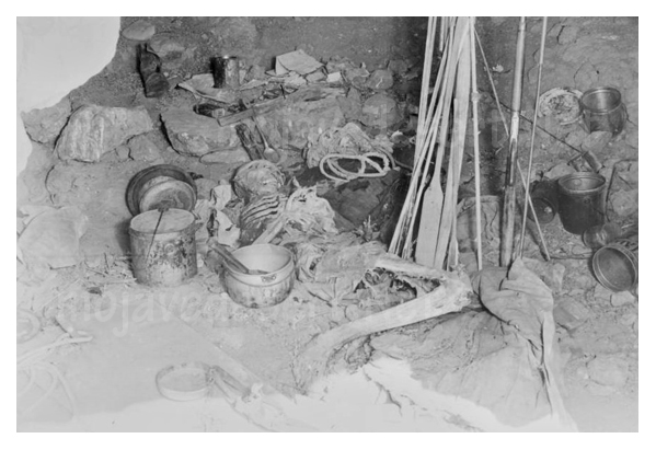
Finally, in February 1940, Queho’s body was found by three prospectors in a cave about ten miles below Boulder Dam and 2,000 feet above the river. They also found fuses and blasting caps from the dam at the site. This cave was one of the best hidden and most impregnable hideaways imaginable. It even had a trip wire hooked to a bell to alert him of intruders. Queho had been dead for at least six months.
Some of his old pursuers, not wanting to acknowledge that they had been outsmarted for thirty years, tried to say he had been dead since 1919. Items in the cave from the construction of Boulder Dam quickly disproved their claim—veneer board, used in concrete moldings at the dam, that Queho used for protection from the elements. And there were fuses, which he used for reloading his bullets and shotgun shells. Also discovered in the cave was the badge of the night watchman killed at the Gold Bug Mine. His loaded Winchester rifle and the shotgun with which he likely killed Maude Douglas were in the cave, as well as a fine bow and twelve steel-tipped arrows (probably for fishing in the river), recently minted coins, and papers from some of his victims.
The large number of eyeglasses in the cave probably indicated that he was afflicted with poor eyesight in his later years. At death he was believed to be about sixty years old. He had died in a position of apparent pain, wearing a canvas hat and pants. One of his legs was wrapped with burlap, which indicated that he may have been snake-bitten. A former acquaintance confirmed the identity of the body by the unusual dental feature of double rows of teeth.
Charley Kenyon, one of the prospectors who discovered Queho’s body, later found other nearby caves that the Indian had used. Queho was also said to have panned a little gold, which he saved in Bull Durham tobacco sacks, then exchanged for food and other supplies. One of the persons who probably had some contact with Queho was the eminent Murl Emery, who always seemed protective of him and also admitted to leaving food for him. Emery was quoted as saying, “Why don’t you let the poor Indian rest?” Emery lived at and operated Nelson’s Landing for many years and was a constant companion of mystery writer Erle Stanley Gardner.
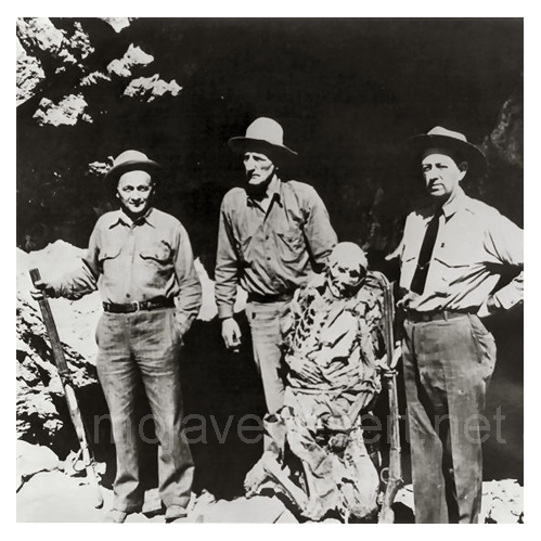
Queho remained controversial even after death. Two political enemies and former law enforcement officers, Gene Ward and Frank Wait, both involved in trying to bring the desperado to justice over the years, fought over his skeleton.
Neither won, as James Cashman and the Elks Lodge intervened to pay the funeral home for the costs of interment. The Elks then displayed Queho’s bones at Helldorado (the premier entertainment event in Las Vegas for more than forty years, beginning in the 1930s) as in a carnival attraction.
The bones were stolen from Helldorado Village and found in Bonanza Wash in Las Vegas; Dick Seneker subsequently acquired them and returned them when James Cashman again offered a reward. The Indian’s remains are now believed to be buried in Cathedral Canyon near Pahrump.
Queho’s name continues to bring forth tales too numerous to confirm. In an oral statement taken in the late 1970s, historian Elbert Edwards of Boulder City gave a rambling account of stories about Queho. Edwards did not rebut the stories of Queho’s murderous binge, attributing a total of seventeen murders to the Indian.
Edwards described one man who was killed with a pick handle before Woodworth was killed at Timber Mountain. He then confirmed the murders of the Gold Bug watchman, Maude Douglas at Nelson, the two St. Thomas miners Hancock and Taylor, and then two unidentified miners. He also described Queho’s murder of a wandering cowboy with his trusty rifle and spoke of five individuals who were killed in a cabin near what is now Boulder Dam—three with a rifle and two with a knife. Edwards’s narrative also related the story of two others, killed in nearby Black Canyon the next day. The authenticity of most of the murders recounted by Edwards is questionable, but they do reveal the legendary status accorded this Indian desperado.
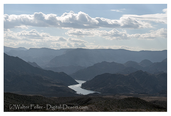
Black Canyon – Colorado River
Queho was a killer who outsmarted all who tried to capture him. The story is tragic, not only because of the lives that he took but because even in Searchlight his story illustrates to us how poorly Indians were treated. The first census, in 1900, reported forty-two Indians in Searchlight, obviously in the river area where there was water. They were eventually driven out of Searchlight.
In the summer of 1905 the Searchlight newspaper reported that the Indian village on the outskirts of town had been destroyed by fire. The paper disparagingly remarked: “All bucks and squaws were away.” Indians were granted no respect in Searchlight, and they were harassed and discriminated against in increasingly offensive ways. It is no wonder that Queho’s fellow Indians helped him. Nor is it surprising that he became known among the few Indians of the area as someone who had stood up to the white man.
–
From: Senator Harry Reid’s book, “Searchlight, The Camp That Didn’t Fail,” University of Nevada Press.
Essex is a small unincorporated community located in the eastern part of San Bernardino County, California, USA. Its history is closely tied to the development and expansion of the railroad and the mining activities in the region.
Here’s an overview of the history of Essex:
Railroad Development: The town’s history can be traced back to the construction of the Atchison, Topeka and Santa Fe Railway in the late 19th century. The railroad played a crucial role in the development of the American West, connecting various communities and facilitating the transportation of goods and people.
Mining Boom: Like many other towns in the region, Essex saw a boom in mining activities during the late 19th and early 20th centuries. The nearby Providence Mountains were known for their mineral deposits, attracting prospectors and miners seeking fortunes in gold and other minerals.
Railroad Town: Essex became a railroad town, serving as a strategic point for the railroad industry. It had a railroad depot, which was essential for loading and unloading goods transported by the trains. The railroad played a significant role in the economic life of Essex during its early years.
Decline: As the mining industry declined and transportation patterns shifted, the importance of towns like Essex diminished. Many of the mines closed, and the once-thriving communities began to decline. The decline in mining activities and changes in transportation methods, such as the decline of rail travel in favor of automobiles and highways, contributed to the economic challenges faced by Essex.
Route 66 Influence: Essex is also situated along the historic Route 66, a famous highway that connected Chicago to Los Angeles. During the mid-20th century, Route 66 became an iconic route for cross-country travel, and Essex served as a stopping point for travelers along this historic road.
Present Day: Today, Essex is a quiet and sparsely populated community. Many of its historic structures may still stand as reminders of its past, and the area may attract historians, photographers, and those interested in exploring the remnants of the old Route 66.
Essex’s history is intertwined with the broader historical developments of the American West, including the expansion of railroads, mining booms, and the evolution of transportation networks. While the town may no longer be a bustling hub, its history contributes to the rich tapestry of the region’s past.
Panamint Valley is a desert valley located in eastern California within the northern Mojave Desert. It is situated between the Inyo Mountains to the west and the Panamint Range to the east. The valley is part of Inyo County and is known for its arid landscape and unique geological features.
Here’s a brief overview of the history of Panamint Valley:
Native American Presence: The area around Panamint Valley has a history of Native American occupation dating back thousands of years. Various Native American groups, including the Timbisha Shoshone, lived in the region, relying on the desert environment for sustenance.
Exploration and Settlement: In the mid-19th century, European-American explorers and settlers began to venture into the area. The valley was part of the route used by pioneers during the California Gold Rush. However, the harsh desert conditions made permanent settlement challenging.
Mining Boom: The late 19th and early 20th centuries saw a mining boom in the surrounding mountains. The Panamint Range, especially, was rich in minerals like silver and lead. Towns such as Ballarat and Panamint City sprang up to support mining activities. Panamint City, in particular, was once a thriving mining town with a peak population of around 2,000 people.
Decline of Mining: As mining operations became less profitable, many of the towns in the region, including those in Panamint Valley, experienced a decline and were eventually abandoned. By the mid-20th century, the mining industry in the area had significantly diminished.
Military Presence: During World War II, the U.S. military established a presence in the Mojave Desert, including around Panamint Valley. The China Lake Naval Weapons Center, now known as the Naval Air Weapons Station China Lake, was established southeast of the valley. The military presence in the region has continued to the present day.
Recreational Activities: In recent times, Panamint Valley has become a destination for outdoor enthusiasts, including hikers, off-road vehicle enthusiasts, and nature lovers. The valley’s unique geological features, such as the Panamint Dunes, attract visitors interested in exploring the desert landscape.
Panamint Valley remains a sparsely populated and remote area known for its historical significance, geological features, and recreational opportunities.
Chloride is a historic mining town located in northwest Arizona. It is situated in the Cerbat Mountains, approximately 20 miles north of Kingman. Chloride was founded in the 1860s following the discovery of silver in the area, and at its peak, it had a significant population due to mining activities.
Today, Chloride is a small and charming town with a population that has diminished compared to its mining heyday. It has retained some of its historic buildings and has become a destination for those interested in exploring the remnants of the Old West.
One notable feature of Chloride is the outdoor murals that adorn the town’s buildings. These murals, often created by local artists, depict scenes from the town’s history and contribute to its unique atmosphere. Artists like Roy Purcell have created Chloride murals, capturing the Old West’s spirit and the town’s mining heritage.
Visiting Chloride in person provides a firsthand experience of its historical charm and artistic expression.
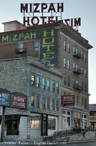
The Mizpah Hotel is a historic hotel located in Tonopah, Nevada. Tonopah is a small town in Nye County, known for its mining history and connection to the silver and gold rushes of the early 20th century.
The Mizpah Hotel was built in 1907 and has a rich history associated with the mining boom in the area. It was a luxurious and modern hotel in its time, catering to the needs of the influx of miners and prospectors drawn to Tonopah’s mining activities.
One of the notable features of the Mizpah Hotel is the “Lady in Red” legend. Legend has it that a woman named Rose, a prostitute who was allegedly murdered in the hotel, haunts Room 502. Some guests have reported paranormal experiences and sightings related to this legend, making the Mizpah Hotel known for its supposed ghostly occurrences.
The hotel underwent restoration efforts and reopened in 2011, retaining its historic charm while offering modern amenities. It has become a popular destination for tourists interested in the history of the area and those intrigued by its reputed haunted reputation.
Tonopah itself is an interesting town to explore, with several historic sites, including the Central Nevada Museum and the Tonopah Historic Mining Park, which provides insights into the region’s mining heritage.
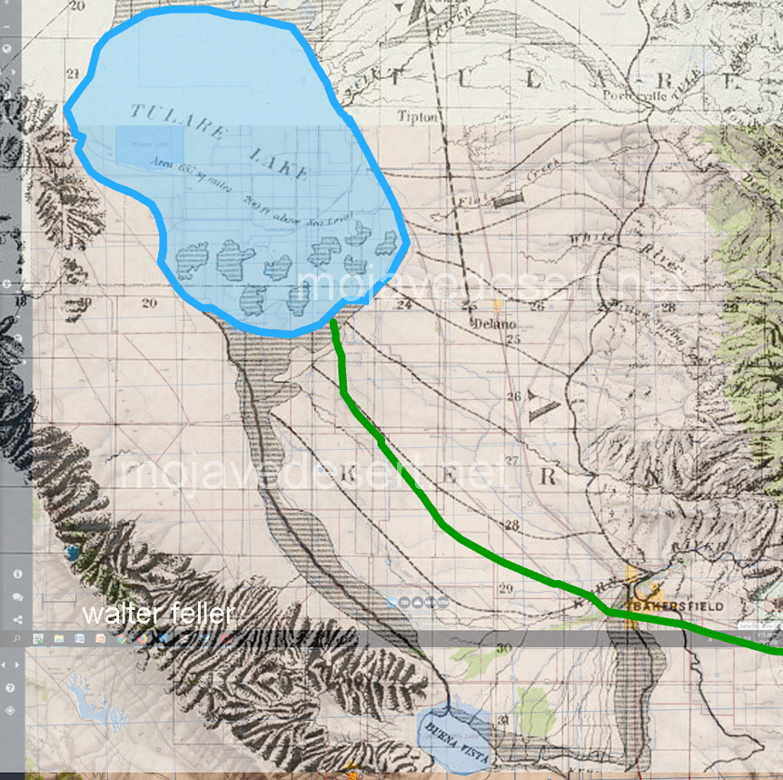
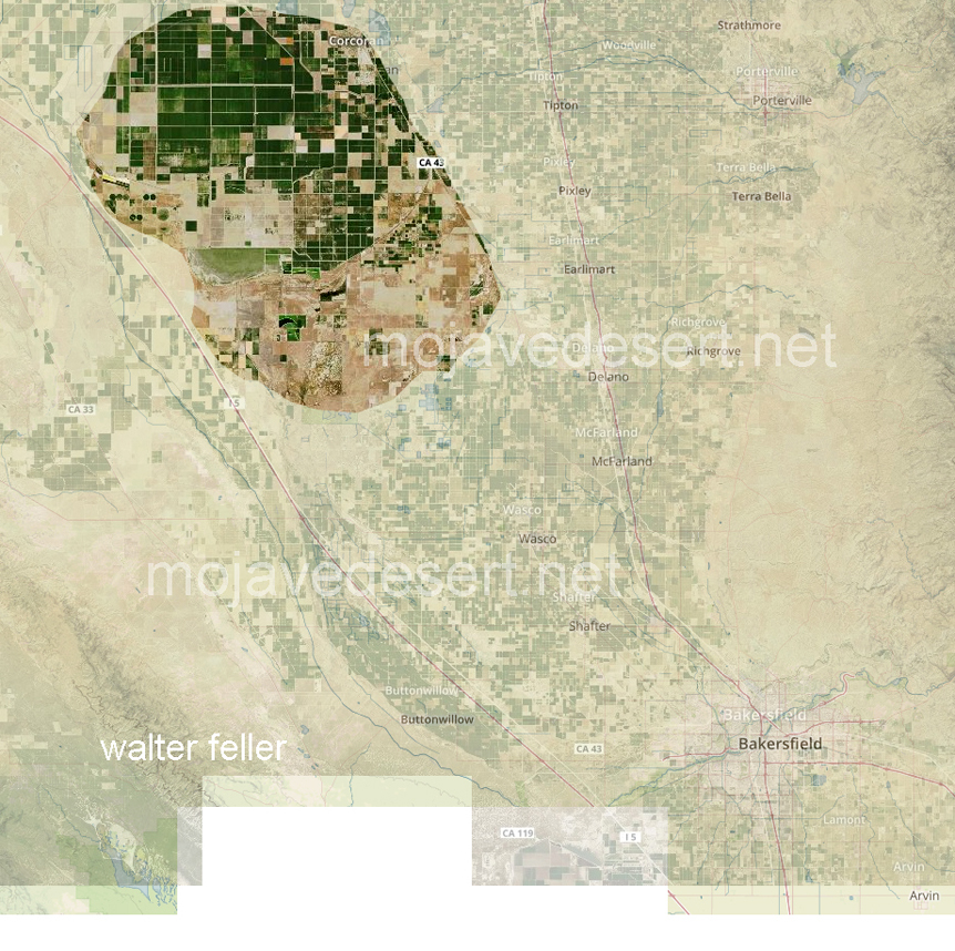
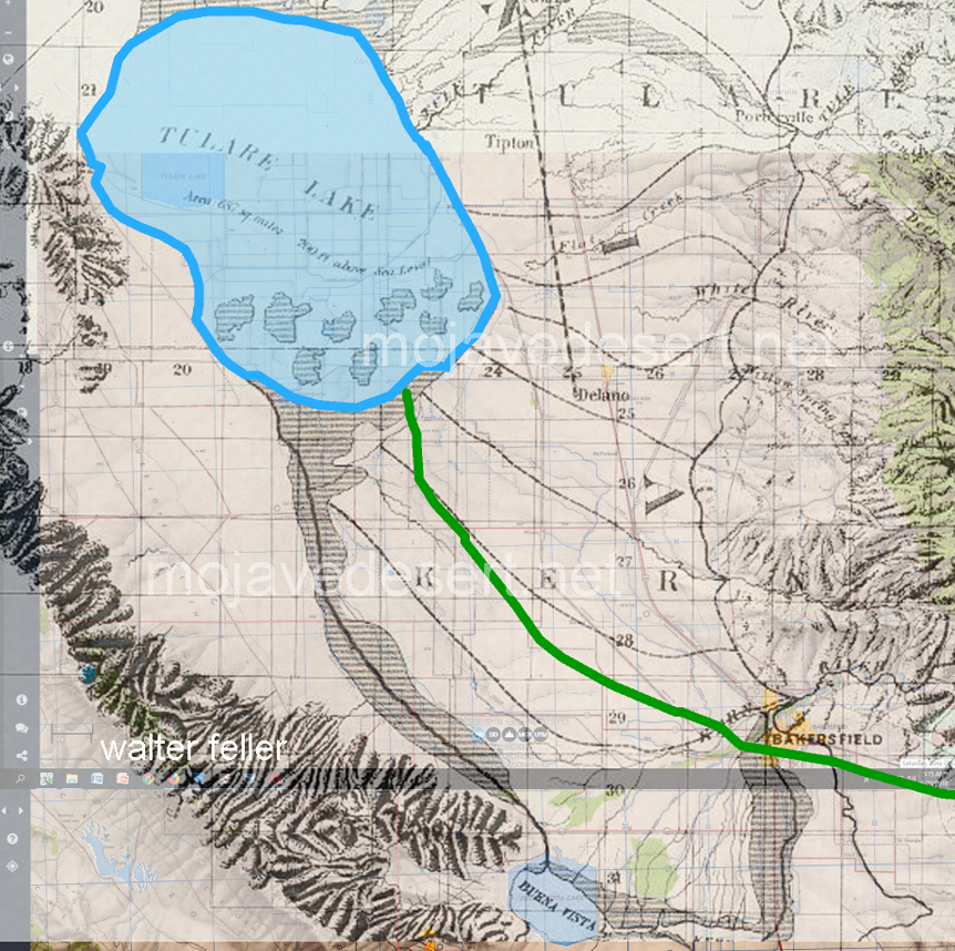
Not so well known is that when they left the mission at San Gabriel, both men made their way north to the San Joaquin Valley and the shore of Tulare Lake. In tracking the paths of both men concerning our modern geography, it is soon discovered that this lake does not seem to exist.
What happened to Tulare Lake?
The answer to this mystery of a disappearing lake is simple yet inelegant and predictable:
At the onset of American settlement in the area in the late 1840s, the lake was the largest body of fresh water west of the Great Lakes. Its destruction by the late 1800s because of diking and water diversion for irrigation was one of the most dramatic signs of a major theme in the state’s history: the rapid transformation of the wild California landscape into one dominated almost completely by human action.
From Report of the Board of Commissioners on the Irrigation of the San Joaquin, Tulare, and Sacramento Valleys of the State of California.
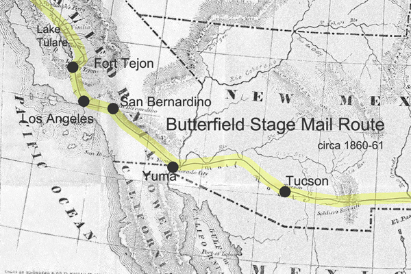
The Butterfield Overland Mail Route was a historic transportation route in the mid-19th century that played a crucial role in connecting the eastern and western parts of the United States.
Here are some key points about the Butterfield Overland Mail Route:
Establishment: The Butterfield Overland Mail Company was awarded a government contract in 1857 to establish and operate a stagecoach and mail route between St. Louis, Missouri, and San Francisco, California. The purpose of the route was to improve communication and transportation between the two coasts, especially in light of the California Gold Rush.
Route: The route covered approximately 2,800 miles and passed through eight present-day states: Missouri, Arkansas, Oklahoma, Texas, New Mexico, Arizona, California, and Oregon. It traversed various terrains, including deserts, mountains, and plains.
Frequency and Duration: The Butterfield Overland Mail Company operated its stagecoaches twice a week in each direction, and the journey took about 25 days to complete. This significantly improved travel time compared to other methods available at the time.
Stations and Stops: The company established a series of stations along the route to facilitate the long and arduous journey, spaced about 20-30 miles apart. These stations provided fresh horses, food, and accommodations for passengers and drivers. Some of these stations eventually became important settlements in their own right.
Challenges: The route faced numerous challenges, including harsh weather conditions, difficult terrain, and the threat of attacks from Native American tribes. The company had to implement security measures to protect passengers and mail.
End of Operations: The Butterfield Overland Mail Route faced financial difficulties exacerbated by the onset of the Civil War. 1861, the service was suspended, and the stagecoaches and stations were abandoned. The route became less relevant as the transcontinental railroad was completed after the Civil War, offering faster and more reliable transportation.
Legacy: While the Butterfield Overland Mail Route was relatively short-lived, its legacy persists. The route contributed to the United States’s westward expansion and shaped the development of communities along its path. Some old stations have been preserved as historic sites, and portions of the route have been designated the “Butterfield Overland Mail Route.”
The Butterfield Overland Mail Route remains an important chapter in the history of westward expansion and transportation in the United States during the mid-19th century.
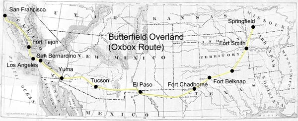
The Butterfield Overland Mail was a stagecoach and mail delivery service that operated from 1857 to 1861. It was a vital communication and transportation link between the eastern and western United States.
The route covered approximately 2,800 miles, connecting St. Louis, Missouri, and San Francisco, California. It passed through several states, including Missouri, Arkansas, Texas, New Mexico, Arizona, and California.
The term “Oxbow” might not be directly associated with the Butterfield Overland Mail but could be a local or regional name for a section of the route or a specific location along the way.
Overland Stage Route:
The Overland Stage Route, on the other hand, generally refers to the network of stagecoach routes that existed in the western United States during the 19th century. These routes were crucial for mail delivery, transportation of passengers, and freight.
The most famous of these stagecoach lines was the Butterfield Overland Mail, but there were other stage lines as well, such as the Central Overland California and Pikes Peak Express Company (C.O.C. & P.P.), which operated a route known as the “Pony Express.”
The 19th century was a period of significant expansion and change in the United States, and the military played a crucial role in securing and maintaining control over newly acquired territories. The Mojave Desert was part of this expansion in the southwestern United States. Here are some key points about the military in the Mojave Desert during the 19th century:
Mexican-American War (1846-1848): The Treaty of Guadalupe Hidalgo 1848 ended the Mexican-American War and ceded a large portion of territory, including the Mojave Desert, to the United States. The U.S. Army played a central role in the conquest and occupation of these new territories.
California Gold Rush (1848-1855): The discovery of gold in California in 1848 led to a massive influx of settlers and prospectors. This increased population in the region and the military was tasked with maintaining order, protecting settlers from Native American resistance, and resolving conflicts among different groups.
Mormon Pioneer Expeditions: In the mid-19th century, Mormon pioneers, led by Brigham Young, established a series of settlements in what is now Utah and the surrounding areas, including parts of the Mojave Desert. The military presence was important for maintaining peace and resolving disputes between the settlers and other groups.
Butterfield Overland Mail Route: In the late 1850s, the Butterfield Overland Mail Company established a stagecoach route through the Mojave Desert, connecting the eastern and western coasts. The U.S. Army protected the mail coaches and stations along the route.
Civil War (1861-1865): During the Civil War, many military forces were withdrawn from the western frontier to participate in the conflict. This temporarily reduced the military presence in the Mojave Desert. Additionally, the Confederate Army briefly invaded Arizona and New Mexico territories, which included parts of the Mojave Desert.
Indian Wars: The 19th century saw conflicts between the U.S. military and various Native American tribes in the Mojave Desert region. The military was involved in efforts to control and relocate Native American populations.
Fort Mojave: Established in 1859, Fort Mojave played a significant role in the military’s presence in the Mojave Desert. It served as a base for operations against local Native American tribes and protected settlers and travelers.
Railroad Construction: The late 19th century also saw the construction of railroads through the Mojave Desert. The military played a role in ensuring the security of railroad workers and the transportation of goods.
Overall, the military presence in the Mojave Desert during the 19th century was shaped by the expansion of the United States, the Gold Rush, conflicts with Native American tribes, and the development of transportation routes across the region.
Randsburg Railway refers to a historic narrow-gauge railway that once operated in and around the town of Randsburg, California, in the United States. Randsburg is a small mining town located in the Mojave Desert, and the railway played a significant role in the transportation of minerals and people in the late 19th and early 20th centuries.
The Randsburg Railway was primarily built to serve the mining industry, carrying gold, silver, and other valuable minerals from the mines in the area to nearby processing facilities. The railway also provided a means of transportation for the town’s residents and visitors.
The railway was initially constructed in 1896, connecting Randsburg with the Southern Pacific Railroad at Kramer Junction. The tracks covered about 12 miles and used narrow-gauge equipment. The Southern Pacific Railroad acquired the Randsburg Railway in 1897, and it became part of their system. This connection with the Southern Pacific allowed for the efficient transportation of ore and other goods to wider markets.
Over the years, the mining industry in Randsburg declined, and as a result, the railway’s importance diminished. The line was eventually abandoned in the mid-1930s. Today, Randsburg is a small, historic town that attracts tourists interested in its mining heritage and the remnants of the railway, which can still be seen in the area.
The Randsburg Railway is a part of the rich history of mining and transportation in the American West. It serves as a reminder of the challenges and opportunities that existed in the region during the late 19th and early 20th centuries.
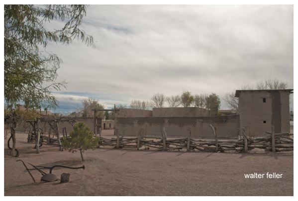
The Mormon Fort in Las Vegas, Nevada, is a historic site that holds significance in the region’s history. It is also known as the Old Mormon Fort State Historic Park. The fort represents the birthplace of Las Vegas and is considered the first permanent, non-native settlement in the Las Vegas Valley.
Here are some key points about the Mormon Fort:
Establishment: The fort was established by a group of Mormon missionaries led by William Bringhurst in 1855. They were sent to the area to establish a way station along the Old Spanish Trail.
Purpose: The Mormons built the fort to provide a place for travelers and settlers to rest and replenish supplies as they journeyed through the region. It served as a crucial stop for those traveling between Salt Lake City and Southern California.
Abandonment: Due to conflicts with local Native American tribes and other challenges, the Mormons abandoned the fort in 1857.
Later History: The fort had various uses over the years, including serving as a ranch and a military post. In the early 20th century, efforts were made to preserve and restore the site.
State Historic Park: Today, the Old Mormon Fort is a state historic park managed by the Nevada Division of State Parks. It offers visitors a glimpse into the area’s past, featuring reconstructed adobe buildings and interpretive exhibits.
Location: The Mormon Fort is located in downtown Las Vegas, near the intersection of Las Vegas Boulevard and Washington Avenue.
Visitors to the Mormon Fort can explore the historic structures, learn about the early pioneers who settled in the area, and gain insights into the challenges faced by the original inhabitants. The site provides a contrast to the modern development of Las Vegas and highlights its historical roots.
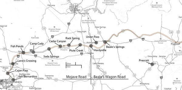
Mojave Road and Beale’s Wagon Road are historic routes in the southwestern United States, particularly in the Mojave Desert region. Here’s some information about each:
The Mojave Road is a historic trail that traverses California’s Mojave Desert. It was a significant route used by Native Americans, Spanish missionaries, and later by American pioneers and traders.
The trail is approximately 138 miles long and extends from the Colorado River near present-day Needles, California, to the Mojave River near present-day Barstow, California.
It was primarily used for transportation and trade between the Colorado River and the coastal settlements in California. The trail passes through varied desert landscapes, including sandy stretches, rocky terrain, and mountainous areas.
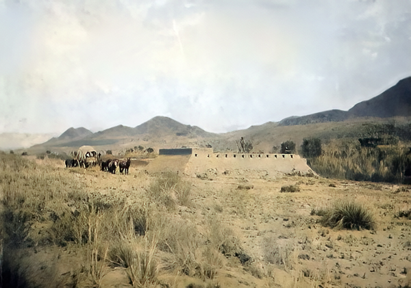
Beale’s Wagon Road, named after Edward F. Beale, a military officer and explorer, was a trail developed in the 19th century for the U.S. Army to improve communication and transportation across the arid lands of the American Southwest.
Edward F. Beale surveyed and established the road in the late 1850s. The road ran from Fort Defiance in Arizona to the Colorado River, passing through present-day Arizona and California.
Beale’s Wagon Road was designed to be more reliable and accessible than other trails, facilitating military movement and communication between California and the western territories.
Mojave Road and Beale’s Wagon Road were important in the United States’ westward expansion. Today, these routes attract history enthusiasts, adventurers, and off-road enthusiasts who explore them to experience the challenges faced by those who traveled these paths in the past. Keep in mind that conditions and accessibility of these trails may vary, so it’s important to check for current information and any regulations before embarking on a journey along these historic routes.
“Death Valley” Scotty, whose full name was Walter E. Scott, was a colorful and legendary figure associated with Death Valley, a desert valley located in Eastern California. Scotty gained fame in the early 20th century for his claims of owning a gold mine in Death Valley and for his flamboyant personality.
Scotty’s story is closely tied to his relationship with wealthy Chicago businessman Albert Johnson. In the early 1900s, Scotty convinced Johnson to invest in his supposed gold mine, even though there was little evidence to support the existence of significant gold deposits. Despite the skepticism of others, Johnson continued to finance Scotty’s ventures, and the two became unlikely friends.
With his charismatic and theatrical personality, Scotty became a well-known character, and his antics and stories helped attract attention to Death Valley. He was known for his cowboy attire, tall tales, and his ability to charm people.
Scotty’s gold mine claims were largely exaggerated, and there is little evidence that he ever discovered a significant amount of gold. The financial arrangement between Scotty and Johnson remained a subject of speculation and mystery.
After Johnson died in 1948, it was revealed that much of the financing had come from Johnson himself, and Scotty had not been as successful in the mining business as he claimed. Despite the deceptive aspects of his story, Scotty remained a beloved figure in Death Valley folklore, and his former home, Scotty’s Castle, is a popular tourist attraction in Death Valley National Park.
The legacy of “Death Valley” Scotty is a mix of fact and fiction, blending the mystique of the Old West with a touch of showmanship and exaggeration.
Rush to Claim Wealth: The news of these discoveries led to a rush of people trying to claim their share of the newfound wealth. Prospectors and miners flocked to the region in search of fortunes.
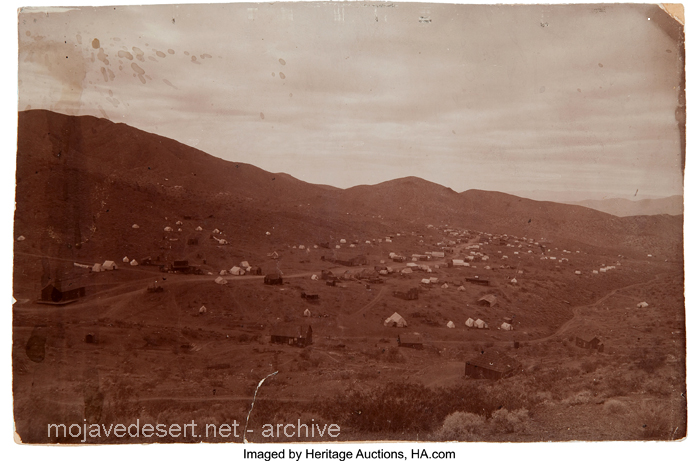
Randsburg c. 1897 – C.W. Tucker – photo
Discovery of Gold and Silver: These booms were triggered by the chance discovery of large deposits of gold and silver in the respective areas. The presence of valuable minerals was the catalyst for the rapid development of these towns.
Leadfield (2003)
Explosive Growth of Boomtowns: The growth of these towns was explosive and often chaotic. They quickly developed into rowdy boomtowns characterized by a fast-paced, often disorderly expansion.
Promoters and Flimflam Men: Alongside serious promoters who saw the economic potential of these towns, there were also flashy con artists and tricksters looking to take advantage of the mining boom for their gain.
Arrival of Various Groups: As these towns grew, they attracted a diverse group of people, including merchants, teamsters, camp followers, schoolteachers, wives, and children. The influx of residents and services accompanied the rapid development.
Development of Farms and Ranches: The growth of these mining towns also led to the development of nearby farms and ranches. These agricultural activities provided food and resources to sustain the booming population.
Hope for Quick Riches: Many who flocked to these mining towns were motivated by the hope of striking it rich quickly. The prospect of finding valuable minerals and becoming wealthy was a powerful draw.
Values of the Old West: The people who settled in these towns held traditional values associated with the Old West, including a strong emphasis on personal freedom, independence, hard work, and the ability to endure the harsh conditions and challenges of the natural environment.
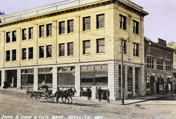
Cook Bank – Rhyolite, Nevada
Like many others in the Old West, these mining booms followed a pattern of rapid growth, economic opportunity, and social change, often accompanied by a degree of lawlessness and volatility. Over time, these towns could thrive or decline depending on the success of mining operations and economic factors, and their histories reflect the larger story of the American frontier and the pursuit of wealth and opportunity.
The Mojave Road, also known as the Old Mojave Road or the Mojave Trail, is a historic trade route and wagon road that traverses the Mojave Desert in the southwestern United States. Native American tribes originally used it for trade, and it later became an important transportation route for European settlers and traders during the 19th century.
Here are some key points about the Mojave Road:
Location: The Mojave Road runs through the Mojave Desert, primarily in what is now California and Nevada. It stretches from the Colorado River in the east to the San Bernardino Mountains in the west, covering approximately 140 miles (225 kilometers).
History: The road has a long history, with Native American tribes using it for centuries for trade and travel. In the 19th century, it became an essential route for early explorers, settlers, and traders moving through the desert.
Water Sources: One of the challenges of traveling the Mojave Road was the scarcity of water sources. Travelers had to rely on natural springs and wells, many of which were marked along the route to aid navigation.
Military Use: During the 19th century, the U.S. Army used the Mojave Road as a military supply route and for communication between the southern California coast and the interior of the Southwest. The road played a role in the U.S. government’s efforts to control the region.
Historic Sites: Along the Mojave Road, there are several historic sites and landmarks, including the Mojave National Preserve, the Mojave River, the Kelso Depot, and the Fort Piute ruins.
Recreation: Today, the Mojave Road is a popular route for off-road enthusiasts, hikers, and history buffs. Travelers can explore the historic route and experience the natural beauty of the Mojave Desert.
Preservation: Efforts have been made to preserve and maintain the Mojave Road as a historic and recreational route. The Mojave Road Guide, written by historian Dennis G. Casebier, is a valuable resource for those interested in traveling the road.
Please note that road conditions and accessibility may vary, so if you plan to explore the Mojave Road, it’s essential to do thorough research and be well-prepared for the journey. Always check for current information and obtain any necessary permits if required.
Leadfield, located in Titus Canyon, was promoted by a man who could have sold ice to an Eskimo. He blasted some tunnels and liberally salted them with lead ore and drew up some enticing maps of the area, which lured Eastern promoters into investing money.
The true story of Leadfield is somewhat different from the usual tale of a stock swindle and a dying town.
During the early days of the Bullfrog boom, W. H. Seaman and Curtis Durnford staked nine lead and copper claims in Titus Canyon and came into Rhyolite with ore samples that assayed as high as $40 to the ton. The Death Valley Consolidated Mining Company was incorporated and immediately began a development and promotional campaign.
The Death Valley Consolidated Mining Company ceased operations in 1906 after realizing that the long and arduous trip between its mine and Rhyolite made the shipment of its ore absolutely unprofitable.
In 1924, three prospectors staked out numerous claims on some lead deposits in Titus Canyon. A local promoter named John Salsberry purchased twelve claims from the three prospectors and formed the Western Lead Mines Company.
The young camp was entering the boom stage, and by January 30th, half a dozen mining companies were in operation. The stock of Western Lead Mines Company soared to $1.57 per share.
Eastern California, and especially Inyo County, was long overdue for a mining boom. With the backing of a successful and skilled promoter, Leadfield seemed assured of obtaining the necessary financial support to take it from a prospecting boom camp into a producing mine town.
The Inyo Independent greeted Julian with a glowing description of his character and abilities, but a different endorsement would be printed in later years.
The boom was now on in earnest, with the Western Lead Company employing 140 men and the Titus Canyon Road being completed. The Western Lead Mine produced 8% to 30% lead and seven ounces of silver per ton.
The California State Corporation Commission was not so impressed with the company and raised the righteous indignation of local folk. The local attitude was well summed up by the Owens Valley Herald: “The Commission is using its every endeavor to try and prejudice the people against this latest promotion of Julian’s.”
The paper pointed out that Julian was not trying to swindle anyone and that he had publicly invited any reputable mining engineer worldwide to visit the Leadfield District. The paper concluded that the future of Leadfield seemed very bright.
Julian was not the only promoter singing the praises of the Leadfield District, for numerous other companies were also trying to cash in on the boom. The Western Lead Mines Company, Julian’s pet, led the pack, with one of its tunnels six hundred feet inside the mountain.
The town of Leadfield was trying to keep pace with the boom and announced that a large hotel would soon be built. On March 15th, the first of Julian’s promotional excursions pulled into Beatty, and 340 passengers were served a sumptuous outdoor feast by the proprietor of the local Ole’s Inn.
Lieutenant-Governor Gover of Nevada gave the keynote speech, and Julian gave a speech praising Julian for overcoming the numerous obstacles that modern governmental bureaucracies put in a man’s path. The trip was a big success, and Western Lead stock advanced 25 on the San Francisco market the next day.
Western Lead stock had soared to $3.30 a share by the end of March, and several ore-buying and smelting concerns sent representatives to the district to discuss reduction and smelting rates.
Leadfield continued to develop in the months following the great train excursion. New mining companies opened for business, and the Tonopah & Tidewater Railroad replied that definite plans for a railroad spur into Leadfield had not been made as the present business does not warrant its construction.
The townsite of Leadfield was officially surveyed on April 30th, and the town’s plat was submitted to Inyo County officials for approval. The town was platted on land donated by the Western Lead Company.
The State of California was breathing hard upon Julian’s neck, and the Corporation Commission hauled a brokerage company into court for selling Western Lead stock without a state permit. Expert witnesses testified that the Western Lead Mine was a quite legitimate proposition.
The continued investigations by the state of California hurt the sales of Western Lead stock, and another factor began to take a toll. Julian’s credibility began to shrink, and the company never recovered from the panic that set in.
Julian bought into the New Roads Mining Company, which gave him control of the two largest mines of Leadfield and announced plans to construct a large milling plant at Leadfield.
As summer approached, the Leadfield boom showed no signs of peaking. The California Corporation Commission ordered that sales of Julian’s personal stock in the Western Lead Mines must immediately cease on the Los Angeles stock exchange due to evidence introduced at a hearing.
Despite the heavy blow to Julian’s financial fortunes, developments at Leadfield proceeded, and the Mining Journal printed a long, detailed report on the Leadfield District in July, which helped to restore public confidence.
The mines agreed with the independent experts and continued to work, and the Boundary Cone Mining Company ordered a new 25-horsepower hoist and headframe and increased its workforce to twelve miners.
In late July, the Western Lead Mining Company brought a $350,000 damage suit against the Los Angeles Times and the California Corporation Commission. Still, the suit was quickly thrown out of court for insufficient cause. In August, a new mining company, the Pacific Lead Mines No. 2, was incorporated.
During September and October, drilling and tunneling continued in Leadfield’s mines, but in late October, two events took place that spelled the end of Leadfield. The main tunnel of the Western Lead Mine finally penetrated the ledge but found almost nothing.
At almost the same time, the California Corporation Commission dealt Julian another blow when it halted stock sales in the Julian Merger Mines, Inc. Julian’s empire fell apart. The other mines slowly closed, one after the other, and Leadfield became a ghost town in a matter of months.
The failure of a mining district led to a flurry of lawsuits. In February of 1927, the Western Lead Company removed its heavy machinery and the pipeline to a mine that the company owned in Arizona.
Julian went on to organize the Julian Oil and Royalties Company and was indicted for fraud, but jumped bail and committed suicide.
Leadfield was a ghost town created by C. C. Julian. Still, the existence of lead ore in the district had been known as far back as the Bullfrog boom days of 1905, and the California Corporation Commission allowed companies other than Julian’s to sell their stock.
Julian did not start the Leadfield boom and had plenty of help in supporting the boom once it had started. The citizens of Inyo County, California, and Nye County, Nevada, also supported the mines.
The collapse of Julian’s financial structure came at the worst possible time for Leadfield. Although it seems doubtful that Leadfield had enough ore to support more than a small mining company or two, indications are that without the sudden panic of the fall of 1926, that mine or two could have survived.
The Titus Canyon Road, an engineering marvel, was built by Julian and cost an estimated $60,000 to build. Without Julian, the road would not have been finished, and today presents one of the most spectacular routes in Death Valley National Park.
High in the El Paso Range, in the upper reaches of Mesquite Canyon, twelve miles west of Randsburg, in the living exponent of persistence, William Schmidt, better known to desert folks in that area as “Burro” Schmidt, 80-year-old recluse, “Burro” spent forty years of his life accomplishing one thing—hand-drilling a half-mile tunnel entirely through a mountain.
Over that period, he worked on farms in the Kern River Valley, accumulating “beans” for the winter at his mine. Regularly, he appeared in Johannesburg with his burros and loaded up supplies at the Teagle’s Store each fall. 1937, his tunnel was finished, and the accomplishment received national publicity. Photographs of the tunnel, his burrow, and “Burro” Schmidt appeared in daily press and international mining journals. Single jack and drill steel and “Burro” Schmidt were the combination that did the job — no compressed air or gasoline motors.
As he nears the end of the trail, happy to have completed a lifetime undertaking, he proposes offering his tunnel and the story of mineralogy it tells to a California university. It will be a natural laboratory for the new generations who want to know the story of the rocks. It is a noble gesture from a nobleman of the desert hills.
The Old Woman, California, IIAB iron meteorite Howard PLOTKIN, Roy S. CLARKE, JR., Timothy J. Mc COY, and Catherine M. CORRIGAN Department of Mineral Sciences, National Museum of Natural History, Smithsonian Institution, P.O. Box 37012, Washington, DC 20013-7012, USA
Summary
PAGE 1
DISCOVERY OF THE METEORITE
Two prospectors found a large dark-colored rock in the Old Woman Mountains in March 1976. They were sure it was a meteorite because they had seen pictures of them in school and museums.
The two prospectors and Jack Harwood tried to figure out what to do with their ”Lucky Nugget” find but lacked the funds needed to hire a helicopter.
They sent a small chip to the Griffith Observatory, but the curator did not detect nickel and concluded that the specimen was not meteoritic.
PAGE 2
Friberg sent a letter to the Smithsonian asking for a value scale for a meteorite, and on August 27, they requested a fragment be sent to them for study. On September 10, they received a reply saying that they would like to conduct an on-site investigation.
TRIP TO THE OLD WOMAN MOUNTAINS
Clarke arranged with Friberg to investigate the meteorite near Twentynine Palms, California. He visited the administrative office of the nearby Joshua Tree National Monument to inform officials of his visit and get their permission to go into the field.
PAGE 3
Clarke, Friberg, and Harwood traveled to the meteorite site in a 1949 four-wheel drive Power Wagon and hiked up the mountain to reach the meteorite. Clarke took several measurements and photographs, and the group left the meteorite at 5:40.
Clarke suspected the meteorite was on federal land and visited the Riverside BLM office on September 23 and 24. He suggested returning to the site with Friberg and BLM officials to determine its location.
Clarke went to the BLM office early in the morning and was picked up by a helicopter. They flew to the agreed-upon rendezvous point but found no one there and then flew to the Old Woman Mountains, where Clarke led them to the meteorite.
On October 1, Gerald Hillier wrote to Friberg to inform him that the meteorite was located on national resource lands and was, therefore, subject to the jurisdiction of the Federal Government. Friberg went to see a lawyer the same day Clarke wrote this letter.
THE QUESTION OF THE METEORITE’S OWNERSHIP
The ownership of meteorites has often been controversial, with the Iowa Supreme Court upholding the landowner Goddard over the finder Winchell and the Oregon Supreme Court upholding the landowner Oregon Iron Company over the finder Hughes.
The finders of a meteorite filed a placer mining claim on the land where it was situated. Still, they were notified by the District Manager of the Riverside BLM that meteorites are not locatable since they do not constitute a valuable mineral deposit.
PAGE 4
A Smithsonian Curator was told that a meteorite found by Japanese-Americans interned on federal lands in the Utah desert was not subject to mining laws and would be transferred to the Smithsonian Institution under the Antiquities Act.
The Smithsonian was granted ownership of the meteorite under the powers of the Antiquities Act, which allowed scientific and educational institutions to gather objects of historic or scientific interest on federal lands.
The Antiquities Act granted the three secretaries jurisdiction over objects of historic or scientific interest. It stipulated that all permits granted by the secretaries ”shall be referred to the Smithsonian Institution for recommendation”. The Old Woman meteorite fell under this jurisdiction.
PAGE 5
The Smithsonian wanted to transfer the Old Woman meteorite to the National Meteorite Collection. Still, the decision was under heavy fire from lawyers representing the finders and John Wasson, a professor of geochemistry and chemistry at the University of California, Los Angeles.
In mid-November, Wasson wrote Clarke and the two California senators, requesting their help keeping the meteorite in southern California. Wasson pointed out that Californians had recently ”lost” the Goose Lake meteorite to the Smithsonian and that the main question was political rather than legal.
On December 21, the Director of Administrative Services granted Secretary Ripley’s request to recover the Old Woman Mountains meteorite and transfer it to the Smithsonian Institution.
The Smithsonian wanted to transport a meteorite from the mountainside to Washington by helicopter. Still, the Secretary of Defense denied their request, saying they did not utilize military transport when commercial carriers were available.
Barry Goldwater and Secretary Ripley wrote to the new Secretary of Defense, Harold Brown, requesting military assistance to remove a meteorite from a mountain. The Marines were authorized to remove the meteorite on June 17.
REMOVAL OF THE METEORITE FROM THE MOUNTAIN
Clarke arrived back in California on June 13, 1977, spent the next few days at the Riverside BLM office, and moved to Needles the next day to observe the lift.
PAGE 6
A Marine helicopter support team moved a meteorite wedged between two boulders, and a Marine Heavy Helicopter Squadron 363 dropped a 25 m cable down to the Marines, who attached it to the meteorite and gently set it down on a desert road 19 km away.
More than 40 representatives of local and national news media, press members, Marines, the meteorite’s three finders, and Wasson were present at the event, and opposing views about the meteorite’s ownership and disposition were strongly voiced.
The Old Woman meteorite was taken off the truck and weighed; it was the second-largest meteorite ever found in the United States. Its exposed upper surface was pitted, reminiscent of regmaglypts, and the bottom surface exhibited a thin, irregular coating of caliche.
PAGE 7
THE DISPUTE MOVES TO THE COURTS
Removing the meteorite from the Old Woman Mountains only intensified the battle over it. The Smithsonian acquired the meteorite on June 24 while still displayed in California.
The Old Woman meteorite had become a cause celebre and was displayed for an additional week at the BLM Riverside office afterwards, it was moved to the San Bernardino County Museum and the Los Angeles County Museum of Natural History.
The two discoverers took the matter to court, arguing they owned the meteorite based on their mining claim. The judge denied the temporary restraining order.
The Smithsonian was under increasing pressure to keep the meteorite in California. The Los Angeles County Museum of Natural History requested that the Smithsonian cede all presumed titles to the meteorite to their museum.
PAGE 8
Pressure was also brought to bear upon Cecil Andrus, the Secretary of the Department of the Interior, to allow the Meteorite to go on permanent display in the Los Angeles County Museum of Natural History.
The California Congressional Delegation urged Ripley to speed up arrangements for the meteorite’s permanent display in California. Ripley assured them that a portion of the meteorite would be sent to an appropriate museum in California.
Ripley clarified the Smithsonian’s position, pointing out the museum’s long involvement with meteorites and its extensive usage by the national and international scientific community. He assured Wasson that a replica of the meteorite would be sent to an appropriate California museum.
The San Bernardino County Museum and the State of California filed a lawsuit on July 20, 1977, against the BLM, the Department of the Interior, Secretary Ripley, et al., seeking a preliminary injunction against removing the meteorite from California.
When the matter was before the court, the San Bernardino County Museum requested that the Old Woman meteorite remain in California with an appropriate museum or scientific institution.
The Smithsonian received welcome news from the Department of Justice attorney representing the defendants in the Old Woman Mountains meteorite lawsuit.
Combined with strong protests from California, Judge Whelan’s ruling quickly prompted Interior Secretary Andrus to grant custody of the Old Woman Meteorite to the state where it was found, turning down a bid by his agency to haul it back to Washington for display.
PAGE 9
Andrus’s decision served as a game-changer because it allowed the Smithsonian to transfer the right and title to the meteorite to the museum and allowed the museum to offer to ship the main mass of the meteorite to a California museum after its scientific study.
In the weeks that followed, the court-ordered settlement discussions took place. The Smithsonian agreed to a consent decree with the State of California that the United States would negotiate for long-term display of the Old Woman meteorite there.
The Department of the Interior supported the Smithsonian’s plan to bring the meteorite to Washington for scientific analysis, but asked that its display and scientific value not be diminished.
Attorneys from the three parties met again on October 17, and agreed to a five-member committee that would make the final decision on what cutting, if any, would be done on the meteorite.
The California attorneys called for the establishment of a Joint Powers Agreement, under which a three-member committee would investigate the possibility of displaying the meteorite in a museum in California.
Judge Whelan denied the State of California’s and San Bernardino County Museum’s motions for preliminary injunction against removal of a meteorite from California and title to it, and vacated and set aside the temporary restraining order to keep the meteorite in California.
The Smithsonian met with members of Congress’s staff in January and February of 1978 to explain their plan to send a meteorite from California to Washington for study. The meteorite arrived at the Smithsonian’s National Museum of Natural History on March 8, 1978.
PAGE 10
The Smithsonian asked Senator Cranston’s staff to help select a museum for the meteorite, and the staff recommended the Los Angeles County Museum of Natural History.
Two other problems soon arose, the San Bernardino County Museum appealed Judge Whelan’s ruling, and John Wasson again stepped forward, claiming that the Smithsonian intended to remove a slice of the meteorite for its study, and that this would seriously detract from the exhibit value of the main mass.
Wasson urged that letters be written to Secretaries Andrus and Ripley requesting that no cutting of the meteorite be carried out until the Smithsonian submitted detailed plans, prepared a position paper comparing the scientific and exhibit-related pros and cons of its proposed plan, and invited comments from several curators and iron meteorite researchers.
DEBATE OVER THE CUTTING OF THE METEORITE
Clarke sent a letter to 19 individuals in September 1978 asking their views on how the Old Woman meteorite should be studied.
Wasson responded to Clarke’s letter by asking the recipients to provide him with a copy of their response to confirm that the amount to be removed seems reasonable from the viewpoint of Californians.
Responses to Clarke’s letter were generally favorable to the Smithsonian’s position, with Vagn Buchwald pointing out that Old Woman appeared to be transitional between group IIA and IIB meteorites and that a large cut and polished surface of Old Woman would provide unique data.
PAGE 11
The injunction against cutting the meteorite was denied in 1978 and again in 1979, opening the way for its scientific study.
Cutting began a week later, on May 29, and the first piece was removed on June 5. It was ground, polished, and etched, and Clarke commented that a major cut was essential.
PAGE 12
THE METEORITE’S RETURN TO CALIFORNIA
Although the injunctions against cutting the meteorite were still before the court, the Smithsonian tried to finalize loan arrangements with the Los Angeles County Museum of Natural History. Still, the acting director expressed his ”significant objection” to the Smithsonian’s plan to cut the meteorite.
In January 1980, the San Bernardino County Museum and the State of California claimed ownership of the Old Woman meteorite. Still, the U.S. Court of Appeals for the Ninth Circuit dismissed their claims.
METALLOGRAPHIC STRUCTURE OF THE OLD WOMAN METEORITE
Old Woman is a highly unusual iron meteorite with two structural types, and the metallographic study of the large slice provides invaluable insights into its formation.
The 427.3 kg butt end was divided into a 207 kg butt end and a 174 kg research slice. The research slice was subdivided, producing a thinner complete slice and a partial slice again extensively subsampled. The Old Woman meteorite is a polycrystalline mass with a strongly bimodal distribution. Seven large grains comprise 85% of the surface area and comprise the hexahedral structure within the meteorite.
PAGE 14
Within the larger grains of kamacite, the only Fe,Ni metallic phase identified, are schreibersite chains that can reach several cm in length. These schreibersites often exhibit embayments or skeletal morphologies, and are similar to the ungrouped, low-Ni iron Zacatecas (1792) (Buchwald 1975). Throughout the large kamacite regions, small schreibersites are common. Carbide and graphite are extremely rare, although we did find one schreibersite inclusion rimmed by graphite and Fe metal.
The entire primary structure is extensive shock modification, including shock melting of troilite-daubreelite-schreibersite inclusions, Neumann banding, and formation of subgrain boundaries within kamacite. A heat-altered zone up to several mm in thickness was observed on sections of the meteorites.
Old Woman is a low-Ni, low-P member of group IIAB, with a bulk Ni concentration of 5.86 wt% (5.59 at%), 0.30 wt% P (0.56 at%), and 0.49 wt% Co. Trace element analyses reveal a composition intermediate in the range of IIAB irons.
PAGE 15
The Widmanstatten structure in iron meteorites was reviewed by Yang and Goldstein (2005), who proposed three mechanisms for their formation. Old Woman is on the boundary between massive transformation and mechanism V and only slightly below the field for mechanism III in P.
Old Woman is not unprecedented in having a bimodal structure, with hexahedral and coarsest octahedral structures evolving in the same mass. This structure is thought to be due to nucleation of austenite crystals on sulfide inclusions.
Old Woman could have evolved via the c fi a2 + c fi a + c (mechanism V) or c fi (a + c) fi a + c +ph (mechanism III) pathways into its present polycrystalline state.
Old Woman is a hexahedral ferromagnetic iron with abundant schreibersite. It may have formed through the c fi (a + c) fi a + c +ph fi a + ph pathway, which was described by Yang and Goldstein (2005).
PAGE 17
Old Woman’s diverse structure may be due to several mechanisms within a single mass, suggesting that further study may yield additional insights.
CONCLUSIONS
Old Woman, the largest meteorite in the National Collection of Meteorites, contains transitional textural types that were previously classified as three distinct meteorites. It is now known that these textures are the result of unique combinations of chemistry, nucleation, and cooling history.
The authors thank Tim Rose, Pam Henson and Brian Daniels, the Office of the Smithsonian Institution Archives, George S. Robinson, Nicole Lunning, Katrina Jackson, Ed Scott and Ursula Marvin, and the Edward P. and Rebecca Rogers Henderson Endowment for travel and research funding.
PAGE 18
SUPPORTING INFORMATION
Marcy Dunn Ramsey’s pencil sketches of the Old Woman meteorite are shown in Fig. S1. The maximum dimension of the meteorite is in the range of 0.8 to 1.0 m.
Fig. S2 shows pencil sketches of the find site of the Old Woman meteorite, a deeply pitted iron meteorite that is approximately 1 m across.
Son of William T. Godward and Delcie Pearl Millslagle. “Bill” was the 2 year child old responsible for the 1932 fire in Bodie, California, that destroyed 70% of the town. He was playing with matches behind the Old Sawdust Corner saloon and ignited the building.
He married Dian Dovereaux on Sept. 9, 1949, in Sandusky, Ohio. He worked as an Engineman Third Class in the US Coast Guard.
Bill and his new bride were on their delayed honeymoon when they were involved in a single-car accident on the US 395 near Susanville, California. Bill died from a broken back and injuries he sustained from the accident. (Findagrave.com)
In warm weather —and it is hardly ever cold in their tropic valley —the men wear only a breech-clout, and the women a single garment generally made of flaming bandannas bought in the piece. They dress their long hair in curious ropes, and plaster the scalp with mud, tattoo the chin in wild patterns, and have no ornaments save fichus, which they make with great skill from tiny glass beads.
They have been practicing cremation from time immemorial, and were just having a funeral near East Bridge. The corpse, dressed in its best, was stretched on top of a huge pile of dry old ties from the railroad, and the chief mourner touched a torch to the heap of dry brush at the bottom. As the flames sprang aloft and hissed and roared, the mourners stood in a gloomy ring, chanting a wild refrain ; and as the savage fire and savage song went on, they threw upon the pyre from time to time all the earthly possessions of the deceased, and one by one their own garments and ornaments.
Passing the strange, jagged spires of peaks, which are called the Needles because two of them have natural eyelets, —though these are visible only from the canon, and not from the railroad, —I crossed the 1300-foot drawbridge, now abandoned for a fine new cantilever, a dozen miles below, and stood upon the there forbidding soil of California. A night at the rather pretty little railroad town of Needles, and I started off again into the grim Mojave Desert. It was the beginning of two hundred miles whose sufferings far outweighed all that had gone before . . .
A few miles east of Shoshone is Chicago Valley, which began in a startling swindle and ended in fame and fortune for one defrauded victim.
A convincing crook from the Windy City found government land open to entry and called it Chicago Valley. It was a desolate area; the only living thing to be seen was an occasional coyote skulking across or a vulture flying over. The promoter needed no capital other than a good front, glib tongue, and the ability to lie without the flicker of a lash.
A few weeks later, Chicago widows with meager endowments, scrub women with savings, and some who coughed too much from long hours in sweatshops began to receive beautifully illustrated pamphlets that described a tropical Eden with lush fields, cooling lakes, and more to the point, riches almost overnight. For $100, anyone concerned would be located.
Soon people began to swing off The Goose, as the dinky train serving Shoshone was called, and head for Chicago Valley. Among the victims was a widow named Holmes with a family of attractive, intelligent children. One of these was a vivacious, beautiful teenager named Helen.
The Holmes were handicapped because of tuberculosis in the family. This, in fact, had induced the widow to invest her savings.
Herman Jones used to ride by the Holmes’ place en route to the Pahrump Ranch on hunting trips and owning several burros; he thought the Holmes’ children would like to have one. Taking the donkey over, he told Helen, “You can use him to work the ranch too. Better and faster than a hoe….” He brought a harness and a cultivator, and showed her how to use the implement.
It was inevitable that investors in Chicago Valley would lose their time, labor, and money.
Thus when Helen Holmes returned the burro to Herman one day, Herman was not surprised when she told him she was on her way to Los Angeles to look for a job.
“But what can you do?”
“I wish I knew. I can get a job washing dishes or waiting on tables.”
Shortly afterward, he heard from her—just a little note saying she was a hello girl on a switchboard. “Knew she’d land on her feet,” Herman grinned, and having a bottle handy, he gurgled a toast to Helen. He had to tell the news, of course, and with each telling, he produced the bottle.
So he was in a pleasant mood when somebody suggested a spot of poker. To mention poker in Shoshone is to have a game, and in a little while, Dad Fairbanks, Dan Modine, deputy sheriff Herman, and two or three others were shuffling chips over in the Mesquite Club.
Herman had the luck and quit with $700. “Fellows,” he said as he folded his money, “take a last look at this roll. You won’t see it again.”
“Oh, you’ll be back,” Fairbanks said.
But Herman didn’t come back. Instead, he went to Los Angeles, and found Helen at the switchboard. She confided excitedly that she had a chance to get into the movies as soon as she could get some nice clothes.
“Fine,” Herman said. “When can I see you?” He made a date for dinner, had a few more drinks and when he met her he had a comfortable binge and a grand idea. “… Listen, Helen. You wouldn’t get mad at a fool like me if I meant well, would you?”
“Why Herman—you know I wouldn’t,” she laughed.
“I’m a little likkered and it’s kinda personal….”
“But you’re a gentleman, Herman—drunk or sober….”
“I’ve been thinking of this picture business. I nicked Dad Fairbanks in a poker game. You know how I am. Lose it all one way or another. You take it and buy what you need, and it’ll do us both some good.”
The refusal was quick. “It’s sweet of you, Herman, but not that. I just couldn’t.”
“You can borrow it, can’t you … so I won’t drink it up?”
The argument won, and soon theatergoers all over the world were clutching their palms as they watched the hair-raising escapes from death that pictured “The Perils of Pauline”—the serial that made Helen Holmes one of the immortals of the silent films. She died at 58 on July 8, 1950.
The story of Olive Oatman, a young girl who endured unimaginable hardships during her captivity among Native American tribes in the mid-19th century, has become an emblem of resilience and survival. This blog post delves into the gripping account of Olive Oatman’s captivity, shedding light on the challenges she faced and the strength she exhibited throughout her ordeal.
The Oatman Family’s Journey
In 1850, the Oatman family embarked on a treacherous journey from Illinois to California, seeking a better life in the West. Unfortunately, their dreams were shattered when they encountered a Native American tribe, the Yavapai, along the Gila River in present-day Arizona. The tribe, driven by desperation and a history of violence against settlers, attacked the Oatman family. All but Olive and Mary Ann were brutally killed. Brother Lorenzo also survived but was left for dead listening to his mothers cries as she held her infant in the rocks where they were thrown.
Oatman family massacre site – Mick Wedley photo
Captivity Among the Yavapai
The Yavapai tribe took Olive, and her younger sister, Mary Ann, captive, subjecting them to constant fear and uncertainty. A year after their capture, they were traded to the Mohave tribe.
Life Among the Mohave
Mohave Indians
Under the care of the Mohave tribe, Olive and Mary Ann were gradually integrated into their new community. The Mohave people treated them with relative kindness, adopting them as members of their tribe and providing them with food and shelter. Olive even received facial tattoos, which were traditional among the Mohave, symbolizing her assimilation into their culture.
Rescue and Reintegration
After five years of captivity, Olive’s story took a dramatic turn when her younger sister, Mary Ann, tragically passed away due to starvation. Determined to return to her white heritage, Olive caught the attention of American authorities, urged by Lorenzo, and eventually negotiated her release. Upon her return to white society, Olive faced challenges in readjusting to her former life. Her facial tattoos, a constant reminder of her captivity, presented a unique hurdle in her reintegration.
Legacy and Impact
The story of Olive Oatman’s captivity quickly captivated the public’s imagination, symbolizing resilience and endurance in the face of adversity. Her tale was widely publicized, and she became somewhat of a celebrity during her lifetime. Olive’s memoir, “Captivity of the Oatman Girls,” published in 1857, further immortalized her experiences and shed light on the often misunderstood dynamics between Native American tribes and settlers during that era.
Conclusion
The captivity of Olive Oatman stands as a testament to the indomitable spirit of human will. Her story serves as a reminder of the strength and resilience of the human spirit in the face of unimaginable hardship. Olive Oatman’s legacy endures, inspiring generations to overcome adversity and find courage even in the darkest of times.
After retiring as a ‘carny,’ or carnival worker at the Venice Pier and Santa Monica Pier, Miles Mahan (1896-1997) began building Hula Ville in 1955.
Wine- and beer-bottle tree sculptures adorned Joshua trees and wooden posts. Desert sandblasted wood signs held poetry and prose; dolls, award statues, and other found objects were displayed outside. A homemade miniature golf course bordered by half-buried bottles was included in his residence, as well as a pickup truck camper and a pickup truck camper without a truck. There was no charge, and donations were accepted.
Mahan also erected a large dancing hula girl sign at the entrance, a business discard he rescued and repurposed. The crude hand-lettered sign beneath her read: “People travel through the state, how little will they know her fate, for the traveler who’ll ever be the wiser, the Supervisors saved her life.” Busses traveling to Las Vegas from Los Angeles would stop, and Miles would entertain them by dancing on his little wooden stage, and they would leave tips. Even in his eighties, he was still able to dance. As much as he enjoyed guessing people’s weights at carnivals, he enjoyed watching Hesperia grow into a city. His poetry and books mention the many people he met along the way, with whom he loved talking about real estate. Whiskey Pete and Scotty from Death Valley were his friends, and Miles was quite a storyteller. These were all true stories. He appeared on the Johnny Carson Show as Johnny invited him back due to his outspoken personality 2 or 3 times. They would send a limo to pick him up and return him.
In 1995 Miles Mahan moved to a convalescent home and died on April 15, 1997. In September 1997, Hula Ville was demolished.
Jackrabbit Homesteads, a unique phenomenon in the American Southwest, hold a significant place in the region’s history and culture. These small, rustic cabins were built on public lands in the mid-20th century. They offered settlers the opportunity to claim a piece of the desert and forge their own paths. We will explore the intriguing story behind these homesteads and their enduring legacy.
The establishment of Jackrabbit Homesteads dates back to the passage of the Small Tract Act of 1938, which aimed to encourage settlement on federal lands. Under this act, individuals could claim up to five acres of land and build a dwelling upon it. Many of these homesteads were constructed between the 1950s and 1970s, attracting individuals seeking a simpler, off-grid lifestyle or a weekend getaway from the hustle and bustle of city life.
Jackrabbit Homesteads were typically modest, one-room cabins constructed from inexpensive materials such as concrete blocks or plywood. These structures were often sparsely furnished, reflecting the self-sufficient nature of the homesteaders who built them. Although lacking in modern amenities, these homesteads provided a sense of freedom and a connection to the surrounding natural landscape.
Living on a Jackrabbit Homestead required resourcefulness and willingness to adapt to harsh desert conditions. Homesteaders relied on rainwater catchment systems and solar power; many grew their own food or raised livestock. The simplicity of this lifestyle allowed individuals to reconnect with nature and find solace in the vast desert.
While Jackrabbit Homesteads have passed, their legacy lives on. Many homesteads have been abandoned or repurposed today as reminders of a bygone era. Some have even been transformed into art installations or preserved as historical landmarks. The National Park Service has recognized the cultural significance of Jackrabbit Homesteads and is working to preserve and document these unique structures.
For those intrigued by the allure of Jackrabbit Homesteads, there are opportunities to explore and experience these historic sites. For instance, Joshua Tree National Park in California is home to several preserved homesteads that offer a glimpse into the past. Visitors can wander through these time capsules, imagining the lives of the individuals who once called these cabins home.
Jackrabbit Homesteads are a testament to the human spirit of resilience and the desire for independence. Scattered across the desert landscape, these modest dwellings tell a story of determination and self-sufficiency. While the era of homesteading may have faded, the legacy of Jackrabbit Homesteads continues to captivate and inspire those who appreciate the allure of a simpler way of life.
Local history shapes community identity and collective memory. It preserves the stories, events, and heritage that shape the present. However, in some cases, the practice of controlling local history and banning people from it has raised concerns. This blog post explores the implications of such practices and their potential consequences for communities.
1. The Power Dynamics of Controlling Local History:
Controlling local history involves the selective interpretation and presentation of historical narratives, often influenced by those in power. Controlling the narrative can emphasize certain perspectives or events while suppressing others, resulting in a skewed understanding of the past. This power dynamic can lead to the exclusion and erasure of marginalized voices and communities.
2. Banning People from Local History:
Banning individuals from participating in local history recording, sharing, or access restricts collective memory and perpetuates exclusion. This exclusion can occur for a variety of reasons, such as political dissent, social status, or cultural differences. However, by denying individuals the right to contribute to, learn from, and engage with local history, a community risks losing valuable insights and perspectives.
3. Implications for Communities:
When individuals are banned from local history, the community as a whole suffers. The diversity of experiences and perspectives is diminished, resulting in a narrow understanding of the past. This can lead to a distorted sense of identity and an inability to learn from past mistakes or appreciate the contributions of all community members. Furthermore, the practice of banning people from local history can perpetuate social divisions and hinder unity and cohesion.
4. Promoting Inclusive Local History:
To ensure a more inclusive and accurate representation of local history, it is crucial to adopt practices that encourage participation from all members of the community. This can be achieved through initiatives such as oral history projects, community-led documentation, and the establishment of inclusive historical archives. Communities can create a more comprehensive and nuanced understanding of their shared past by actively involving diverse voices.
5. The Importance of Dialogue and Understanding:
Rather than banning individuals from local history, fostering open dialogue and understanding can lead to a more inclusive and comprehensive narrative. Communities can work toward reconciliation and healing by creating spaces for conversations, sharing different perspectives, and acknowledging history’s complexities. This approach allows for a more accurate reflection of the past, embracing diversity and promoting a sense of belonging for all community members.
Conclusion:
Controlling local history and banning people from it has far-reaching consequences for communities. It perpetuates power imbalances, excludes marginalized voices, and limits collective memory. Instead of resorting to such practices. Communities should strive for inclusivity, open dialogue, and the active participation of all individuals in shaping and preserving local history. Doing so can create a more accurate, diverse, and enriching understanding of the past, ensuring a more inclusive and united future.
The Victor Valley, once known for its vibrant character and idyllic charm, has witnessed a gradual decline in its unique essence over the years. Let us examine the factors contributing to the waning character of the Victor Valley and reflect upon the changes that have shaped its present state.
The Historical Significance:
The Victor Valley has a rich history, deeply rooted in the California Gold Rush and the railroad system development. These historical events played a pivotal role in shaping the valley’s character, attracting settlers, prospectors, and entrepreneurs seeking opportunities. The region blossomed with small communities, bustling industries, and a strong sense of community.
Urbanization and Economic Shifts:
Over time, the Victor Valley has undergone significant urbanization and economic shifts, which have profoundly impacted its character. With the expansion of cities and towns, vast open spaces have been replaced by commercial developments and residential neighborhoods. This rapid growth has led to a loss of natural beauty and a decline in historical landmark preservation.
Furthermore, economic changes have influenced the character of the Victor Valley. The decline of traditional industries, such as agriculture and mining, has resulted in a shift towards a service-based economy. While this has brought economic stability and employment opportunities, it has also contributed to a loss of the valley’s unique identity as small businesses struggle to compete with larger corporate chains.
Cultural Shifts and Loss of Community Spirit:
Another significant factor contributing to the waning character of the Victor Valley is the cultural shifts experienced by its residents. As the valley has become more diverse, the sense of community and shared values that once defined its character has diminished. People are now more connected virtually than physically, and the traditional community spirit has given way to individualism and isolation.
The Impact of Modernization:
The advent of modern technology and social media has further eroded the character of the Victor Valley. The constant connectivity and virtual interactions have replaced face-to-face communication, making it harder for residents to connect and engage with each other. The valley’s unique charm, once fostered by personal connections and local events, now struggles to compete with the allure of the digital age.
Preserving the Victor Valley’s Character:
Despite Victor Valley’s challenges, there is hope for preserving its character. Community-driven initiatives, historical preservation efforts, and a renewed focus on local businesses can help restore the valley’s identity. By embracing sustainable development practices and promoting cultural events celebrating the valley’s heritage, residents and local authorities can work together to attempt to revive the character that once defined the Victor Valley.
Conclusion:
The waning character of Victor Valley reminds us of the ever-changing nature of our society. The forces of urbanization, economic shifts, cultural changes, and technological advancements have left an indelible mark on the valley’s identity.
In the vast realm of digital art, few artists can claim to have revolutionized the medium quite like Walter Feller’s. With his groundbreaking project, aptly named the “Digital Desert,” Feller has created a virtual oasis of creativity that pushes the boundaries of what is possible in the digital world. In this post, we will explore the captivating world of Walter Feller’s Digital Desert and delve into the mesmerizing beauty that lies within.
Unveiling the Digital Desert:
The Digital Desert is not just a collection of digital vintage/historical and contemporary works but an immersive experience that transports viewers into a realm where contemporary reality and history blend seamlessly. Feller has meticulously crafted a vast landscape within the digital realm, using his exceptional technical skills and boundless artistic vision. The result is a breathtaking desert expanse teeming with dunes, majestic rock formations, and an ever-changing sky that displays nature’s nuances.
Exploring the Creative Oasis:
Within the Digital Desert, Feller’s creativity knows no bounds. It is a space where traditional artistic techniques merge with innovative digital tools. Each artwork within the Digital Desert is an awe-inspiring masterpiece, meticulously crafted with attention to detail and an unwavering dedication to perfection. From hyper-realistic landscapes, Feller’s artistry encompasses a vast array of styles and themes, leaving viewers captivated and inspired.
The Role of Technology:
Feller’s Digital Desert would not be possible without the technological advancements that have paved the way for digital art to flourish. Through his mastery of digital tools, Feller has harnessed the power of software and hardware to create art that pushes the boundaries of imagination in creating a historical model. The Digital Desert serves as a testament to the limitless possibilities that technology offers to historians and artists, allowing them to bring their visions to life in once unimaginable ways.
Impact and Influence:
Walter Feller’s Digital Desert has garnered widespread acclaim and has left an indelible mark on the digital art community. His work has inspired countless artists to explore digital art possibilities and opened up new avenues for creative expression. Feller’s unique ability to seamlessly blend traditional artistry with cutting-edge technology has set a new standard in digital art, making him a true pioneer.
Conclusion:
Walter Feller’s Digital Desert is a testament to the power of human creativity and the boundless possibilities within the digital realm. Through his awe-inspiring artworks, Walter Feller has created a virtual oasis that captivates viewers and pushes the boundaries of what is possible in digital art. The Digital Desert is a testament to Feller’s unparalleled talent, technical skill, and unwavering dedication to his craft. As we venture further into the digital age, the legacy of Walter Feller and his Digital Desert will undoubtedly continue to inspire and shape the future of art and internet development.
History of San Bernardino and Riverside counties Brown, John & Boyd, James – 1922
Typical of the troubles of the times is the following article from a local newspaper of February 1867: “For several years past, our citizens have been greatly annoyed by roving bands of Indians who come into the valley and steal all the horses and cattle they find unguarded. Nor do they hesitate to attack stockmen and travelers if an opportunity offers. Already Messrs. Parish, Bemus and Whiteside, and a dozen others have fallen victim to their bloodthirstiness within the past four years. Growing bolder by impunity, on the 29th of January, they attacked the sawmill of Mr. James upon the mountain, a few miles east of this place, having previously robbed the house of Mr. Cain, carrying off five horses and burned down the house. The party at the mill, consisting of Messrs. Armstrong, Richardson, Cain, and Talmadge, sallied out to meet them. A brisk fight followed when the party, finding that most of the Indians had guns and fearful of being overpowered, retreated to the mill. The next morning the party, having been reinforced, went out and was attacked again, the fight lasting for more than an hour. Two of the white men were wounded, two Indians were killed, and three wounded. A party was made up to pursue these Indians, and after following them, found the Indians encamped in the desert at Rabbit Springs. The company made an attack, the men having to climb up the steep mountains and over the rocks on all fours, and the skirmishing lasted until dark. The skirmishing lasted for two days longer when the whites were compelled to withdraw because supplies were exhausted. Four Indians were killed and two of the white party wounded.” The Mojave region came under the protection of Camp Cady, which was established as a regular military post in 1868 on the road between Wilmington and Northern Arizona territory, and about 100 troops under Colonel Ayers remained here until about 1870.
Tonopah was one of Southern Nevada’s most prosperous mining communities, drawing hundreds of prospectors from its founding in 1900. Silver was first discovered on May 19, 1900, by prospector Jim Butler who was traveling through the area. On an overnight stop, Butler discovered silver outcroppings near Tonopah Springs. When Butler’s friend Tasker Oddie (later Nevada Senator and Governor) had Butler’s sample assayed, it was found to be worth $50-$600 per ton. That August, Butler and his wife staked eight claims in Tonopah. Mrs. Butler christened the first three claims Desert Queen, Burro, and Mizpah. The Mizpah became Tonopah’s largest producer over the next forty years. Later that year, Butler leased his claims for one year, collecting 25% of the royalties from the gold and silver ore that was mined.
In 1901 several companies opened, including the West End Consolidated Mining Company and the Tonopah Extension Mining Company. In January, the mining camp had a population of 40, including three women. By springtime, the population rose to 250, and Tonopah’s first stage, the Concord, arrived from Sodaville. In May 1901, Tonopah’s first post office and the largest building in the city, The Mizpah Bar & Grill, opened. That summer, Tonopah’s population reached 650. W.W. Booth advertised the district through his newspaper, the Tonopah Bonanza. As word spread, more prospectors entered the area, and three large mining corporations were formed in early 1902: The Tonopah Belmont Mining Company, the Montana Tonopah Mining Company, and the Tonopah Mining Company.
The camp was still relatively primitive in 1902. Prices, crude sanitary conditions, and Tonopah’s isolation made it difficult to obtain supplies. This changed in early 1903 when construction began on a 60-mile-long narrow gauge railroad connecting Tonopah with the Carson and Colorado Branches of the Southern Pacific Railroad at the Sodaville Junction.
By the end of 1903, Tonopah’s population surged to 3,000. With several profitable silver and gold strikes, production boomed, and mining stocks listed on the San Francisco stock exchange since April soared. A building boom followed the mining boom. There were thirty-two saloons, six faro games, two dancehalls, two weekly newspapers, several mercantile stores, and two churches built before 1904. On July 25, 1904, the town celebrated the completion of the narrow gauge railroad with speeches, sporting events, horse races down Main Street, and several dances.
The population continued to grow as transportation to the district became easier, and by May 1905, the Nye County seat was moved from Belmont to Tonopah, the post office changed its name to Tonopah, and construction began on a new $55,000 Nye County courthouse. On July 7, 1905, Tonopah’s first city government was incorporated. In the fall, the two railroads in Tonopah merged into the Tonopah and Goldfield Railroad Company, its track gauge standardized and extended to Goldfield.
Tonopah survived the financial panic of 1907. The city had five banks, modern hotels, cafes, an opera house, a school, electric and water companies, numerous gambling halls, and several four to five-story buildings downtown. In 1908 and 1909, Tonopah was devastated by a series of fires. In May 1908, a fire destroyed an entire block of the commercial district. A year later, the roundhouse and the machine shops at the Tonopah and Goldfield Railroad burned to the ground. The infamous Belmont fire occurred on February 23, 1911, when the 1,200-foot mine shaft of the Belmont Mine caught fire. Seventeen men perished from the toxic fumes of the blaze.
Mining activity expanded in 1912 when the Belmont mine and mill began operating in July. The daily wage for a machine operator averaged $4.50-$5.50 per shift. The following year was Tonopah’s most profitable: Annual production in gold, silver, copper, and lead was valued at $10 million. Several mills were constructed to process 1,830 tons of ore daily, including the Tonopah Belmont Development Company’s massive 500-ton mill on the east side of Mount Oddie.
Tonopah reached its peak production between 1910 and 1914. Between the end of World War I and the Great Depression, four companies remained active: the Tonopah Mining Company, Tonopah Belmont, Tonopah Extension, and West End Consolidated Mines. In 1921, four of the twenty-five principal silver mines in the nation were still in Tonopah, and Tonopah was the nation’s second-largest producer of gold. But on October 31, 1939, a fire destroyed the Belmont Mine, and another fire in 1942 closed the Tonopah Extension Mill. World War II brought an Army Air Force Base to the area, but it was shut down upon the close of the war. When the Tonopah and Goldfield Railroad ceased operations in 1947, Tonopah’s remaining mines closed, and the population dwindled.
The total production of Tonopah’s mines over its forty years of production is estimated at over $150 million, and during that time, Tonopah produced many millionaires and statesmen, including Tasker Oddie, Jim Butler, Frank Golden, Zeb Kendall, and Key Pittman. In the words of Nevada historian Stanley Paher, “Virginia City had put Nevada on the map; Tonopah kept it there.”
UNLV describes the history of Searchlight in the following;
“Gold ore was first discovered in Searchlight by Paiute Indians in 1870, 55 miles south of Las Vegas, but it was not until 1897, when G.F. Colton, a notable prospector, discovered a rich gold vein and word spread, that Searchlight boomed. The following year, the mining district was fully organized. The Quartette Mill opened in 1898 and soon became one of the city’s finest producers. In 1902 the first newspaper, Searchlight, began publishing, and the Duplex Mining Company constructed a twenty-stamp mill. In 1903 a miners’ strike brought the town’s production to a standstill until the mining companies brought in non-union miners to work the mines. The boom peaked during the spring of 1907 when the first train of the Barnwell & Searchlight Railroad arrived at Searchlight’s station to a warm greeting of a fifty-piece cowboy band. In 1907 Searchlight contained over forty-four working mines and a population of 5,000. However, Searchlight was hard hit by the financial panic of 1907.
The city recovered after a number of years and, by 1910, was noted for its fashionable and modern amenities and its commuter train. The community boasted a luxurious hotel, several saloons, a barbershop, a lumberyard, shops, cafes, union halls, boarding houses, schools, several stables, the newspaper, and its own hospital. The biggest mines were the Quartette, Cyrus Noble, Little Brown Jug, Old Bottle, and Duplex, whose gold production totaled $7 million. In 1934 a flotation mill was built, and a 30-ton custom mill ran briefly in 1935. However, by the late 1940s, little was left of the once modern boomtown of Searchlight.”
Image courtesy of the Franklin M. Murphy Photograph Collection, approximately 1929-1933. PH-00232. Special Collections and Archives, University Libraries, University of Nevada, Las Vegas. Las Vegas, Nevada.
From the revised Journals of Jedediah Smith edited by Walter Feller
About 18 miles from the first mentioned creek, we crossed another 80 yards wide in appearance like the first, and three miles further came to a farm. In this distance, we had passed many herds of cattle belonging to the residents of the Angel village and some thousands of wild horses. The wild horses sometimes become so abundant to eat the grass relatively clean.
My guide informed me that the village’s inhabitants and vicinity collect whenever they consider the country overstocked. They build a large and sturdy pen with a small entrance, and two wings extending from the access to the right and left. Then mounting their swiftest horses, they scour the country and surrounding large bands; they drive them into the enclosure by hundreds.
The California Method – Edward Vischer, 1874
They may lasso a few of the most handsome and take them out of the pack. A horse selected in this manner is immediately thrown down and altered, blindfolded, saddled, and haltered (for the Californians always commence with the halter). The horse can then get up, and a man is mounted. When he is firmly in his seat and the halter in his hand, an assistant takes off the blind the several men on horseback with handkerchiefs to frighten and some with whips to whip-raise the yell, and away they go. The poor horse, so severely punished and spooked, does not think of flouncing but dashes off at no slow rate for a trial of his speed. After running until he is exhausted and finds he cannot eliminate his enemies, he gives up.
He is tied for 2 or 3 days, saddled, and ridden occasionally. If he proves docile, he is bound by the neck to a tame horse until he becomes attached to the company, then let loose. But if a horse proves immediately refractory, they do not trouble themselves with him long but release him from his bondage by thrusting a knife to his heart.
Cruel as this fate may seem, it is a mercy compared to the hundreds left in the pack, for they die a most lingering and horrible death within a narrow space without the possibility of escape. Without a morsel to eat, they gradually lose their strength and sink to the ground making vain efforts to regain their feet, when at last, all-powerful hunger has left them, the strength to raise their heads from the dust, their eyes becoming dim with the approach of death, may catch a glimpse of green and widespread pastures and winding streams while they are perishing from want.
They die one by one, and at length, the last and strongest sinks down among his companions to the plain. No man of feeling can imagine such a scene without surprise, indignation, and pity. Indignation and wonder that men are so heartless and unfeeling. Pity for the noblest of animals dying from want amid fertile fields. A disgraceful fact to the Californians not credited to a single narrator but has been since corroborated.