Mojave River: A Lifeline in the Desert

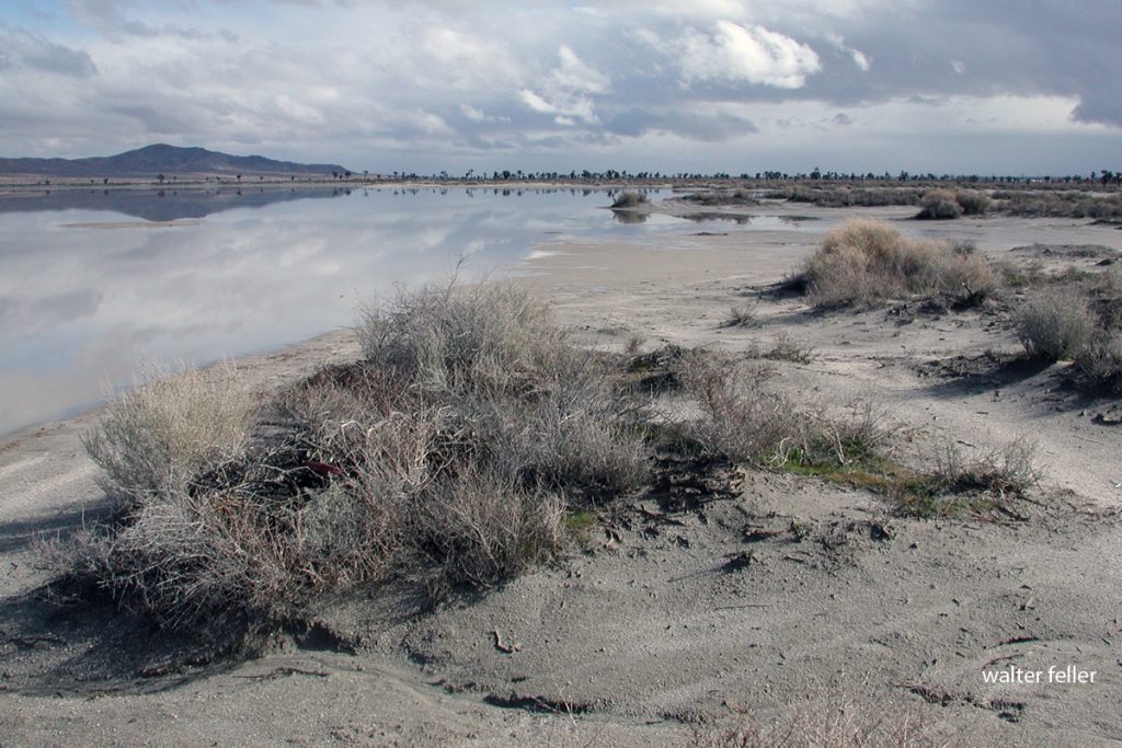
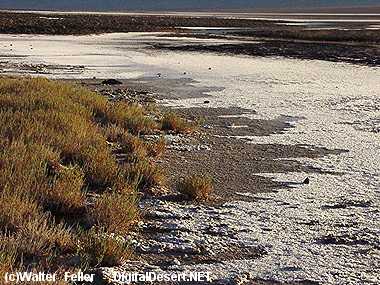
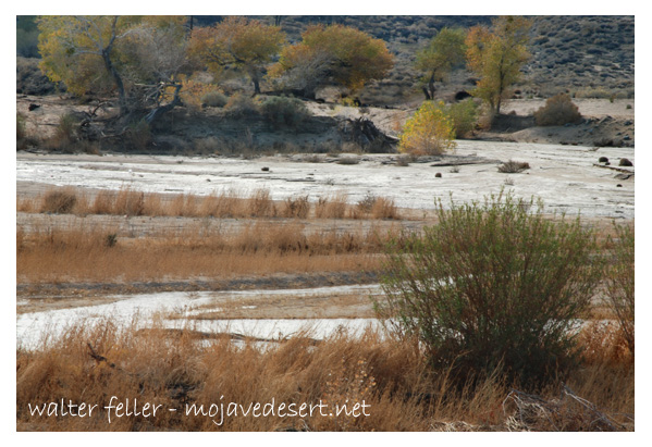
Mojave River at Lanes Crossing

Introduction:

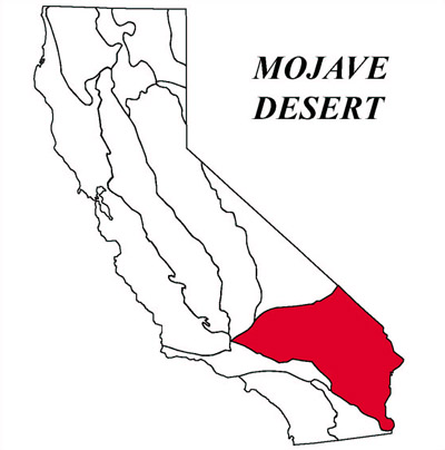
The Mojave River, a hidden gem in the arid landscapes of California, serves as a vital lifeline in the Mojave Desert. This remarkable river spans approximately 110 miles and offers a diverse ecosystem, historical significance, and recreational opportunities for nature enthusiasts and history buffs.

Geography and Formation:
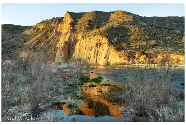
The Mojave River originates in the San Bernardino Mountains and meanders through the Mojave Desert, eventually dissipating into Soda Lake. Its path encompasses various landscapes, including rugged canyons, barren deserts, and lush riparian habitats. The river’s formation can be traced back thousands of years ago when geological processes and the ever-changing climate of the region shaped its course.

Ecological Importance:
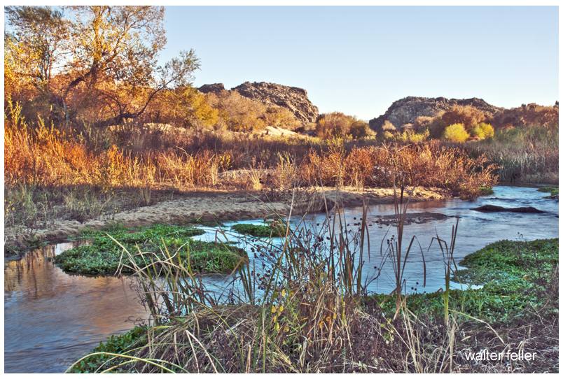
Despite the harsh Mojave Desert conditions, the Mojave River sustains a surprising array of flora and fauna. The river’s riparian zones provide an ideal habitat for a variety of plant species, such as willows, cottonwoods, and mesquite trees. These lush areas attract diverse wildlife, including birds, reptiles, and mammals, seeking refuge in this desert oasis.

Historical Significance:
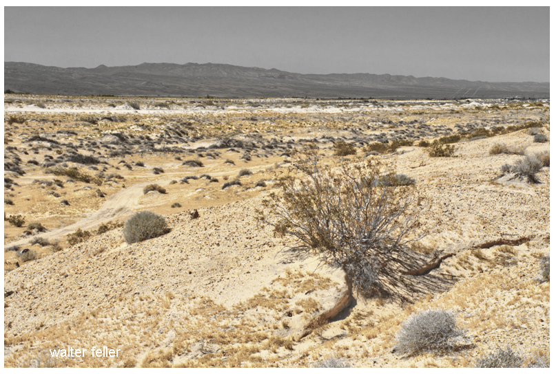
The Mojave River holds a significant place in the history of California. Native American tribes, such as the Mojave, Serrano, and Chemehuevi, once relied on the river’s resources for sustenance and survival. European explorers, including Spanish missionaries and fur trappers, ventured along its banks, leaving behind a legacy of cultural exchange and exploration.

Moreover, during the mid-1800s, the Mojave River played a crucial role in the development of the Old Spanish Trail and the Mojave Road. These historic trade routes linked the Spanish colonies of California with the eastern United States, facilitating trade and migration.

Recreational Opportunities:
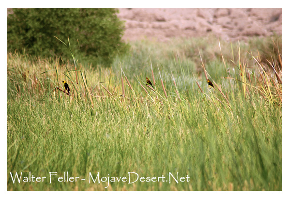
For outdoor enthusiasts, the Mojave River offers a plethora of recreational activities. Hiking trails, such as the Mojave Riverwalk Trail, provide opportunities for exploration, allowing visitors to immerse themselves in desert scenery. Camping facilities and picnic areas along the river’s banks provide the most idyllic setting for a peaceful getaway amidst nature’s tranquility.

Conservation Efforts:
Recognizing the importance of preserving this vibrant ecosystem, numerous conservation organizations and government agencies have worked to protect and restore the Mojave River. These initiatives focus on sustaining river water quality and preserving riparian habitats.

Conclusion:

The Mojave River stands as a testament to the resilience of nature in the face of adversity. Its meandering path through the Mojave Desert provides a lifeline for both wildlife and humans, offering a sanctuary amidst the arid landscapes. Whether you are a nature lover, history enthusiast, or adventure seeker, the Mojave River is a destination that promises a unique and memorable experience. So, embark on a journey to this desert oasis, and let the Mojave River captivate you with its beauty and allure.
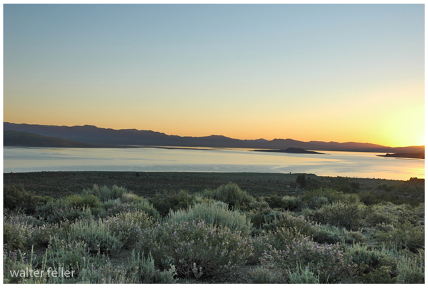
Mojave River

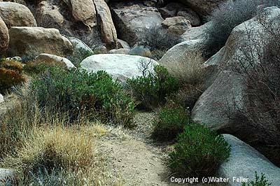
Riparian Habitats

Brine Flies

Brine flies at Mono Lake are one of those old, workmanlike desert stories where something humble ends up being essential.

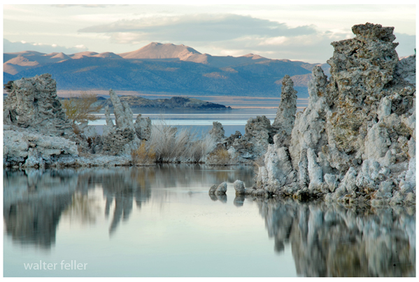
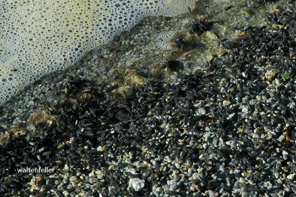
Mono Lake is extremely salty and alkaline, so almost nothing can live there. Brine flies (Ephydra hians) are the big exception. They spend most of their lives as larvae and pupae underwater, grazing on algae that coat the lake bottom and tufa formations. When they emerge as adults, they form the dark, moving bands you see along the shoreline and rocks.

Their trick is simple but effective. Adult flies have dense hairs and a waxy coating that traps air around their bodies, allowing them to walk underwater to lay eggs and feed without drowning. It looks strange, but it works, and it has worked for a very long time.

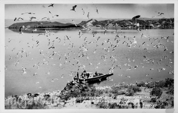
Ecologically, brine flies are the backbone of Mono Lake. They convert algae into protein, and in doing so, they feed millions of migratory birds. Eared grebes, phalaropes, gulls, and others depend on the flies during migration, sometimes doubling their body weight before moving on. If the flies disappeared, Mono Lake would be nearly silent.

Culturally, they mattered too. The Kutzadikaa Paiute, often called the Mono Lake Paiute, harvested brine fly pupae, dried them, and traded them as a high-protein food. Early Euro-American settlers mostly saw the flies as a nuisance, but the Paiute understood precisely what they were worth.

Today, brine flies are also an indicator species. When lake levels drop, and salinity rises too far, fly populations suffer. Keeping Mono Lake at a sustainable level is not just about scenery or tufa towers; it is about preserving this old, tightly balanced system that has been working more or less the same way since long before modern water diversions arrived.

-End-

As a Play

You could think of the Mojave Desert as a grand Broadway production—ancient, dramatic, and full of subtle choreography that has played out for millions of years.

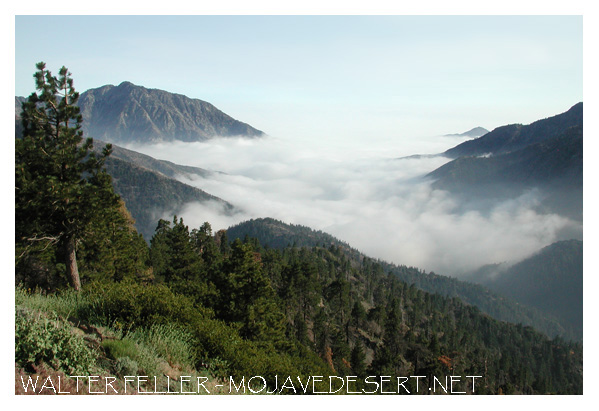
view from walker pass

The stage is the geology: immense backdrops of folded mountains, tilted strata, and fault lines painted by time. Volcanic cones serve as spotlight towers, alluvial fans sweep like curtains drawn across the basin floor, and the Mojave River cuts a wandering path like a traveling stagehand moving props between acts.

The set is built from plants, rocks, and the occasional weathered structure. Joshua trees rise like eccentric stage pieces, each with its own pose under the lights. Creosote bushes fill in the ensemble—reliable, understated performers who know every cue. Abandoned mining cabins, ghost towns, and derelict rail ties serve as the props and scenery from earlier acts, remnants left between scenes of prosperity and decline.
The lighting crew is the sun, directing each scene with precision—blinding spotlights at noon, warm amber tones at dusk, and moonlit silver rehearsals after dark. The wind adds the soundtrack, whispering through canyons or howling like a restless audience.

The actors? Coyotes, bighorn sheep, and lizards—all improvising within a script written by climate and time. Even the rain, when it shows up, steals the scene with a brief but powerful soliloquy, transforming everything for one fleeting act before bowing out again for months, sometimes years.

Every performance is different, but the play never closes. The Mojave’s production runs continuously, with geology always holding center stage and life finding its cues wherever it can.

When Bees Sleep

Things to say to a seven-year-old

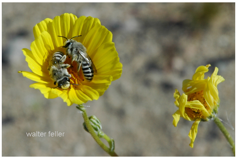
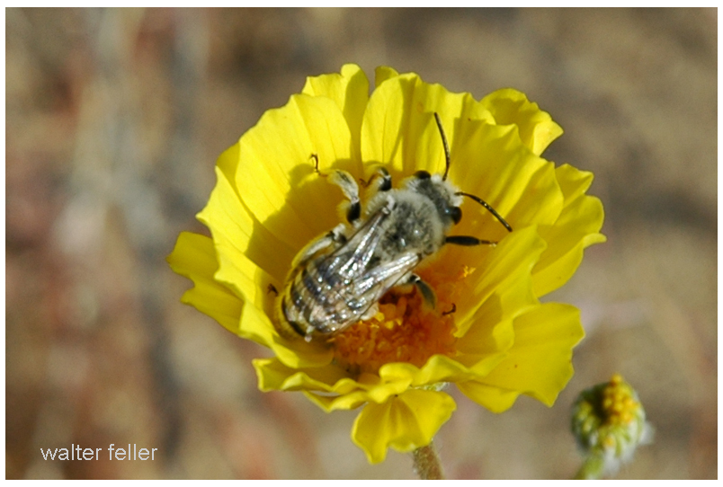
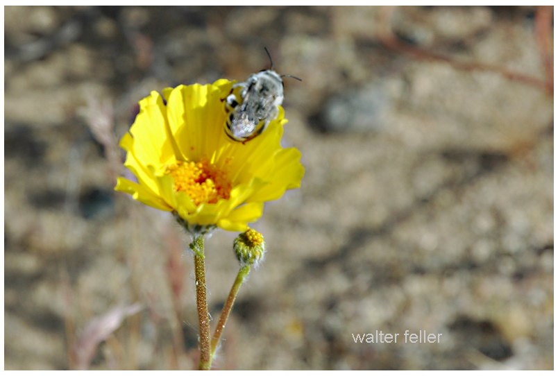
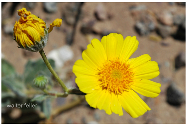
In the Mojave Desert, the bright yellow desert gold flowers open wide in the sunshine. They look like little suns shining across the sand. Bees love to visit, buzzing from one bloom to the next, sipping sweet nectar and rolling in golden pollen.

As the sun sinks low, the flowers start to close their petals. It’s bedtime for desert gold. But sometimes, a bee is still inside. When the petals fold shut, the bee is tucked in—safe and snug in a soft bed of pollen. The flower becomes a tiny motel room just for bees.

On windy nights, the motel isn’t always calm. The flower sways and shakes, tossing the bee about like a boat on stormy water. That’s what makes it “wild” life. But even if it gets bumpy, the bee is better off inside than out in the cold desert night.

Bees are hard workers with a wonderful work ethic. They don’t even leave the job when it’s time to rest. They sleep right at work, in golden beds of pollen. And when the morning sun warms the desert and the flowers open again, the bees are already up and ready—buzzing off to do their important work all over again.

Sunflower

Damn Yellow Flowers

Tribal Generations

Before the arrival of the Spanish and other Europeans, a Native American tribe might separate into two (or more) for several reasons, all tied to natural social, environmental, and political dynamics:

  1. Territorial Expansion – As a tribe grew in population, they might need more space to hunt, gather, or farm. A portion of the group might move to a new area, eventually developing their own identity and leadership.
  2. Resource Availability – If a hunting or fishing ground became overused, or if a drought affected a key water source, some members of the tribe might migrate elsewhere, forming a new but related group.
  3. Disagreements Over Leadership – Tribal leadership was often based on consensus, but disagreements could arise. If a faction preferred a different leader or way of governance, they might break away and establish their own group.
  4. Cultural or Spiritual Differences – A group within the tribe might develop distinct beliefs, ceremonies, or practices, leading to a natural separation over time.
  5. Trade and Alliances – Interaction with neighboring tribes could lead to new connections, intermarriage, or even the adoption of different customs, creating a distinct offshoot of the original tribe.
  6. Conflict or Internal Struggles – Disputes over hunting grounds, resources, or social issues could lead a faction to break away to avoid ongoing conflict.
  7. Seasonal or Nomadic Patterns – Some groups might split due to differing seasonal migration routes, with each eventually forming its own traditions and leadership.

Many tribes we recognize today likely formed through gradual separations like these, rather than sudden or dramatic splits. Over time, they developed distinct dialects, customs, and identities while still often maintaining shared ancestry and connections.

Mojave: Nature or Nurture

If you’re wondering whether the Mojave Desert is shaped more by nature or human influence, the answer is a combination of both. However, nature has had the predominant role for much longer.

Over millions of years, nature has carved out the Mojave, sculpting its landscapes through the forces of wind and water. It has created mountain ranges, valleys, and ancient lakebeds, setting the stage with extreme temperatures, limited rainfall, and hardy plants and animals that have adapted to survive in this challenging environment. Species like Joshua trees, creosote bushes, bighorn sheep, and sidewinder rattlesnakes have all found a way to thrive in a land where survival is not guaranteed.

In contrast, humans have made their mark in a much shorter timeframe. Indigenous peoples, such as the Chemehuevi and Mojave, lived sustainably in the region, moving with the seasons and utilizing the land’s resources without depleting them. Later, settlers, miners, ranchers, railroad builders, and modern developers added further layers of change. Some areas, like Las Vegas, military installations, and sprawling solar farms, have undergone significant transformation. In contrast, other regions remain relatively untouched, preserving their raw, ancient beauty.

So, is the Mojave a product of nature or nurture? Nature formed it, while humans have made adjustments—sometimes respecting its limits and other times pushing them. Regardless of how much we build or alter the landscape, the desert continues to adhere to its own rules. Flash floods serve as reminders of the power of water, sand dunes shift and reclaim the land, and scorching summer temperatures demonstrate who is truly in charge.

Owens Valley*

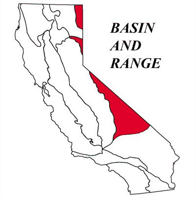
Owens Valley happens to be one of the most singular and interesting places in the United States. It is located in the western part of the continent – between the Sierra Nevada and the Inyo Mountains. This valley forms part of the geomorphic province of Basin and Range, characterized by mountains and valleys as unique features resulting from the process of Earth crust movement.

Geomorphology: The Shape of the Land

The Owens Valley lies within crust of the Basin and Range province, which is famous for its “horst and graben” structure. Consider the crust of the earth to be rifting apart: the surface breaks, and some blocks go down while others rise up. This process forms a pattern of highs and lows. Owens Valley is one of these low areas, known as a “graben,” while surrounding mountains are the high areas known as “horsts.” The elevation of the valley varies from about 3000 to 6000 feet and includes flat and gently sloping areas.
Erosion, the wearing away of rocks and soil by water and wind, and deposition combine in the process whereby these materials are laid down in new places. Through such continuous action, an alluvial fan—the fan-shaped deposit of soil and rocks at the base of the mountains—and a basin fill, or a layering of sediments on the floor of the valley, form over time.
Soil and Vegetation: Life on the Land

Soils in Owens Valley vary considerably. On the alluvial fans, Torrifluvents and Torriorthents soils are well drained and support a wide variety of plant life. Elsewhere in the basin-fill areas, the soils may be poorly drained and these areas may support different kinds of plants. There is even dune sand in places!
The vegetation of Owens Valley differs according to soil and location. You might find plants such as saltbush and greasewood that are tolerated on salty soils in the areas of basin fill. On the alluvial fans, there were plants like shadscale and hop-sage that could stand the drier conditions. Higher up on the fans, there is black bush with sagebrush. South of Owens Lake, creosote bush is the predominant plant.

Climate: Hot and Dry

Long-term temperatures and rainfall—Owens Valley has a hot and dry climate. Average annual precipitation, or the amount of rain that falls in an average year, is only about 4 to 8 inches. Most of this rain falls during the winter months. The mean annual temperature varies from 55° to 65° F. Because it is so dry, plants and animals must be tough in order to survive with little water.

Water: The Lifeline

Water plays a major role in the Owens Valley way of life. Along the middle of this long valley runs the Owens River, which furnishes water to many plants, animals, and people. Centuries ago, Owens Lake used to overflow periodically and send water to the neighboring valleys. Nowadays, so much of the Owens River water is exported to Los Angeles that Owens Lake is virtually dry.

Conclusion

Owens Valley is a place both fascinating in geology and ecology. Distinct landform, variety of soils, and flora hardiness testify to the ability of life to adapt to the rigors of heat and dryness. Understanding Owens Valley would help us recognize the sensitive links between land, water, plants, and animals that give this part of the world its special identity.

*AI

Why is there Snow?

Snow is one of nature’s most captivating occurrences, turning landscapes into winter wonderlands. Have you ever wondered why snowfall occurs? Let’s discover the icy world of snow and understand how it forms.

It must be Cold

In order for snow to form, the temperature needs to be cold, particularly below freezing (32°F or 0°C). When the atmosphere freezes, moisture can change into ice without going through the liquid stage. The process of making snow starts with this important initial stage. Cold temperatures act like a natural freezer, providing the right environment for water to transform into ice crystals.

Humidity in the Atmosphere

Despite being invisible, water vapor is constantly present in the air. The moisture originates from lakes, oceans, rivers, and even plants. As moist air rises into the atmosphere, it loses heat and becomes cooler. The reduced ability of colder air to hold water vapor causes the vapor to condense into tiny droplets, eventually forming clouds.

Cloud formation

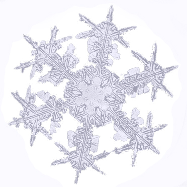
Clouds are primarily made up of tiny water droplets or ice particles. When the air temperature cools enough within these clouds, the water droplets freeze and change into ice crystals, forming the basis of snowflakes. Ice crystals in clouds collide, stick together, and grow in size, forming intricate snowflake patterns.

When Snowflakes Fall

When the snowflakes become thick, they start falling from the clouds. While descending, they pass through different layers of the atmosphere. If the temperature by the surface is freezing, the snowflakes stay whole and fall as snow. If the temperature is warmer near the surface, snowflakes may melt and change into rain or sleet before reaching the ground.

Snow

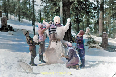
Different forms of snow can occur based on the temperature and moisture content in the atmosphere. During extreme cold, snow becomes light and airy, ideal for creating snow angels and skiing. When the temperature gets closer to freezing, the snow becomes more moist and dense, perfect for making snowmen and having snowball fights.

Summary

Snow is an intriguing outcome of low temperatures, moisture, and cloud movements. It starts with chilled air turning water vapor into ice crystals. The snowflakes are made of crystals, creating a white blanket when they fall to the ground. Snow creates happiness and thrill, transforming the world into a winter wonderland of leisure pursuits. The next time you witness snowflakes descending, remember nature’s process of mixing cold and moisture to form a magical winter scene!

Yucca Moths and Joshua Trees: A Mutualistic Relationship

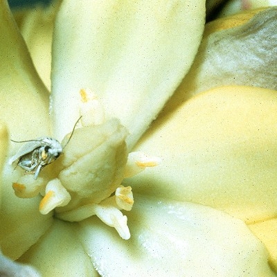
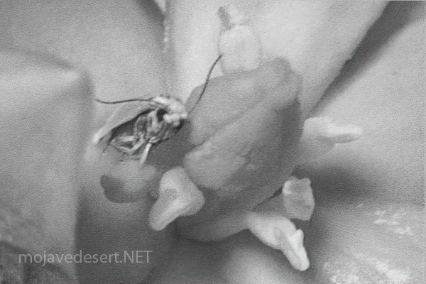
Pronuba moth in a yucca blossom. NPS

https://mojavedesert.net/trees/yucca-brevifolia

Introduction The relationship between Joshua trees (Yucca brevifolia) and yucca moths (Tegeticula synthetica) is a classic example of mutualism, where both species benefit from their interaction. This symbiotic relationship is essential for the reproduction of Joshua trees and the lifecycle of yucca moths.

Yucca Moth Pollination Process

  1. Flowering: Joshua trees typically bloom from February to late April, producing clusters of creamy white to green flowers. The blooming process depends on sufficient rainfall and a winter freeze.
  2. Moth Activity: Female yucca moths visit Joshua tree flowers during their active period. Unlike most insects that visit flowers for nectar, yucca moths have a unique role. The female moth collects pollen from the anthers of one flower and forms it into a ball using specialized tentacles near her mouth.
  3. Pollination: The moth deliberately transfers the pollen ball to the stigma of another Joshua tree flower. This deliberate act ensures cross-pollination, which is crucial for the genetic diversity and reproductive success of the Joshua tree.
  4. Egg Laying: After pollinating the flower, the female moth lays her eggs inside the flower’s ovary. This ensures that her larvae will have a food source when they hatch.
  5. Larval Feeding: As the seeds develop within the flower’s ovary, the moth eggs hatch into larvae. These larvae feed on a portion of the developing seeds. Despite this seed predation, enough seeds typically remain viable to ensure successful reproduction of the Joshua tree.

Selective Abortion Joshua trees have developed a mechanism to ensure seed survival despite the larvae feeding. They can selectively abort ovaries that contain too many moth eggs. This limits the number of larvae that can develop and ensures that sufficient seeds remain viable for the tree’s reproduction.

Mutual Benefits

  • For the Joshua Tree: The deliberate pollination by the yucca moth increases the likelihood of successful seed set and promotes genetic diversity due to cross-pollination.
  • For the Yucca Moth: The Joshua tree provides a secure environment for the moth to lay its eggs and a reliable food source for the larvae.

Unique Adaptations

  • Yucca Moth: Specialized tentacles for collecting and transferring pollen. This adaptation is unique among insects and has specifically evolved to pollinate Joshua trees.
  • Joshua Tree: Flower structure that accommodates the yucca moth’s pollination behavior. The tree’s ability to selectively abort seed pods with too many larvae is also a crucial adaptation for managing seed predation.

Ecological Importance The relationship between Joshua trees and yucca moths is a cornerstone of the Mojave Desert ecosystem. This mutualism ensures the reproduction and survival of Joshua trees and supports a complex web of life, providing food and habitat for various species of birds, mammals, reptiles, and insects.

Conclusion The intricate pollination mechanism between Joshua trees and yucca moths highlights these species’ deep co-evolution and interdependence. This mutualistic relationship is essential for their survival and plays a vital role in maintaining the ecological balance of the Mojave Desert.

Grasshopper Mouse

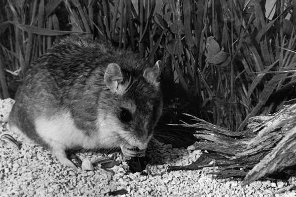
The grasshopper mouse, belonging to the genus Onychomys, is a fascinating creature known for its unique behaviors and adaptations. Here’s a detailed overview of its natural history:

Physical Description

  • Size: Small rodents, typically around 4 to 5 inches in body length, with an additional 1 to 2 inches of tail.
  • Appearance: They have a robust body, short tails, and large ears. Their fur is generally grayish-brown on the back and white on the belly.

Habitat

  • Geographic Range: Found in North America, particularly in the arid and semi-arid regions of the western United States and Mexico.
  • Preferred Environment: Grasshopper mice inhabit deserts, scrublands, and prairies. They are well-adapted to dry environments and can be found in areas with sparse vegetation.

Behavior

  • Nocturnal Lifestyle: These mice are primarily nocturnal, coming out to hunt and forage at night.
  • Territoriality: Grasshopper mice are highly territorial and aggressive. They establish and defend territories vigorously.

Diet

  • Carnivorous Diet: Unlike many other rodents, grasshopper mice are primarily carnivorous. They feed on insects, other small invertebrates, and even small vertebrates.
  • Specialization: They are named for their tendency to prey on grasshoppers, but their diet can also include beetles, scorpions, spiders, and even other mice.
  • Hunting: Known for their hunting prowess, they are sometimes called “scorpion mice” due to their ability to hunt and consume scorpions, showing resistance to the venom.

Vocalizations

  • Unique Calls: Grasshopper mice are known for their high-pitched, wolf-like howls, which they use to communicate with each other, especially to mark territory.

Reproduction

  • Breeding Season: Typically breed from spring through late summer.
  • Litter Size: Females give birth to 2 to 6 young after a gestation period of about 30 days.
  • Parental Care: The young are weaned after a few weeks and reach maturity at around 2 to 3 months.

Adaptations

  • Water Conservation: Adapted to arid environments, grasshopper mice obtain most of their water from the food they eat and have efficient kidneys to conserve water.
  • Venom Resistance: They have developed a resistance to the venom of scorpions, allowing them to prey on these arachnids without harm.

Ecological Role

  • Predator Control: By preying on insects and other small animals, grasshopper mice help control the populations of these species in their habitats.
  • Indicator Species: Their presence and health can be indicators of the ecological balance in their environment.

The grasshopper mouse’s unique dietary habits, vocalizations, and behaviors make it a remarkable example of adaptation to harsh environments, playing a crucial role in the ecosystems they inhabit.

Parietal Eye

The parietal eye, also known as the third eye, is a part of the pineal gland and is found in some species of reptiles and amphibians. It is a photosensitive organ located on the top of the head and is capable of detecting light and dark. Here are some key points about the parietal eye:

  1. Location and Structure: The parietal eye is situated in the parietal area of the brain, on the top of the head, and it is visible as a small, light-sensitive spot in some reptiles and amphibians.
  2. Function: The parietal eye’s primary function is to detect changes in light intensity, helping the animal regulate its circadian rhythms and hormone production. It can also influence basking, thermoregulation, and seasonal reproduction.
  3. Presence in Species: The parietal eye is found in various species of reptiles, such as some lizards (like iguanas) and tuataras, as well as some species of amphibians and fish. It is not present in birds or mammals.
  4. Evolutionary Aspect: The parietal eye is considered an ancient feature in vertebrate evolution, reflecting an early adaptation to environmental light changes.
  5. Comparison with Pineal Gland: While the parietal eye is light-sensitive, the pineal gland in other vertebrates (including humans) receives light information indirectly through the eyes and the brain. Both structures are involved in regulating circadian rhythms and reproductive cycles.

In summary, the parietal eye is an intriguing evolutionary feature that aids certain reptiles and amphibians in detecting environmental light and regulating physiological functions.

The Parietal Eye: Nature’s Light Sensor

The parietal eye, often called the third eye, is a fascinating feature found in some reptiles and amphibians. This photosensitive organ, located on the top of the head, plays a crucial role in detecting light and dark and aids in regulating various physiological processes.

Structure and Location

The parietal eye is situated in the parietal area of the brain and is visible as a small, light-sensitive spot. Unlike the primary eyes, which detect images, it acts as a direct light sensor. This organ is found in certain lizards (including iguanas), tuataras, and some amphibians and fish. Birds and mammals, however, do not possess this feature.
Function and Role

The primary function of the parietal eye is to detect changes in light intensity, helping the animal maintain its circadian rhythms and regulate hormone production. This detection influences behaviors such as basking, thermoregulation, and seasonal reproduction. By sensing light, the parietal eye helps these animals adapt to their environment, optimizing their physiological and behavioral responses.

Evolutionary Significance

The presence of the parietal eye is an ancient adaptation, reflecting early vertebrate evolution. It showcases how animals have developed specialized organs to respond to environmental changes. While the parietal eye is a direct light sensor, other vertebrates, including humans, rely on the pineal gland for similar functions. The pineal gland receives light information indirectly through the eyes and brain, playing a key role in regulating circadian rhythms and reproductive cycles.

Conclusion

The parietal eye is a remarkable evolutionary feature that underscores the diversity of adaptations in the animal kingdom. By detecting light and dark, it enables reptiles and amphibians to finely tune their behaviors and physiological processes to their environments, ensuring their survival and reproductive success.

Summary

The parietal eye, or third eye, is a light-sensitive organ found in some reptiles and amphibians, situated on the top of the head. It detects changes in light intensity, aiding in regulating circadian rhythms, hormone production, and behaviors like basking and thermoregulation. Present in species such as lizards, tuataras, and some amphibians, this ancient adaptation highlights early vertebrate evolution. Unlike the parietal eye, the pineal gland in other vertebrates receives light information indirectly through the eyes and brain. This unique feature helps these animals optimize their responses to environmental changes, ensuring survival and reproductive success.

#5 – Mojave National Preserve: A Vast Desert Wilderness

/mojave-preserve/

The Mojave National Preserve, encompassing over 1.6 million acres, offers diverse landscapes, wildlife, and recreational activities. Located in southeastern California, the preserve is a haven for outdoor enthusiasts and nature lovers. Here’s an expanded look at what makes the Mojave National Preserve a popular destination:

Key Features and Attractions

  1. Kelso Dunes:
    • Dune Field: Covering over 45 square miles, the Kelso Dunes are some of the tallest dunes in North America, with the highest peak rising about 650 feet.
    • Hiking and Exploration: Visitors can hike to the top of the dunes for panoramic views and experience the phenomenon of “singing sands,” a booming sound produced by the movement of the sand.
    • Sunset Views: The dunes are stunning at sunset when the shifting light creates dramatic shadows and colors.
  2. Hole-in-the-Wall:
    • Geological Features: This area is named for its unique rock formations created by volcanic activity and erosion. The walls are filled with holes and cavities, giving the area its distinctive appearance.
    • Rings Loop Trail: A popular 1.5-mile loop trail that features metal rings bolted into the rock to help hikers navigate steep sections of the trail. The trail offers a close-up view of the fascinating rock formations.
    • Visitor Center: The Hole-in-the-Wall Information Center provides exhibits on the area’s geology, wildlife, and cultural history.
  3. Cinder Cone Lava Beds:
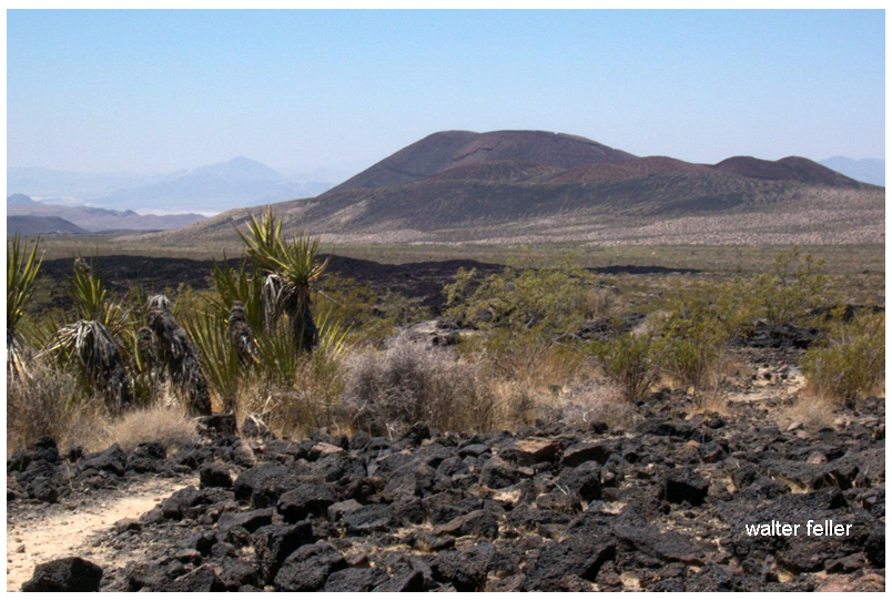
    • Volcanic Landscape: This area features ancient volcanic cones, lava flows, and craters, offering a rugged and dramatic landscape.
    • Hiking Trails: Trails wind through the lava beds, providing opportunities to explore the unique terrain and view the surrounding desert.
  4. Mitchell Caverns:
    • Limestone Caves: Located in the Providence Mountains State Recreation Area, these caverns are filled with stalactites, stalagmites, and other fascinating formations.
    • Guided Tours: The only way to explore the caverns is through guided tours offered by California State Parks, which provide insights into the caves’ geological history and natural features.
  5. Mojave Road:
    • Historic Route: The Mojave Road is a historic 140-mile off-road trail that follows a route used by Native Americans, early explorers, and settlers. It provides a challenging and adventurous way to experience the preserve.
    • Landmarks: Along the route, travelers can see historic sites, old military forts, and natural landmarks. The route requires a high-clearance 4WD vehicle and careful planning.

Wildlife and Plant Life

  • Desert Flora: The preserve has various desert plants, including Joshua trees, creosote bushes, cacti, and wildflowers. Springtime can bring vibrant blooms, adding color to the landscape.
  • Wildlife: The preserve’s diverse habitats support a wide range of wildlife, including bighorn sheep, coyotes, desert tortoises, and numerous bird species. The varying elevations and environments within the preserve create unique ecosystems.

Recreational Activities

  1. Hiking:
    • Diverse Trails: The preserve offers a range of hiking trails, from short nature walks to strenuous backcountry routes. Trails provide opportunities to explore the varied landscapes and observe the native flora and fauna.
    • Backpacking: For those seeking a more immersive experience, the preserve offers backcountry camping and backpacking opportunities. Permits are required for overnight stays.
  2. Camping:
    • Developed Campgrounds: The preserve has several developed campgrounds, including Hole-in-the-Wall and Mid Hills, which offer amenities such as picnic tables, fire rings, and restrooms.
    • Dispersed Camping: For a more primitive experience, visitors can camp in designated areas throughout the preserve. Dispersed camping allows for solitude and a closer connection with nature.
  3. Stargazing:
    • Dark Skies: The remote location of the preserve provides excellent conditions for stargazing. The lack of light pollution allows for clear views of the night sky, making it a perfect spot for observing stars, planets, and meteor showers.
  4. Bird Watching:
    • Diverse Bird Species: The varied habitats within the preserve attract a wide range of bird species, making it a popular destination for bird watchers. Seasonal migrations and diverse environments provide opportunities to see both resident and migratory birds.
  5. Off-Roading:
    • Designated Routes: The preserve has numerous designated off-road vehicle routes, offering adventurous ways to explore the rugged terrain. It’s important to stay on designated routes to protect the environment and adhere to regulations.

Historical and Cultural Sites

  • Kelso Depot: A restored 1924 Union Pacific train depot now serving as the preserve’s visitor center. The depot features exhibits on the history of the railroad, mining, and desert communities.
  • Rock Springs Land and Cattle Company: Historical ranch buildings and corrals that provide a glimpse into the ranching history of the area.

Conservation and Preservation

  • Protected Area: The Mojave National Preserve is managed by the National Park Service, protecting its unique landscapes, wildlife, and cultural resources.
  • Leave No Trace: Visitors are encouraged to practice Leave No Trace principles, minimizing their impact on the environment and helping to preserve the preserve’s natural beauty and integrity.

Visitor Information

  • Accessibility: The preserve is accessible via Interstate 15 and Interstate 40, with several entry points and visitor centers providing information and resources.
  • Seasonal Considerations: The best times to visit are spring and fall when temperatures are moderate. Summer temperatures can be extreme, and winter can bring cold nights and occasional snow at higher elevations.
The Mojave National Preserve offers a diverse and captivating landscape with countless opportunities for exploration and adventure. Whether hiking through rugged canyons, climbing towering dunes, or simply soaking in the vast desert vistas, the preserve provides a memorable and enriching experience for all who visit.

Mohave Tui Chub

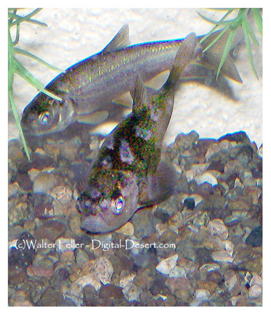
The Mohave Tui Chub (Siphateles bicolor mohavensis) is a fascinating species of fish native to the Mojave Desert region of California, specifically the Mojave River basin. This fish is notable for its unique adaptations to a harsh desert environment and as a symbol of conservation challenges and efforts in arid ecosystems. The Mohave Tui Chub is currently listed as an endangered species, making its survival a priority for environmentalists and scientists. This essay explores the biology, habitat, conservation status, and ongoing efforts to preserve this distinctive species.

Biology and Habitat

The Mohave Tui Chub is a small, stout fish, typically dark olive in color, that thrives in the freshwater marshes and isolated springs of its native habitat. As a member of the Cyprinidae family, it is adapted to survive in the variable conditions of desert water systems, which can range from clear to turbid. This species is predominantly a bottom-dweller, feeding on various invertebrates and organic debris, demonstrating a versatile diet that aids in its survival in limited environments.

Historically, the Mohave Tui Chub inhabited many interconnected water systems in the Mojave Desert. However, its habitat has drastically reduced due to water diversion, groundwater pumping, and the introduction of non-native species that compete for resources and introduce diseases.

Conservation Status and Efforts

The Mohave Tui Chub’s status as an endangered species results from extensive habitat loss and ecological changes. The redirection of water sources for agricultural and urban development has fragmented its living spaces, leaving the species vulnerable and isolated. Furthermore, introducing predatory fish species has led to a significant decline in their numbers.

Conservation efforts for the Mohave Tui Chub are multifaceted. They include habitat restoration, legal protection of water resources, and breeding programs aimed at increasing population numbers. Programs like the Artificial Propagation and Reintroduction Plan have established secure populations in protected areas. Moreover, environmental education programs are raising awareness about preserving this unique species and its ecosystem.

Conclusion

The Mohave Tui Chub is more than just a species; it represents the broader challenges of conserving biodiversity in desert ecosystems. The efforts to save the Mohave Tui Chub from extinction indicate a larger environmental stewardship goal to maintain the ecological balance and health of the Mojave Desert. Protecting this fish entails preserving a fragile ecosystem that supports diverse life. Through continued conservation initiatives and public support, there is hope that the Mohave Tui Chub will thrive again as proof of nature’s resilience and the effectiveness of concerted human conservation efforts.

https://digital-desert.com/mojave-preserve/mojave-tui-chub-resources.html

Snowshoe Wrightwood’s Table Mountain

 BY CHRIS KASTEN

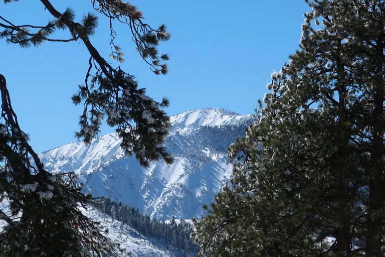
9,399′ high Mt. Baden-Powell’s massif dominates the southwest skyline from Table Mountain.

Joanie and I got out for a great afternoon of snowshoeing up on Wrightwood’s Table Mountain about a week and a half ago.   Since then,  more storms have dropped even more of the precious powder on our local mountains.   Whether you like to cross-country ski or snowshoe, it’s a fantastic time to be out amongst our high country peaks, canyons and forests!

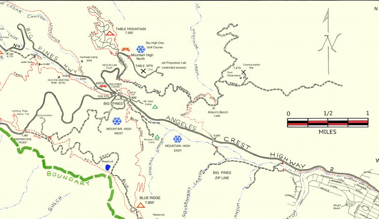
Inset of the Trails of Wrightwood – Big Pines map. The area we went snowshoeing is depicted as Table Mountain (with campground symbol) at an elevation of 7,200′. The west end of Wrightwood appears in the lower right corner of image.

Table Mountain is 7,516′ high and super easy to get to from Wrightwood.  Just drive.  You’re only looking at four miles from our village center.  Make sure to turn off to the right on Table Mountain Road when you arrive at the three way split in the roads at Big Pines.  Table Mountain Campground is where we did our snowshoeing on a quiet Friday, where we seemed to have the place to ourselves.  The wind had sculpted the snow into pristine dunes along the gently sloping ridge top that the extensive campground straddles.

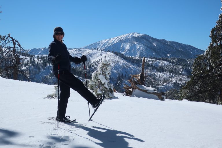
Joanie seems to almost float atop the powder on the sunny slopes of Table Mountain!

All the campsites were, of course, hidden under the snowy mantle, with just the picnic tabletops presenting themselves as a bit of a depth gauge.  Most of the time, snow depth was around 24″ and in places well over three feet.  The windward sides of the mammoth white fir and Ponderosas were coated in sparkling icicles that fell like shards of glass in the wind gusts that came out of the southwest.  Mt. Baden-Powell kept constant watch over us from across the great gulf of the East Fork of the San Gabriel River.   The Mojave Desert off to the north was a mosaic of tans, yellow sands and the right-angled patchwork of green winter crops scattered here and there.  It looked and felt warmer down there.  And high up on Table Mountain, that day was to be one of cobalt blue skies, bright white snows, wind and evergreens.

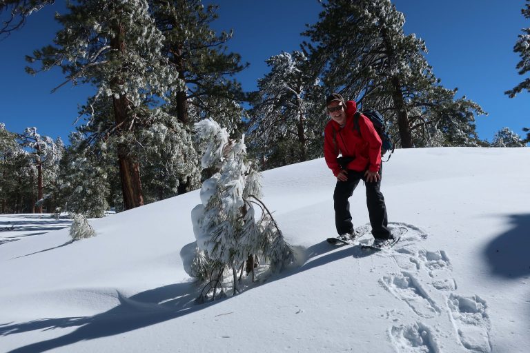
A small wind-bent snowy pine and Chris have a little visit amongst Table Mountain’s frozen forest.

Douglas Wallflowers in Blossom

MARCH 29, 2020 BY CHRIS KASTEN

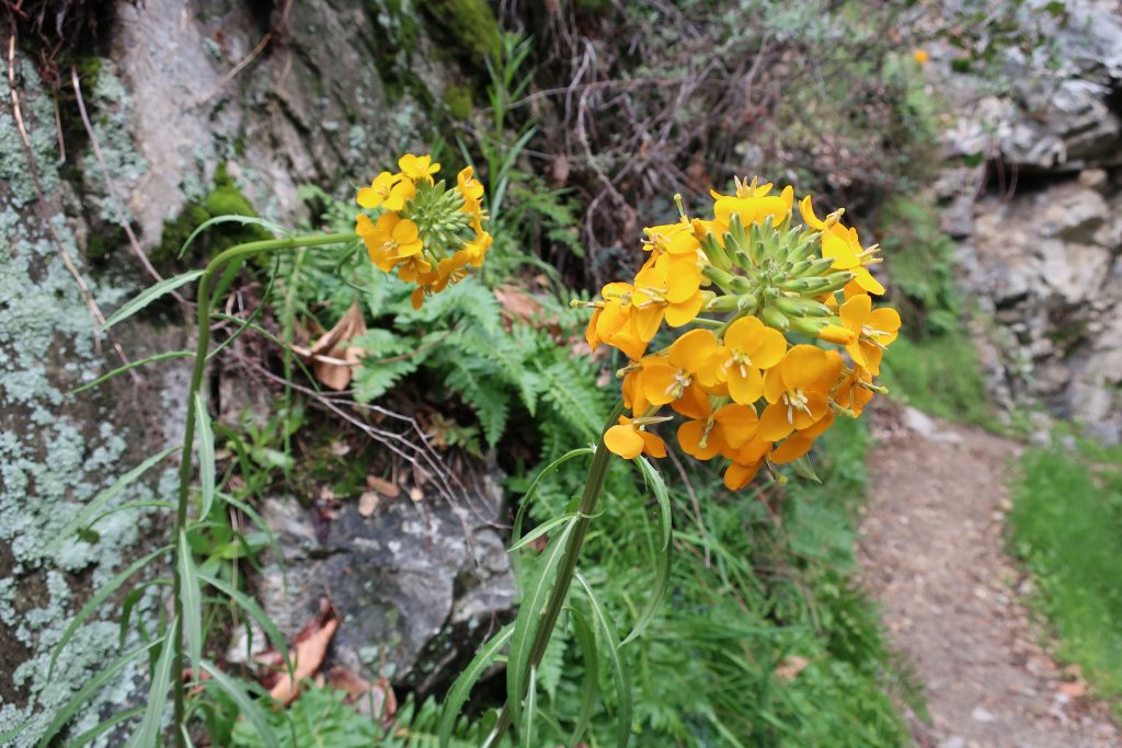
Here’s a Douglas Wallflower alongside the Upper Falls Trail, as seen this last Monday while hiking up the Big Santa Anita Canyon under cloudy skies.   Our series of much-needed rain storms have brought back thick green grasses and the start to what’ll most likely be a colorful Spring of other wildflowers.  Joanie and I hiked the two-mile Falling Sign Loop from Fern Lodge.

These Douglas Wallflowers (Erysimum capitatum) popped out at us just downstream from the double slot pools on the Upper Falls Trail. There’s also a nice grouping of wallflowers near the second bench up the road from Roberts’ Camp in San Olene Canyon.

Sturtevant Falls was tumbling down nicely.  The scent of white sage peppered the cool air and the background surf-like sound of the stream followed us the whole way.  We brought along an old shovel, cleaning off small slides here and there.   Wild lilacs (buck brush) are still sending their mild lavender scent into the canyon breezes while the bright red orange of Indian paintbrush pokes up from the damp earth near Hoegee’s Drop-Off.  And overarching along most of the route, the Laurel bay blossoms still cling to the dark green canopies.  Look for the tender dark reddish purple leaves of the canyon big-leaf maples as their foliage begins to fill back in for a new season.  Even the white alders are pushing out a myriad of their bright green leaflets, replacing that smokey look of dormancy with new life.

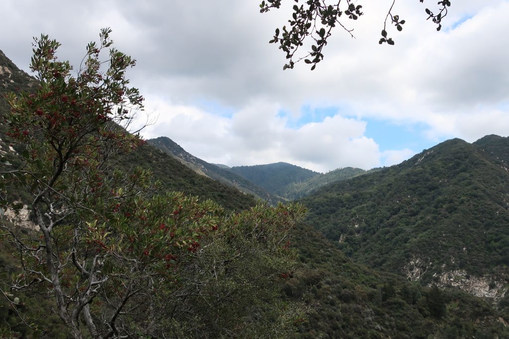
View looking east up into the East Fork of Big Santa Anita Canyon from Gabrielino Trail. Note the Toyon in the foreground, still hanging onto some of its’ red berries. That’s Rankin and Monrovia peaks in the most distant background. Clamshell Peak is barely captured on the right hand side of photo.

Western Fence lizards are out at Tin Can Point

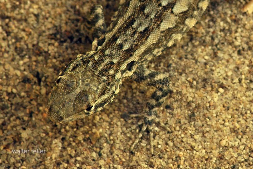
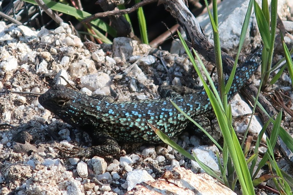
This turquoise colored fence lizard (Sceloporus occidentalis) was seen out in the warmth of early Spring at Tin Can Point. Tin Can Point is just up from Fern Lodge Junction on the Gabrielino Trail. It’s the first switchback you’d encounter after the trail passes through the canyon live oak forest and then enters the chaparral, just a few minutes up from the trail junction.

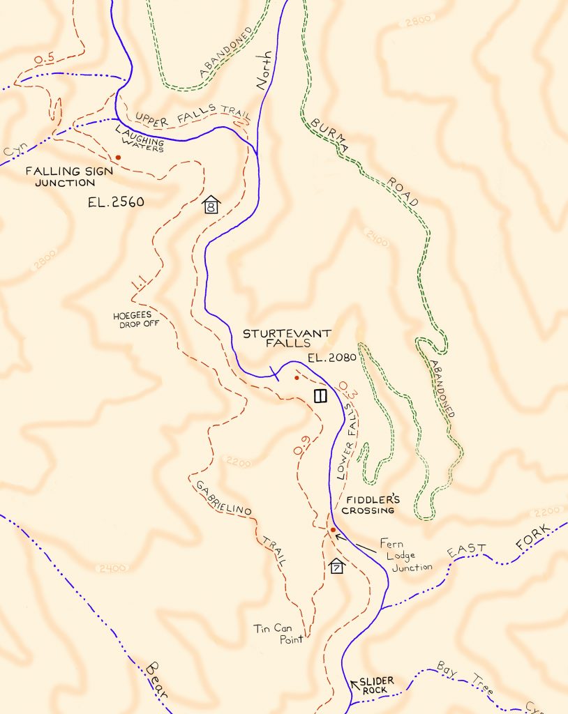
A beautiful fence lizard basks in the gentle warmth of early Spring at Tin Can Point.   See inset of the Chantry Flat – Mt. Wilson Trails map, below, to see where this point is.  As of this writing,  a cold wet pacific storm is dropping nearly six days of chilly rain and snow in much of the San Gabriel mountains.  Big Santa Anita Canyon dam has received over 5 1/2″ of rain in the last week.  Something I just learned recently about these Western Fence lizards is that their populations have the effect of reducing the incidence of Lyme’s disease in the ticks that live in the chaparral,  such as found covering much of the slopes of the Big Santa Anita Canyon!  Apparently, a protein in the lizard’s blood kills the bacterium in the tick’s gut, which is good news for hikers and even their dogs during the spring and autumn months.

Like most reptiles, Western Fence lizards hibernate, at least for a little while each winter throughout their habitats which are wide-spread throughout California.  As for food, these lizards eat spiders and various insects such as mosquitos, beetles and grasshoppers.   The females lay several small clutches of eggs (3-17) in the spring, the young emerging in the summer.

Detail of Gabrielino Trail section, Chantry Flat – Mt. Wilson Trails map.

On your next hike out from Chantry Flats, watch for for lizards flitting about on the trails and sunning themselves on the myriad stretches of rock.  As for the various types of reptiles to be found in the Big Santa Anita, Western Fence lizards are abundant and deserve a place in the sun!

source:  Wikipedia, Western Fence lizards

Indian Trails

Establishment of the ancient Indian trails.

Oasis of Mara, Joshua Tree National Park – 2006

The indigenous peoples of the Mojave Desert, such as the Mojave, Chemehuevi, Serrano, and others, developed the first trails through the desert based on a deep understanding of the natural environment, honed over generations of living in this challenging landscape. These trails were not found by accident but were carefully established routes facilitating travel, trade, and access to resources within the desert and between different ecological zones. Here are some key methods and considerations that these indigenous peoples likely used to establish the trails:

  1. Water Sources: Finding and remembering the locations of reliable water sources was crucial for survival in the desert. Trails often connected springs, rivers, and waterholes that could sustain travelers through the arid landscape.
  2. Landmarks: Natural landmarks such as mountains, rock formations, and distinctive vegetation would have served as navigation aids, helping to guide the way and mark progress along the trails.
  3. Seasonal Variations: Understanding the seasonal changes in the desert, including variations in water availability and the movement of game animals, would have influenced the timing and direction of travel on these trails.
  4. Trade and Social Networks: Trails facilitated trade and communication between indigenous groups. They were designed to connect communities and trading posts, enabling the exchange of goods, ideas, and cultural practices.
  5. Observation and Oral Tradition: Knowledge of the landscape and its best routes would have been passed down through generations, with each generation refining and adding to this knowledge base. This oral tradition ensured that valuable information about navigating the desert was retained and shared within communities.
  6. Adaptation to the Environment: Trails would have been adjusted and modified over time in response to environmental changes, such as the shifting of water sources or the growth of new obstacles. This adaptive approach ensured that the trails remained viable over long periods.

These trails, established through intimate knowledge of the desert environment, would later be used by European explorers, settlers, and others as they moved through the Mojave Desert. The legacy of these indigenous trail-making practices is a testament to the ingenuity and resilience of the desert’s original inhabitants.

OpenAI. (2024). ChatGPT (4) [Large language model]. https://chat.openai.com

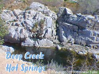
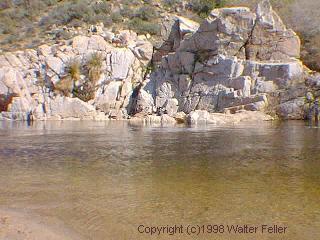
Deep Creek Hot Springs

/deep-creek-hot-springs/

Deep Creek Hot Springs, located near Apple Valley in the Mojave Desert of Southern California, is a popular natural attraction within the San Bernardino National Forest. These hot springs are renowned for their scenic beauty and the therapeutic benefits of the mineral-rich waters. The area around Deep Creek Hot Springs offers a variety of outdoor activities, including hiking, swimming, and wildlife viewing.

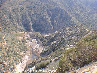
Access to Deep Creek Hot Springs is primarily through hiking trails, the most common being the Bradford Ridge Path from the high desert side and the Pacific Crest Trail from the Lake Arrowhead side. The hike to the hot springs is known for its rugged terrain, offering a moderate to challenging trek depending on the path chosen and the hiker’s experience level.

The hot springs themselves are situated along Deep Creek, a tributary of the Mojave River. The area features several pools with varying temperatures, allowing visitors to choose their preferred level of warmth. The surrounding environment is a mix of desert and riparian zones, home to various plant and animal species.

It’s important to note that visiting Deep Creek Hot Springs requires adherence to local regulations and respect for the natural environment. The area is managed by the U.S. Forest Service, which may impose restrictions to protect the habitat and ensure the safety and enjoyment of all visitors. Additionally, due to its remote location and the necessity of hiking to reach the hot springs, visitors should be well-prepared with adequate water, food, and safety gear.

Acorn Canyon

/angeles-national-forest/

Acorn Falls

The Acorn Canyon Trail is a popular hiking trail in Wrightwood, California. It is part of the San Gabriel Mountains and offers a beautiful natural setting for outdoor enthusiasts. The trail is known for its scenic views.

View from the Acorn Trail

Trail conditions, accessibility, and regulations may change over time, so it’s a good idea to check with local authorities or websites dedicated to hiking in the area for the most up-to-date information before planning your visit. Additionally, be prepared with appropriate hiking gear and follow Leave No Trace principles to protect the environment while enjoying the trail.

Acorn Canyon is indeed a part of the Angeles National Forest in California. It’s a beautiful area for hiking and enjoying the outdoors. As with any outdoor activity, it’s important to be prepared and follow safety guidelines when exploring this area.

Acorn Falls

Here are some general tips:

  1. Trail Information: Ensure you have up-to-date information about the Acorn Canyon Trail, including its length, difficulty level, and recent trail conditions or closures. This information is often found on the Angeles National Forest website or from local ranger stations.
  2. Hiking Gear: Wear appropriate clothing and footwear for hiking. Don’t forget essentials like a hat, sunscreen, sunglasses, and plenty of water. Depending on the season, you may also want to carry insect repellent.
  3. Trail Etiquette: Practice Leave No Trace principles by staying on designated trails, disposing of trash properly, and respecting wildlife. It’s also a good idea to yield the trail to others and be courteous to fellow hikers.
  4. Safety: Let someone know your plans, including your expected return time. Carry a map and a fully charged cell phone, but be aware that cell phone reception may be limited in some parts of the forest.
  5. Wildlife: Be aware of the potential for encounters with wildlife, including snakes. Stay on the lookout and keep a safe distance.
  6. Weather: Check the weather forecast for the area before heading out. Weather conditions can change rapidly in mountainous areas, so be prepared for sudden temperature drops or rain.
  7. Permits and Regulations: Depending on the specific trail and activities you plan to do, you may need permits or have to follow certain regulations. Check with the forest service or relevant authorities for necessary permits or rules.
  8. Emergency Contacts: Have the contact information for local emergency services or the nearest ranger station in emergencies.

Safety should be a priority when enjoying the outdoors, especially in wilderness areas like the Angeles National Forest. Enjoy your hike in Acorn Canyon and take in the area’s natural beauty while staying safe and respecting the environment.

California Grizzlies

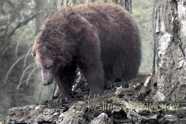
The California grizzly bear (Ursus arctos californicus) is a subspecies of the brown bear that once inhabited various regions of California. Historically, grizzly bears were found throughout the state, from the coast to the mountains and valleys. They were an important part of California’s wildlife and played a role in the culture and folklore of indigenous peoples.

California grizzly bear (Ursus arctos californicus)

Unfortunately, due to habitat loss, hunting, and human conflicts, the California grizzly bear population declined significantly throughout the 19th century. The last known California grizzly bear in the wild was killed in 1922 in Tulare County. The species was declared extinct in 1924.

Efforts have been made to preserve the memory of the California grizzly bear, and it is often symbolically represented in the state’s flag and seal. The California grizzly bear is also the state animal, even though it no longer exists in the wild.

1846 – 1910
1911 – 1952
Today

There have been occasional discussions and proposals for reintroducing grizzly bears to certain parts of California, but these efforts are complex and face challenges related to habitat, human-wildlife conflicts, and public opinion. As of my last knowledge update in January 2022, there were no active reintroduction programs in place. Still, it’s advisable to check for the latest information, as conservation efforts and plans may evolve.

Grizzly Bears in Bear Valley

Bears – Yosemite

Issac Slover

1845

Benjamin Wilson leads a posse of 22 men into the San Bernardino Mountains to search for Indians who had been raiding ranches in . He discovers Big Bear Valley and gives it the name it has today. Up until 1845, Bear Valley was known to the local Serrano Indians as Yahaviat, which means “Pine Place”. – bb

Mojave Desert Ecological Transitions

The Mojave Desert, located in the southwestern United States, is a unique and ecologically diverse ecosystem known for its extreme temperatures, arid conditions, and distinct plant and animal life. Various factors, including topography, climate, and human activities, influence the transitions within the Mojave Desert ecosystem.

Here are some key ecological transitions within the Mojave Desert:

  1. Elevation Gradients:
    • The Mojave Desert exhibits significant elevation gradients, ranging from below sea level in Death Valley to higher elevations in mountainous regions such as the Spring Mountains and the Mojave National Preserve. These elevation changes lead to variations in temperature, precipitation, and vegetation types.
  2. Flora and Fauna Shifts:
    • Plant and animal species are adapted to specific elevation ranges within the Mojave Desert. As you move from lower to higher elevations, you may encounter shifts in vegetation types, with desert shrubs giving way to pinyon-juniper woodlands and eventually to coniferous forests.
  3. Water Availability:
    • Water availability is a critical factor influencing ecological transitions in the Mojave Desert. Oasis ecosystems, supported by underground aquifers or natural springs, provide unique habitats in contrast to the surrounding arid landscapes. These oases can support a higher diversity of plant and animal life.
  4. Playa Ecosystems:
    • Playas, or dry lake beds, are common features in the Mojave Desert. During rainfall, playas can fill with water, creating temporary wetland habitats that support a burst of life, including migratory birds and amphibians. However, these ecosystems are highly dependent on unpredictable precipitation patterns.
  5. Human Impact:
    • Human activities, such as urban development, agriculture, and infrastructure projects, have significantly altered the Mojave Desert landscape. Urban areas like Las Vegas and Los Angeles have expanded into the desert, leading to habitat fragmentation and loss. Human activities can disrupt natural ecological processes and contribute to invasive species encroachment.
  6. Climate Change Effects:
    • The Mojave Desert is not immune to the impacts of climate change. Changes in temperature and precipitation patterns can affect the distribution of plant and animal species, alter vegetation composition, and influence the timing of biological events, such as flowering and migration.
  7. Fire Ecology:
    • Fire is a natural ecological process in many ecosystems, including the Mojave Desert. Some plant species in the desert have adapted to fire, and periodic wildfires can shape vegetation patterns. However, altered fire regimes due to human activities or climate change can have complex effects on the ecosystem.
Spring Mountains
Desert Front
Ibex Spring
Emerson Dry Lake
Human Impact – Victorville

Understanding these ecological transitions is crucial for effective conservation and management of the Mojave Desert. Conservation efforts need to consider the interconnectedness of various factors and address the challenges posed by human activities and climate change to maintain the health and biodiversity of this unique desert ecosystem.

Mojave Desert Ecotones

Ecotones are transitional zones between different ecosystems, characterized by a mix of species from adjacent ecosystems and often exhibiting unique ecological dynamics. In the case of the Mojave Desert, there are several ecotones where the desert transitions into other ecosystems. Here are some notable ecotones in the Mojave Desert:

  1. Mojave Desert Scrub to Pinyon-Juniper Woodland:
    • At higher elevations in the Mojave Desert, the vegetation transitions from typical desert scrub, dominated by creosote bush (Larrea tridentata), Joshua trees (Yucca brevifolia), and other drought-tolerant plants, to pinyon-juniper woodlands. Pinyon pine (Pinus monophylla) and juniper (Juniperus spp.) become more prevalent in these transitional areas.
  2. Pinyon-Juniper Woodland to Coniferous Forest:
    • In the mountainous regions surrounding the Mojave Desert, pinyon-juniper woodlands transition further into coniferous forests. Species such as ponderosa pine (Pinus ponderosa) and white fir (Abies concolor) become more dominant. This transition is often associated with increasing elevation and cooler temperatures.
  3. Desert Washes and Riparian Zones:
    • Where desert washes, or arroyos, intersect with the Mojave Desert, there are ecotones characterized by riparian vegetation. These transitional zones may include cottonwood (Populus fremontii) and willow (Salix spp.) trees, providing habitat for different plant and animal species compared to the surrounding arid landscape.
  4. Desert to Playa Ecosystems:
    • The transition from the desert to playa ecosystems, such as dry lake beds, represents another ecotone. Playas can support unique vegetation adapted to periodic flooding and provide a habitat for migratory birds during wet periods.
  5. Urban-Wildland Interface:
    • There is an ecotone known as the urban-wildland interface, where urban areas encroach upon the Mojave Desert. The interaction between human-dominated landscapes and the natural desert environment characterizes this transition zone. Human activities in these areas can have significant impacts on the desert ecosystem.
  6. Mojave Desert to Great Basin Transition:
    • In the northern reaches of the Mojave Desert, there is a transition zone where the desert ecosystem merges with the Great Basin. This transition is marked by changes in vegetation and species composition influenced by elevation and precipitation.

Understanding and protecting these ecotones is crucial for preserving biodiversity and maintaining ecosystem resilience in the Mojave Desert. These transitional zones often support unique assemblages of plants and animals that are adapted to the specific conditions found at the boundaries between different ecosystems. Human activities, including urban development and climate change, can impact these ecotones, emphasizing the importance of conservation and sustainable management practices in the region.

Mojave Desert Ecozones

https://mojavedesert.net/ecology/

Ecozones, also known as ecological zones or ecoregions, are geographic areas with distinct ecological characteristics, including climate, vegetation, and animal life. In the case of the Mojave Desert, several ecozones can be identified, each with its unique set of features. These ecozones help to categorize and understand the diverse environments within the broader Mojave Desert region.

Here are some key Mojave Desert ecozones:

  1. Lower Colorado River Valley:
    • This ecozone includes the area along the lower course of the Colorado River, extending into southeastern California. Riparian habitats, including marshes and wetlands, along the riverbanks characterize it. The presence of water allows for a higher diversity of plant and animal life compared to the more arid parts of the Mojave Desert.
  2. Mojave Desert Basin and Range:
    • The Mojave Desert Basin and Range ecozone cover the central and southern parts of the Mojave Desert. It includes vast expanses of arid lands with characteristic desert scrub vegetation, dominated by creosote bush, Joshua trees, and various cacti. Basins and mountain ranges mark the terrain.
  3. Mojave High Desert:
    • This ecozone encompasses higher elevations within the Mojave Desert, including areas with pinyon-juniper woodlands and coniferous forests. It is found in mountainous regions such as the Spring Mountains and the Mojave National Preserve. The Mojave High Desert exhibits cooler temperatures and a different plant and animal community compared to lower elevations.
  4. Sonoran Desert Transition:
    • Along the Mojave Desert’s southern boundary is a transition zone into the Sonoran Desert. This ecozone exhibits characteristics of both deserts and supports a mix of plant species from both regions. A warmer and subtropical climate influences the Sonoran Desert Transition ecozone compared to the central Mojave.
  5. Mojave Desert Playas:
    • Playas, or dry lake beds, are characteristic features of the Mojave Desert landscape. These flat, unvegetated areas are part of the Mojave Desert Playas ecozone. They are important for unique plant and animal communities adapted to the periodic flooding during rain events.
  6. Mojave-Upland Desert Scrub:
    • This ecozone includes upland areas within the Mojave Desert, characterized by desert scrub vegetation. It represents the transitional zone between lower elevations and the Mojave High Desert, showcasing variations in plant composition and adaptations to different environmental conditions.

Understanding these ecozones is essential for the Mojave Desert’s conservation efforts and management strategies. Each ecozone has its ecological processes, biodiversity, and environmental challenges. Conservation initiatives should consider each ecozone’s specific characteristics to ensure the long-term health and sustainability of the Mojave Desert ecosystem.

Microhabitats

https://mojavedesert.net/glossary/microhabitat.html

A desert microhabitat refers to a small-scale environment within a desert with unique characteristics and supporting specific life forms. Deserts are harsh ecosystems characterized by low precipitation levels and extreme temperatures. Despite these challenging conditions, various microhabitats exist within deserts, providing specialized plants and animals with niches to thrive. Here are some examples of desert microhabitats:

  1. Shade of Rocks or Sand Dunes:
    • Some plants and animals find refuge in the shade provided by rocks or dunes, where temperatures are slightly lower.
  2. Rock Crevices:
    • Gaps and crevices in rocks can offer protection from the sun and wind. Certain plant species may establish themselves in these microenvironments.
  3. Dry Riverbeds (Washes):
    • Though dry for much of the year, riverbeds in deserts (washes) may have occasional water flow during rain events, attracting a variety of life adapted to sporadic water availability.
  4. Salt Flats:
    • In some desert regions, there are vast salt flats where specific salt-tolerant plants and microorganisms can survive.
  5. Oases:
    • Oases are areas with water sources, often surrounded by vegetation. They provide a vital microhabitat for a diversity of plant and animal species in an otherwise arid landscape.
  6. Burrows and Nests:
    • Some desert animals create burrows or nests to escape extreme temperatures and predators. Examples include burrowing rodents, reptiles, and certain bird species.
  7. Cryptobiosis in Microorganisms:
    • Certain microorganisms in deserts can enter a state of cryptobiosis, a dormant condition that allows them to survive extreme dryness until conditions become more favorable.
  8. Surface Crusts:
    • Microbial crusts on the desert surface, composed of algae, fungi, and bacteria, play a crucial role in stabilizing soil and preventing erosion. They also contribute to nutrient cycling.
  9. Camouflage Adaptations:
    • Both plants and animals in deserts often have adaptations for camouflage, helping them blend in with the surroundings and avoid predators.

Understanding and preserving these microhabitats is essential for the conservation of desert ecosystems. Even small-scale disturbances can significantly impact the delicate balance of life in these environments.

MICROHABITAT – Mojave Desert – Glossary of Terms and Definitions

mojavedesert.net › glossary › microhabitat

Desert Wash – Desert Habitats. Roadside water runoff can also create a microhabitat of its own. The sacred datura, also called jimson weed or thorn apple, …

Microhabitats

digital-desert.com › joshua-tree-national-park › cap-rock-trail

Joshua Tree National Park, the Mojave Desert – Cap Rock Interpretive Trail.

Sacred Datura (Jimson Weed) – Desert Wildflower Photo

mojavedesert.net › wildflower › datura

Microhabitat · Indian Culture Ceremonialism · Wildflower Photo Guide · Joshua Tree National Park · List of Mojave Desert Shrubs * · Plants at Hoover Dam · Zion …

Desert Wash – Desert Habitats

mojavedesert.net › desert-habitats › desert-wash

Unlike the sparse vegetation in most of the Mojave, plantlife in washes is lush and deep-rooted. Plants range from shrubs such as the catclaw acacia, cheesebush …

Pinto Period

digital-desert.com › death-valley-history › pinto-period

Dramatic environmental changes came to the Mojave Desert with the end of the Pleistocene Era, characterized by harsh climatic conditions with higher …

Joshua Tree Nature Trails

digital-desert.com › joshua-tree-national-park › nature-trails

Oasis Visitor Center, Twentynine Palms. Skull Rock – .25 mile loop, Microhabitat – Cap Rock · A relict population – Hidden Valley · Disappearing soil – Arch …

Pinyon Pine, REGENERATION PROCESSES

mojavedesert.net › trees › pinus-monophylla › 2.00.html

The seed characteristics and the microhabitats in which seeds are placed are important in determining their fate after dispersal. … Singleleaf pinyon seedlings …

Cap Rock

digital-desert.com › joshua-tree-national-park › cap-rock-trail

Cap Rock. Cap Rock formation, Joshua Tree National Park In the Land of Little Rain The Mojave Desert, called by Mary Austin “the land …

Pinyon Pine, Pinus Monophylla – Mojave Desert Trees

mojavedesert.net › trees › pinus-monophylla

The ecotones between singleleaf pinyon woodlands and adjacent shrublands and grasslands provide favorable microhabitats for singleleaf pinyon seedling …

Rain & Rain Shadow

Rainshadow Desert

Rain shadow desert. Clouds fill in East San Gabriel Canyon
Inspiration Point, Angeles National Forest

Mojave Desert Rain Shadow

The Mojave Desert rain shadow is a meteorological phenomenon that occurs in the southwestern United States. A rain shadow is an area on the leeward side of a mountain or mountain range that receives significantly less precipitation than the windward side. In the case of the Mojave Desert, this rain shadow effect is primarily influenced by the Sierra Nevada mountain range.

The prevailing westerly winds carry moist air from the Pacific Ocean. As this air rises over the western slopes of the Sierra Nevada, it cools and condenses, leading to precipitation. By the time the air descends on the eastern side of the mountains, it has lost much of its moisture, creating a rain shadow effect.

The Mojave Desert, located east of the Sierra Nevada in California, experiences this rain shadow effect. The descending air on the eastern side of the mountains warms up, leading to a drier and warmer climate in the Mojave Desert compared to the western side of the Sierra Nevada.

As a result, the Mojave Desert is characterized by arid and semi-arid conditions, with lower annual precipitation than the Sierra Nevada’s western slopes. This rain shadow effect plays a significant role in shaping the climate and ecosystem of the region. The Mojave Desert is known for its unique flora and fauna adapted to the arid conditions influenced by the rain shadow effect.

American Desert – The Mojave Desert

Overview. View from shadow mountains near El Mirage The Mojave Desert exists in a rain shadow created by the Transverse Ranges and the Sierra Nevada Mountain …

Panamint Valley

The Mojave Desert – Life at the Extremes

For example, the California portion of the desert often receives as little as 3 cm of rain. The Mojave is considered a rain shadow desert because the …

Natural and Cultural Settings in the California Mojave

Fremont Valley

As mentioned, the Mojave Desert is characterized by its extreme aridity caused by a rain shadow effect. Annual rainfall amounts to around 10 to …

Water in the Mojave Desert

The rain shadow effect is produced by the high mountains on the west, which block the movement of wet winter storms. Artesian Wells · Flash Floods · Intro:: …

Joshua Tree National Park

… rain shadow” effect produced by the high mountains on the west, and 2) the … The Joshua trees serve as a rain gauge in those areas of the desert where no …

Diversity in California

Desert conditions exist in the rain shadow of the mountain ranges. This exceptional variation in landscape features, latitudinal range, geological …

Cajon Pass Physical Attributes

The rain shadow from the San Gabriel Mountains affects vegetation types and water availability in the Mojave Front Country Place. It is a transition zone …

Earthquakes

San Juan Capistrano (Wrightwood) 

December 8, 1812 | M7.5

This midmorning earthquake occurred on December 8, 1812, with an estimated magnitude of 7.5 (Mw). The location is uncertain but probably on the San Andreas fault near Wrightwood in San Bernardino County.

This quake is remembered, and named after, its death toll: forty Native Americans attending mass at San Juan Capistrano were killed when the church collapsed due to the mortar in the walls failing. Records from this time are poor, but it is likely that there was also damage at Mission San Gabriel and in San Diego.

1857 Fort Tejon Earthquake

The Fort Tejon earthquake occurred on January 9, 1857, and is one of the largest historical earthquakes in California. It had an estimated magnitude of 7.9 and was associated with the southern segment of the San Andreas Fault

1952 Kern County Earthquake

The 1952 Kern County earthquake occurred in southern California on July 21, 1952. This earthquake had an estimated magnitude of 7.3, making it one of the most powerful earthquakes in California’s history. The epicenter was near the White Wolf Fault in the southern Sierra Nevada mountain range.

1872 Owens Valley Earthquake

The 1872 Owens Valley earthquake was a significant seismic event on March 26, 1872, in Owens Valley, California, USA. The earthquake is estimated to have had a magnitude of 7.4 to 7.9, making it one of the largest historical earthquakes in California.

Cajon Pass 

July 22, 1899 | M5.7

On July 22, 1899, a magnitude 5.7 (ML) earthquake occurred about 15 miles northwest of San Bernardino. People reported feeling this quake in much of Southern California. No deaths were reported, but the number of injuries is uncertain.

The earthquake caused landslides that blocked the Lytle Creek Canyon road and the road through Cajon Pass. It also caused some damage to buildings in San Bernardino, Highland and Patton. Minor damage was also reported in Redlands, Pomona, Riverside, Pasadena and Los Angeles.

Manix

April 10, 1947 | M6.5

On April 10, 1947, a magnitude 6.5 (Mw) earthquake occurred about 25 miles east of Barstow. Because of its remote location, it didn’t cause a lot of damage. However, there were reports of cracked floors and walls, a few collapsed structures, and heavy objects being moved.

This quake was notable because it was the largest earthquake at that time—and the first to cause surface rupture (about three miles of rupture)—in the Mojave Block tectonic region.

Big Bear Earthquake

TYPE OF FAULTING: left-lateral strike-slip
TIME: June 28, 1992 / 8:05:30 am PDT
LOCATION: 34° 12′ N, 116° 49.6′ W 8 km (5 miles) SE of Big Bear Lake 40 km (25 miles) east of San Bernardino
MAGNITUDE: MSS.4

DEPTH: 5 km

While technically an “aftershock” of the Landers earthquake (indeed, the largest aftershock), the Big Bear earthquake occurred over 40 km west of the Landers rupture, on a fault with a different orientation and sense of slip than those involved in the main shock — an orientation and slip which could be considered “conjugate” to the faults which slipped in the Landers rupture.

The Big Bear earthquake rupture did not break the surface; in fact, no surface trace of a fault with the proper orientation has been found in the area. However, the earthquake produced its own set of aftershocks, and from these, we know the fault geometry — left-lateral slip on a northeast-trending fault.

Following the Landers mainshock by three hours (it occurred while TV news coverage of the Landers earthquake was being broadcast live from Caltech), the Big Bear earthquake caused a substantial amount of damage in the Big Bear area, but fortunately claimed no lives. Landslides triggered by the jolt blocked roads in the San Bernardino Mountains, however, aggravating the clean-up and rebuilding process.

Mormon Rocks

/mormon-rocks/

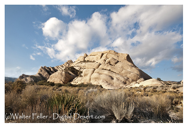
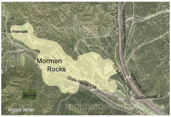
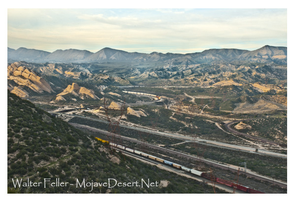
The Mormon Rocks, also known as the Rock Candy Mountains, are a series of distinctive sandstone outcrops in the Cajon Pass, a mountain pass in the San Bernardino Mountains of Southern California. The Cajon Pass is a critical transportation corridor connecting the Los Angeles Basin with the Mojave Desert and beyond.

Here are some key points about Mormon Rocks and their significance:

  1. Location: The Mormon Rocks are within the Cajon Pass, traversed by Interstate 15 and several major railroad lines. The rocks are easily visible from the highway, making them a notable geological feature.
  2. Geological Formation: The rocks are sedimentary sandstone and formed through tectonic and erosional processes over millions of years. The distinctive red and white banded appearance is due to iron oxide (hematite) and other minerals.
  3. Cultural Significance: The Mormon Rocks have cultural and historical significance. The area is named after a group of Mormon pioneers who passed through the Cajon Pass in the mid-19th century during their westward migration. The rocks are a prominent landmark in the pass and have been featured in various forms of media.
  4. Recreational Opportunities: The area around Mormon Rocks provides outdoor activities and recreation opportunities. There are trails and viewpoints where visitors can appreciate the geological formations and enjoy scenic views of the surrounding landscape.
  5. Conservation: The Mormon Rocks are part of the San Bernardino National Forest, and efforts are made to preserve and protect the natural and cultural resources in the area.
  6. Railroad Transportation: The Cajon Pass is a crucial route for road and rail traffic. The presence of the rocks adds to the landscape’s visual appeal and has made the pass a notable location for train enthusiasts who enjoy watching trains navigate the steep grades of the pass.

Whether you are interested in geology, history, or simply enjoying scenic landscapes, the Mormon Rocks in the Cajon Pass offer a unique and visually striking destination. If you plan to visit, be sure to follow any posted regulations and respect the natural environment.

A Yucca Moth and its Yucca

https://mojavedesert.net/plants/

The relationship between a yucca moth and a yucca plant is a classic example of mutualism, a symbiotic relationship where both species benefit. Yucca moths and yucca plants have coevolved over millions of years, and their interaction is highly specialized.

  1. Pollination:
    • Yucca Moths: Female yucca moths play a crucial role in pollination. They are equipped with specialized mouthparts called maxillae, which they use to collect and carry pollen. The female moth visits the flowers of the yucca plant to lay her eggs.
    • Yucca Plants: Yucca plants rely on yucca moths for pollination. The female moth collects pollen from one yucca flower and then deposits it on the stigma of another flower while laying her eggs. This ensures cross-pollination, facilitating genetic diversity in the yucca plant population.
  2. Egg-Laying and Larval Development:
    • Yucca Moths: The female moth deposits her eggs inside the ovaries of the yucca flowers. She uses specialized structures called ovipositors, which also transfer the pollen. The eggs hatch into larvae.
    • Yucca Plants: The yucca plant provides a place for the yucca moth to lay eggs, and the developing larvae feed on some of the developing seeds within the yucca fruit. The yucca plant sacrifices a small portion of its seeds to nourish the larvae.
  3. Specificity and Coevolution:
    • The relationship between yucca moths and yucca plants is highly specific. Each species of yucca plant is typically associated with a specific species of yucca moth.
    • This specificity has arisen through coevolution, where the traits of each species have adapted to complement the other. Yucca moths have evolved to be efficient pollinators of yucca plants, while yucca plants have developed features that attract and support yucca moths.
  4. Obligate Mutualism:
    • The relationship is often considered an obligate mutualism, meaning each species depends on the other for reproduction. Yucca moths rely on yucca plants for a place to lay their eggs, and yucca plants rely on yucca moths for effective pollination.
Yucca schidigera

This intricate relationship between yucca moths and yucca plants highlights the fascinating ways organisms can evolve together, developing mutual dependencies crucial for their survival and reproduction.

Yucca brevifolia

Wild Burros

/wildlife/wild-burro.html

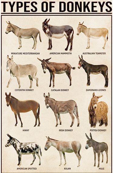
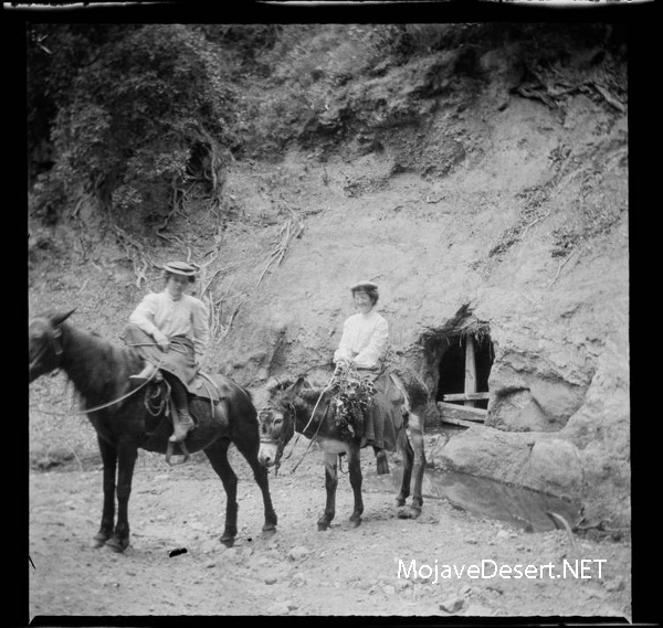
Wild burros, also known as wild donkeys, can be found in various desert regions around the world. In North America, one notable population of wild burros resides in the deserts of the southwestern United States, particularly in states like Arizona, California, Nevada, and Utah. These burros are descendants of domesticated animals brought to the region by early European settlers and prospectors.

Here are some key points about wild burros in the desert:

  1. Origins: Wild burros in the American Southwest are often descendants of animals brought by Spanish explorers and settlers in the 1500s. Over the centuries, these domesticated animals escaped or were released, adapting to the arid desert environment.
  2. Adaptations: Wild burros have evolved to thrive in harsh desert conditions. They are well-adapted to arid environments, with efficient water retention capabilities and the ability to consume a variety of desert vegetation.
  3. Habitat: Wild burros are typically found in semi-arid and arid regions, where water sources may be scarce. Deserts provide them with open spaces, rocky terrain, and sparse vegetation that suits their browsing and grazing habits.
  4. Behavior: Wild burros are social animals and often form small herds led by a jack, a dominant male. They have a hierarchical social structure and communicate through vocalizations and body language.
  5. Conservation Concerns: While wild burros have adapted well to desert life, their populations sometimes face challenges. Overgrazing, competition for limited water sources, and conflicts with human activities can impact their well-being. As a result, ongoing efforts are to manage and conserve wild burro populations in some areas.
  6. Management and Control: In some regions, wild burro populations are managed to prevent overgrazing and habitat degradation. This may involve relocation, adoption programs, or fertility control measures to balance the burro population and the available resources.
  7. Tourism and Observation: Wild burros in the desert can be a point of interest for tourists and nature enthusiasts. Observing these animals in their natural habitat can be a unique experience. Still, visitors need to respect their space and adhere to any regulations in place for their protection.

Understanding the ecology and behavior of wild burros is crucial for their conservation and coexistence with human activities in desert environments. Conservation efforts aim to balance preserving these iconic animals and maintaining the health of the ecosystems they inhabit.

El Burro

Oatman, Arizona

Desert Food Chain

The desert food chain is a complex system involving various organisms interacting for energy and survival. Despite the harsh conditions of deserts, life has adapted to these environments, and a delicate balance exists within the food chain. Here is a simplified overview of the desert food chain:

Seeds → kangaroo rat → rattlesnake → hawk
Wildflowers → grasshopper → lizard → roadrunner
Grasses and wildflowers → desert tortoise → raven (primarily eggs and young tortoises)
Shrubs → jackrabbit → coyote

  1. Producers:
    • Plants and Cacti: Deserts have specialized plants adapted to conserve water and thrive in arid conditions. Examples include cacti, succulents, and drought-resistant shrubs. These plants are primary producers, converting sunlight into energy through photosynthesis.
  2. Primary Consumers:
    • Herbivores: Insects, rodents, and small mammals feed on desert plants. Examples include grasshoppers, mice, and rabbits. These organisms are primary consumers that obtain their energy by consuming plants.
  3. Secondary Consumers:
    • Carnivores: Predators in the desert feed on herbivores. Examples include snakes, lizards, and birds of prey. Some mammals like foxes and coyotes also fall into this category, preying on smaller animals for sustenance.
  4. Tertiary Consumers:
    • Top Predators: Larger predators at the top of the desert food chain prey on herbivores and smaller carnivores. Examples include large birds of prey like eagles and apex predators like some species of bobcats and mountain lions.
  5. Scavengers:
    • Scavengers: These organisms feed on the remains of dead animals. Scavengers play a crucial role in nutrient recycling in the desert ecosystem. Vultures are an example of scavengers.
  6. Decomposers:
    • Microorganisms: Decomposers decompose organic matter, such as dead plants and animals, into simpler nutrients the soil can absorb. Bacteria and fungi are essential decomposers in the desert ecosystem.

Throughout this food chain, energy is transferred from one trophic level to the next, with each level being dependent on the level below for its energy source. Water is a limiting factor in deserts, and many organisms have adapted various mechanisms to conserve water or extract it efficiently from their food sources. The delicate balance of the desert food chain is essential for the survival of its inhabitants in these harsh environments.

Desert Food Chain

Ecosections

Ecosections, also known as ecological sections, are geographic subdivisions of a region based on its climate, landforms, and vegetation. In California, the state is divided into several ecosections, each characterized by unique ecological features. These divisions help in understanding and managing the diverse ecosystems within the state. Remember that the specific ecosection classification system may vary depending on the source. One commonly used system is the “California Ecological Units” classification. Here are some examples of ecosections in California:

  1. Sierra Nevada
    • Characterized by high mountain ranges, including the iconic Sierra Nevada.
    • Alpine and subalpine ecosystems, mixed conifer forests, and meadows.
  2. Southern California Mountains and Valleys
    • Encompasses the Transverse and Peninsular Ranges.
    • Chaparral, coastal sage scrub, and oak woodlands are common vegetation types.
  3. Central California Valley
    • Includes the expansive Central Valley, a major agricultural region.
    • Diverse agricultural landscapes, grasslands, and riparian ecosystems.
  4. Great Basin
    • Spans the northeastern part of California.
    • Sagebrush steppe, pinyon-juniper woodlands, and mountain ranges.
  5. Mojave Desert
    • It is located in the southeastern part of the state.
    • Characterized by desert landscapes with Joshua trees, creosote bush, and other desert plants.

These ecosections provide a framework for understanding the ecological diversity of California, which is crucial for conservation, land management, and environmental planning. It’s important to note that these descriptions are generalizations, and there may be ecosystem variations and overlaps within each ecosection.

California High & Low Deserts

https://mojavedesert.net/ecology/

California is home to high and low deserts, characterized by distinct features, climates, and elevations. The primary differences between California’s high and low deserts include elevation, temperature, and vegetation.

Low Desert
High Desert
  1. Elevation:
    • High Desert: The high desert refers to areas at higher elevations, typically between 2,000 and 4,000 feet above sea level. Examples of high desert regions in California include the Mojave Desert. Cities like Lancaster and Palmdale are located in the high desert region.
    • Low Desert: The low desert, on the other hand, is found at lower elevations, often below 2,000 feet. The Colorado Desert, part of the larger Sonoran Desert, is an example of a low desert in California. Cities like Palm Springs and Indio are located in the low desert region.
  2. Temperature:
    • High Desert: High deserts generally experience greater temperature fluctuations between day and night. Summers can be hot, with daytime temperatures exceeding 100°F (37.8°C), while winters can be cool, with nighttime temperatures dropping significantly.
    • Low Desert: Low deserts tend to have higher average temperatures, especially during the summer. Daytime temperatures in the low desert areas can often surpass 100°F (37.8°C), and the winters are milder compared to the high deserts.
  3. Vegetation:
    • High Desert: Vegetation in the high desert is adapted to the arid conditions and includes hardy shrubs, grasses, and some cold-resistant plants. Joshua trees are a characteristic plant of the Mojave Desert.
    • Low Desert: The low desert is known for its unique plant life, including various species of cacti and succulents. The iconic saguaro cactus is commonly found in the lower elevations of the Sonoran Desert.
  4. Geography:
    • High Desert: The high desert often features rocky terrain and vast expanses of open land and is characterized by a mix of mountains, plateaus, and valleys.
    • Low Desert: The low desert may have more sandy and flat terrain, including areas with salt flats. Rugged mountains may also punctuate the landscape.

It’s important to note that these are generalizations, and there can be variations within each desert region. The specific characteristics can also vary depending on the exact location within California.

Life in a Desert Wash

https://mojavedesert.net/desert-habitats/desert-wash.html

A desert wash, also known as an arroyo, is a dry riverbed or gulley that occasionally fills with water during periods of heavy rain or flash floods in arid regions. Life in a desert wash is characterized by its adaptability to extreme and unpredictable conditions. Here’s a glimpse into what life in a desert wash might be like:

  1. Flora and Fauna:
    • Plants: Some plants in desert washes are adapted to survive both dry and wet conditions. These may include drought-resistant shrubs, grasses, and small trees. Seeds of various plants may lie dormant until the rare occurrence of rainfall triggers germination.
    • Wildlife: Animals in desert washes are often adapted to both desert and aquatic environments. Insects, reptiles, and small mammals may be common, taking advantage of the occasional water source. Larger mammals might use the wash as a corridor for movement.
  2. Survival Strategies:
    • Dormancy and Adaptation: Many plants and animals in desert washes have developed strategies to survive long periods of drought. They may go into a state of dormancy, conserving energy until water becomes available again.
    • Migration: Some animals may migrate to and from the wash, following the water source. This movement can be triggered by seasonal changes or the availability of food and water.
  3. Flash Floods:
    • Quick Response: Life in a desert wash must be adaptable to sudden changes. Flash floods can transform a dry riverbed into a rushing torrent of water in a matter of minutes. Some animals have evolved behaviors or adaptations to quickly escape or take advantage of these temporary water sources.
  4. Biodiversity Hotspots:
    • Rich Ecosystems: Desert washes can be biodiversity hotspots despite the harsh conditions. The intermittent water flow creates a mosaic of habitats, supporting various life. The contrast between wet and dry periods contributes to the diversity of species that can inhabit these areas.
  5. Challenges:
    • Water Scarcity: Water scarcity is the primary challenge for life in a desert wash. Species must be adapted to survive with limited water resources and quickly respond to the unpredictable nature of rainfall.
    • Temperature Extremes: Desert environments often experience extreme temperatures, ranging from scorching heat during the day to cold nights. Life in a desert wash needs to endure these temperature fluctuations.
  6. Human Interaction:
    • Cultural Significance: In some regions, desert washes hold cultural significance for local communities. People may have traditional practices and stories associated with these areas.
    • Conservation: The fragile ecosystems of desert washes are susceptible to human activities. Conservation efforts are crucial to preserving the unique flora and fauna that depend on these environments.

Life in a desert wash is a testament to the resilience and adaptability of nature in the face of challenging environmental conditions. The flora and fauna that inhabit these areas have evolved unique strategies to cope with the extremes of desert life, making these ecosystems fascinating and diverse.

Tarantula Migration

The term “tarantula migration” is often used to describe the phenomenon of large groups of tarantulas moving en masse in search of food, mates, or new habitats. Tarantulas are solitary spiders for most of the year, but during certain seasons, they may engage in these migrations. This behavior is more commonly observed in some species of tarantulas, particularly in the southwestern United States.

Here are some key points about tarantula migrations:

Timing: Tarantula migrations typically occur in the late summer and early fall, often in August and September. This timing is associated with the mating season for many tarantula species.

Purpose: Tarantulas migrate to find mates as males search for females. The females may also move to find suitable locations to lay their eggs or search for prey.

Location: The most famous tarantula migrations in the United States occur in the deserts of the American Southwest, such as Arizona and California. These migrations can involve thousands of tarantulas moving across the desert floor.

Behavior: During a migration, tarantulas can be seen traveling on the ground in search of food and potential mates. They often move during the evening and nighttime to avoid extreme daytime heat.

Species: The most well-known species that participate in these migrations is the Aphonopelma species, commonly called the desert tarantula. However, not all tarantulas engage in migrations, and the behavior can vary among different species.

Conservation: Tarantula migrations are an important part of the ecosystem, as they help control insect populations and serve as a food source for various predators. Conservation efforts are often aimed at protecting their habitats.

During a tarantula migration, it’s not uncommon for people to go out and observe or photograph the spiders. Still, it’s essential to do so responsibly and without disturbing their natural behavior or habitats.

Suppose you’re interested in witnessing a tarantula migration. In that case, it’s best to consult local experts or naturalists who can guide you to appropriate locations and provide you with additional information on when and where to observe this fascinating natural phenomenon.

Tarantulas Mating Process

/wildlife/tarantula.html

The mating process of tarantulas, like many other spiders, is quite fascinating and can vary among different species, but there are some common elements to it. Here’s a general overview of how tarantulas mate:

Courtship: The process typically begins with a male tarantula searching for a receptive female. Male tarantulas are often smaller and have less colorful markings than females. When a male finds a female’s silk-lined burrow or web, he approaches cautiously to initiate courtship. However, approaching a female can be risky because some females may perceive the male as potential prey rather than a potential mate.

Drumming and vibrations: To signal his intentions to the female, the male may engage in courtship rituals, including drumming on the female’s web or tapping on her burrow. These vibrations are thought to be a way for the male to communicate and let the female know he is not a threat.

Presentation of a sperm sac: Once the male has successfully courted the female, he may present her with a sperm sac. This sac contains sperm that he has produced and stored in his pedipalps, which are modified appendages near the front of his body.

Copulation: If the female is receptive to the male’s advances, she will allow him to approach her. They engage in a mating ritual in which the male transfers his sperm into the female’s reproductive organs using specialized structures called pedipalps. This process can be risky for the male, as the female might suddenly become aggressive or attempt to prey on him.

Male retreats: After copulation, the male usually makes a hasty retreat to avoid being attacked by the female. Some male tarantulas may not survive this encounter, especially in species with highly aggressive females.

Female’s egg sac: If the mating is successful, the female will eventually lay eggs and create an egg sac, which she guards closely. The female may carry the egg sac with her and continue to protect it until the spiderlings (baby tarantulas) hatch.

It’s important to note that the mating process in tarantulas can be dangerous for the males, as females of some species are known to be aggressive and may cannibalize the male after mating. To maximize their chances of reproducing, male tarantulas have developed various courtship behaviors and tactics to minimize the risk of being consumed.

Additionally, the mating process can vary between different tarantula species, and some species may have unique courtship rituals and behaviors.

Tarantula Hawk Wasp

/wildlife/tarantula-wasp.html

The tarantula hawk wasp is a large and impressive species of wasp known for its distinctive and painful sting. These wasps are primarily found in the southwestern United States, Mexico, and parts of Central and South America. Here are some key characteristics and facts about the tarantula hawk wasp:

Size: Tarantula hawk wasps are among the largest wasps in the world, with a body length that can reach up to 2 inches (5 cm).

Coloration: They are usually brightly colored, with black bodies and iridescent blue or black wings. The coloration may vary among species.

Venomous sting: Tarantula hawk wasps are solitary predators, and their primary prey is tarantulas. They paralyze the tarantula with their potent venomous sting, then lay an egg on the immobilized spider. The larva that hatches from the egg feeds on the paralyzed tarantula.

Painful sting: The sting of a female tarantula hawk is considered one of the most painful insect stings in the world, and it is rated as a 4 on the Schmidt Sting Pain Index, created by entomologist Justin Schmidt. The pain from the sting can be excruciating and may last for several minutes.

Solitary behavior: Tarantula hawk wasps are solitary insects, meaning they do not form colonies or nests like social wasps such as yellow jackets or paper wasps. Each female hunts for and provisions her own prey.

Males vs. females: Male tarantula hawk wasps are typically smaller than females and do not have a stinger. Their primary purpose is to mate with females.

Habitat: These wasps are often found in arid or desert regions, where tarantulas are more abundant. They are also commonly spotted near flowers, as they feed on nectar and other plant fluids in addition to hunting for tarantulas.

Flight: Tarantula hawk wasps are known for their agile and powerful flight. They can be seen soaring through the air in search of tarantulas or nectar-rich flowers.

Defensive behavior: Although tarantula hawk wasps are not typically aggressive toward humans, they will defend themselves if they feel threatened. It’s best to observe them from a safe distance to avoid getting stung.

Conservation: These wasps play a role in regulating tarantula populations, and they are considered beneficial in their ecosystems. However, they are vulnerable to habitat loss and pesticides, which can impact their populations.

In summary, the tarantula hawk wasp is a fascinating and somewhat intimidating insect known for its painful sting and unique predatory behavior. While they can deliver a formidable sting, they are generally not aggressive toward humans unless provoked.

Limber Pine Trees

/a/baden-powell/lp1.html

Limber pine (Pinus flexilis) is a species of pine tree that is native to western North America, particularly the Rocky Mountains and surrounding areas. It is known for its adaptability to harsh mountainous environments and its distinctive characteristics. Here’s some information about limber pine trees:

Physical Characteristics:

Limber Pine

Limber pine is a slow-growing, long-lived species that can take several hundred years to reach maturity. Mature trees can live over 1000 years old. Although Limber pine stands tend to be even-aged, populations also occur in uneven-aged stands and on very harsh sites as widely spaced, isolated individuals. Most trees grow irregularly or in a multi-stemmed form and rarely reach more than 50 feet (15 meters). In high elevations, they sometimes develop krummholz (stunted, twisted shrubs due to wind exposure). Trunks can reach a diameter of 6.5 feet (2 meters). This species is cold- and drought-tolerant. The trees are ectomycorrhizal, have deep taproots, and are very wind-resistant. Limber pine has thin bark.

The needles of limber pine trees are arranged in bundles of five, and they are flexible, giving the tree its common name, “limber.”

The tree’s bark is often scaly and furrowed, varying in color from gray to reddish-brown.

Cone and Seed Production:

Limber pine trees produce both male and female cones. Female cones are larger and take about two years to mature.

The seeds of limber pine trees are large and winged, and they serve as a crucial food source for various wildlife, including birds, squirrels, and bears.

Limber pine trees have a serotinous cone adaptation, meaning their cones remain closed and require the intense heat of a fire to open and release seeds.
This helps the species regenerate after wildfires.

Adaptation:

Limber pine is well-adapted to high-elevation, cold, and windy mountain environments. It can thrive in poor soils and withstand extreme temperature fluctuations.

These trees have a deep root system that helps them access water and nutrients in rocky and challenging soils.

Conservation:

Limber pine trees are vulnerable to various threats, including mountain pine beetle infestations and white pine blister rust, which is a fungal disease.

Conservation efforts are in place to protect and restore limber pine populations. These efforts include monitoring for disease, maintaining genetic diversity, and conducting controlled burns to promote regeneration.

Ecological Significance:

Limber pine trees play a critical role in mountain ecosystems by providing habitat and food for various wildlife species.

The seeds of limber pine are an essential food source for Clark’s nutcrackers, a type of bird. These birds play a role in seed dispersal, helping to regenerate limber pine populations.

Recreational Use:

Limber pine forests are popular among hikers, campers, and outdoor enthusiasts, as they often grow in scenic mountain environments. These forests provide habitat and shade for recreation.

Limber pine trees are an important and iconic component of the mountain ecosystems in western North America. Their adaptability to challenging environments and their role in providing food and habitat for wildlife make them a valuable part of these ecosystems. Conservation efforts are crucial to ensuring the continued health and resilience of limber pine populations in the face of various threats, including disease and climate change.

Beavertail Cactus

https://mojavedesert.net/cactus/beavertail.html

The beavertail cactus, scientifically known as Opuntia basilaris, is a species of prickly pear cactus native to the southwestern United States and parts of northern Mexico. It gets its common name from the shape of its pads, which resemble the broad, flattened tail of a beaver. This cactus is known for its distinctive, bluish-gray, oval or paddle-shaped stems, which are typically covered in tiny, hair-like spines and glochids, which are small, hair-like prickles that can irritate the skin upon contact.

Beavertail cacti produce colorful flowers in shades of pink, magenta, or purple. These flowers often appear at the edges of the pads in the spring and early summer. The fruits of this cactus are edible and are usually red or purple when ripe.

Beavertail cacti are adapted to arid and desert environments and are well-suited to the harsh conditions of their natural habitat. They are drought-tolerant and can store water in their stems to survive periods of water scarcity. These cacti play a role in providing food and habitat for wildlife in their native regions.

In landscaping and gardening, beavertail cacti are often cultivated for their ornamental value, as their unique appearance and vibrant flowers make them attractive additions to xeriscape gardens or desert-themed landscapes. However, it’s essential to handle them with care due to their spines and glochids, which can cause skin irritation.

Like other cacti, the beavertail cactus prefers well-draining soil and requires minimal watering once established. It is important to be mindful of local regulations when collecting or cultivating beavertail cacti, as they are protected in some areas due to their ecological importance and vulnerability to overharvesting.

Ecosystems of Death Valley

https://digital-desert.com/death-valley-ecosystems/

Death Valley, located in California, is home to a unique and diverse range of ecosystems. Despite its harsh and extreme conditions, this national park supports a surprising variety of plant and animal life. The following are some of the key ecosystems found within Death Valley.

1. Desert Scrub: The dominant ecosystem in Death Valley is the desert scrub, characterized by sparse vegetation and rocky landscapes. Plants such as creosote bushes, desert holly, and Joshua trees have adapted to survive in arid conditions. These plants have deep root systems and waxy leaves to conserve water.

2. Salt Flats: Death Valley is famous for its vast salt flats, known as playas. These white, barren expanses are created by water evaporation, leaving behind mineral deposits. Certain organisms, such as salt-tolerant algae and brine flies, can survive in this environment despite harsh conditions.

3. Badlands: Death Valley’s rugged badlands are formed by erosion, resulting in unique formations of clay-rich soil and sedimentary rocks. The lack of vegetation allows intricate geological formations. These areas are home to reptiles, rodents, and insects that have adapted to extreme temperatures and water scarcity.

4. Oasis: Death Valley surprises visitors with small oases. These are areas where underground water reaches the surface, creating a lush and vibrant habitat. Palm, cottonwood, and various bird species can be found in these isolated pockets of life.

5. Mountains: Death Valley is surrounded by mountain ranges, which provide a contrasting ecosystem to the desert below. These higher elevations offer cooler temperatures and more precipitation, allowing for the growth of coniferous forests. Pinyon pines, junipers, and bristlecone pines thrive in the mountains, providing shelter for various wildlife.

6. Springs and Waterways: Death Valley is home to several natural springs and waterways despite the desert environment. These water sources attract diverse animals, including bighorn sheep, coyotes, and reptiles. The presence of water also supports vegetation growth, such as willows and cattails.

Each of these ecosystems within Death Valley contributes to the region’s overall biodiversity and ecological balance. The park’s extreme conditions have fostered the development of unique adaptations among its plant and animal inhabitants. Exploring these diverse ecosystems is a captivating experience that highlights the resilience of life in the face of adversity.