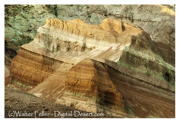
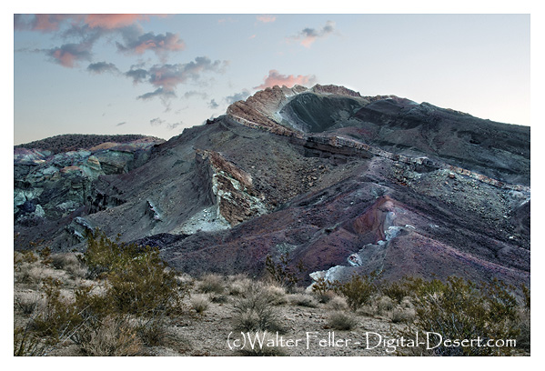
Rainbow Basin is a geological formation in the Mojave Desert of California. It is known for its unique and colorful rock formations, which provide valuable insights into the region’s geological history. Here are some key aspects of the geology of Rainbow Basin:
Sedimentary Rocks: Rainbow Basin primarily comprises sedimentary rocks accumulated over millions of years. These rocks include sandstones, shales, and mudstones. The different layers of sedimentary rocks represent different periods of geological history.
Fossilized Marine Life: Within the sedimentary rocks of Rainbow Basin, fossils of marine life from the Miocene epoch (approximately 15-20 million years ago) have been found. These fossils include shells, bones, and other remnants of ancient sea creatures. This suggests that a shallow sea once covered the area.
Faulting and Uplift: The geology of Rainbow Basin has been influenced by tectonic forces. The region is situated near the intersection of several fault lines, including the Garlock Fault. These fault movements have caused the uplift of the rocks, exposing them to erosion and creating the unique landscape seen today.
Erosion and Weathering: Over time, erosion and weathering have shaped the colorful rock formations in Rainbow Basin. These processes have created intricate patterns and exposed layers of colored sediments, giving the area its name.
Geological Time Scale: The rocks at Rainbow Basin span a significant portion of the geological time scale, providing geologists with valuable information about the changing environments and life forms that existed in the area millions of years ago.
Geological Tours: Rainbow Basin is a popular destination for geological enthusiasts and tourists interested in its unique geology. There are guided tours and interpretive exhibits that provide insights into the geological history of the area.
Rainbow Basin, Barstow, Ca.
In summary, Rainbow Basin is a geological wonder in the Mojave Desert, characterized by its sedimentary rocks, fossils, faulting, erosion, and vibrant colors. It offers a glimpse into the geological history of California and the forces that have shaped its landscape over millions of years.
Barstow, California, has a rich history related to railroads. Here is an overview of the railroad history in Barstow:
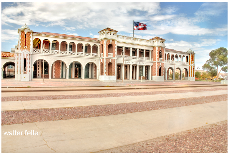
Harvey House – Casa Del Desierto
Early Railroad Development: Barstow’s history as a railroad town dates back to the late 19th century when the Atchison, Topeka, and Santa Fe Railway (AT&SF) and the Southern Pacific Railroad (SP) played significant roles in its development. The AT&SF arrived in Barstow in 1883, and the SP followed shortly after.
Railroad Facilities: Barstow became a strategic location for both railroads due to its position as a junction point. It was a division point on the AT&SF line, meaning it had extensive locomotive maintenance and repair facilities. Additionally, it served as a crew change and refueling station.
Harvey House: The historic Casa del Desierto, also known as the Harvey House, was a prominent feature of the Barstow railroad history. It was a luxurious hotel and restaurant built by the Fred Harvey Company in 1911 to serve passengers traveling on the AT&SF railway. The Harvey House has been beautifully restored and now houses a museum.
Railroad Growth: Barstow continued growing as a railroad town over the years. It had a large rail yard, roundhouse, and various support facilities to handle the extensive railroad traffic passing through the area.
Importance as a Railroad Junction: Barstow’s strategic location made it a crucial junction for freight and passenger trains. It was a hub for transferring goods and passengers between different rail lines, making it a bustling activity center.
Modern Times: While the significance of railroads has declined in recent years, Barstow still maintains its historical ties to the railroad industry. The Barstow Rail Museum and the Harvey House Museum are popular attractions for visitors interested in learning about the town’s railroad history.
Barstow’s history as a railroad town is an integral part of its identity, and the legacy of the railroads can still be seen and appreciated in the town today.
The history of mining in the Barstow area is closely tied to the extraction of various minerals and resources that played a significant role in the development of Southern California. Here’s a more detailed look at the history of mining in the Barstow area:
Borax Mining: Borax mining was one of the earliest mining activities in the Barstow region. In the late 19th century, borax deposits, a valuable industrial mineral used in various applications, were discovered in the nearby Calico Mountains. The Pacific Coast Borax Company, owned by Francis Marion “Borax” Smith, was instrumental in developing borax mines in the area. This marked the beginning of significant mining operations in the region, with borax being a primary focus.
Calico Mining District: The Calico Mining District, which includes the town of Calico, was a major center of mining activity in the Barstow area. Silver and silver-lead ores were the primary resources mined in this district. At its peak in the late 1800s, Calico had a population of over 3,000 people and was a bustling mining town.
Calico Ghost Town: Calico, often referred to as Calico Ghost Town today, was once a thriving mining town. It featured numerous mines, including the Bismarck, Silver King, and Oriental Mines. Visitors to Calico can explore the well-preserved historic buildings, mines, and artifacts, gaining insight into the region’s mining history.
Railroad Transportation: The expansion of railroads played a crucial role in facilitating the transportation of mined materials from the Barstow area to other parts of California and beyond. The Atchison, Topeka, and Santa Fe Railway was a key transportation link for the mining industry, enabling the efficient movement of ores and minerals.
Variety of Minerals: While borax, silver, and silver-lead ores were among the most significant resources mined in the Barstow area, various other minerals were also extracted. These included gypsum, limestone, and barite. These minerals had industrial applications and were important for construction and manufacturing.
Decline of Mining: As the easily accessible mineral deposits were depleted, mining activities in the Barstow area began to decline. Many mines were abandoned, and mining communities saw a decrease in population. The shift in economic focus led to the decline of mining as a major industry in the region.
Today, the mining history of the Barstow area is preserved through places like Calico Ghost Town, museums, and historical sites. These serve as reminders of the pioneering spirit of early miners and the role mining played in shaping the history of Barstow and the surrounding region.
The Curse of Bodie is a legend that suggests the town of Bodie, particularly its well-preserved buildings and artifacts, is cursed. This legend is not uncommon in ghost towns and adds to the town’s mystique. Here are the key elements of the Curse of Bodie legend:
Taking Artifacts: According to the legend, the curse affects those who take artifacts, items, or souvenirs from Bodie Ghost Town without proper permission. This includes visitors who remove historical objects from the town as keepsakes.
Misfortune and Bad Luck: Those who are believed to have taken items from Bodie may experience a series of misfortunes and bad luck in their lives. The curse brings financial troubles, health problems, or other unfortunate circumstances to those who have taken something from the town.
Returning Stolen Items: Some versions of the legend suggest that the curse can be lifted or mitigated by returning the stolen item to Bodie. Restoring the item to its rightful place is believed to break the curse and avoid further misfortune.
Mail-Back Items: Over the years, there have been reports of people mailing stolen artifacts or items back to Bodie, accompanied by letters expressing remorse for taking them and hoping to undo the curse. These returned items are often referred to as “Ghost Town Mail.”
Warnings and Signs: Bodie’s visitor center and park rangers often display warnings and signs advising visitors not to take anything from the town, emphasizing the belief in the curse and the importance of preserving the site’s historical integrity.
Cultural Preservation: The legend of the curse serves as a reminder of the importance of preserving historical and cultural heritage. It encourages responsible tourism and respect for the historical significance of Bodie Ghost Town.
It’s important to note that the Curse of Bodie is part of the folklore and mystique surrounding the town, and there is no scientific evidence to confirm the existence of such a curse. Nevertheless, the legend has become a cultural phenomenon associated with Bodie, and many visitors are aware of it. As a result, most people who visit Bodie today respect its historical artifacts and refrain from taking items as souvenirs, contributing to the ongoing preservation of the site.
Bodie Ghost Town is not only known for its well-preserved historical buildings but also for its legends and stories that have contributed to its reputation as a haunted and mysterious place.
Here are some of the legends associated with Bodie:
The Curse of Bodie: One of the most famous legends surrounding Bodie is the supposed curse that befalls anyone who removes items or artifacts from the town. According to the legend, those who take something from Bodie will suffer bad luck until they return the item. As a result, many people who have taken souvenirs from the town have mailed them back, claiming misfortune.
The Ghosts of Bodie: Bodie is often considered one of the most haunted places in California. Visitors and park rangers have reported numerous ghostly sightings and unexplained phenomena. Some claim to have seen apparitions of former residents heard disembodied voices or witnessed strange lights in the windows of abandoned buildings.
The Jinxed Bodie Gold Nugget: Legend states that a large gold nugget was found in Bodie in the late 1800s. The nugget was said to be cursed, and those who possessed it met with misfortune or tragedy. Some believe the nugget was eventually returned to Bodie to lift the curse.
The Murder of Cain and Kenner: Two brothers, Cain and Kenner, were involved in a bitter dispute over a mining claim in Bodie. The feud escalated, leading to the murder of both brothers. It is said that their spirits still haunt the town, and some visitors claim to have heard the sound of gunshots echoing in the distance.
The Lady in White: A popular ghost story involves the “Lady in White,” who is said to roam the streets of Bodie at night. According to the legend, she appears as a woman in a white dress, often near the cemetery. Her identity and the circumstances of her death remain a mystery.
The Bodie Fire Curse: Bodie experienced several destructive fires during its history, including a massive blaze in 1932 that devastated much of the town. Some believe these fires resulted from a curse placed on the town due to its wild and lawless reputation during its heyday.
The Phantom Miner: There have been reports of a phantom miner wandering the hills around Bodie. This spectral figure is often described as a miner with a pickaxe and a lantern, continuing his work in the afterlife.
It’s important to note that these legends are part of the folklore and mystique surrounding Bodie Ghost Town. While they add to the town’s allure, they are not verified historical facts. Nonetheless, they contribute to the intrigue and mystique of Bodie, making it a captivating destination for those interested in history and the supernatural. Visitors can enjoy these stories while exploring the well-preserved remnants of the past in this iconic ghost town.
A day in Bodie Ghost Town provides visitors with a unique and immersive experience that offers a glimpse into the past and showcases the history, culture, and daily life of a late 19th-century mining town.
Here’s what a day in Bodie can show you:
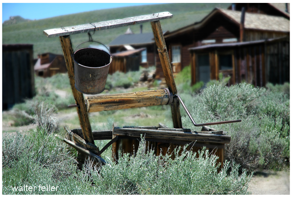
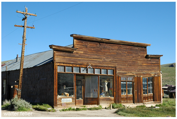
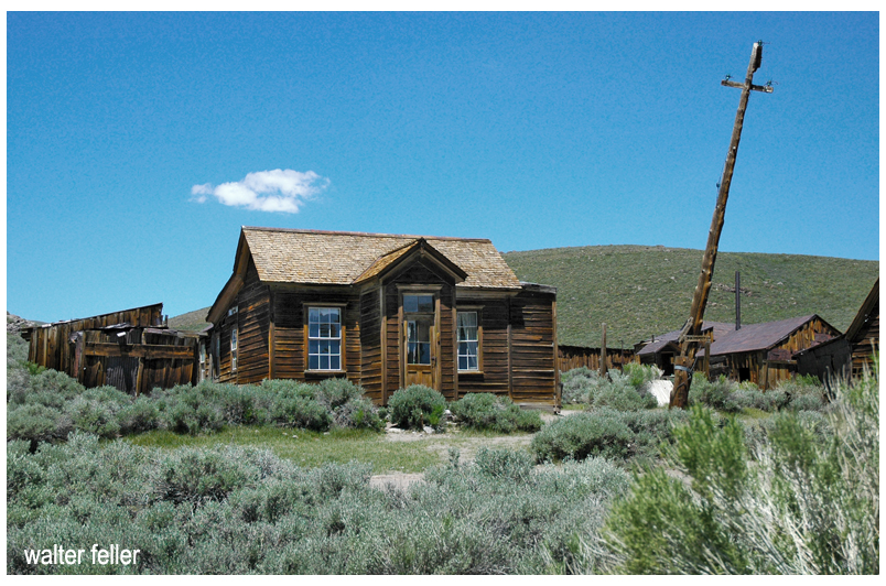
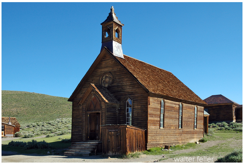
Well-Preserved Buildings: Bodie is known for its remarkably well-preserved buildings. A walk through the town reveals a variety of structures, including homes, saloons, general stores, a church, a schoolhouse, and more. These buildings are frozen in time, filled with period-appropriate furnishings, tools, and artifacts, allowing visitors to see how people lived and worked in the late 1800s.
Historic Artifacts: Inside the buildings and throughout the town, you’ll find a wide range of historical artifacts, from old mining equipment to personal belongings of the town’s former residents. These items provide insight into the daily lives and occupations of Bodie’s inhabitants.
Authentic Atmosphere: Bodie Ghost Town has a unique atmosphere that transports visitors back in time. The unpaved streets, weathered wooden buildings, and the absence of modern amenities contribute to an authentic Old West ambiance.
Interpretive Displays: The Bodie State Historic Park often features interpretive displays and signs that provide historical context and information about the town’s history, its prominent figures, and its residents’ challenges.
Photography Opportunities: Bodie is a popular destination for photographers due to its picturesque buildings, dramatic landscapes, and the way natural elements have reclaimed some areas. The interplay of light and shadow on the historic structures creates stunning photo opportunities.
Ghost Town Lore: Visitors can learn about the legends and stories associated with Bodie, including its reputation for being a rough and lawless place during its heyday. The town’s history contains tales of mining accidents, shootouts, and colorful characters.
Spectacular Scenery: Bodie is surrounded by beautiful natural landscapes, with views of the Sierra Nevada Mountains in the background. Visitors can enjoy the region’s scenic beauty, including meadows and desert flora.
Visitor Center: Bodie has a visitor center where you can gather information about the town’s history, obtain maps, and watch introductory videos that provide background on the site. It’s a good starting point for your visit.
Guided Tours (seasonal): Bodie may offer guided tours led by knowledgeable park rangers or docents, depending on the time of year. These tours provide additional insights and stories about the town’s history.
Peaceful Serenity: Bodie is often described as a peaceful and serene place. The remote location, lack of crowds (compared to more famous tourist destinations), and the sense of isolation contribute to a tranquil and reflective experience.
Overall, a day in Bodie Ghost Town offers a fascinating journey into the past, providing a tangible connection to the lives of those who once called this historic mining town home. It’s a place where history comes alive, and visitors can appreciate the challenges and triumphs of the people who lived there during the late 1800s.
Bodie and Mojave Desert ghost towns are examples of abandoned settlements in the Western United States. Still, they are located in different regions and have distinct historical and geographical contexts.
Bodie
Cima
Here’s how Bodie ghost town compares to Mojave Desert ghost towns
Location:
Bodie Ghost Town is located in eastern California, near the Nevada border, in the Bodie Hills of the Sierra Nevada Mountains. It is not part of the Mojave Desert.
Mojave Desert ghost towns, on the other hand, are scattered throughout the Mojave Desert region, which covers parts of California, Nevada, Utah, and Arizona. These ghost towns are found in a desert landscape, whereas Bodie is in a mountainous area.
Historical Significance:
Bodie Ghost Town was once a bustling mining town during the late 19th century. It boomed during the Gold Rush but declined when the mines became depleted. It is known for its remarkably well-preserved buildings and artifacts, making it a popular tourist attraction and a State Historic Park.
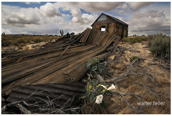
The Mojave Desert ghost towns have diverse histories related to mining or other industries. These towns experienced growth and decline due to factors like mining, railroads, or changes in economic activity in the region.
Geography and Climate:
Bodie’s location in the Sierra Nevada Mountains has a colder, alpine climate with snowy winters. It is not in a desert like the Mojave Desert ghost towns, which have hot, arid desert climates.
Preservation:
Bodie Ghost Town is notable for its excellent preservation, with many buildings and artifacts remaining intact. It provides a unique glimpse into the past due to its relatively isolated location and the efforts to protect and maintain it.
Mojave Desert ghost towns vary in their levels of preservation. Some may have deteriorated significantly, while others may have been partially restored or maintained for historical and tourist purposes.
In summary, while Bodie Ghost Town and Mojave Desert ghost towns share the common theme of being abandoned settlements in the American West, they differ in their locations, historical backgrounds, climates, and levels of preservation. Each ghost town has its unique story and charm, showcasing the diversity of the history and landscapes of the Western United States.
Similarities
While Bodie Ghost Town and Mojave Desert ghost towns differ, they also share similarities due to their historical significance as abandoned settlements in the American West.
Bodie
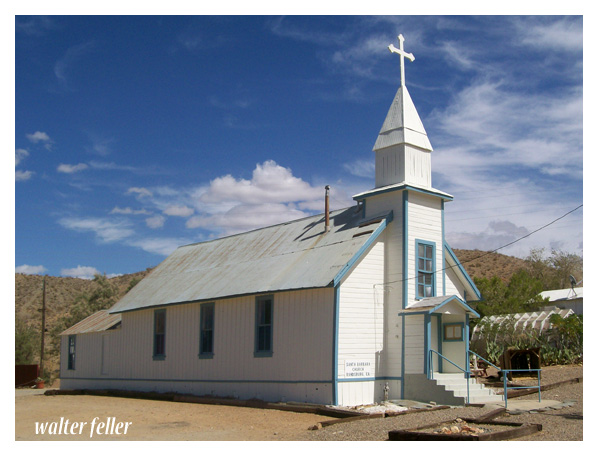
Santa Barbara Church – Randsburg
Here are some commonalities between them:
Mining History: Both Bodie Ghost Town and many Mojave Desert ghost towns have roots in mining activities. They were often established to support nearby mining operations for gold, silver, copper, or other valuable minerals.
Boom and Bust Cycles: Both ghost towns experienced periods of rapid growth and prosperity (boom) followed by economic decline and abandonment (bust) as the mining or other industries became less profitable or were exhausted.
Historic Architecture: Both Bodie and the Mojave Desert ghost towns feature historic buildings and structures that reflect the architectural styles of the late 19th and early 20th centuries. These buildings offer insights into the daily lives of the people who once inhabited these towns.
Tourism and Preservation: Many ghost towns, including Bodie, have been preserved and turned into tourist attractions or historic sites. Visitors can explore the well-preserved or partially restored buildings and artifacts, providing a glimpse into the past.
Cultural Significance: These ghost towns hold cultural significance, representing a particular era in American history when mining and westward expansion were prominent. They serve as reminders of the challenges and opportunities that shaped the American West.
Isolation: Bodie Ghost Town and many Mojave Desert ghost towns are often located in remote or isolated areas. This isolation contributed to their decline and abandonment as access to resources and services became more challenging.
Natural Surroundings: While Bodie is mountainous, some Mojave Desert ghost towns are in arid desert landscapes. Both types of locations offer unique natural surroundings that add to the appeal of these historical sites.
Photogenic and Cinematic Appeal: Bodie and Mojave Desert ghost towns have been popular settings for photography and film productions. Their well-preserved or picturesque appearances have made them attractive for creative projects.
Historical Documentation: Researchers and historians have documented the histories of both Bodie and Mojave Desert ghost towns, helping preserve the stories and heritage of these places.
In summary, Bodie Ghost Town and Mojave Desert ghost towns share several similarities in their historical origins, economic activities, architectural heritage, cultural significance, and appeal as tourist destinations. However, it’s important to recognize that each ghost town has unique characteristics and history that make it special.
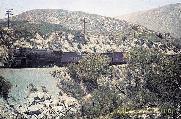
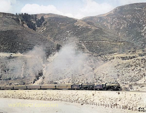
The Cajon Pass is a significant mountain pass in Southern California, USA, and it has a rich history when it comes to railroads. It is a crucial transportation route for both freight and passenger trains.
Courtesy Burlington Northern Santa Fe Railroad Blue Cut- 1941 (colorized)
Here’s some information about railroads in the Cajon Pass:
History: The history of railroads in the Cajon Pass dates back to the 19th century. The first railroad line through the pass was the California Southern Railroad, completed in the 1880s. It was later acquired by the Atchison, Topeka and Santa Fe Railway (ATSF).
Santa Fe Railway: The ATSF (Santa Fe) significantly developed the Cajon Pass as a major transportation route. They constructed numerous tracks, tunnels, and bridges to facilitate the passage of trains through the rugged terrain of the pass.
Union Pacific:Union Pacific (UP) also operates through the Cajon Pass. UP and BNSF (Burlington Northern Santa Fe) are two major freight railroads that use this pass for transporting goods between the West Coast and the rest of the United States.
Passenger Rail: Besides freight, passenger trains use the Cajon Pass. Amtrak’s Pacific Surfliner and Metrolink commuter trains provide passenger services in the region, connecting cities like Los Angeles and San Bernardino.
Cajon Pass Railfan Locations: The Cajon Pass is a popular spot for rail enthusiasts (railfans) to watch and photograph trains. There are various well-known locations, such as Sullivan’s Curve and the Hill 582 Overlook, where railfans gather to enjoy the sight of trains traversing the pass.
Modern Operations: The Cajon Pass remains a vital artery for transporting goods between Southern California and the rest of the country. Freight trains of various lengths and configurations, including long double-stack container trains, can frequently pass through the area.
Upgrades and Maintenance: Railroads invest in upgrading and maintaining the tracks and infrastructure in the Cajon Pass to ensure safe and efficient rail transportation.
Courtesy Burlington Northern Santa Fe Railroad – 1941 photo (colorized)
Please note that while this information provides an overview of railroads in the Cajon Pass. It’s always a good idea to check with local authorities or rail companies for the most up-to-date information on rail operations in the Cajon Pass.
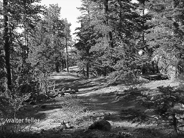
Sorrow deepens in the evening then glides on tilted wings Between the twisted trees Above the trail through a woodland malice .
. And shadow after shadow drops from the moonlight pouring through the forest. The white moon and the burnt black shadows. Shoved into sadness . These terrible shadows, one after another Long wings slowly, gracefully beating Silent, save the wind. Silent and sad. .
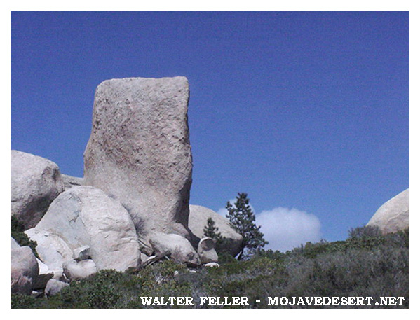
Arrowhead Pinnacles is a popular rock climbing area in Southern California’s San Bernardino Mountains. It is known for its unique and challenging rock formations, making it a favorite destination for rock climbers and outdoor enthusiasts.
Here are some key details about Arrowhead Pinnacles:
Location: Arrowhead Pinnacles is situated within the San Bernardino National Forest, near the city of San Bernardino in San Bernardino County, California. It is approximately 80 miles east of Los Angeles.
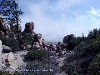
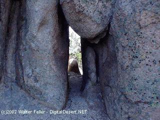
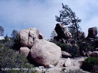
Rock Formations: The area is characterized by a series of granite rock spires and pinnacles, which provide a wide range of climbing opportunities. The granite formations offer a variety of cracks, slabs, and faces for climbers of different skill levels.
Rock Climbing: Arrowhead Pinnacles is primarily known for its rock climbing opportunities. Climbers can find routes that vary in difficulty, from beginner-friendly routes to more advanced and challenging climbs. The granite rocks and scenic surroundings make it a popular destination for traditional and sports climbing.
Access: Access to Arrowhead Pinnacles typically requires a National Forest Adventure Pass for parking. The area is accessible via a short hike from the parking area to the climbing routes. Climbers should check for specific regulations and access updates from the San Bernardino National Forest or local climbing organizations.
Scenic Beauty: Besides rock climbing, Arrowhead Pinnacles offers stunning views of the surrounding San Bernardino Mountains and Lake Arrowhead. The area’s natural beauty attracts climbers, hikers, and nature enthusiasts.
Safety: Climbing at Arrowhead Pinnacles requires proper gear, including ropes, harnesses, helmets, and climbing shoes. Climbers should also be aware of the weather conditions and potential hazards associated with outdoor rock climbing.
As with any outdoor activity, it’s essential for climbers to prioritize safety and adhere to Leave No Trace principles to protect the natural environment. Before visiting Arrowhead Pinnacles, you should check with local climbing organizations or the San Bernardino National Forest for up-to-date information on access, routes, and any seasonal closures or restrictions.