The Old Spanish Trail had become increasingly used as a pack mule trail between New Mexico and California, and with this traffic came the opportunity for those to take advantage of the distance and desperate nature of the land.
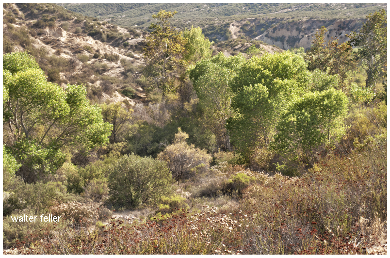
Hundreds and sometimes even thousands of stolen horses from the ranchos would burst through Coyote Canyon beginning their ‘journey of death’ across the Mojave.
California horses were beautiful creatures, and the mules were taller and stronger than those in New Mexico and they were easy to steal. The rolling hills and plains presented clear paths to the Cajon where numerous hidden canyons and washes were available to slip into and prepare for the furious run across the desert. Horses would be stolen in herds from many different ranchos at once. Hundreds of horses, even thousands could be commandeered and driven by just a few experienced thieves.
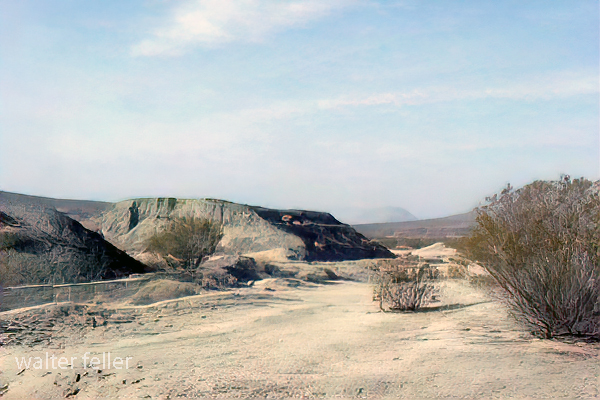
Narrows, Crowder Cyn., Cajon Pass
Chief Walkara, ‘Hawk of the Mountains’ and the greatest horse thief in all of history along with his band of renegade Chaguanosos , and notables such as Jim Beckwourth and Pegleg Smith would work together in this illegal trade. During one raid they were said to have coordinated the theft of 3,000-5,000 horses, driving them to Fort Bridger to trade for more horses to run to New Mexico to trade again. Horses would fall from exhaustion every mile and the local bands of Paiute would feast on the remains.
The rich ranchos of southern California.
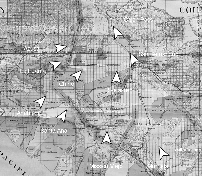
In 1843 Michael White was granted one league of land at the mouth of the Cajon Pass called Rancho Muscupiabe. At a point overlooking the trails leading into and away from the canyon he was expected to thwart the raiders and horse thieves that were plaguing the Southern California ranchos. In theory it was a good plan but in practice it did not work so well.
From the piedmont between Devil and Cable canyons, Miguel Blanco could keep an eye out for the horse thieves entering the Cajon.
He built his home of logs and earth and constructed corrals for his stock. However, the location between Cable and Devil Canyon only served as a closer and more convenient target for the Indian thieves. His family was with him, but after six weeks until it became too dangerous. He left after nine months without any livestock and in debt.
The Old Spanish Trail went down this slope to behind Miguel Blanco’s rough-hewn homestead. Indians would watch from this forest for Miguel to leave and they would slip down and steal everything that could be stolen.
Miguel sold his property, however, Miguel had misread the grant, letting the rancho go for much less than it was worth. The land described on the grant was roughly 5 times larger than Miguel thought. Blanco brought a suit but lost.
Muscupiabe Rancho
As the late 1840s and 1850s rolled by wagon roads were being developed in the canyon minimizing the effectiveness of the maze of box canyons being used to cover the escape of desperadoes on horseback. With California becoming a state frontiersmen such as Beckwourth and Peg Leg Smith would not steal from fellow Americans. Horse-thieving under U.S. law had become a crime where before it was just stealing horses from Mexicans. That was only serious if caught in the act. Americans would never extradite them. For the most part, that was the end of the horse stealing raids.
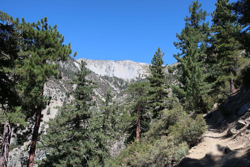
Mount Baldy as seen from the Baldy Bowl Trail. It’s a steep climb to the “Bowl”, let alone the summit. However, the alpine scenery and bright blue skies make it entirely worth it.
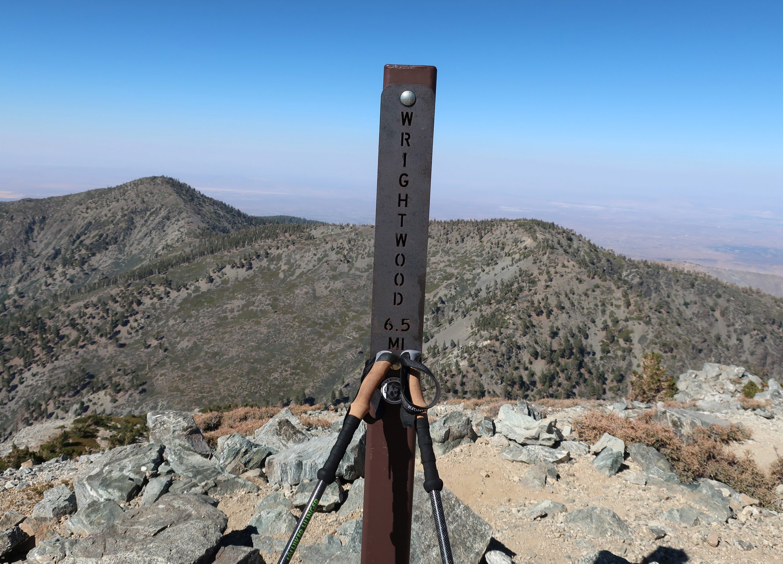
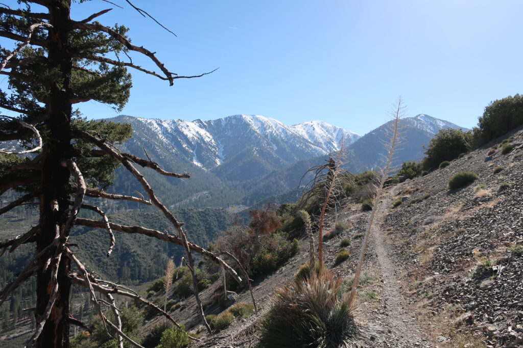
Hike Mount Baldy to Wrightwood via the North Backbone Trail. This trip takes you from south to north, traversing the San Gabriel mountains eastern high country. The terrain is high and dry, passing amongst wind bent pines, colorful outcroppings of rock, and views in all directions while taking you through stunning alpine scenery.
Total Distance = Approx. 12 miles one way
Initial Elevation Gain = 3,900′ the first 4 miles to Mt Baldy. Once on the North Backbone trail, which’ll take off northward at the 10,064′ summit, there is an initial 1,300′ of steep descent down to the first saddle. Next there’s 900′ of climb to Dawson Peak followed by 400′ of drop to the next saddle. Finally there’s a brief climb of 450′ to the gentle summit of Pine Mountain. Now and finally, there’s a good 1,400′ drop down to the last little saddle before climbing up a couple hundred yards to the end of the North Backbone trail. In another 1 1/2 miles of level trail walking you’ll reach the upper end of the Acorn Trail where there will be 1,600′ of drop into Wrightwood. Over the length of this hike your total Gain will be 5,250′ and the total DROP will be 4,700′.
Map to take: Tom Harrison’s “ANGELES High Country” map, 2018. Nothing against map apps, I just happen to really like having a physical map as well as bringing an orienteering compass, too.
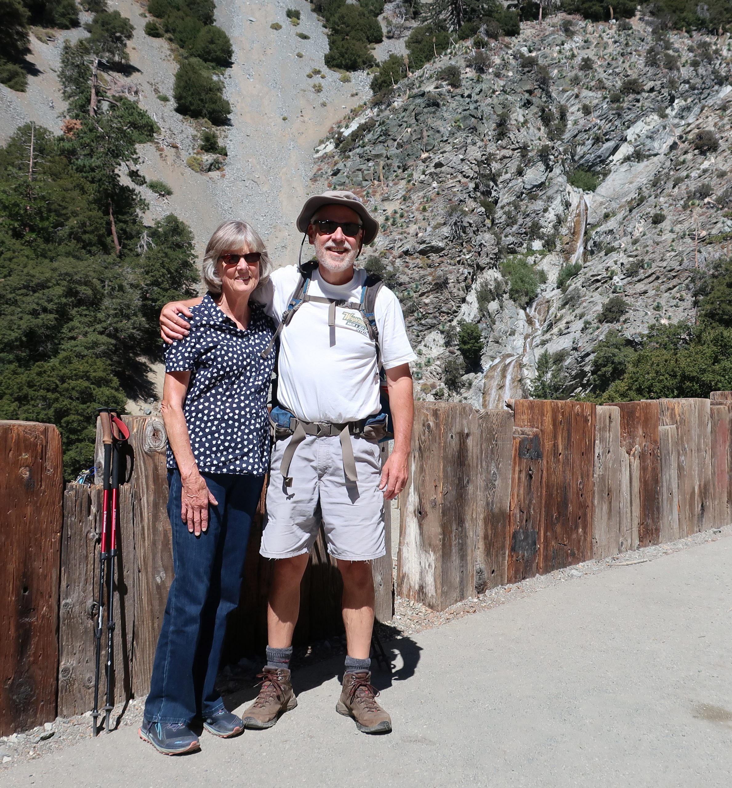
Joanie and Chris just a short distance up San Antonio Canyon from Manker Flat Campground. That’s San Antonio Falls just off to the right of my shoulder.
This last Monday, my wife and I drove around to San Antonio Canyon above Upland, from our home in Wrightwood. I’d been thinking about hiking up Mt. Baldy from the U.S. Forest Service Manker Flat campground and had been kicking this idea around for about a week. As some days went by, got to thinking that it’d be really nice to just keep on hiking from Baldy’s summit to Wrightwood via the North Backbone trail. Easy, speasy.
All of this area, including the North Backbone trail, I had hiked years earlier, meaning in some cases, some decades ago… It all seemed so easy in my head and being that it was only going to be a day hike, there wouldn’t be a heavy pack to lug up and down the ridge tops. That’s it, a cinch! I’m now pushing 59 years and still hiking, yet there’s no denying that the hikes take a wee bit longer and the recovery the day after is longer . Yeah. Well, as things turned out, we got started a bit later than planned, meaning like almost 11:00 a.m. Nonetheless, it ended up being a great day to hike! My wife was going to drop me off at the Manker Flat trailhead and we’d meet up later in Wrightwood.
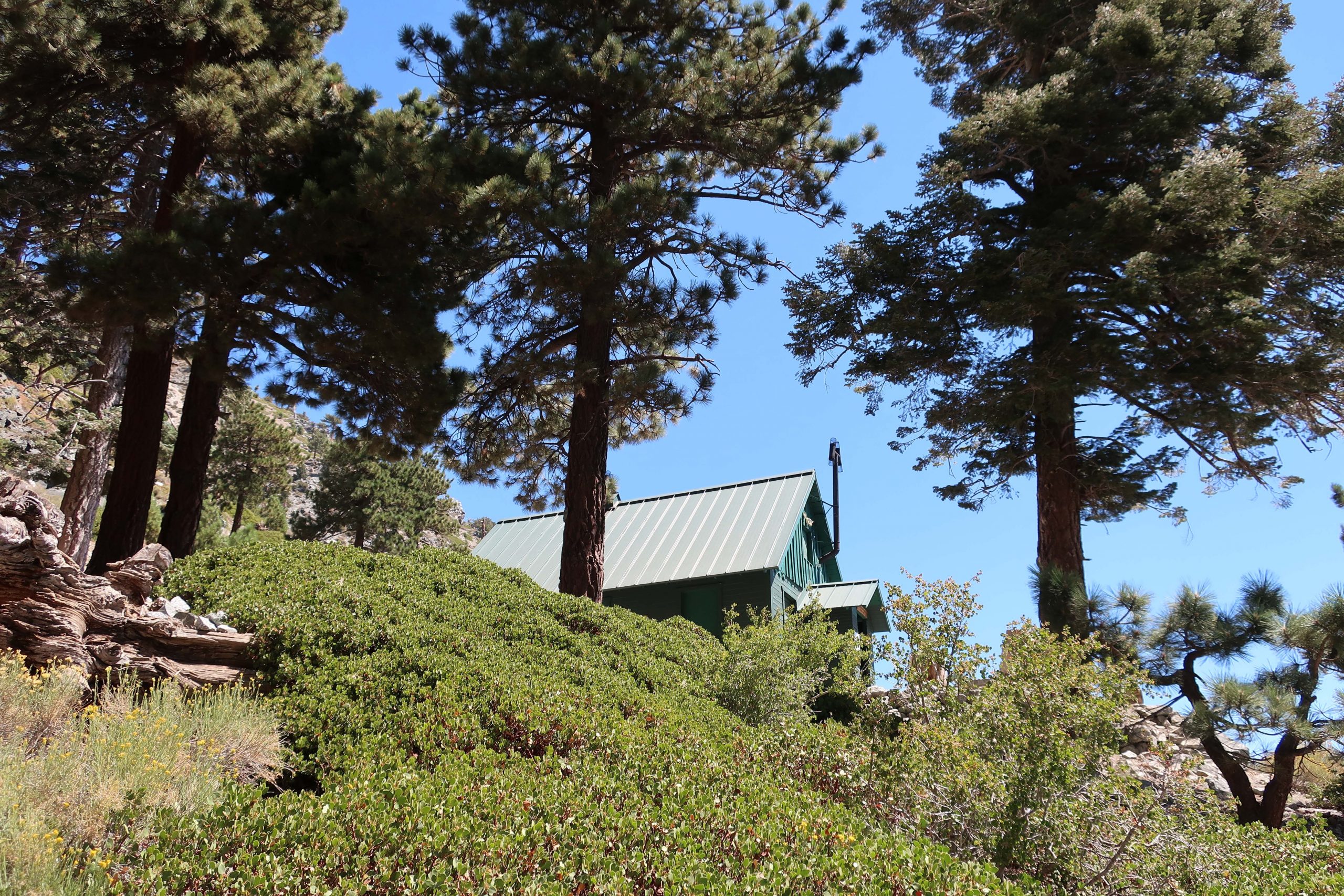
The Sierra Club’s “Ski Hut” was built back in the 1930’s. After a couple of really steep miles, the Baldy Bowl Trail passes just beneath this beautifully maintained cabin.
I’d wanted to show Joanie San Antonio Falls, which she’d never seen before, and peer down at some of the little cabins hidden along the little creek. This meant walking the gated fire road, which is unfortunately paved, up to its’ first switchback at the base of the falls. It can be sort of hot and exposed, like it was the day we went. Still it was worth seeing the Falls. We said our goodbyes out under the bright blue sky and off I climbed up the fire road which had now become dirt. It’d be some ten hours before we’d meet up, again, on the other side of the range in Wrightwood.
View looking toward Baldy Notch from Mt. Baldy Bowl. This photo was taken just minutes after passing by the Sierra Club Ski Hut.
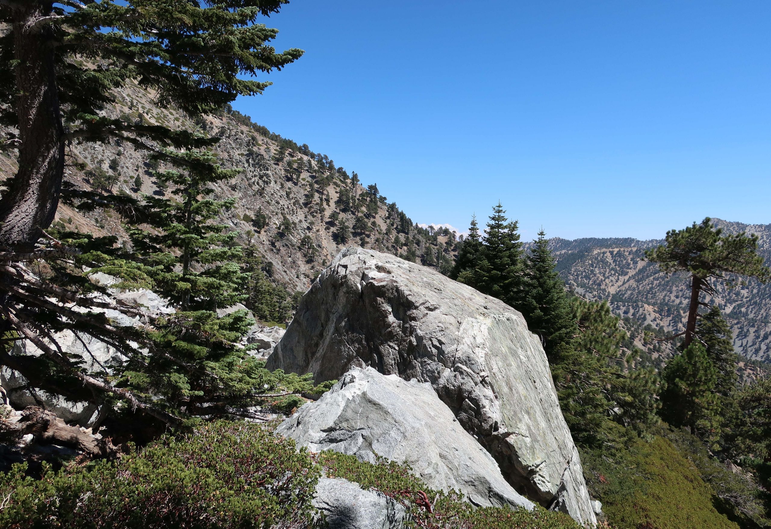
The turn off for the Baldy Bowl trail came up quickly on my left. That’s where the work began. Two things that came to mind and became readily apparent in no time at all was: 1. How much steeper the trail was than I had remembered it and 2. Just how big Mt. Baldy really is, no matter which way you go up it. It’s really a tall, broad mountain, especially by Southern California standards. Throughout the climb, despite the frequent standing up rests to slow the heart down and catch my breath, it was absolutely beautiful looking out over rugged San Antonio canyon. The trail climbs quickly up through oaks, mountain mahogany, manzanita and of course, shading pines and white fir. Just before reaching the Baldy Bowl, named by early x-country skiers in the early 20th century, you pass under the Sierra Club’s ski hut. Available to overnight stays by reservation only, this place is meticulously maintained and obviously loved by the membership. No one was there that day and I just kept hiking along, grateful for the icy cold stream that lay just moments ahead. There are strips of meadow flowers hugging the stream banks both below and above the trail. Flowers and willows crowded together along the tumbling, silver thread of water. The section where the trail crosses through the bowl is a complex of boulders, many the size of small cabins. It’s slow going and requires taking your time to read the trail, watching for clues as to where to meander next. Constantly, there was this sense that I was in the Sierras, and yet, somehow this San Gabriel mountains scenery felt, looked and even had that scent of Sierra rock and pine. All too soon, the trail leaves the Bowl and begins to switchback up through Jeffrey and Ponderosa pines. Soon the lodgepole pines began to make their presence and so did someone else.
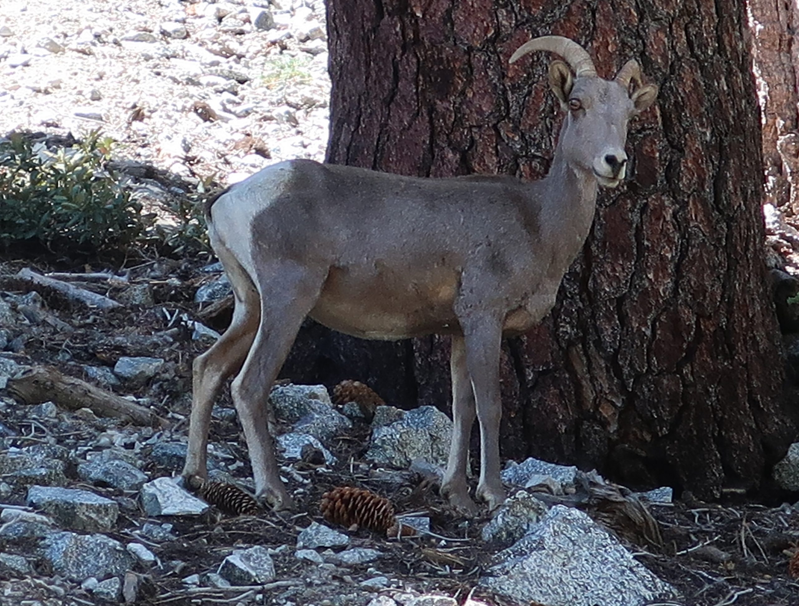
A solitary Big Horn sheep on the west side of the Baldy Bowl. This is a female or commonly known as a ewe. Often elusive, these creatures are able to easily scale the steepest and loosest of high country slopes.
It had been years since seeing a bighorn sheep. Like always, it was never my eyes that would detect these elusive creatures. The sound of a few pebbles breaking loose from the hillside caught my attention and there she was! A few minutes later, another ewe peered at me from behind a fallen tree. She and her lamb were grazing on about a 45 degree slope on the edge of the Bowl. A double gift for sure. Occasionally I’d stop at the end of a switchback and take in the changing view of the ridge line (Devil’s Backbone) coming in from Baldy Notch. By now I’d reached the broad ridge top defining the west side of Baldy Bowl, the immense scale of the smooth talus slope dropping steeply off the south side of the summit had become apparent. The trees, pretty much all lodgepole, were twisted and sculpted by the centuries of storms blowing in off the Pacific.
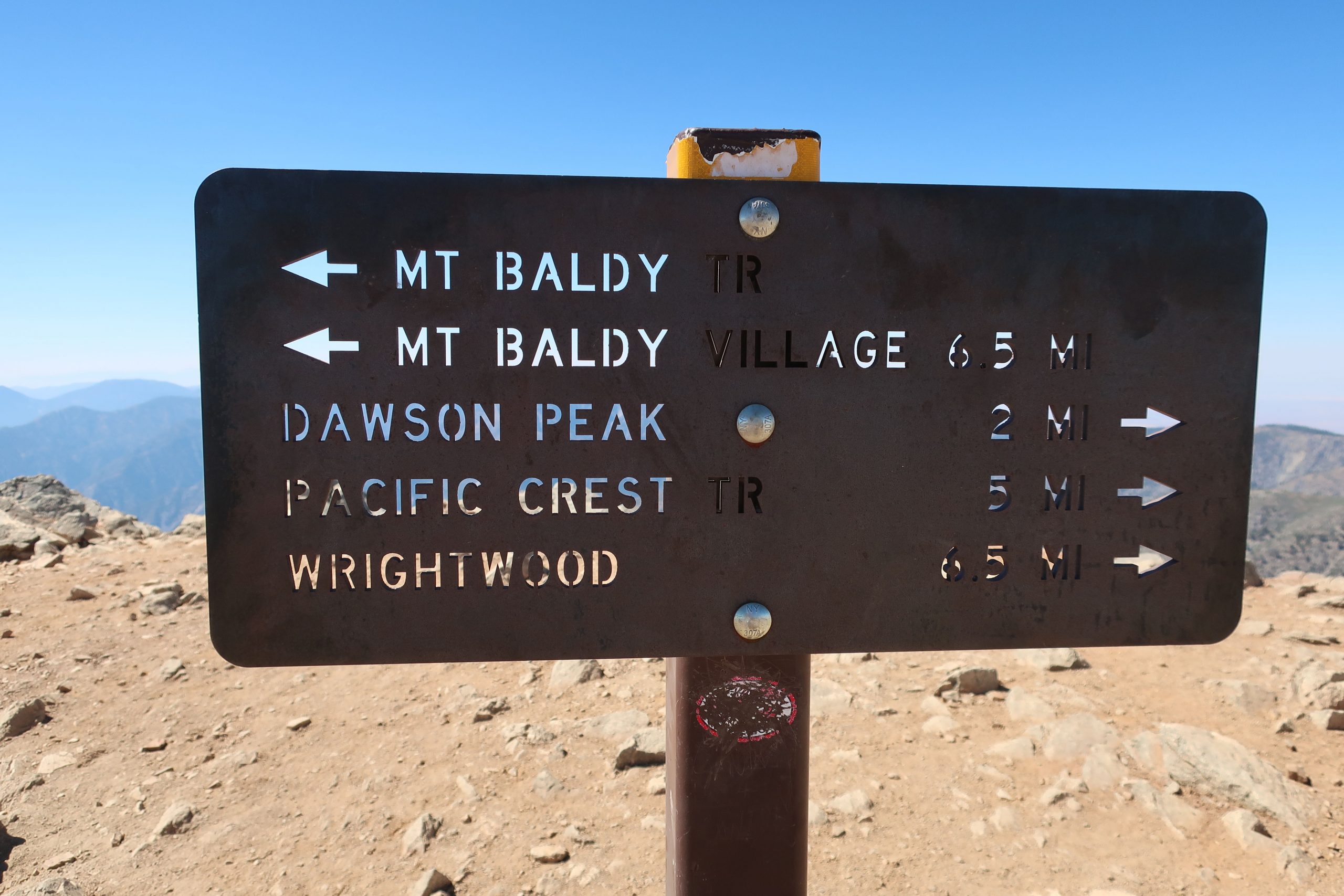
One of the trail signs at the summit of Mt. Baldy. There’s no lack of directional signage here, a good thing.
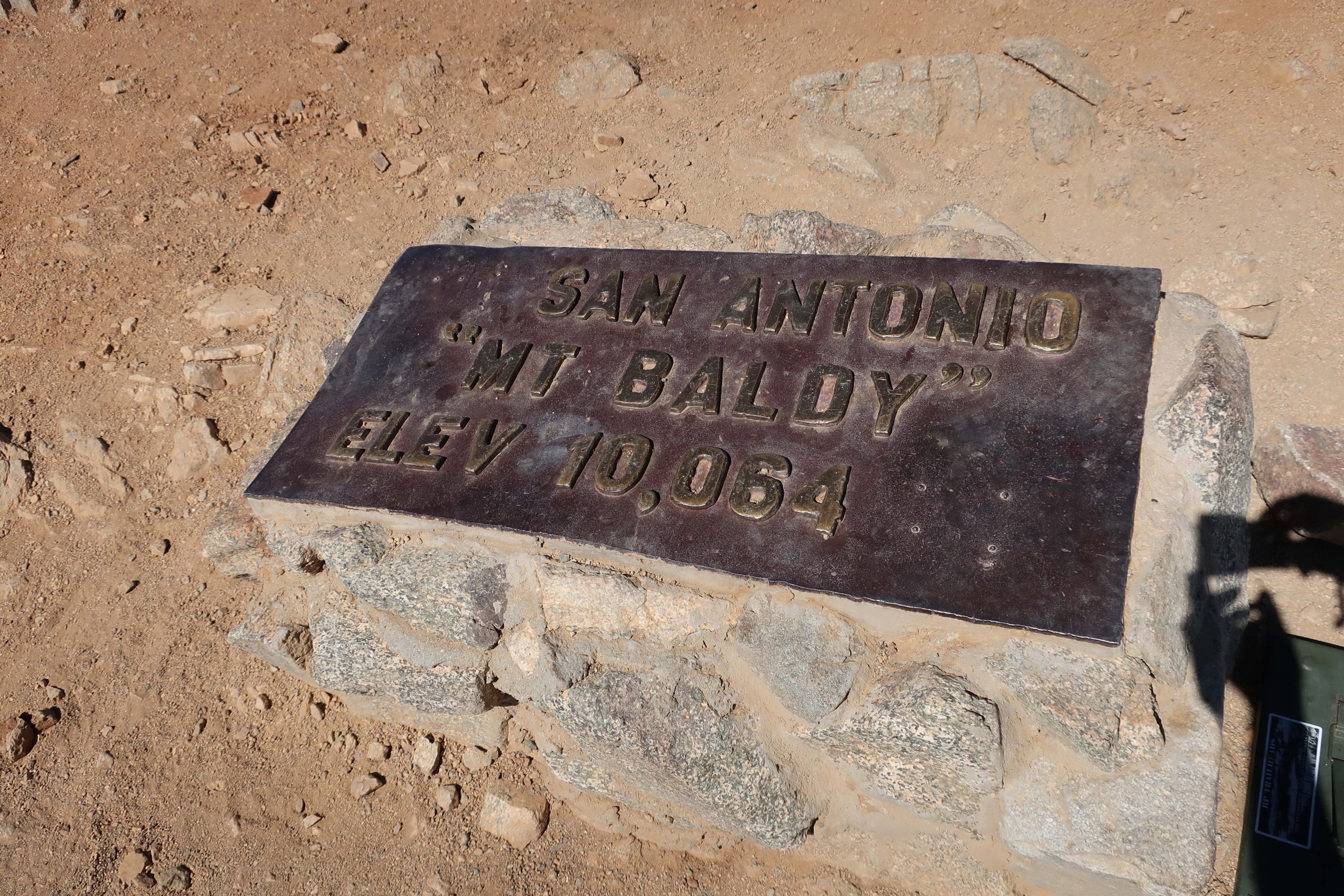
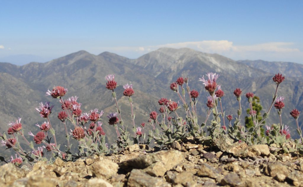
One thing that really caught my eye along the whole route were the really well made and maintained trail signs. Not only are there good directional signs along the way, there are even square steel posts with reflective tape on them, often giving you a good sense of where the trail would be should it be dark or there be a mantle of snow on the ground. This trail has really been well thought out. Another detail that became subtly apparent after some time was the lack of litter. My route was especially pristine and free of trash. There’s definitely a sense of stewardship going on up here. I hadn’t brought a watch, so never did determine just when I summited. That was purposeful and there was this wonderful relief at not having to know. Probably at least several hours had elapsed before making it to the top. There were probably no more than a dozen people sharing the trail up to the top that day. Really peaceful. Found a spot near the summit marker (elev. 10,064′) to sit down on my tired haunches, looking out to the north and down into the Fish Fork.
Here’s the monument marking the summit of one of the most popular peaks in Southern California.
While taking in the view, a fit 30 something man with a solid build and neatly cropped red beard approached, asking if he wasn’t spoiling my solitude. Of course not! Pull up a boulder and sit down. Pretty soon I learned where he’d been, as his IPA cracked open and quickly vanished. Sam had started out at the Heaton Flat trailhead way down in the East Fork before heading up to Iron Mountain, one of the most isolated and difficult peaks to reach. From there, he worked his way across West San Antonio Ridge to the summit of West Mt. Baldy. From here, he’d drop down to Manker Flat and find his hidden mountain bike and take that back to his car by pedaling over the Glendora Mountain Ridge Road! That’s the caliber of company you can sometimes run into on higher peaks… Soon I was off and heading down the North Backbone Trail toward Blue Ridge and Wrightwood beyond. Gotta tell you, taking trekking poles was one of my best moves of the day. The descent was extremely steep down to the first saddle north of Mt. Baldy. Spots where I definitely would have slipped just from fatigue, were pretty easily walked down with the aid of the poles. This is a trip where you’d be glad to have a set of them.
Here’s the view looking toward the North Backbone trail from Mt. Baldy’s summit. That’s Dawson Peak straight ahead, just off to the right of the steel sign. Pine Mountain is further out, on the left of photo. Hiking this ridge is the key to traversing the San Gabriels to Wrightwood.
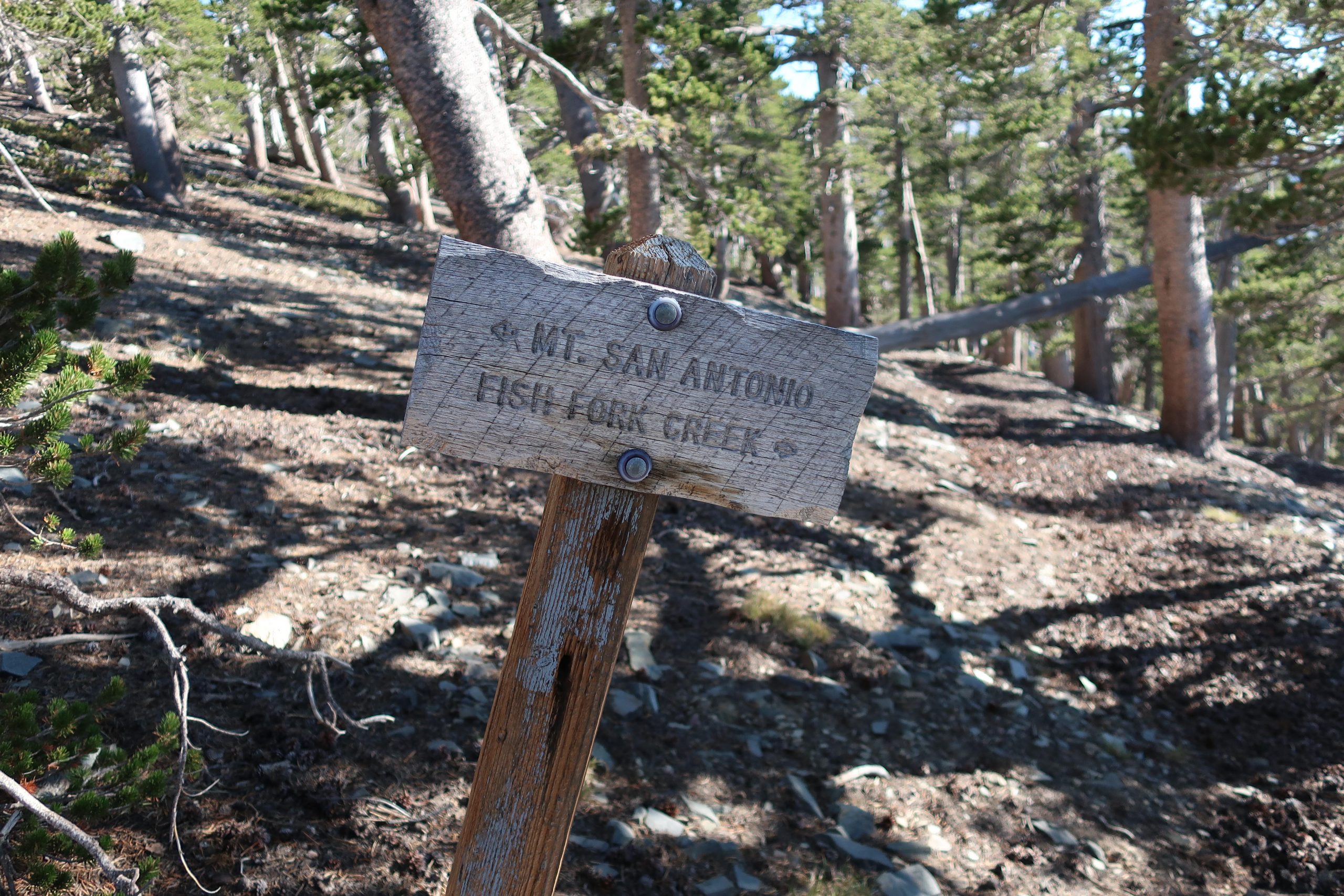
The climb up to Dawson Peak went well. There’s lots of rabbitbrush along the way. The trail weaved in and out of the thick yellow blossoms, giving the late afternoon light a feeling of autumn. Mountain mahogany and twisted rock outcroppings kept things interesting as well. There was a great view down toward the Cajon Pass with commuters making their sluggish drive back toward the desert. A freight train could be seen climbing the serpentine railroad tracks as well, tiny in comparison to the arid landscape. All this activity was silent, visible, yes, yet no sound whatsoever. To my left, grand scenes of the Fish Fork and Mount Baden Powell, continued to dominate my senses. A refreshing and constant breeze out of the west kept me cooled down. Once on top of Dawson (elev. 9,575′), I signed the summit register and continued on down a gentle descent through sun – polished plates of schist. Talus, I suppose. Beautiful stuff that sounded like ceramic dinner plates clunking together under my boots at times. There were even these beautiful, hidden, forested and shaded flats just below the trail at times, spots that would make for a perfect campsite. Untouched. Just before reaching the saddle between Dawson and Pine Mountain, I saw the old and seemingly untrammeled Fish Fork Trail coming in from my left.
Trail junction for the seldom trod Dawson Peak Trail in the upper Fish Fork. This is the upper end of what appears on Tom Harrison’s Angeles High Country map as being the 4 1/2 mile route down to Fish Fork Campsite, probably one of the most remote places in the San Gabriels. The elevation at this spot is 9,200′.
There’s even an old graying wooden sign indicating the way down. I’ve always wanted to follow this trail which drops down to Fish Fork trail camp, probably one of the most isolated haunts in our range. That old feeling came back somewhat suddenly, mixed with wonder at how good things still are in the backcountry here. Pristine. And since it’s hard to get to, at least for me, nothing’s trashed. A constant truth throughout the ages. Thank God. Amen.
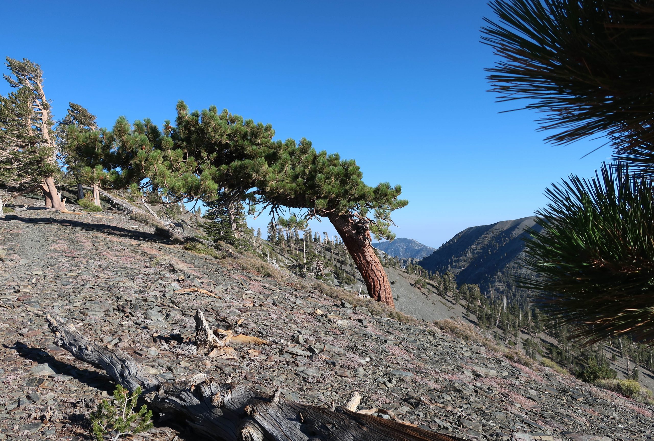
A section of the North Backbone trail, looking back toward Dawson Peak. The ridge line on the horizon, seen off to the right is part of the Mount Harwood / Mt. Baldy massif. This picturesque “flag” tree in the foreground is one of many found along these high country slopes and ridge tops, sculpted over the centuries from the high winds blowing in from Pacific winter storms.
Soon I was climbing yet, again. This time it was up to Pine Mountain (9,648′). Weaving amongst more pines and mountain mahogany, the sun continued to drop further and further down across the mountains, casting longer and longer shadows in the gentle wind. Up on top, the summit register of nested red cans was easily found in a cairn of rocks. The desire to linger here awhile longer was resisted by the nagging feeling to at least get to Blue Ridge and the Pacific Crest Trail (PCT) before it got dark. So, reluctantly, off I dragged my now tired self down a gentle slope amongst a thick forest of lodgepole pine. The deepening pools of shade penetrated the forest in a way that reminded me of being a little boy, maybe six or seven, running through the giant sequoias where our family used to camp every summer in a tent cabin. I missed people that I hadn’t thought about in awhile. They all came back for a bit and I reveled in this.
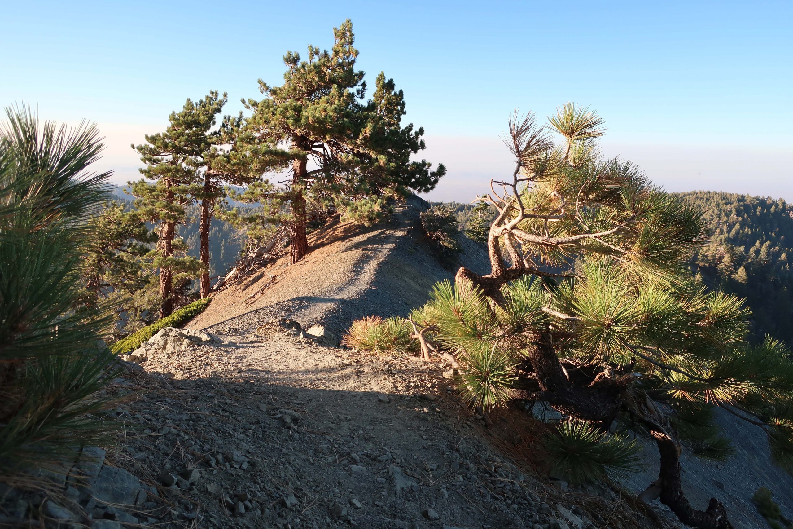
As the sun sunk lower and lower in the west, I made my way along the top of the ridge to the north of Pine Mountain, dropping toward Blue Ridge which is visible to the right.
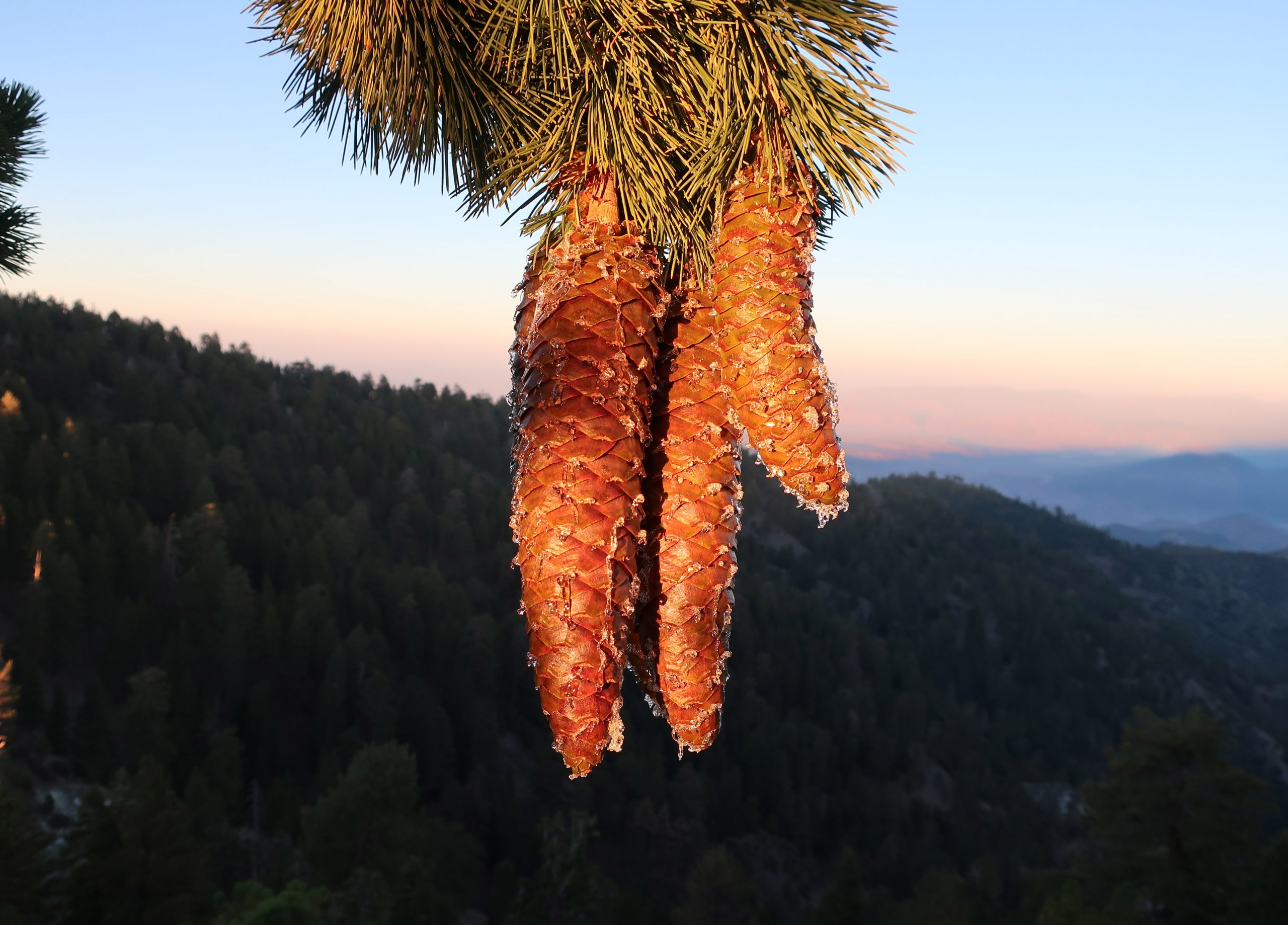
After a short while, the ridge top timber all but left, becoming a sharp edged knife of rock, bathed in orange golden sunlight. Take your time here, Chris, something kept gently telling me. I was tired and starting to get sloppy, not quite so nimble as hours earlier. Eventually the ridge got easier and right before sun had set below the horizon, a beam of that gold light struck some dangling cones hanging from an ancient sugar pine. This hike kept getting more and more gorgeous, nostalgic in a way. In the graying light, I made a last little climb up to the dirt road (East Blue Ridge recreation road) to the northern terminus of the North Backbone Trail.
The gold light of early evening illuminates several sugar pine cones along the North Backbone trail. That’s the Mojave Desert in the background, while distant ranges still bask in the sunset.
I scurried up the slope behind the road, following a scratch trail that led to the PCT. Turning left (west) and continuing at a pretty fast clip, I arrived at a spot just to the west of the large slide above Wrightwood. The lights of homes were now twinkling in the early evening darkness. Time to get the flashlight out. I continued on in the dark, amongst and under the tall white fir and pines. Still no one around. Perfect. Here and there you could make out the silhouette of Pine Mountain to the south. A short time later was the turn-off for the Acorn Trail, which would descend about 1,600′ feet down into upper Wrightwood. Up here, it was possible to reach Joanie by radio, and yes, you guessed it…. Without a bit of shame, I took the ride back to our home in the little red Honda while Joanie told me about her day. Why the hell not? Who wants to walk on pavement I say to myself. That ride was heaven on earth. And so there you have it, it’s possible to walk across the highest point in the San Gabriels in a day! The next day my thighs felt entirely spent while walking on the little stone paths around our yard. And yet, looking back on it all, such as all good hikes, it was definitely worth it.
Mid-winter through spring is a good time to hike up to Mt. Wilson. Even as Chantry Flat in the Big Santa Anita Canyon continues to heal from the Bobcat Fire of 2020, don’t feel like there’s no good way up to Mt. Wilson. If you’ve never done it, hiking up the Old Mount Wilson Trail from the scenic Sierra Madre is not a bad way. The canyon you’ll travel through on your way up toward Manzanita Ridge is known as the Little Santa Anita Canyon. This is the original way up to “Wilson’s Peak,” named after Don Benito Wilson. The trail dates back to the 1860s.
A view of Mt. Baldy from Manzanita Ridge.
Manzanita Ridge, sections of it quite true to its’ name, makes up the watershed divide between Winter Creek (to the north) and Little Santa Anita Canyon on the south. Following the ridge line up toward the Old Mount Wilson Toll Road views out into the High Country of the San Gabriels abound. Once up on the Toll Road, you’ll continue to walk along refrigerator-sized boulders that have dropped off the near vertical slopes of Mt. Harvard.
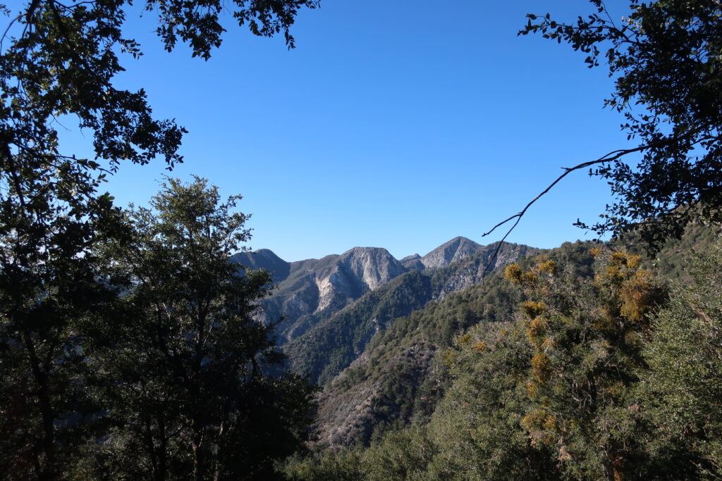
Once you reach Martin’s Saddle, the site of a once popular trail resort of the late 19th Century, views out toward the west are to be had. You’re now contouring the slopes of Upper Eaton Canyon, a beautifully rugged wilderness in its own right. Looking out across the steep and deep tributary canyons, there is, from left to right, Mt. Lowe, Mt. Markham (flat-topped), and San Gabriel Peak. When the air is clear, this scene is spectacular.
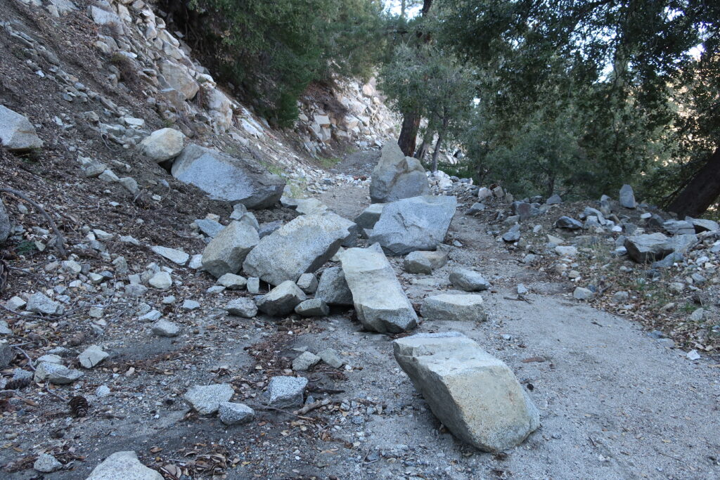
Boulders accumulate on the Mt. Wilson Toll Road after winter storms.A view across Upper Eaton Canyon
Once up at the top, I found a picnic bench in the open-air pavilion and soaked in the sunlight for some time before heading back down. The Pacific reflected back at me like an amber platter just to the north of the Palos Verdes peninsula. What a beautiful place to be hiking. What a beautiful place to be alive.
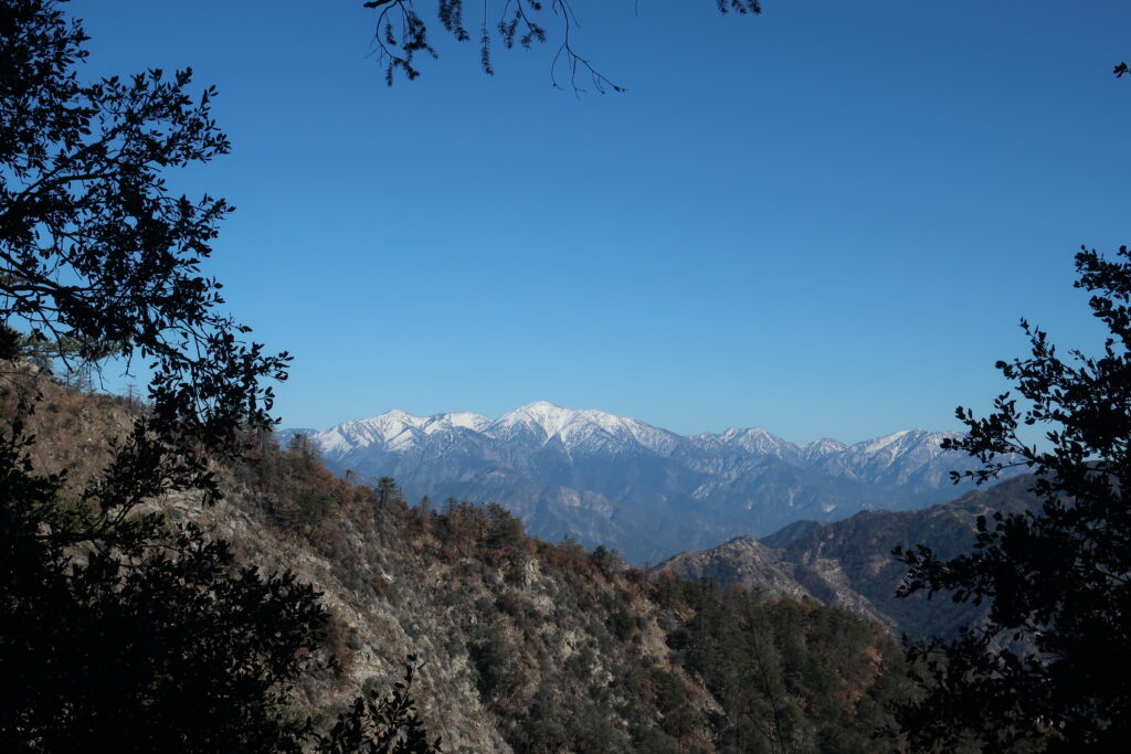
Mt. Baldy and Dawson Peak are seen from the PCT. This view looks across upper Lytle Creek and some miles below East Blue Ridge.
Vincent Gap trailhead is once again open to vehicles coming in through Wrightwood. Highway 2 continues to be gated to any driving west of the trailhead. If you’re looking to hike up to Mt. Baden Powell or drop down into the East Fork, all this is possible now and through the summer and autumn months.
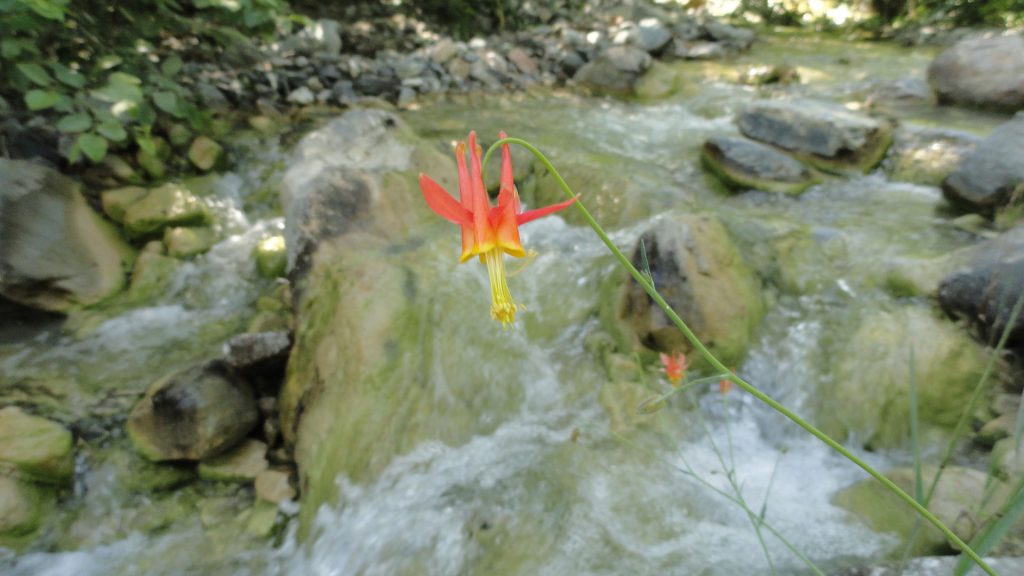
Looking out across the East Fork of the San Gabriel River to Pine Mountain, Dawson Peak, and Mt. Baldy. This view is from a spur ridge just below the summit of Mt. Baden-Powell. A native Columbine graces the East Fork just downstream from Mine Gulch Campsite.
In the summer of 1845, Benjamin D Wilson, who owned part of the interest in the Jurupa Rancho, the site of the present city of Riverside, led a troop of Calvary in search of cattle rustlers.
Setting out from San Bernardino Valley, he divided his command. Most of the men he sent throughCajon Pass, keeping only 22 Mexican troopers with him to follow a trail across the mountains. Two days later, Wilson and his men reached the lake, where they sighted scores of grizzly bears.
Most of the soldiers had been vaqueros. They formed in pairs and drew reatas, each pair attacking a bear. One looped a rope around the bear’s neck; his companion roped the same bear by a hind foot. Then, the men drew apart to stretch the rope taut and hold the bear a prisoner. They bagged and skinned eleven bears, stretched their hides, and continued across the mountains to join the rest of the command in the desert at Rancho Las Flores on the Mojave River.
Here, the reunited party engaged Indians in a fight, after which Wilson and his 22 vaquero-troopers returned home by the way of the lake. They again found the place overrun with bears, and the same 22 soldiers brought in eleven more bears– enough to give them a bear rug apiece as a trophy. Then, Wilson named Bear Lake to the little body of water.
Years later, the name was changed to Baldwin Lake. The name survives, however, in Big Bear Lake, which was created at the site of the Talmadge Ranch in 1884 when a dam was built to provide a constant water supply for the Redlands District.
– adapted from ~ Pioneer Tales of San Bernardino County – WPA – 1940.
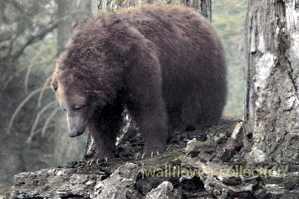
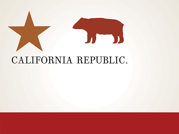
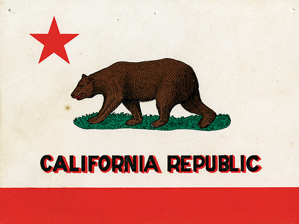
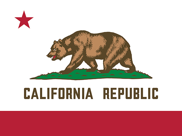
The California grizzly bear (Ursus arctos californicus) is a subspecies of the brown bear that once inhabited various regions of California. Historically, grizzly bears were found throughout the state, from the coast to the mountains and valleys. They were an important part of California’s wildlife and played a role in the culture and folklore of indigenous peoples.
California grizzly bear (Ursus arctos californicus)
Unfortunately, due to habitat loss, hunting, and human conflicts, the California grizzly bear population declined significantly throughout the 19th century. The last known California grizzly bear in the wild was killed in 1922 in Tulare County. The species was declared extinct in 1924.
Efforts have been made to preserve the memory of the California grizzly bear, and it is often symbolically represented in the state’s flag and seal. The California grizzly bear is also the state animal, even though it no longer exists in the wild.
1846 – 1910
1911 – 1952
Today
There have been occasional discussions and proposals for reintroducing grizzly bears to certain parts of California, but these efforts are complex and face challenges related to habitat, human-wildlife conflicts, and public opinion. As of my last knowledge update in January 2022, there were no active reintroduction programs in place. Still, it’s advisable to check for the latest information, as conservation efforts and plans may evolve.
Benjamin Wilson leads a posse of 22 men into the San Bernardino Mountains to search for Indians who had been raiding ranches in . He discovers Big Bear Valley and gives it the name it has today. Up until 1845, Bear Valley was known to the local Serrano Indians as Yahaviat, which means “Pine Place”. – bb
Gentrification is a complex and multifaceted process that typically involves the transformation of a neighborhood or community due to an influx of wealthier residents and increased property development. While gentrification is commonly associated with urban areas, how it might manifest in desert regions is worth considering.
In the context of desert areas like the Mojave Desert, some factors may contribute to changes in local communities:
Tourism Development: Deserts are often attractive to tourists seeking unique landscapes and experiences. Developing tourist infrastructure, such as upscale resorts, could change the local economy and demographics.
Environmental Conservation and Luxury Living: Some desert areas may become appealing to those seeking a more secluded or environmentally conscious lifestyle. This could lead to the development of upscale residences, potentially displacing existing communities.
Renewable Energy Projects: The Mojave Desert, particularly, has seen increased interest in renewable energy projects like solar farms. This can bring economic development but may also change the local population dynamics.
Artistic and Cultural Appeal: Artists and individuals attracted to the tranquility and unique landscapes of the desert may contribute to gentrification by establishing art communities or cultural hubs.
It’s crucial to note that the impact of gentrification can vary based on the specific characteristics of each desert region and the policies in place to address community concerns. Local governments and community organizations play a crucial role in shaping development patterns and mitigating the potential negative effects of gentrification, such as displacement of long-term residents and cultural erosion.
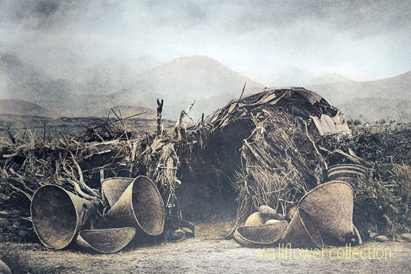
Mono Paiute wickiup – Edward Curtis 1900 (colorized)
A “wikiup” in the context of Native American culture typically refers to a traditional type of shelter or dwelling. It is a simple, dome-shaped structure constructed using a framework of branches or saplings. The frame is often covered with various materials, such as brush, reeds, grass, or sometimes animal hides. Various indigenous peoples in North America commonly used these shelters.
The design of wikiups varied among different tribes, reflecting the local environment and available resources. They were relatively easy to construct and could be adapted to different climates. Nomadic or semi-nomadic groups often used Wikiups as temporary or seasonal shelters.
It’s important to note that the term “wikiup” might be spelled or pronounced differently in various indigenous languages, and the specific features of these shelters could vary based on cultural and regional differences.
The most famous lost mine in the Death Valley area is the Lost Breyfogle. There are many versions of the legend, but all agree that somewhere in the bowels of those rugged mountains is a colossal mass of gold, which Jacob Breyfogle found and lost.
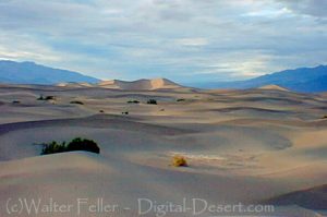
Mesquite Flats Sand Dunes – Death Valley
Jacob Breyfogle was a prospector who roamed the country around Pioche and Austin, Nevada, with infrequent excursions into theDeath Valleyarea. He traveled alone.
Indian George, Hungry Bill, and Panamint Tom saw Breyfogle several times in the country around Stovepipe Wells, but they could never trace him to his claim. When followed, George said, Breyfogle would step off the trail and completely disappear. Once George told me about trailing him into the Funeral Range. He pointed to the bare mountain. “Him there, me see. Pretty quick—” He paused, puckered his lips. “Whoop—no see.”
Breyfogle left a crude map of his course. All lost mines must have a map. Conspicuous on this map are the Death Valley Buttes which are landmarks. Because he was seen so much here, it was assumed that his operations were in the low foothills. I have seen a rough copy of this map made from the original in possession of “Wildrose” Frank Kennedy’s squaw, Lizzie.
Breyfogle presumably coming from his mine, was accosted near Stovepipe Wells by Panamint Tom, Hungry Bill, and a young buck related to them, known as Johnny. Hungry Bill, from habit, begged for food. Breyfogle refused, explaining that he had but a morsel and several hard days’ journey before him. On his burro he had a small sack of ore. When Breyfogle left, Hungry Bill said, “Him no good.”
Incited by Hungry Bill and possible loot, the Indians followed Breyfogle for three or four days across the range. Hungry Bill stopped en route, sent the younger Indians ahead. At Stump Springs east ofShoshone, Breyfogle was eating his dinner when the Indians sneaked out of the brush and scalped him, took what they wished of his possessions and left him for dead.
Ash Meadows Charlie, a chief of the Indians in that area confided to Herman Jones that he had witnessed this assault. This happened on the Yundt Ranch, or as it is better known, the Manse Ranch. Yundt and Aaron Winters accidentally came upon Breyfogle unconscious on the ground. The scalp wound was fly-blown. They had a mule team and light wagon and hurried to San Bernardinowith the wounded man. The ore, a chocolate quartz, was thrown into the wagon.
Resting Springs
“I saw some of it at Phi Lee’s home, theResting Spring Ranch,” Shorty Harris said. “It was the richest ore I ever saw. Fifty pounds yielded nearly $6000.”
Breyfogle recovered, but thereafter was regarded as slightly “off.” He returned to Austin, Nevada, and the story followed.
Wildrose (Frank) Kennedy, an experienced mining man obtained a copy of Breyfogle’s map and combed the country around the buttes in an effort to locate the mine. Kennedy had the aid of the Indians and was able to obtain, through his squaw Lizzie, such information as Indians had about the going and coming of the elusive Breyfogle.
“Some believe the ore came from around Daylight Springs,” Shorty said, “but old Lizzie’s map had no mark to indicate Daylight Springs. But it does show the buttes and the only buttes in Death Valley are those above Stovepipe Wells.
“Kennedy interested Henry E. Findley, an old time Colorado sheriff and Clarence Nyman, for years a prospector for Coleman andSmith(thePacific Borax Company). They induced Mat Cullen, a rich Salt Lake mining man, to leave his business and come out. They made three trips into the valley, looking for that gold. It’s there somewhere.”
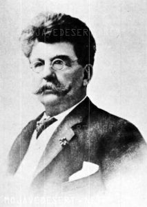
Francis Marion “Borax” Smith
At Austin, Breyfogle was outfitted several times to relocate the property, but when he reached the lower elevation of the valley, he seemed to suffer some aberration which would end the trip. His last grubstaker was not so considerate. He told Breyfogle that if he didn’t find the mine promptly he’d make a sieve of him and was about to do it when a companion named Atchison intervened and saved his life. Shortly afterward, Breyfogle died from the old wound.
Indian George, repeating a story told him by Panamint Tom, once told me that Tom had traced Breyfogle to the mine and after Breyfogle’s death went back and secured some of the ore. Tom guarded his secret. He covered the opening with stone and leaving, walked backwards, obliterating his tracks with a greasewood brush. Later when Tom returned prepared to get the gold he found that a cloudburst had filled the canyon with boulders, gravel and silt, removing every landmark and Breyfogle’s mine was lost again.
“Some day maybe,” George said, “big rain come and wash um out.”
Among the freighters of the early days was John Delameter who believed the Breyfogle was in the lower Panamint. Delameter operated a 20 mule team freighting service between Daggett and points in both Death Valley and Panamint Valley. He told me that he found Breyfogle down in the road about twenty-eight miles south of Ballarat with a wound in his leg. Breyfogle had come into the Panamint from Pioche, Nevada, and said he had been attacked by Indians, his horses stolen, while working on his claim, which he located merely with a gesture toward the mountains.
Subsequently, Delameter made several vain efforts to locate the property, but like most lost mines, it continues to be lost. But it was good bait for a grubstake for years and served both the convincing liar and the honest prospector.
Nearly all old timers had a version of the Lost Breyfogle differing in details, but all agreed on the chocolate quartz and its richness.
That Breyfogle really lost a valuable mine, there can be little doubt, but since he is authentically traced from the northern end of Death Valley to the southern, and since the chocolate quartz is found in many places of that area, one who cares to look for it must cover a large territory.
“Gold Stone is the name of a new camp, thirty-five miles north of Barstow, where some phenomenal ore has been found. Quite a stampede followed the discovery.
The area is the site of the only commercial opal mine in the California Desert. Waterman. Five years before the famous silver discoveries at Calico, George G.
4 days ago … Post Views: 12. Goldstone, Barstow California, Mojave Desert. digital-desert.com › goldstone-ghost-town. Goldstone Ghost Town. More of a site …
Goldstone – Mojave Desert. Several people were involved in mining during this same time, including John Harper and Goodrich. 289. One of the most active …
Persistent rumors have it that gold … 1859: Bodie, California … by prospector Wakeman S. Bodey, who the town was named after. Bodey died in November making …
States: Primarily in California and Nevada, with smaller portions in Arizona and Utah. Extent: The Mojave Desert is part of the larger North American Desert and …
Some of the dry lake beds are Bicycle, Coyote, East Cronese, West Cronese, Goldstone, Langford Wells, Leach, Manix, Nelson, Pilot Knob Valley, Red Pass, and …
And now, with the operations of the Goldstone tracking station ushering the “space age” into the desert, the future holds promise far beyond the wildest dreams …
