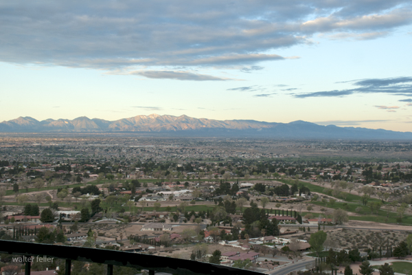
The Waning Character of the Victor Valley: A Reflection on Change

Introduction:

The Victor Valley, once known for its vibrant character and idyllic charm, has witnessed a gradual decline in its unique essence over the years. Let us examine the factors contributing to the waning character of the Victor Valley and reflect upon the changes that have shaped its present state.

The Historical Significance:

The Victor Valley has a rich history, deeply rooted in the California Gold Rush and the railroad system development. These historical events played a pivotal role in shaping the valley’s character, attracting settlers, prospectors, and entrepreneurs seeking opportunities. The region blossomed with small communities, bustling industries, and a strong sense of community.

Urbanization and Economic Shifts:

Over time, the Victor Valley has undergone significant urbanization and economic shifts, which have profoundly impacted its character. With the expansion of cities and towns, vast open spaces have been replaced by commercial developments and residential neighborhoods. This rapid growth has led to a loss of natural beauty and a decline in historical landmark preservation.

Furthermore, economic changes have influenced the character of the Victor Valley. The decline of traditional industries, such as agriculture and mining, has resulted in a shift towards a service-based economy. While this has brought economic stability and employment opportunities, it has also contributed to a loss of the valley’s unique identity as small businesses struggle to compete with larger corporate chains.

Cultural Shifts and Loss of Community Spirit:

Another significant factor contributing to the waning character of the Victor Valley is the cultural shifts experienced by its residents. As the valley has become more diverse, the sense of community and shared values that once defined its character has diminished. People are now more connected virtually than physically, and the traditional community spirit has given way to individualism and isolation.

The Impact of Modernization:

The advent of modern technology and social media has further eroded the character of the Victor Valley. The constant connectivity and virtual interactions have replaced face-to-face communication, making it harder for residents to connect and engage with each other. The valley’s unique charm, once fostered by personal connections and local events, now struggles to compete with the allure of the digital age.

Preserving the Victor Valley’s Character:

Despite Victor Valley’s challenges, there is hope for preserving its character. Community-driven initiatives, historical preservation efforts, and a renewed focus on local businesses can help restore the valley’s identity. By embracing sustainable development practices and promoting cultural events celebrating the valley’s heritage, residents and local authorities can work together to attempt to revive the character that once defined the Victor Valley.

Conclusion:

The waning character of Victor Valley reminds us of the ever-changing nature of our society. The forces of urbanization, economic shifts, cultural changes, and technological advancements have left an indelible mark on the valley’s identity.

The Hog Drive to Daggett

TRUE STORIES – TOLD INCORRECTLY – A DESERT TRADITION

A totally unrelated photo of Leslie Kirchner riding his pig reminds me of the legend of the Daggett Pig Drive.

There were too many pigs, and it would have been too expensive to have them hauled to market, yet the little girl’s family needed the money to live in a hotel in Long Beach or someplace like that. The decision was made to drive the hogs to the railroad depot in Daggett as an old-fashioned cattle drive to Abilene. Betty was excited.

There were hogs and pigs as far as the eye could see, being guided by drovers experienced not with driving pigs but with small cattle. One-eyed Ben, the old man, said, “Driving pigs is just like driving tiny cows, except they don’t have horns, which is good because pigs are angry.” The hogs snorted, grunted, and squealed as they hurried down the dusty road. The trick, however, was to keep them from running and losing all their weight.

Little Betty cried when her father told her pigs were classified into ‘lard’ or ‘bacon.’ That meant the dreams of her two favorite pigs, Willis and Tina, wouldn’t be getting a pig wedding and then having a pig family together. Their future looked dark. “Lard or bacon?” thought Betty.

“Cheer up, Betty,” her father told her. “Have a stick of gum.”

And she did, and she stopped crying and went to live in a hotel in or near Long Beach.

The End

Fiction inspired by a true event as described in “Daggett, Life in a Mojave Frontier Town,” by Dix Van Dyke – Edited by Peter Wild.

Protecting the Mojave in 1974

Los Angeles Herald Examiner Photo Collection
Howell, E. Bruce – 1974

Photograph caption dated April 3, 1974 reads, “Shy desert tortoise curls up inside his shell on top of a groove left in desert sand by motorcycle on the Stoddard Valley off-road vehicle racing area of Barstow. Already legally protected as an endangered species, environmentalists and scientists say the threat is heightened along with other desert life by off-road vehicle activities.”

Photograph caption dated April 3, 1974 reads, “Environmentalist group that recently toured the Mojave Desert to show evidence of damage done by indiscriminate use of off-road vehicle say they believe holes on this live desert tortoise shell were caused by bullets.”

Photograph caption dated April 3, 1974 reads, “Tiny marker planted in Mojave Desert at Stoddard Valley, marks U.S. Bureau of Land Management boundary separating approved off-road vehicle race course from a restricted area. Heavy tire tracks on both sides of marker indicate that such markers are virtually ignored, except by desert visitors with guns, who have riddled them with bullets.”

Photograph caption dated April 3, 1974 reads, “Stoddard Valley on Mojave Desert near Barstow, despite its vast openness is a continuous maze of off-road vehicle tire tracks. Federal plan for managing off-road vehicle use on desert has left it open for off-road vehicle races and closed other areas. But environmentalists and scientists say regulations for restricted areas are too vague and open to this kind of damage.”

Photograph caption dated April 3, 1974 reads, “These people seek to defend the vast Mojave Desert from a federal program that regulates off-road vehicles. They claim regulations are vague, unenforceable, and could open the desert to extensive off-road vehicle damage. From left are UC Riverside professors Bill Mayhew, zoology; Sylvia Broadbent, anthropology; and Richard E. Gutting, Jr., attorney for Environmental Defense Fund.”

Photograph caption dated April 3, 1974 reads, “Judith Winder, staffer for Environmental Defense Fund, sketches petroglyph of longhorn sheep from rock in Inscription Canyon.”

Photograph caption dated April 3, 1974 reads, “Hand of UC Riverside anthropology professor, Sylvia Broadbent, points out recent chisel mark at bottom of a chipped out section of volcanic rock which had an ancient Indian carving on it. Such damage to antiquities, which is widespread in the Mojave Desert is illegal. This damage was in Inscription Canyon near Barstow.”

Photograph caption dated April 3, 1974 reads, “Richard E. Gutting, Jr., kneeling, attorney for Environmental Defense Fund, and UC Riverside anthropology professor Sylvia Broadbent, examine off-road vehicle dislocation of ‘desert pavement,’ a dark, rocky covering on desert floor which takes thousands of years to form but is important to the natural balance of desert life. Light swath was made by off-road vehicle race.”

Photograph caption dated April 3, 1974 reads, “Off-road vehicle race course touring party gathers at scene of ancient Indian sleeping circle (foreground), a circular formation of larger rocks in midst of small ones, which anthropologists say were foundations for shelters built by prehistoric Indians. All such sites, they assert, should be protected.”

Photograph caption dated April 3, 1974 reads, “Not just ordinary boulders, these, according to Dr. Sylvia Broadbent, UC Riverside anthropology professor, who said there is no question that the slightly concave rock in the upper half of photo was worn that way by ancient Indians grinding grain and marks on the surface of the rock in the lower photo were also made by the same Indians.”

Photograph caption dated April 3, 1974 reads, “Petroglyphs, ancient Indian rock art, abound on the walls of Inscription Canyon near Barstow. Archaeologists look upon them as valuable keys to unlocking the secrets of prehistoric peoples who inhabited the vast Mojave Desert, but complain they are being destroyed by desert visitors at an alarming rate.”

Photograph caption dated April 3, 1974 reads, “He calls the Mojave Desert ‘home.’ Desert lizard suns itself on dark, porous volcanic rock in Inscription Canyon. Same rocks are covered with ancient Indian petroglyphs, and rock art carvings, indicating the canyon may have been where Indians trapped and captured longhorn sheep and other desert game. The entire canyon is falling victim to vandals and souvenir hunters.”


The Legend of ‘Three-fingered’ Bob

A Mystery of the Mojave – Men on the Mesa:

‘Three-fingered’ Bob lay dying on the saloon floor in the mud and the blood and the beer. He was an old man for his time–34 years old to be exact. Quite old for a varmint and bank robber like him up here on the mesa.

They called him ‘Three-fingered’ Bob because, of course, his name was Bob. He liked that. He was playing cards one night and lost a bet. He lost his finger to a dull knife for a marker on his debt. Six days later he paid his debt and his finger was returned to him, but it was too late to reattach. Bob didn’t learn his lesson.

The next week he lost a finger on the other hand–another bet he couldn’t cover. He paid his gambling debt sooner this time, after only one day–but it was too late to sew the finger back on.

Within days it happened once more. Bob was now down to two fingers remaining on one hand and three on the other. Three fingers, on the one hand, wasn’t why they called him ‘Three-fingered’ Bob. He was called ‘Three-fingered’ Bob because he kept his three dried-up fingers in a little bag tied to his belt.

I never did find out what happened to ‘Three-fingered’ Bob, why he was dying, and why the mud and the blood and the beer were all over the floor. Because by the time I finished telling you his story he died and the coroner came and took his corpse away.

“What did kill ‘Three-fingered Bob?” you may ask. This, no one knows that I know of. In fact, we may never know as this is, . . . A Mystery of the Mojave ~

Photo Edits/Updates 12/2021

Afton Canyon

Ivanpah Dry Lake

Red Mountain

Red Mountain

Bell Mountain, Apple Valley, Ca.

Digital-Desert.com/MojaveDesert.Net — Corporate Campus

Summit Valley, Hesperia, Ca.

Inyo Mine, Echo Canyon, Death Valley

Furnace Creek Wash, Death Valley

Badwater Spring, Death Valley

We all need a place to watch the world spin . . .
Needles Eye, Echo Canyon, Death Valley

Furnace Creek, Death Valley National Park

Devil’s Playground, Soda Lake, Mojave National Preserve

Joshua Tree National Park

Providence Mountains, Mojave National Preserve

Sunrise Bungalow, Mojave Preserve

Soda Lake, Pacific Coast Soda Company 

Winterkind, Inspiration Point, San Gabriel National Monument

San Bernardino National Forest2/2010

Marl Springs, Mojave National Preserve, Mojave Road

Marl Spring, Mojave National Preserve

Last Chance Spring, Last Chance Canyon, El Paso Mountains, Cudahy ghost town, Lost 49ers

Last Chance Spring – 2010

Lava Field, Amboy Crater – 2008

Bell Mountain Summit, Apple Valley, Ca. – 1/2004

Saratoga Springs, Death Valley National Park

Bell Mountain, Apple Valley, Victor Valley, Ca. 2011

Mojave Preserve – NPS

LIST OF ILLUSTRATIONS –


Mojave Administrative History; NPS – Eric Nystrom

Illustration 1 – Joshua tree and buckhorn cholla

Illustration 2 – Prehistoric petroglyphs at Indian Well

Illustration 3 – The 7IL Ranch

Illustration 4 – Stone walls of 1880s-era Providence

Illustration 5 – U.S. Highway 66, Essex, California

Illustration 6 – High-tension power wires and associated infrastructure

Illustration 7 – Visitor’s center for Providence Mountains State Recreation Area

Illustration 8 – Zzyzx

Illustration 9 – Four-wheel drive vehicles traveling the Mojave Road

Illustration 10 – Painted sign opposing S.21

Illustration 11 – Cross on Sunrise Rock

Illustration 12 – Solar panels at Hole-in-the-Wall

Illustration 13 – Mojave National Preserve entrance monument

Illustration 14 – Official logo of Mojave National Preserve

Illustration 15 – Buildings at the New Trail Mine

Illustration 16 – Graffiti on Kelbaker Road

Illustration 17 – The Union Pacific Railroad

Illustration 18 – Kelso Depot

Illustration 19 – NPS visitors’ center at Hole-in-the-Wall

Illustration 20 – Lake Tuendae at Zzyzx

Illustration 21 – Desert cattle

Illustration 22 – Rock walls of the military outpost at Piute Creek

Illustration 23 – The Rock Springs Land & Cattle Company trough and corral

Illustration 24 – Headframe of the Evening Star Mine

Illustration 25 – Morning Star Mine