Mining Frauds and Scams

The Mojave Desert region, with its history of mining activities, would not have been immune to such fraudulent activities. To learn about specific instances of mining frauds and scams in the Mojave Desert, you may want to consult historical records, books, and academic sources that focus on the history of mining in that region. Local archives, historical societies, and mining museums could also be valuable resources for uncovering such stories.

General information about mining frauds and scams in historical contexts.

Mining frauds and scams have occurred in various mining regions throughout history, including the Mojave Desert region. Some common types of mining frauds and scams include:

  1. Salting the Mine: This fraud involves planting valuable minerals or ore samples in a mine to make it seem more productive than it actually is. Investors are then lured into investing in the mine, only to discover that the value was artificially inflated.
  2. Phantom Mines: Scammers may create fictitious mining operations on paper, complete with impressive documentation and financial reports. They then seek investors, promising high returns, but the mine doesn’t actually exist.
  3. Pump and Dump Schemes: In these schemes, fraudsters artificially inflate the stock prices of mining companies by spreading false information or rumors about the discovery of valuable resources. Once the stock prices rise, they sell their shares at a profit, leaving other investors with worthless stocks.
  4. Unscrupulous Claims: Some individuals have made fraudulent mining claims on public lands, hoping to sell those claims to investors or mining companies. These claims may not have any actual mineral deposits or rights.
  5. Misrepresentation of Assays: Scammers may manipulate or falsify assay reports, which are essential for assessing the quality and quantity of minerals in a mine. Investors can be deceived into thinking a mine is more valuable than it is.
  6. Ponzi Schemes: Ponzi schemes can also be associated with mining investments, where early investors are paid with funds from new investors rather than actual mining profits.

Please note that while mining frauds and scams have occurred historically in various regions, including the Death Valley area, specific details and cases would require in-depth historical research and documentation. If you’re interested in learning about specific instances of mining frauds in Death Valley, I recommend consulting historical records, books, and academic sources that focus on the region’s history.

Considering the Gentrification of the Mojave Desert

Gentrification is a complex and multifaceted process that typically involves the transformation of a neighborhood or community due to an influx of wealthier residents and increased property development. While gentrification is commonly associated with urban areas, how it might manifest in desert regions is worth considering.

Barstow, California

In the context of desert areas like the Mojave Desert, some factors may contribute to changes in local communities:

  1. Tourism Development: Deserts are often attractive to tourists seeking unique landscapes and experiences. Developing tourist infrastructure, such as upscale resorts, could change the local economy and demographics.
  2. Environmental Conservation and Luxury Living: Some desert areas may become appealing to those seeking a more secluded or environmentally conscious lifestyle. This could lead to the development of upscale residences, potentially displacing existing communities.
  3. Renewable Energy Projects: The Mojave Desert, particularly, has seen increased interest in renewable energy projects like solar farms. This can bring economic development but may also change the local population dynamics.
  4. Artistic and Cultural Appeal: Artists and individuals attracted to the tranquility and unique landscapes of the desert may contribute to gentrification by establishing art communities or cultural hubs.

It’s crucial to note that the impact of gentrification can vary based on the specific characteristics of each desert region and the policies in place to address community concerns. Local governments and community organizations play a crucial role in shaping development patterns and mitigating the potential negative effects of gentrification, such as displacement of long-term residents and cultural erosion.

Shea’s Castle

/antelope-valley/

“Shea Desert Castle Sold,” Los Angeles Times, 25 Mar 1935 (colorized)

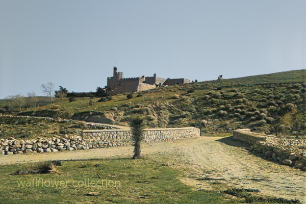
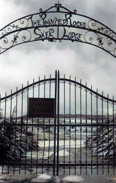
Richard Peter Shea built Shea’s Castle in 1924, also known as Sky Castle or Castle Ranch.

1929’s stock market crash bankrupted Shea. Shea’s wife died, the bank took over the castle, and Shea committed suicide.

Over the years, the property has changed hands and been used as a filming location.

Trigger, Roy Rogers’ horse, was trained on the property.

It is now a private residence.

The massive granite structure, built by R. P. Shea, was sold to three Beverly Hills women in 1935. The “castle” boasts many unique design elements that remain untouched after the purchase.
This photograph appears with the article, “Shea Desert Castle Sold,” Los Angeles Times, 25 Mar 1935: 19.CAPTIONText from negative sleeve: Shae’s [sic] Castle nitrates

Handwritten on negative: Shae’s [sic] Castle 3-16-35
Text from newspaper caption: “Dream Home” in Mojave Desert Passes Into New Hands; A massive granite structure in the Mojave Desert, built ten years ago as a “dream home” of R. P. Shea, yesterday, passed into the hands of new owners. So incongruous is its setting that many believe they are beholding a mirage when they see the $175,000 castle.

The Man who was Hanged Twice

by Myrtle Nyles – November 1964 – Desert Magazine

Skidoo came to life because of fog. When Harry Ramsey and a man called One-eye Thompson lost their way on a road leading to the new boom camp of Harrisburg, they stopped to rest near a log lying against an outcropping of rock. When the fog lifted, the rock turned out to be gold. This was back in 1905. In deciding upon a name for the town that sprung up, a numerologist associated a popular expression of the day, 23-Skidoo, with the fact that a Rhyolite man named Bob Montgomery had successfully piped water from Telescope Peak 23 miles away and suggested the name Skidoo. So it became.

Downtown Skidoo. Death Valley National Park

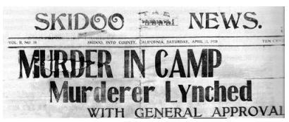
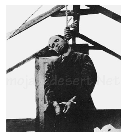
Old-timers say the camp produced over a million dollars worth of gold ore between its discovery and its demise some 20 years later. Skidoo’s chief claim to fame, however, was not its riches. Rather, it was an infamous lynching of a scoundrel named Joe Simpson in 1908.

On a tour to the ghost town of Skidoo in 1962, we were privileged to be accompanied by an 87-year-old gentleman named George Cook. The interesting thing about Mr. Cook was that it was he who pulled on the rope at the lynching. His participation had only recently been divulged to a few intimate friends—after all others involved had passed on to their rewards, or whatever.

Joe "Hooch" Simpson
Joe “Hooch” Simpson

“Joe Simpson,” Mr. Cook told us, ‘was a would-be villain who had killed a man at Keeler after shooting-up Jack Gun’s Saloon in Independence the preceding year. He’d somehow gotten off and drifted to Skidoo where he became a partner with Fred Oakes in the Gold Seal Saloon. Across the street was Jim Arnold’s Skidoo Trading Company.

“Arnold was a friendly, well-liked man and had always been on good terms with Simpson, but Simpson became drunk and abusive one April morning and decided to hold up a bank situated in part of Arnold’s Skidoo Trading Company. Apprehended, his gun was taken away and hidden by the deputy sheriff, but a little later Simpson found his weapon and returned to the store to shoot Jim Arnold. He then turned on two other men who had come to the rescue, but his aim was poor and both escaped. Eventually, Simpson was overpowered and placed under guard in the deputy sheriff’s cabin. Unfortunately,” Mr. Cook lamented, “the popular Jim Arnold died that night.”

Skidoo went wild with indignation. After Arnold’s funeral, which the entire camp attended, a group went to the improvised jail, led the prisoner out at the end of a rope, and hanged him to the nearest telephone pole. When Sheriff Nailor from Independence arrived, after a hazardous trip over rough roads via Tonopah and Rhyolite, he made the now famous statement, “It’s the best thing that ever happened to Inyo County; it saved us $25,000!”

But this wasn’t the end. Several spectators had forgotten their cameras and wanted pictures of the hanging. So, Joe Simpson’s body was obligingly strung up again, this time from the ridgepole of the tent where he was “laid out.” News of this gruesome encore spread and the lynching won everlasting fame. In his private narrative of the event, George Cook added a factor never before related: “Joe was dead before we got the rope around his neck; he died of a heart attack (from fright) and was already gone when dragged to the telephone pole scaffold.”

It was also he, George Cook confessed, who assisted Dr. MacDonald in removing the head from Simpson’s corpse. The doctor, it seems, had once performed an operation on Simpson s nose and wanted to make a further medical study of the case. Going at night, they performed the severance at the lonely prospect hole where Simpson’s body had been tossed. (No one in Skidoo would give him a decent burial, so great was the indignation at his senseless crime). The skull was exhibited for a period in a showcase at Wildrose, but later disappeared.

The remainder of the skeleton resisted oblivion, however. Years later when George Cook returned to Skidoo to work in the mill, an agitated prospector appeared one day to report a headless skeleton of a man who’d evidently been murdered. Because Cook was the only old-timer around at the time, he was consulted. Indeed a crime had been committed sometime, he agreed, but of the details, he had conveniently forgotten.

Last year George Cook passed away. Small in stature, religious, mild-tempered, and given to writing sentimental verse, he was the antithesis of our Western idea of a vigilante. The role forced upon him by his acute anger over the murder of a friend bothered this good man to the end of his days. His belief that Simpson did not expire at his hand appeared to be a real comfort. And, perhaps he was right. We cannot disagree, for George Cook was there.

Much interesting history is connected with the now-defunct Skidoo. Following its early boom, the town was deserted for a period, then, under new management, the mine and mill reopened during the 1930s and a period of production occurred. The old wild days never returned, however, and its fame as a mining camp still rests upon the lynching incident —to which we add, “Joe Simpson did not die because of a rope and a telephone pole. He died of a heart attack!”

by Myrtle Nyles – November 1964 – Desert Magazine

Editor’s Note: This is but one version of this story, and it is worth saying that it has generated many other versions and stories through its telling.

History of Skidoo

In January 1906 two wandering prospectors, John Ramsey and John (One-Eye) Thompson were headed towards the new gold strike at Harrisburg. Along the way a blinding fog came in and the two camped near Emigrant Spring for fear of getting lost. … More

A History of American Indians in California:1880-1904


In the 1880s, there was increased public awareness of the problems California Indians were confronting. While the problems were rarely analyzed, many people helped to improve the quality of life for Indians. There was an effort to improve the education of Indians through schools, and to provide them with land to better their economic conditions so that Indians could become full citizens of the United States of America.

In the early 1880s, Helen Hunt Jackson wrote A Century of Dishonor and sent a copy of her book to each United States congressman. She was then appointed to a commission to examine the condition of Indians in Southern California. Her visits resulted in The Report on the Condition and Needs of the Mission Indians of California, by special agents Helen Jackson and Abbot Kinney. The report summarized the problems and concerns of Southern California Indians; many of the conditions outlined in the report, however, were applicable to all California Indians. The report noted that Indians had been continually displaced from their land. She also noted that while many Indians had taken “immoral” paths, others had chosen the responsibilities of herding animals and raising crops. In her report, she also noted that the United States government had done little to right the wrongs of the past. While Jackson did not solve all the problems of Southern California Indians, her work did bring their concerns to the attention of the American public and Congress.

One recurring concern was the lack of education and training necessary for survival in American society. The government, as well as Jackson, saw education as a way of assimilating Indians into the mainstream of United States society. Reports from the Secretary of the Interior and the Bureau of Indian Affairs at that time expressed the goals of the government in relation to the educational process. In 1908, one report stated, “the rooms held three or four each and it was arranged that no two tribes were placed in the same room. This not only helped in the acquirement of English, but broke up tribal and race clannishness, a most important victory in getting Indians toward real citizens.” (Spicer, 1969:235) An earlier report stated, “I can see no reason why a strong government like ours should not govern and control them [Indians] and compel each one to settle down and stay in one place, his own homestead, wear the white man’s clothing, labor for his own support, and send his children to school.” (Spicer, 1969:236) Other people had even stronger ideas. For instance, George Ellis, in his book, The Red Man and the White Man in North America, wrote, “The Indian must be made to feel he is in the grasp of a superior.” (Ellis 1882:572) In opposition to this view, the Indian Rights Association was formed in 1882. This Indian advocate group would play a powerful role in formulating Indian policy in upcoming years.

While the approaches differed, all agreed that education was necessary. “In California, three types of educational programs were established for native peoples. The first was the Federal Government reservation day school. The second type was the boarding school, fashioned after Carlisle. And finally, the nearby public school that allowed Indians to attend began a slow, though steady, increase in popularity among policy makers.” (Heizer, 1978:115) While the public schools seemed the best alternative, most Indians did not have the right to attend these schools until the 1920s.

In 1881, an elementary school system for Indians was established in California. However, the Indians soon recognized that the schools were a threat to their culture, as well as to the tribe as a political unit. “As a result, considerable resistance to the schools developed. Native peoples destroyed the day school at Potrero in 1888, and burned the school at Tule River in 1890. At Pachanga, a Luiseno named Venturo Molido, burned the school and assassinated the school teacher in 1895.” (Heizer, 1978:115) Much of the destruction and violence could have been avoided if the school system and the government had recognized the great importance the Indians placed on being able to maintain their cultural beliefs. In 1891, school attendance was made mandatory. But while attendance was mandatory, there were still Indian children who did not attend.

In 1901, the first Indian hospital in California was established at Sherman Institute in Riverside. Sherman later became a boarding school for Indian children. While hospitals and other facilities improved conditions for California Indians, most Indians were still without homes.

During this period, another major focus was on the acquisition of land for Indians. Probably the most interesting example of the way land was acquired is evidenced by the Yokayo Pomo in 1881: “After collecting nearly $1,000 from their people, the head man selected a 120-acre site near the Russian River and made the down payment. The Yokayo groups prospered; they paid the entire balance owed on their land, and even saved enough to purchase farm machinery shortly thereafter.” (Heizer, 1978:118)

A major tool the government used in trying to assimilate Indians during this time was the General Allotment Act of 1887, also known as the Dawes Act, which appeared to be generally advantageous to Indians. However, the major intent of the act was to break down the role of tribal government. The act itself provided that each Indian living on a reservation would receive a 160-acre allotment of land per family unit, and each single man would receive 80 acres if the reservation had enough land. If there was not enough land, other provisions were made. Indians not residing on a reservation would be entitled to settle on any surveyed or unsurveyed government lands not appropriated. The lands allotted would be held in trust for 25 years by the Bureau of Indian Affairs. If all other provisions of the act were met, that is, if the Indians made use of the lands for agriculture and became self-sufficient, then the land would become the property of the individual. “Native people understood full well the implications of allotment and offered considerable resistance. Nevertheless, the Bureau of Indian Affairs began ordering allotments of various sizes at Rincon, Morongo, and Pala Reservations in 1893. . . . The next year, allotments were begun at Round Valley Reservation. By the turn of the century, 1,614 individual allotments were made among eight reservations in the state.” (Heizer, 1978:117)

Long before the passage of the Dawes Act, people recognized that problems would occur from its implementation. In 1881, Senator Henry Moore Teller of Colorado spoke in opposition to an earlier form of the Allotment Act. Senator Teller concluded, “If I stand alone in the Senate, I want to put upon the record my prophecy in this matter, that when 30 or 40 years shall have passed and these Indians shall have parted with their title, they will curse the hand that was raised professedly in their defense to secure this kind of legislation, and if the people who are clamoring for it understood Indian character and Indian laws, and Indian morals, and Indian religion, they would not be here clamoring for this at all.” (Spicer, 1969:234) The senator would soon be proven correct.

Other Indians, such as the Cupenos from Warner Springs, chose to fight for their lands in the courts. With the assistance of the Indian Rights Association, they began a suit to stop their eviction from their home at the Warner Ranch. In 1888, they won a favorable decision which temporarily stopped their eviction. However, the case was appealed to the United States Supreme Court, and in 1903, the Cupenos were evicted from their home.

Still, other Indians chose to purchase land that was once theirs and reside on it. However, not every transaction was fair. In 1904, the San Francisco Chronicle reported that Indians who bought land from Whites were being dispossessed by the heirs of the granters, who gave no valid titles. “The Northern California Indian Association reported that about 10,000 Indians lived on land to which whites hold title. They were subject to eviction ‘at any time.’ The Indians are recognized for what they are not, usually competent to compete with white men in economic struggle. . . . Congress should buy lands for Indians in locations where they now are and allot them small farms in severalty. . . . It is also asked that their status as to citizenship be satisfactorily established. This petition is now before congress. It should be granted for justice and honesty. . . .” (San Francisco Chronicle, 1904).

The struggle for homes would continue.

https://www.nps.gov/parkhistory/online_books/5views/5views1d.htm

Malki Museum

A History of American Indians in California:HISTORIC SITES


Malki Museum
Riverside County

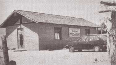
The Malki Museum is located on the Morongo Indian Reservation on Fields Road near the town of Banning, California. It is constructed of adobe bricks, and is approximately 30′ x 50′ x 12′ in size. Display cases house cultural objects made by Indians from the surrounding area, while the museum grounds include several brush arbors and a botanical garden. Both the museum and its grounds are well attended.

The Malki Museum was constructed in 1965 by the Cahuilla Indians and serves to preserve and enhance Cahuilla Indian lifeways. Its cultural exhibits relate the story of the Cahuillas from the pre-contact period to the present. Malki was also the first home for a publishing company, the Ballena Press, which has expanded its services to include ethnographic and ethnohistoric information and analysis of southwestern tribes.

The Malki Museum was the first Indian controlled and operated museum in California. As such, it is an important example to other Indian groups who are interested in preserving their material culture through a museum. Although the idea of an Indian Museum operated by Indian people seems like an obvious and natural development, it should be remembered that it takes dedicated people to actually accomplish such a task. Malki is a living example of an Indian people’s ability to adapt to the fast-changing circumstances that surround their cultural heritage. It will serve future generations by providing them with a glimpse into the rich and beautiful history of the Cahuilla people.

https://www.nps.gov/parkhistory/online_books/5views/5views1h46.htm

Tejon Indian Reservation

A History of American Indians in California: HISTORIC SITES


Tejon Indian Reservation
Kern County

In the early 1800s, Indians in the interior of California began to feel the effects of trappers and explorers. By mid-century, coastal Indians who moved inland following the breakup of the missions also suffered under the influx of miners and settlers. When the federal government sent Indian agents to write treaties with California Indians, Agent George W. Barbour negotiated the treaties with both interior and coastal Indians in the southern San Joaquin Valley. In return for the promise of goods, annuities, and land, the Indians vacated much of their home land.

In February of 1852, President Millard Fillmore submitted 18 California Indian treaties to the United States Congress for ratification, but the California delegation objected, complaining that the treaties provided too much good land for the Indians. Congress failed to ratify the treaties but did make some provisions for California Indians.

Edward F. Beale was appointed Superintendent of Indian Affairs for California in April 1852. Upon arrival in September, Beale toured the state to determine the status of California Indians. He reported in February 1853 that “our laws and policy with respect to Indians have been neglected or violated. . . . [The Indians] are driven from their homes and deprived of their hunting-grounds and fishing-waters at the discretion of the whites. . . .” Beale requested $500,000 for military reservations where both soldiers and Indians would reside.

Beale hired H. B. Edwards to start farming operations at Tejon and the San Joaquin River. On March 2, 1853, Congress appropriated $250,000 for five reservations, not to exceed 25,000 acres each, to be located on public lands, with good land, wood, and water. In September, Beale expanded the Tejon Farm into the first California reservation.

To gain support for his efforts, Beale named the reservation after Senator William Sebastian, Chairman of the Indian Affairs Committee. The Sebastian Indian Reservation, more commonly known as Tejon Indian Reservation, was located in the southern end of the San Joaquin Valley, “between Tejon Vaquero Headquarters and Canada de las Uvas. . . .” (Latta, 1977:736)

Tejon was located on a Mexican land grant rather than on public land, but Beale argued that no public lands were available and that the unoccupied grant could be purchased if necessary. Beale’s primary reason for choosing Tejon was the presence of mission-trained Indians with agricultural skills, more likely to succeed on a reservation.

Despite substantial opposition, Beale continued to gather Indians and move them to Tejon. In early 1854, he reported 2,500 Indians at Tejon and 2,650 acres under cultivation. Beale’s arguments for a reservation of 75,000 acres failed, and in July 1854, he was replaced by Thomas J. Henley.

When Henley took charge, he noted only 800 Indians, with fewer than 350 present at one time, and only 1,500 acres under cultivation, indicating that numbers of Indians and amount of acreage under cultivation had been inflated. Most of the crops failed that year because of drought. Henley started the Tule River Farm to supplement the reservation’s food, but the Indians still had to gather native foods and the government had to bring in more supplies in order to feed the reservation population. Throughout the reservation’s existence, drought, insects, and crop disease undermined the attempts at farming.

In November of 1856, the reservation was reduced to 25,000 acres. That year, 700 Indians were reported residing on the reservation and 700 acres were under cultivation. By 1859, Henley had been replaced.

In addition to crop failure, the reservation faced loss of the land when the land grant claim was upheld in court. Settlers also encroached on the unsurveyed and unfenced land, allowing cattle and sheep to eat reservation crops. During the 1863 drought year, all the crops were lost except for 30 tons of hay.

Meanwhile, former agent Edward F. Beale had purchased five contiguous ranchos in the Tejon area, including the reservation land, and was raising 100,000 sheep. In 1863, he offered to lease 12,000 acres to the government for a dollar an acre, but withdrew the offer when he found that the government planned to move Owens River Indians there. He noted that he had made the offer only because Indians already on the reservation were his friends.

Jose Pacheco, a Tejon leader, wrote to General Wright on April 16, 1864, “I should not have troubled you with this letter, Dear General, did I not think the agents here had wronged us. You and our great father at Washington do not know how bad we fare, or you would give us food or let us go back to our lands where we can get plenty of fish and game. I do not think we get the provisions intended for us by our Great Father; the agents keep it from us, and sell it to make themselves rich, while we and our children are very poor and hungry and naked.” (Sacramento Union, April 28, 1964)

The reservation was ordered closed in June 1864, and on July 11, Austin Wiley wrote, “I have the honor to inform you that all the Indians on the Tejon Farm and in the vicinity of Fort Tejon, some two hundred in number, have been removed from there to the Tule River farm.” Wiley noted that there was no food for the Indians at Tejon.

Shortly thereafter, D. N. Cooley, Commissioner of Indian Affairs, summarized the reasons for the reservation’s failure: “The lack of legal title to the land severely restrained investment in construction and development, leaving the reserve and the Indians on it in a state of constant uncertainty. The ideal of converting Indians from food gathering to settled agriculture was never realized.”

(Note: Unless otherwise specified, all above quotes are from government reports as cited in California Department of Parks and Recreation reference document No. 169, “Tejon Indian Reservation.”)

https://www.nps.gov/parkhistory/online_books/5views/5views1h92.htm
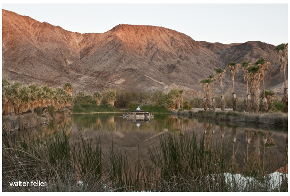
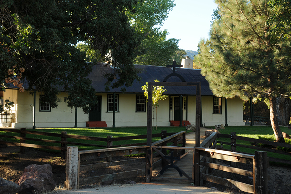
Desert Studies Center – Zzyzx

/zzyzx/

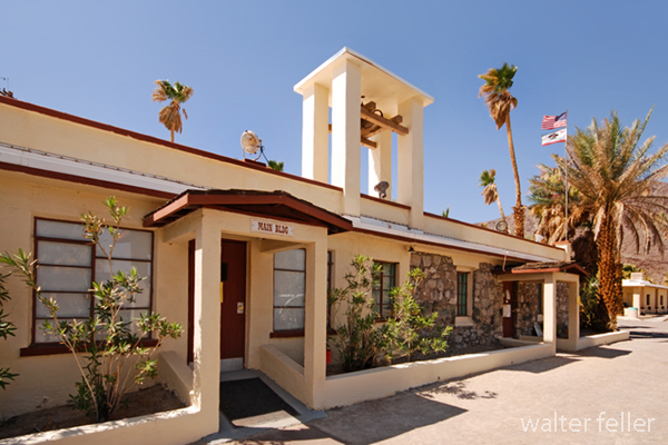
Main Building – Desert Studies Center

Zzyzx, pronounced “zy-zicks,” is a unique and intriguing place in the Mojave Desert of Southern California, USA. Specifically, it is home to the Desert Studies Center, operated by the California State University (CSU) system. The center serves as a field station for research and education focused on the desert ecosystem.

Here are some key points about Zzyzx and the Desert Studies Center:

  1. Location: Zzyzx is approximately 100 miles northeast of Los Angeles, near Baker, California. The Desert Studies Center is part of the larger California State University system and is used for academic and research purposes.
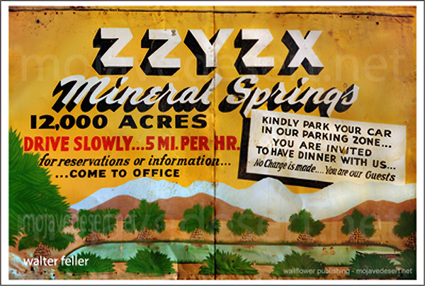
  2. History: The name “Zzyzx” was given to the area by Curtis Howe Springer, a self-proclaimed medical doctor and radio evangelist who established the Zzyzx Mineral Springs and Health Spa in the 1940s. The name was created to be the last word in English, and Springer intended to use it for marketing purposes. However, in 1974, the Bureau of Land Management (BLM) reclaimed the land, and it became the site for the Desert Studies Center.
  3. Desert Studies Center: The Desert Studies Center is a research and educational facility jointly operated by the California State University system. It provides a base for researchers, students, and educators interested in studying the unique ecology and geology of the Mojave Desert. The center offers facilities for field courses, workshops, and research projects related to desert studies.
  4. Facilities: The Desert Studies Center has dormitories, classrooms, laboratories, and other amenities to support researchers and students. It serves as a hub for scientific exploration and learning about the challenges and adaptations of life in desert environments.
  5. Research: Researchers at the Desert Studies Center focus on various topics, including desert ecology, geology, climate, and biodiversity. The unique characteristics of the Mojave Desert make it an ideal location for studying desert ecosystems and understanding how plants, animals, and microorganisms have adapted to this arid environment.

Visitors to the Desert Studies Center can explore the surrounding Mojave Desert, learn about its flora and fauna, and gain insights into the challenges and opportunities presented by desert ecosystems. It’s a valuable resource for those interested in environmental science, ecology, and desert studies.

Lake Tuendae

Tejon Ranch

/beale-adobe/

The Tejon Ranch, located in California, has a rich and varied history that spans centuries.

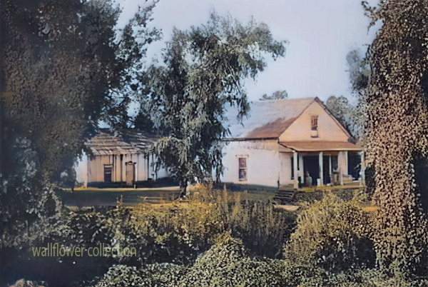
Tejon Ranch Headquarters

Here is an overview of its history:

  1. Native American Presence: The area around Tejon Ranch was originally inhabited by Native American communities, including the Kitanemuk people. These indigenous groups had a deep connection with the land, relying on its resources for their sustenance.
  2. Spanish Era: With the arrival of Spanish explorers and missionaries in the 18th century, the Tejon Ranch area became part of the vast landholdings of the Spanish missions and the California missions system. The land was used for cattle ranching and agriculture to support the missions.
  3. Mexican Land Grants: Following Mexico’s independence from Spain in 1821, the Mexican government began granting large tracts of land, including the Tejon Ranch, to private individuals. The Rancho El Tejon was granted to José Antonio Aguirre in 1843.
  4. Gold Rush and Transition: The California Gold Rush of 1848-1855 brought significant changes to the region. The influx of people seeking gold and the economic and political shifts associated with the U.S.-Mexican War led to the end of Mexican land grants. 1852, the U.S. government affirmed the land grant, and Benjamin and James Roberts acquired the Rancho El Tejon.
  5. Ranching and Agriculture: The Tejon Ranch became a center for ranching and agriculture. Cattle ranching, farming, and other activities flourished on the vast expanse of land. The ranch was crucial in supplying beef and other products to growing communities in Southern California.
  6. Treaty of Fort Tejon: In 1854, the U.S. government negotiated the Treaty of Fort Tejon with various Native American tribes, including the Kitanemuk. However, the treaty was not fully implemented, leading to conflicts and struggles for the indigenous people.
  7. Railroad Development: The Southern Pacific Railroad played a significant role in developing the Tejon Ranch. In the late 19th century, the railroad bypassed the Tehachapi Mountains, where the ranch is located, favoring a route through the nearby Tehachapi Pass. This decision affected the economic growth of the Tejon Ranch region.
  8. 20th Century and Beyond: The Tejon Ranch underwent various ownership and land use changes. In the 20th century, it evolved into a diversified operation involving agriculture, ranching, and commercial activities. The Tejon Ranch Company, established in the early 1900s, was key in managing and developing the property.

Today, the Tejon Ranch remains one of the largest privately-owned ranches in California, known for its conservation efforts, including partnerships with environmental organizations to preserve significant portions of the land as open space. The ranch’s history reflects the broader historical and cultural shifts in California, from indigenous habitation to Spanish colonization, Mexican land grants, and the economic transformations of the 19th and 20th centuries.

E.F. Beale and the Tejon Ranch

Edward Fitzgerald Beale, often referred to as E.F. Beale, played a significant role in the history of the Tejon Ranch.

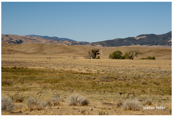
Tejon Ranch – La Liebre Rancho

Here’s an overview of his connection to the ranch:

  1. Military Career: E.F. Beale was born in 1822 and had a distinguished military career. He served as a lieutenant in the U.S. Navy and later became Superintendent of Indian Affairs in California and Nevada.
  2. Surveyor and Explorer: In the 1850s, Beale was appointed by the U.S. government to survey and explore a wagon road along the 35th parallel from Fort Defiance in Arizona to the Colorado River. This expedition, known as the Beale Wagon Road, aimed to improve transportation and communication between the East and the newly acquired territories in the West.
  3. Tejon Ranch and the Wagon Road: The Beale Wagon Road passed through the Tejon Ranch, linking Fort Tejon to the Colorado River. Beale recognized the strategic importance of the Tejon Pass for transportation routes and recommended it as a route for the railroad.
  4. Land Acquisition: In 1861, Beale purchased the Rancho El Tejon, which included the Tejon Ranch. He acquired the property from the prominent rancher General Edward Beale Tracy. E.F. Beale engaged in various agricultural and ranching activities on the land.
  5. Conservation and Agriculture: Beale was not only interested in ranching but also in conservation. He introduced various agricultural improvements to the ranch, including cultivating wheat and vineyards. Beale also advocated for land conservation and recognized the need to protect natural resources.
  6. Tejon Ranch Company: In the early 20th century, the Tejon Ranch changed ownership and management. The Tejon Ranch Company was established in 1936, and E.F. Beale’s descendants were involved in the company’s operations.
  7. Legacy: E.F. Beale’s legacy is intertwined with the history of the Tejon Ranch. His contributions to the development of transportation routes, his role in the acquisition of the ranch, and his efforts in both ranching and conservation have left a lasting impact on the region.
Tejon Ranch winter quarters

Today, the Tejon Ranch remains a significant property in California, known for its historical, cultural, and environmental importance. The Tejon Ranch Company continues to manage the property, balancing agricultural activities with conservation initiatives and partnerships to preserve large portions of the land as open space.

Saline Valley Salt Tram

/saline-valley/salt-tram/

Photo of tramway tower in Saline Valley

The Saline Valley Salt Tram, also known as the Saline Valley Tramway, is a historic tramway system used to transport salt from the Saline Valley in California, USA. The Saline Valley is located within the Death Valley National Park.

The tramway was constructed in the early 20th century to facilitate the transportation of salt from the salt flats in the Saline Valley to the Owens Valley. The system consisted of cables and tramcars that carried salt over the Inyo Mountains. The salt was then transported to market via the Owens Valley.

The operation of the Saline Valley Salt Tram ceased in the mid-20th century, and the tramway itself has since fallen into disuse and disrepair. The remnants of the tramway, including some of the infrastructure and cables, can still be found in the Saline Valley. The area attracts historians, hikers, and those interested in exploring the remnants of historical infrastructure.