Willie Boy & Carlota

A Braided Tale

The story of Willie Boy is one of the most haunting and complex episodes in the history of the California desert. It begins in the early autumn of 1909, when a young Chemehuevi-Paiute man named Willie Boy falls deeply in love with Carlota, the daughter of a respected tribal elder. Their romance, set in the desert landscapes around Banning and Twentynine Palms, was as ill-fated as any tragic ballad of the Old West, and it ended in bloodshed, loss, and a manhunt that became part of American legend.

Willie Boy was about twenty-eight years old, a Chemehuevi from the Southern Paiute people, raised near the Colorado River but often working for white ranchers in the San Gorgonio Pass area. He was a quiet man, by most accounts, known for his skill as a runner and his ability as a capable worker. Carlota was sixteen, the daughter of William and Maria Mike, who lived with their people at the Oasis of Mara, now part of Joshua Tree National Park. Their families knew each other, but Chemehuevi tradition forbade marriage between cousins, which made the match impossible in the eyes of her father.

When Willie Boy and Carlota ran off together, they defied both cultural law and parental authority. They were brought back once, but they met again later that year when the Mike family traveled to Banning for the fall fruit harvest. The reunion of the two lovers set the final tragedy in motion. One evening in late September 1909, Willie Boy went to the Mike family’s camp near the Gilman Ranch to ask for Carlota’s hand. Her father, a strong-willed and traditional man, refused him flatly. Some say the older man reached for a gun, others that Willie Boy had brought one and lost his nerve. There was a struggle, a shot, and when the dust settled, William Mike lay dead. Whether the shooting was deliberate or accidental has never been settled.

Knowing that the white authorities would come for him, Willie Boy fled into the desert with Carlota. They rode and walked across the dry country east of Banning, following faint trails and water holes that only local people knew. When Maria Mike discovered her husband’s body at dawn, she reported the killing to the sheriff. Within hours, a posse had formed, led by Riverside County Sheriff Frank Wilson and his deputy Ben de Crevecoeur. With them were a handful of local ranchers and two Native trackers, John Hyde and Segundo Chino.

The chase that followed quickly became a national story. Newspapers painted Willie Boy as a savage outlaw, “a drunken Piute renegade” who had killed in a jealous rage and carried off a helpless girl. The language was raw, racist, and designed to sell papers. Reporters wrote that the “bloodthirsty Indian” might even threaten President Taft, who happened to be visiting Riverside that week. This hysteria turned a local tragedy into a full-blown legend.

Meanwhile, Willie Boy and Carlota pressed deeper into the Mojave. They moved mostly at night, hiding by day in the arroyos and canyons. Willie Boy’s endurance was remarkable; he could travel fifty miles across rough ground in a day. But they were running low on food and water, and the posse was relentless.

At some point during the pursuit, Carlota was killed. Her body was found later, shot through the back. Early newspaper reports said Willie Boy had murdered her so she would not slow him down. That version fit the outlaw story perfectly, but later investigations suggest otherwise. The coroner’s report showed she was shot from long range, likely by a posse member who mistook her for Willie Boy. She was wearing his coat at the time. Decades later, oral histories from the Chemehuevi confirmed that this is what their elders always believed: that the white men killed Carlota by mistake, then blamed her lover to save face.

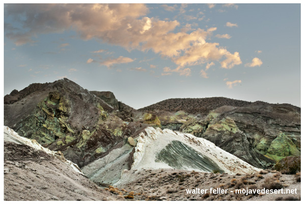
After Carlota’s death, the posse pressed on. The final confrontation came at Ruby Mountain, near what is now Landers. Willie Boy took a defensive position among the rocks. As the posse approached, he opened fire, deliberately aiming for their horses rather than their riders. One deputy, Charlie Reche, was wounded in the arm. The standoff lasted all day until the lawmen pulled back to tend to the injured. At sunset, they heard a single gunshot from the mountain. They assumed Willie Boy had turned the gun on himself. When they returned a few days later, they found a badly decomposed body lying near a rifle and declared the manhunt over. They burned the remains on the spot rather than carrying them out of the desert.

That cremation left no evidence. No one could later prove that the body was Willie Boy’s, and none of the posse’s surviving photographs show a face that can be identified. This gap opened the door to one of the enduring mysteries of the story. Among the Chemehuevi, Paiute, and Cahuilla people, the belief persisted that Willie Boy escaped. They said he traveled north through the desert and eventually settled with relatives near Pahrump, Nevada, living quietly until tuberculosis took him years later. Segundo Chino, one of the trackers on the posse who later married Maria Mike, is said to have admitted that the posse never actually caught Willie Boy.

The events deeply shook the Chemehuevi community. They left their traditional home at the Oasis of Mara, afraid that William Mike’s restless spirit might bring misfortune. For many years, they refused to speak of the tragedy. In that silence, white writers filled the void. The newspapers portrayed Willie Boy as a villain and the manhunt as a piece of frontier nostalgia.

Half a century later, journalist Harry Lawton rediscovered the tale. Working from old newspaper clippings and interviews with surviving posse members, he published Willie Boy: A Desert Manhunt in 1960. His book treated the story as both history and myth, but it still leaned toward the posse’s version. The novel won awards and inspired the 1969 film Tell Them Willie Boy Is Here, directed by Abraham Polonsky and starring Robert Blake and Robert Redford. The film gave the story a tragic, modern edge and questioned some of the old assumptions, but it also cemented certain inaccuracies in popular memory.

In the 1990s, historians James Sandos and Larry Burgess revisited the story in The Hunt for Willie Boy: Indian-Hating and Popular Culture. They demonstrated how racism and sensationalism influenced the original reports and concluded that many of the most colorful details were fabricated. They agreed that Carlota was almost certainly killed by the posse, not by Willie Boy, but they accepted that he probably died on Ruby Mountain.

A generation later, Native historian Clifford Trafzer went further. Drawing on oral histories from Chemehuevi and Cahuilla elders, he argued that the man the posse burned was not Willie Boy at all. In the stories told by his people, Willie Boy survived the chase, lived for years among the Paiute in Nevada, and died quietly of illness. Trafzer’s work reframed the legend as a Native tragedy rather than a Western adventure.

For the Chemehuevi and other desert people, the story of Willie Boy and Carlota is more than a love story gone wrong. It represents the collision of two worlds: traditional tribal law and the laws of the new American order. It marks the loss of a way of life and the pain of a community forced into silence.

Today, the tale continues to echo across the desert. Artists and filmmakers have attempted to retell the story from the Native perspective. In 2016, Cahuilla artist Lewis de Soto created an installation in Twentynine Palms called Carlota, giving voice to the young woman whose story had long been overshadowed. In 2022, Jason Momoa produced The Last Manhunt, a film made in collaboration with the Chemehuevi that depicts the event as the tribe remembers it.

Whether Willie Boy died on Ruby Mountain or escaped into the Nevada desert may never be known. What is certain is that his story reveals how quickly truth can be twisted by fear and prejudice, and how long it can take for those who were silenced to be heard again.

The Willie Boy saga began as a local tragedy, became a legend through the press, and has endured as a window into the uneasy meeting of cultures in the desert. It reminds us that history is not fixed in stone, but lives in the voices of those who tell it, and that sometimes the best we can do is listen to all of them.

Landers, CA

Oasis of Mara

Twentynine Palms, CA

Cahuilla

Chemehuevi

Willie Boy

Other Roads

Mormon Hogback, Sanford Pass

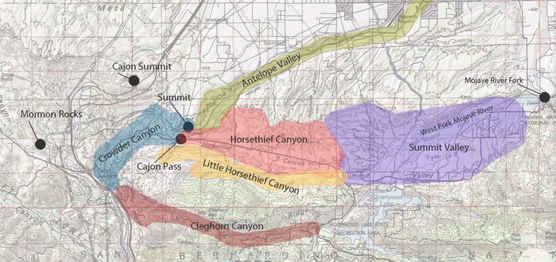
In the early 1850s, long wagon trains of Mormon pioneers crept down from the high desert into the mouth of Cajon Pass, hoping to reach the fertile San Bernardino Valley beyond. They soon found themselves at a natural choke point – a narrow ravine called Coyote Canyon, now known as Crowder Canyon – where sheer rock walls and a jumbled creek bed made passage nearly impossible. The first wagons through had to be disassembled: wheels removed and rolled by hand, cargo shifted onto a mule’s back, and wagon beds dragged piece by piece over the worst boulders. Early travelers remembered this grueling process, and the Mormon settlers who followed in 1851 likely endured the same ordeal to get their covered wagons through the upper Cajon Pass.

But adversity often sparks ingenuity. Not long after, some enterprising pioneers scouted a detour a few miles to the west of the treacherous canyon. There, a high spine of land offered a way around the worst narrows. This route ran along a slender ridge – a true hogback that rose above the canyon – and though it added a few extra miles, it spared travelers from having to lug their wagons through Coyote Canyon’s rock-strewn gauntlet. The Mormon colonists heading to Southern California in those years eagerly embraced this alternate path. In fact, by the early 1850s, they had established a wagon trail atop that ridge, which would later be known as the Mormon Hogback in honor of the many Latter-day Saint families who had blazed it.

In 1850, a veteran freighter named William T. B. Sanford took it upon himself to hack a rough wagon road along this western Cajon route. Sanford’s road departed the old Spanish Trail near present-day Victorville, climbed onto the flanks of Baldy Mesa, and then edged down through the West Cajon Valley, eventually descending toward a cluster of towering sandstone outcrops. Those pale rocks marked a kind of gateway at the foot of the hogback trail. They would later be known as the Mormon Rocks – named for the Mormon pioneers who camped beneath them after braving the ridge and finally emerging into the open Cajon wash.

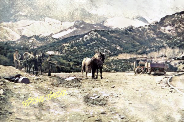
Traveling the Mormon Hogback was still a heart-pounding adventure. The ridge was narrow and the drop-offs unforgiving; in places, the trail was scarcely wider than a wagon itself. The ascent to the summit was so steep that teams often had to “double up,” hitching multiple teams of oxen or mules to a single wagon. One contemporary account describes wagons needing as many as 32 mules in harness to tug a heavy load up the incline. On the way back down, drivers would lock their wagon wheels and skid the first several yards, the wooden rims dragging like sleds to slow the descent. The air filled with the shouts of teamsters and the groan of brake chains as each wagon inched along the hogback’s crest. It was perilous, yes, but for a time, this high road was the only practical way for settlers and supply wagons to get through Cajon Pass intact.

Despite these dangers, the ridge route quickly became the preferred wagon road. Sanford and others made further upgrades over the years. In 1855, workers even cut into the mountainside to create a new alignment about a mile and a half west of the original track. This was known as the Sanford Cutoff, which bypassed the most challenging section of the hogback. The grades were gentler than before, though still outrageously steep – some stretches tilted at a 30% incline, straining both beast and brake. Nevertheless, from the mid-1850s up until 1861, virtually every wagon train bound to or from Southern California chose to tackle the Mormon Hogback via Sanford’s route rather than risk the old rocky canyon. For the Mormon settlers in particular, this ridge road was a vital lifeline, allowing them to bring wagons loaded with families, lumber, and provisions into their new settlements without having to unload and reassemble everything at Cajon Pass.

The reign of the Mormon Hogback came to an end in the 1860s. In 1861, a local pioneer named John Brown Sr. partnered with two associates to finally tame the original canyon route itself. Capitalizing on a surge of travelers during a nearby gold rush, Brown’s company widened and improved the old trail through Crowder (Coyote) Canyon, smoothing out the worst boulders and drop-offs. They built a proper wagon road right through Cajon Pass’s eastern narrows and set up toll gates to collect fees from anyone using this new shortcut. Travelers gladly paid a few dollars rather than face the old hogback or haul their wagons apart again. With the opening of John Brown’s toll road – shorter and far less harrowing – the Mormon Hogback’s importance swiftly faded. The new turnpike through the canyon became the main gateway between the desert and the coast. Before long, even stagecoaches and mail wagons were rumbling through Crowder Canyon instead of teetering along the ridge.

Although the wagon ruts along the Mormon Hogback have long since faded into the brush, its legacy remains etched in the landscape and lore of Cajon Pass. The very name “Mormon Rocks” for those sandstone sentinels is a reminder of the emigrants who passed that way in the 1850s. Modern highways and railroads now carry traffic through Cajon Pass, roughly tracing the corridors that pioneers like the Mormons and John Brown once opened up. In fact, the historic Mormon wagon trail itself wound through the same valley of curious rock formations that visitors see today. Next time you drive north from San Bernardino and glimpse the weathered cliffs and crags of Cajon Pass, imagine a line of canvas-topped wagons winding down a dusty mountain ridge. That was the Mormon Hogback – a vital, if temporary, wagon road born of necessity and determination, now a nearly forgotten chapter of the westward migration to Southern California.

Chief Walkara

The Greatest Horse Thief

Walkara – Representational from an original sketch.

Chief Walkara (also spelled Wakara or Walker) was a Ute leader who rose to prominence during the early 1800s in what is now Utah, Nevada, and parts of California. Born around 1808 near the Spanish Fork River, he belonged to the Timpanogos band of the Ute people. He was one of several brothers who became influential chiefs, including Arapeen and Sanpitch. From an early age, Walkara was known for his mastery of horses, his courage in battle, and his sharp understanding of trade and diplomacy. These traits positioned him to take full advantage of the chaotic frontier world between Native peoples, Mexicans, and Americans along the Old Spanish Trail.

Walkara’s early fame came from his raiding and trading operations along the Old Spanish Trail, the overland route linking Santa Fe and Los Angeles. During the 1820s and 1830s, this route passed through Ute country, and Walkara quickly learned that power came from controlling who moved through it. He and his men imposed tolls on Mexican traders, demanding gifts of blankets, powder, or metal goods in exchange for safe passage. These tolls were enforced by threat of force but usually honored by both sides, as the traders knew they could not travel safely without Ute permission. Over time, Walkara’s camp became a trading post in its own right, where goods from New Mexico and California were exchanged for furs, horses, and captives.

His influence grew through large-scale raiding, particularly horse raids on ranches and missions in southern California. Walkara’s bands, sometimes numbering 100 to 200 mounted warriors, crossed the Mojave Desert to raid the ranchos of San Luis Obispo, San Juan Capistrano, and Mission San Gabriel. One raid in 1840 reportedly netted as many as 3,000 horses and mules, all of which were driven back across the desert without a single man being lost. His skill in organizing and leading these raids earned him the nickname “the greatest horse thief in the West.” The horses were driven north and east to Utah, where they were traded to Mexican or American intermediaries for guns, powder, and whiskey. Among those traders were mountain men such as James Beckwourth and Thomas “Pegleg” Smith, who became Walkara’s partners. They supplied him with weapons and other goods and, in turn, took the stolen horses to market in Santa Fe or Oregon, often reaping huge profits.

Walkara’s power extended beyond raiding. He also commanded loyalty and fear among many Great Basin tribes. Some allied with him for protection or shared in his profits; others paid tribute to avoid attack. He often incorporated Paiute, Goshute, and Shoshone warriors into his raiding parties. His leadership and wealth gave him the stature of a regional warlord, and even his enemies respected his authority. By the 1830s, he was widely recognized by traders from both Mexico and the United States as the most powerful Ute chief in the Great Basin.

A darker side of Walkara’s trade network was his involvement in the Native slave trade. The Utes had long been active in capturing people from neighboring tribes, particularly the more vulnerable Paiutes and Goshutes, and selling them to New Mexican traders. Walkara expanded this practice into a large-scale system of slave raiding. His men attacked Paiute and Goshute camps, taking women and children captive to sell or trade. Many of these captives were sold to Hispanic traders from New Mexico, who took them south to be used as domestic servants, laborers, or farmhands. Children were preferred because they were easier to train and control, and young girls were especially valued. Prices were often recorded as approximately $200 for a girl and $150 for a boy. This trade devastated the Paiute and Goshute peoples, forcing them to live in hiding and even to sell their own children in times of famine to avoid starvation. Horses and captives were often traded interchangeably—one could be exchanged for the other—creating a grim but efficient cycle of commerce that enriched Walkara’s band.

Walkara’s involvement in this trade was no secret. Mexican records show that New Mexican traders, including men such as Don Pedro León Luján, met with Walkara and other Ute chiefs to trade for captives in the 1830s and 1840s. Although Mexican law forbade the practice, it was widely tolerated in frontier regions. When American settlers and Mormon pioneers began arriving later, they were shocked by the existence of this trade. However, many of them also purchased captives as servants under the justification of “redeeming” them. Among the Utes themselves, some oral traditions dispute that Walkara directly sold captives, suggesting that later historians exaggerated the practice or misunderstood Ute customs. Even so, contemporary reports from Mexican, American, and Mormon sources confirm that his band played a significant role in supplying the slave markets of New Mexico.

During these same years, Walkara cultivated relationships with both Mexican and American traders. His dealings with Mexican traders were essentially pragmatic—he provided horses and slaves in exchange for guns, ammunition, knives, and whiskey. With American trappers and explorers, his relations were usually friendly and based on mutual trade. The Utes found that trading with Americans brought better goods than the old Spanish system had, and Walkara’s fluency in both Spanish and English helped him act as a go-between. He often guided traders through Ute territory or arranged safe passage for them in exchange for gifts and favors. American mountain men respected him as a man of intelligence and courage. When John C. Fremont’s expeditions passed near Ute lands in the early 1840s, they noted the presence of influential Ute leaders who controlled the trade and movement in central Utah—almost certainly referring to Walkara.

By the time the first Mormon settlers entered the Salt Lake Valley in 1847, Walkara was already a well-known figure across the entire Great Basin. He had grown wealthy in horses, arms, and trade goods, and his name was known as far as Santa Fe and Los Angeles. Initially, he welcomed the Mormon pioneers, hoping they would become valuable trading partners like the trappers before them. He even accepted baptism into the Mormon Church in 1850, though this was likely more a political gesture than a religious conversion. However, as the Mormons expanded their settlements, they began to interfere with the horse and slave trades that had been central to Walkara’s power. These changes, combined with growing tensions over resources, eventually led to the Walker War of 1853–1854. But in his earlier years, long before that conflict, Walkara was already a legend—an adaptable and ambitious leader who built an empire of horses, trade, and influence stretching from the Mojave Desert to the Rocky Mountains.

He died in 1855 near Meadow, Utah, reportedly from pneumonia, and was buried according to Ute custom with his horse and belongings. His life marked the end of an era when Ute power and frontier trade shaped the fate of the Great Basin, before the arrival of settlers and soldiers transformed it forever.

Old Spanish Trail

John C. Fremont

James Beckwourth

Thomas “Pegleg” Smith

As a Play

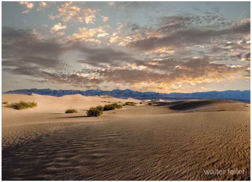
You could think of the Mojave Desert as a grand Broadway production—ancient, dramatic, and full of subtle choreography that has played out for millions of years.

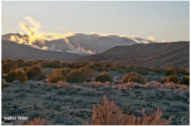
view from walker pass

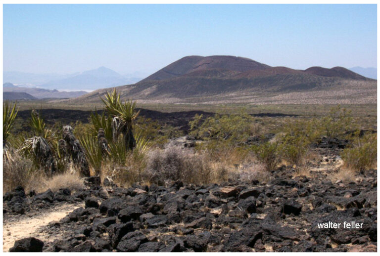
The stage is the geology: immense backdrops of folded mountains, tilted strata, and fault lines painted by time. Volcanic cones serve as spotlight towers, alluvial fans sweep like curtains drawn across the basin floor, and the Mojave River cuts a wandering path like a traveling stagehand moving props between acts.

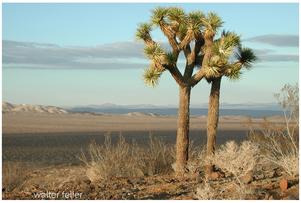
The set is built from plants, rocks, and the occasional weathered structure. Joshua trees rise like eccentric stage pieces, each with its own pose under the lights. Creosote bushes fill in the ensemble—reliable, understated performers who know every cue. Abandoned mining cabins, ghost towns, and derelict rail ties serve as the props and scenery from earlier acts, remnants left between scenes of prosperity and decline.

The lighting crew is the sun, directing each scene with precision—blinding spotlights at noon, warm amber tones at dusk, and moonlit silver rehearsals after dark. The wind adds the soundtrack, whispering through canyons or howling like a restless audience.

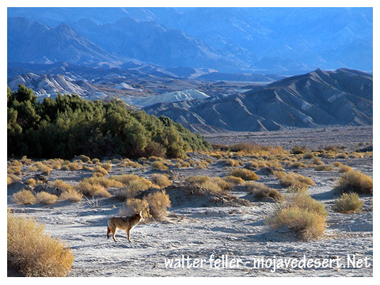
The actors? Coyotes, bighorn sheep, and lizards—all improvising within a script written by climate and time. Even the rain, when it shows up, steals the scene with a brief but powerful soliloquy, transforming everything for one fleeting act before bowing out again for months, sometimes years.

Every performance is different, but the play never closes. The Mojave’s production runs continuously, with geology always holding center stage and life finding its cues wherever it can.

The Ord Mountains

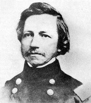
General Edward O. C. Ord has a small but interesting connection to the Mojave.

Ord was a career officer who fought in the Mexican-American War, against Native tribes in California, and later became a Union general in the Civil War. Before his rise to prominence, though, he spent time in California during the 1840s and 1850s. After arriving in Monterey in 1847, Ord worked on some of the earliest surveys of California.

That position put him in charge of military affairs in California and Nevada, where he directed troop deployments in and around the Mojave to protect settlers and suppress conflicts with Native peoples. His work overlapped with the surveying of wagon roads, trails, and the need to establish military posts to protect emigrants, mail lines, and freight routes. Fort Tejon, established in 1854, and later Camp Cady along the Mojave River (1860s), were part of that broader mission. While Ord himself did not leave a long record of direct operations in the Mojave, his service in California helped shape the Army’s early presence in the desert region.

In 1863, during the Civil War, Ord briefly commanded the Department of the Pacific, headquartered in San Francisco. That position placed him in broad command of military affairs in California and Nevada, and he oversaw troop deployments in and around the Mojave, where soldiers guarded settlers and suppressed conflicts with Native peoples.

There are actually two distinct mountain ranges in Southern California that bear the name Ord Mountains, and the duplication stems from historical, cartographic, and military associations.

The better-known Ord Mountains sit north of Lucerne Valley and southeast of Barstow, between the Stoddard Wells area and Johnson Valley. These were named for General Edward O. C. Ord, a Civil War officer who had earlier surveyed parts of California in the late 1840s. His name was applied to several places in the state, and this Mojave range was one of them.

A second, lesser-known Ord Mountains name shows up southwest of Lucerne Valley, closer to Hesperia and Apple Valley. This separate range appears to have been named after an incident in 1849, when Lieutenant Ord and his cavalry detachment were attacked while surveying in that area. Contemporary reports described the soldiers being “surrounded and mauled” by Native Americans. Later mapmakers and local usage extended Ord’s name to those hills as well, even though they are distinct from the main Ord Mountains to the north.

    So, while General Ord is not a “Mojave figure” in the sense of someone like Kit Carson, Edward Beale, or later officers tied directly to desert posts, his career intersected with the Mojave at points when the U.S. Army was extending its influence, building forts, and securing travel routes across the desert.

    Lucerne Valley

    San Bernardino National Forest

    Camp Cady

    Mojave River

    Timeline

    1604 – Juan de Onate meets the Mohave while seeking a route to the Southern Sea.
    1772 – Deserting soldiers from San Diego Mission cross along the north foot of the San Gabriel Mountains; Capt. Pedro Fages pursues.
    1776 (March) – Father Francisco Garces travels west along the Mojave River, passing the future Camp Cady site, bound for San Gabriel Mission.
    1776 – Spanish explorers pass through what is now southern Nevada.
    1810 (May 20) – Padre Francisco Dumetz names the San Bernardino Valley for St. Bernardine of Siena; Politana asistencia established.
    1812 – Earthquakes damage Alta California missions; Serrano destroy the Politana chapel.
    1819 – Fr. Joaquin Pasqual Nuez with Gabriel Moraga leads punitive expedition; Moraga camps at future Camp Cady.
    1826 – Jedediah Smith crosses from the Colorado River to San Bernardino via the Mojave.
    1827 – Smith attacked by Mohave on return; ten men killed. Ewing Young’s trappers trouble Mohave villages.
    1829 – Rafael Rivera scouts Las Vegas Valley; Antonio Armijo leads caravan to California via Mojave River and Cajon Pass. San Bernardino asistencia rebuilt. Ewing Young and Kit Carson use the trail and camping sites.
    1830 (Jan 28) – Armijo’s caravan descends Mojave River to Cajon Pass, fixing the first regular Old Spanish Trail.
    1831 – William Wolfskill and George Yount travel the trail.
    1832–1834 – Trade expands; missions suffer livestock thefts; caravans increase.
    1837 – William Pope and Isaac Slover enter via the North Branch.
    1838 – Lorenzo Trujillo and others settle near San Bernardino.
    1839–1841 – New Mexican settlers arrive in California; John Rowland and William Workman lead immigrant parties.
    1842 – Agua Mansa and Politana communities form.
    1843 – Rancho Muscupiabe granted to Michael White (Miguel Blanco).
    1844 – Fremont and Kit Carson cross Mojave; Carson and Godey avenge Resting Springs massacre.
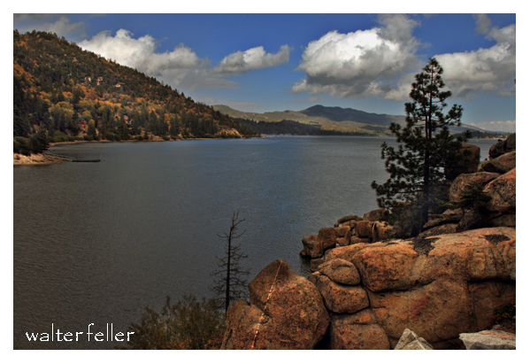
    1845 – Benjamin Wilson leads posse into San Bernardino Mountains, names Big Bear Valley.
    1846 (May 13) – Mexican-American War begins; Californios defeat Kearny at San Pasqual in December.
    1847 (Jan 13) – Capitulation of Cahuenga ends fighting in California.
    1848 (Jan 24) – Gold discovered at Sutter’s Mill.
    1848 (Feb 2) – Treaty of Guadalupe Hidalgo; U.S. acquires California.
    1848 – Salt Spring, first recorded gold discovery in San Bernardino County.
    1849 – Lost 49ers cross Death Valley. Capt. Jefferson Hunt leads Mormon Battalion members across the Mojave Road.
    1850 – California becomes a state. Early gold reported in San Bernardino Mountains.
    1851 (June 11) – Mormon colonists arrive in San Bernardino; Hunt brings first Mormon immigrant train. Hunt begins mail service from Mojave River base, lasting three years.
    1852 – Mormon lumber road built toward Crestline.
    1853 – Lt. Williamson surveys Mojave River; San Bernardino County petitioned.
    1854 – Fort Tejon established.
    1855 – First gold at Big Bear; Oasis of Mara noted. Mormon missionaries establish Las Vegas fort.
    1857 (Jan 9) – Fort Tejon earthquake; San Bernardino disincorporated. Edward F. Beale notes Camp Cady site.
    1858 (Jan) – Beale, Mercer, and 45 dragoons march toward the Colorado, passing site of future Camp Cady. Butterfield Overland stages begin service.
    1859 (Jan) – Companies B and K, First Dragoons, scout Mojave River. Sept 29, dragoons return to Fort Tejon. Oct 21, Capt. Hancock sends wagon train of supplies via Mojave Road. Oct 29, J. Winston establishes depot at future Camp Cady.
    1859 – Bodie, California, discovered by Wakeman S. Bodey.
    1860 (Feb 11) – Lt. Col. B. L. Beall sends dragoons from Tejon in search of Indians. (Mar 31) Los Angeles Star calls for military post. (Apr 14) Maj. James Carleton establishes Camp Cady, named for Col. Albemarle Cady. (Apr–Jul) Patrols build redoubts at Soda and Bitter Springs; Carleton recalled to Tejon.
    1860 – Coso discovered by Dr. E. Darwin French. Tecopa and Cerro Gordo ores found.
    1861 (Jan 29) – Supply train sent to Fort Mojave via Camp Cady. (Apr) Civil War begins.
    1861 – White Mountain City established; mining begins in New York Mountains; Sage Land District discovered.
    1862 (Jan–Feb) – Floods damage Mojave roads. (Apr 14) Lt. Nathaniel Pierce and detachment briefly garrison Camp Cady.
    1862 – Cerro Gordo worked by Mexican miners; Turtle Mountains, Whipple Mountains, and Copper Basin mined.
    1863 – Camp not permanently garrisoned; visited by Federal troops.
    1863 – Freeman District organized; Irataba copper district formed; Rock Spring silver discovered.
    1864 (Jul–Sep) – Capt. John Cremony and Company B, 2nd California Cavalry, patrol Mojave Road from Cady to Rock Springs.
    1864 – El Paso Mining District active.
    1865 (Apr 23) – Official establishment date of Camp Cady. Rotations of California Infantry and Cavalry serve. Pvt. Somerindyke dies by accident; Elliot Coues visits in November.
    1865 – Cerro Gordo revived by Coso miners; Tecopa developed; Bullion Mine in Ivanpah discovered.
    1866 (Jan) – Capt. Benjamin West commended for building work. (Jul 29) Skirmish near Mojave kills several soldiers.
    1866 – Anthony Mill Ruins noted.
    1867 (Feb–Aug) – Lt. Manuel Eyre commands Camp Cady; Indian fights at Marl Springs and Pahute Springs. Store at camp burned; Eyre dismissed in 1866.
    1868 (Oct 6) – Old site abandoned; new Camp Cady built half a mile west with permanent adobe buildings.
    1868 – Clark Mountain copper discovery.
    1870 (Oct 19) – Gen. Stoneman designates Camp Cady a military reservation.
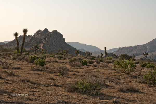
    1870 – Darwin rediscovered; Avawatz area named.
    1871 (Mar) – Camp Cady abandoned; property turned over to local stockmen.
    1871 – Chloride Cliff ore discovered.
    1872 – Oro Grande/Silver Mountain district organized.
    1873 – Old Woman Mountains discovery; Twentynine Palms finds; Panamint boom.
    1874 – Darwin silver-lead bodies located.
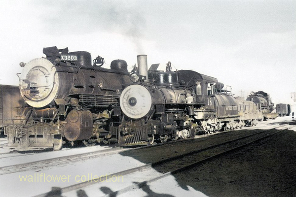
    1874–76 – Southern Pacific completes Tehachapi Loop, connecting San Francisco to Los Angeles.
    1875 – Savahia Peak, Exchequer, Waterman, and Riggs mines discovered.
    1876 – Ord and Fry Mountains claims located; Lookout district silver-lead discovered.
    1877 – Wildrose kilns operate; Beveridge district mined.
    1879 – George G. Lee dies, linked to Calico discovery.
    1880 – Providence Bonanza King silver discovered; Nantan mine located.
    1881 – SP builds Mojave to Calico Station. Harmony Borax Works founded; Calico camp grows; Alvord Mine consolidated.
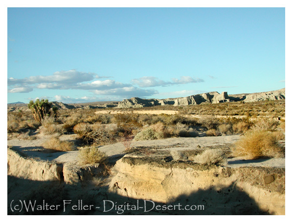
    1882–83 – SP extends track to Needles.
    1882 – Providence Mountains gold-iron ores.
    1883 – Atlantic & Pacific builds to Kingman; Carson & Colorado reaches Keeler. Needles Reduction Works opens; Ballarat’s Panamint Valley Mine located.
    1883 (Aug 21) – Machinery for Alvord Mill delivered to Camp Cady.
    1884 – A&P crosses Colorado River and acquires SP line Waterman Junction to Needles. Kramer siding established.
    1884 (Jul 5) – President Arthur declares Camp Cady useless for military purposes.
    1888 – Paradise Mine discovered.
    1890 – Vanderbilt gold discovered by Bob Black.
    1893 – Nevada Southern links Goffs to Manvel/Barnwell. Lost Horse Mine established in Joshua Tree region.
    1895 – California Eastern begins service.
    1897 – Stone Hammer and Orange Blossom mines discovered.
    1898 – Randsburg Railway opens. Bagdad-Chase gold discovered; Copper City and Goldstone developed.
    1899 – Rosalie post office moved from Ivanpah.
    1900 – Coolgardie placers found.
    1902 – Ludlow & Southern and Barnwell & Searchlight railroads built. Halloran Spring mines recorded.
    1903 – Keane Wonder Mine discovered.
    1904 – Tonopah & Tidewater Railroad opens. Rhyolite, Nevada founded.
    1905 – San Pedro, Los Angeles & Salt Lake Railroad completed; Tonopah & Goldfield Railroad opens. Inyo Mine developed; Leadfield begins; turquoise discovered at Halloran Spring.
    1906 – Las Vegas & Tonopah Railroad built. Skidoo founded; Goldbend and Death Valley Mine discovered. Albert Johnson and Walter Scott make first trip to Death Valley.
    1906–1922 – Johnson and Scotty visit Death Valley intermittently.
    1907 – Bullfrog Goldfield connects Nevada camps. Garvanza Mine; Hart boomtown founded; Gold Belt discovered.
    1908–10 – Arizona & California line links Cadiz, Rice, and Parker. 1908 – Gold Valley discovery.
    1909 – Gypsite discovered at Koehn Dry Lake.
    1910 – Slocum and Opal camps founded.
    1911 – Silver Lake talc mines opened; Saltdale noted.
    1912 – Southern Pacific builds Jawbone Branch to Owens Valley.
    1913 – Trona Railway opens. Clipper Mountains discovery.
    1915–16 – California Southern (II) built between Rice and Ripley. Crutts mining camp appears.
    1915–1917 – Johnson acquires ranches in Grapevine Canyon, names them Death Valley Ranch.
    1921 – Johnson plans permanent structures. Eichbaum opens Towne Pass toll road.
    1922 – Johnson hires Frederick Kropf as superintendent.
    1922–1924 – Garage, main house, cookhouse built.
    1924–1925 – Stables, chicken coop, workshop built.
    1925 – Matt Roy Thompson hired.
    1925–1926 – Commissary constructed.
    1926–1931 – Architect MacNeilledge designs Spanish-style complex, replaced by de Dubovay in 1931.
    1927 – U.S. Borax opens Furnace Creek Inn.
    1929 – Dewey Kruckeberg landscapes Death Valley Ranch.
    1930 – Hoover withdraws land for study; Johnson learns surveys flawed. Eichbaum completes road to Grapevine Canyon. Tourist traffic increases.
    1930–1931 – Daily visitors range from 40 to 100 during construction.
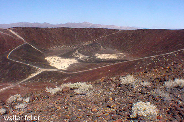
    1931 – Johnson halts construction over title issues.
    1933 (Feb 11) – Hoover proclaims Death Valley National Monument. Johnsons move to Hollywood, visit monthly.
    1934 – Johnson opens informal public tours; Burton Frasher postcards produced.
    1935 (Aug 22) – Roosevelt allows Johnson to repurchase Grapevine Canyon land.
    1936–1937 – Formal tours begin, $1 admission. Bessie Johnson manages.
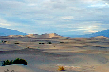
    1937 (Nov 17) – Johnson receives land patent.
    1938 (Mar) – Flood washes away last traces of Camp Cady.
    1941 (Oct) – Bessie Johnson publishes 10,000 castle guidebooks.
    1942–1945 – WWII rationing reduces castle visitation.
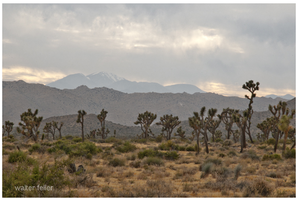
    1943 (Apr 22) – Bessie Johnson dies in auto accident on Towne Pass.
    1946 – Johnson creates the Gospel Foundation.
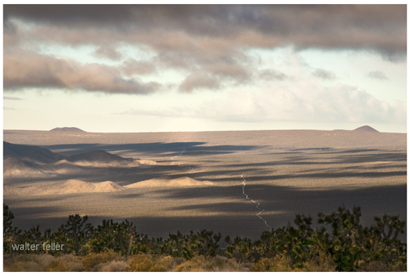
    1947 (May 19) – Johnson wills property to Gospel Foundation.
    1948 (Jan 7) – Johnson dies; Foundation continues operating castle as “museum-hotel.”
    1970 (Jul) – NPS purchases Grapevine ranches and castle for $850,000; furnishings donated.
    1970–1973 – National Parks Concessions administers castle tours and upkeep.
    1973 – NPS assumes full responsibility for Scotty’s Castle.

    House Finches Living Outside

    Something you can explain to a 7-year-old

    A long time ago, house finches lived only in the western United States and Mexico. They were small, cheerful birds. The males wore bright red feathers, while the females blended in with soft browns. People loved hearing their songs in backyards and towns.

    In the 1940s, some sellers decided to trap these birds and bring them east. They thought people in New York would buy them as pets if they gave them a fancy name. So, they called them “Hollywood finches,” as if the birds were little movie stars from California.

    At first, people did buy them. However, a new law soon made it illegal to sell wild birds. The sellers didn’t want to get in trouble, so they opened the cages and let the finches go free in the East.

    The birds didn’t just survive—they thrived. They built nests on porches and rooftops, sang their songs in city parks, and raised families. Over time, they spread across the East and eventually met up with their western cousins. Today, house finches live almost everywhere in the United States.

    So the next time you hear a happy chirp in your neighborhood, remember: that little bird might be the great-great-grandchild of one of those “Hollywood finches” who escaped their cages and made a brand-new life.

    They’re called house finches because they like to live near people and their homes.

    Unlike some shy birds that stay deep in the forest, house finches are very comfortable around neighborhoods. They often build their nests on porches, in hanging flowerpots, or in the nooks and crannies of houses and buildings. People would see them perched on rooftops or windowsills, singing their cheerful songs, and so the name “house finch” stuck.

    So the name really means “a finch that likes living around houses.”

    Where Lizards Live

    Something for a Seven-Year-Old

    a straight, clear explanation for a 7-year-old:

    So, a lizard’s home isn’t a building—

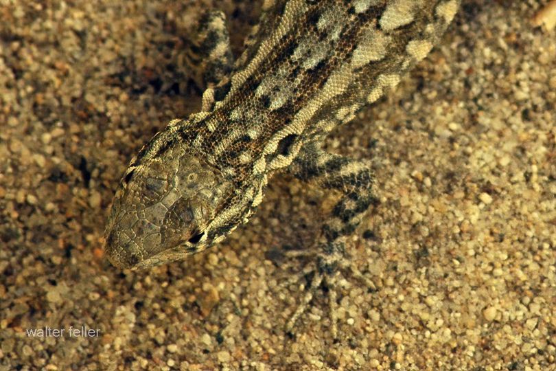
    Lizards in the desert have some clever ways of finding homes. They don’t live in houses like people do, but they find spots that keep them safe from the hot sun and from hungry animals. Many lizards dig little burrows in the sand or dirt where it’s cooler. Others hide under rocks, inside cracks, or even in bushes.

    Mojave fringe-toed lizard

    During the hottest part of the day, they often stay hidden in these safe spots. When it’s cooler in the morning or evening, they come out to run around, eat bugs, or warm up by lying on sunny rocks.

    So, a desert lizard’s “house” could be a hole in the ground, a shady bush, or even a crack in a boulder—it’s wherever they can stay safe and comfortable.

    Men, Cattle & Cattlemen

    Raising cattle in the Mojave National Preserve comes with unique challenges and a long history. The area has been home to cattle ranching since the late 19th century, with ranchers taking advantage of the sparse but hardy desert vegetation and natural springs.

    Historical Perspective

    Cattle ranching in the Mojave Preserve dates back to the late 1800s, with ranchers establishing homesteads and using the land for grazing. Ranches like Rock Spring Ranch, Valley View Ranch, and the OX Ranch were some of the key operations. Water was always the limiting factor, so early ranchers developed wells, windmills, and water troughs to sustain their herds.

    During the 20th century, ranching continued despite the harsh environment. The Bureau of Land Management (BLM) and later the National Park Service (NPS) managed grazing leases. Still, conflicts arose over land use, conservation, and the impact of cattle on fragile desert ecosystems.

    Modern Challenges

    After the creation of the Mojave National Preserve in 1994, the National Park Service began phasing out cattle ranching through voluntary buyouts of grazing rights. Some ranchers chose to sell, while others held on under special agreements. Today, very few cattle operations remain in the preserve, and grazing is largely restricted.

    Key challenges include:

    • Water Scarcity: Natural springs and wells are limited, making it difficult to maintain large herds.
    • Harsh Climate: Extreme temperatures and unpredictable rainfall mean cattle must be resilient to drought conditions.
    • Regulatory Restrictions: The National Park Service enforces conservation policies, restricting new grazing leases and limiting herd sizes.
    • Predation and Disease: Coyotes and mountain lions pose risks to cattle, and disease can spread in remote conditions with limited veterinary care.

    Legacy and Conservation

    Tehachapi beef – Selected for character

    Though large-scale ranching has faded chiefly, remnants of the cattle industry remain in the form of historic ranch sites, windmills, and abandoned corrals scattered throughout the preserve. Some former ranching areas have become part of conservation efforts to restore native plant life and protect desert ecosystems.

    Ranching played a significant role in shaping the human history of the Mojave, but in many areas, the land is slowly returning to a more natural state.

    Mojave Preserve

    Ranches in the Preserve

    Desert Ranches

    Trona

    Trona: The Mineral and the Lake That Made It Famous

    When people hear the word “Trona,” they might think first of the tiny desert town in California’s Searles Valley. But long before there was a town, there was a mineral—trona itself—and long before that, there was a great Ice Age lake that left behind an astonishing chemical treasure chest. This is the story of the mineral, the lake, and the wider desert world it belongs to.

    The Mineral Trona
    Trona is a sodium carbonate mineral with the chemical formula Na3(CO3)(HCO3)·2H2O. At first glance, it doesn’t look impressive—grayish, sometimes yellowish, dull and earthy in texture. You can scratch it with a fingernail, since it ranks only 2.5 on the Mohs scale. But appearances deceive. Trona is the raw material that fuels the soda ash industry, and soda ash in turn is essential for making glass, detergents, paper, and countless industrial products.

    Trona forms in dry, alkaline lakes where evaporation pulls water away and leaves dissolved salts behind. In crystal form, it can be fibrous, granular, or massive, and it’s often found alongside related salts like nahcolite, gaylussite, and halite. It belongs to the evaporite family—minerals that crystallize in the desert sun as lakes vanish.

    Trona’s Desert Cousins
    To understand trona, you have to meet its “cousins.” Borax, another evaporite mineral, forms in highly alkaline, boron-rich lakes. Borax is white and powdery, long known for its role in glassmaking and cleaning products, and it gained fame during the “20 Mule Team” borax days of Death Valley. Hanksite, a rare mineral found almost exclusively in Searles Lake, is more exotic. With its strange mix of carbonate, sulfate, and chloride, it grows in large hexagonal crystals prized by collectors. Thenardite, a sodium sulfate, appears later in the drying sequence, often after trona has already crystallized. And halite—plain rock salt—is the final curtain call in the evaporation process, forming thick beds of common salt.

    Together, these minerals tell the chemical story of ancient lakes. Each one signals a different stage in the drying cycle: carbonates like trona first, then borates, then sulfates, then chlorides, with rare mixes like hanksite reserved for the most concentrated brines.

    The Evaporation Sequence
    Picture a great lake in the desert slowly drying under the sun. As water disappears, minerals crystallize out in a sequence. First come the carbonates—trona and nahcolite—as the lake becomes alkaline. If boron is present, borax forms next. With more evaporation, sodium sulfate minerals like thenardite precipitate. Finally, halite—rock salt—deposits in massive beds, and in the last brine stages, unusual combinations like hanksite grow. It’s nature’s chemistry experiment written on the desert floor.

    Searles Lake: A Desert Laboratory
    Searles Lake in the Mojave Desert is one of the best examples of this process. During the Ice Age, between 30,000 and 12,000 years ago, Searles Lake was a deep freshwater body. Fed by the Mojave River, it was part of a chain of lakes stretching across the desert. When the climate dried, Searles Lake shrank and minerals built up, cycle after cycle, until its bed became one of the richest evaporite deposits on earth.

    Today, companies mine Searles Lake for trona, borax, soda ash, sodium sulfate, and halite. They use solution-mining, pumping brines from beneath the playa into evaporation ponds, then refining the salts. The nearby town of Trona, California, owes its name and existence to this mineral wealth. Each October, the community hosts “Gem-O-Rama,” when collectors from around the world flock to dig crystals of hanksite, borax, and halite fresh from the brines.

    The Mojave River Lake Chain


    Searles Lake didn’t exist in isolation. It was one link in a chain of Ice Age lakes connected by the Mojave River. The river began in the San Bernardino Mountains, flowed through the Victor Valley, and filled Lake Manix near Barstow. When Lake Manix spilled north through Afton Canyon, water reached Soda and Silver Lakes, forming Lake Mojave. In the wettest periods, Lake Mojave overflowed into Searles Lake. From there, water sometimes spilled farther into Panamint Valley, filling Panamint Lake. In the very wettest times, the chain reached all the way to Death Valley, where Lake Manly stretched 80 miles long and hundreds of feet deep.

    This chain acted like a conveyor belt for water and minerals. Each basin concentrated dissolved salts, but Searles Lake, being closed and rarely flushed, became a perfect trap. That is why its sediments are so rich in trona and other evaporites.

    From Ice Age to Industry
    When the Ice Age ended, about 12,000 years ago, the climate warmed, and the Mojave River carried far less water. Searles Lake dried into a playa, but its mineral layers remained. By the 1800s, prospectors discovered borax there. In 1873, John and Dennis Searles began mining borax with mule teams, one of the earliest borax operations in California. By the early 1900s, large-scale industrial mining was underway, and the town of Trona was established to house workers. Throughout the 20th century, operations expanded with new methods, and today the lake continues to support a thriving industry and a small desert community.

    A Legacy Written in Salt
    Searles Lake is more than a dry playa; it is a book of climate history, a record of ancient rivers, and a living source of industrial minerals. The mineral trona, dull to look at but essential to modern life, is both its namesake and its most important product. In the larger story of the desert, Searles Lake shows how geology, chemistry, and human enterprise meet in one stark basin. From Ice Age waters to the shelves of today’s stores, trona’s journey is a desert tale written in crystal layers.