Roads West

Mojave Road and Beale’s Wagon Road are historic routes in the southwestern United States, particularly in the Mojave Desert region. Here’s some information about each:

  1. Mojave Road:
    • The Mojave Road is a historic trail that traverses California’s Mojave Desert. It was a significant route used by Native Americans, Spanish missionaries, and later by American pioneers and traders.
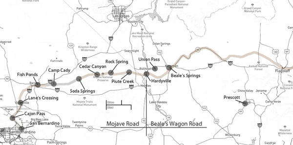
    • The trail is approximately 138 miles long and extends from the Colorado River near present-day Needles, California, to the Mojave River near present-day Barstow, California.
    • It was primarily used for transportation and trade between the Colorado River and the coastal settlements in California. The trail passes through varied desert landscapes, including sandy stretches, rocky terrain, and mountainous areas.
  2. Beale’s Wagon Road:
    • Beale’s Wagon Road, named after Edward F. Beale, a military officer and explorer, was a trail developed in the 19th century for the U.S. Army to improve communication and transportation across the arid lands of the American Southwest.
    • Edward F. Beale surveyed and established the road in the late 1850s. The road ran from Fort Defiance in Arizona to the Colorado River, passing through present-day Arizona and California.
    • Beale’s Wagon Road was designed to be more reliable and accessible than other trails, facilitating military movement and communication between California and the western territories.

Mojave Road and Beale’s Wagon Road were important in the United States’ westward expansion. Today, these routes attract history enthusiasts, adventurers, and off-road enthusiasts who explore them to experience the challenges faced by those who traveled these paths in the past. Keep in mind that conditions and accessibility of these trails may vary, so it’s important to check for current information and any regulations before embarking on a journey along these historic routes.

Mojave Road

/mojave-road/

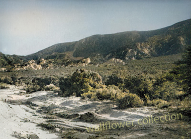
Soda Springs – 1863

The Mojave Road, also known as the Old Mojave Road or the Mojave Trail, is a historic trade route and wagon road that traverses the Mojave Desert in the southwestern United States. Native American tribes originally used it for trade, and it later became an important transportation route for European settlers and traders during the 19th century.

Here are some key points about the Mojave Road:

Location: The Mojave Road runs through the Mojave Desert, primarily in what is now California and Nevada. It stretches from the Colorado River in the east to the San Bernardino Mountains in the west, covering approximately 140 miles (225 kilometers).

History: The road has a long history, with Native American tribes using it for centuries for trade and travel. In the 19th century, it became an essential route for early explorers, settlers, and traders moving through the desert.

Water Sources: One of the challenges of traveling the Mojave Road was the scarcity of water sources. Travelers had to rely on natural springs and wells, many of which were marked along the route to aid navigation.

Military Use: During the 19th century, the U.S. Army used the Mojave Road as a military supply route and for communication between the southern California coast and the interior of the Southwest. The road played a role in the U.S. government’s efforts to control the region.

Historic Sites: Along the Mojave Road, there are several historic sites and landmarks, including the Mojave National Preserve, the Mojave River, the Kelso Depot, and the Fort Piute ruins.

Recreation: Today, the Mojave Road is a popular route for off-road enthusiasts, hikers, and history buffs. Travelers can explore the historic route and experience the natural beauty of the Mojave Desert.

Preservation: Efforts have been made to preserve and maintain the Mojave Road as a historic and recreational route. The Mojave Road Guide, written by historian Dennis G. Casebier, is a valuable resource for those interested in traveling the road.

Please note that road conditions and accessibility may vary, so if you plan to explore the Mojave Road, it’s essential to do thorough research and be well-prepared for the journey. Always check for current information and obtain any necessary permits if required.

High Desert Small Atlas

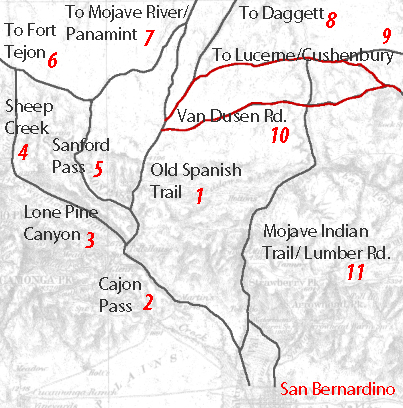
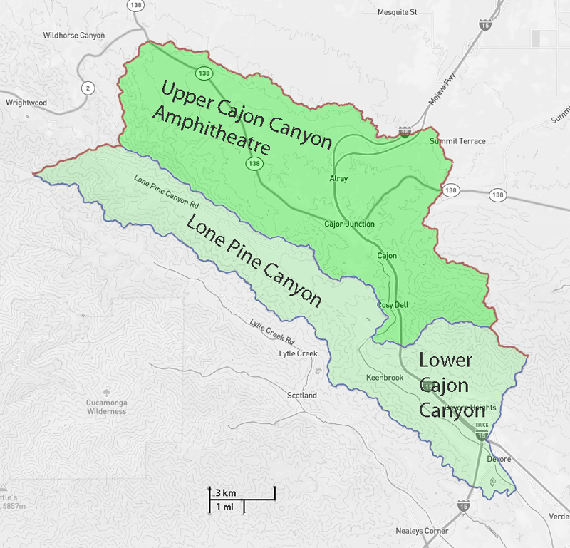
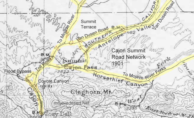
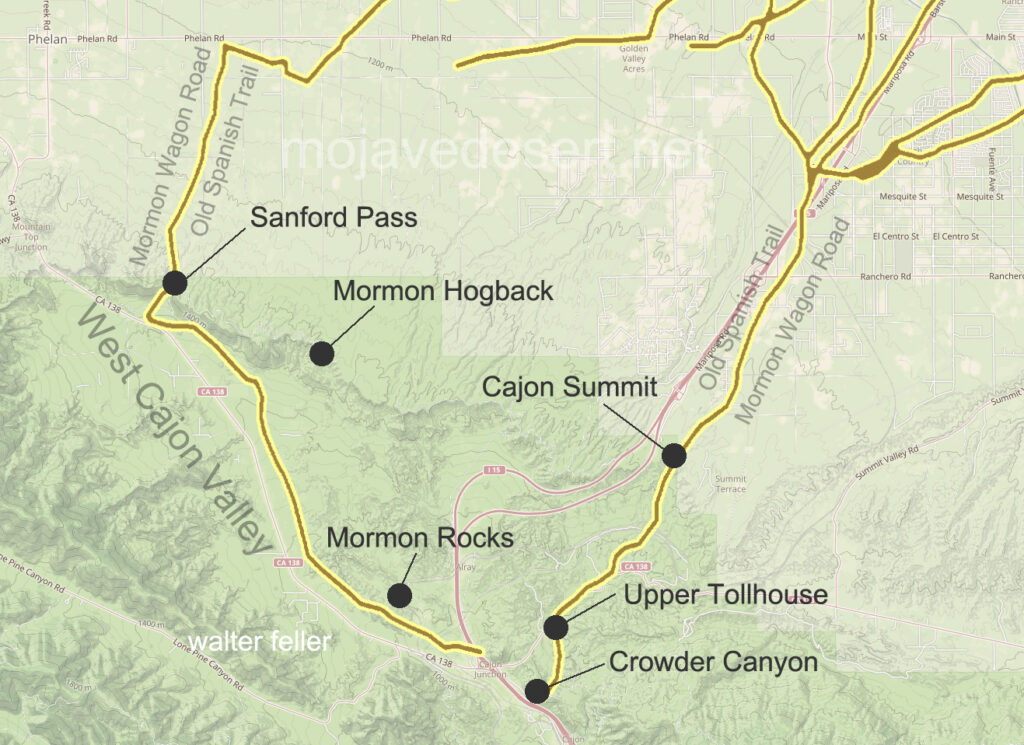
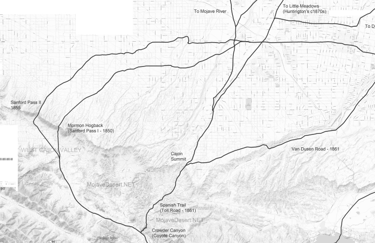
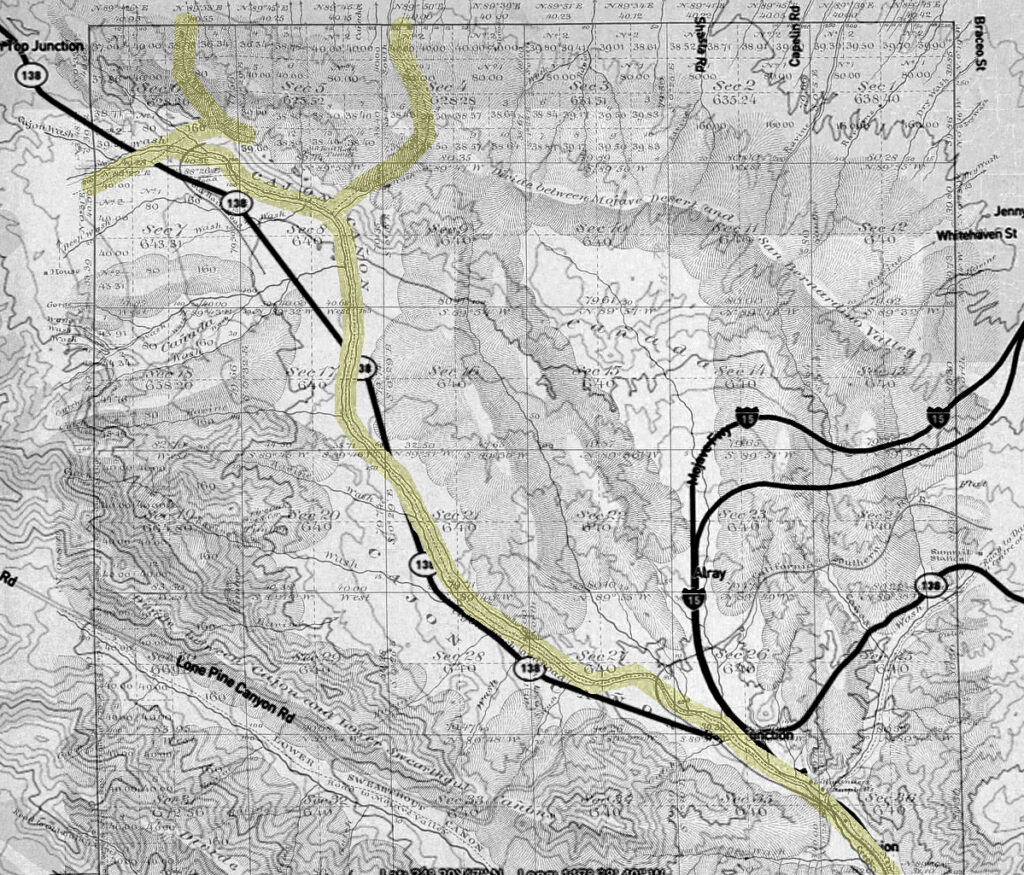
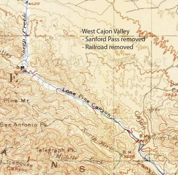
Cajon Pass/Victor Valley Roads

Working copy – not all roads included

1 – Old Spanish Trail/Indian trail (1827)
2 – Cajon Pass (Lower) – Indian trail
3 – Lone Pine Canyon – Indian trail
4 – Sheep Creek – Indian trail
5 – Sanford Pass (c.1854-57)
6 – Fort Tejon – Indian trail
7 – to Mojave River – Indian trail
8 – to Daggett (c.1855)
9 – Lucerne/Cushenbury Lumber road
10 – Van Dusen/Holcomb Valley Road – (1862)
11 – Mojave Indian trail (c.1776, 1826)

Freighting

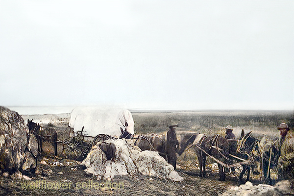
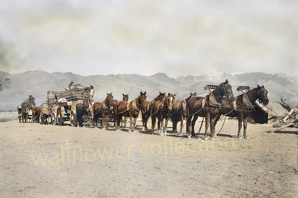
10-horse freight outfit – R. & J. Reynolds collection

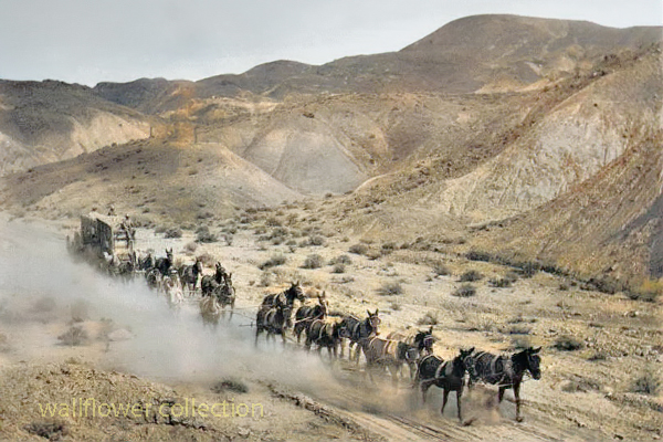
“Freighting” became an important occupation. The man who wished to engage in it must be a considerable capitalist, for the heavy wagons, constructed especially for the purpose, were expensive, and strong, well-broken mules were required. Eight, ten, twelve, and sometimes eighteen or twenty mules or horses were used as motive power for the “outfit.” The wagons were carefully packed, and often carried thousands of dollars worth of merchandise. The driving of one of these “freighters” over the mountains and deserts required forethought, prompt action, and good judgment. There was always danger from the Utes. Apaches and other Indians. The heat and the cold, the alkali dust, the blinding glare of the sun upon the desert sands, thirst and hunger—all of these tested to the uttermost the physical and mental powers of the teamsters.

Ingersoll’s century annals of San Bernadino County, 1769-1904 

Lucerne Valley Road Network – 1901

These maps are based on a USGS 1901 base map and overlay onto a current street map. This series was developed to show how the dependence on potable water for man or beast shaped the transportation network in the late 19th Century.

This map identifies various geographic locations, general features, and roads throughout the Lucerne & Johnson valleys as it was in 1901.

The blue marks show reliable water and rest stops as would be used by travelers and teamsters. These water stops are roughly 10 miles apart as the roads go.

The generalized trails connecting the water and rest stops are highlighted. A few redundant and miscellaneous trails have been purposely omitted for clarity.

This map has had the 1901 base map replaced with a current street map.

This map has had the water node locations removed.

Finally, the 1901 trails have been highlighted and the location labels removed for clarity in showing the relationship between the roads then and now.

Carreta

American Automobile Assoc. photo

The pretty senorita is standing next to a carreta, a two-wheeled cart pulled by mules to haul freight in early Spanish and Mexican California. The carreta could be built quickly and inexpensively. Four-wheeled wagons in Southern California were a rarity if there were any at all until the first ones rolled in through the Cajon Pass in 1849 driven by Mormon pioneers.