#5 – Mojave National Preserve: A Vast Desert Wilderness

/mojave-preserve/

The Mojave National Preserve, encompassing over 1.6 million acres, offers diverse landscapes, wildlife, and recreational activities. Located in southeastern California, the preserve is a haven for outdoor enthusiasts and nature lovers. Here’s an expanded look at what makes the Mojave National Preserve a popular destination:

Key Features and Attractions

  1. Kelso Dunes:
    • Dune Field: Covering over 45 square miles, the Kelso Dunes are some of the tallest dunes in North America, with the highest peak rising about 650 feet.
    • Hiking and Exploration: Visitors can hike to the top of the dunes for panoramic views and experience the phenomenon of “singing sands,” a booming sound produced by the movement of the sand.
    • Sunset Views: The dunes are stunning at sunset when the shifting light creates dramatic shadows and colors.
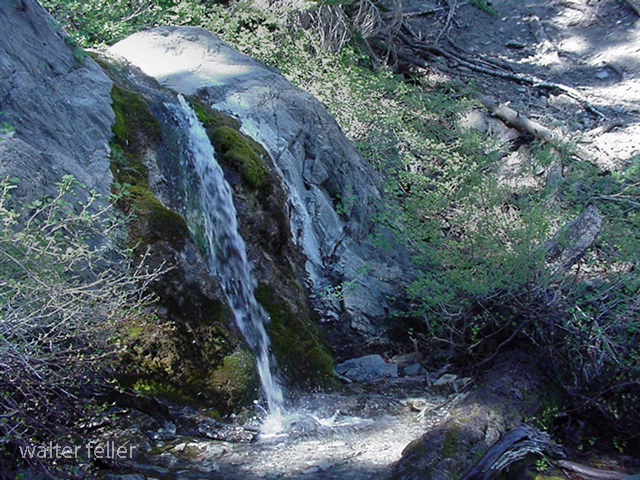
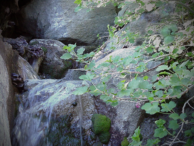
  2. Hole-in-the-Wall:
    • Geological Features: This area is named for its unique rock formations created by volcanic activity and erosion. The walls are filled with holes and cavities, giving the area its distinctive appearance.
    • Rings Loop Trail: A popular 1.5-mile loop trail that features metal rings bolted into the rock to help hikers navigate steep sections of the trail. The trail offers a close-up view of the fascinating rock formations.
    • Visitor Center: The Hole-in-the-Wall Information Center provides exhibits on the area’s geology, wildlife, and cultural history.
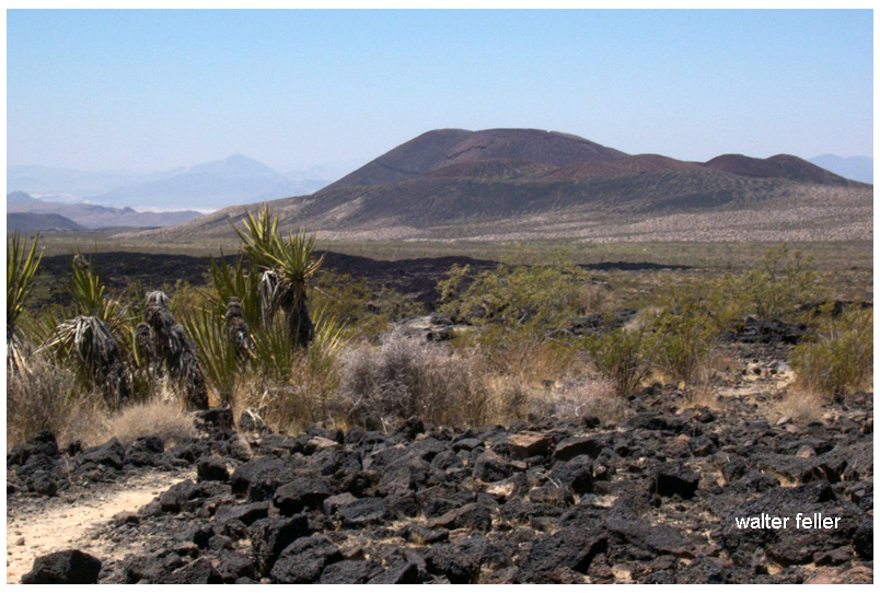
  3. Cinder Cone Lava Beds:
    • Volcanic Landscape: This area features ancient volcanic cones, lava flows, and craters, offering a rugged and dramatic landscape.
    • Hiking Trails: Trails wind through the lava beds, providing opportunities to explore the unique terrain and view the surrounding desert.
  4. Mitchell Caverns:
    • Limestone Caves: Located in the Providence Mountains State Recreation Area, these caverns are filled with stalactites, stalagmites, and other fascinating formations.
    • Guided Tours: The only way to explore the caverns is through guided tours offered by California State Parks, which provide insights into the caves’ geological history and natural features.
  5. Mojave Road:
    • Historic Route: The Mojave Road is a historic 140-mile off-road trail that follows a route used by Native Americans, early explorers, and settlers. It provides a challenging and adventurous way to experience the preserve.
    • Landmarks: Along the route, travelers can see historic sites, old military forts, and natural landmarks. The route requires a high-clearance 4WD vehicle and careful planning.

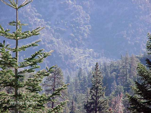
Wildlife and Plant Life

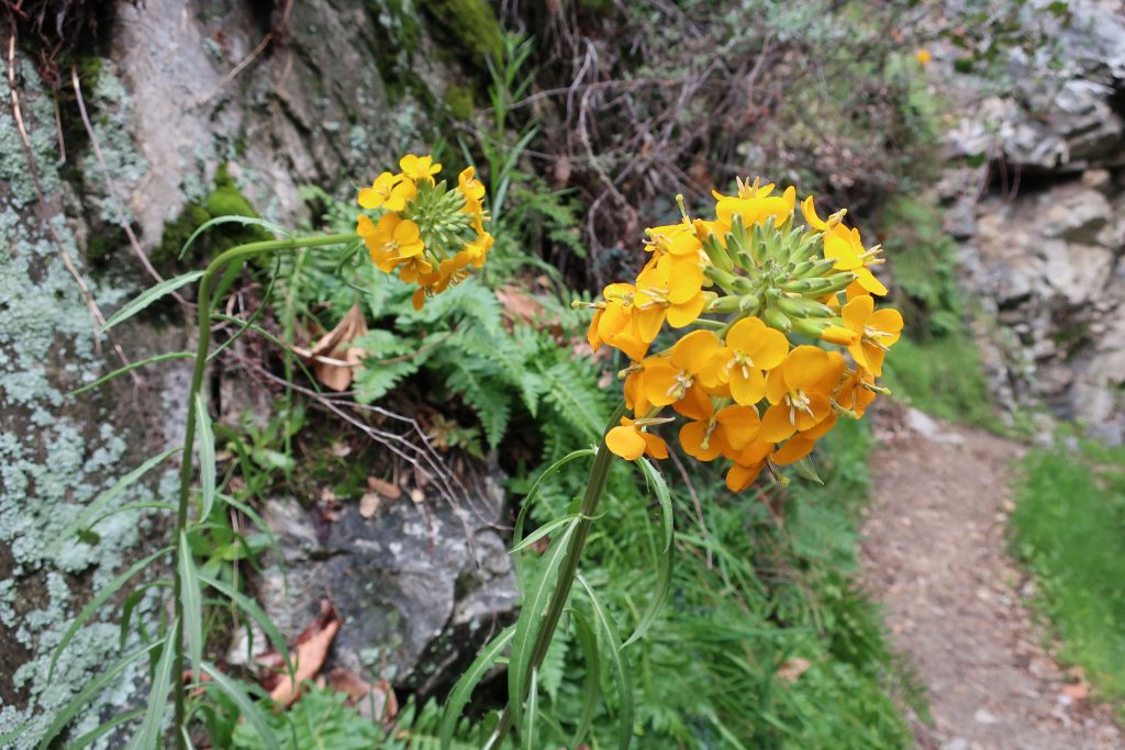
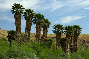
  • Desert Flora: The preserve has various desert plants, including Joshua trees, creosote bushes, cacti, and wildflowers. Springtime can bring vibrant blooms, adding color to the landscape.
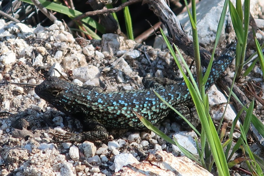
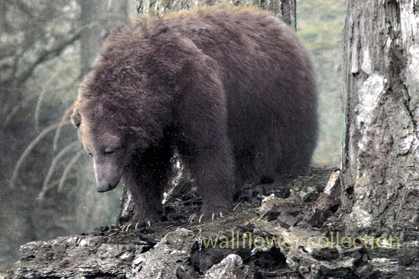
  • Wildlife: The preserve’s diverse habitats support a wide range of wildlife, including bighorn sheep, coyotes, desert tortoises, and numerous bird species. The varying elevations and environments within the preserve create unique ecosystems.

Recreational Activities

  1. Hiking:
    • Diverse Trails: The preserve offers a range of hiking trails, from short nature walks to strenuous backcountry routes. Trails provide opportunities to explore the varied landscapes and observe the native flora and fauna.
    • Backpacking: For those seeking a more immersive experience, the preserve offers backcountry camping and backpacking opportunities. Permits are required for overnight stays.
  2. Camping:
    • Developed Campgrounds: The preserve has several developed campgrounds, including Hole-in-the-Wall and Mid Hills, which offer amenities such as picnic tables, fire rings, and restrooms.
    • Dispersed Camping: For a more primitive experience, visitors can camp in designated areas throughout the preserve. Dispersed camping allows for solitude and a closer connection with nature.
  3. Stargazing:
    • Dark Skies: The remote location of the preserve provides excellent conditions for stargazing. The lack of light pollution allows for clear views of the night sky, making it a perfect spot for observing stars, planets, and meteor showers.
  4. Bird Watching:
    • Diverse Bird Species: The varied habitats within the preserve attract a wide range of bird species, making it a popular destination for bird watchers. Seasonal migrations and diverse environments provide opportunities to see both resident and migratory birds.
  5. Off-Roading:
    • Designated Routes: The preserve has numerous designated off-road vehicle routes, offering adventurous ways to explore the rugged terrain. It’s important to stay on designated routes to protect the environment and adhere to regulations.

Historical and Cultural Sites

  • Kelso Depot: A restored 1924 Union Pacific train depot now serving as the preserve’s visitor center. The depot features exhibits on the history of the railroad, mining, and desert communities.
  • Rock Springs Land and Cattle Company: Historical ranch buildings and corrals that provide a glimpse into the ranching history of the area.

Conservation and Preservation

  • Protected Area: The Mojave National Preserve is managed by the National Park Service, protecting its unique landscapes, wildlife, and cultural resources.
  • Leave No Trace: Visitors are encouraged to practice Leave No Trace principles, minimizing their impact on the environment and helping to preserve the preserve’s natural beauty and integrity.

Visitor Information

  • Accessibility: The preserve is accessible via Interstate 15 and Interstate 40, with several entry points and visitor centers providing information and resources.
  • Seasonal Considerations: The best times to visit are spring and fall when temperatures are moderate. Summer temperatures can be extreme, and winter can bring cold nights and occasional snow at higher elevations.

The Mojave National Preserve offers a diverse and captivating landscape with countless opportunities for exploration and adventure. Whether hiking through rugged canyons, climbing towering dunes, or simply soaking in the vast desert vistas, the preserve provides a memorable and enriching experience for all who visit.

Mohave Tui Chub

The Mohave Tui Chub (Siphateles bicolor mohavensis) is a fascinating species of fish native to the Mojave Desert region of California, specifically the Mojave River basin. This fish is notable for its unique adaptations to a harsh desert environment and as a symbol of conservation challenges and efforts in arid ecosystems. The Mohave Tui Chub is currently listed as an endangered species, making its survival a priority for environmentalists and scientists. This essay explores the biology, habitat, conservation status, and ongoing efforts to preserve this distinctive species.

Biology and Habitat

The Mohave Tui Chub is a small, stout fish, typically dark olive in color, that thrives in the freshwater marshes and isolated springs of its native habitat. As a member of the Cyprinidae family, it is adapted to survive in the variable conditions of desert water systems, which can range from clear to turbid. This species is predominantly a bottom-dweller, feeding on various invertebrates and organic debris, demonstrating a versatile diet that aids in its survival in limited environments.

Historically, the Mohave Tui Chub inhabited many interconnected water systems in the Mojave Desert. However, its habitat has drastically reduced due to water diversion, groundwater pumping, and the introduction of non-native species that compete for resources and introduce diseases.

Conservation Status and Efforts

The Mohave Tui Chub’s status as an endangered species results from extensive habitat loss and ecological changes. The redirection of water sources for agricultural and urban development has fragmented its living spaces, leaving the species vulnerable and isolated. Furthermore, introducing predatory fish species has led to a significant decline in their numbers.

Conservation efforts for the Mohave Tui Chub are multifaceted. They include habitat restoration, legal protection of water resources, and breeding programs aimed at increasing population numbers. Programs like the Artificial Propagation and Reintroduction Plan have established secure populations in protected areas. Moreover, environmental education programs are raising awareness about preserving this unique species and its ecosystem.

Conclusion

The Mohave Tui Chub is more than just a species; it represents the broader challenges of conserving biodiversity in desert ecosystems. The efforts to save the Mohave Tui Chub from extinction indicate a larger environmental stewardship goal to maintain the ecological balance and health of the Mojave Desert. Protecting this fish entails preserving a fragile ecosystem that supports diverse life. Through continued conservation initiatives and public support, there is hope that the Mohave Tui Chub will thrive again as proof of nature’s resilience and the effectiveness of concerted human conservation efforts.

https://digital-desert.com/mojave-preserve/mojave-tui-chub-resources.html

Snowshoe Wrightwood’s Table Mountain

 BY CHRIS KASTEN

9,399′ high Mt. Baden-Powell’s massif dominates the southwest skyline from Table Mountain.

Joanie and I got out for a great afternoon of snowshoeing up on Wrightwood’s Table Mountain about a week and a half ago.   Since then,  more storms have dropped even more of the precious powder on our local mountains.   Whether you like to cross-country ski or snowshoe, it’s a fantastic time to be out amongst our high country peaks, canyons and forests!

Inset of the Trails of Wrightwood – Big Pines map. The area we went snowshoeing is depicted as Table Mountain (with campground symbol) at an elevation of 7,200′. The west end of Wrightwood appears in the lower right corner of image.

Table Mountain is 7,516′ high and super easy to get to from Wrightwood.  Just drive.  You’re only looking at four miles from our village center.  Make sure to turn off to the right on Table Mountain Road when you arrive at the three way split in the roads at Big Pines.  Table Mountain Campground is where we did our snowshoeing on a quiet Friday, where we seemed to have the place to ourselves.  The wind had sculpted the snow into pristine dunes along the gently sloping ridge top that the extensive campground straddles.

Joanie seems to almost float atop the powder on the sunny slopes of Table Mountain!

All the campsites were, of course, hidden under the snowy mantle, with just the picnic tabletops presenting themselves as a bit of a depth gauge.  Most of the time, snow depth was around 24″ and in places well over three feet.  The windward sides of the mammoth white fir and Ponderosas were coated in sparkling icicles that fell like shards of glass in the wind gusts that came out of the southwest.  Mt. Baden-Powell kept constant watch over us from across the great gulf of the East Fork of the San Gabriel River.   The Mojave Desert off to the north was a mosaic of tans, yellow sands and the right-angled patchwork of green winter crops scattered here and there.  It looked and felt warmer down there.  And high up on Table Mountain, that day was to be one of cobalt blue skies, bright white snows, wind and evergreens.

A small wind-bent snowy pine and Chris have a little visit amongst Table Mountain’s frozen forest.

Douglas Wallflowers in Blossom

MARCH 29, 2020 BY CHRIS KASTEN

Here’s a Douglas Wallflower alongside the Upper Falls Trail, as seen this last Monday while hiking up the Big Santa Anita Canyon under cloudy skies.   Our series of much-needed rain storms have brought back thick green grasses and the start to what’ll most likely be a colorful Spring of other wildflowers.  Joanie and I hiked the two-mile Falling Sign Loop from Fern Lodge.

These Douglas Wallflowers (Erysimum capitatum) popped out at us just downstream from the double slot pools on the Upper Falls Trail. There’s also a nice grouping of wallflowers near the second bench up the road from Roberts’ Camp in San Olene Canyon.

Sturtevant Falls was tumbling down nicely.  The scent of white sage peppered the cool air and the background surf-like sound of the stream followed us the whole way.  We brought along an old shovel, cleaning off small slides here and there.   Wild lilacs (buck brush) are still sending their mild lavender scent into the canyon breezes while the bright red orange of Indian paintbrush pokes up from the damp earth near Hoegee’s Drop-Off.  And overarching along most of the route, the Laurel bay blossoms still cling to the dark green canopies.  Look for the tender dark reddish purple leaves of the canyon big-leaf maples as their foliage begins to fill back in for a new season.  Even the white alders are pushing out a myriad of their bright green leaflets, replacing that smokey look of dormancy with new life.

View looking east up into the East Fork of Big Santa Anita Canyon from Gabrielino Trail. Note the Toyon in the foreground, still hanging onto some of its’ red berries. That’s Rankin and Monrovia peaks in the most distant background. Clamshell Peak is barely captured on the right hand side of photo.

Western Fence lizards are out at Tin Can Point

This turquoise colored fence lizard (Sceloporus occidentalis) was seen out in the warmth of early Spring at Tin Can Point. Tin Can Point is just up from Fern Lodge Junction on the Gabrielino Trail. It’s the first switchback you’d encounter after the trail passes through the canyon live oak forest and then enters the chaparral, just a few minutes up from the trail junction.

A beautiful fence lizard basks in the gentle warmth of early Spring at Tin Can Point.   See inset of the Chantry Flat – Mt. Wilson Trails map, below, to see where this point is.  As of this writing,  a cold wet pacific storm is dropping nearly six days of chilly rain and snow in much of the San Gabriel mountains.  Big Santa Anita Canyon dam has received over 5 1/2″ of rain in the last week.  Something I just learned recently about these Western Fence lizards is that their populations have the effect of reducing the incidence of Lyme’s disease in the ticks that live in the chaparral,  such as found covering much of the slopes of the Big Santa Anita Canyon!  Apparently, a protein in the lizard’s blood kills the bacterium in the tick’s gut, which is good news for hikers and even their dogs during the spring and autumn months.

Like most reptiles, Western Fence lizards hibernate, at least for a little while each winter throughout their habitats which are wide-spread throughout California.  As for food, these lizards eat spiders and various insects such as mosquitos, beetles and grasshoppers.   The females lay several small clutches of eggs (3-17) in the spring, the young emerging in the summer.

Detail of Gabrielino Trail section, Chantry Flat – Mt. Wilson Trails map.

On your next hike out from Chantry Flats, watch for for lizards flitting about on the trails and sunning themselves on the myriad stretches of rock.  As for the various types of reptiles to be found in the Big Santa Anita, Western Fence lizards are abundant and deserve a place in the sun!

source:  Wikipedia, Western Fence lizards

Indian Trails

Establishment of the ancient Indian trails.

Oasis of Mara, Joshua Tree National Park – 2006

The indigenous peoples of the Mojave Desert, such as the Mojave, Chemehuevi, Serrano, and others, developed the first trails through the desert based on a deep understanding of the natural environment, honed over generations of living in this challenging landscape. These trails were not found by accident but were carefully established routes facilitating travel, trade, and access to resources within the desert and between different ecological zones. Here are some key methods and considerations that these indigenous peoples likely used to establish the trails:

  1. Water Sources: Finding and remembering the locations of reliable water sources was crucial for survival in the desert. Trails often connected springs, rivers, and waterholes that could sustain travelers through the arid landscape.
  2. Landmarks: Natural landmarks such as mountains, rock formations, and distinctive vegetation would have served as navigation aids, helping to guide the way and mark progress along the trails.
  3. Seasonal Variations: Understanding the seasonal changes in the desert, including variations in water availability and the movement of game animals, would have influenced the timing and direction of travel on these trails.
  4. Trade and Social Networks: Trails facilitated trade and communication between indigenous groups. They were designed to connect communities and trading posts, enabling the exchange of goods, ideas, and cultural practices.
  5. Observation and Oral Tradition: Knowledge of the landscape and its best routes would have been passed down through generations, with each generation refining and adding to this knowledge base. This oral tradition ensured that valuable information about navigating the desert was retained and shared within communities.
  6. Adaptation to the Environment: Trails would have been adjusted and modified over time in response to environmental changes, such as the shifting of water sources or the growth of new obstacles. This adaptive approach ensured that the trails remained viable over long periods.

These trails, established through intimate knowledge of the desert environment, would later be used by European explorers, settlers, and others as they moved through the Mojave Desert. The legacy of these indigenous trail-making practices is a testament to the ingenuity and resilience of the desert’s original inhabitants.

OpenAI. (2024). ChatGPT (4) [Large language model]. https://chat.openai.com

Deep Creek Hot Springs

/deep-creek-hot-springs/

Deep Creek Hot Springs, located near Apple Valley in the Mojave Desert of Southern California, is a popular natural attraction within the San Bernardino National Forest. These hot springs are renowned for their scenic beauty and the therapeutic benefits of the mineral-rich waters. The area around Deep Creek Hot Springs offers a variety of outdoor activities, including hiking, swimming, and wildlife viewing.

Access to Deep Creek Hot Springs is primarily through hiking trails, the most common being the Bradford Ridge Path from the high desert side and the Pacific Crest Trail from the Lake Arrowhead side. The hike to the hot springs is known for its rugged terrain, offering a moderate to challenging trek depending on the path chosen and the hiker’s experience level.

The hot springs themselves are situated along Deep Creek, a tributary of the Mojave River. The area features several pools with varying temperatures, allowing visitors to choose their preferred level of warmth. The surrounding environment is a mix of desert and riparian zones, home to various plant and animal species.

It’s important to note that visiting Deep Creek Hot Springs requires adherence to local regulations and respect for the natural environment. The area is managed by the U.S. Forest Service, which may impose restrictions to protect the habitat and ensure the safety and enjoyment of all visitors. Additionally, due to its remote location and the necessity of hiking to reach the hot springs, visitors should be well-prepared with adequate water, food, and safety gear.

Acorn Canyon

/angeles-national-forest/

Acorn Falls

The Acorn Canyon Trail is a popular hiking trail in Wrightwood, California. It is part of the San Gabriel Mountains and offers a beautiful natural setting for outdoor enthusiasts. The trail is known for its scenic views.

View from the Acorn Trail

Trail conditions, accessibility, and regulations may change over time, so it’s a good idea to check with local authorities or websites dedicated to hiking in the area for the most up-to-date information before planning your visit. Additionally, be prepared with appropriate hiking gear and follow Leave No Trace principles to protect the environment while enjoying the trail.

Acorn Canyon is indeed a part of the Angeles National Forest in California. It’s a beautiful area for hiking and enjoying the outdoors. As with any outdoor activity, it’s important to be prepared and follow safety guidelines when exploring this area.

Acorn Falls

Here are some general tips:

  1. Trail Information: Ensure you have up-to-date information about the Acorn Canyon Trail, including its length, difficulty level, and recent trail conditions or closures. This information is often found on the Angeles National Forest website or from local ranger stations.
  2. Hiking Gear: Wear appropriate clothing and footwear for hiking. Don’t forget essentials like a hat, sunscreen, sunglasses, and plenty of water. Depending on the season, you may also want to carry insect repellent.
  3. Trail Etiquette: Practice Leave No Trace principles by staying on designated trails, disposing of trash properly, and respecting wildlife. It’s also a good idea to yield the trail to others and be courteous to fellow hikers.
  4. Safety: Let someone know your plans, including your expected return time. Carry a map and a fully charged cell phone, but be aware that cell phone reception may be limited in some parts of the forest.
  5. Wildlife: Be aware of the potential for encounters with wildlife, including snakes. Stay on the lookout and keep a safe distance.
  6. Weather: Check the weather forecast for the area before heading out. Weather conditions can change rapidly in mountainous areas, so be prepared for sudden temperature drops or rain.
  7. Permits and Regulations: Depending on the specific trail and activities you plan to do, you may need permits or have to follow certain regulations. Check with the forest service or relevant authorities for necessary permits or rules.
  8. Emergency Contacts: Have the contact information for local emergency services or the nearest ranger station in emergencies.

Safety should be a priority when enjoying the outdoors, especially in wilderness areas like the Angeles National Forest. Enjoy your hike in Acorn Canyon and take in the area’s natural beauty while staying safe and respecting the environment.

California Grizzlies

The California grizzly bear (Ursus arctos californicus) is a subspecies of the brown bear that once inhabited various regions of California. Historically, grizzly bears were found throughout the state, from the coast to the mountains and valleys. They were an important part of California’s wildlife and played a role in the culture and folklore of indigenous peoples.

California grizzly bear (Ursus arctos californicus)

Unfortunately, due to habitat loss, hunting, and human conflicts, the California grizzly bear population declined significantly throughout the 19th century. The last known California grizzly bear in the wild was killed in 1922 in Tulare County. The species was declared extinct in 1924.

Efforts have been made to preserve the memory of the California grizzly bear, and it is often symbolically represented in the state’s flag and seal. The California grizzly bear is also the state animal, even though it no longer exists in the wild.

1846 – 1910
1911 – 1952
Today

There have been occasional discussions and proposals for reintroducing grizzly bears to certain parts of California, but these efforts are complex and face challenges related to habitat, human-wildlife conflicts, and public opinion. As of my last knowledge update in January 2022, there were no active reintroduction programs in place. Still, it’s advisable to check for the latest information, as conservation efforts and plans may evolve.

Grizzly Bears in Bear Valley

Bears – Yosemite

Issac Slover

1845

Benjamin Wilson leads a posse of 22 men into the San Bernardino Mountains to search for Indians who had been raiding ranches in . He discovers Big Bear Valley and gives it the name it has today. Up until 1845, Bear Valley was known to the local Serrano Indians as Yahaviat, which means “Pine Place”. – bb

Mojave Desert Ecological Transitions

The Mojave Desert, located in the southwestern United States, is a unique and ecologically diverse ecosystem known for its extreme temperatures, arid conditions, and distinct plant and animal life. Various factors, including topography, climate, and human activities, influence the transitions within the Mojave Desert ecosystem.

Here are some key ecological transitions within the Mojave Desert:

  1. Elevation Gradients:
    • The Mojave Desert exhibits significant elevation gradients, ranging from below sea level in Death Valley to higher elevations in mountainous regions such as the Spring Mountains and the Mojave National Preserve. These elevation changes lead to variations in temperature, precipitation, and vegetation types.
  2. Flora and Fauna Shifts:
    • Plant and animal species are adapted to specific elevation ranges within the Mojave Desert. As you move from lower to higher elevations, you may encounter shifts in vegetation types, with desert shrubs giving way to pinyon-juniper woodlands and eventually to coniferous forests.
  3. Water Availability:
    • Water availability is a critical factor influencing ecological transitions in the Mojave Desert. Oasis ecosystems, supported by underground aquifers or natural springs, provide unique habitats in contrast to the surrounding arid landscapes. These oases can support a higher diversity of plant and animal life.
  4. Playa Ecosystems:
    • Playas, or dry lake beds, are common features in the Mojave Desert. During rainfall, playas can fill with water, creating temporary wetland habitats that support a burst of life, including migratory birds and amphibians. However, these ecosystems are highly dependent on unpredictable precipitation patterns.
  5. Human Impact:
    • Human activities, such as urban development, agriculture, and infrastructure projects, have significantly altered the Mojave Desert landscape. Urban areas like Las Vegas and Los Angeles have expanded into the desert, leading to habitat fragmentation and loss. Human activities can disrupt natural ecological processes and contribute to invasive species encroachment.
  6. Climate Change Effects:
    • The Mojave Desert is not immune to the impacts of climate change. Changes in temperature and precipitation patterns can affect the distribution of plant and animal species, alter vegetation composition, and influence the timing of biological events, such as flowering and migration.
  7. Fire Ecology:
    • Fire is a natural ecological process in many ecosystems, including the Mojave Desert. Some plant species in the desert have adapted to fire, and periodic wildfires can shape vegetation patterns. However, altered fire regimes due to human activities or climate change can have complex effects on the ecosystem.
Spring Mountains
Desert Front
Ibex Spring
Emerson Dry Lake
Human Impact – Victorville

Understanding these ecological transitions is crucial for effective conservation and management of the Mojave Desert. Conservation efforts need to consider the interconnectedness of various factors and address the challenges posed by human activities and climate change to maintain the health and biodiversity of this unique desert ecosystem.