Chukar

Chukars (Alectoris chukar) were introduced to the Mojave Desert in the southwestern United States in the mid-20th century. These introductions were part of efforts to establish populations of chukars for hunting and recreational purposes in the arid regions of the United States. Chukars were brought to the Mojave Desert and other arid areas in the western United States as game birds to provide opportunities for hunters.

The specific dates of these introductions can vary by location, but chukars were likely introduced to the Mojave Desert in the 1940s and 1950s. The birds adapted well to the desert environment and have since established populations in parts of the Mojave Desert, making them a popular game bird for hunting in the region. However, it’s worth noting that their introduction has led to both positive and negative ecological impacts, and they are a subject of interest and concern in terms of their effects on native flora and fauna.

The chukar (Alectoris chukar) is a bird species that belongs to the partridge family and is native to the rocky and hilly regions of South Asia and parts of the Middle East. Chukars have been introduced to various other regions for hunting and have established populations in some parts of the world. Here are some key characteristics and information about chukars:

  1. Physical Description: Chukars are medium-sized game birds with a plump body and relatively short legs. They have distinctive markings, including a barred pattern on their flanks and a black line running from their beak, through the eye, and down the side of the neck. Males and females are similar in appearance, but males tend to have slightly brighter and more vibrant colors.
  2. Range: Chukars are native to various habitats across South Asia, including countries like Pakistan, India, Nepal, and parts of the Middle East, including Iran and Turkey. They have also been introduced to other parts of the world, including North America, New Zealand, and some European countries, as game birds.
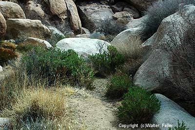
  3. Habitat: Chukars prefer arid and rocky habitats like desert canyons, hillsides, and semi-arid landscapes. They are well adapted to living in rugged terrain and can be found at various elevations, from low deserts to high mountains.
  4. Behavior: Chukars are social birds and often gather in coveys, which are groups of individuals. They feed on a variety of seeds, plants, and small insects. Their call is distinctive and sounds like “chukar-chukar-chukar,” which is how they got their common name.
  5. Reproduction: Chukars typically nest in rocky crevices or depressions on the ground. The female incubates the eggs, and the chicks are precocial, meaning they can leave the nest shortly after hatching. Chukar chicks can feed themselves and are raised by the female until they are old enough to fly.
  6. Conservation: Chukars are not considered globally threatened, and their populations are stable in their native range. However, in regions where they have been introduced as game birds, they are subject to hunting regulations to ensure sustainable populations.
  7. Game Birds: Chukars are popular game birds, and they are commonly hunted for sport and their meat. They are often released for hunting purposes in many parts of the world.

Chukars are known for their adaptability to arid and rocky environments and are appreciated by hunters for their challenging behavior and flight patterns. They have become established in various regions due to their introduction to recreational hunting.

Gambel’s Quail

https://digital-desert.com/wildlife/gambels-quail.html

Gambel’s quail (Callipepla gambelii) is a species of New World quail that is native to the southwestern United States and parts of Mexico. They are named after William Gambel, a 19th-century naturalist who documented various species of North American birds.

Here are some key characteristics and information about Gambel’s quail:

  1. Physical Description: Gambel’s quail are medium-sized birds with a plump, rounded body. They have a distinctive appearance with a prominent topknot or plume on their head, which consists of a black feather with white edges. Males and females look similar, but males are slightly larger and more colorful.
  2. Range: These quail are primarily found in the arid and semi-arid regions of the southwestern United States, including parts of Arizona, New Mexico, Nevada, Utah, Colorado, and California, as well as northern Mexico.
  3. Habitat: They inhabit various desert and semi-desert environments, including shrublands, scrubby areas, and open woodlands. Gambel’s quail is particularly adapted to arid regions and can often be found in areas with brushy cover.
  4. Behavior: These birds are known for their distinctive “ka-KAA” call, which is often heard in the early morning and late evening. They are generally ground-dwelling birds and spend most of their time foraging for seeds, leaves, and insects on the ground. They are social birds and often gather in family groups or coveys, especially during the non-breeding season.
  5. Reproduction: Gambel’s quail breed during the spring and early summer. Nests are typically placed on the ground and are well-hidden. The female incubates the eggs and cares for the chicks after hatching. The chicks are precocial and can leave the nest shortly after hatching.
  6. Conservation: Gambel’s quail populations are generally stable, and they are not considered to be at risk. They have adapted well to human-altered landscapes in some areas and can even be seen in suburban environments.
  7. Game Birds: Gambel’s quail are often hunted for sport and are considered game birds in the regions where they are found. Hunting seasons and regulations are in place to ensure the sustainability of the population.

Gambel’s quail are iconic birds of the American Southwest, and their distinctive appearance and calls make them a popular sight for birdwatchers and nature enthusiasts in their native habitat.

Barstow, California

https://digital-desert.com/barstow-ca/

.

  1. Early Inhabitants: The Barstow area was originally inhabited by Native American tribes, including the Mojave people, for centuries before European settlers arrived.
  2. Railroad History: Barstow’s modern history began with the arrival of the Atchison, Topeka, and Santa Fe Railroad in the late 19th century. The railroad played a significant role in the city’s development, as it was a vital stop on the transcontinental rail line, connecting the eastern United States to the West Coast.
  3. Water Stop and Rail Depot: Barstow served as an important water stop for steam locomotives, providing a place for trains to refill their water tanks in the desert. The city also became a key rail depot and maintenance facility.
  4. Name Change: Originally known as Waterman Junction, the city’s name was changed to Barstow in 1886 in honor of William Barstow Strong, a president of the Santa Fe Railroad.
  5. Route 66: In the early 20th century, Barstow became an integral part of the iconic Route 66, the “Main Street of America,” connecting Chicago to Los Angeles. The city thrived as a popular stopping point for travelers on this historic route.
  6. Military Presence: During World War II, Barstow’s population grew due to the establishment of the Marine Corps Logistics Base Barstow and the nearby Fort Irwin National Training Center, which continue to play significant roles in the local economy.
  7. Modern Times: Barstow remains a transportation center today, situated at the junction of Interstates 15 and 40. It continues to serve as a rest stop for travelers and a transportation and logistics hub for goods moving across the country.
  8. Historical Landmarks: The city has preserved its historical heritage, with several landmarks and museums, including the Route 66 Mother Road Museum and the Western America Railroad Museum, showcasing its rich transportation history.

Barstow’s history is deeply intertwined with the development of transportation networks, from the railroad to Route 66 and modern interstate highways. Today, it remains an essential point of access and commerce for those traveling through the Mojave Desert in Southern California.

Beavertail Cactus

https://mojavedesert.net/cactus/beavertail.html

The beavertail cactus, scientifically known as Opuntia basilaris, is a species of prickly pear cactus native to the southwestern United States and parts of northern Mexico. It gets its common name from the shape of its pads, which resemble the broad, flattened tail of a beaver. This cactus is known for its distinctive, bluish-gray, oval or paddle-shaped stems, which are typically covered in tiny, hair-like spines and glochids, which are small, hair-like prickles that can irritate the skin upon contact.

Beavertail cacti produce colorful flowers in shades of pink, magenta, or purple. These flowers often appear at the edges of the pads in the spring and early summer. The fruits of this cactus are edible and are usually red or purple when ripe.

Beavertail cacti are adapted to arid and desert environments and are well-suited to the harsh conditions of their natural habitat. They are drought-tolerant and can store water in their stems to survive periods of water scarcity. These cacti play a role in providing food and habitat for wildlife in their native regions.

In landscaping and gardening, beavertail cacti are often cultivated for their ornamental value, as their unique appearance and vibrant flowers make them attractive additions to xeriscape gardens or desert-themed landscapes. However, it’s essential to handle them with care due to their spines and glochids, which can cause skin irritation.

Like other cacti, the beavertail cactus prefers well-draining soil and requires minimal watering once established. It is important to be mindful of local regulations when collecting or cultivating beavertail cacti, as they are protected in some areas due to their ecological importance and vulnerability to overharvesting.

Mojave or Mohave?

IS WORD “MOJAVE”: J OR H?

Much confusion and argument have arisen from the two spellings of the word “Mojave.” A ruling of the Geographical Board in Washington, D.C., however, a few years ago simplified the problem somewhat. If you are in California, the name of the river, the city, and the desert should be spelled with a “j”: Mojave. If, on the other hand, you happen to be in Arizona, then you must spell the name of the county and the Indian tribe with an “h”: Mohave.

Dr. A.L. Kroeber of the University of California, a noted anthropologist, claims that only the “h” spelling should exist since the word is an Indian one, not Spanish, and was only transliterated by the early Spanish, who gave all “h” sounds a spelling of “j.” The very same problem arose with the greatest Indian tribe of Northern Arizona: should it be Navaho or Navajo?

The word Mojave (or Mohave) itself is of Indian origin and is that tribe’s name for “three mountains,” referring to three distinctive landmarks near the present city of Needles, whose name also refers to this geological oddity.

from; Desert Rat Scrapbook
Published by Harry Oliver

Fort Commander, Publisher, Distributor, Lamp Lighter, Editor, Artist, Gardener, Janitor, Owner
A paper that grows on you as you as you turn each page . . . excepting page 5

Pictures are by the author, many of them are woodcuts.

“I Did All but the Spelling.”

Cultural Mojave

The Mojave Desert, located in the southwestern United States, is not only a vast expanse of arid land and rugged beauty but also a region rich in cultural heritage. The Cultural Mojave is a term that encompasses the diverse traditions, art forms, and history of the indigenous peoples and settlers who have called this desert home for centuries.

One of the most prominent aspects of the Cultural Mojave is the Native American heritage. The Mojave people, also known as the Pipa Aha Macav, have inhabited the region for thousands of years and have a deep connection to the land. Their traditional way of life, which includes hunting, gathering, and agriculture, reflects their strong bond with nature. Through their storytelling, music, and art, the Mojave people preserve and pass down their cultural traditions from generation to generation.

Artistic expression plays a significant role in the Cultural Mojave. The desert landscape, with its stark beauty and unique features, has inspired numerous artists over the years. From painters capturing the vibrant colors of the desert sunsets to photographers capturing the vastness of the dunes, the art of the Cultural Mojave reflects the awe-inspiring nature of the region.

Another important aspect of the Cultural Mojave is the history of exploration and settlement. The desert has long been a crossroads for travelers, from Native American trade routes to the westward migration of pioneers during the 19th century. The stories of these intrepid explorers and settlers are woven into the region’s fabric, adding depth and complexity to its cultural identity.

In recent years, the Cultural Mojave has gained attention as a center for alternative and sustainable living. The desert’s remote location and vast open spaces have attracted individuals and communities seeking a simpler and more environmentally conscious way of life. From off-grid living to eco-friendly architecture, the Cultural Mojave is a hub for innovative ideas and practices that promote harmony with the natural world.

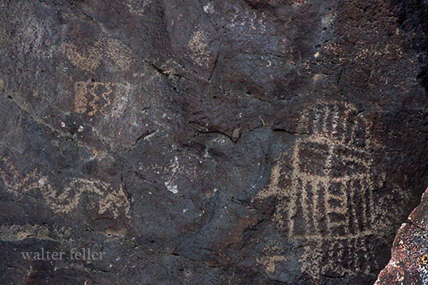
It is the spirit of the human spirit that constitutes the Cultural Mojave. It is a place where ancient traditions merge with modern innovations, creating an extraordinary and vibrant cultural tapestry. Whether it’s exploring ancient petroglyphs, attending traditional ceremonies, or simply marveling at the breathtaking landscape, the Cultural Mojave offers a multitude of experiences that celebrate the rich heritage of this extraordinary desert region.

Ecotones Defined

Ecotone is a term used in ecology to describe a transitional zone between two different ecosystems. It is an area where two distinct ecological communities meet and interact, creating a unique and diverse habitat. Ecotones are characterized by a blend of species and environmental conditions from both adjacent ecosystems, resulting in a rich array of biodiversity.

Ecotones can be found in various natural settings, such as where a forest meets a grassland, a river merges with a lake, or a shoreline transitions into a marsh. These transitional zones often display a gradient of species composition, with certain species being more abundant or specialized at specific points along the ecotone.

The dynamics of an ecotone are influenced by the physical and biological processes occurring in both adjacent ecosystems. Factors such as climate, topography, soil type, and water availability can shape the structure and function of the ecotone. As a result, ecotones can exhibit unique microclimates, hydrological patterns, and nutrient cycling dynamics that differ from the surrounding ecosystems.

Ecotones play an essential role in supporting biodiversity and promoting ecological resilience. They serve as corridors or stepping stones for species migration, allowing for gene flow and enhancing genetic diversity. Ecotones also provide habitat for specialized species that are adapted to the unique conditions found within the transitional zone.

Furthermore, ecotones contribute to ecosystem services by providing valuable resources and ecological functions. They can regulate water flow, filter pollutants, and stabilize soil, thus helping to mitigate the impacts of human activities on surrounding ecosystems. Ecotones also offer recreational and educational opportunities, allowing people to appreciate the beauty and ecological significance of these transitional areas.

In conclusion, ecotones are dynamic and complex zones that bridge the gap between two distinct ecosystems. They are characterized by a unique blend of species and environmental conditions, creating a diverse and valuable habitat. Understanding and conserving ecotones is crucial for maintaining biodiversity, promoting ecological resilience, and ensuring the sustainability of our natural environment.

Shoshone, California

https://digital-desert.com/shoshone-ca/

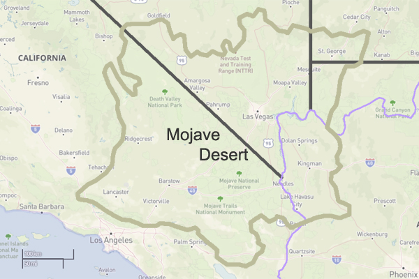
Shoshone, California, is a small unincorporated community in Inyo County, California. Nestled in the southern part of the state, Shoshone is situated in the Mojave Desert near the eastern border of Death Valley National Park. The town was founded in 1910 and has a rich history tied to mining and agriculture.

One of the main attractions in Shoshone is the Shoshone Museum, which showcases the town’s history and the surrounding area. The museum exhibits Native American heritage, mining operations, and early pioneers. Visitors can learn about the Mojave Desert’s wildlife, geology, and plant life.

Outdoor enthusiasts can explore the nearby Death Valley National Park, which is just a short drive away from Shoshone. This vast national park offers a variety of recreational activities like hiking, camping, and birdwatching. With its striking landscapes, including dunes, salt flats, and rugged mountains, Death Valley is a must-visit destination for nature lovers.

Shoshone is a peaceful and quiet community that offers a respite from the hustle and bustle of city life. With its charming small-town atmosphere, visitors can experience a slower pace of life and reconnect with nature. The town has a few accommodations, including a motel and camping facilities, making it an excellent base for exploring the surrounding area.

Whether you’re interested in history, outdoor activities, or simply looking for a peaceful getaway, Shoshone, California, has something to offer. Its unique location near Death Valley National Park and rich history make it a destination worth visiting. So, pack your bags and embark on an adventure to Shoshone, where you can immerse yourself in the desert’s beauty and tranquility.

Death Photography

Today, we look at Post-Mortem Photography through a different lens. – w.feller

The practice of death photography in the late 19th century holds a significant place in the history of photography. During this era, capturing post-mortem portraits of deceased loved ones became a common and accepted practice. Death photography, also known as mourning or post-mortem photography, served as a way for families to remember and mourn their departed relatives.

In the 1800s, death was an ever-present aspect of life. Illnesses such as tuberculosis, typhoid fever, and smallpox were prevalent, and mortality rates were high, especially among children. In this context, death photography emerged as a way to preserve the memory of the deceased and create a lasting visual memento.

The process of death photography involved carefully arranging the deceased in lifelike poses, often with family members or close friends surrounding them. The intent was to capture a sense of peace and serenity, presenting the dead as if they were merely sleeping. The use of props, such as books or toys, was used to enhance the illusion of life further.

The technical limitations of photography required long exposure times; the deceased was the most suitable subject for portrait photography, as they could remain still for long, extended periods. As a result, death photography became an integral part of the photographic practices of the time.

Families cherished these photographs, often displayed prominently in homes or carried as keepsakes. They provided a tangible connection to the deceased, allowing grieving individuals to feel closer to their loved ones even after they died. Death photography also played a role in the mourning process, providing a visual representation of the deceased’s final moments and facilitating the grieving process.

The popularity of death photography began to decline in the late 19th century with the introduction of post-mortem embalming techniques and the increasing availability of faster photographic processes. As society’s attitudes towards death and mourning evolved, death photography gradually fell out of favor.

While it may seem strange or macabre to modern sensibilities, it is essential to understand the historical and cultural context in which it existed. Death photography in the 1800s served as a way for people to cope with loss and pay tribute to their departed loved ones, reflecting the customs and beliefs of the time.

Death photography in the 1800s was a significant practice that allowed families to remember and grieve for their deceased relatives. These photographs provided a tangible connection to the departed and played a crucial role in the mourning process. Although the practice has declined over time, it remains an important part of the history of photography. It offers insights into the cultural attitudes towards death and loss during the 19th century.

Leadfield – Summary

https://mojavedesert.net/mining-history/leadfield/index.html

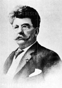
Leadfield, located in Titus Canyon, was promoted by a man who could have sold ice to an Eskimo. He blasted some tunnels and liberally salted them with lead ore and drew up some enticing maps of the area, which lured Eastern promoters into investing money.

The true story of Leadfield is somewhat different from the usual tale of a stock swindle and a dying town.

During the early days of the Bullfrog boom, W. H. Seaman and Curtis Durnford staked nine lead and copper claims in Titus Canyon and came into Rhyolite with ore samples that assayed as high as $40 to the ton. The Death Valley Consolidated Mining Company was incorporated and immediately began a development and promotional campaign.

The Death Valley Consolidated Mining Company ceased operations in 1906 after realizing that the long and arduous trip between its mine and Rhyolite made the shipment of its ore absolutely unprofitable.

In 1924, three prospectors staked out numerous claims on some lead deposits in Titus Canyon. A local promoter named John Salsberry purchased twelve claims from the three prospectors and formed the Western Lead Mines Company.

The young camp was entering the boom stage, and by January 30th, half a dozen mining companies were in operation. The stock of Western Lead Mines Company soared to $1.57 per share.

Eastern California, and especially Inyo County, was long overdue for a mining boom. With the backing of a successful and skilled promoter, Leadfield seemed assured of obtaining the necessary financial support to take it from a prospecting boom camp into a producing mine town.

The Inyo Independent greeted Julian with a glowing description of his character and abilities, but a different endorsement would be printed in later years.

The boom was now on in earnest, with the Western Lead Company employing 140 men and the Titus Canyon Road being completed. The Western Lead Mine produced 8% to 30% lead and seven ounces of silver per ton.

The California State Corporation Commission was not so impressed with the company and raised the righteous indignation of local folk. The local attitude was well summed up by the Owens Valley Herald: “The Commission is using its every endeavor to try and prejudice the people against this latest promotion of Julian’s.”

The paper pointed out that Julian was not trying to swindle anyone and that he had publicly invited any reputable mining engineer worldwide to visit the Leadfield District. The paper concluded that the future of Leadfield seemed very bright.

Julian was not the only promoter singing the praises of the Leadfield District, for numerous other companies were also trying to cash in on the boom. The Western Lead Mines Company, Julian’s pet, led the pack, with one of its tunnels six hundred feet inside the mountain.

The town of Leadfield was trying to keep pace with the boom and announced that a large hotel would soon be built. On March 15th, the first of Julian’s promotional excursions pulled into Beatty, and 340 passengers were served a sumptuous outdoor feast by the proprietor of the local Ole’s Inn.

Lieutenant-Governor Gover of Nevada gave the keynote speech, and Julian gave a speech praising Julian for overcoming the numerous obstacles that modern governmental bureaucracies put in a man’s path. The trip was a big success, and Western Lead stock advanced 25 on the San Francisco market the next day.

Western Lead stock had soared to $3.30 a share by the end of March, and several ore-buying and smelting concerns sent representatives to the district to discuss reduction and smelting rates.

Leadfield continued to develop in the months following the great train excursion. New mining companies opened for business, and the Tonopah & Tidewater Railroad replied that definite plans for a railroad spur into Leadfield had not been made as the present business does not warrant its construction.

The townsite of Leadfield was officially surveyed on April 30th, and the town’s plat was submitted to Inyo County officials for approval. The town was platted on land donated by the Western Lead Company.

The State of California was breathing hard upon Julian’s neck, and the Corporation Commission hauled a brokerage company into court for selling Western Lead stock without a state permit. Expert witnesses testified that the Western Lead Mine was a quite legitimate proposition.

The continued investigations by the state of California hurt the sales of Western Lead stock, and another factor began to take a toll. Julian’s credibility began to shrink, and the company never recovered from the panic that set in.

Julian bought into the New Roads Mining Company, which gave him control of the two largest mines of Leadfield and announced plans to construct a large milling plant at Leadfield.

As summer approached, the Leadfield boom showed no signs of peaking. The California Corporation Commission ordered that sales of Julian’s personal stock in the Western Lead Mines must immediately cease on the Los Angeles stock exchange due to evidence introduced at a hearing.

Despite the heavy blow to Julian’s financial fortunes, developments at Leadfield proceeded, and the Mining Journal printed a long, detailed report on the Leadfield District in July, which helped to restore public confidence.

The mines agreed with the independent experts and continued to work, and the Boundary Cone Mining Company ordered a new 25-horsepower hoist and headframe and increased its workforce to twelve miners.

In late July, the Western Lead Mining Company brought a $350,000 damage suit against the Los Angeles Times and the California Corporation Commission. Still, the suit was quickly thrown out of court for insufficient cause. In August, a new mining company, the Pacific Lead Mines No. 2, was incorporated.

During September and October, drilling and tunneling continued in Leadfield’s mines, but in late October, two events took place that spelled the end of Leadfield. The main tunnel of the Western Lead Mine finally penetrated the ledge but found almost nothing.

At almost the same time, the California Corporation Commission dealt Julian another blow when it halted stock sales in the Julian Merger Mines, Inc. Julian’s empire fell apart. The other mines slowly closed, one after the other, and Leadfield became a ghost town in a matter of months.

The failure of a mining district led to a flurry of lawsuits. In February of 1927, the Western Lead Company removed its heavy machinery and the pipeline to a mine that the company owned in Arizona.

Julian went on to organize the Julian Oil and Royalties Company and was indicted for fraud, but jumped bail and committed suicide.

Leadfield was a ghost town created by C. C. Julian. Still, the existence of lead ore in the district had been known as far back as the Bullfrog boom days of 1905, and the California Corporation Commission allowed companies other than Julian’s to sell their stock.

Julian did not start the Leadfield boom and had plenty of help in supporting the boom once it had started. The citizens of Inyo County, California, and Nye County, Nevada, also supported the mines.

The collapse of Julian’s financial structure came at the worst possible time for Leadfield. Although it seems doubtful that Leadfield had enough ore to support more than a small mining company or two, indications are that without the sudden panic of the fall of 1926, that mine or two could have survived.

The Titus Canyon Road, an engineering marvel, was built by Julian and cost an estimated $60,000 to build. Without Julian, the road would not have been finished, and today presents one of the most spectacular routes in Death Valley National Park.