Micheal White

Miguel Blanco

Villains with the Blackest Hearts

An experience of Michael White (Miguel Blanco) on the Old Spanish Trail to San Bernardino, California.

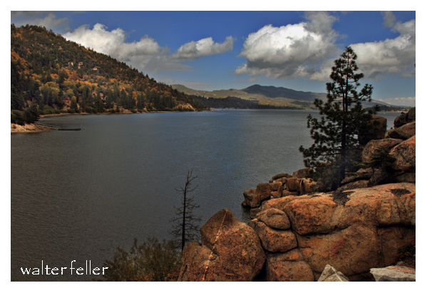
We stopped a day or two on a lake called the San José (now known as the Beggars’), and I told my partner to take care of the horses, as I wanted to ride around and take a look at the country. Riding round I heard firing a little ahead of me. Hurrying on, I discovered that our New Mexicans had surrounded a rancheria of Piutes. I saw one little Indian boy, about 12 years old, with his arm nearly shot off, just hanging by the skin a little below the shoulder. I began to scold the New Mexicans and called them a pack of damned brutes and cowards, and they were so.

There was one old Indian, standing with his bow and arrow. They wanted to take and kill him, but were afraid to approach near enough to come within reach of his arrow. I went up to the Indian and asked him for his bow and arrows—they had solemnly promised me not to hurt him if I succeeded in disarming him. The Indian handed them to me and I shall never forgive myself for having taken the word of those villains, for villains they were, of the blackest kind. As soon as they saw the Indian without arms they came near and riddled him with bullets.

I parted with them and went by myself. This was a considerable distance from our camp. I found another rancheria in a thicket of willows. An Indian came out and by sign asked me if I had come to fight. I said no; then he asked me if I was hungry, and answering in the affirmative, he invited me to alight, and partake of what he had, which was atole [a drink], made of the seed of hogweed, and barbecued trout of the most delicious—as you may suppose, considering I had had nothing to eat in nearly 24 hours. Whilst I was eating up came the confounded New Mexicans, and the Indians ran to conceal themselves in the brush. All but two succeeded in escaping—those two unfortunate Piutes were taken by the Mexicans, tied, and shot in cold blood. I begged, entreated, threatened, and did all I could to have their lives spared but all my efforts were unavailing. When they were about to shoot the Indians, I was so indignant that I raised my gun, aimed at one of the gang, and pulled the trigger, and it wouldn’t fall, though I pulled it with all my force. 10 or 12 guns were pointed at me, but they didn’t fire, as my gun had not gone off—they said this was what saved me. The rascal’s name was Tomás Salazar. I assured them that I would never again travel with such a set of brutes. They answered, “ Que! no es pecado matar esos indios gentiles.” [Oh, well. It’s no sin to kill those pagan Indians.]

My partner in the camp wanted me to keep quiet, because the New Mexicans were exasperated against me and would put me to death if I said more. From that time I had no rest at night. I was apprehensive of being murdered.

California all the way back to 1828. By Michael C.
White. Written by Thomas Savage for the Bancroft
Library, 1877

Barstow

What would it have been like to live on the edge of the desert wilderness between 1850 and 1870?

Life in the Barstow, Daggett, and Calico area between 1850 and 1870 would have been characterized by the challenges and opportunities of frontier living and the influence of the California Gold Rush.

During this period, the area was an important outpost along the Mojave Road, a major trade route connecting southern California with the rest of the Southwest. Barstow, Daggett, and Calico towns would have seen a steady stream of pioneers, settlers, and traders passing through, seeking respite, supplies, and companionship on their journeys.

Life in the area would have been challenging, as settlers and travelers had to contend with harsh desert conditions, extreme temperatures, and limited resources. The towns would have offered essential services such as food, water, lodging, and blacksmithing, providing a lifeline for those passing through the unforgiving landscape.

The California Gold Rush of the late 1840s and 1850s also impacted the area, as prospectors and miners flocked to California for their fortunes. The discovery of gold and other minerals in the region brought settlers and entrepreneurs to the area, leading to mining camps and boomtowns.

Life in the mining camps and towns would have been marked by hard work, uncertainty, and camaraderie as people came together to build communities and seek their fortunes in the California desert. The mining industry played a central role in shaping the area’s economy and society, with miners facing dangerous working conditions and fluctuations in the market for minerals.

Overall, life in the Barstow, Daggett, and Calico area between 1850 and 1870 would have been characterized by the challenges and opportunities of frontier living. The towns served as vital outposts, providing essential services and support to pioneers and settlers seeking a better life in the American West.

1871 – 1900

The introduction of the railroad to the Barstow, Daggett, and Calico area between 1871 and 1900 would have significantly impacted the region’s life and economy.

The railroad would have facilitated the transportation of goods, materials, and people to and from the mining towns, making it easier to access the area and transport resources in and out. This would have boosted the local economy and helped the mining industry thrive by providing a more efficient means of transportation for the minerals extracted from the mines.

The railroad also brought an influx of new settlers and businesses to the area, further contributing to the growth and development of the towns. The increased connectivity provided by the railroad would have helped the communities in the area become more integrated with the rest of the region and the broader economy.

Life in the mining towns between 1871 and 1900, with the presence of the railroad, would have been marked by increased economic activity, improved infrastructure, and enhanced opportunities for trade and commerce. The towns would have become more connected to the outside world, allowing for exchanging goods, services, and ideas.

The railroad would have also influenced social life in the towns, bringing new cultural influences and experiences to the area. The increased mobility provided by the railroad would have allowed for more interaction between the residents of the mining towns and the wider world, enhancing the diversity and vibrancy of the communities.

Overall, the introduction of the railroad to the Barstow, Daggett, and Calico area between 1871 and 1900 would have been a transformative event, shaping the region’s economy, society, and culture and contributing to the growth and prosperity of the mining towns during this period.

1901 – 1926

Life in the Barstow, Daggett, and Calico areas between 1901 and 1926 would have been influenced by the region’s continued growth and development, as well as by significant historical events and social changes during that time.

  1. Railroad Expansion: The early 20th century saw further expansion of the railroad network in the area, with the Atchison, Topeka, and Santa Fe Railway playing a prominent role. The railroads continued to be a driving force in the local economy, facilitating the transportation of goods, people, and resources to and from the towns.
  2. Mining Industry: The mining industry remained a significant part of the economy during this period, with Calico continuing to produce silver, borax, and other minerals. The town experienced periods of boom and bust as the demand for minerals fluctuated, shaping the livelihoods of the residents in the area.
  3. Cultural and Social Changes: The early 20th century brought about changes in cultural and social norms, with new technologies, entertainment, and modes of transportation becoming more prevalent in the region. The towns would have been influenced by trends in popular culture and the influx of new residents and visitors to the area.
  4. World War I: The impact of World War I would have been felt in the Barstow, Daggett, and Calico areas, with residents likely affected by the war effort, rationing, and economic changes resulting from the conflict. The mining industry may have seen shifts in production and demand during this time.
  5. Prohibition and the Roaring Twenties: The period also saw the implementation of Prohibition in the United States, which may have had varying effects on the towns depending on their adherence to the ban on alcohol. The Roaring Twenties brought about changes in social customs, fashion, and entertainment that would have been reflected in the area’s communities.

Overall, life in the Barstow, Daggett, and Calico areas between 1901 and 1926 would have been a dynamic mix of economic, social, and cultural changes shaped by the continued growth of the region, historical events, and the evolving lifestyles of the people living in the American Southwest during this time.

1927 – 1940

Significant changes in transportation, economic conditions, and social dynamics shaped life in the Barstow, Daggett, and Calico areas between 1926 and 1940. The introduction of the National Old Trails Highway and later Route 66, followed by the onset of the Great Depression, would have had a profound impact on the communities in the region.

  1. Route 66 and Transportation: Establishing Route 66 as a major east-west highway in 1926 would have brought increased traffic, travelers, and commerce through the towns of Barstow, Daggett, and Calico. The highway served as a vital link between the Midwest and the West Coast, providing economic opportunities for businesses along its route.
  2. Impact of the Great Depression: The onset of the Great Depression in 1929 would have brought economic hardship to the area’s residents. The collapse of the economy, widespread unemployment, and financial instability would have affected the towns’ businesses, workers, and families, leading to struggles to make ends meet and maintain their livelihoods.
  3. Mining Industry and Agriculture: The mining industry in Calico and surrounding areas may have been impacted by the economic downturn, with fluctuations in demand for minerals and challenges in maintaining profitability. Agriculture in the region may have also faced challenges due to the Depression, affecting local farmers and growers.
  4. Migration and Transient Population: The economic conditions of the Great Depression may have led to an influx of migrants, transient populations, and “Okies” traveling along Route 66 in search of work and opportunities. The towns along the highway would have seen more transient populations passing through, seeking respite and resources.
  5. Community Support and Resilience: Despite the era’s challenges, the communities in Barstow, Daggett, and Calico would have likely come together to support one another, with local organizations, churches, and charities assisting those in need. Resilience, resourcefulness, and a sense of community would have been key in navigating the difficulties of the Great Depression.

Overall, life in the Barstow, Daggett, and Calico area between 1926 and 1940 would have been characterized by the transformative impact of Route 66, the challenges of the Great Depression, and the resilience of the communities in the face of economic hardship and uncertainty. The towns would have been part of a shifting landscape shaped by changes in transportation, economy, and society during this time period.

1941 – 1970

Life in the Barstow area between 1941 and 1970 would have been marked by significant historical events, economic changes, and social transformations that influenced the development and character of the region during this period. Here are some key aspects of life in the Barstow area between 1941 and 1970:

  1. World War II and Military Presence: The outbreak of World War II in 1941 would have profoundly impacted the Barstow area, as the town’s strategic location and proximity to military installations made it a hub for military activity. The nearby Marine Corps Logistics Base Barstow and the National Training Center at Fort Irwin would have brought a significant military presence to the region, influencing the local economy and community.
  2. Industrial Development: The post-war period saw the growth of industrial development in the region, driven in part by the construction of highways, such as Interstate 15 and Interstate 40, that passed through the Barstow area. The expansion of transportation infrastructure, including railroads and highways, facilitated the movement of goods and people through the region, contributing to economic growth.
  3. Population Growth and Urbanization: The period between 1941 and 1970 would have witnessed population growth and urbanization in the Barstow area as more people moved to the region searching for employment opportunities, particularly in the military, transportation, and logistics sectors. The town of Barstow would have experienced changes in its demographics and urban landscape during this time.
  4. Cultural and Social Changes: The post-war period brought about cultural and social changes in the Barstow area, influenced by trends in popular culture, music, and entertainment. The town would have been impacted by shifts in societal norms, technological advancements, and changing attitudes toward race and gender.
  5. Civil Rights Movement and Social Activism: The Civil Rights Movement of the 1960s would have resonated in the Barstow area as communities grappled with racial inequality, discrimination, and social justice issues. Residents may have participated in civil rights activism, protests, and movements for equality and justice during this period.
  6. Environmental Concerns: The growth of industrial activity and infrastructure in the Barstow area would have raised ecological concerns related to pollution, resource depletion, and land use. In response to these challenges, residents may have become more aware of the need for environmental conservation and sustainability.

Overall, life in the Barstow area between 1941 and 1970 would have been shaped by wartime mobilization, industrial development, population growth, cultural changes, social activism, and environmental considerations. The region would have been part of a dynamic landscape undergoing transformation and evolution in response to historical events and societal shifts during this time.

1971 – 2000

Living in the Barstow area from 1971 to 2000 would have been characterized by continued growth, industry changes, demographic shifts, and evolving social dynamics. Here are some critical aspects of life in the Barstow area during this period:

  1. Military Influence: The presence of military bases, such as the Marine Corps Logistics Base Barstow and the National Training Center at Fort Irwin, would have continued to shape the economy and community of the Barstow area. Military personnel and their families would have been a significant part of the population, contributing to the local economy and culture.
  2. Transportation Hub: Barstow’s strategic location at the intersection of major highways, including Interstate 15 and Interstate 40, would have solidified its role as a transportation hub. The town would have continued to serve as a stop for travelers, truckers, and tourists passing through the area on their way to Southern California destinations.
  3. Industrial and Economic Development: From 1971 to 2000, the Barstow area would have seen further industrial and economic development. The expansion of logistics, transportation, and distribution industries would have created job opportunities and attracted businesses to the region, contributing to local economic growth.
  4. Tourism and Hospitality: Barstow would have become a popular stopping point for tourists visiting attractions such as the Calico Ghost Town, the Mother Road Museum, and Route 66 landmarks. The hospitality industry, including hotels, restaurants, and retail shops, would have flourished to cater to visitors passing through the area.
  5. Environmental Awareness and Conservation: The Barstow area may have experienced increasing awareness of environmental issues and a growing emphasis on conservation and sustainability during the 1971 to 2000 period. Efforts to protect natural resources, preserve desert ecosystems, and promote responsible land use would have become more prominent in the community.
  6. Cultural Diversity and Community Life: The demographic makeup of the Barstow area would have continued to diversify, reflecting immigration, migration, and changes in population trends. Residents would have celebrated cultural diversity through community events, festivals, and activities that showcase different traditions and heritage.
  7. Technological Advancements: Advances in technology, communication, and digital infrastructure would have influenced daily life in the Barstow area. Residents may have experienced improved connectivity, access to information, and changes in how they interact with technology in their personal and professional lives.

Living in the Barstow area from 1971 to 2000 would have been characterized by a mix of military influence, transportation prominence, economic development, tourism opportunities, environmental awareness, cultural diversity, and technological advancements. The town would have continued to evolve and adapt to changing conditions while maintaining its role as a significant community in the high desert region of Southern California.

2001 – 2021

Life in the Barstow area from 2001 to today would have been characterized by further economic development, changes in industry, continued military presence, technological advancements, and ongoing efforts to address social and environmental issues. Here are some critical aspects of life in the Barstow area during this period:

  1. Economic Diversification: The Barstow area would have continued to diversify its economy beyond traditional industries such as transportation and military-related sectors. Efforts to attract new businesses, promote tourism, and support local entrepreneurship would have contributed to the region’s economic growth and job creation.
  2. Renewable Energy Initiatives: The Barstow area may have seen increased focus on renewable energy initiatives, such as solar and wind power projects, as part of efforts to transition towards sustainable energy sources and reduce reliance on fossil fuels. These developments would have created opportunities for green jobs and investment in clean technology.
  3. Infrastructure Improvements: Infrastructure projects, including upgrades to transportation networks, utilities, and public facilities, would have been implemented to support the growing population and economic activities in the Barstow area. Investments in infrastructure would have aimed to enhance connectivity, efficiency, and quality of life for residents.
  4. Military Training and Operations: The Marine Corps Logistics Base Barstow and the National Training Center at Fort Irwin would have continued to play a significant role in the community, providing training and support for military personnel and contributing to the local economy. Military exercises and operations conducted in the region would have influenced daily life for residents.
  5. Education and Healthcare Services: Access to education and healthcare services in the Barstow area would have been a focus of community development efforts. Schools, colleges, and medical facilities would have expanded to meet the needs of a growing population and ensure that residents have access to quality services.
  6. Community Engagement and Social Initiatives: Community organizations, non-profit groups, and local government agencies would have worked together to address social issues, promote inclusivity, and support community well-being. Initiatives related to youth programs, affordable housing, healthcare access, and cultural events would have enriched the social fabric of the Barstow area.
  7. Digital Connectivity and Innovation: Technological advancements in communication, digital infrastructure, and e-commerce would have influenced how residents in the Barstow area connect, access services, and engage with the broader world. Efforts to expand broadband access and promote digital literacy would increase connectivity and provide opportunities for residents.

Overall, life in the Barstow area from 2001 to today would have been shaped by ongoing economic development, infrastructure improvements, renewable energy initiatives, military activities, community engagement, technological advancements, and efforts to address social and environmental challenges. The region would have continued to evolve and adapt to changing conditions while maintaining its unique character and sense of community in the high desert of Southern California.

Hallie Daggett


Hallie Morse Daggett, the daughter of John Daggett. John Daggett was a notable figure in his own right, having served as the Lieutenant Governor of California from 1883 to 1887 and later as the Superintendent of the San Francisco Mint.

Hallie’s connection to her father and upbringing influenced her independent spirit and determination.

Growing up in a family with such a public-service-oriented background may have instilled in her the confidence and resilience to pursue a career in the traditionally male-dominated forestry and fire lookout work. Her pioneering role as the first woman fire lookout in the United States Forest Service, where she dedicated 14 years of her life to protecting the forests of Northern California.

John Daggett

Daggett, California

Fred Loring

“Fred W. Loring, in his campaign costume, with his mule `Evil Merodach.’ Taken about 48 hours before he was brutally murdered by Apache–Mohaves while en route from Prescott, Arizona Territory to San Bernardino, Ca., by stage. Loring had been with the Wheeler expedition as general assistant and correspondent and was returning to the East with a mind stored with rare adventure and scenic wonders.”

By Timothy H. O’Sullivan, 1871.

FRED W. LORING AND HIS MULE “EVIL MERODACH” PRESCOTT, ARIZONA

Boron Related Index

Boron, California

digital-desert.com › boron-ca

In the Spring of 1925, William M. Dowsing and J. L. Hannan discovered a huge deposit 120 feet (37 m) thick just 1 1/2 miles west of Suckow’s shaft, which they …

Boron Cemetery – Mojave desert photo tour

digital-desert.com › boron-cemetery

Virtual tour of graveyard in boron california.

Kramer Junction (Four Corners) Mojave High Desert

digital-desert.com › kramer-junction-ca

3) Go west on State Route 58 through Boron, Mojave, or California City and up to Tehachapi and over the Southern Sierra. 4) Go east to Barstow. There is …

Heritage of the Upper Mojave Desert

mojavedesert.net › books › upper-Mojave

Boron. What was formerly Amargo is the community of Boron today. When a camp was created for mining employees,…

Boron and Copper Discoveries

mojavedesert.net › mining-history › overview

The Copper World Mine, discovered in 1869, was systematically mined in 1898. Ore was smelted west of the mine at Valley Wells. After reduction at the …

Antelope Valley

digital-desert.com › antelope-valley

This valley is one of nine in California with the same name. This valley sweeps across the western Mojave high desert and includes the communities of Lancaster, …

What is Borax? – Notes

digital-desert.com › blog › what-is-borax

Sep 27, 2023  Chemical Composition: Borax is an inorganic compound comprising sodium, boron, oxygen, and water molecules. Its chemical formula is Na2B4O7· …

Mojave, California

digital-desert.com › mojave-ca

The population was 3,836 at the 2000 census. The town is located at the northwestern corner of the Mojave Desert, below the Oak Creek Pass. Mojave, Ca …

20 Mule Team Mule Skinner

digital-desert.com › death-valley-history › skinner

Boron California. [19][20] The first post office at Boron opened in 1938. History of Borax Mining in … The Twenty Mule Teams hauled more than 20 million …

KRAMER DISTRICT

mojavedesert.net › desert-fever › kramer-district

Desert Fever – Kern County: Kramer District. This district, located some 30 miles east of Mojave, contains the most important source of borax and borate …

Highway 58

digital-desert.com › road-trail › highway-58

State Highway 58 (SR 58) in California, which traverses the Mojave Desert, passes through a range of interesting and diverse points of interest. Here’s a look …

Mule Skinner

/death-valley-history/skinner.html

Introduction

The mule skinner was a skilled tradesman who specialized in working with mules. Their job was to maintain and care for the animals, as well as harness them for tasks such as pulling carts or carrying loads. Mule skinners had a unique set of skills that were essential for the successful operation of various agricultural and transportation industries.

Responsibilities

1. Caring for the Animals: Mule skinners were responsible for the daily care and maintenance of mules. This included grooming, feeding, and watering them, as well as providing any necessary medical attention. They also ensured that the mules were properly shod and fit for work.

2. Harnessing and Driving: One of the key duties of a mule skinner was to harness the animals for the task at hand. They needed to know the correct placement of harness and straps to ensure the safety and comfort of the mules. Mule skinners also drove the mules using a variety of methods, such as using a whip or voice commands.

3. Teamster: Mule skinners were often employed as teamsters, leading teams of mules in tasks such as pulling carts or carrying loads. They needed to know how to manage a team of mules, keeping them coordinated and working together efficiently.

4. Maintenance and Repair: Mule skinners were responsible for maintaining the mules’ equipment and keeping everything in good working order. This included repairing harnesses, mending cart wheels, and other tasks to ensure the mules’ safety and productivity.

5. Safety and Security: Mule skinners had to ensure the mules’ safety and security at all times. They needed to be aware of the potential dangers on the road and take precautions to prevent accidents or injury to the animals.

Skills and Qualifications

To become a mule skinner, individuals typically had to possess certain skills and qualifications. These may include:

– Technical Knowledge: Mule skinners needed to know the anatomy and behavior of mules, as well as the best methods for harnessing and driving them. They also needed to possess knowledge of mule breeding and veterinary care.

– Leadership and Communication: Mule skinners had to be good leaders, able to effectively communicate with a team of mules and other drivers. They needed to be able to calm animals when agitated and guide them safely through challenging situations.

– Physical Strength and Endurance: Mule skinners needed to possess physical strength and endurance to work long hours in physically demanding conditions. They needed to be able to handle the mules and harness them, as well as assist in loading and unloading carts or wagons.

– Problem-Solving Skills: Mule skinners often encountered unexpected situations and had to think on their feet. They needed problem-solving skills to quickly assess situations and make sound decisions to ensure the safety and well-being of the mules.

Conclusion

The mule skinner was a skilled tradesman who played a significant role in various industries that rely on mules. Their job was to care for and maintain the animals, harness them for work, and drive them effectively. Mule skinners had a unique set of skills that allowed them to successfully handle mules and contribute to the success of various agricultural and transportation operations.

Southern Pacific Railroad Pages

Southern Pacific Railroad

mojavedesert.net › mining-history › overview

The Southern Pacific. The Southern Pacific began construction at Mojave in February 1882 of a new line to Needles, on the Colorado River. The destination was …

Southern Pacific Railroad

mojavedesert.net › railroads › southern-pacific-railroad

Historic RR Chronology … That railroad was never built, but the Southern Pacific constructed a line through the desert in 1882-83 from Mojave to Needles, …

The Southern Pacific and later Santa Fe transcontinental route

mojavedesert.net › railroads › railroads-021

In taking over this Southern Pacific line, especially the part between Needles and Barstow, the Santa Fe System achieved ownership of a transcontinental …

Southern Pacific Railroad – Jawbone

mojavedesert.net › railroads › jawbone

Jawbone branch of the Southern Pacific Railroad of the Mojave Desert.

Lancaster California

digital-desert.com › lancaster-ca

Lancaster, California. The Beginning. The Southern Pacific Railroad built a line from San Francisco to Los Angeles which was completed in 1876. Along the line …

Chronology/Timeline of Railroads of the Mojave Desert

mojavedesert.net › railroads › chronology

Mojave Desert Historic Railroad Chronology · 1876 – 1915 · 1881 Southern Pacific – Mojave – Calico Station (Daggett) · 1883 Atlantic & Pacific builds to Kingman

California Southern Railway

mojavedesert.net › railroads › california-southern

Notes asnd links regarding the California Southern Railway in the Cajon Pass to Barstow in 1887 – Mojave Desert.

Railroads in the Mojave (San Bernardino County)

mojavedesert.net › railroads › railroad-history03

The First Railroads. The Southern Pacific. The first western railroad project was put forth in 1835, when a line starting from Lake Michigan and extending …

Railroads of the Mojave Desert

mojavedesert.net › railroads

Atlantic & Pacific Railroad · Bullfrog Goldfield · Barnwell Searchlight · California Eastern Railroad/Railway · California Southern Railway · Carson and Colorado …

Carson & Colorado Railroad

mojavedesert.net › railroads › carson-and-colorado

… Southern Pacific’s narrow gauge subsidiary, the Nevada and California Railroad. … In the early 20th century, it o

Dawson Saddle Trail

Hike the Dawson Saddle Trail for Cooler Temps

AUGUST 19, 2020 BY CHRIS KASTEN

Late afternoon sun works its’ way through layers of smoke and cumulus clouds while the Ranch Fire burns way down below in the mouth of San Gabriel Canyon. That’s Mt. Williamson in the background, just right of center.

Hike the Dawson Saddle Trail for cooler temps and beautiful views of canyons and desert.  A few days ago, Joanie and I drove up to Dawson Saddle for a late afternoon hike.  Located approximately 13 miles west of Wrightwood, Dawson Saddle is the highest spot along the Angeles Crest Highway.  At an elevation of 7,901′ , this trailhead starts you out at about the coolest temps possible this time of year.  While the Front Country of the San Gabriel mountains smolders during the occasional heat waves of summer,  high country hikes, or walks, are well worth considering for a refreshing getaway.

Scarlet monkey flowers are in full bloom along this small unnamed stream flowing off of Mt. Burnham. The location of the photo was taken along Highway 2 (Angeles Crest Highway) just east of Dawson Saddle. In the background is a culvert running underneath and through the old rock work of the highway.

About a mile up the trail, while heading toward Throop Peak, we caught this scene of smoke and cumulus clouds out over San Gabriel Canyon.  The Ranch Fire II was still out of control a short distance up Highway 39 near Azusa.  Up above 8,000′ , the breeze coming in from the Pacific was cooling, yet tinged with the acrid scent of burning chaparral from miles away.   Our light was beginning to fade and we turned back around for the trailhead.  While driving back home, we stopped at a spot alongside the highway, where an unnamed stream flowed down the north slope of Mt. Burnham and then under the road.  Clusters of Crimson Monkey Flower and Columbine graced the stream bed.  Scooping up the icy water and splashing our faces and arms under a darkening  summer sky revived us for the twilight drive back.

Blue Ridge Trail Hike

/wrightwood-ca/

AUGUST 19, 2020 BY CHRIS KASTEN

Joanie pauses alongside the Blue Ridge Trail to check out some dried flower stalks of grass in the fading light.

Wrightwood’s Blue Ridge Trail hike, located just three miles west of this scenic mountain village, is a good place to get some shade and maybe even a little cooler weather, this time of year.   The trail runs between Big Pines and Blue Ridge Campground, traversing richly forested mountainsides.  Total elevation gain is only 1,100′ in the two miles spent under the canopy of expansive white fir, black oaks, Jeffrey, ponderosa and sugar pine.  Starting at 6,800′ , the trailhead is located just across Highway 2 from the old Big Pines Lodge.   There’s also a U.S. Forest Service information station here, which incidentally,  is closed for the meantime due to Covid cutbacks throughout the Forest Service.   Park in the paved lot adjacent to the restrooms.  Walk down a worn trail through the brush that’ll cross the Mountain High West parking lot’s exit road.  Look for the brown painted trail sign.

Clusters of asters are found growing along much of the Blue Ridge Trail, Wrightwood, CA. Also, look for them along the Lightning Ridge Trail as well as the Pacific Crest Trail where it runs along both East and West Blue Ridge.

Halfway up the trail is, true to its’ name, the Half Way rest.  It’s a nice log bench indicating that you’re only a mile from Blue Ridge Campground and a mile from where you began.   You’ll pass by some gentle draws along the mountainside where glades of gentle green squaw currant, dogwood and willow grow lushly.  There’s the smell of moist plants and earth dropping down from these quiet places.  The terrain is gentle, especially for the San Gabriel mountains.  Take the time to breathe all this beauty in.  Return the way you came.

Bobcat Fire Aftermath

Big Santa Anita Canyon

SEPTEMBER 20, 2020 BY CHRIS KASTEN

This photo was taken just a couple of days ago by an unnamed fire fighter and posted on Instagram. Photo was taken near Chantry Flat and is looking north up toward Sturtevant Falls. The arrow tip is in the Fern Lodge area of the main canyon, where the Upper Falls Trail and Gabrielino Trail leave the canyon bottom, continuing up and past Sturtevant Falls toward Cascade Picnic Area and Spruce Grove trail camp. It appears that much of the canyon bottom tree canopy is still intact after the Bobcat Fire !

Attached are two photos taken of Big Santa Anita Canyon in the aftermath of the Bobcat Fire.   There’s a third photo here, too.  It is of the flames dropping into the upper Big Santa Anita Canyon during the fire’s early stages of development.  The first photo was taken a couple of days ago.  Here you’re looking up the canyon from a point near the trailhead at Chantry Flats.  The second photo was taken by Larry Webster of Mt. Wilson just a day ago.  The view is from the east end of the summit looking down toward Sturtevant Camp.  Note the smoke still curling up from either the camp or adjacent to it.  It’s still too early to know what the damage actually was to the camp or the nearly eighty private cabins up and down the Big Santa Anita Canyon and Winter Creek.   Updates to follow as they come in.

This photo was taken after the fire passed through,  by Larry Webster of Mt. Wilson, CA. That’s Monrovia Peak, highest point in center horizon of photo. At the tip of arrow is Sturtevant Camp. As of this writing, it’s unknown how the camp fared in the Bobcat Fire.

This photo was taken before the Bobcat Fire reached Mt. Wilson.  Sturtevant Camp’s heliport is marked by the small red arrow.  Coincidentally, the camp itself, is located at the bottom, or start,  of the arrow’s shaft.

The Bobcat Fire dropping down into upper Big Santa Anita Canyon. At the end of the little red arrow is the heliport at Sturtevant Camp. Photo taken from Mt. Wilson by Larry Webster.