Mormon Fort, Las Vegas, Nevada

https://digital-desert.com/mormon-fort/

The Mormon Fort in Las Vegas, Nevada, is a historic site that holds significance in the region’s history. It is also known as the Old Mormon Fort State Historic Park. The fort represents the birthplace of Las Vegas and is considered the first permanent, non-native settlement in the Las Vegas Valley.

Here are some key points about the Mormon Fort:

  1. Establishment: The fort was established by a group of Mormon missionaries led by William Bringhurst in 1855. They were sent to the area to establish a way station along the Old Spanish Trail.
  2. Purpose: The Mormons built the fort to provide a place for travelers and settlers to rest and replenish supplies as they journeyed through the region. It served as a crucial stop for those traveling between Salt Lake City and Southern California.
  3. Abandonment: Due to conflicts with local Native American tribes and other challenges, the Mormons abandoned the fort in 1857.
  4. Later History: The fort had various uses over the years, including serving as a ranch and a military post. In the early 20th century, efforts were made to preserve and restore the site.
  5. State Historic Park: Today, the Old Mormon Fort is a state historic park managed by the Nevada Division of State Parks. It offers visitors a glimpse into the area’s past, featuring reconstructed adobe buildings and interpretive exhibits.
  6. Location: The Mormon Fort is located in downtown Las Vegas, near the intersection of Las Vegas Boulevard and Washington Avenue.

Visitors to the Mormon Fort can explore the historic structures, learn about the early pioneers who settled in the area, and gain insights into the challenges faced by the original inhabitants. The site provides a contrast to the modern development of Las Vegas and highlights its historical roots.

Roads West

Mojave Road and Beale’s Wagon Road are historic routes in the southwestern United States, particularly in the Mojave Desert region. Here’s some information about each:

  1. Mojave Road:
    • The Mojave Road is a historic trail that traverses California’s Mojave Desert. It was a significant route used by Native Americans, Spanish missionaries, and later by American pioneers and traders.
    • The trail is approximately 138 miles long and extends from the Colorado River near present-day Needles, California, to the Mojave River near present-day Barstow, California.
    • It was primarily used for transportation and trade between the Colorado River and the coastal settlements in California. The trail passes through varied desert landscapes, including sandy stretches, rocky terrain, and mountainous areas.
  2. Beale’s Wagon Road:
    • Beale’s Wagon Road, named after Edward F. Beale, a military officer and explorer, was a trail developed in the 19th century for the U.S. Army to improve communication and transportation across the arid lands of the American Southwest.
    • Edward F. Beale surveyed and established the road in the late 1850s. The road ran from Fort Defiance in Arizona to the Colorado River, passing through present-day Arizona and California.
    • Beale’s Wagon Road was designed to be more reliable and accessible than other trails, facilitating military movement and communication between California and the western territories.

Mojave Road and Beale’s Wagon Road were important in the United States’ westward expansion. Today, these routes attract history enthusiasts, adventurers, and off-road enthusiasts who explore them to experience the challenges faced by those who traveled these paths in the past. Keep in mind that conditions and accessibility of these trails may vary, so it’s important to check for current information and any regulations before embarking on a journey along these historic routes.

Scotty

“Death Valley” Scotty, whose full name was Walter E. Scott, was a colorful and legendary figure associated with Death Valley, a desert valley located in Eastern California. Scotty gained fame in the early 20th century for his claims of owning a gold mine in Death Valley and for his flamboyant personality.

Scotty’s story is closely tied to his relationship with wealthy Chicago businessman Albert Johnson. In the early 1900s, Scotty convinced Johnson to invest in his supposed gold mine, even though there was little evidence to support the existence of significant gold deposits. Despite the skepticism of others, Johnson continued to finance Scotty’s ventures, and the two became unlikely friends.

With his charismatic and theatrical personality, Scotty became a well-known character, and his antics and stories helped attract attention to Death Valley. He was known for his cowboy attire, tall tales, and his ability to charm people.

Scotty’s gold mine claims were largely exaggerated, and there is little evidence that he ever discovered a significant amount of gold. The financial arrangement between Scotty and Johnson remained a subject of speculation and mystery.

After Johnson died in 1948, it was revealed that much of the financing had come from Johnson himself, and Scotty had not been as successful in the mining business as he claimed. Despite the deceptive aspects of his story, Scotty remained a beloved figure in Death Valley folklore, and his former home, Scotty’s Castle, is a popular tourist attraction in Death Valley National Park.

The legacy of “Death Valley” Scotty is a mix of fact and fiction, blending the mystique of the Old West with a touch of showmanship and exaggeration.

Boomtown Historical Context and Characteristics

Rush to Claim Wealth: The news of these discoveries led to a rush of people trying to claim their share of the newfound wealth. Prospectors and miners flocked to the region in search of fortunes.

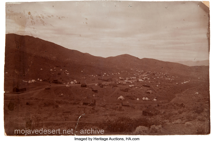
Randsburg c. 1897 – C.W. Tucker – photo

Discovery of Gold and Silver: These booms were triggered by the chance discovery of large deposits of gold and silver in the respective areas. The presence of valuable minerals was the catalyst for the rapid development of these towns.

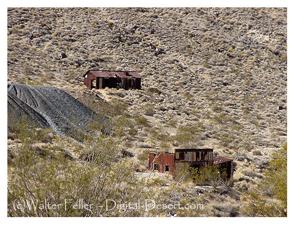
Leadfield (2003)

Explosive Growth of Boomtowns: The growth of these towns was explosive and often chaotic. They quickly developed into rowdy boomtowns characterized by a fast-paced, often disorderly expansion.

Promoters and Flimflam Men: Alongside serious promoters who saw the economic potential of these towns, there were also flashy con artists and tricksters looking to take advantage of the mining boom for their gain.

Arrival of Various Groups: As these towns grew, they attracted a diverse group of people, including merchants, teamsters, camp followers, schoolteachers, wives, and children. The influx of residents and services accompanied the rapid development.

Development of Farms and Ranches: The growth of these mining towns also led to the development of nearby farms and ranches. These agricultural activities provided food and resources to sustain the booming population.

Hope for Quick Riches: Many who flocked to these mining towns were motivated by the hope of striking it rich quickly. The prospect of finding valuable minerals and becoming wealthy was a powerful draw.

Values of the Old West: The people who settled in these towns held traditional values associated with the Old West, including a strong emphasis on personal freedom, independence, hard work, and the ability to endure the harsh conditions and challenges of the natural environment.

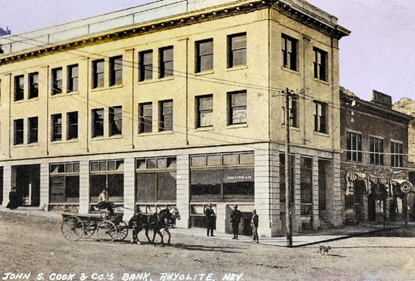
Cook Bank – Rhyolite, Nevada

Like many others in the Old West, these mining booms followed a pattern of rapid growth, economic opportunity, and social change, often accompanied by a degree of lawlessness and volatility. Over time, these towns could thrive or decline depending on the success of mining operations and economic factors, and their histories reflect the larger story of the American frontier and the pursuit of wealth and opportunity.

Mojave Road

/mojave-road/

Soda Springs – 1863

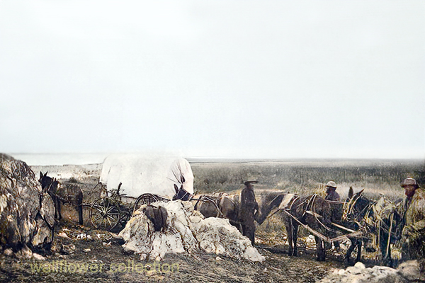
The Mojave Road, also known as the Old Mojave Road or the Mojave Trail, is a historic trade route and wagon road that traverses the Mojave Desert in the southwestern United States. Native American tribes originally used it for trade, and it later became an important transportation route for European settlers and traders during the 19th century.

Here are some key points about the Mojave Road:

Location: The Mojave Road runs through the Mojave Desert, primarily in what is now California and Nevada. It stretches from the Colorado River in the east to the San Bernardino Mountains in the west, covering approximately 140 miles (225 kilometers).

History: The road has a long history, with Native American tribes using it for centuries for trade and travel. In the 19th century, it became an essential route for early explorers, settlers, and traders moving through the desert.

Water Sources: One of the challenges of traveling the Mojave Road was the scarcity of water sources. Travelers had to rely on natural springs and wells, many of which were marked along the route to aid navigation.

Military Use: During the 19th century, the U.S. Army used the Mojave Road as a military supply route and for communication between the southern California coast and the interior of the Southwest. The road played a role in the U.S. government’s efforts to control the region.

Historic Sites: Along the Mojave Road, there are several historic sites and landmarks, including the Mojave National Preserve, the Mojave River, the Kelso Depot, and the Fort Piute ruins.

Recreation: Today, the Mojave Road is a popular route for off-road enthusiasts, hikers, and history buffs. Travelers can explore the historic route and experience the natural beauty of the Mojave Desert.

Preservation: Efforts have been made to preserve and maintain the Mojave Road as a historic and recreational route. The Mojave Road Guide, written by historian Dennis G. Casebier, is a valuable resource for those interested in traveling the road.

Please note that road conditions and accessibility may vary, so if you plan to explore the Mojave Road, it’s essential to do thorough research and be well-prepared for the journey. Always check for current information and obtain any necessary permits if required.

Leadfield – Summary

https://mojavedesert.net/mining-history/leadfield/index.html

Leadfield, located in Titus Canyon, was promoted by a man who could have sold ice to an Eskimo. He blasted some tunnels and liberally salted them with lead ore and drew up some enticing maps of the area, which lured Eastern promoters into investing money.

The true story of Leadfield is somewhat different from the usual tale of a stock swindle and a dying town.

During the early days of the Bullfrog boom, W. H. Seaman and Curtis Durnford staked nine lead and copper claims in Titus Canyon and came into Rhyolite with ore samples that assayed as high as $40 to the ton. The Death Valley Consolidated Mining Company was incorporated and immediately began a development and promotional campaign.

The Death Valley Consolidated Mining Company ceased operations in 1906 after realizing that the long and arduous trip between its mine and Rhyolite made the shipment of its ore absolutely unprofitable.

In 1924, three prospectors staked out numerous claims on some lead deposits in Titus Canyon. A local promoter named John Salsberry purchased twelve claims from the three prospectors and formed the Western Lead Mines Company.

The young camp was entering the boom stage, and by January 30th, half a dozen mining companies were in operation. The stock of Western Lead Mines Company soared to $1.57 per share.

Eastern California, and especially Inyo County, was long overdue for a mining boom. With the backing of a successful and skilled promoter, Leadfield seemed assured of obtaining the necessary financial support to take it from a prospecting boom camp into a producing mine town.

The Inyo Independent greeted Julian with a glowing description of his character and abilities, but a different endorsement would be printed in later years.

The boom was now on in earnest, with the Western Lead Company employing 140 men and the Titus Canyon Road being completed. The Western Lead Mine produced 8% to 30% lead and seven ounces of silver per ton.

The California State Corporation Commission was not so impressed with the company and raised the righteous indignation of local folk. The local attitude was well summed up by the Owens Valley Herald: “The Commission is using its every endeavor to try and prejudice the people against this latest promotion of Julian’s.”

The paper pointed out that Julian was not trying to swindle anyone and that he had publicly invited any reputable mining engineer worldwide to visit the Leadfield District. The paper concluded that the future of Leadfield seemed very bright.

Julian was not the only promoter singing the praises of the Leadfield District, for numerous other companies were also trying to cash in on the boom. The Western Lead Mines Company, Julian’s pet, led the pack, with one of its tunnels six hundred feet inside the mountain.

The town of Leadfield was trying to keep pace with the boom and announced that a large hotel would soon be built. On March 15th, the first of Julian’s promotional excursions pulled into Beatty, and 340 passengers were served a sumptuous outdoor feast by the proprietor of the local Ole’s Inn.

Lieutenant-Governor Gover of Nevada gave the keynote speech, and Julian gave a speech praising Julian for overcoming the numerous obstacles that modern governmental bureaucracies put in a man’s path. The trip was a big success, and Western Lead stock advanced 25 on the San Francisco market the next day.

Western Lead stock had soared to $3.30 a share by the end of March, and several ore-buying and smelting concerns sent representatives to the district to discuss reduction and smelting rates.

Leadfield continued to develop in the months following the great train excursion. New mining companies opened for business, and the Tonopah & Tidewater Railroad replied that definite plans for a railroad spur into Leadfield had not been made as the present business does not warrant its construction.

The townsite of Leadfield was officially surveyed on April 30th, and the town’s plat was submitted to Inyo County officials for approval. The town was platted on land donated by the Western Lead Company.

The State of California was breathing hard upon Julian’s neck, and the Corporation Commission hauled a brokerage company into court for selling Western Lead stock without a state permit. Expert witnesses testified that the Western Lead Mine was a quite legitimate proposition.

The continued investigations by the state of California hurt the sales of Western Lead stock, and another factor began to take a toll. Julian’s credibility began to shrink, and the company never recovered from the panic that set in.

Julian bought into the New Roads Mining Company, which gave him control of the two largest mines of Leadfield and announced plans to construct a large milling plant at Leadfield.

As summer approached, the Leadfield boom showed no signs of peaking. The California Corporation Commission ordered that sales of Julian’s personal stock in the Western Lead Mines must immediately cease on the Los Angeles stock exchange due to evidence introduced at a hearing.

Despite the heavy blow to Julian’s financial fortunes, developments at Leadfield proceeded, and the Mining Journal printed a long, detailed report on the Leadfield District in July, which helped to restore public confidence.

The mines agreed with the independent experts and continued to work, and the Boundary Cone Mining Company ordered a new 25-horsepower hoist and headframe and increased its workforce to twelve miners.

In late July, the Western Lead Mining Company brought a $350,000 damage suit against the Los Angeles Times and the California Corporation Commission. Still, the suit was quickly thrown out of court for insufficient cause. In August, a new mining company, the Pacific Lead Mines No. 2, was incorporated.

During September and October, drilling and tunneling continued in Leadfield’s mines, but in late October, two events took place that spelled the end of Leadfield. The main tunnel of the Western Lead Mine finally penetrated the ledge but found almost nothing.

At almost the same time, the California Corporation Commission dealt Julian another blow when it halted stock sales in the Julian Merger Mines, Inc. Julian’s empire fell apart. The other mines slowly closed, one after the other, and Leadfield became a ghost town in a matter of months.

The failure of a mining district led to a flurry of lawsuits. In February of 1927, the Western Lead Company removed its heavy machinery and the pipeline to a mine that the company owned in Arizona.

Julian went on to organize the Julian Oil and Royalties Company and was indicted for fraud, but jumped bail and committed suicide.

Leadfield was a ghost town created by C. C. Julian. Still, the existence of lead ore in the district had been known as far back as the Bullfrog boom days of 1905, and the California Corporation Commission allowed companies other than Julian’s to sell their stock.

Julian did not start the Leadfield boom and had plenty of help in supporting the boom once it had started. The citizens of Inyo County, California, and Nye County, Nevada, also supported the mines.

The collapse of Julian’s financial structure came at the worst possible time for Leadfield. Although it seems doubtful that Leadfield had enough ore to support more than a small mining company or two, indications are that without the sudden panic of the fall of 1926, that mine or two could have survived.

The Titus Canyon Road, an engineering marvel, was built by Julian and cost an estimated $60,000 to build. Without Julian, the road would not have been finished, and today presents one of the most spectacular routes in Death Valley National Park.

ONE TUNNEL . . . ONE LIFETIME

By Paul Hubbard, Randsburg Times    

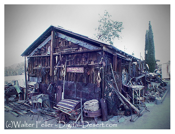
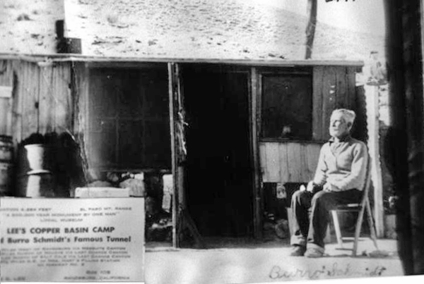
High in the El Paso Range, in the upper reaches of Mesquite Canyon, twelve miles west of Randsburg, in the living exponent of persistence, William Schmidt, better known to desert folks in that area as “Burro” Schmidt, 80-year-old recluse, “Burro” spent forty years of his life accomplishing one thing—hand-drilling a half-mile tunnel entirely through a mountain.

 Over that period, he worked on farms in the Kern River Valley, accumulating “beans” for the winter at his mine. Regularly, he appeared in Johannesburg with his burros and loaded up supplies at the Teagle’s Store each fall. 1937, his tunnel was finished, and the accomplishment received national publicity. Photographs of the tunnel, his burrow, and “Burro” Schmidt appeared in daily press and international mining journals. Single jack and drill steel and “Burro” Schmidt were the combination that did the job — no compressed air or gasoline motors.

As he nears the end of the trail, happy to have completed a lifetime undertaking, he proposes offering his tunnel and the story of mineralogy it tells to a California university. It will be a natural laboratory for the new generations who want to know the story of the rocks. It is a noble gesture from a nobleman of the desert hills.

https://digital-desert.com/burro-schmidt-tunnel/

https://digital-desert.com/burro-schmidt-cabin/

https://mojavedesert.net/people/schmidt.html

https://digital-desert.com/burro-schmidt-cabin/memorial.html

Old Woman Meteorite

The Old Woman, California, IIAB iron meteorite
Howard PLOTKIN, Roy S. CLARKE, JR., Timothy J. Mc COY,

and Catherine M. CORRIGAN
Department of Mineral Sciences, National Museum of Natural History, Smithsonian Institution, P.O. Box 37012,
Washington, DC 20013-7012, USA

Summary

PAGE 1

DISCOVERY OF THE METEORITE

  • Two prospectors found a large dark-colored rock in the Old Woman Mountains in March 1976. They were sure it was a meteorite because they had seen pictures of them in school and museums.
  • The two prospectors and Jack Harwood tried to figure out what to do with their ”Lucky Nugget” find but lacked the funds needed to hire a helicopter.
  • They sent a small chip to the Griffith Observatory, but the curator did not detect nickel and concluded that the specimen was not meteoritic.

PAGE 2

  • Friberg sent a letter to the Smithsonian asking for a value scale for a meteorite, and on August 27, they requested a fragment be sent to them for study. On September 10, they received a reply saying that they would like to conduct an on-site investigation.

TRIP TO THE OLD WOMAN MOUNTAINS

  • Clarke arranged with Friberg to investigate the meteorite near Twentynine Palms, California. He visited the administrative office of the nearby Joshua Tree National Monument to inform officials of his visit and get their permission to go into the field.

PAGE 3

  • Clarke, Friberg, and Harwood traveled to the meteorite site in a 1949 four-wheel drive Power Wagon and hiked up the mountain to reach the meteorite. Clarke took several measurements and photographs, and the group left the meteorite at 5:40.
  • Clarke suspected the meteorite was on federal land and visited the Riverside BLM office on September 23 and 24. He suggested returning to the site with Friberg and BLM officials to determine its location.
  • Clarke went to the BLM office early in the morning and was picked up by a helicopter. They flew to the agreed-upon rendezvous point but found no one there and then flew to the Old Woman Mountains, where Clarke led them to the meteorite.
  • On October 1, Gerald Hillier wrote to Friberg to inform him that the meteorite was located on national resource lands and was, therefore, subject to the jurisdiction of the Federal Government. Friberg went to see a lawyer the same day Clarke wrote this letter.

THE QUESTION OF THE METEORITE’S OWNERSHIP

  • The ownership of meteorites has often been controversial, with the Iowa Supreme Court upholding the landowner Goddard over the finder Winchell and the Oregon Supreme Court upholding the landowner Oregon Iron Company over the finder Hughes.
  • The finders of a meteorite filed a placer mining claim on the land where it was situated. Still, they were notified by the District Manager of the Riverside BLM that meteorites are not locatable since they do not constitute a valuable mineral deposit.

PAGE 4

  • A Smithsonian Curator was told that a meteorite found by Japanese-Americans interned on federal lands in the Utah desert was not subject to mining laws and would be transferred to the Smithsonian Institution under the Antiquities Act.
  • The Smithsonian was granted ownership of the meteorite under the powers of the Antiquities Act, which allowed scientific and educational institutions to gather objects of historic or scientific interest on federal lands.
  • The Antiquities Act granted the three secretaries jurisdiction over objects of historic or scientific interest. It stipulated that all permits granted by the secretaries ”shall be referred to the Smithsonian Institution for recommendation”. The Old Woman meteorite fell under this jurisdiction.

PAGE 5

  • The Smithsonian wanted to transfer the Old Woman meteorite to the National Meteorite Collection. Still, the decision was under heavy fire from lawyers representing the finders and John Wasson, a professor of geochemistry and chemistry at the University of California, Los Angeles.
  • In mid-November, Wasson wrote Clarke and the two California senators, requesting their help keeping the meteorite in southern California. Wasson pointed out that Californians had recently ”lost” the Goose Lake meteorite to the Smithsonian and that the main question was political rather than legal.
  • On December 21, the Director of Administrative Services granted Secretary Ripley’s request to recover the Old Woman Mountains meteorite and transfer it to the Smithsonian Institution.
  • The Smithsonian wanted to transport a meteorite from the mountainside to Washington by helicopter. Still, the Secretary of Defense denied their request, saying they did not utilize military transport when commercial carriers were available.
  • Barry Goldwater and Secretary Ripley wrote to the new Secretary of Defense, Harold Brown, requesting military assistance to remove a meteorite from a mountain. The Marines were authorized to remove the meteorite on June 17.

REMOVAL OF THE METEORITE FROM THE MOUNTAIN

  • Clarke arrived back in California on June 13, 1977, spent the next few days at the Riverside BLM office, and moved to Needles the next day to observe the lift.

PAGE 6

  • A Marine helicopter support team moved a meteorite wedged between two boulders, and a Marine Heavy Helicopter Squadron 363 dropped a 25 m cable down to the Marines, who attached it to the meteorite and gently set it down on a desert road 19 km away.
  • More than 40 representatives of local and national news media, press members, Marines, the meteorite’s three finders, and Wasson were present at the event, and opposing views about the meteorite’s ownership and disposition were strongly voiced.
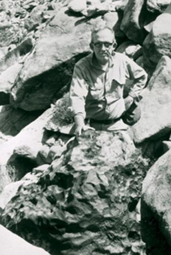
  • The Old Woman meteorite was taken off the truck and weighed; it was the second-largest meteorite ever found in the United States. Its exposed upper surface was pitted, reminiscent of regmaglypts, and the bottom surface exhibited a thin, irregular coating of caliche.

PAGE 7

THE DISPUTE MOVES TO THE COURTS

  • Removing the meteorite from the Old Woman Mountains only intensified the battle over it. The Smithsonian acquired the meteorite on June 24 while still displayed in California.
  • The Old Woman meteorite had become a cause celebre and was displayed for an additional week at the BLM Riverside office afterwards, it was moved to the San Bernardino County Museum and the Los Angeles County Museum of Natural History.
  • The two discoverers took the matter to court, arguing they owned the meteorite based on their mining claim. The judge denied the temporary restraining order.
  • The Smithsonian was under increasing pressure to keep the meteorite in California. The Los Angeles County Museum of Natural History requested that the Smithsonian cede all presumed titles to the meteorite to their museum.

PAGE 8

  • Pressure was also brought to bear upon Cecil Andrus, the Secretary of the Department of the Interior, to allow the Meteorite to go on permanent display in the Los Angeles County Museum of Natural History.
  • The California Congressional Delegation urged Ripley to speed up arrangements for the meteorite’s permanent display in California. Ripley assured them that a portion of the meteorite would be sent to an appropriate museum in California.
  • Ripley clarified the Smithsonian’s position, pointing out the museum’s long involvement with meteorites and its extensive usage by the national and international scientific community. He assured Wasson that a replica of the meteorite would be sent to an appropriate California museum.
  • The San Bernardino County Museum and the State of California filed a lawsuit on July 20, 1977, against the BLM, the Department of the Interior, Secretary Ripley, et al., seeking a preliminary injunction against removing the meteorite from California.
  • When the matter was before the court, the San Bernardino County Museum requested that the Old Woman meteorite remain in California with an appropriate museum or scientific institution.
  • The Smithsonian received welcome news from the Department of Justice attorney representing the defendants in the Old Woman Mountains meteorite lawsuit.
  • Combined with strong protests from California, Judge Whelan’s ruling quickly prompted Interior Secretary Andrus to grant custody of the Old Woman Meteorite to the state where it was found, turning down a bid by his agency to haul it back to Washington for display.

PAGE 9

  • Andrus’s decision served as a game-changer because it allowed the Smithsonian to transfer the right and title to the meteorite to the museum and allowed the museum to offer to ship the main mass of the meteorite to a California museum after its scientific study.
  • In the weeks that followed, the court-ordered settlement discussions took place. The Smithsonian agreed to a consent decree with the State of California that the United States would negotiate for long-term display of the Old Woman meteorite there.
  • The Department of the Interior supported the Smithsonian’s plan to bring the meteorite to Washington for scientific analysis, but asked that its display and scientific value not be diminished.
  • Attorneys from the three parties met again on October 17, and agreed to a five-member committee that would make the final decision on what cutting, if any, would be done on the meteorite.
  • The California attorneys called for the establishment of a Joint Powers Agreement, under which a three-member committee would investigate the possibility of displaying the meteorite in a museum in California.
  • Judge Whelan denied the State of California’s and San Bernardino County Museum’s motions for preliminary injunction against removal of a meteorite from California and title to it, and vacated and set aside the temporary restraining order to keep the meteorite in California.
  • The Smithsonian met with members of Congress’s staff in January and February of 1978 to explain their plan to send a meteorite from California to Washington for study. The meteorite arrived at the Smithsonian’s National Museum of Natural History on March 8, 1978.

PAGE 10

  • The Smithsonian asked Senator Cranston’s staff to help select a museum for the meteorite, and the staff recommended the Los Angeles County Museum of Natural History.
  • Two other problems soon arose, the San Bernardino County Museum appealed Judge Whelan’s ruling, and John Wasson again stepped forward, claiming that the Smithsonian intended to remove a slice of the meteorite for its study, and that this would seriously detract from the exhibit value of the main mass.
  • Wasson urged that letters be written to Secretaries Andrus and Ripley requesting that no cutting of the meteorite be carried out until the Smithsonian submitted detailed plans, prepared a position paper comparing the scientific and exhibit-related pros and cons of its proposed plan, and invited comments from several curators and iron meteorite researchers.

DEBATE OVER THE CUTTING OF THE METEORITE

  • Clarke sent a letter to 19 individuals in September 1978 asking their views on how the Old Woman meteorite should be studied.
  • Wasson responded to Clarke’s letter by asking the recipients to provide him with a copy of their response to confirm that the amount to be removed seems reasonable from the viewpoint of Californians.
  • Responses to Clarke’s letter were generally favorable to the Smithsonian’s position, with Vagn Buchwald pointing out that Old Woman appeared to be transitional between group IIA and IIB meteorites and that a large cut and polished surface of Old Woman would provide unique data.

PAGE 11

  • The injunction against cutting the meteorite was denied in 1978 and again in 1979, opening the way for its scientific study.
  • Cutting began a week later, on May 29, and the first piece was removed on June 5. It was ground, polished, and etched, and Clarke commented that a major cut was essential.

PAGE 12

THE METEORITE’S RETURN TO CALIFORNIA

  • Although the injunctions against cutting the meteorite were still before the court, the Smithsonian tried to finalize loan arrangements with the Los Angeles County Museum of Natural History. Still, the acting director expressed his ”significant objection” to the Smithsonian’s plan to cut the meteorite.
  • In January 1980, the San Bernardino County Museum and the State of California claimed ownership of the Old Woman meteorite. Still, the U.S. Court of Appeals for the Ninth Circuit dismissed their claims.

METALLOGRAPHIC STRUCTURE OF THE OLD WOMAN METEORITE

  • Old Woman is a highly unusual iron meteorite with two structural types, and the metallographic study of the large slice provides invaluable insights into its formation.
  • The 427.3 kg butt end was divided into a 207 kg butt end and a 174 kg research slice. The research slice was subdivided, producing a thinner complete slice and a partial slice again extensively subsampled. The Old Woman meteorite is a polycrystalline mass with a strongly bimodal distribution. Seven large grains comprise 85% of the surface area and comprise the hexahedral structure within the meteorite.

PAGE 14

  • Within the larger grains of kamacite, the only Fe,Ni metallic phase identified, are schreibersite chains that can reach several cm in length. These schreibersites often exhibit embayments or skeletal morphologies, and are similar to the ungrouped, low-Ni iron Zacatecas (1792) (Buchwald 1975). Throughout the large kamacite regions, small schreibersites are common. Carbide and graphite are extremely rare, although we did find one schreibersite inclusion rimmed by graphite and Fe metal.
  • The entire primary structure is extensive shock modification, including shock melting of troilite-daubreelite-schreibersite inclusions, Neumann banding, and formation of subgrain boundaries within kamacite. A heat-altered zone up to several mm in thickness was observed on sections of the meteorites.
  • Old Woman is a low-Ni, low-P member of group IIAB, with a bulk Ni concentration of 5.86 wt% (5.59 at%), 0.30 wt% P (0.56 at%), and 0.49 wt% Co. Trace element analyses reveal a composition intermediate in the range of IIAB irons.

PAGE 15

  • The Widmanstatten structure in iron meteorites was reviewed by Yang and Goldstein (2005), who proposed three mechanisms for their formation. Old Woman is on the boundary between massive transformation and mechanism V and only slightly below the field for mechanism III in P.
  • Old Woman is not unprecedented in having a bimodal structure, with hexahedral and coarsest octahedral structures evolving in the same mass. This structure is thought to be due to nucleation of austenite crystals on sulfide inclusions.
  • Old Woman could have evolved via the c fi a2 + c fi a + c (mechanism V) or c fi (a + c) fi a + c +ph (mechanism III) pathways into its present polycrystalline state.
  • Old Woman is a hexahedral ferromagnetic iron with abundant schreibersite. It may have formed through the c fi (a + c) fi a + c +ph fi a + ph pathway, which was described by Yang and Goldstein (2005).

PAGE 17

  • Old Woman’s diverse structure may be due to several mechanisms within a single mass, suggesting that further study may yield additional insights.

CONCLUSIONS

  • Old Woman, the largest meteorite in the National Collection of Meteorites, contains transitional textural types that were previously classified as three distinct meteorites. It is now known that these textures are the result of unique combinations of chemistry, nucleation, and cooling history.
  • The authors thank Tim Rose, Pam Henson and Brian Daniels, the Office of the Smithsonian Institution Archives, George S. Robinson, Nicole Lunning, Katrina Jackson, Ed Scott and Ursula Marvin, and the Edward P. and Rebecca Rogers Henderson Endowment for travel and research funding.

PAGE 18

SUPPORTING INFORMATION

  • Marcy Dunn Ramsey’s pencil sketches of the Old Woman meteorite are shown in Fig. S1. The maximum dimension of the meteorite is in the range of 0.8 to 1.0 m.
  • Fig. S2 shows pencil sketches of the find site of the Old Woman meteorite, a deeply pitted iron meteorite that is approximately 1 m across.

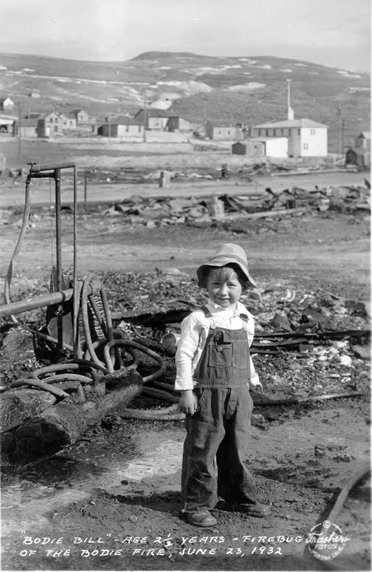
William Brewster “Bodie Bill” Godward

Son of William T. Godward and Delcie Pearl Millslagle. “Bill” was the 2 year child old responsible for the 1932 fire in Bodie, California, that destroyed 70% of the town. He was playing with matches behind the Old Sawdust Corner saloon and ignited the building.

He married Dian Dovereaux on Sept. 9, 1949, in Sandusky, Ohio. He worked as an Engineman Third Class in the US Coast Guard.

Bill and his new bride were on their delayed honeymoon when they were involved in a single-car accident on the US 395 near Susanville, California. Bill died from a broken back and injuries he sustained from the accident.
(Findagrave.com)

The Worst of It

In warm weather —and it is hardly ever cold in their tropic valley —the men wear only a breech-clout, and the women a single garment generally made of flaming bandannas bought in the piece. They dress their long hair in curious ropes, and plaster the scalp with mud, tattoo the chin in wild patterns, and have no ornaments save fichus, which they make with great skill from tiny glass beads.

They have been practicing cremation from time immemorial, and were just having a funeral near East Bridge. The corpse, dressed in its best, was stretched on top of a huge pile of dry old ties from the railroad, and the chief mourner touched a torch to the heap of dry brush at the bottom. As the flames sprang aloft and hissed and roared, the mourners stood in a gloomy ring, chanting a wild refrain ; and as the savage fire and savage song went on, they threw upon the pyre from time to time all the earthly possessions of the deceased, and one by one their own garments and ornaments.

Passing the strange, jagged spires of peaks, which are called the Needles because two of them have natural eyelets, —though these are visible only from the canon, and not from the railroad, —I crossed the 1300-foot drawbridge, now abandoned for a fine new cantilever, a dozen miles below, and stood upon the there forbidding soil of California. A night at the rather pretty little railroad town of Needles, and I started off again into the grim Mojave Desert. It was the beginning of two hundred miles whose sufferings far outweighed all that had gone before . . .

A TRAMP
ACROSS THE CONTINENT
BY CHARLES F. LUMMIS