by walter feller
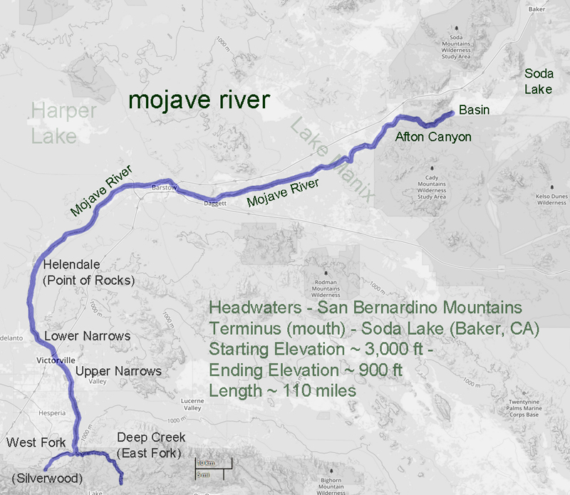
In 1852 a survey was made of the southwestern edge of the Mojave Desert. The Old Spanish Trail # had become a wagon road bringing thousands of pioneers to the west and developed as a supply route between Los Angeles and Salt Lake City. The survey was as accurate as any at that time and followed the trail from near the top of the Cajon Pass to a point where the trail leaves the Mojave River near Fishponds. The trail to Salt Lake continues north as we know it, but the river flowing east on this map bears southeast and empties into the Colorado River. At the time it was thought the Mojave (spelled Mohahve on the map) River followed this course. It did not. There was no Mojave Road in 1852 and not many Americans had traversed that portion of the desert. As we now know the Mojave River cuts through Afton Canyon and then disappears into the sink of the Mojave before it reaches Soda Lake.
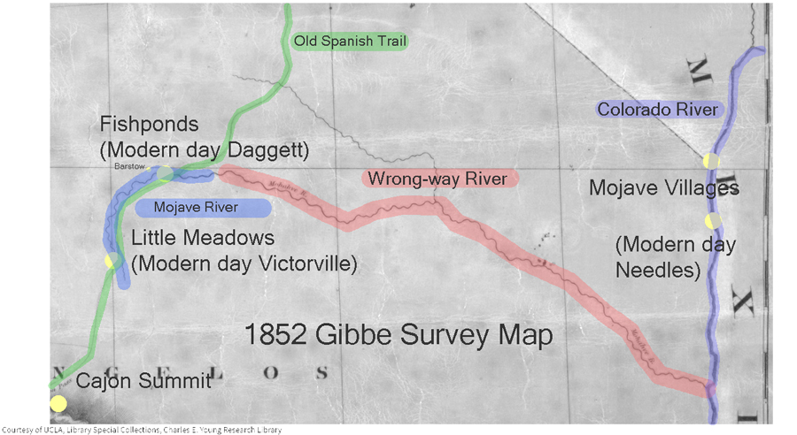
The Williamson survey the next year in 1853 begins to correct the true ancient course of the river as it would have found its way to converge with the Amargosa River and empty into Death Valley’s Lake Manly via Soda Lake, Silver Lake, Silurian Lake, and Salt Springs.
-End –