The California Southern

As to the Atlantic and Pacific, it suffered in common with other similar enterprises from the financial crash of 1873 and subsequently entered into a combination with the Atchison, Topeka, and Santa Fe, and that St. Louis and San Francisco railroad companies, which gave the Atchison road a half interest in the charter of the Atlantic and Pacific, owned by the St Louis company, to which a valuable land grant attached. The two companies constructed, jointly, from the main line of the Atchison road at Albuquerque west to the Colorado at the Needles, between 1879 and 1883, with the intention of carrying their road thence to Los Angeles and San Francisco. But at this juncture the Southern Pacific again stopped the way.

The California Southern Railroad was chartered October 12, 1880, to construct a line from San Diego to San Bernardino, and the California Southern Extension company was chartered May 23, 1881, to extend this road to a connection with the Atlantic and Pacific in California, at a point about eighty miles northeast of San Bernardino. The two companies consolidated under the name of the first above-mentioned, and the road was completed to Colton in August 1882 and opened from San Diego to San Bernardino on September 13, 1883.

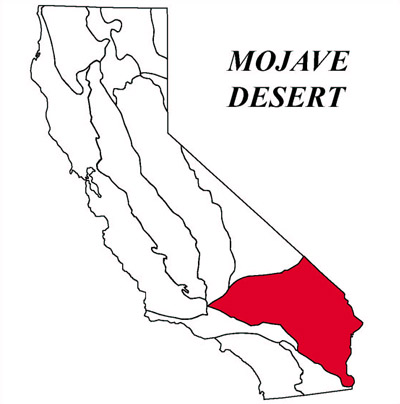
Soon afterward the Southern Pacific, obtaining through the purchase of stock a share in the management, secured the extension of the Atlantic and Pacific to the Colorado at the Needles, which compelled it to connect there with the former. This had nearly been a death-blow to the California Southern, which had suffered much, not only by opposition, but by floods in the Temecula canon, which rendered impassable thirty miles of its track, carrying bridges and ties entirely away, some being seen a hundred miles at sea. It must not only rebuild this thirty miles, but in order to reach the Atlantic and Pacific, must construct 300 miles of new road over mountain and desert, instead of the 80 miles as first intended. For several months the directors hesitated. But finally the Southern Pacific determined to sell to the California Southern the road from the Needles to Mojave, built by the Pacific Improvement company, the successor of the Western Development company. The transfer took place in October 1884, and the California Southern at once recommenced construction and repairs, and in November 1885 opened its line from San Diego to Barstow. In October 1886, it formally passed under the control of the Atchison, Topeka, and Santa Fe company, and was operated as a division of that road. Thus after ten years of struggle, two of the eastern roads effected an entrance into California.

histofcalifvol724bancmiss.pdf 629-631/850

Dirt Bike

Order Number00162855
TitleUp a steep and bumpy ‘road’
Collection IDValley Times Collection
Location/AccessionHCNVT_d066_f4_i15
Date1958
Physical Description1 photographic print : b&w ; 21 x 26 cm.
DescriptionPhotograph caption dated March 8, 1958 reads, “Nick Nicholson of North Hollywood is shown doing what doesn’t come easily as he negotiates a rocky and steep hill as many riders will do tomorrow in the national championship Moose Run over hill and dale in the Victorville area. (See Innocent Bystander).”
SubjectMotorcycle racing.
Motorcycling.
Motorcyclists.
Motorcycles.
Young men.
Victorville (Calif.).
Portrait photographs.
Coverage1951; 1952; 1953; 1954; 1955; 1956; 1957; 1958; 1959; 1960
CreditsThis project was supported in whole or in part by the U.S. Institute of Museum and Library Services under the provisions of the Library Services and Technology Act, administered in California by the State Librarian.; Made accessible through a grant from the John Randolph Haynes and Dora Haynes Foundation and Photo Friends.
http://rightsstatements.org/vocab/UND/1.0/
Reproduction InformationImages available for reproduction and use. Please see the Ordering & Use page at http://tessa.lapl.org/OrderingUse.html for additional information.
Internal NotesSee Folder Record PH-VT-000137 for upload information.
Sub-Collection NameValley Times Photo Collection

Freight wagons

Order Number00024931
TitleFreight wagons
Collection IDSecurity Pacific National Bank Collection
Location/AccessionVictorville.
DateCirca 1900
Physical Description1 photograph :b&w
DescriptionFreight wagons ready to go from Victorville to Big Bear Lake, being pulled by a team of 8 horses.
SubjectFreight and freightage–California–Victorville.
Victorville (Calif.).
FormatPhotographic prints
Reproduction InformationImages available for reproduction and use. Please see the Ordering & Use page at http://tessa.lapl.org/OrderingUse.html for additional information.
Sub-Collection NameSecurity Pacific National Bank Photo Collection

Owens Valley*

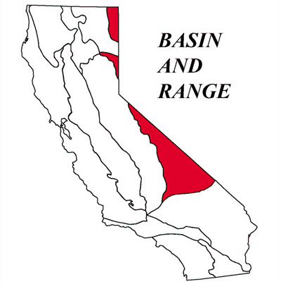
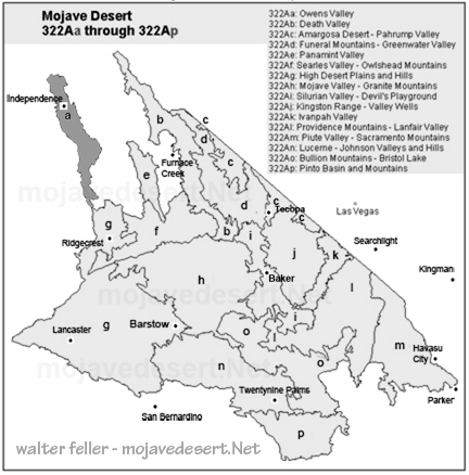
Owens Valley happens to be one of the most singular and interesting places in the United States. It is located in the western part of the continent – between the Sierra Nevada and the Inyo Mountains. This valley forms part of the geomorphic province of Basin and Range, characterized by mountains and valleys as unique features resulting from the process of Earth crust movement.

Geomorphology: The Shape of the Land

The Owens Valley lies within crust of the Basin and Range province, which is famous for its “horst and graben” structure. Consider the crust of the earth to be rifting apart: the surface breaks, and some blocks go down while others rise up. This process forms a pattern of highs and lows. Owens Valley is one of these low areas, known as a “graben,” while surrounding mountains are the high areas known as “horsts.” The elevation of the valley varies from about 3000 to 6000 feet and includes flat and gently sloping areas.

Erosion, the wearing away of rocks and soil by water and wind, and deposition combine in the process whereby these materials are laid down in new places. Through such continuous action, an alluvial fan—the fan-shaped deposit of soil and rocks at the base of the mountains—and a basin fill, or a layering of sediments on the floor of the valley, form over time.

Soil and Vegetation: Life on the Land

Soils in Owens Valley vary considerably. On the alluvial fans, Torrifluvents and Torriorthents soils are well drained and support a wide variety of plant life. Elsewhere in the basin-fill areas, the soils may be poorly drained and these areas may support different kinds of plants. There is even dune sand in places!

The vegetation of Owens Valley differs according to soil and location. You might find plants such as saltbush and greasewood that are tolerated on salty soils in the areas of basin fill. On the alluvial fans, there were plants like shadscale and hop-sage that could stand the drier conditions. Higher up on the fans, there is black bush with sagebrush. South of Owens Lake, creosote bush is the predominant plant.

Climate: Hot and Dry

Long-term temperatures and rainfall—Owens Valley has a hot and dry climate. Average annual precipitation, or the amount of rain that falls in an average year, is only about 4 to 8 inches. Most of this rain falls during the winter months. The mean annual temperature varies from 55° to 65° F. Because it is so dry, plants and animals must be tough in order to survive with little water.

Water: The Lifeline

Water plays a major role in the Owens Valley way of life. Along the middle of this long valley runs the Owens River, which furnishes water to many plants, animals, and people. Centuries ago, Owens Lake used to overflow periodically and send water to the neighboring valleys. Nowadays, so much of the Owens River water is exported to Los Angeles that Owens Lake is virtually dry.

Conclusion

Owens Valley is a place both fascinating in geology and ecology. Distinct landform, variety of soils, and flora hardiness testify to the ability of life to adapt to the rigors of heat and dryness. Understanding Owens Valley would help us recognize the sensitive links between land, water, plants, and animals that give this part of the world its special identity.

*AI

California to Salt Lake City

THE OVERLAND MAIL
1849-1869
Promoter of Settlement
Precursor of Railroads by
LE ROY R. HAFEN, PH.D .
Historian, The Stale Historical and Natural History Society of Colorado

The first United States mail between California and Salt Lake City was established in 1851. This route was advertised January 27, 1851, and the thirty-seven bids received ranged from $20,000 for “horseback or two horse coach service,” to $200,000 per year for service with ” 135 pack animals with 45 men, divided into three parties.” One bid was for a four-horse coach with a guard of six men, at $135,000 per year. The lowest bid was accepted and a contract was made in April with Absalom Woodward and George Chorpenning for a monthly service at $14,000 per year; the trip each way was to be made in thirty days. No points were designated at which the route should touch, but it was to go “by the then traveled trail, considered about 910 miles long.”

Chorpenning and his men left Sacramento May 1, 1851, with the first mail. They had great difficulty in reaching Carson valley, having had to beat down the snow with wooden mauls to open a trail for their animals over the Sierras. For sixteen days and nights they struggled through and camped upon deep snow. Upon reaching Carson valley, Chorpenning staked off in the usual western manner, a quarter section of land and arranged to establish a mail station. The town of Genoa, Nevada, grew-up on this site. Chorpenning and several men continued eastward and reached Salt Lake City June 5th, having been delayed somewhat by snow in the Goose Creek mountains.

Throughout the summer, difficulties were experienced with the Indians; and Woodward, who left Sacramento with the November mail, was killed by them just west of Malad River in northern Utah. The December and January mails from Sacramento were forced to return on account of deep snow, but the February (1852) mail was pushed through by way of the Feather River Pass and reached Salt Lake City in sixty days. The carriers endured frightful sufferings; owing to the fact that their horses were frozen to death in the Goose Creek mountains, they had to go the last two hundred miles to Salt Lake City on foot. Permission was obtained from the special agent in San Francisco to send the March mail down the coast to San Pedro and thence by the Cajon Pass and the Mormon trail to Salt Lake City. During the summer of 1852 the service continued to be performed across northern Nevada by way of the Humboldt River; but as winter approached, arrangements were made with the mail agent at San Francisco to carry the Utah mail via Los Angeles during the winter months. The Carson valley post office was supplied monthly by a carrier on snow-shoes. Fred Bishop and Dritt were the first carriers and they were succeeded by George Pierce and John A. Thompson. The latter, “Snowshoe Thompson,” a Norwegian by birth, made himself famous in this section by his feats on snow-shoes during succeeding winters. The shoes used were ten feet long and of the Canadian pattern. He often took one hundred pounds upon the journey between Placerville and Carson, and made the trip in three days to Placerville and the return journey in two days.

With the interruption by bad weather of the mail service east of Salt Lake City, the mail was sent westward to San Pedro, where it was transmitted by steamer to the Atlantic seaboard. This increased the weight of Chorpenning mail from about one hundred pounds to about five hundred pounds. For this additional service Chorpenning made claim and in 1857 received payment on a pro rata basis.

The causes of the irregularity and interruption of the mail service to Utah had not been explained to the Postmaster-general by the Special Agent at San Francisco and so, upon the grounds of the derangement of the service, the Postmaster-general annulled the contract with Chorpenning, and made one with W. L. Blanchard of California. The new contractor was to receive $50,000 per year, and was to maintain a fortified post at Carson valley. Upon learning of this new arrangement in January, 1853, Chorpenning set out for Washington and, after setting forth his case before the new Postmaster-general, was reinstated. A verbal agreement was made that the compensation should be increased to $30,000 per year and permission was given to carry the mails via San Pedro during the winter months.

During the first three years (1851-4) the Utah-California mail was carried except in winter, by the old emigrant route. This route lay from Sacramento
through Folsom, Placerville, along the old road through Strawberry and Hope valleys to Carson valley. From this point it led to the Humboldt, which stream
was followed nearly to its source. Leaving the Humboldt the route led northeastward into southern Idaho in the vicinity of the Goose Creek mountains, and thence southeasterly around the north side of Great Salt Lake to Salt Lake City.

In the lettings of 1854, the Utah-California mail route was changed to run from Salt Lake City over the Mormon trail to San Diego. Chorpenning was again the successful bidder. The mail was to be carried monthly each way, through in twenty-eight days, for a compensation of $12,500 per year. Chorpenning thought it worthwhile to enter a low bid to ensure getting the contract since he expected that the service would probably be increased to a weekly schedule, the time per trip reduced, and the compensation increased.

The service began July 1, 1854, and was to continue for four years. The mail was carried on horseback or on pack mules. During that first summer, Indian difficulties arose and continued at intervals for months. The emigration fell off and expenses on the route increased. Similar difficulties had been encountered by the contractors east of the Rocky Mountains, who appealed to Congress and received increased remuneration by the act of March 3, 1855. Encouraged by their success with Congress, and inasmuch as his difficulties continued, Chorpenning went to Washington and presented his claims in June, 1856. Congress responded with an act for his relief March 3, 1857. It provided that the compensation be increased to $30,000 per year from July 1, 1853, to the termination of the contract in 1858; that the full contract pay be allowed during the suspension of the contract in the spring of 1853; and that the Postmaster-general make an additional allowance on a pro rata basis for the extra service performed prior to 1853. A total of $109,072.95 was allowed and paid under the provisions of this act.

During the four years of the duration of the contract (until July i, 1858), the mail was carried with fair regularity, and often in less than schedule time. The service was usually performed on horseback, but a wagon was used occasionally. The mail of December, 1857, was taken from Salt Lake City to Los Angeles by wagon in twenty-six days, while on horseback the trip often did not consume more than twenty days.

Wells Fargo and Company, Adams and Company, and other express companies maintained express service on the line during this period (1854-8). There was also much freighting and some emigrant travel over the road. The Mormon “State of Deseret” had included the whole of this route with its terminus upon the Pacific Coast. A colony was planted by these pioneers at San Bernardino in 1851 and considerable trade and intercourse was carried-on over this road.

The route was in general that of the present “Arrowhead Trail” automobile road. From Los Angeles the route led to San Bernardino, through Cajon Pass to the Mohave River, which was followed for fifty miles. From the Mohave River the route lay to the north to Bitter Springs, then turned eastward by Kingston Springs to Las Vegas, Nevada. From this famous resting station a dry stretch of sixty miles was crossed leading to the Muddy Creek. After crossing another “bench” the Virgin River was reached, and this stream was followed to Beaver Dams, Arizona. Leaving the Virgin River the road crossed the “slope” and over a little mountain range to the Santa Clara Creek, which stream was followed to the vicinity of the famous Mountain Meadows. From Mountain Meadows the route led to Cedar City and thence almost due north through the Mormon settlements of Parowan, Beaver, Fillmore, Nephi, Payson, Provo, and Lehi to Salt Lake City.”

Before the termination of the contract on this route the policy of extensive increases in the western mail lines was inaugurated, and partisans of the “Central Route” via Salt Lake City and across northern Nevada were demanding service upon that more direct route to San Francisco. Accordingly, in 1858 this Los Angeles to-Salt Lake City route was discontinued and the original route of 1851 was re-established and put upon an improved basis.

Why is there Snow?

Snow is one of nature’s most captivating occurrences, turning landscapes into winter wonderlands. Have you ever wondered why snowfall occurs? Let’s discover the icy world of snow and understand how it forms.

It must be Cold

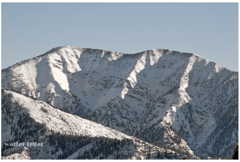
In order for snow to form, the temperature needs to be cold, particularly below freezing (32°F or 0°C). When the atmosphere freezes, moisture can change into ice without going through the liquid stage. The process of making snow starts with this important initial stage. Cold temperatures act like a natural freezer, providing the right environment for water to transform into ice crystals.

Humidity in the Atmosphere

Despite being invisible, water vapor is constantly present in the air. The moisture originates from lakes, oceans, rivers, and even plants. As moist air rises into the atmosphere, it loses heat and becomes cooler. The reduced ability of colder air to hold water vapor causes the vapor to condense into tiny droplets, eventually forming clouds.

Cloud formation

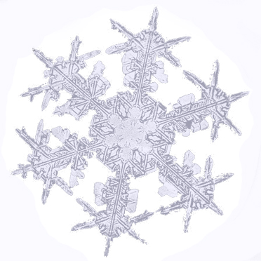
Clouds are primarily made up of tiny water droplets or ice particles. When the air temperature cools enough within these clouds, the water droplets freeze and change into ice crystals, forming the basis of snowflakes. Ice crystals in clouds collide, stick together, and grow in size, forming intricate snowflake patterns.

When Snowflakes Fall

When the snowflakes become thick, they start falling from the clouds. While descending, they pass through different layers of the atmosphere. If the temperature by the surface is freezing, the snowflakes stay whole and fall as snow. If the temperature is warmer near the surface, snowflakes may melt and change into rain or sleet before reaching the ground.

Snow

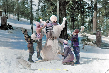
Different forms of snow can occur based on the temperature and moisture content in the atmosphere. During extreme cold, snow becomes light and airy, ideal for creating snow angels and skiing. When the temperature gets closer to freezing, the snow becomes more moist and dense, perfect for making snowmen and having snowball fights.

Summary

Snow is an intriguing outcome of low temperatures, moisture, and cloud movements. It starts with chilled air turning water vapor into ice crystals. The snowflakes are made of crystals, creating a white blanket when they fall to the ground. Snow creates happiness and thrill, transforming the world into a winter wonderland of leisure pursuits. The next time you witness snowflakes descending, remember nature’s process of mixing cold and moisture to form a magical winter scene!