Desert Photography

Desert photography offers unique challenges and opportunities due to arid regions’ distinctive landscapes and lighting conditions. Whether you’re capturing vast dunes, rocky terrains, or desert flora and fauna, here are some tips to enhance your desert photography:
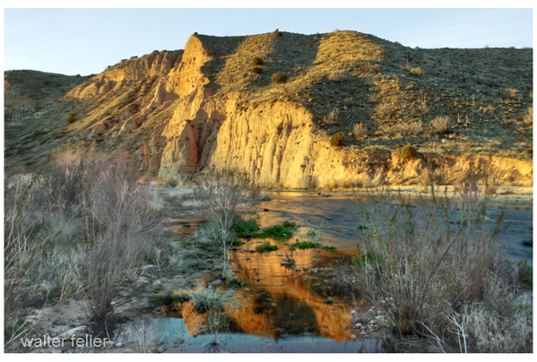
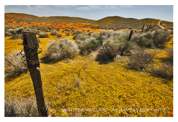
West Fork, Mojave River
  1. Golden Hours: The soft, warm light during the golden hours (shortly after sunrise and before sunset) can add a magical touch to your desert photos. Shadows are longer, and the colors become more vibrant, creating a pleasing atmosphere.
  2. Contrast and Textures: Deserts often feature striking contrasts between sand, rocks, and the sky. Emphasize these contrasts in your compositions to create visually appealing images. Pay attention to the textures of the sand or rocky surfaces.
  3. Silhouettes: Use the strong sunlight to create silhouettes of desert features. This technique can be particularly effective when the sky has captivating colors during sunrise or sunset.
  4. Wide Angle for Landscapes: A wide-angle lens is great for capturing the vastness of desert landscapes. It lets you include expansive skies, sweeping dunes, or rocky formations in your frame.
  5. Macro Photography: Explore the smaller details of the desert environment with macro photography. Capture close-up shots of desert flowers, reptiles, or insects to showcase the intricacies of life in arid regions.
  6. Use a Polarizing Filter: A polarizing filter can help reduce glare from the sun on sand or rocks and enhance the colors of the sky. It’s particularly useful when photographing in midday sunlight.
  7. Capture the Night Sky: Deserts often have low light pollution, making them ideal for astrophotography. Consider capturing the night sky, stars, and celestial objects. Use a sturdy tripod and a wide aperture for long exposure shots.
  8. Add a Point of Interest: To give your photos a focal point, include an interesting subject such as a lone tree, a rock formation, or even a person in the vast desert landscape. This helps create a sense of scale and adds visual interest.
  9. Protect Your Gear: Deserts can be harsh with blowing sand and intense sunlight. Keep your camera and lenses protected when not in use, and consider using lens hoods or lens caps to prevent sand from damaging your equipment.
  10. Mind the Temperature: Be mindful of the temperature, especially in hot desert environments. Carry sufficient water, protect yourself from the sun, and take breaks to avoid heat-related issues.
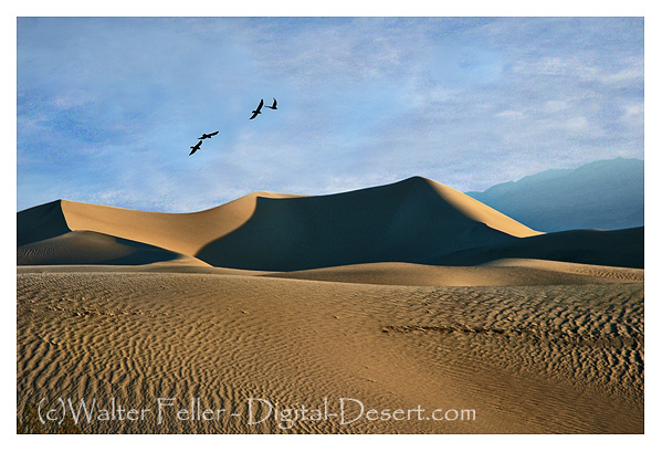
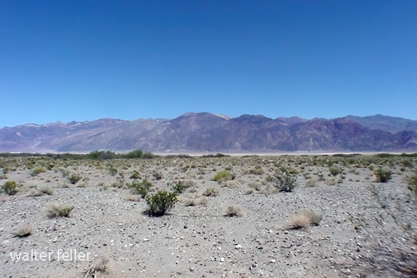
Death Valley, Mesquite Dunes

Remember that each desert is unique, so take the time to explore and discover the specific features that make the desert you photograph special. Experiment with different compositions, lighting conditions, and perspectives to create captivating desert images.
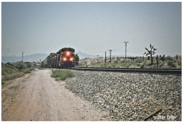
Railfanning

mojavedesert.Net/railroads

Railfanning refers to the hobby or activity of watching, photographing, and sometimes documenting trains and railroads. Railfans, or rail enthusiasts, engage in railfanning for various reasons, including a fascination with trains, locomotives, and rail infrastructure, as well as an interest in the history and operations of railroads.

Railfanning activities can include:

  1. Spotting Trains: Railfans often visit train stations, rail yards, and scenic locations along rail lines to observe and photograph trains as they pass by.
  2. Photography and Videography: Railfans use cameras and video equipment to capture images and footage of trains. Some focus on capturing the unique designs of locomotives, while others may document rare or historic trains.
  3. Collecting Memorabilia: Railfans often collect items related to trains, such as timetables, tickets, and other memorabilia. Some may also collect model trains.
  4. Tracking Train Movements: With modern technology, railfans can use websites, apps, and radio scanners to track the movements of trains in real time. This allows them to plan their railfanning activities and capture specific trains.
  5. Engaging in Online Communities: Many railfans connect through online forums, social media groups, and websites dedicated to railfanning. They share their experiences, photos, and information about train sightings.
  6. Visiting Railroad Museums: Railfans may also enjoy visiting museums dedicated to preserving and showcasing the history of railroads. These museums often have static displays of historic locomotives and rolling stock.
  7. Documenting Railroad History: Some railfans are also historians who document the history of railroads in their region. They may research and compile information about past and present rail lines, companies, and infrastructure.

Railfanning is a diverse hobby with enthusiasts of all ages. The appeal of trains and railroads can range from an appreciation of engineering and technology to a nostalgic connection with the past. It’s a hobby that allows individuals to combine their love of transportation, history, and photography while enjoying the sights and sounds of trains in action.

Petroglyphs, Pictographs, and Geoglyphs in the Mojave Desert

/petroglyphs/

The Mojave Desert, located in the southwestern United States, is rich in cultural and historical significance, with evidence of human habitation dating back thousands of years. Petroglyphs, pictographs, and geoglyphs are among the archaeological features found in the Mojave Desert, offering glimpses into the region’s past.

Here’s a brief overview of each:

  1. Petroglyphs:
    • Petroglyphs are rock engravings created by carving or pecking into the surface of a rock.
    • They are often found on exposed rock surfaces, such as canyon walls or large boulders.
    • Petroglyphs in the Mojave Desert can depict various symbols, animals, human figures, and abstract designs.
    • Native American communities made these carvings as a form of communication, storytelling, or spiritual expression.
  2. Pictographs:
    • Pictographs are rock art created by applying pigments to the surface of rocks. These pigments are usually composed of natural materials like plant extracts or mineral pigments.
    • Pictographs are found on rock shelters, caves, and cliff faces, often in areas with some protection from the elements.
    • Like petroglyphs, pictographs in the Mojave Desert can represent various subjects, including humans, animals, and symbolic patterns.
    • The pictograph colors can include red, black, white, and yellow, with red being a common choice.
  3. Geoglyphs:
    • Geoglyphs are large designs or motifs created on the ground’s surface, often by arranging stones or altering the landscape’s natural features.
    • While geoglyphs are more commonly associated with other regions like the Nazca Lines in Peru, there are examples of geoglyphs in the Mojave Desert as well.
    • The Blythe Intaglios, located in the lower Colorado River valley near Blythe, California, is a notable example of geoglyphs in the Mojave Desert. These large human and animal figures were created by scraping away dark rocks to reveal the lighter soil beneath.

Preservation of these cultural artifacts is crucial, and many sites are protected to prevent vandalism and degradation. Researchers and archaeologists work to study and document these features, shedding light on the history and practices of the indigenous peoples who lived in the Mojave Desert. It is important visitors respect and avoid disturbing these archaeological sites to ensure their preservation for future generations.

Geography of the Antelope Valley

/antelope-valley/geography.html

The Antelope Valley is a region located in northern Los Angeles County and southeastern Kern County in the state of California.

Here are some key geographical features and aspects of the Antelope Valley:

  1. Location:
    • Counties: The Antelope Valley spans Los Angeles County to the south and Kern County to the north.
  2. Topography:
    • Desert Landscape: The Antelope Valley is part of the Mojave Desert, characterized by a high desert landscape with arid conditions.
    • Valley and Basin: The region is named after the pronghorn antelope that used to roam the area. It is a valley and basin surrounded by mountain ranges, including the San Gabriel Mountains to the south and the Tehachapi Mountains to the northwest.
  3. Cities and Communities:
    • Palmdale: One of the major cities in the Antelope Valley, located in Los Angeles County.
    • Lancaster: Another significant city in the region in Los Angeles County.
    • Quartz Hill: A community within the Antelope Valley, known for its agricultural history.
    • Rosamond: A community in Kern County, east of Lancaster, known for its aerospace industry.
  4. Climate:
    • High Desert Climate: The Antelope Valley experiences a high desert climate with hot summers and cool winters.
    • Low Precipitation: The region receives relatively low annual precipitation, and water scarcity is a concern.
  5. Agriculture:
    • Historical Agriculture: The Antelope Valley has a history of agriculture, especially in areas like Quartz Hill. However, water availability has posed challenges for sustained agricultural practices.
  6. Edwards Air Force Base:
    • Military Presence: The Antelope Valley is home to Edwards Air Force Base, a major aerospace and flight test facility.
  7. Transportation:
    • Highways: Major highways, including State Route 14 (Antelope Valley Freeway), connect the Antelope Valley to the rest of Southern California.
  8. Natural Attractions:
    • Poppy Reserve: The Antelope Valley California Poppy Reserve is a notable natural attraction, drawing visitors during the spring when wildflowers, including poppies, bloom.
  9. Economic Activities:
    • Aerospace Industry: The aerospace industry, including Edwards Air Force Base and related activities, plays a significant role in the economy of the Antelope Valley.
  10. Challenges:
    • Water Scarcity: Like many desert regions, water scarcity is a challenge in the Antelope Valley, and sustainable water management is crucial for the area’s development.

Understanding the geography of the Antelope Valley involves recognizing its desert setting, mountainous surroundings, urban centers, and economic activities.

/antelope-valley/

Mormon Battalion

https://mojavedesert.net/military/fort-irwin-04.html

Mormon Battalion, flag

The Mormon Battalion was a United States Army volunteer unit composed primarily of Latter-day Saint (Mormon) men. It was formed during the Mexican-American War in 1846. The battalion played a significant role in the western expansion of the United States and the development of the American West.

Here are some key points about the Mormon Battalion:

  1. Formation: The Mormon Battalion was officially organized on July 16, 1846, in Council Bluffs, Iowa. The Mormon pioneers, led by Brigham Young, had been forced to leave their homes in Nauvoo, Illinois, and were headed west to the Salt Lake Valley.
  2. Purpose: The battalion was created to support the U.S. war effort in the Mexican-American War (1846–1848). The U.S. government, in need of troops to secure the territory acquired in the Southwest, allowed the Mormons to form their unit.
  3. Service: The Mormon Battalion marched over 2,000 miles from Council Bluffs to San Diego, California, through harsh and challenging conditions. They were mustered out of service in July 1847.
  4. Contribution to Western Expansion: The journey of the Mormon Battalion played a role in opening up a southern wagon route to California and exploring potential routes for future transportation and communication lines.
  5. Legacy: The legacy of the Mormon Battalion is still remembered today. Many battalion members settled in California after their service, and their contributions are commemorated in various historical sites and monuments. The battalion is also remembered as a unique episode in American military history and the history of the Church of Jesus Christ of Latter-day Saints.

The Mormon Battalion’s journey was a remarkable chapter in the American West’s history and the United States’s expansion during the 19th century.

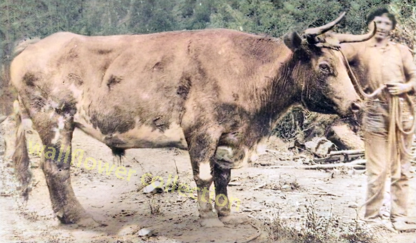
Old Crump

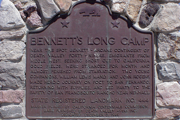
In 1849, a wagon train bound for California split up, with many members opting for a supposed shortcut to the goldfields. The shortcut did not work out, and these intrepid wanderers found themselves stranded, lock, stock, barrel, and four children on the floor of a place called ‘Death Valley.’

Bennett’s Long Camp

Over a month of hardship and waiting had passed while two heroic young men walked to find a way out and return with supplies to bring this band of Lost 49ers to safety. This they did, returning with food, a white horse, and a one-eyed mule. Sadly enough, the white horse had to be abandoned in a dry fall in the Panamint Mountains.

With these heroes returning, they could make their escape. The children were weak, tired, and sick and would not make the trip if they had to walk, so the pioneers sewed several shirts together, making saddlebags to carry them in.

The children were uncomfortable and sick. They cried, but ‘Crump,’ the ox selected to bear this burden, seemed to sense the importance of carrying its cargo as gently as possible, never missing a step, stumbling, or even making a sudden, jarring move.

This ordeal, beginning late in 1849 and finishing up early in 1850, became a distant memory to the party members.

Years later, a much older William Manly, one of the two heroes who saved the emigrants (John Rogers being the other), was walking down a road in the Central Valley. He noticed that over in a shady pasture, there was a fat ox relishing the long, tender blades of grass. Strangely enough, the ox looked vaguely familiar. Sure enough, it was Old Crump, warm and gentle as ever.

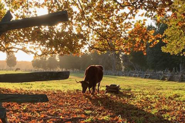
Ox in pasture of green grass
Retired beast of burden – NPS photo

Back in 1850, when things settled after their hardship-fraught journey and arrival at their destination, the owner of the ox retired the creature as a reward for its distinguished service, and Crump never worked another day in his life.

Chapter XI – Death Valley in 49
Wm. Lewis Manly

Draft Oxen

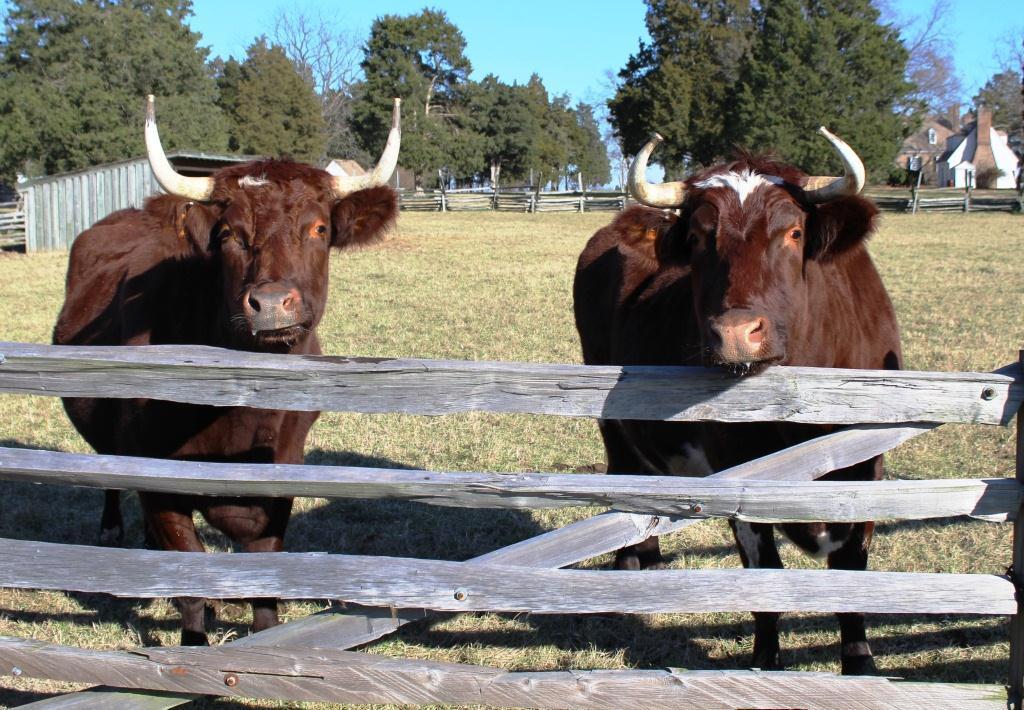
Draft oxen are domesticated cattle trained to work as draft animals, primarily for agricultural purposes. They have been used for centuries in many parts of the world to pull plows, wagons, and other heavy loads. Oxen are typically castrated male cattle, and they are trained to respond to commands from their handlers.

NPS photo of oxen - ox tream
Oxen – NPS photo

Here are some key characteristics and advantages of using draft oxen:

  1. Strength: Oxen are strong animals, capable of pulling heavy loads, plowing fields, and performing other tasks requiring significant physical strength. They are often used for tilling soil and other agricultural activities.
  2. Endurance: Oxen are known for their endurance. They can work long hours, making them suitable for tasks requiring sustained effort, such as plowing large fields or pulling heavy loads over extended distances.
  3. Steadiness and Reliability: Oxen is generally known for its steady and reliable work. They are patient animals and can handle repetitive tasks at a consistent pace.
  4. Adaptability: Oxen are well-adapted to various climates and terrains. They can work in different conditions and are particularly useful in areas where mechanized equipment may not be practical or accessible.
  5. Low Maintenance: Oxen are often considered low-maintenance animals compared to some other draft animals. They can graze on pasture, and their dietary requirements are relatively simple. They also have sturdy hooves, which reduces the need for frequent hoof care.
  6. Draught Power: Oxen have been historically crucial for providing draught power in agriculture. They were widely used before the advent of mechanized farming equipment and are still used in some regions where traditional farming methods persist.
  7. Manure Production: Aside from their work capabilities, oxen also produce manure, which can be used as crop fertilizer. This contributes to the sustainability of agricultural practices.

While draft oxen have been widely used historically, the prevalence of mechanized agriculture has led to a decline in their use in many developed countries. However, in certain regions and for specific purposes, draft oxen continue to be valued for their strength, reliability, and suitability for sustainable and traditional farming practices. Training and working with oxen require skill and patience, as they respond well to positive reinforcement and consistent handling.

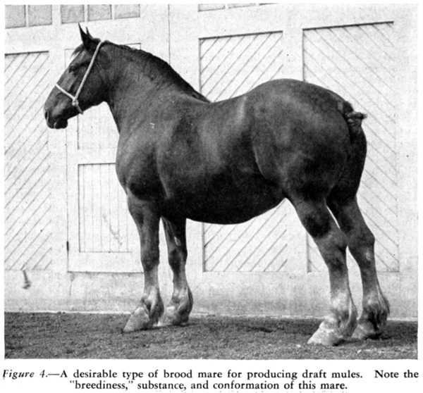
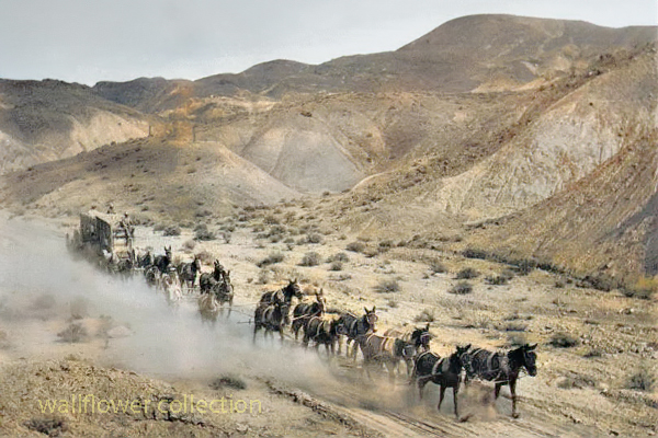
Draft Mules

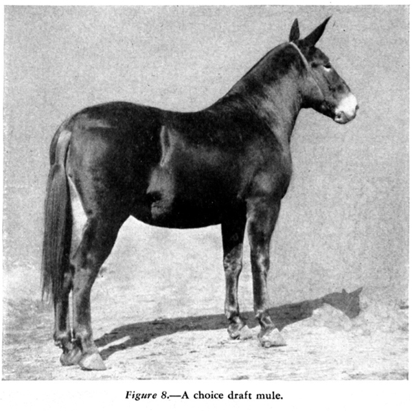
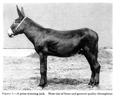
Draft mules are hybrid animals created by mating a male donkey (jack) with a female horse (mare). The resulting offspring is known as a mule, and when specifically bred for heavy work, it is referred to as a draft mule. Draft mules are known for their strength, endurance, and intelligence, making them valuable partners in agricultural and heavy-duty tasks.

Here are some key characteristics and advantages of draft mules:

  1. Strength: Draft mules are robust, inheriting the strength of their horse and donkey parents. They are capable of pulling heavy loads and performing strenuous tasks.
  2. Endurance: Mules, in general, are known for their endurance. They can work long hours without tiring quickly, making them well-suited for demanding tasks in agriculture and transportation.
  3. Intelligence: Mules are considered intelligent animals, often possessing a combination of the best traits from both donkeys and horses. They are known for their problem-solving abilities and adaptability.
  4. Sure-footedness: Mules tend to be sure-footed, making them well-suited for navigating challenging terrains. This quality is particularly advantageous in agricultural settings or uneven landscapes.
  5. Economical: Draft mules are often considered more economical than some other draft animals. They typically have lower maintenance costs than some purebred draft horses and are known for being hardy and requiring less veterinary care.
  6. Longevity: Mules are known for their longevity. They often live longer than horses and can remain active and productive for many years.
  7. Versatility: Draft mules can be used for various tasks, including plowing fields, pulling wagons, logging, and other heavy agricultural work. Their adaptability makes them valuable in a range of settings.

Despite their many advantages, it’s essential to note that mules, like all animals, require proper care and training. Additionally, because mules are hybrids, they are usually sterile and cannot reproduce, unlike their horse and donkey parents.

Wild Burros

/wildlife/wild-burro.html

Wild burros, also known as wild donkeys, can be found in various desert regions around the world. In North America, one notable population of wild burros resides in the deserts of the southwestern United States, particularly in states like Arizona, California, Nevada, and Utah. These burros are descendants of domesticated animals brought to the region by early European settlers and prospectors.

Here are some key points about wild burros in the desert:

  1. Origins: Wild burros in the American Southwest are often descendants of animals brought by Spanish explorers and settlers in the 1500s. Over the centuries, these domesticated animals escaped or were released, adapting to the arid desert environment.
  2. Adaptations: Wild burros have evolved to thrive in harsh desert conditions. They are well-adapted to arid environments, with efficient water retention capabilities and the ability to consume a variety of desert vegetation.
  3. Habitat: Wild burros are typically found in semi-arid and arid regions, where water sources may be scarce. Deserts provide them with open spaces, rocky terrain, and sparse vegetation that suits their browsing and grazing habits.
  4. Behavior: Wild burros are social animals and often form small herds led by a jack, a dominant male. They have a hierarchical social structure and communicate through vocalizations and body language.
  5. Conservation Concerns: While wild burros have adapted well to desert life, their populations sometimes face challenges. Overgrazing, competition for limited water sources, and conflicts with human activities can impact their well-being. As a result, ongoing efforts are to manage and conserve wild burro populations in some areas.
  6. Management and Control: In some regions, wild burro populations are managed to prevent overgrazing and habitat degradation. This may involve relocation, adoption programs, or fertility control measures to balance the burro population and the available resources.
  7. Tourism and Observation: Wild burros in the desert can be a point of interest for tourists and nature enthusiasts. Observing these animals in their natural habitat can be a unique experience. Still, visitors need to respect their space and adhere to any regulations in place for their protection.

Understanding the ecology and behavior of wild burros is crucial for their conservation and coexistence with human activities in desert environments. Conservation efforts aim to balance preserving these iconic animals and maintaining the health of the ecosystems they inhabit.

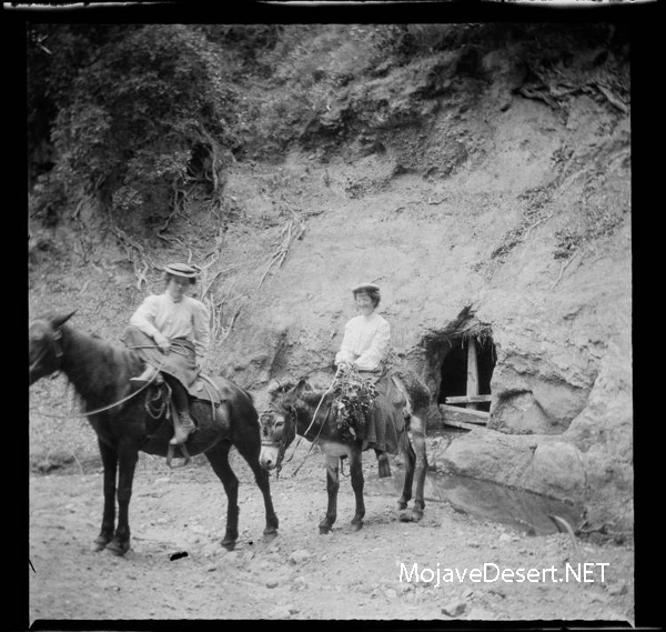
El Burro

Oatman, Arizona

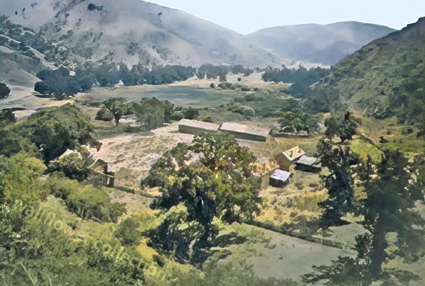
Fort Tejon Earthquake 1857

/fort-tejon/

The Fort Tejon earthquake occurred on January 9, 1857, and is one of the largest historical earthquakes in California. It had an estimated magnitude of 7.9 and was associated with the southern segment of the San Andreas Fault. Here are some key details about the Fort Tejon earthquake:

  1. Date and Time:
    • The earthquake struck on January 9, 1857.
  2. Location:
    • The epicenter was near Fort Tejon in Kern County, California.
  3. Magnitude:
    • The earthquake is estimated to have had a magnitude of 7.9.
  4. San Andreas Fault:
    • The earthquake was associated with the southern segment of the San Andreas Fault.
  5. Damage:
    • The region affected by the earthquake was sparsely populated, which helped reduce casualties.
    • Significant damage occurred to buildings, infrastructure, and landscapes.
    • The earthquake caused surface rupture along the fault, creating a noticeable surface offset.
  6. Aftershocks:
    • A series of aftershocks followed the main event, further contributing to the seismic activity in the region.
  7. Impact on Landscape:
    • The earthquake caused visible changes in the landscape, with the ground surface breaking along the fault line.
  8. Historical Significance:
    • The Fort Tejon earthquake is significant in understanding the seismic history of California.
    • It provided valuable information about the behavior of the San Andreas Fault and the potential for large earthquakes in the region.

It’s worth noting that the Fort Tejon earthquake occurred when the population in the affected area was relatively low, which helped mitigate the impact on human lives. The earthquake remains an important event in studying California’s seismic activity and understanding earthquake hazards in the region.