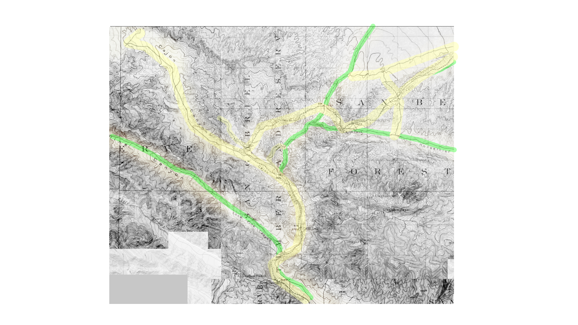
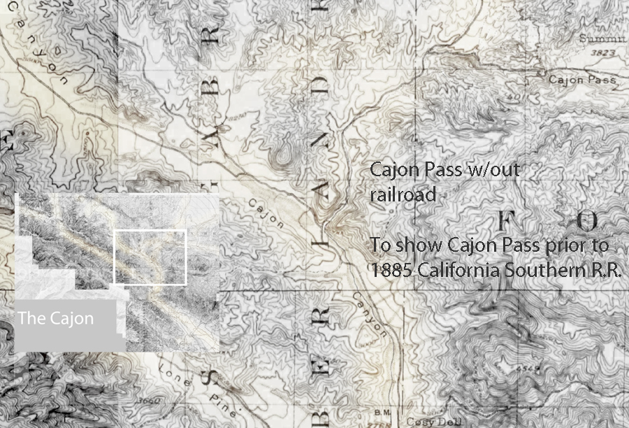
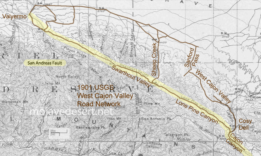
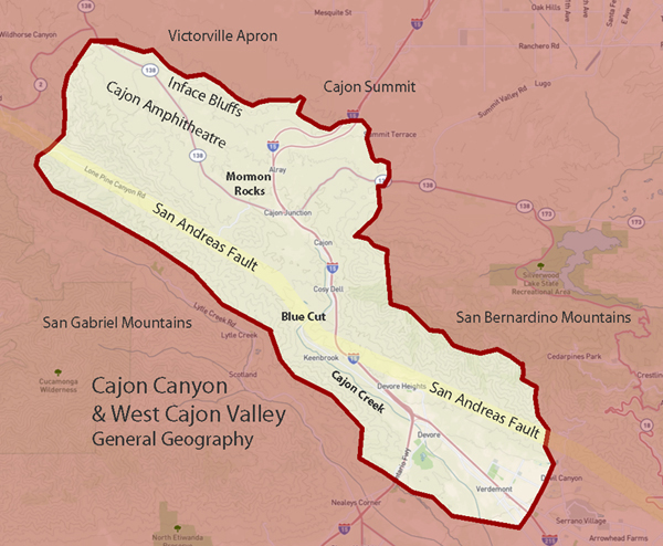
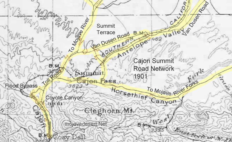
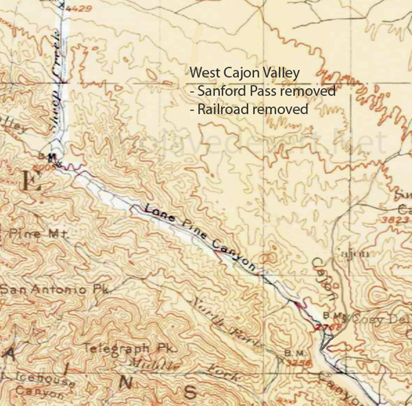
Cajon 1901 base map not showing California Southern Railroad (A.T.&S.F.) constructed in 1885.
Effectively shows the canyon as far back as 1857 when the Sanford Pass was carved into the mountain.
Sanford Pass
https://digital-desert.com/sanford-pass/
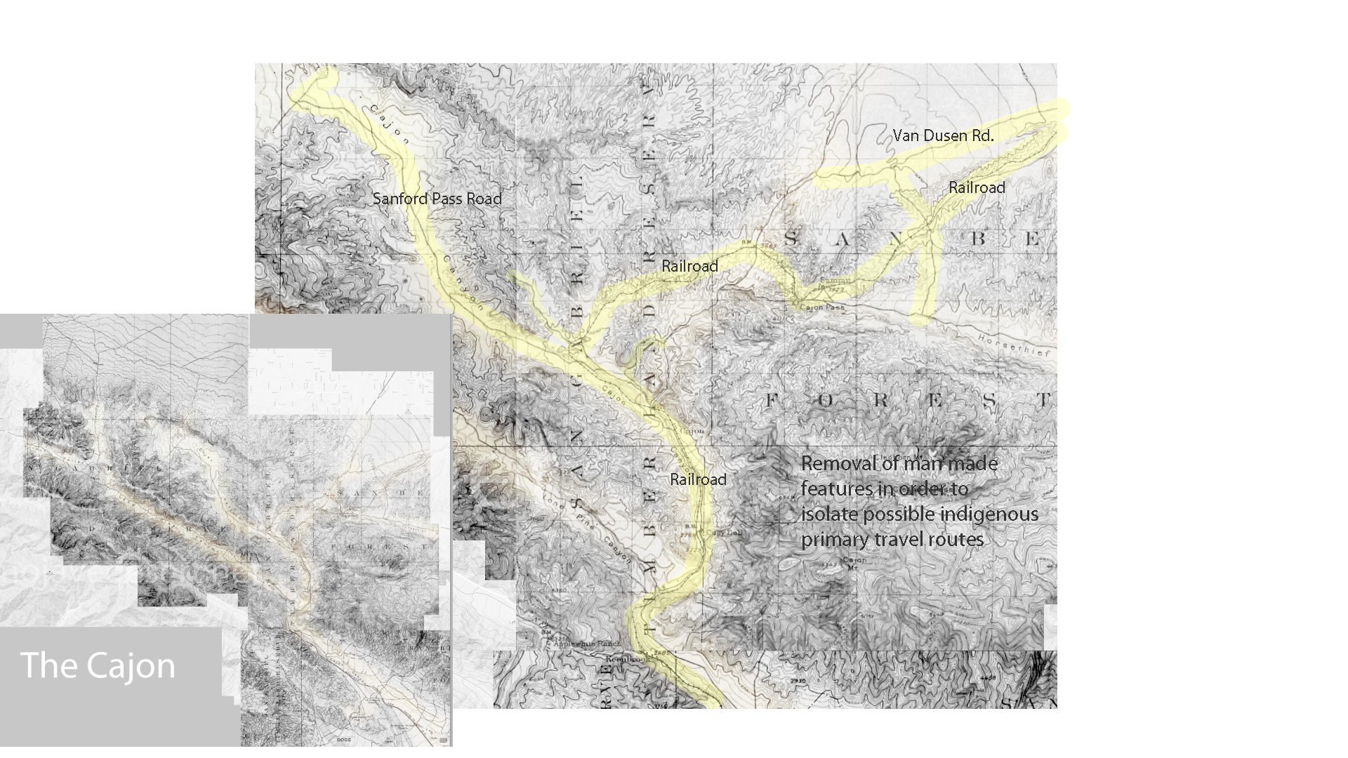
Cajon 1901 base map not showing California Southern Railroad (A.T.&S.F.) constructed in 1885.
Effectively shows the canyon as far back as 1857 when the Sanford Pass was carved into the mountain.
Sanford Pass
https://digital-desert.com/sanford-pass/
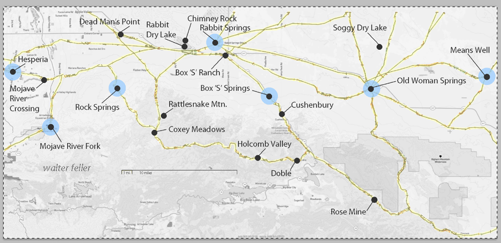
These maps are based on a USGS 1901 base map and overlay onto a current street map. This series was developed to show how the dependence on potable water for man or beast shaped the transportation network in the late 19th Century.
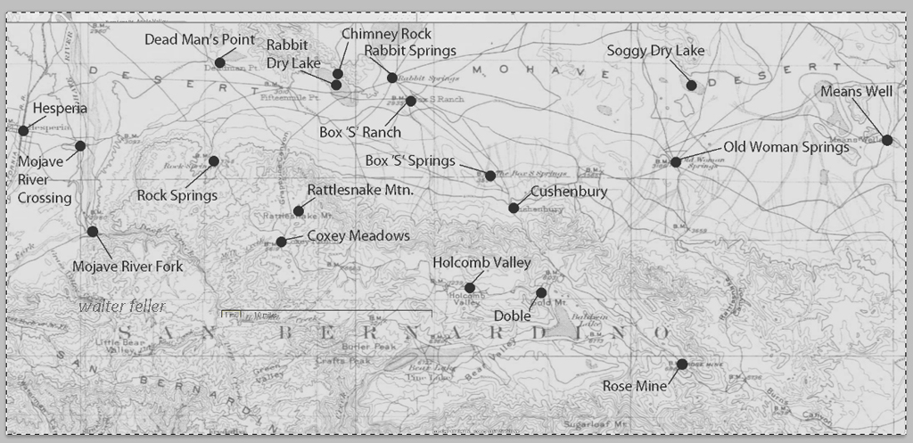
This map identifies various geographic locations, general features, and roads throughout the Lucerne & Johnson valleys as it was in 1901.
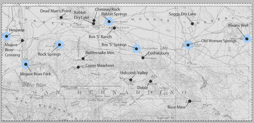
The blue marks show reliable water and rest stops as would be used by travelers and teamsters. These water stops are roughly 10 miles apart as the roads go.
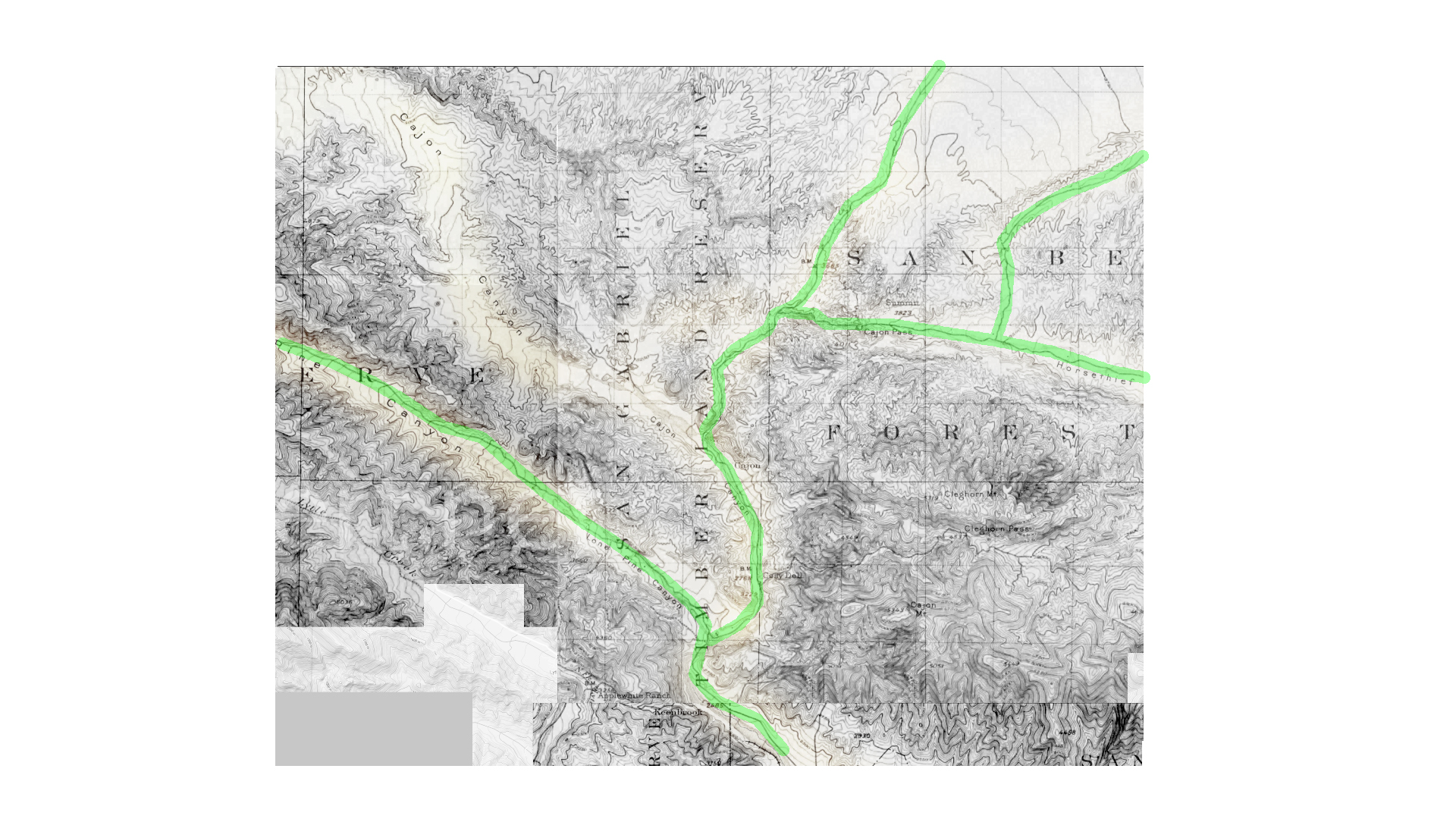
The generalized trails connecting the water and rest stops are highlighted. A few redundant and miscellaneous trails have been purposely omitted for clarity.
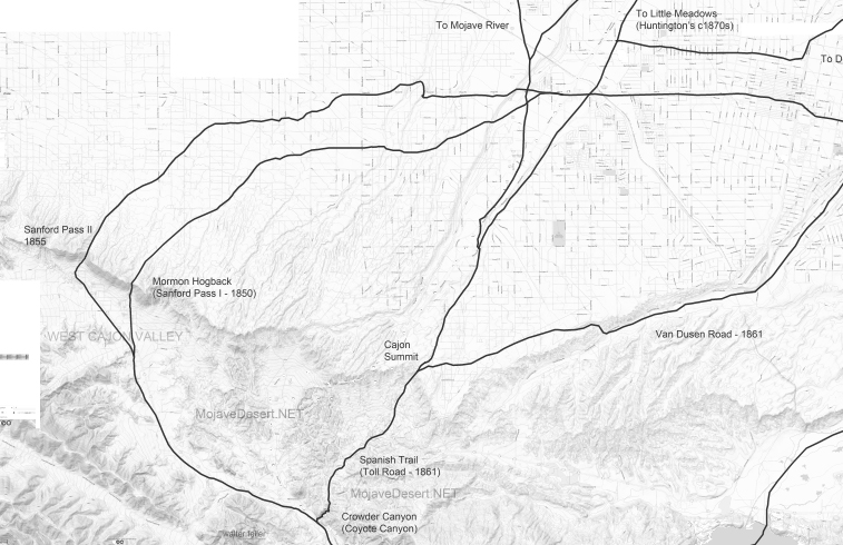
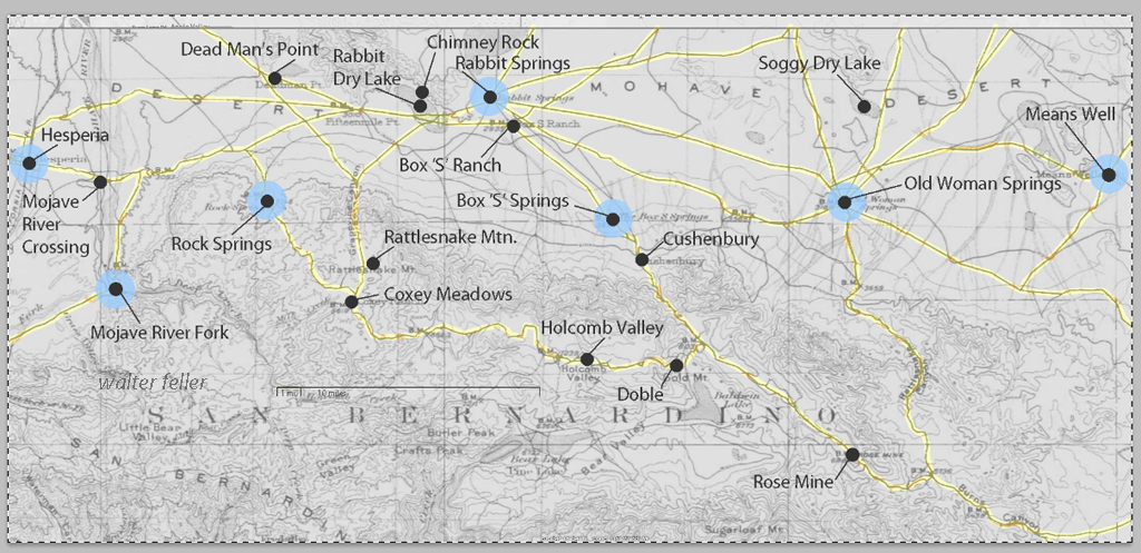
This map has had the 1901 base map replaced with a current street map.
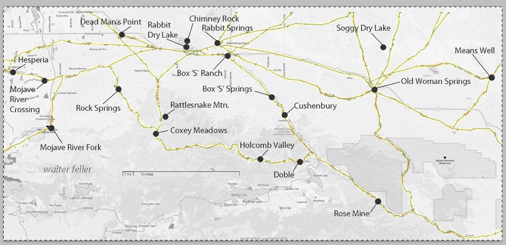
This map has had the water node locations removed.
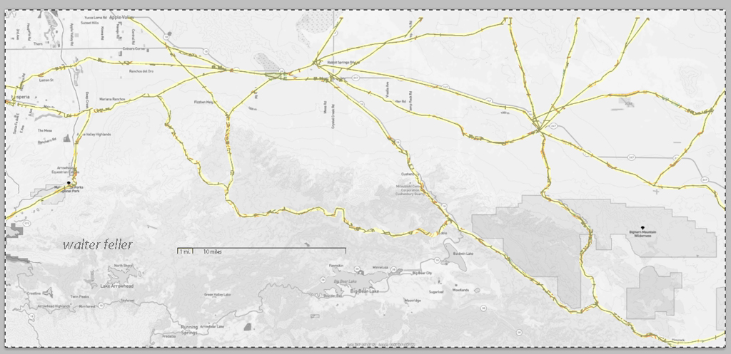
Finally, the 1901 trails have been highlighted and the location labels removed for clarity in showing the relationship between the roads then and now.
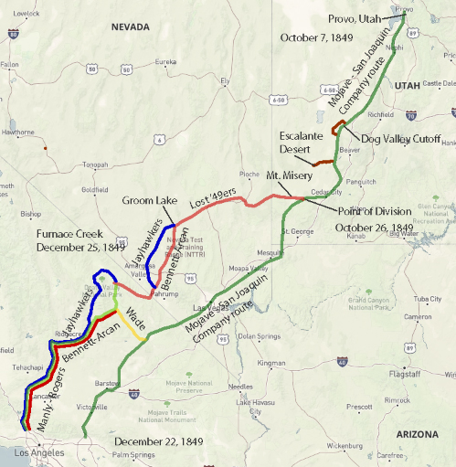
Jefferson Hunt’s Mojave San Joaquin Company, a wagon train made up of anxious gold seekers and settlers frustrated by a late start across the desert in late 1849 join with Captain Hunt to be guided across the Mojave Desert along the new southern route. Tensions rise with a wrong venture into the Escalante Desert and at a point east of Enterprise, and north of Mountain Meadows, Utah, anarchy ensues and the train breaks up into two factions; those who will become lost and those who will go on as planned. Of the 107 wagons in this once large party, only seven wagons remain.
Furnace Creek, Death Valley National Park
On December 22, 1849, the ‘Mojave Sand-walking Company,’ as it became known, arrived in San Bernardino, California. At the same time the remaining ‘Lost ’49ers,’ about one-quarter of those who broke away originally, were entering the desolate Death Valley and would be celebrating Christmas Day near what we know as Furnace Creek.
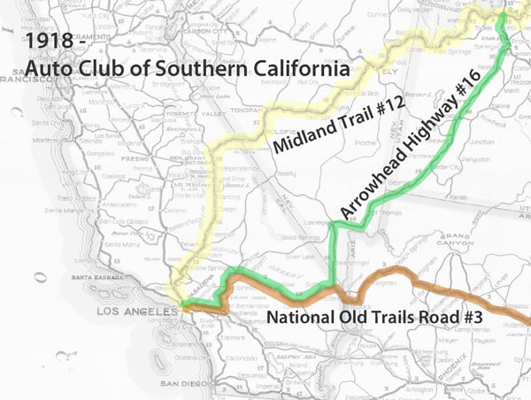
This map shows the three main trails across the Mojave Desert; the Midland Trail, Arrowhead Trail, and the National Old Trails Road. These roads at the time were unpaved and varied in condition and the skills involved to navigate them.
There were two equally onerous obstacles along the Salt Lake Wagon Road that early-on pioneers had to overcome; on the east end of the trail, there was Virgin Hill at Mormon Mesa and the Virgin River. To the west, the challenge was the Cajon Pass.
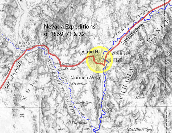
Virgin Hill was a 360-foot change in elevation in only .6 miles (1 foot rise every 9 feet). Teams would have to be doubled up to pull loads over the rocky vertical sections of the steep trail.