Mormon Mesa
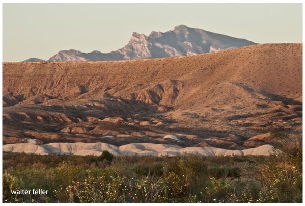
West side of Mormon Mesa from Overton, Nevada
Mormon Mesa is a broad, flat-topped plateau in southeastern Nevada, rising above the Virgin River corridor between present-day Mesquite and the Muddy River basin. Its significance is geographic rather than scenic: Mormon Mesa forms a dry, exposed travel surface that could only be reached by committing to a steep climbmost notably at Virgin Hill.
In trail logic, the mesa represents a shift in rules. Below, movement followed water, grass, and shelter along the Virgin River. Above, travel depended on distance judgment, timing, and endurance. There was little surface water, few landmarks, and no easy retreat. For this reason, Mormon Mesa was never a destination; it was a necessary crossing.
Indigenous travelers, Old Spanish Trail pack trains, and later Mormon Road wagons all used the mesa selectively and seasonally, entering it only when conditions allowed. Its long sightlines aided orientation, but exposure made mistakes costly.
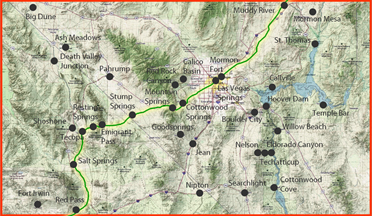
Virgin River Las Vegas), Old Spanish Trail/Mormon Road
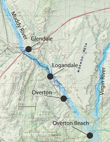
Mormon Mesa Area
". . . Mormon Mesa is located approximately ~100 km north of Las Vegas, Nevada along the I-15 corridor between the towns of Moapa, Overton and Mesquite. It is a flat-topped mesa that extends north and south around the Mormon Mountains, ending in a point near Overton. The mesa extends approximately 198 m above the Virgin River on the east, and the Muddy River and Meadow Valley Wash on the west. Mormon Mesa is unique because it is capped by a ~3 to 4-m thick stage VI petrocalcic soil that has developed on Tertiary sediments of the Muddy Creek Formation. The initiation of soil formation on Mormon Mesa is believed to have begun when the lower Colorado River drainage system formed approx. 5.4 Ma."
Geologic Assessment of Piedmont and Playa Flood Hazards in the Ivanpah Valley Area,
Clark County, Nevada
P. Kyle House1, Brenda J. Buck2, Alan R. Ramelli1