Hike Mount Baldy to Wrightwood – North Backbone Trail

 BY CHRIS KASTEN

Mount Baldy as seen from the Baldy Bowl Trail. It’s a steep climb to the “Bowl”, let alone the summit. However, the alpine scenery and bright blue skies make it entirely worth it.

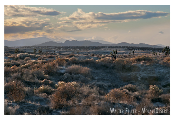
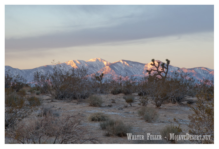
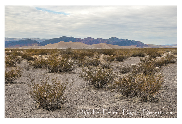
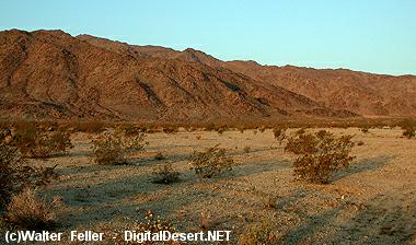
Hike Mount Baldy to Wrightwood via the North Backbone Trail.  This trip takes you from south to north, traversing the San Gabriel mountains eastern high country.   The terrain is high and dry, passing amongst wind bent pines, colorful outcroppings of rock, and views in all directions while taking you through stunning alpine scenery.

Total Distance =   Approx. 12 miles one way

Initial Elevation Gain =  3,900′  the first 4 miles to Mt Baldy.   Once on the North Backbone trail, which’ll take off northward at the 10,064′ summit,  there is an initial 1,300′ of steep descent down to the first saddle.  Next there’s 900′ of climb to Dawson Peak followed by 400′ of drop to the next saddle.  Finally there’s a brief climb of 450′ to the gentle summit of Pine Mountain.   Now and finally, there’s a good 1,400′ drop down to the last little saddle before climbing up a couple hundred yards to the end of the North Backbone trail.   In another 1 1/2 miles of level trail walking you’ll reach the upper end of the Acorn Trail where there will be  1,600′ of drop into Wrightwood.   Over the length of this hike your total Gain will be 5,250′ and the total DROP will be 4,700′.

Map to take:  Tom Harrison’s “ANGELES High Country” map, 2018.  Nothing against map apps, I just happen to really like having a physical map as well as bringing an orienteering compass, too.

Joanie and Chris just a short distance up San Antonio Canyon from Manker Flat Campground. That’s San Antonio Falls just off to the right of my shoulder.

This last Monday, my wife and I drove around to San Antonio Canyon above Upland, from our home in Wrightwood.  I’d been thinking about hiking up Mt. Baldy from the U.S. Forest Service Manker Flat campground and had been kicking this idea around for about a week.   As some days went by,  got to thinking that it’d be really nice to just keep on hiking from Baldy’s summit to Wrightwood via the North Backbone trail.  Easy, speasy.

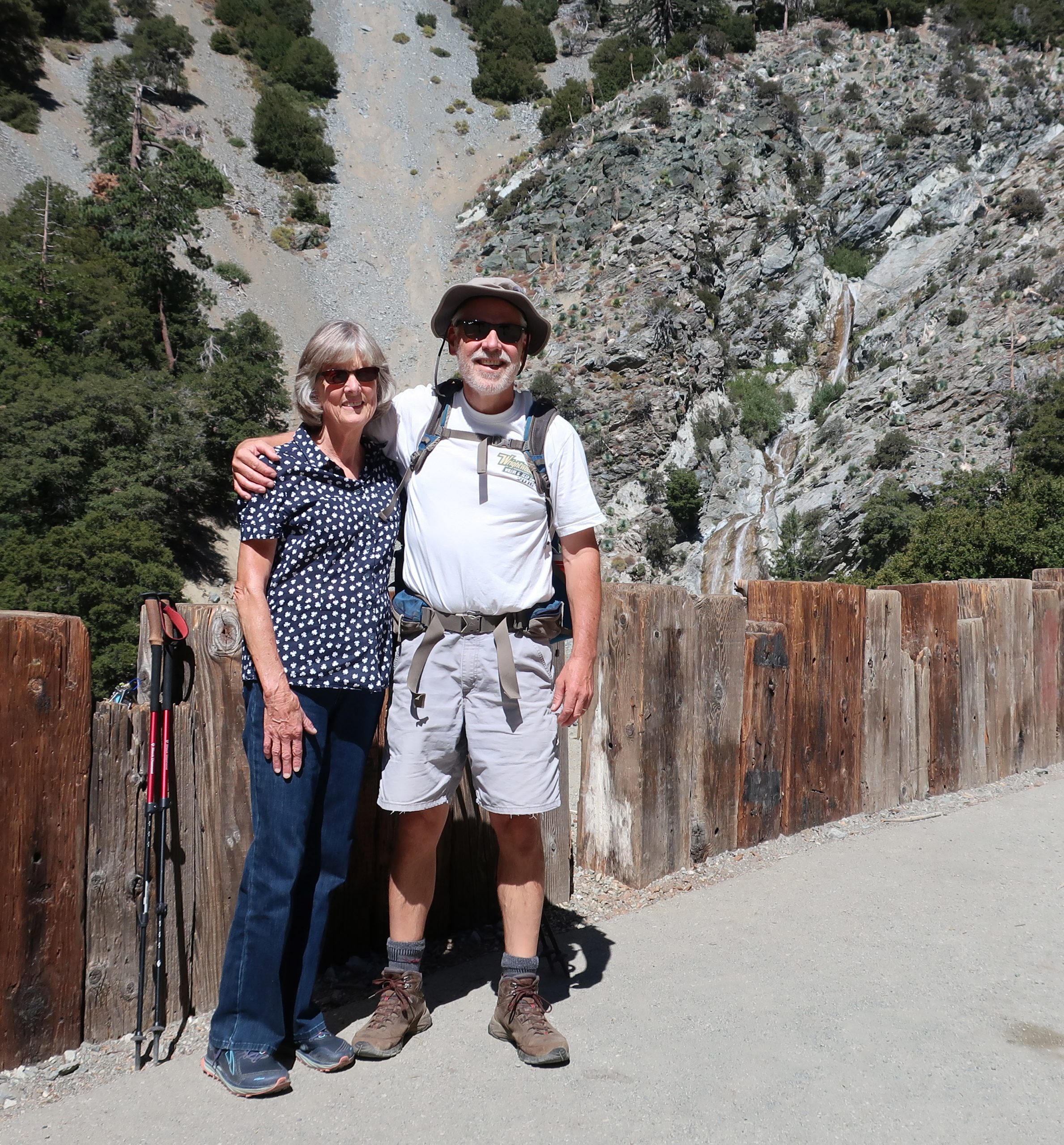
All of this area, including the North Backbone trail,  I had hiked years earlier, meaning in some cases,  some decades ago…    It all seemed so easy in my head and being that it was only going to be a day hike, there wouldn’t be a heavy pack to lug up and down the ridge tops.   That’s it, a cinch!  I’m now pushing 59 years and still hiking, yet there’s no denying that the hikes take a wee bit longer and the recovery the day after is longer .  Yeah.  Well, as things turned out,  we got started a bit later than planned, meaning like almost 11:00 a.m.  Nonetheless, it ended up being a great day to hike!  My wife was going to drop me off at the Manker Flat trailhead and we’d meet up later in Wrightwood.

The Sierra Club’s “Ski Hut” was built back in the 1930’s. After a couple of really steep miles, the Baldy Bowl Trail passes just beneath this beautifully maintained cabin.

I’d wanted to show Joanie San Antonio Falls, which she’d never seen before, and peer down at some of the little cabins hidden along the little creek.  This meant walking the gated fire road,  which is unfortunately paved,  up to its’ first switchback at the base of the falls.  It can be sort of hot and exposed, like it was the day we went.  Still it was worth seeing the Falls.  We said our goodbyes out under the bright blue sky and off I climbed up the fire road which had now become dirt.  It’d be some ten hours before we’d meet up, again,  on the other side of the range in Wrightwood.

View looking toward Baldy Notch from Mt. Baldy Bowl. This photo was taken just minutes after passing by the Sierra Club Ski Hut.

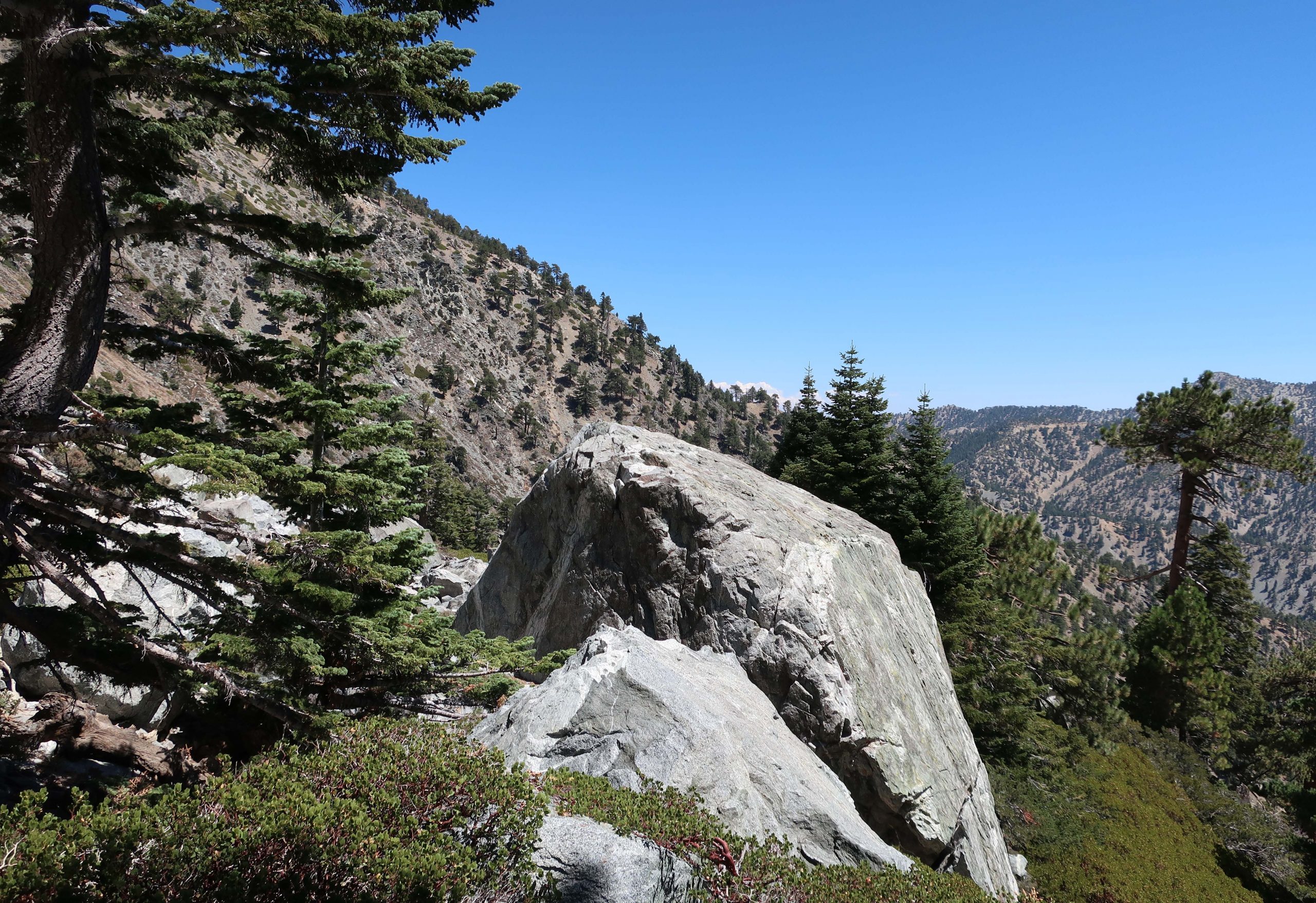
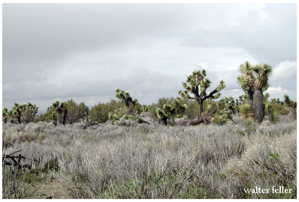
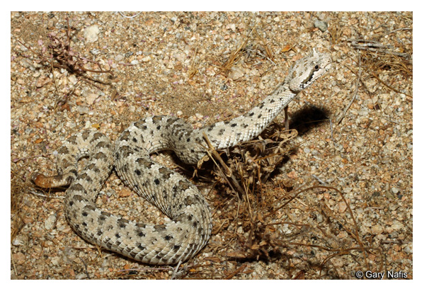
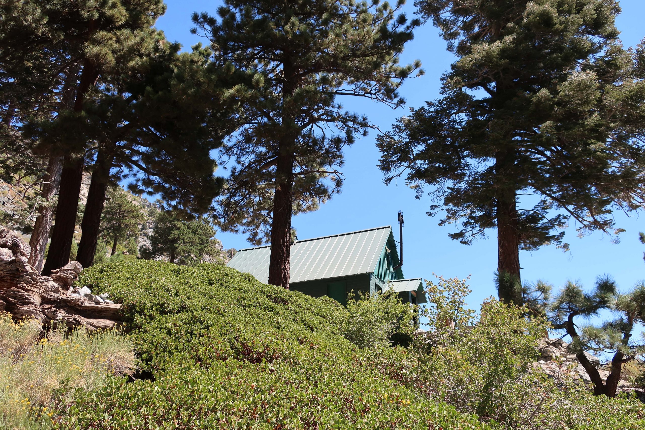
The turn off for the Baldy Bowl trail came up quickly on my left.  That’s where the work began.  Two things that came to mind and became readily apparent in no time at all was:  1.  How much steeper the trail was than I had remembered it and 2.  Just how big Mt. Baldy really is, no matter which way you go up it.   It’s really a tall, broad mountain, especially by Southern California standards.  Throughout the climb, despite the frequent standing up rests to slow the heart down and catch my breath,  it was absolutely beautiful looking out over rugged San Antonio canyon.  The trail climbs quickly up through oaks, mountain mahogany, manzanita and of course, shading pines and white fir.  Just before reaching the Baldy Bowl, named by early x-country skiers in the early 20th century, you pass under the Sierra Club’s ski hut.  Available to overnight stays by reservation only,  this place is meticulously maintained and obviously loved by the membership.  No one was there that day and I just kept hiking along, grateful for the icy cold stream that lay just moments ahead.  There are strips of meadow flowers hugging the stream banks both below and above the trail.  Flowers and willows crowded together along the tumbling, silver thread of water.  The section where the trail crosses through the bowl is a complex of boulders, many the size of small cabins.  It’s slow going and requires taking your time to read the trail, watching for clues as to where to meander next.   Constantly, there was this sense that I was in the Sierras, and yet,  somehow this San Gabriel mountains scenery felt, looked and even had that scent of Sierra rock and pine.   All too soon, the trail leaves the Bowl and begins to switchback up through Jeffrey and Ponderosa pines.  Soon the lodgepole pines began to make their presence and so did someone else.

A solitary Big Horn sheep on the west side of the Baldy Bowl. This is a female or commonly known as a ewe. Often elusive, these creatures are able to easily scale the steepest and loosest of high country slopes.

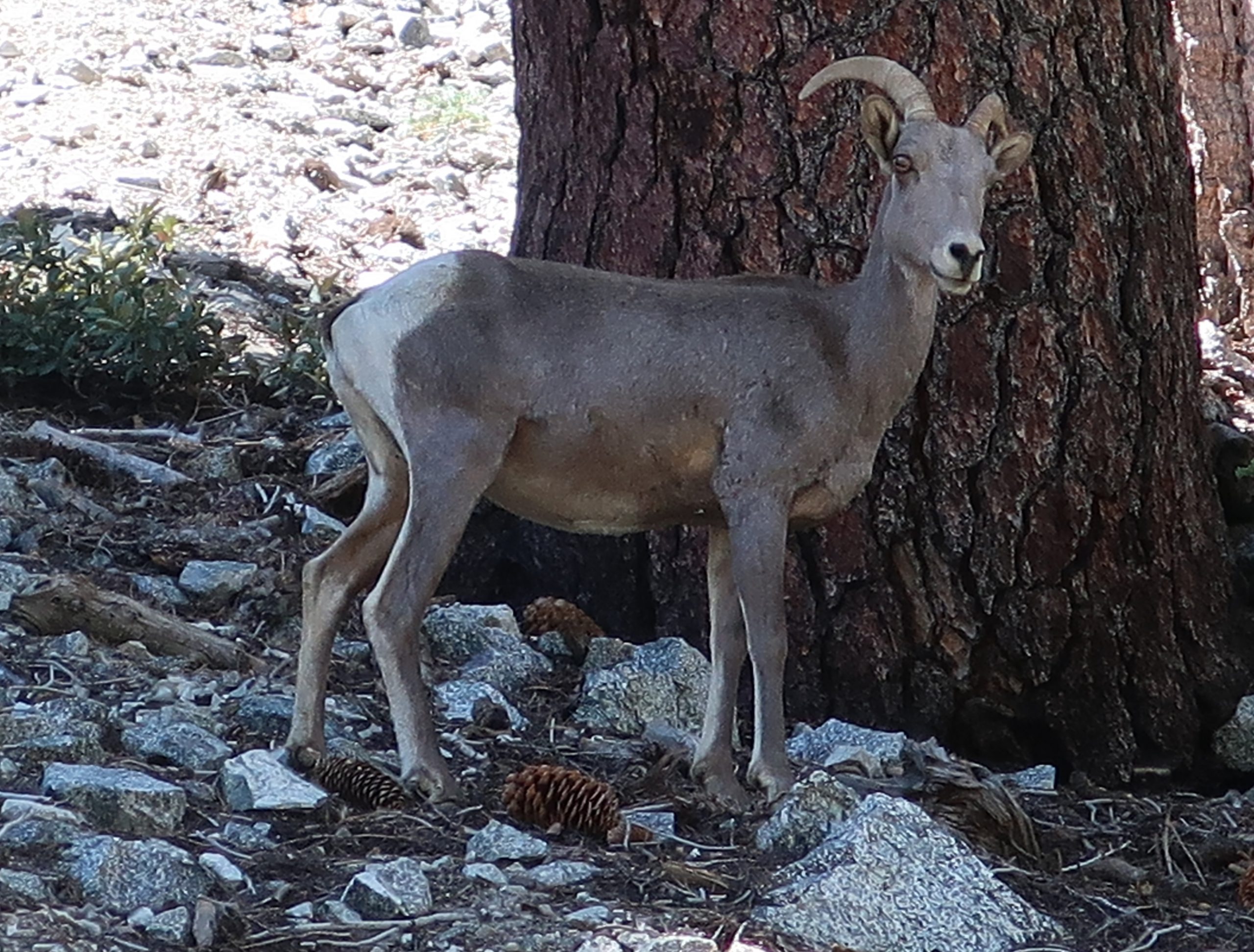
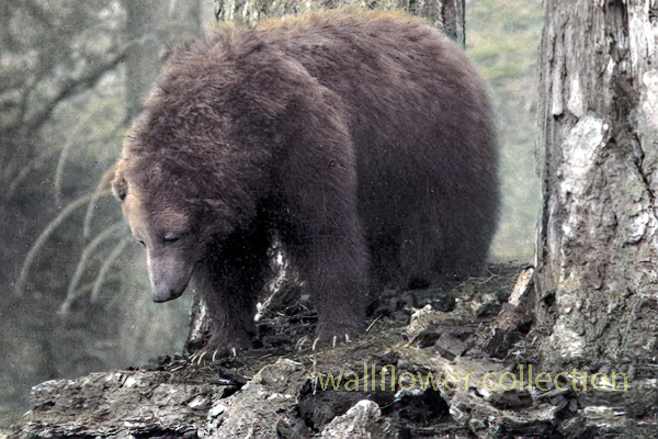
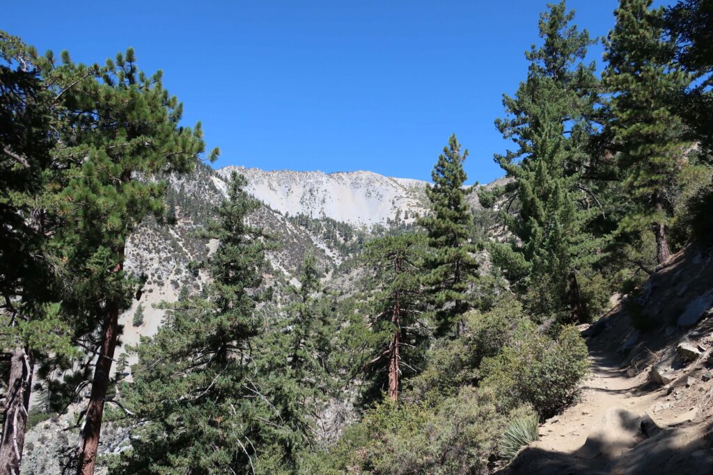
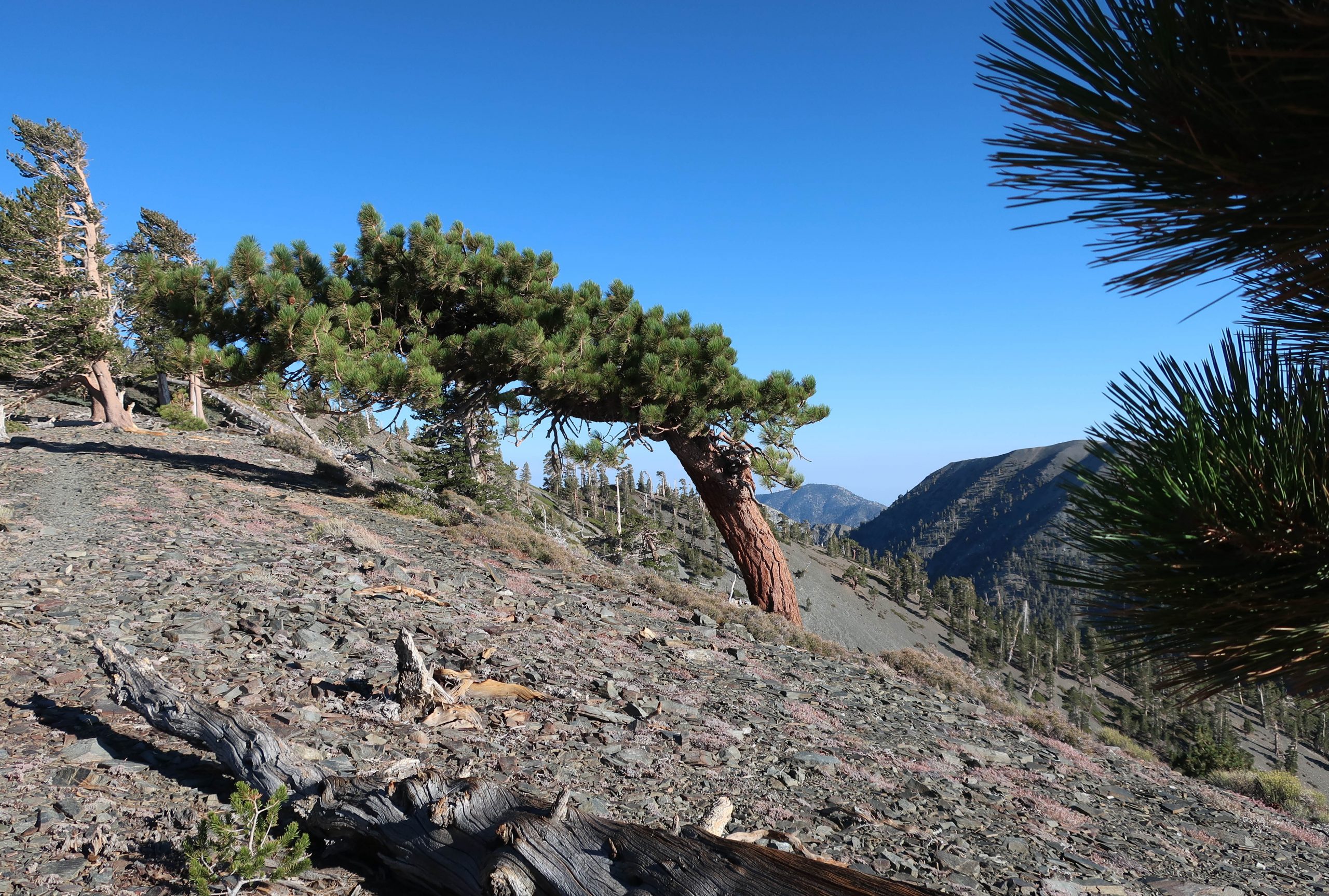
It had been years since seeing a bighorn sheep.  Like always, it was never my eyes that would detect these elusive creatures.  The sound of a few pebbles breaking loose from the hillside caught my attention and there she was!  A few minutes later, another ewe peered at me from behind a fallen tree.  She and her lamb were grazing on about a 45 degree slope on the edge of the Bowl.  A double gift for sure.  Occasionally I’d stop at the end of a switchback and take in the changing view of the ridge line (Devil’s Backbone)  coming in from Baldy Notch.   By now I’d reached the broad ridge top defining the west side of Baldy Bowl, the immense scale of the smooth talus slope dropping steeply off the south side of the summit had become apparent.    The trees, pretty much all lodgepole, were twisted and sculpted by the centuries of storms blowing in off the Pacific.

One of the trail signs at the summit of Mt. Baldy. There’s no lack of directional signage here, a good thing.

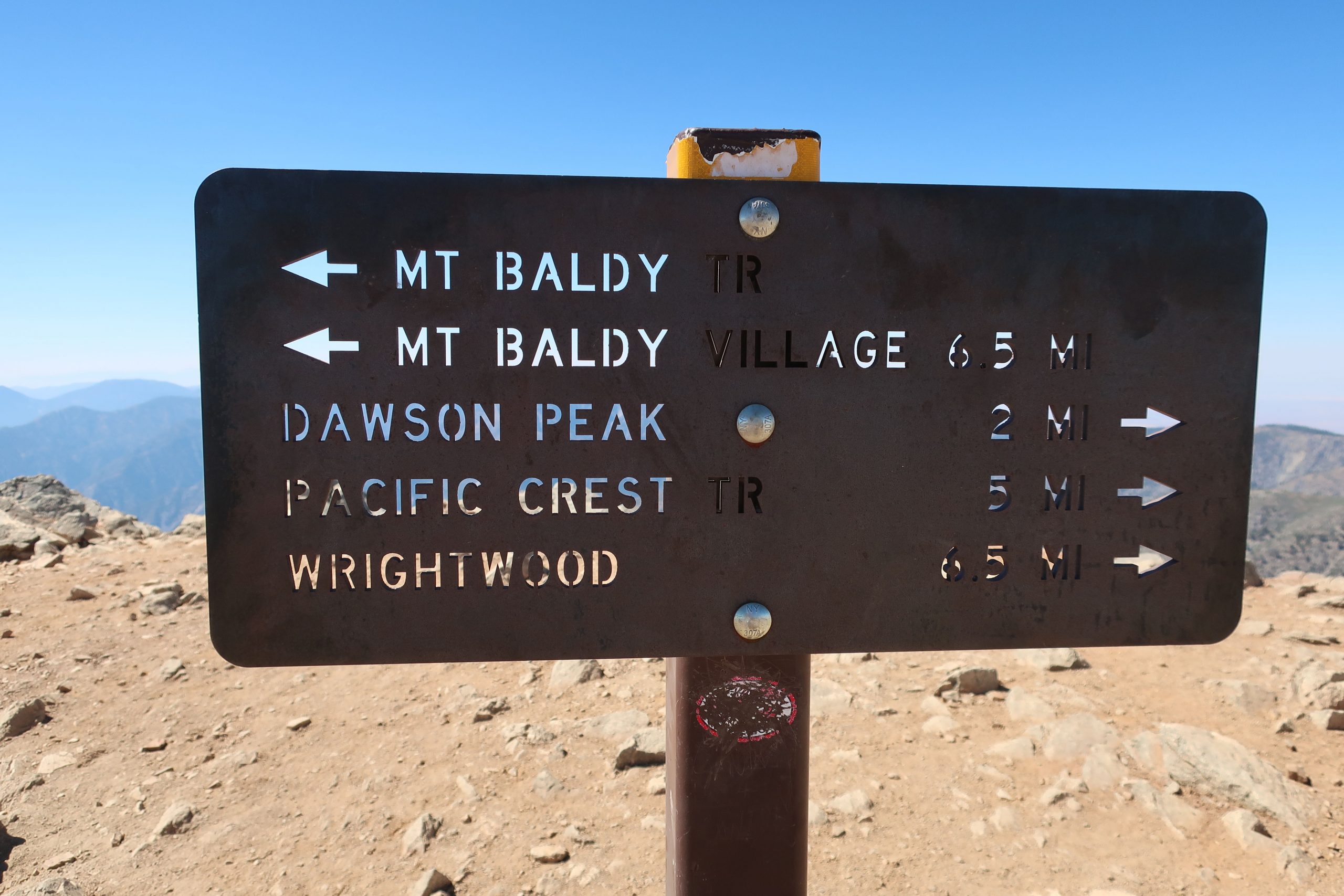
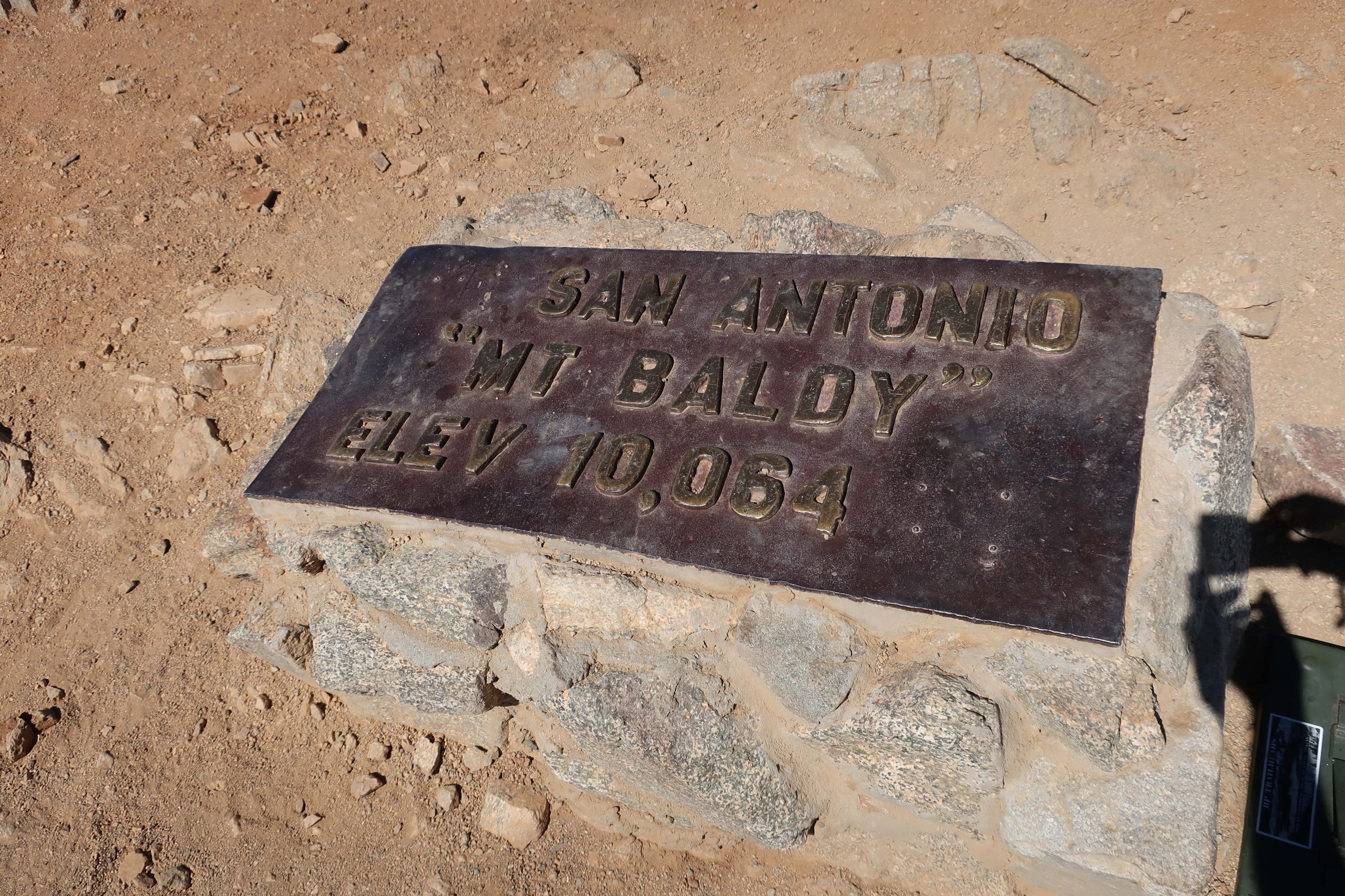
One thing that really caught my eye along the whole route were the really well made and maintained trail signs.  Not only are there good directional signs along the way, there are even square steel posts with reflective tape on them, often giving you a good sense of where the trail would be should it be dark or there be a mantle of snow on the ground.   This trail has really been well thought out.   Another detail that became subtly apparent after some time was the lack of litter.  My route was especially pristine and free of trash.  There’s definitely a sense of stewardship going on up here.  I hadn’t brought a watch, so never did determine just when I summited.  That was purposeful and there was this wonderful relief at not having to know.  Probably at least several hours had elapsed before making it to the top.  There were probably no more than a dozen people sharing the trail up to the top that day.  Really peaceful.   Found a spot near the summit marker (elev. 10,064′) to sit down on my tired haunches, looking out to the north  and down into the Fish Fork.

Here’s the monument marking the summit of one of the most popular peaks in Southern California.

While taking in the view, a fit 30 something man with a solid build and neatly cropped red beard approached, asking if he wasn’t spoiling my solitude.  Of course not!  Pull up a boulder and sit down.  Pretty soon I learned where he’d been, as his IPA cracked open and quickly vanished.  Sam had started out at the Heaton Flat trailhead way down in the East Fork before heading up to Iron Mountain, one of the most isolated and difficult peaks to reach.   From there, he worked his way across West San Antonio Ridge to the summit of West Mt. Baldy.  From here, he’d drop down to Manker Flat and find his hidden mountain bike and take that back to his car by pedaling over the Glendora Mountain Ridge Road!  That’s the caliber of company you can sometimes run into on higher peaks…   Soon I was off and heading down the North Backbone Trail toward Blue Ridge and Wrightwood beyond.  Gotta tell you, taking trekking poles was one of my best moves of the day.  The descent was extremely steep down to the first saddle north of Mt. Baldy.  Spots where I definitely would have slipped just from fatigue, were pretty easily walked down with the aid of the poles.  This is a trip where you’d be glad to have a set of them.

Here’s the view looking toward the North Backbone trail from Mt. Baldy’s summit. That’s Dawson Peak straight ahead, just off to the right of the steel sign. Pine Mountain is further out, on the left of photo. Hiking this ridge is the key to traversing the San Gabriels to Wrightwood.

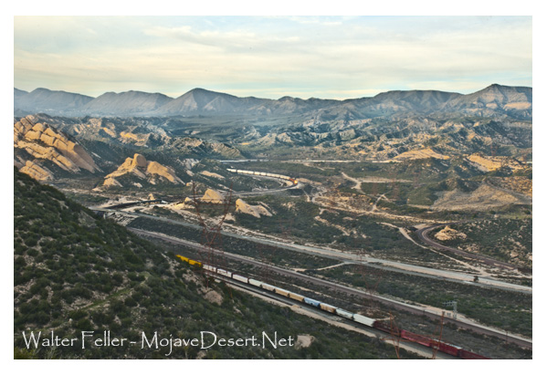
The climb up to Dawson Peak went well.  There’s lots of rabbitbrush along the way.  The trail weaved in and out of the thick yellow blossoms, giving the late afternoon light a feeling of autumn.  Mountain mahogany and twisted rock outcroppings kept things interesting as well.  There was a great view down toward the Cajon Pass with commuters making their sluggish drive back toward the desert.  A freight train could be seen climbing the serpentine railroad tracks as well, tiny in comparison to the arid landscape.  All this activity was silent, visible, yes, yet no sound whatsoever.  To my left, grand scenes of the Fish Fork and Mount Baden Powell, continued to dominate my senses.  A refreshing and constant breeze out of the west kept me cooled down.  Once on top of Dawson (elev. 9,575′), I signed the summit register and continued on down a gentle descent through sun – polished plates of schist.  Talus, I suppose.  Beautiful stuff that sounded like ceramic dinner plates clunking together under my boots at times.  There were even these beautiful, hidden, forested and shaded flats just below the trail at times, spots that would make for a perfect campsite.  Untouched.  Just before reaching the saddle between Dawson and Pine Mountain, I saw the old and seemingly untrammeled Fish Fork Trail coming in from my left.

Trail junction for the seldom trod Dawson Peak Trail in the upper Fish Fork. This is the upper end of what appears on Tom Harrison’s Angeles High Country map as being the 4 1/2 mile route down to Fish Fork Campsite, probably one of the most remote places in the San Gabriels. The elevation at this spot is 9,200′.

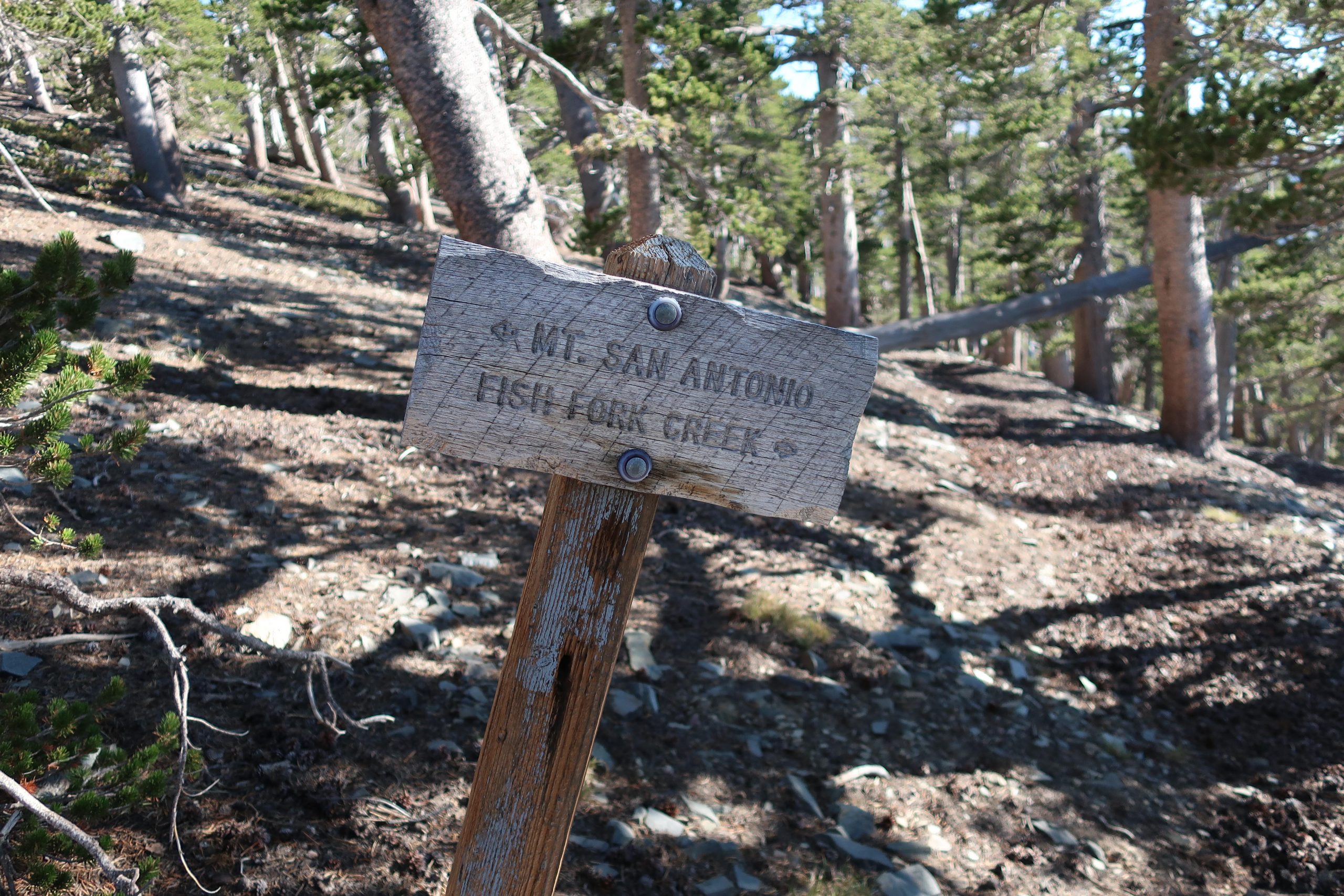
There’s even an old graying wooden sign indicating the way down.  I’ve always wanted to follow this trail which drops down to Fish Fork trail camp, probably one of the most isolated haunts in our range.  That old feeling came back somewhat suddenly, mixed with wonder at how good things still are in the backcountry here.  Pristine.  And since it’s hard to get to, at least for me, nothing’s trashed.  A constant truth throughout the ages.  Thank God. Amen.

A section of the North Backbone trail, looking back toward Dawson Peak. The ridge line on the horizon, seen off to the right is part of the Mount Harwood / Mt. Baldy massif. This picturesque “flag” tree in the foreground is one of many found along these high country slopes and ridge tops, sculpted over the centuries from the high winds blowing in from Pacific winter storms.

Soon I was climbing yet, again.  This time it was up to Pine Mountain (9,648′).   Weaving amongst more pines and mountain mahogany,  the sun continued to drop further and further down across the mountains, casting longer and longer shadows in the gentle wind.  Up on top, the summit register of nested red cans was easily found in a cairn of rocks.   The desire to linger here awhile longer was resisted by the nagging feeling to at least get to Blue Ridge and the Pacific Crest Trail (PCT) before it got dark.  So, reluctantly, off I dragged my now tired self down a gentle slope amongst a thick forest of lodgepole pine.  The deepening pools of shade penetrated the forest in a way that reminded me of being a little boy, maybe six or seven, running through the giant sequoias where our family used to camp every summer in a tent cabin.  I missed people that I hadn’t thought about in awhile.  They all came back for a bit and I reveled in this.

As the sun sunk lower and lower in the west, I made my way along the top of the ridge to the north of Pine Mountain, dropping toward Blue Ridge which is visible to the right.

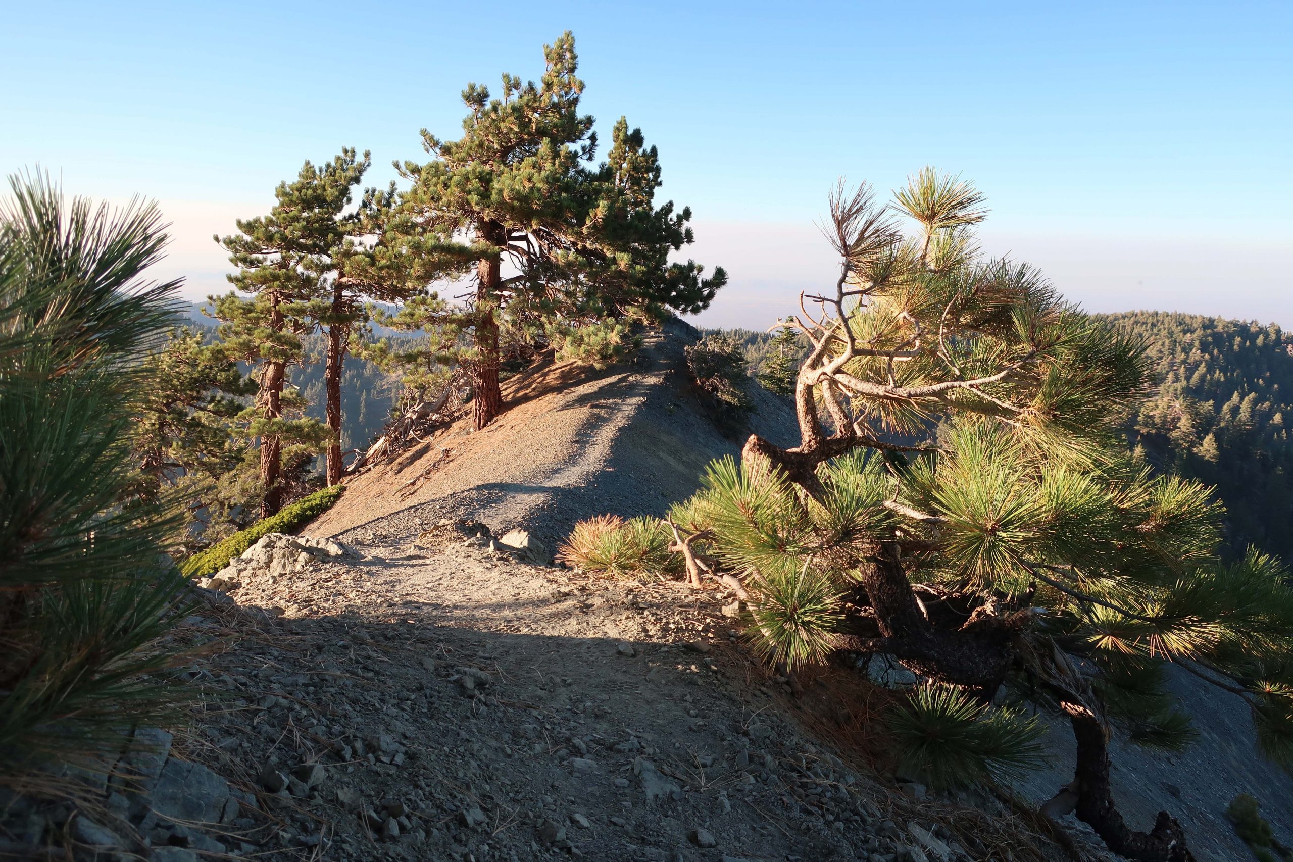
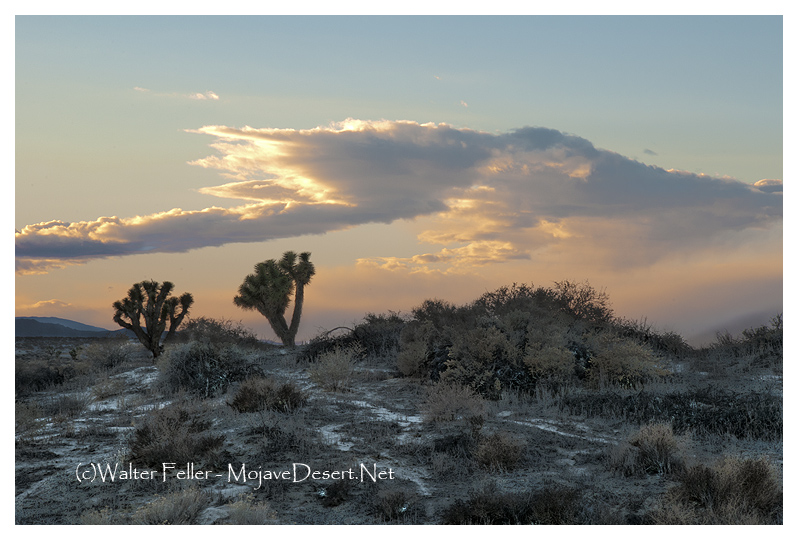
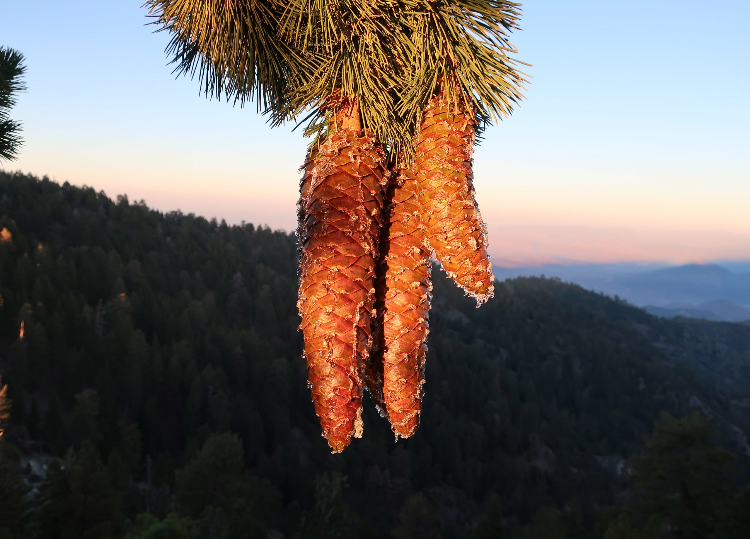
After a short while, the ridge top timber all but left, becoming a sharp edged knife of rock, bathed in orange golden sunlight.  Take your time here, Chris, something kept gently telling me.  I was tired and starting to get sloppy, not quite so nimble as hours earlier.  Eventually the ridge got easier and right before sun had set below the horizon, a beam of that gold light struck some dangling cones hanging from an ancient sugar pine.  This hike kept getting more and more gorgeous, nostalgic in a way.  In the graying light, I made a last little climb up to the dirt road (East Blue Ridge recreation road) to the northern terminus of the North Backbone Trail.

The gold light of early evening illuminates several sugar pine cones along the North Backbone trail. That’s the Mojave Desert in the background, while distant ranges still bask in the sunset.

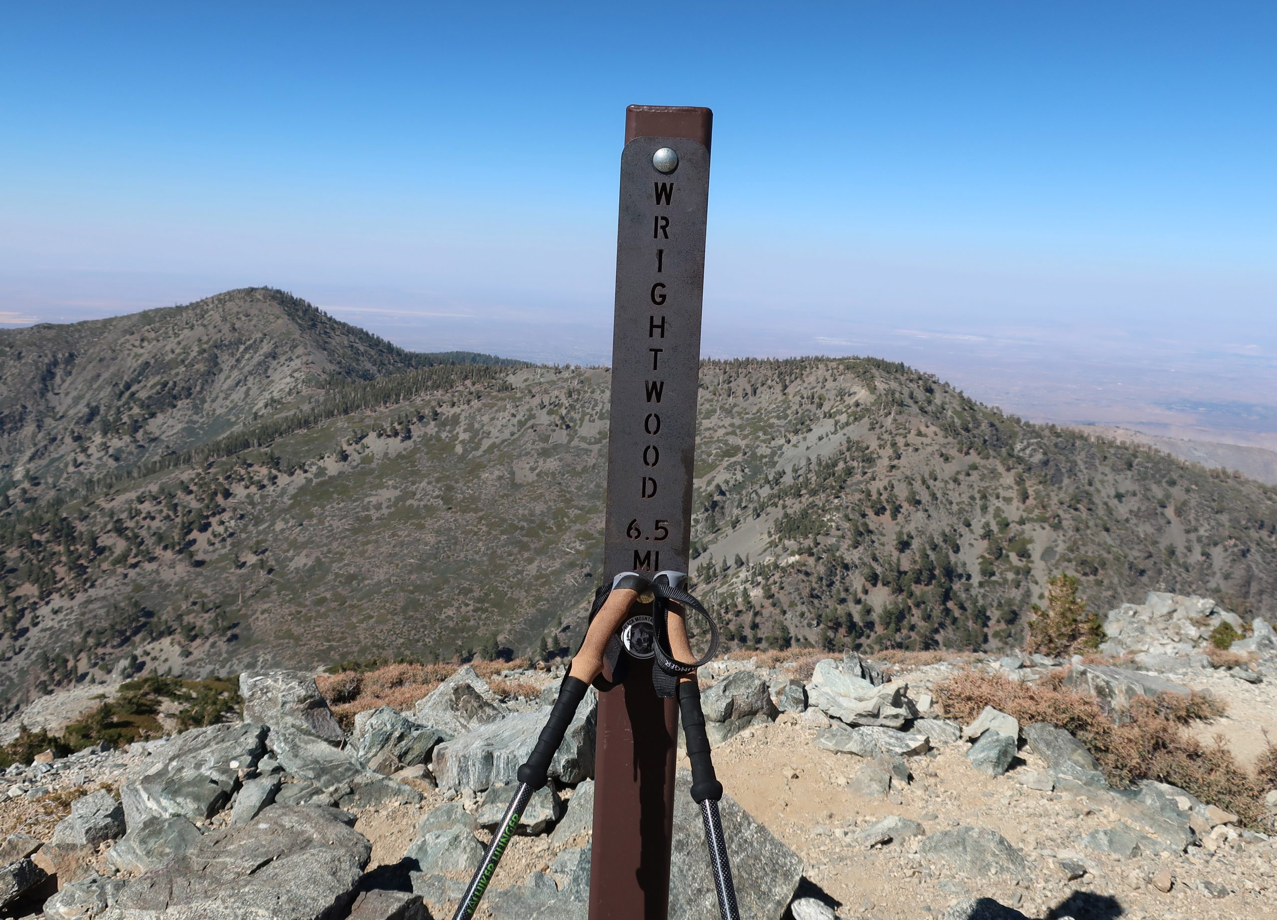
I scurried up the slope behind the road, following a scratch trail that led to the PCT.  Turning left (west) and continuing at a pretty fast clip, I arrived at a spot just to the west of the large slide above Wrightwood.  The lights of homes were now twinkling in the early evening darkness.  Time to get the flashlight out.   I continued on in the dark, amongst and under the tall white fir and pines. Still no one around.  Perfect.  Here and there you could make out the silhouette of Pine Mountain to the south.   A short time later was the turn-off for the Acorn Trail, which would descend about 1,600′ feet down into upper Wrightwood.  Up here, it was possible to reach Joanie by radio, and yes, you guessed it….  Without a bit of shame, I took the ride back to our home in the little red Honda while Joanie told me about her day.  Why the hell not?  Who wants to walk on pavement I say to myself.  That ride was heaven on earth.  And so there you have it, it’s possible to walk across the highest point in the San Gabriels in a day!  The next day my thighs felt entirely spent while walking on the little stone paths around our yard.   And yet, looking back on it all, such as all good hikes,  it was definitely worth it.

California Grizzlies

The California grizzly bear (Ursus arctos californicus) is a subspecies of the brown bear that once inhabited various regions of California. Historically, grizzly bears were found throughout the state, from the coast to the mountains and valleys. They were an important part of California’s wildlife and played a role in the culture and folklore of indigenous peoples.

California grizzly bear (Ursus arctos californicus)

Unfortunately, due to habitat loss, hunting, and human conflicts, the California grizzly bear population declined significantly throughout the 19th century. The last known California grizzly bear in the wild was killed in 1922 in Tulare County. The species was declared extinct in 1924.

Efforts have been made to preserve the memory of the California grizzly bear, and it is often symbolically represented in the state’s flag and seal. The California grizzly bear is also the state animal, even though it no longer exists in the wild.

1846 – 1910
1911 – 1952
Today

There have been occasional discussions and proposals for reintroducing grizzly bears to certain parts of California, but these efforts are complex and face challenges related to habitat, human-wildlife conflicts, and public opinion. As of my last knowledge update in January 2022, there were no active reintroduction programs in place. Still, it’s advisable to check for the latest information, as conservation efforts and plans may evolve.

Grizzly Bears in Bear Valley

Bears – Yosemite

Issac Slover

1845

Benjamin Wilson leads a posse of 22 men into the San Bernardino Mountains to search for Indians who had been raiding ranches in . He discovers Big Bear Valley and gives it the name it has today. Up until 1845, Bear Valley was known to the local Serrano Indians as Yahaviat, which means “Pine Place”. – bb

Mormon Rocks

/mormon-rocks/

The Mormon Rocks, also known as the Rock Candy Mountains, are a series of distinctive sandstone outcrops in the Cajon Pass, a mountain pass in the San Bernardino Mountains of Southern California. The Cajon Pass is a critical transportation corridor connecting the Los Angeles Basin with the Mojave Desert and beyond.

Here are some key points about Mormon Rocks and their significance:

  1. Location: The Mormon Rocks are within the Cajon Pass, traversed by Interstate 15 and several major railroad lines. The rocks are easily visible from the highway, making them a notable geological feature.
  2. Geological Formation: The rocks are sedimentary sandstone and formed through tectonic and erosional processes over millions of years. The distinctive red and white banded appearance is due to iron oxide (hematite) and other minerals.
  3. Cultural Significance: The Mormon Rocks have cultural and historical significance. The area is named after a group of Mormon pioneers who passed through the Cajon Pass in the mid-19th century during their westward migration. The rocks are a prominent landmark in the pass and have been featured in various forms of media.
  4. Recreational Opportunities: The area around Mormon Rocks provides outdoor activities and recreation opportunities. There are trails and viewpoints where visitors can appreciate the geological formations and enjoy scenic views of the surrounding landscape.
  5. Conservation: The Mormon Rocks are part of the San Bernardino National Forest, and efforts are made to preserve and protect the natural and cultural resources in the area.
  6. Railroad Transportation: The Cajon Pass is a crucial route for road and rail traffic. The presence of the rocks adds to the landscape’s visual appeal and has made the pass a notable location for train enthusiasts who enjoy watching trains navigate the steep grades of the pass.

Whether you are interested in geology, history, or simply enjoying scenic landscapes, the Mormon Rocks in the Cajon Pass offer a unique and visually striking destination. If you plan to visit, be sure to follow any posted regulations and respect the natural environment.

A Yucca Moth and its Yucca

https://mojavedesert.net/plants/

The relationship between a yucca moth and a yucca plant is a classic example of mutualism, a symbiotic relationship where both species benefit. Yucca moths and yucca plants have coevolved over millions of years, and their interaction is highly specialized.

  1. Pollination:
    • Yucca Moths: Female yucca moths play a crucial role in pollination. They are equipped with specialized mouthparts called maxillae, which they use to collect and carry pollen. The female moth visits the flowers of the yucca plant to lay her eggs.
    • Yucca Plants: Yucca plants rely on yucca moths for pollination. The female moth collects pollen from one yucca flower and then deposits it on the stigma of another flower while laying her eggs. This ensures cross-pollination, facilitating genetic diversity in the yucca plant population.
  2. Egg-Laying and Larval Development:
    • Yucca Moths: The female moth deposits her eggs inside the ovaries of the yucca flowers. She uses specialized structures called ovipositors, which also transfer the pollen. The eggs hatch into larvae.
    • Yucca Plants: The yucca plant provides a place for the yucca moth to lay eggs, and the developing larvae feed on some of the developing seeds within the yucca fruit. The yucca plant sacrifices a small portion of its seeds to nourish the larvae.
  3. Specificity and Coevolution:
    • The relationship between yucca moths and yucca plants is highly specific. Each species of yucca plant is typically associated with a specific species of yucca moth.
    • This specificity has arisen through coevolution, where the traits of each species have adapted to complement the other. Yucca moths have evolved to be efficient pollinators of yucca plants, while yucca plants have developed features that attract and support yucca moths.
  4. Obligate Mutualism:
    • The relationship is often considered an obligate mutualism, meaning each species depends on the other for reproduction. Yucca moths rely on yucca plants for a place to lay their eggs, and yucca plants rely on yucca moths for effective pollination.
Yucca schidigera

This intricate relationship between yucca moths and yucca plants highlights the fascinating ways organisms can evolve together, developing mutual dependencies crucial for their survival and reproduction.

Yucca brevifolia

Mojave Desert Experiences

The Mojave Desert, located in the southwestern United States, is a vast and captivating landscape known for its unique geological features and diverse ecosystems. Here are some activities you can enjoy in the Mojave Desert:

  1. Joshua Tree National Park:
    • Hiking: Explore the numerous hiking trails, such as the popular trails to Hidden Valley, Barker Dam, and Ryan Mountain.
    • Rock Climbing: Joshua Tree is renowned for its granite rock formations, making it a world-class destination for rock climbers of all skill levels.
    • Stargazing: The park is a designated International Dark Sky Park, offering excellent stargazing opportunities.
  2. Mojave National Preserve:
    • Kelso Dunes: Hike to the top of these iconic dunes for panoramic views of the desert landscape.
    • Hole-in-the-Wall: Explore the unique volcanic rock formations and hike through the scenic canyons of Hole-in-the-Wall.
  3. Off-Highway:
    • Mojave Road: Embark on the historic Mojave Road, a 140-mile trail that takes you through the heart of the Mojave Desert. It’s a popular route for off-road enthusiasts.
  4. Red Rock Canyon State Park:
    • Scenic Drive: Enjoy a scenic drive through the park, with opportunities for short hikes to view the striking red rock formations.
    • Wildflower Viewing: The park comes alive in the spring with vibrant wildflowers, offering a colorful display.
  5. Death Valley National Park:
    • Badwater Basin: Visit the lowest point in North America and explore the unique salt flats.
    • Artist’s Palette: Drive through this colorful area known for its mineral-stained hills.
    • Zabriskie Point: Enjoy panoramic views of the badlands and eroded rock formations.
  6. Ghost Towns:
    • Calico Ghost Town: Explore this well-preserved ghost town that was once a bustling silver mining community.
    • Randsburg: Visit another historic mining town known for its quirky atmosphere and vintage charm.
  7. Mojave Air and Space Port:
    • Aerospace Museum: Discover the history of aviation and space exploration at the Mojave Air and Space Port, home to innovative aerospace projects.
  8. Bird Watching:
    • The Mojave Desert is home to a variety of bird species. Bring binoculars and explore areas like the Amargosa River and nearby wetlands for birdwatching opportunities.
  9. Photography:
    • Capture the unique landscapes, rock formations, and vibrant sunsets the Mojave Desert offers. Joshua Tree’s unique Joshua trees and the play of light and shadow make for excellent photographic opportunities.
  10. Camping:
    • Enjoy camping under the desert stars at designated campgrounds in Joshua Tree National Park, Mojave National Preserve, and Death Valley National Park.

Remember to check weather conditions, carry plenty of water, and follow Leave No Trace principles when exploring the Mojave Desert. Always be aware of the desert’s extreme temperatures and take necessary precautions for a safe and enjoyable experience.

Mojave River: A Lifeline in the Desert

Introduction:

The Mojave River, a hidden gem in the arid landscapes of California, serves as a vital lifeline in the Mojave Desert. This remarkable river spans approximately 110 miles and offers a diverse ecosystem, historical significance, and recreational opportunities for nature enthusiasts and history buffs.

Geography and Formation:

The Mojave River originates in the San Bernardino Mountains and meanders through the Mojave Desert, eventually dissipating into Soda Lake. Its path encompasses various landscapes, including rugged canyons, barren deserts, and lush riparian habitats. The river’s formation can be traced back thousands of years ago when geological processes and the ever-changing climate of the region shaped its course.

Ecological Importance:

Despite the harsh Mojave Desert conditions, the Mojave River sustains a surprising array of flora and fauna. The river’s riparian zones provide an ideal habitat for a variety of plant species, such as willows, cottonwoods, and mesquite trees. These lush areas attract diverse wildlife, including birds, reptiles, and mammals, seeking refuge in this desert oasis.

Historical Significance:

The Mojave River holds a significant place in the history of California. Native American tribes, such as the Mojave, Serrano, and Chemehuevi, once relied on the river’s resources for sustenance and survival. European explorers, including Spanish missionaries and fur trappers, ventured along its banks, leaving behind a legacy of cultural exchange and exploration.

Moreover, during the mid-1800s, the Mojave River played a crucial role in the development of the Old Spanish Trail and the Mojave Road. These historic trade routes linked the Spanish colonies of California with the eastern United States, facilitating trade and migration.

Recreational Opportunities:

For outdoor enthusiasts, the Mojave River offers a plethora of recreational activities. Hiking trails, such as the Mojave Riverwalk Trail, provide opportunities for exploration, allowing visitors to immerse themselves in desert scenery. Camping facilities and picnic areas along the river’s banks provide the most idyllic setting for a peaceful getaway amidst nature’s tranquility.

Conservation Efforts:

Recognizing the importance of preserving this vibrant ecosystem, numerous conservation organizations and government agencies have worked to protect and restore the Mojave River. These initiatives focus on sustaining river water quality and preserving riparian habitats.

Conclusion:

The Mojave River stands as a testament to the resilience of nature in the face of adversity. Its meandering path through the Mojave Desert provides a lifeline for both wildlife and humans, offering a sanctuary amidst the arid landscapes. Whether you are a nature lover, history enthusiast, or adventure seeker, the Mojave River is a destination that promises a unique and memorable experience. So, embark on a journey to this desert oasis, and let the Mojave River captivate you with its beauty and allure.

Indifference of the Desert: Gateway to Eternity

The desert, a vast expanse of arid land, holds an enigmatic allure that has captivated explorers, writers, and artists for centuries. In its barrenness lies a certain indifference, an apathy that transcends the human realm. It is a world of endless silence, where life struggles to survive, and time appears to stand still. This place, looking into the indifferent nature of the desert, exploring its striking beauty, unforgiving climate, and ability to evoke a sense of insignificance in the face of its vastness.

The desert’s indifference is paradoxically intertwined with its mesmerizing beauty. Stretching as far as the eye can see, the landscape is dominated by sand dunes, rocky outcrops, and expansive plains. The desert’s neutral color palette, comprising earthy tones of beige, ochre, and rust, creates a harmonious symphony of hues. Its vastness and emptiness instill a sense of awe as if gazing upon an infinite canvas that has been left untouched by human hands.

The desert’s indifference is most apparent in its extreme climate. The desert’s temperatures fluctuate dramatically from scorching heat during the day to bone-chilling cold at night. The barrenness of the landscape exacerbates these conditions, as there are no obstacles to provide shade or shelter. Survival in such an environment requires adaptation and resilience, as even the hardiest of creatures struggle to endure the harshness of the desert’s indifference.

In the desert, time seems to lose its relevance. The shifting sands, sculpted by the wind, erase any trace of human presence, leaving behind a blank canvas for nature to paint anew. The desert’s indifference to the passage of time can be both humbling and disorienting. It serves as a reminder of the transience of human existence, as the footprints we leave behind are quickly swallowed by the relentless sands, making us feel insignificant in the face of eternity.

While the desert’s indifference may seem daunting, it offers valuable lessons for those who are willing to listen. It teaches us to embrace solitude and find solace in our own company. It encourages us to adapt and persevere in the face of adversity. It reminds us of the impermanence of life and the importance of cherishing the present moment. The desert’s indifference serves as a gentle yet profound reminder of our place in the grand tapestry of the universe.

The indifference of the desert is a captivating paradox. Its silent beauty, harsh climate, and timeless sands evoke a sense of insignificance in the face of its vastness. Yet, within its indifference lies wisdom and resilience. The desert beckons us to embrace solitude, adapt to change, and appreciate the fleeting nature of existence. Let us heed its call and find solace in the indifference of the desert, for within its silence lies a profound understanding of the human condition.

(c)Walter Feller

Scientific Names for Mojave Desert Plants and Animals

The Mojave Desert is a vast and fascinating landscape known for its extreme temperatures and unique biodiversity. Plants and animals have adapted to survive harsh conditions. Understanding their scientific names can provide insights into their classification and evolutionary history. In the following, we will explore some scientific names of Mojave Desert plants and animals.

Plants:

1. Yucca brevifolia – Commonly known as the Joshua tree, Yucca brevifolia is an iconic sight in the Mojave Desert. Its scientific name refers to the short leaves (brevifolia) that distinguish this species.

Kangaroo rat

2. Larrea tridentata – Also known as the creosote bush, Larrea tridentata is a desert shrub that thrives in the Mojave Desert. Its scientific name reflects the three-toothed (tridentata) leaves that are characteristic of this plant.

3. Opuntia basilaris – The beavertail cactus, scientifically known as Opuntia basilaris, is common in the Mojave Desert. Its scientific name refers to the basal (basilaris) pads that resemble a beaver’s tail.

Animals:

1. Crotalus cerastes – The sidewinder rattlesnake, scientifically known as Crotalus cerastes, is a venomous snake found in the Mojave Desert. Its scientific name refers to its scales’ horned (cerastes) appearance and unique sidewinding locomotion.

2. Dipodomys deserti – The desert kangaroo rat, scientifically known as Dipodomys deserti, is a small rodent that inhabits the Mojave Desert. Its scientific name reflects its desert habitat (deserti) and its kangaroo-like hopping behavior.

3. Phrynosoma platyrhinos – The desert horned lizard, scientifically known as Phrynosoma platyrhinos, is a reptile known for its unique appearance and defensive behavior. Its scientific name refers to this species’ flat-nosed (platyrhinos) characteristic.

These are just a few examples of the scientific names given to plants and animals that call the Mojave Desert their home. Understanding these names allows scientists and researchers to classify and study these organisms more effectively. It also highlights life’s incredible diversity and adaptability in this harsh environment.

As we continue to explore and learn about the Mojave Desert’s flora and fauna, let us appreciate the scientific names that provide a deeper understanding of the incredible plants and animals that thrive in this unique ecosystem.

All You Need to Know About the Western Fence Lizard

Introduction:

The western fence lizard, scientifically known as Sceloporus occidentalis, is a fascinating reptile found throughout North America’s western regions. With its unique appearance and interesting behaviors, this lizard has captured the attention of many nature enthusiasts and researchers alike. In this blog post, we will delve into the world of the western fence lizard and uncover some intriguing facts about this remarkable creature.

Physical Characteristics:

The western fence lizard has a distinctive appearance that sets it apart from other lizard species. It typically measures 5 to 8 inches long, with a slender body and a long, tapering tail. Its coloration varies depending on its environment, but it usually sports a grayish-brown or olive-brown hue, making it blend seamlessly with its surroundings. One of the most striking features of this lizard is the rows of spiky scales running along its back, giving it the appearance of a miniature dinosaur.

Habitat and Distribution:

This hardy lizard is commonly found in a variety of habitats, ranging from grasslands and woodlands to rocky outcrops and deserts. It is particularly prevalent in the western regions of North America, including California, Oregon, Washington, and parts of Mexico. The western fence lizard is well-adapted to dry and arid environments, often basking in the sun to regulate its body temperature. It is also an excellent climber, frequently seen perched on rocks or tree trunks.

Behavior and Diet:

The western fence lizard is primarily active during the day, basking in the sun to warm up its body and fuel its metabolism. It is an omnivorous lizard, meaning it feeds on a wide range of insects, spiders, snails, and small fruits. Interestingly, this lizard has also been observed consuming ticks, making it an important predator for controlling tick populations in its habitat. In addition, the western fence lizard is known for its unique defense mechanism known as “automimicry.” When threatened, it flattens its body and exposes its bright blue belly, tricking predators into mistaking it for a larger, more dangerous creature.

Reproduction and Lifespan:

Breeding season for the western fence lizard typically occurs during the spring and early summer months. Male lizards engage in territorial displays, bobbing their heads and extending their bright blue throat patches to attract females. Once mating occurs, females lay their eggs in sandy soil or under logs, and the eggs are left to incubate for several months. Hatchlings emerge in late summer or early fall, ready to embark on their own independent journeys. The lifespan of a western fence lizard can range from 5 to 10 years in the wild.

Conservation Status:

Fortunately, the western fence lizard is not currently listed as a threatened or endangered species. Its adaptability to various habitats and its ability to control tick populations make it an important component of its ecosystem. However, habitat loss and fragmentation due to human activities pose potential threats to the species. It is crucial that we continue to protect and conserve the natural habitats that support the western fence lizard and other wildlife.

Conclusion:

The western fence lizard is a captivating reptile with unique physical attributes and intriguing behaviors. Its ability to thrive in diverse environments and contribute to the ecosystem makes it a valuable species to study and appreciate. By understanding and respecting these remarkable creatures, we can ensure their survival and the preservation of the natural world they call home.

Walter Feller – 2023

Mojave Black-collared Lizard: A Fascinating Reptile of the Southwest

Introduction:

The Mojave Black-collared Lizard, scientifically known as Crotaphytus bicinctores, is a captivating reptile found in the arid regions of the Southwestern United States. With its distinct appearance and unique behaviors, this lizard species fascinates scientists and nature enthusiasts alike. Let us explore the intriguing characteristics of the Mojave Black-collared Lizard and its importance to the ecosystem.

Physical Features:

The Mojave Black-collared Lizard boasts a striking appearance, with a dark black collar around its neck that contrasts beautifully against its vibrant, patterned body. Typically, adult males have a more prominent collar than females, making it easier to identify their gender. This medium-sized lizard can grow up to 8 inches in length, with a slender body and long tail. Its skin is covered in small granular scales, providing both protection and flexibility.

Habitat and Distribution:

These lizards are primarily found in the Mojave Desert region, which spans across parts of California, Nevada, Arizona, and Utah. They thrive in arid, rocky landscapes, where they can bask in the sun and seek shelter within crevices and rock formations. The ability of the Mojave Black-collared Lizard to adapt to such harsh environments is truly remarkable.

Behavior and Diet:

The Mojave Black-collared Lizard is diurnal, meaning it is most active during the day. It spends a significant amount of time basking in the sun to regulate its body temperature and increase its energy levels. This lizard is an opportunistic hunter, preying on a variety of insects, spiders, and small reptiles. Its diet consists of grasshoppers, beetles, ants, and even smaller lizards.

Reproduction and Survival:

During the breeding season, which typically occurs in the spring, males engage in territorial displays to attract females. These displays involve head-bobbing, push-ups, and even changing their body colors to impress potential mates. After mating, females lay a clutch of eggs in sandy soil, carefully burying them for protection. The eggs incubate for several weeks before hatching, and the young lizards are fully independent upon emergence.

Conservation Status:

The Mojave Black-collared Lizard is currently listed as a species of least concern by the International Union for Conservation of Nature (IUCN). However, it is important to monitor their population numbers and habitat conditions, as the destruction of their arid habitats could pose a threat in the future. Conservation efforts, such as habitat preservation and controlled tourism in their natural habitats, can help ensure the long-term survival of this unique reptile.

Conclusion:

The Mojave Black-collared Lizard is undoubtedly a fascinating creature, with its distinct appearance, adaptive behaviors, and important role in the ecosystem. As we continue to explore and appreciate our planet’s biodiversity, it is crucial to protect and conserve species like the Mojave Black-collared Lizard, ensuring their survival for generations to come.

Walter Feller – 2023