A 19th-Century Stagecoach Ambush in the Mojave Desert

Disclaimer

Historical events and figures from the 19th-century American West inspire this fictional account. While specific characters and incidents are invented, they reflect the real dangers and drama experienced by travelers during this period.

Introduction

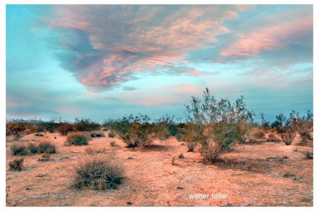
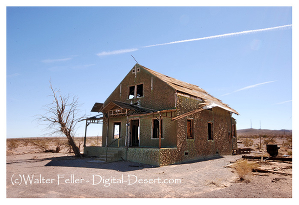
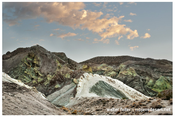
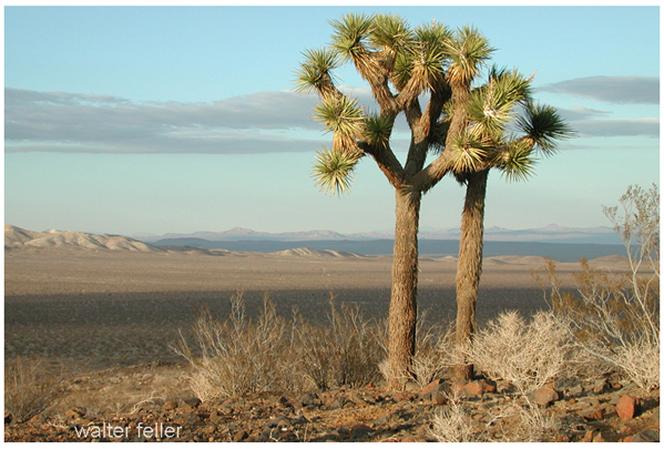
The vast and arid expanse of the Mojave Desert, with its rugged terrain and searing heat, served as both a backdrop and a stage for countless stories of adventure, survival, and crime during the 19th century. Among these tales, the ambush and robbery of stagecoaches stand out, epitomizing the lawlessness and danger that travelers faced in this harsh landscape. This narrative delves into the intricacies of one such dramatic incident, highlighting the perilous journey, the cunning of the outlaws, and the subsequent impact on the victims and the broader society.

Setting the Scene: The Mojave Desert

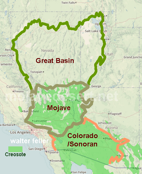
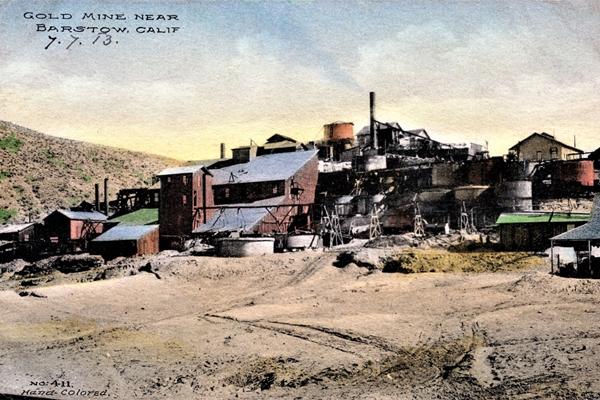
The Mojave Desert, spanning southeastern California, southern Nevada, southwestern Utah, and northwestern Arizona, is characterized by its extreme temperatures, sparse vegetation, and formidable terrain. During the 19th century, this region was a critical corridor for stagecoach routes, vital for communication and transportation. These routes connected burgeoning towns and mining camps, crucial in the United States’ westward expansion. Travelers on these stagecoaches included prospectors, merchants, settlers, and even lawmen, all braving the unforgiving environment in pursuit of fortune, opportunity, or duty.

The Stagecoach and Its Journey

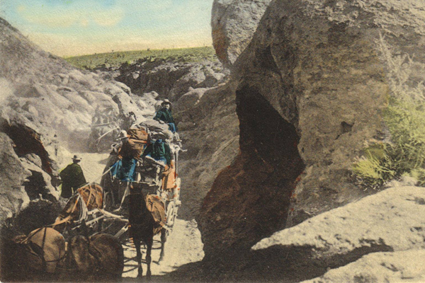
In the summer of 1874, a Wells Fargo stagecoach embarked on a routine yet perilous journey from Los Angeles to Las Vegas. Laden with passengers and valuable cargo, including gold bullion destined for the banks of San Francisco, the stagecoach was a prime target for bandits. The stagecoach driver, an experienced and stoic man named Samuel Hawkins, was well aware of the risks. Accompanying him were two armed guards tasked with protecting the passengers and the precious cargo.

The passengers on this fateful trip included a diverse group: a wealthy miner named John Everhart, a young schoolteacher named Mary Collins, a traveling salesman named Thomas Reid, and an elderly couple, the Whitmans, heading to visit their grandchildren. Each passenger carried their hopes and fears, adding to the tense atmosphere within the coach.

The Ambush

As the stagecoach neared the isolated stretch known as Dead Man’s Pass, a notorious ambush point, Hawkins and his guards heightened their vigilance. Unbeknownst to them, a gang of outlaws led by the infamous bandit known as Black Jack Ketchum had been tracking the coach for days. Ketchum, a former cowboy turned outlaw, was infamous for his ruthless and cunning tactics. He had orchestrated numerous robberies across the Southwest, and his reputation instilled fear in both travelers and lawmen.

The ambush was swift and brutal. As the stagecoach entered a narrow canyon, gunshots rang out, shattering the stillness of the desert. The horses reared in panic as bullets struck the ground around them. Hawkins struggled to maintain control, but the outlaws quickly overpowered the guards. In the ensuing chaos, the stagecoach came to a halt, surrounded by Ketchum and his men.

The Robbery

With practiced efficiency, the outlaws forced the passengers out of the coach onto the hot, dusty ground. Ketchum, a tall and imposing figure with a black bandana covering his face, demanded the gold and any valuables. The passengers, terrified and disoriented, complied, handing over their money, jewelry, and personal belongings. After recognizing resistance’s futility, John Everhart offered up the gold bullion, hoping to avoid further violence.

Despite the tension, Ketchum maintained a perverse sense of decorum, assuring the passengers that no harm would come to them if they cooperated. This promise, however, was tenuous at best, as any hint of resistance would have likely resulted in bloodshed. After securing the loot, the outlaws bound the passengers and stagecoach crew, leaving them stranded in the sweltering desert heat.

Aftermath and Impact

The aftermath of the ambush left the passengers and crew in a dire situation. Bound and dehydrated, they faced the very real threat of succumbing to the elements before help could arrive. Fortunately, a passing group of miners stumbled upon the scene later that day and freed the captives. The miners provided water and escorted the shaken travelers to the nearest town, where they could report the crime and seek medical attention.

News of the ambush spread rapidly, stirring outrage and fear among the local communities. The robbery highlighted the vulnerabilities of stagecoach travel and the need for greater security measures. In response, Wells Fargo increased the number of armed guards on its coaches and began offering substantial rewards for information leading to the capture of outlaws like Ketchum.

The Pursuit of Justice

Law enforcement agencies, spurred by public demand and the lucrative rewards, intensified their efforts to apprehend the culprits. Black Jack Ketchum and his gang became the targets of a relentless manhunt. Over the next few months, several members of the gang were captured or killed in skirmishes with lawmen. Ketchum was eventually apprehended in a dramatic showdown, ending his reign of terror.

The trial of Black Jack Ketchum was sensational, drawing large crowds and extensive media coverage. Convicted of multiple crimes, including the stagecoach robbery, Ketchum was sentenced to hang. His execution marked a significant victory for law enforcement and served as a stark warning to other would-be outlaws.

Legacy of the Ambush

The ambush and robbery of the stagecoach in the Mojave Desert left an indelible mark on the region’s history. It underscored the constant dangers faced by travelers during the westward expansion and the harsh realities of life in the frontier. The incident also led to lasting changes in how stagecoach companies operated, with increased security measures becoming standard practice.

For the passengers and crew involved, the experience was a harrowing reminder of their vulnerability. Many of them carried the psychological scars of that day for the rest of their lives, while others found a renewed sense of resilience and determination. The ambush also entered local folklore, becoming a story told and retold around campfires and in saloons, a testament to the lawlessness and adventure that characterized the American West.

Conclusion

The 19th-century stagecoach ambush in the Mojave Desert vividly illustrates the perils and unpredictability of frontier life. It is a story of survival against the odds, the brutality of outlaws, and the relentless pursuit of justice. As a piece of Western history, it reminds us of the challenges faced by those who ventured into the unknown and the enduring spirit of those who sought to bring order to the lawless expanses of the American frontier.

Allelopathic Properties of the Creosote Bush

Introduction

Apple Valley

The desert creosote bush (Larrea tridentata) is a remarkable plant native to the arid regions of North America and is known for its resilience and adaptability. One of the most intriguing aspects of this plant is its allelopathic properties. Allelopathy refers to the biochemical interactions between plants, where one plant releases chemicals that can inhibit neighboring plants’ growth, survival, and reproduction. This essay explores the allelopathic properties of the creosote bush, examining its chemical mechanisms, ecological impacts, and potential applications.

Overview of the Creosote Bush

The creosote bush dominates in the southwestern United States and northern Mexico deserts. It thrives in extreme conditions characterized by high temperatures, low rainfall, and poor soil quality. The plant is well-adapted to these harsh environments, with small, waxy leaves to minimize water loss and an extensive root system to maximize water uptake. Beyond its physical adaptations, the creosote bush employs chemical strategies to maintain its dominance in the desert ecosystem.

Chemical Mechanisms of Allelopathy

The allelopathic properties of the creosote bush are primarily attributed to the secondary metabolites it produces. These compounds include phenolic acids, flavonoids, and lignins, which are released into the soil and air through various plant parts such as leaves, roots, and stems. Among these, phenolic compounds like nordihydroguaiaretic acid (NDGA) play a crucial role.

NDGA is a potent antioxidant and a significant allelopathic agent. It inhibits competing plants’ seed germination and root growth by disrupting cellular respiration and photosynthesis. Studies have shown that soils beneath creosote bushes have higher concentrations of NDGA, leading to reduced germination rates and stunted growth of other plant species. This chemical warfare allows the creosote bush to secure essential resources such as water and nutrients by minimizing competition.

Ecological Impacts

The allelopathic properties of the creosote bush have significant ecological implications. By suppressing the growth of other plants, the creosote bush creates a unique microhabitat that influences plant diversity and distribution in desert ecosystems. This phenomenon leads to a mosaic of vegetation patterns, where patches dominated by creosote bushes are interspersed with bare soil or sparse vegetation.

The reduced plant diversity around creosote bushes can impact other trophic levels, including herbivores and predators. For instance, herbivorous insects and small mammals that rely on various plant species for food may find fewer resources in areas dominated by creosote bushes. Consequently, the allelopathic effects of the creosote bush can influence the distribution and abundance of these animals.

Additionally, the altered plant community structure can affect soil properties. The reduced litter input from other plant species may lead to lower organic matter content and changes in soil microbial communities. These changes can further reinforce the creosote bush’s dominance, creating a feedback loop that maintains its competitive edge.

Potential Applications

Understanding the allelopathic properties of the creosote bush has practical applications in agriculture and weed management. The compounds responsible for allelopathy, such as NDGA, could be explored as natural herbicides. These bioherbicides offer an environmentally friendly alternative to synthetic chemicals, potentially reducing the ecological footprint of agricultural practices.

Furthermore, studying allelopathy in the creosote bush can inform sustainable land management strategies in arid regions. By recognizing the impacts of allelopathic plants on ecosystem dynamics, land managers can make informed decisions to promote biodiversity and maintain ecological balance. For example, controlling the spread of creosote bushes in areas where they threaten native plant communities could help preserve biodiversity.

Challenges and Future Research

While the creosote bush’s allelopathic properties offer exciting possibilities, there are challenges to consider. The complexity of natural ecosystems means that the effects of allelopathy are not always straightforward. Factors such as soil type, climate, and interactions with other organisms can influence the outcome of allelopathic interactions. Therefore, comprehensive field studies are essential to fully understanding the ecological impacts of allelopathy in diverse settings.

Hesperia

Future research should also explore allelopathy’s genetic and molecular basis in the creosote bush. Identifying the genes and regulatory pathways involved in the production of allelopathic compounds could provide insights into the evolutionary origins of this trait and its potential for manipulation. Additionally, investigating the interactions between allelopathic compounds and soil microorganisms could reveal new aspects of plant-microbe interactions and their role in shaping plant communities.

Conclusion

Apple Valley

The allelopathic properties of the desert creosote bush highlight the intricate and dynamic nature of plant interactions in arid ecosystems. The creosote bush significantly influences plant community structure, soil properties, and overall ecosystem dynamics by producing secondary metabolites. While challenges remain in fully understanding and harnessing these properties, the potential applications in agriculture and land management are promising. Continued research into the allelopathic mechanisms of the creosote bush will advance our ecological knowledge and contribute to the development of sustainable practices in managing natural and agricultural systems.

Governor Robert Waterman and Mining in the Mojave Desert

Governor Robert Waterman played a significant role in the history of mining in the Mojave Desert. His influence extended beyond his political career, deeply impacting the development of the region’s mining industry.

Early Life and Career

Waterman Ranch

Robert Whitney Waterman was born in Fairfield, New York, on December 15, 1826. He moved to California during the Gold Rush in 1850 and engaged in various business ventures. Eventually, he settled in San Bernardino County and became involved in mining, real estate, and ranching.

Mining Ventures

Waterman Mine

Waterman’s most notable contribution to the Mojave Desert’s mining history was the discovery and development of the Waterman Mine. Here are some key points:

  • Waterman Mine: Robert Waterman discovered the Waterman Mine in 1881, located in the Calico Mountains. The mine became one of the richest silver mines in California, producing substantial amounts of silver ore.
  • Calico Ghost Town: Calico grew rapidly around the mining operations, with Waterman playing a pivotal role in its development. At its peak, Calico had over 500 mines and was one of the most productive silver-mining districts in the state.

Political Career

Waterman’s success in mining bolstered his political career. He served as the 17th Governor of California from September 12, 1887, to January 8, 1891. During his tenure, he continued to support mining interests and infrastructure development in the state.

Contributions to Mining Legislation

As governor, Waterman worked on several initiatives to support the mining industry:

  • Infrastructure Development: Waterman advocated for expanding railroads and transportation networks, which were crucial for transporting ore from remote mining sites in the Mojave Desert to processing facilities and markets.
  • Mining Laws: He supported legislation that protected miners’ rights and promoted fair practices in the industry, ensuring that mining operations could thrive in California.

Legacy


Governor Robert Waterman’s legacy in the Mojave Desert is still evident today. The Calico Ghost Town, now a historical landmark and tourist attraction, is a testament to his contributions to the mining industry. His efforts helped shape the economic landscape of the Mojave Desert, leaving a lasting impact on the region’s development.

Conclusion

Governor Robert Waterman’s involvement in mining, particularly in the Mojave Desert, was instrumental in the industry’s growth. His discovery of the Waterman Mine and subsequent political support for mining operations contributed significantly to the area’s economic prosperity. His legacy continues to be remembered through historical sites like the Calico Ghost Town.

https://mojavedesert.net/desert-fever/waterman.html

/ghost-towns/upper-mojave/

Pendergast Hotel

Ludlow, California

The Pendergast Hotel in Ludlow, California, has a rich history tied to the development of the Mojave Desert and the railroad’s bustling activity.

Early History and Construction: The Pendergast Hotel was established during the late 19th century, likely around the time the Southern Pacific Railroad extended its lines through the Mojave Desert. Ludlow became an important stop along the route, leading to the development of various amenities, including hotels to serve travelers and workers.

Ownership and Operation: The hotel was named after its owner, Edward Pendergast, a prominent figure in the local community. Pendergast was involved in various business ventures and contributed to the growth and development of Ludlow.

Role in the Community: The Pendergast Hotel served as a central hub for the community, providing lodging, meals, and a place for social gatherings. It catered to railroad workers, miners, and travelers passing through the region.

Decline and Historical Significance: As the railroad’s importance diminished and transportation shifted towards automobiles, Ludlow and the Pendergast Hotel experienced a decline. However, the hotel remains a significant part of Ludlow’s history, representing the era of railroad expansion and the development of the Mojave Desert.

Preservation and Legacy: While the hotel no longer operates, it stands as a historical landmark, offering a glimpse into the past and Ludlow’s role in the broader context of the Mojave Desert’s development.

If you are interested in more detailed historical accounts, local archives, and historical societies in the area may provide further insights into the Pendergast Hotel and its impact on the region.

The Mojave Biome

https://mojavedesert.net/ecology

Introduction

The Mojave Desert, encompassing vast stretches across southeastern California, southern Nevada, and minor portions of Utah and Arizona, is a region of stark beauty and extremity. This desert is not just a barren wasteland but a vibrant biome with a unique blend of ecological, geological, and climatic elements. Each facet of the Mojave contributes to its distinctive landscape and the diversity of life that has adapted to thrive under some of the most challenging conditions on Earth. This essay will explore the intricate geology, dynamic climate, and resilient ecology of the Mojave Desert, revealing the complex interplay between these aspects that sustains life in this extraordinary desert biome.

Section 1: Geology of the Mojave Desert

Rainbow Basin – early morning

Geological Composition and Formation

The Mojave Desert’s dramatic landscape is sculpted from a geological past marked by intense tectonic activity and volcanic eruptions. The region predominantly features igneous and metamorphic rocks, interspersed with extensive sandy plains that have formed from the erosion of granite. These geological materials not only dictate the rugged aesthetics of the desert but also influence its ecological patterns.

Historical Development

The formation of the Mojave is primarily associated with the interactions between the North American and Pacific Plate. These tectonic plates’ movements have spurred a variety of geological phenomena, from the creation of fault lines to significant volcanic activity. The desert lies within the Basin and Range Province, characterized by its striking topography of narrow mountain ranges separated by broad valleys, directly resulting from crustal stretching.

Landscape Features

Notable geographical features of the Mojave include Death Valley, the lowest and one of the hottest places in North America, and the Joshua Tree National Park, famous for its rugged rock formations and iconic Joshua trees. These landmarks define the desert’s appearance and contribute to its geological diversity, which supports a range of ecosystems and influences the distribution of flora and fauna.

Section 2: Climate of the Mojave Desert

Characteristic Climate Conditions

The climate of the Mojave Desert is defined by extremity and variability, with scorching summers and chilly winters. This desert experiences some of the most extreme temperature fluctuations on the planet, with summer daytime temperatures often exceeding 100°F, while winter nights can plummet below freezing.

Seasonal Weather Patterns

Rainfall in the Mojave is minimal and unpredictable, typically less than two inches annually, making it one of the driest regions in the United States. Water scarcity profoundly affects the desert’s geological and ecological aspects, shaping its landscape and the life forms it supports.

Impact on Desert Landscape

The harsh climatic conditions have significantly influenced the desert’s soil composition and erosion patterns and determined water availability. These factors force plants and animals in the Mojave to evolve specialized adaptations to manage the limited resources efficiently.

Section 3: Ecology of the Mojave Desert

Flora and Adaptations

The vegetation of the Mojave is as resilient as it is varied, with species like the Joshua tree, creosote bush, and numerous cacti having developed remarkable adaptations to conserve water and minimize sun exposure. These plants are crucial for stabilizing the desert soil and providing essential resources for other organisms.

Fauna and Ecological Niches

The desert is home to various animals uniquely adapted to its extreme environment. Species such as the desert tortoise, known for its longevity, the cunning coyote, and the elusive bighorn sheep thrive here by optimizing their physiological and behavioral traits to conserve water and regulate body temperature.

Ecological Interactions

Loggerhead Shrike

Ecological interactions in the Mojave are intricate, with each species playing a vital role in maintaining the balance of the ecosystem. Predatory birds and mammals help control the populations of smaller animals and insects, ensuring a dynamic but stable ecosystem despite challenging conditions.

Conclusion

The Mojave Desert is a biome of exceptional resilience and beauty, epitomizing the remarkable adaptability of life. Understanding its geology, climate, and ecology offers profound insights into how diverse life forms survive and thrive in one of the planet’s most inhospitable landscapes. The Mojave is a vivid example of ecological balance and adaptation, providing valuable lessons on resilience and sustainability.

This essay provides a comprehensive overview of the Mojave Desert’s natural aspects, designed to educate and engage general readers interested in one of North America’s most fascinating biomes.

Historic Journey: The Road to Panamint

Introduction

Nestled within the rugged landscapes of Eastern California, the Panamint Valley is home to a historical artery that has played a pivotal role in developing the American West—the road to Panamint. Originally trodden by Native Americans and later transformed by the ambitions of silver miners, this route not only facilitated economic booms but also bore witness to the ebbs and flows of fortune. The road to Panamint is a testament to the region’s mining era, epitomizing the broader transportation infrastructure development crucial for westward expansion.

Historical Background

The Panamint Valley, framed by the arid peaks of the Panamint Range, was first utilized by the Shoshone Native Americans, who traversed these harsh landscapes following seasonal migration patterns and trade routes. The discovery of silver in 1872 marked a turning point for the valley. News of silver attracted droves of prospectors, catalyzing the establishment of mining camps and the nascent stages of the road. This road would soon become the lifeline for a burgeoning settlement, later known as Panamint City.

Development of the Road

The transformation from a series of Native trails to a fully functional road was propelled by the mining industry’s explosive growth. As prospectors and entrepreneurs flooded the area, the demand for a reliable transportation route skyrocketed. The road to Panamint was quickly carved out of the valley’s rugged terrain, facilitating the movement of people and ore. During the mid-1870s, Panamint City blossomed into a boomtown, with the road being crucial for transporting silver ore to markets beyond the valley. However, as the mines depleted and profits dwindled, the road witnessed the departure of those who had come seeking fortune, leaving behind ghost towns and tales of a fleeting era.

Significance in Regional History

Beyond its economic contributions, the road to Panamint played a significant role in shaping the regional history of Eastern California. It facilitated the integration of remote areas into the state’s broader economic and cultural fabric. Moreover, it was a stage for several historical events, including conflicts between Native Americans and settlers and among competing mining companies. The road connected Panamint with the outside world and helped establish transportation routes that would later support the growth of other regional industries and settlements.

Preservation and Legacy

Today, the road to Panamint is a shadow of its former self, yet it remains an integral part of the cultural heritage of the American West. Efforts have been undertaken to preserve its historical significance, recognizing the road as a physical pathway and a historical document inscribed upon the landscape. It is featured in historical tours, providing insights into the challenges and triumphs of those who once traveled its length in pursuit of silver and survival. The preservation of this road allows contemporary visitors and historians alike to traverse the same paths miners once did, offering a tangible connection to the past.

Conclusion

The road to Panamint encapsulates the spirit of an era driven by the quest for precious metals and the relentless push toward the West. Its historical importance remains a key narrative in understanding how transportation helped shape the economic and cultural landscapes of the American West. As we reflect on its legacy, the road to Panamint continues to offer valuable lessons on resilience and the transient nature of human endeavors.

https://mojavedesert.net/history/pioneer/part-time-prospector-16.html

/post-office-spring/

https://mojavedesert.net/desert-fever/panamint.html

https://digital-desert.com/panamint-city

Pinto Basin and Mountains

The Pinto Basin and Mountains, located in Joshua Tree National Park in southern California, are notable for their rugged terrain, diverse geology, and rich history. Here’s an overview of the key aspects of this region:

Geography and Geology

Pinto Basin

  • Location: The Pinto Basin is in the southeastern part of Joshua Tree National Park.
  • Terrain: The basin is characterized by broad, sandy expanses interspersed with rocky outcrops and occasional washes.
  • Geology: The basin’s geology is diverse, with ancient Precambrian rocks, including gneiss and schist, and recent sedimentary deposits. The basin’s alluvial fans are made of materials eroded from the surrounding mountains.

Pinto Mountains

  • Location: The Pinto Mountains lie to the south of the Pinto Basin.
  • Elevation: The mountains vary in elevation, with some peaks rising over 3,000 feet above sea level.
  • Geology: The mountain range comprises various rock types, including granitic and metamorphic rocks, indicative of a complex geological history involving volcanic activity and tectonic movements.

History

Prehistoric and Native American Presence

  • Pinto Culture: The region is named after the Pinto Culture, an early Native American group that inhabited the area around 8,000 to 10,000 years ago. Artifacts such as stone tools and points have been found, suggesting a hunter-gatherer lifestyle.
  • Native American Tribes: Various tribes, including the Chemehuevi and Cahuilla, lived in the region, relying on its resources for sustenance.

Historic Era

  • Mining: In the late 19th and early 20th centuries, the Pinto Basin and Mountains saw sporadic mining activity, primarily for gold and other minerals. Remnants of old mines and mining equipment can still be found in the area.
  • Homesteading: In the early 20th century, homesteaders attempted to settle in the region, though the harsh desert environment made it challenging.

Flora and Fauna

  • Flora: The Pinto Basin is home to various desert plant species, including creosote bush, Joshua trees, and ocotillo. The area’s unique ecosystem supports common and rare plant species adapted to the arid conditions.
  • Fauna: The Pinto Basin’s wildlife includes desert bighorn sheep, coyotes, jackrabbits, and numerous bird species. Reptiles such as lizards and snakes inhabit the area.

Recreation and Attractions

  • Hiking: The Pinto Basin offers several hiking opportunities, with trails ranging from easy walks to challenging backcountry routes. Popular trails include the Lost Palms Oasis and the Arch Rock Nature Trail.
  • Scenic Drives: The Pinto Basin Road provides a scenic drive through the basin, offering stunning landscape views and access to various trailheads and viewpoints.
  • Stargazing: The remote location and minimal light pollution make the Pinto Basin an excellent spot for stargazing and astrophotography.

The Pinto Basin and Mountains are a fascinating area within Joshua Tree National Park, offering visitors a glimpse into the natural and cultural history of the Mojave Desert.

/ecosections/322ap.htm

Mohave Tui Chub

The Mohave Tui Chub (Siphateles bicolor mohavensis) is a fascinating species of fish native to the Mojave Desert region of California, specifically the Mojave River basin. This fish is notable for its unique adaptations to a harsh desert environment and as a symbol of conservation challenges and efforts in arid ecosystems. The Mohave Tui Chub is currently listed as an endangered species, making its survival a priority for environmentalists and scientists. This essay explores the biology, habitat, conservation status, and ongoing efforts to preserve this distinctive species.

Biology and Habitat

The Mohave Tui Chub is a small, stout fish, typically dark olive in color, that thrives in the freshwater marshes and isolated springs of its native habitat. As a member of the Cyprinidae family, it is adapted to survive in the variable conditions of desert water systems, which can range from clear to turbid. This species is predominantly a bottom-dweller, feeding on various invertebrates and organic debris, demonstrating a versatile diet that aids in its survival in limited environments.

Historically, the Mohave Tui Chub inhabited many interconnected water systems in the Mojave Desert. However, its habitat has drastically reduced due to water diversion, groundwater pumping, and the introduction of non-native species that compete for resources and introduce diseases.

Conservation Status and Efforts

The Mohave Tui Chub’s status as an endangered species results from extensive habitat loss and ecological changes. The redirection of water sources for agricultural and urban development has fragmented its living spaces, leaving the species vulnerable and isolated. Furthermore, introducing predatory fish species has led to a significant decline in their numbers.

Conservation efforts for the Mohave Tui Chub are multifaceted. They include habitat restoration, legal protection of water resources, and breeding programs aimed at increasing population numbers. Programs like the Artificial Propagation and Reintroduction Plan have established secure populations in protected areas. Moreover, environmental education programs are raising awareness about preserving this unique species and its ecosystem.

Conclusion

The Mohave Tui Chub is more than just a species; it represents the broader challenges of conserving biodiversity in desert ecosystems. The efforts to save the Mohave Tui Chub from extinction indicate a larger environmental stewardship goal to maintain the ecological balance and health of the Mojave Desert. Protecting this fish entails preserving a fragile ecosystem that supports diverse life. Through continued conservation initiatives and public support, there is hope that the Mohave Tui Chub will thrive again as proof of nature’s resilience and the effectiveness of concerted human conservation efforts.

https://digital-desert.com/mojave-preserve/mojave-tui-chub-resources.html

History of the Salton Sea

Salton Sea view from Mastodon Peak

The Salton Sea, located in the Colorado Desert of Southern California, is a fascinating and complex body of water with a rich history shaped by both natural and human influences. Here’s an overview of its history:

Prehistoric and Early History

  1. Ancient Lake Cahuilla:
    • The Salton Sea’s basin has intermittently held water for thousands of years. The area was once part of Lake Cahuilla, a massive freshwater lake that existed during prehistoric times and was periodically filled by the Colorado River.
    • Native American tribes, such as the Cahuilla and Kumeyaay, lived around the lake and utilized its resources.

Formation of the Modern Salton Sea

  1. 1905-1907: Creation:
    • The modern Salton Sea was created by accident in 1905 when engineers working on irrigation canals for the Imperial Valley inadvertently diverted the entire flow of the Colorado River into the Salton Sink.
    • For nearly two years, the river flowed unchecked into the basin, filling it and creating the Salton Sea.

20th Century Development

  1. Agricultural Hub:
    • The region around the Salton Sea became a vital agricultural area due to the fertile soil and irrigation from the Colorado River.
    • Runoff from these agricultural activities has been a major source of water for the Sea.
  2. Mid-20th Century: Recreation Boom:
    • In the 1950s and 1960s, the Salton Sea became a popular recreational destination, often referred to as a “miracle in the desert.”
    • Resorts, marinas, and yacht clubs flourished, attracting celebrities and tourists for boating, fishing, and other water activities.

Environmental Challenges

  1. Rising Salinity and Pollution:
    • Over time, the Salton Sea’s salinity increased due to evaporation and lack of freshwater inflow: agricultural runoff containing fertilizers and pesticides further degraded water quality.
    • The increasing salinity began to harm fish populations, leading to mass die-offs and the collapse of the once-thriving fishing industry.
  2. Health and Environmental Concerns:
    • The drying of the Salton Sea has exposed toxic dust from the lakebed, posing health risks to surrounding communities.
    • The ecosystem has been severely impacted, with significant losses of fish and bird populations that once thrived in the area.

Modern Efforts and Challenges

  1. Restoration Efforts:
    • Numerous efforts have been proposed and some initiated to address the Salton Sea’s environmental issues. These include water management projects, habitat restoration, and dust suppression measures.
    • California state agencies and environmental groups continue to work on strategies to mitigate the ecological and health impacts.
  2. Ongoing Challenges:
    • Despite these efforts, the Salton Sea remains a critical environmental challenge. Balancing agricultural needs, wildlife conservation, and public health concerns continues to be a complex and contentious issue.

The history of the Salton Sea is a testament to the intricate interplay between human activities and natural processes. It serves as a poignant reminder of the consequences of environmental mismanagement and the ongoing need for sustainable solutions.

Barstow & the National Old Trails Road

Barstow, California, has a significant historical connection to the National Old Trails Road, which was key in developing the American road transportation system. The National Old Trails Road, also known as the Ocean-to-Ocean Highway, was established in the early 20th century and stretched from Baltimore, Maryland, to California, ending in Los Angeles. This road was one of the earliest transcontinental highways and was instrumental in promoting automotive travel and the development of roadside infrastructure across the United States.

Barstow’s Role
/notr/

Barstow emerged as an essential stop along the National Old Trails Road due to its strategic location at the junction of several key routes. It lies at the crossroads of the Mojave River Valley, where the Salt Lake Trail, the Mojave Road, the Old Spanish Trail, and later, the railroad routes converge. This made Barstow a crucial hub for transportation and logistics, connecting the eastern parts of the country with the West Coast.

Development and Impact
/barstow-ca/

With the rise of the automobile, Barstow became a popular stopover for travelers traveling across the country. The town provided essential services such as lodging, fuel, and vehicle repairs, which helped support its local economy. The presence of the National Old Trails Road also encouraged the development of other infrastructure, including the famed Route 66, which was aligned with parts of the Old Trails Road.

Route 66 and Beyond
/route-66/

In 1926, with the establishment of the U.S. Highway System, much of the National Old Trails Road was incorporated into U.S. Route 66. Barstow continued to thrive as a key stop along Route 66, attracting tourists and travelers with its diners, motels, and other attractions tailored to the road-tripping public.

Today, Barstow celebrates its rich transportation history through museums and cultural sites that highlight its role in the era of cross-country travel. The town serves as a gateway to regional attractions and continues to honor the legacy of the National Old Trails Road and Route 66.