12 Petroglyph Corridor Nodes

(Mojave–Great Basin system) * DRAFT *

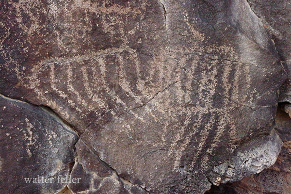
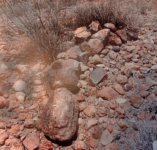
A petroglyph corridor is a stretch of landscape where rock art sites appear repeatedly along a natural travel route. Instead of a single isolated panel or canyon full of carvings, the imagery is distributed along a pathway that people used for movement across the desert.

In practical terms, a petroglyph corridor is a travel landscape marked by symbolic sites.

Format
Node | Region Belt | Corridor Intersection | Node Type | Motif Emphasis | Significance

  1. Coso Petroglyph Field
    Region Belt: Eastern Sierra–Great Basin frontier
    Corridor Intersection: Owens Valley corridor / eastern Mojave uplands
    Node Type: Major ceremonial core
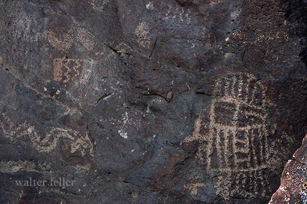
    Motif Emphasis: Bighorn sheep, hunters, anthropomorphs
    Significance: One of the largest rock art landscapes in North America and the primary symbolic center of the Coso corridor.
  1. Little Petroglyph Canyon
    Region Belt: Coso Range
    Corridor Intersection: Coso canyon travel routes
    Node Type: Canyon site-core
    Motif Emphasis: Sheep imagery and hunting scenes
    Significance: Dense petroglyph concentration marking a heavily traveled volcanic canyon corridor.
  1. Renegade Canyon
    Region Belt: Coso Range
    Corridor Intersection: Coso canyon system
    Node Type: Canyon ceremonial node
    Motif Emphasis: Hunters, patterned-body anthropomorphs
    Significance: Major interpretive canyon central to debates over Coso symbolism and ceremonial activity.
  1. Sheep Canyon
    Region Belt: Coso Range
    Corridor Intersection: Hunting landscape corridor
    Node Type: Specialized hunting node
    Motif Emphasis: Bighorn sheep
    Significance: Strongly associated with hunting geography and ritual interpretations tied to sheep imagery.
  1. Grapevine Canyon
    Region Belt: Mojave–Colorado corridor
    Corridor Intersection: Lower Colorado River travel routes
    Node Type: Major corridor anchor
    Motif Emphasis: Rectilinear geometric forms
    Significance: Key node connecting Mojave rock art with lower Colorado River cultural traditions.
  1. Sloan Canyon
    Region Belt: Southern Nevada–Mojave margin
    Corridor Intersection: Las Vegas basin travel routes
    Node Type: Canyon corridor node
    Motif Emphasis: Abstract geometric motifs
    Significance: Important transition node linking Basin and Range traditions with Mojave landscapes.
  1. Black Canyon (Pahranagat)
    Region Belt: Southern Great Basin
    Corridor Intersection: Pahranagat Valley–White River travel route
    Node Type: Valley corridor node
    Motif Emphasis: Anthropomorphic figures
    Significance: Core location of the Pahranagat Representational Style.
  1. Pahranagat Valley Wetlands
    Region Belt: Southern Great Basin
    Corridor Intersection: Basin travel routes
    Node Type: Water-source corridor node
    Motif Emphasis: Mixed imagery across nearby sites
    Significance: Wetland basin likely served as a staging area for travel and symbolic marking.
  1. Mojave River – Afton Canyon
    Region Belt: Central Mojave Desert
    Corridor Intersection: Mojave River travel corridor
    Node Type: Water corridor node
    Motif Emphasis: Mixed Mojave petroglyph forms
    Significance: One of the few natural passageways through the central Mojave Desert terrain.
  1. Newberry Mountains Ritual Complex
    Region Belt: Central Mojave
    Corridor Intersection: Cross-desert routes between Mojave River and eastern desert
    Node Type: Ritual landscape node
    Motif Emphasis: Ceremonial deposits and symbolic associations
    Significance: Key ritual comparison site tied to bighorn symbolism.
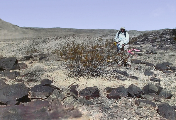
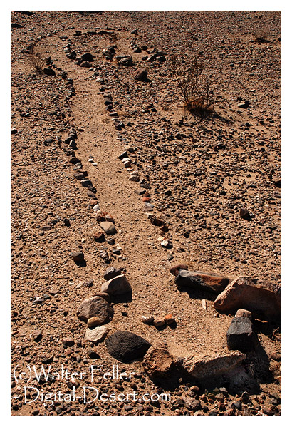
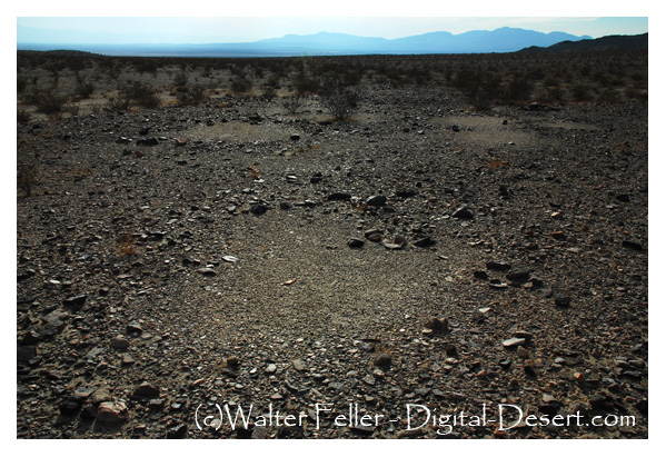
  1. Mojave National Preserve Lava Fields
    Region Belt: Eastern Mojave Desert
    Corridor Intersection: Basin margin travel routes
    Node Type: Distributed rock art field
    Motif Emphasis: Mixed abstract and representational motifs
    Significance: Petroglyph clusters associated with springs and lava landscapes.
  1. Lagomarsino Canyon
    Region Belt: Western Great Basin
    Corridor Intersection: Basin-to-basin travel routes
    Node Type: Monumental abstract node
    Motif Emphasis: Circles, grids, abstract motifs
    Significance: One of the largest rock art concentrations in the Great Basin.

Geoglyphs & Rock Alignments

Fort Irwin & Beyond

Juduth Reed, archaeologist – photo Russell Kaldenberg

A geoglyph is a ground design created by arranging or removing surface materials so the figure appears when viewed from above. In desert settings, this usually means placing or clearing pavement stones, exposing lighter soil, or scraping shallow lines that catch low-angle light. Mojave examples tend to occupy quiet, stable surfaces such as old lake margins, bajadas, ridgelines, and mesa tops. Their age is difficult to determine without stratified artifacts, and they usually appear in liminal settings that suggest signaling, marking, ceremony, or boundary use.

Mojave Desert geoglyphs are scattered and subtle, blending with the surface rather than dominating it. They are created by repositioning varnished stones or removing surface layers, forming sinuous lines, circles, meanders, keyhole forms, and occasionally serpentine figures. Most notable examples can be found in the eastern and central Mojave, where travel corridors, ancient water sources, and basin edges converge. Documented sites are located at Fort Irwin, along the Amargosa drainage, near the Lower Colorado River region, and within ancient lake basins such as Cronese, Soda, and Silver. These figures are commonly twenty to sixty feet long or wide. They are not dramatic from the ground; they reveal their form from oblique or aerial views. Many alignments appear to mark direction, vantage, or symbolic forms rooted in local cultural landscapes. Research is limited by erosion, restricted access to lands, and the scarcity of datable material.

Geoglyphs at Fort Irwin became known only after archaeologists expanded survey work into newly added training lands. Earlier work on the site documented petroglyphs, pictographs, and small rock circles, but newer surveys revealed another category of rock art: broad surface alignments set directly into the desert pavement. These geoglyphs consist of fist-sized stones arranged into straight lines, curves, swirls, and branching patterns covering portions of pavement roughly a quarter of an acre in size. They sit so low and blend so closely in tone with the surrounding ground that they remain almost invisible until someone familiar with desert varnish and pavement structure points them out. Artifacts and oxidation patterns provide relative age clues, though no firm dates are given.

Archaeologists describe the Mojave landscape as highly readable, with scars, signals, and surface changes preserved by aridity. In this setting, rock alignments are found on stable pavements, old lake margins, and gentle rises where water once flowed across the ground. Fort Irwin sits within that framework: ancient lake basins, remnant shorelines, and corridors that once linked seasonal camps. Nearby lithic scatters suggest long-term movement associated with water, game, and travel. Interpretations of the geoglyphs remain limited. Some broken quartzite fragments hint at possible ceremonial use, but the exact meaning remains unknown. Cultural memory tied to such features has not survived, and researchers avoid overreaching beyond what the land itself reveals.

Photo by Russell Kaldenberg

Within the broader Goldstone basin sector of the installation, survey data also note a low ridge with surface materials arranged into a curving alignment that may represent a stylized serpent or directional form. Its placement on a quiet slope between pavement and basin edge fits a familiar Mojave pattern in which subtle figures mark routes, thresholds, or vantage points without leaving associated domestic remains. Features of this kind are typically visible only from an angled view, where dark varnished stones contrast with lighter soil. Because the land is part of an active training area, precise locations are protected, and access is restricted to guided visits. As with other prehistoric sites on the post, Fort Irwin treats these alignments as resources to be safeguarded.

Together, the abstract pavement figures and the additional curving alignment illustrate how ancient travelers marked the basin edges and crossings of the central Mojave. They show that even in a landscape that seems empty at first glance, the ground carries the record of movement, gathering, and intention shaped into the surface itself.

Core Bibliography: Mojave Geoglyphs and Rock Alignments

Allen, Mark W. 1991. Archaeological Investigations at Fort Irwin. Fort Irwin Cultural Resources Program.

Basgall, Mark E. 1993. Chronometric Studies in the Mojave Desert. Publications in California Prehistory 34.

Clewlow, C. William Jr. 1976. Prehistoric Trails of the Lake Mojave Region. UC Archaeological Research Facility Report 30.

Davis, Emma Lou. 1978. The Ancient Californians: Rancholabrean Hunters of the Mojave Desert. Ballena Press.

Fort Irwin Cultural Resources Program. Various Survey Reports and Inventory Summaries, 1980s to present.

Goldstone Deep Space Communications Complex. Cultural Resources Overview Studies, 1990s–2000s.

Heizer, Robert F., and Martin A. Baumhoff. 1962. Prehistoric Rock Art of Nevada and Eastern California. University of California Press.

Minor, Rick. 1987. Intaglios and Ground Figures of the American Southwest. American Rock Art Research Association.

Schaefer, Jerry. 1995. Cultural Resource Management Studies at Fort Irwin, California. ASM Affiliates.

  1. U.S. Army, Fort Irwin Cultural Resources Program. Survey reports and site documentation for expanded training lands, various years.
  2. Sutton, Mark Q., and Jill K. Gardner. Patterns of Mojave Desert Prehistory. Nevada State Museum Anthropological Papers, 1997.
  3. Warren, Claude N., and Robert H. Crabtree. Prehistory of the Southwest and Great Basin. In Handbook of North American Indians, Vol. 11, Great Basin. Smithsonian Institution, 1986.
  4. Draut, Amy E., et al. Late Pleistocene lake histories in the Mojave River and Amargosa Basin region. USGS Professional Papers and Open-File Reports, various years.
  5. McCarthy, Daniel. Ground figures of the Mojave and Colorado Deserts. In Rock Art Papers, San Diego Museum of Man, various volumes.
  6. GSA and USGS publications on desert pavement formation, varnish development, and surface stability relevant to geoglyph preservation.
  7. California Department of Parks and Recreation. Archaeological surveys within the Mojave Desert region, assorted site records.

Special thanks to Russell Kaldenburg