Levels of History (DRAFT)

A Mojave Regional Perspective

Oral history and word of mouth sit at the most intimate level. This is where interviews, remembered events, family stories, miner recollections, ranch accounts, and “what people around here said” belong. These are not weak sources; they are simply different sources. They preserve lived experience, but they must be marked as memory, testimony, or tradition rather than treated automatically as settled fact.

Family and genealogy history is the next layer. This works especially well on your sites for desert families, settlers, ranchers, mining people, storekeepers, road builders, and local civic figures. In your system, genealogy matters most when it connects a family to place, movement, land use, occupation, or continuity across generations.

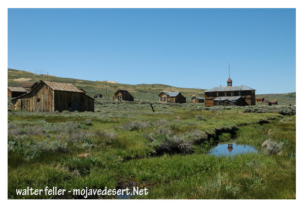
Local and community history is one of your core operating levels. This is where places like Apple Valley, Goodsprings, Barstow, Littlerock, Boron, Pearblossom, or Lucerne Valley live as communities rather than just dots on a map. It includes schools, churches, inns, cemeteries, road junctions, stores, clubs, folklore, preservation fights, and the memory of ordinary people.

Regional history is probably the true center of gravity for both sites. The Mojave Desert is not just a collection of towns. It is a region with shared constraints and patterns: aridity, routes, mining belts, rail corridors, military geography, basin-and-range structure, ecological transitions, and a distinct cultural imagination. This is where your corridor logic, basin overlays, and node system become especially powerful. Regional history lets you connect Camp Cady to the Mojave Road, Barstow to rail convergence, Apple Valley to the Mojave River corridor, and Joshua Tree to wider desert systems.

State history is still important, but more as a framing layer than a primary one. California and Nevada state structures matter because they shape land law, water law, transportation planning, parks, counties, and preservation regimes. In your project, state history is most useful when it explains why a regional or local pattern took the form it did.

National history enters when the Mojave intersects larger U.S. processes – westward expansion, railroad building, federal land management, military occupation, highway development, wartime industry, conservation law, and tourism. But your sites usually should not begin here. They should arrive here after grounding the subject.

International or world history is the outer ring. It matters when the Mojave is tied to bigger systems: Spanish colonial networks, Mexican-era movement, global mining capital, transoceanic migration, climate history, wartime logistics, or worldwide desert studies. Useful, yes – but not the everyday scale of your project.

So if I were to adapt this specifically for Digital-Desert / MojaveDesert.net, I would rank the historical levels like this:

  1. Oral / memory / testimony
  2. Family / genealogy
  3. Site-core history
  4. Community / local history
  5. Corridor history
  6. Basin / landscape history
  7. Regional Mojave history
  8. State context
  9. National context
  10. International context

That version fits your actual architecture better than the standard textbook ladder.

Just as important, your sources also fall into levels. For your work, I would sort them this way:

Memory sources:
interviews, oral accounts, family recollections, folklore, local tradition

Material/local evidence:
photos, buildings, ruins, artifacts, cemeteries, inscriptions, maps, site visits

Documentary sources:
newspapers, county records, land patents, census schedules, mining records, railroad timetables, diaries, military reports

Interpretive sources:
local histories, scholarly books, agency reports, geology papers, ethnographies, historical syntheses

That gives you a good method rule:

The closer the source is to lived experience, the more valuable it is for texture and local meaning.
The closer the source is to formal documentation, the more useful it is for chronology, attribution, and verification.
The best pages on your sites usually combine both.

So in relation to your two domains, I would say this plainly:

Digital-Desert.com is strongest when it builds on oral, local, corridor, and regional history.
MojaveDesert.net is strongest when it organizes those same layers into a broader structural and interpretive framework.
Neither site needs to chase “national history” as its main identity. Their evidence lies in showing how the Mojave’s local realities connect to wider systems.

A practical label set for page-building could be:

Memory
Family
Site-core
Community
Corridor
Basin
Regional
State context
National context
Global context

That would fit your architecture far better than a generic school-history list.

A Typical Ghost Town

Bodie is often used as a model ghost town for the Mojave Desert region, even though it lies north of it, in the Sierra Nevada–Great Basin transition zone, because it embodies the same historical, environmental, and cultural forces that shaped Mojave ghost towns. In short, Bodie represents the type, even if not the place.

Here’s why:

1. Mining Boom and Bust Pattern
Bodie’s rise and fall followed the same pattern as Mojave mining towns like Calico, Rhyolite, and Skidoo. A rich ore discovery in 1859 triggered a rush, creating a town of thousands almost overnight. When the mines declined in the 1880s and 1890s, the population vanished just as quickly. That boom-and-bust cycle defines the Mojave’s mining history as well.

2. Harsh, Isolated Environment
Although Bodie sits at a higher elevation and experiences freezing winters rather than desert heat, it shares the same frontier isolation—extreme weather, scarce water, and rugged terrain. Like the Mojave, survival there depended on resourcefulness and imported supplies.

3. Architectural and Material Similarities
The wood-frame, false-front buildings, stamp mills, and corrugated-iron roofs in Bodie are identical in style and function to those found in Mojave towns such as Ballarat or Randsburg. These towns employed similar construction methods and materials, which were hauled in by wagon or rail.

4. Cultural Reflection of the Mining West
Bodie’s lawlessness, saloons, and transient population mirror the social life of Mojave towns. Newspapers, dance halls, and miners’ unions appeared rapidly, then disappeared when the ore played out.

5. Preservation and Interpretation
Bodie is one of the best-preserved ghost towns in the American West—maintained in a state of “arrested decay.” Because of this, it serves as a tangible reference point for understanding less intact Mojave sites. It shows what Calico or Goldfield might have looked like before time and scavengers took their toll.

So, even though it’s geographically outside the Mojave Desert, Bodie stands as an ideal representative of the region’s mining-era ghost towns—capturing their architecture, atmosphere, and transient human story better than almost anywhere else.

-.-

Bodie, CA. Ghost Town

Petroglyphs, Pictographs, and Geoglyphs in the Mojave Desert

/petroglyphs/

The Mojave Desert, located in the southwestern United States, is rich in cultural and historical significance, with evidence of human habitation dating back thousands of years. Petroglyphs, pictographs, and geoglyphs are among the archaeological features found in the Mojave Desert, offering glimpses into the region’s past.

Here’s a brief overview of each:

  1. Petroglyphs:
    • Petroglyphs are rock engravings created by carving or pecking into the surface of a rock.
    • They are often found on exposed rock surfaces, such as canyon walls or large boulders.
    • Petroglyphs in the Mojave Desert can depict various symbols, animals, human figures, and abstract designs.
    • Native American communities made these carvings as a form of communication, storytelling, or spiritual expression.
  2. Pictographs:
    • Pictographs are rock art created by applying pigments to the surface of rocks. These pigments are usually composed of natural materials like plant extracts or mineral pigments.
    • Pictographs are found on rock shelters, caves, and cliff faces, often in areas with some protection from the elements.
    • Like petroglyphs, pictographs in the Mojave Desert can represent various subjects, including humans, animals, and symbolic patterns.
    • The pictograph colors can include red, black, white, and yellow, with red being a common choice.
  3. Geoglyphs:
    • Geoglyphs are large designs or motifs created on the ground’s surface, often by arranging stones or altering the landscape’s natural features.
    • While geoglyphs are more commonly associated with other regions like the Nazca Lines in Peru, there are examples of geoglyphs in the Mojave Desert as well.
    • The Blythe Intaglios, located in the lower Colorado River valley near Blythe, California, is a notable example of geoglyphs in the Mojave Desert. These large human and animal figures were created by scraping away dark rocks to reveal the lighter soil beneath.

Preservation of these cultural artifacts is crucial, and many sites are protected to prevent vandalism and degradation. Researchers and archaeologists work to study and document these features, shedding light on the history and practices of the indigenous peoples who lived in the Mojave Desert. It is important visitors respect and avoid disturbing these archaeological sites to ensure their preservation for future generations.