Dendrites

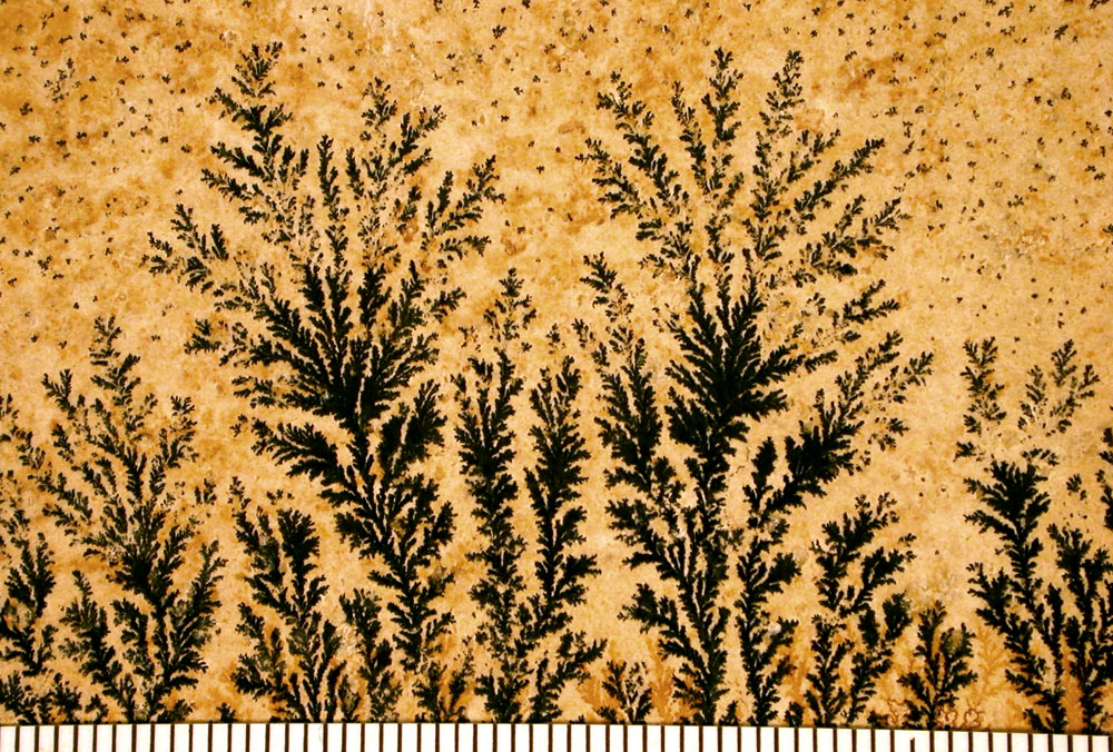
Dendrite fossils are not actual fossils but mineral formations that display branching, tree-like patterns on rock surfaces. These patterns are called “dendrites,” derived from the Greek word dendron, meaning “tree.” Due to their resemblance to ferns, mosses, or algae, they are often mistaken for fossilized plants.

Formation of Dendritic Patterns

  • Mineral Deposition: Dendritic patterns form when mineral-rich water percolates through cracks and fissures in rocks. As the water evaporates, minerals like manganese and iron oxides precipitate out of the solution.
  • Crystallization Process: These minerals crystallize in branching patterns along the rock’s surface or within its layers, creating intricate designs that mimic organic structures.
  • Environment: Such formations commonly occur in sedimentary rocks like limestone, sandstone, and shale, where groundwater movement is prevalent.

Distinguishing Features

  • Inorganic Origin: Unlike true fossils, dendrites do not result from the preservation of organic material. They are entirely inorganic, formed solely by mineral processes.
  • Lack of Cellular Structure: Under magnification, dendrites lack the cellular details that characterize fossilized plant material.
  • Surface Patterns: Dendritic formations are typically two-dimensional patterns on rock surfaces, whereas fossils often have three-dimensional structures.

Common Misconceptions

  • Mistaken Identity: The visual similarity to plant life leads many to incorrectly identify dendrites as fossilized flora.
  • Educational Importance: Understanding dendrites helps in learning how to differentiate between mineral formations and actual fossils, which is crucial in fields like paleontology and geology.

Significance in Geology and Collecting

  • Scientific Interest: Dendrites provide insights into mineral deposition processes and the geological history of the area where they are found.
  • Aesthetic Value: Their intricate and visually appealing patterns make dendritic rocks popular among collectors and are often used in jewelry and decorative items.

Examples and Notable Locations

  • Solnhofen Limestone, Germany: Known for fine-grained limestone that often displays dendritic patterns, sometimes mistaken for fossilized plants.
  • Utah and New Mexico, USA: Regions where dendritic manganese oxides are commonly found on sandstone surfaces.
  • Chiastolite Stones: A variety of andalusite that shows cross-shaped (cruciform) patterns due to carbonaceous impurities, sometimes confused with dendritic patterns.

Conclusion

While dendritic patterns, or “dendrite fossils,” captivate the imagination with their lifelike appearances, they are mineralogical phenomena rather than remnants of ancient life. Recognizing the difference between these mineral formations and true fossils enhances our understanding of geological processes and helps prevent misinterpretations in both amateur and professional studies.


References

  • Mineralogy and Geology Texts: For detailed explanations of mineral formation processes.
  • Field Guides on Fossil Identification: To learn how to distinguish between fossils and mineral patterns.
  • Geological Surveys: For information on regions where dendritic formations are prevalent.
Historic Journey: The Road to Panamint

Introduction

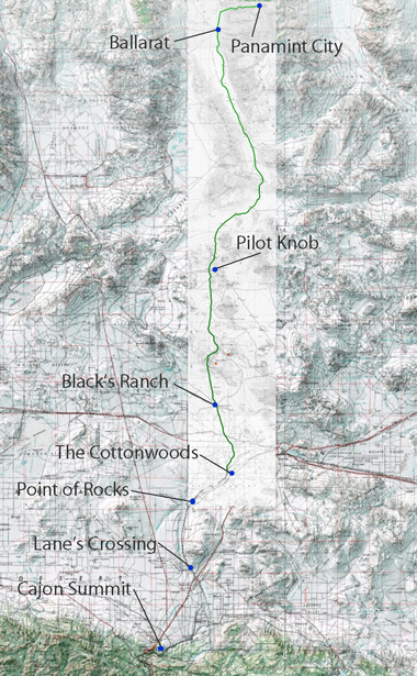
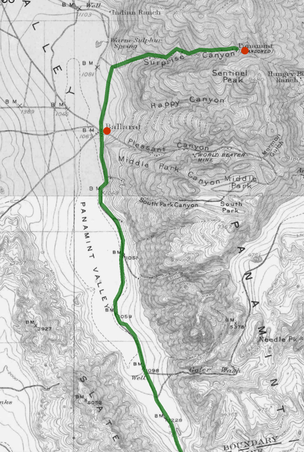
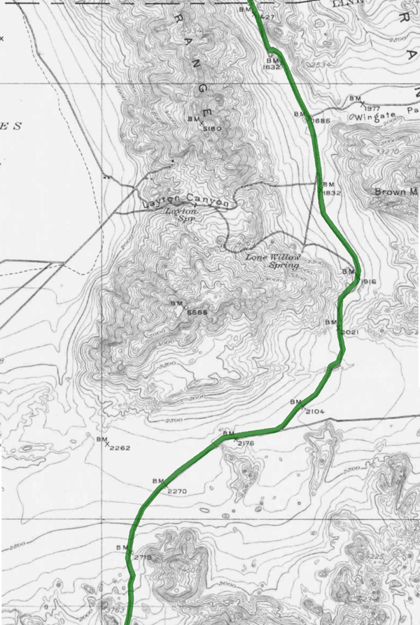
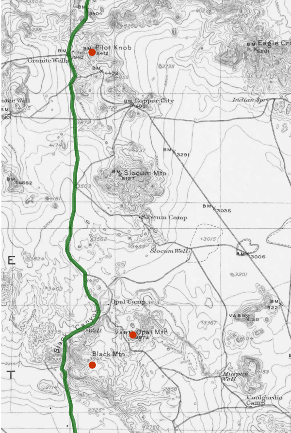
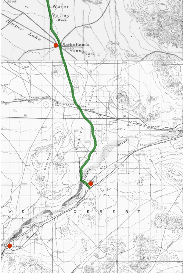
Nestled within the rugged landscapes of Eastern California, the Panamint Valley is home to a historical artery that has played a pivotal role in developing the American West—the road to Panamint. Originally trodden by Native Americans and later transformed by the ambitions of silver miners, this route not only facilitated economic booms but also bore witness to the ebbs and flows of fortune. The road to Panamint is a testament to the region’s mining era, epitomizing the broader transportation infrastructure development crucial for westward expansion.

Historical Background

The Panamint Valley, framed by the arid peaks of the Panamint Range, was first utilized by the Shoshone Native Americans, who traversed these harsh landscapes following seasonal migration patterns and trade routes. The discovery of silver in 1872 marked a turning point for the valley. News of silver attracted droves of prospectors, catalyzing the establishment of mining camps and the nascent stages of the road. This road would soon become the lifeline for a burgeoning settlement, later known as Panamint City.

Development of the Road

The transformation from a series of Native trails to a fully functional road was propelled by the mining industry’s explosive growth. As prospectors and entrepreneurs flooded the area, the demand for a reliable transportation route skyrocketed. The road to Panamint was quickly carved out of the valley’s rugged terrain, facilitating the movement of people and ore. During the mid-1870s, Panamint City blossomed into a boomtown, with the road being crucial for transporting silver ore to markets beyond the valley. However, as the mines depleted and profits dwindled, the road witnessed the departure of those who had come seeking fortune, leaving behind ghost towns and tales of a fleeting era.

Significance in Regional History

Beyond its economic contributions, the road to Panamint played a significant role in shaping the regional history of Eastern California. It facilitated the integration of remote areas into the state’s broader economic and cultural fabric. Moreover, it was a stage for several historical events, including conflicts between Native Americans and settlers and among competing mining companies. The road connected Panamint with the outside world and helped establish transportation routes that would later support the growth of other regional industries and settlements.

Preservation and Legacy

Today, the road to Panamint is a shadow of its former self, yet it remains an integral part of the cultural heritage of the American West. Efforts have been undertaken to preserve its historical significance, recognizing the road as a physical pathway and a historical document inscribed upon the landscape. It is featured in historical tours, providing insights into the challenges and triumphs of those who once traveled its length in pursuit of silver and survival. The preservation of this road allows contemporary visitors and historians alike to traverse the same paths miners once did, offering a tangible connection to the past.

Conclusion

The road to Panamint encapsulates the spirit of an era driven by the quest for precious metals and the relentless push toward the West. Its historical importance remains a key narrative in understanding how transportation helped shape the economic and cultural landscapes of the American West. As we reflect on its legacy, the road to Panamint continues to offer valuable lessons on resilience and the transient nature of human endeavors.

https://mojavedesert.net/history/pioneer/part-time-prospector-16.html

/post-office-spring/

https://mojavedesert.net/desert-fever/panamint.html

https://digital-desert.com/panamint-city

Mohave Tui Chub

The Mohave Tui Chub (Siphateles bicolor mohavensis) is a fascinating species of fish native to the Mojave Desert region of California, specifically the Mojave River basin. This fish is notable for its unique adaptations to a harsh desert environment and as a symbol of conservation challenges and efforts in arid ecosystems. The Mohave Tui Chub is currently listed as an endangered species, making its survival a priority for environmentalists and scientists. This essay explores the biology, habitat, conservation status, and ongoing efforts to preserve this distinctive species.

Biology and Habitat

The Mohave Tui Chub is a small, stout fish, typically dark olive in color, that thrives in the freshwater marshes and isolated springs of its native habitat. As a member of the Cyprinidae family, it is adapted to survive in the variable conditions of desert water systems, which can range from clear to turbid. This species is predominantly a bottom-dweller, feeding on various invertebrates and organic debris, demonstrating a versatile diet that aids in its survival in limited environments.

Historically, the Mohave Tui Chub inhabited many interconnected water systems in the Mojave Desert. However, its habitat has drastically reduced due to water diversion, groundwater pumping, and the introduction of non-native species that compete for resources and introduce diseases.

Conservation Status and Efforts

The Mohave Tui Chub’s status as an endangered species results from extensive habitat loss and ecological changes. The redirection of water sources for agricultural and urban development has fragmented its living spaces, leaving the species vulnerable and isolated. Furthermore, introducing predatory fish species has led to a significant decline in their numbers.

Conservation efforts for the Mohave Tui Chub are multifaceted. They include habitat restoration, legal protection of water resources, and breeding programs aimed at increasing population numbers. Programs like the Artificial Propagation and Reintroduction Plan have established secure populations in protected areas. Moreover, environmental education programs are raising awareness about preserving this unique species and its ecosystem.

Conclusion

The Mohave Tui Chub is more than just a species; it represents the broader challenges of conserving biodiversity in desert ecosystems. The efforts to save the Mohave Tui Chub from extinction indicate a larger environmental stewardship goal to maintain the ecological balance and health of the Mojave Desert. Protecting this fish entails preserving a fragile ecosystem that supports diverse life. Through continued conservation initiatives and public support, there is hope that the Mohave Tui Chub will thrive again as proof of nature’s resilience and the effectiveness of concerted human conservation efforts.

https://digital-desert.com/mojave-preserve/mojave-tui-chub-resources.html

Odometer

Are we there yet?

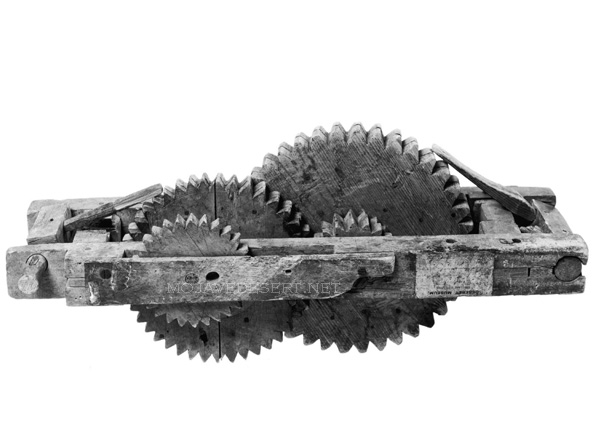
An odometer was an instrument used by American pioneers, particularly during the westward expansion in the 19th century, to measure the distance traveled. These devices were vital for journeys along routes like the Old Spanish Trail, as they helped travelers gauge their progress, estimate their arrival times, and manage their resources more effectively.

Wagon odometer – Courtesy LDS Church

The basic principle of the odometer dates back to ancient times, with variations used by the Romans and Chinese. However, the version used on covered wagons was adapted to the needs of the pioneers. It typically involved a mechanism that counted the revolutions of a wagon wheel. Since the wheel’s circumference was known, each revolution corresponded to a specific distance traveled. This count was then converted into miles or another distance unit and displayed.

This simple but effective device was crucial for pioneers who had to navigate vast, often unmarked territories. Knowing how far they had traveled, they could make informed decisions about when to rest, resupply, or seek shelter, especially as they faced the weather, terrain, and other uncertainties of frontier travel.

Bodie -v- Mojave Ghost Towns

Bodie and Mojave Desert ghost towns are examples of abandoned settlements in the Western United States. Still, they are located in different regions and have distinct historical and geographical contexts.

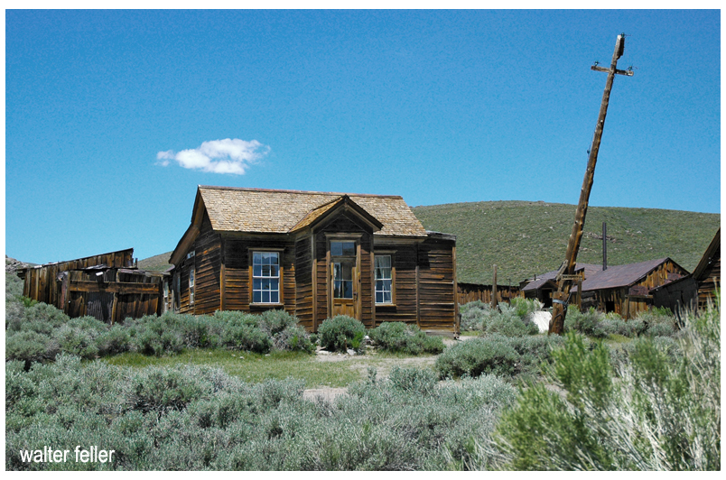
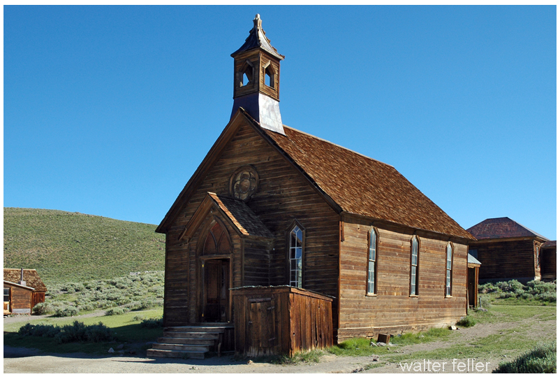
Bodie
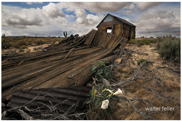
Cima

Here’s how Bodie ghost town compares to Mojave Desert ghost towns

  1. Location:
    • Bodie Ghost Town is located in eastern California, near the Nevada border, in the Bodie Hills of the Sierra Nevada Mountains. It is not part of the Mojave Desert.
    • Mojave Desert ghost towns, on the other hand, are scattered throughout the Mojave Desert region, which covers parts of California, Nevada, Utah, and Arizona. These ghost towns are found in a desert landscape, whereas Bodie is in a mountainous area.
  2. Historical Significance:
    • Bodie Ghost Town was once a bustling mining town during the late 19th century. It boomed during the Gold Rush but declined when the mines became depleted. It is known for its remarkably well-preserved buildings and artifacts, making it a popular tourist attraction and a State Historic Park.
    • The Mojave Desert ghost towns have diverse histories related to mining or other industries. These towns experienced growth and decline due to factors like mining, railroads, or changes in economic activity in the region.
  3. Geography and Climate:
    • Bodie’s location in the Sierra Nevada Mountains has a colder, alpine climate with snowy winters. It is not in a desert like the Mojave Desert ghost towns, which have hot, arid desert climates.
  4. Preservation:
    • Bodie Ghost Town is notable for its excellent preservation, with many buildings and artifacts remaining intact. It provides a unique glimpse into the past due to its relatively isolated location and the efforts to protect and maintain it.
    • Mojave Desert ghost towns vary in their levels of preservation. Some may have deteriorated significantly, while others may have been partially restored or maintained for historical and tourist purposes.

In summary, while Bodie Ghost Town and Mojave Desert ghost towns share the common theme of being abandoned settlements in the American West, they differ in their locations, historical backgrounds, climates, and levels of preservation. Each ghost town has its unique story and charm, showcasing the diversity of the history and landscapes of the Western United States.

Similarities

While Bodie Ghost Town and Mojave Desert ghost towns differ, they also share similarities due to their historical significance as abandoned settlements in the American West.

Bodie
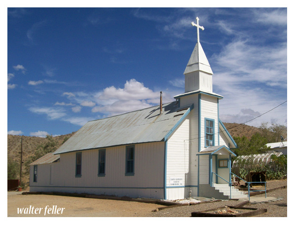
Santa Barbara Church – Randsburg

Here are some commonalities between them:

  1. Mining History: Both Bodie Ghost Town and many Mojave Desert ghost towns have roots in mining activities. They were often established to support nearby mining operations for gold, silver, copper, or other valuable minerals.
  2. Boom and Bust Cycles: Both ghost towns experienced periods of rapid growth and prosperity (boom) followed by economic decline and abandonment (bust) as the mining or other industries became less profitable or were exhausted.
  3. Historic Architecture: Both Bodie and the Mojave Desert ghost towns feature historic buildings and structures that reflect the architectural styles of the late 19th and early 20th centuries. These buildings offer insights into the daily lives of the people who once inhabited these towns.
  4. Tourism and Preservation: Many ghost towns, including Bodie, have been preserved and turned into tourist attractions or historic sites. Visitors can explore the well-preserved or partially restored buildings and artifacts, providing a glimpse into the past.
  5. Cultural Significance: These ghost towns hold cultural significance, representing a particular era in American history when mining and westward expansion were prominent. They serve as reminders of the challenges and opportunities that shaped the American West.
  6. Isolation: Bodie Ghost Town and many Mojave Desert ghost towns are often located in remote or isolated areas. This isolation contributed to their decline and abandonment as access to resources and services became more challenging.
  7. Natural Surroundings: While Bodie is mountainous, some Mojave Desert ghost towns are in arid desert landscapes. Both types of locations offer unique natural surroundings that add to the appeal of these historical sites.
  8. Photogenic and Cinematic Appeal: Bodie and Mojave Desert ghost towns have been popular settings for photography and film productions. Their well-preserved or picturesque appearances have made them attractive for creative projects.
  9. Historical Documentation: Researchers and historians have documented the histories of both Bodie and Mojave Desert ghost towns, helping preserve the stories and heritage of these places.

In summary, Bodie Ghost Town and Mojave Desert ghost towns share several similarities in their historical origins, economic activities, architectural heritage, cultural significance, and appeal as tourist destinations. However, it’s important to recognize that each ghost town has unique characteristics and history that make it special.