The Mojave System organizes a vast body of desert research into a unified, accessible framework. By linking geography, history, ecology, and human activity across corridors, basins, and nodes, it provides structured entry points for exploration, interpretation, and deeper study of the Mojave Desert landscape.
“Mojave System”
They immediately see:
- Top 100 Nodes
- Corridor Network
- Basin & Hydrology
- System Diagrams
This tells them:
“This is a working tool.”
Step 2 — Start With a Node (BARSTOW)
They search or click:
Barstow
Now the node page is more advanced than Tier 1.
Node: Barstow (Tier 2 View)
Includes:
- Type: Corridor Convergence Node
- Connected Corridors:
- Mojave River Corridor
- 35th Parallel Corridor
- Cajon Pass Corridor
- Linked Nodes:
- Daggett
- Afton Canyon
- Needles
- Functional Role:
- rail classification hub
- highway junction
- desert logistics center
Now they’re not just reading—they’re seeing relationships.
They click:
Trace Corridor

4
They open:
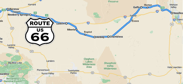
“35th Parallel Corridor (Needles – Barstow – Mojave)”
Now they see:
- Node chain:
- Needles -> Goffs -> Essex -> Ludlow -> Daggett -> Barstow
- Infrastructure layers:
- railroad (1883)
- Route 66
- I-40
- Function:
- transcontinental movement
They notice:
Daggett + Afton Canyon appear tied to water
They click:
View Basin / Hydrology
Step 4 — Basin & Hydrology Layer (This is your edge)
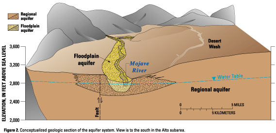
4
They open:
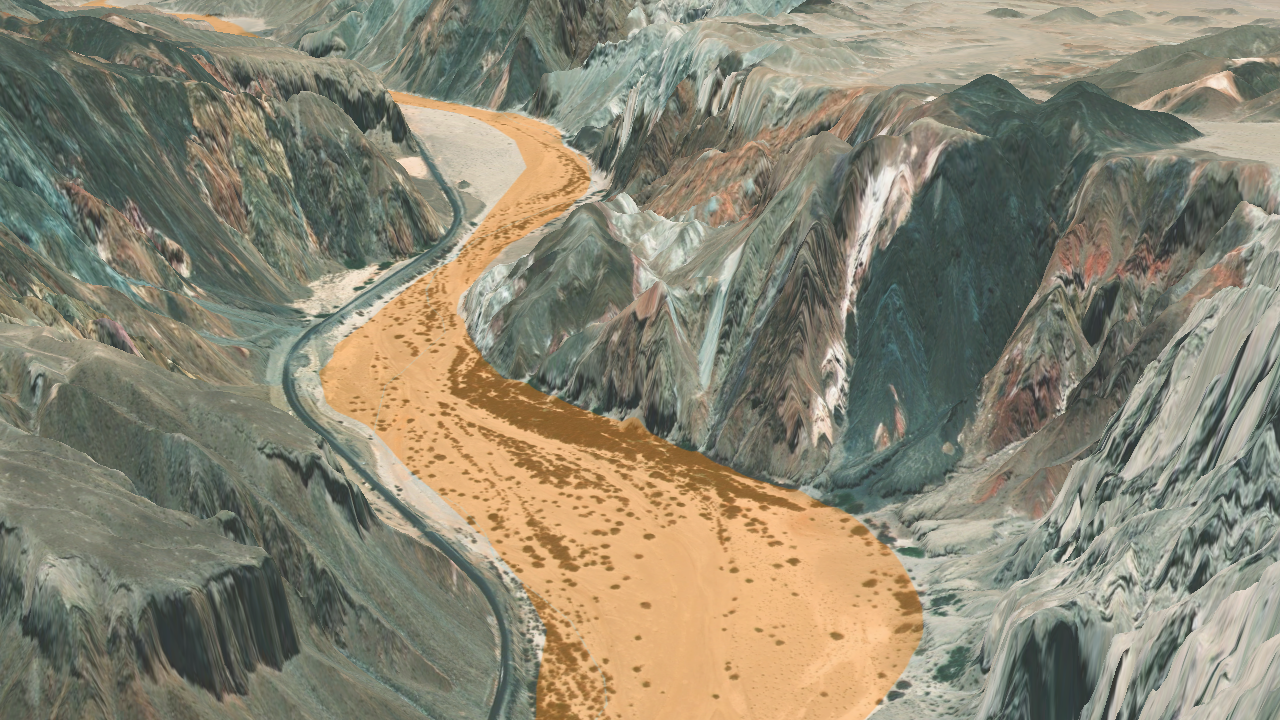
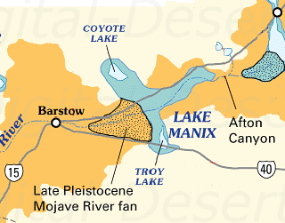
“Lake Manix & Mojave River System”
Now they see:
- ancient lake (Lake Manix)
- overflow event
- formation of Afton Canyon
- subsurface river flow
Key realization:
“Afton Canyon exists because the lake breached—and the river still follows that path.”
Now Barstow, Daggett, and Needles are no longer random:
- Barstow = corridor convergence
- Daggett = water + rail junction
- Afton Canyon = forced water outlet
This is deep structural understanding.
Step 5 — Cross-System Comparison
Now they test the system.
They ask:
“Is this similar to Tecopa / Death Valley?”
They click:
Tecopa Basin
They see:
- Lake Tecopa overflow
- Amargosa River
- connection into Death Valley
Now they recognize a pattern:
“Closed basin -> overflow -> corridor formation”
This is advanced understanding most people never reach.
Step 6 — System Diagram (Validation)
They open:
Mojave System Map
They now visually confirm:
- basins
- corridors
- nodes
Everything they just learned lines up.
Step 7 — Outcome
At the end of this session, the user now understands:
- why Barstow exists
- why Afton Canyon is where it is
- how water shaped transportation
- how basins control movement
That is not casual knowledge.
That is working knowledge.