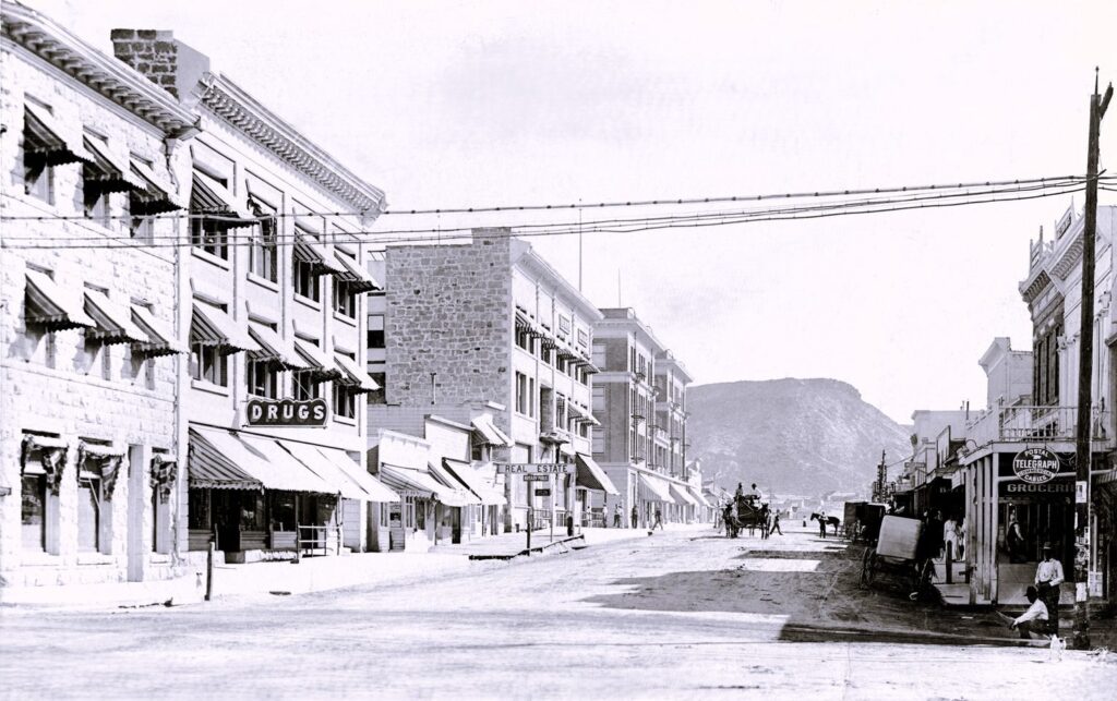
1910 Columbia Street in Goldfield, Nevada. Amidst the dust of mining fortunes, this town thrived as a hub of gold mining activity.
Goldfield, Nevada, was founded in 1902 after gold was discovered in the area. The town quickly grew into one of the largest in Nevada, with a population peaking at around 20,000 during its heyday. Goldfield was established to support the booming mining industry in the region, particularly the gold mines.
The town boasted numerous businesses, including saloons, hotels, banks, and brothels, catering to the needs of miners and prospectors. It became known as the “Queen of the Tonopah Mining District” due to its wealth and prominence in the area.
However, like many mining towns, Goldfield’s fortunes declined after the initial boom. By the 1920s, the population had dwindled, and the town fell into decline. Today, Goldfield is a ghost of it’s former self, with remnants of its past glory still visible today, including historic buildings, mines, and artifacts.
Image courtesy of the University of Nevada, Reno, Special Collections. Nevada Ghost Towns and Historic Sites is in Goldfield, NV.
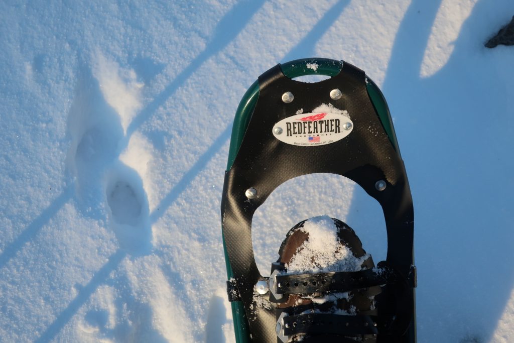
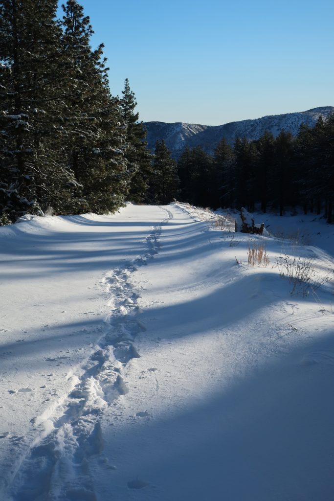
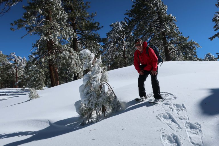
Yesterday, I headed up Heath Creek and got a quick snowshoe in to the upper gate. Only went about a mile up from Thrush Rd. However, it’s about 460′ of gain. It’s been so long since we’ve had this kind of snow. Forgot how much of a chug it would be with snowshoes on – ha! Good times.
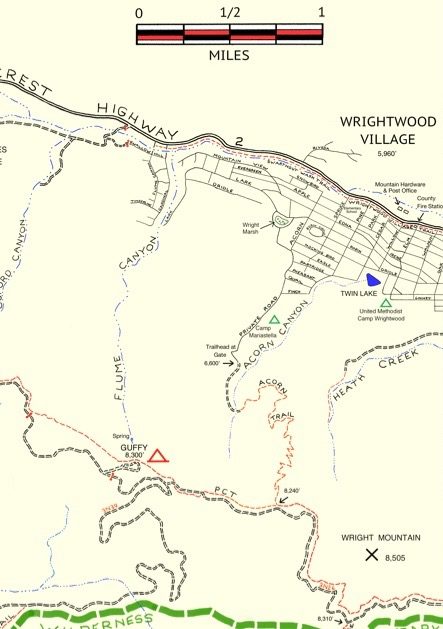
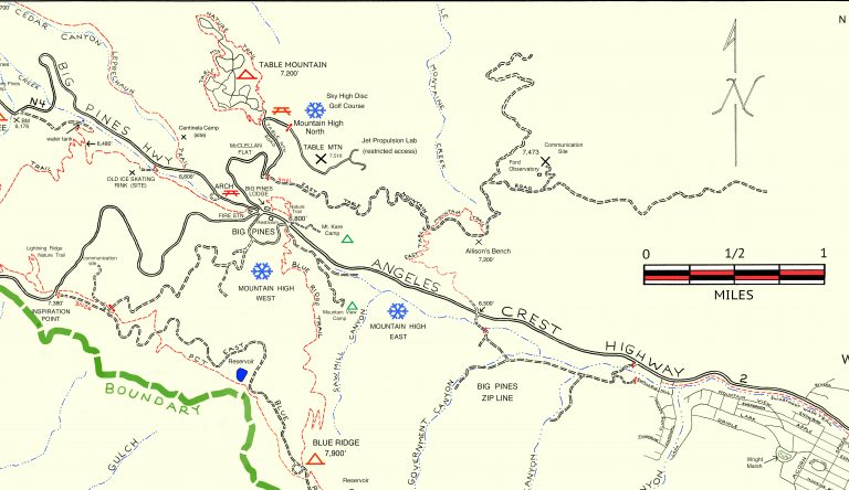
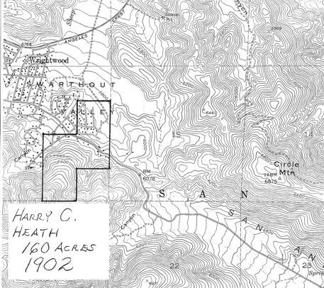
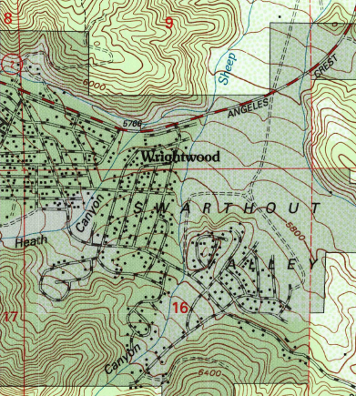
Here’s a small section of the Wrightwood – Big Pines map depicting part of Heath Creek. Access this hike by taking the dirt road that departs south, climbing upslope from Thrush Rd. between Victorville Street and Heath Creek Rd.
Elevation Gain / Loss:
From the lower gate (just above Thrush Rd.) to upper gate = 460′. The elevation on Thrush Rd. at spot where you walk up the beginning of levee road is 5,840′. This gain takes place in approximately one mile along the levee road located on west side of Heath Creek. Elevation of upper gate is 6,300′.
If you have time, keep on going past the upper gate. Soon you’ll encounter some sawn log benches placed in a square configuration. Keep going further up along the stream bed on the old, steeply rutted jeep road which is in places barely a trace. It’s steeper going now than it was on the levee road between the two gates.
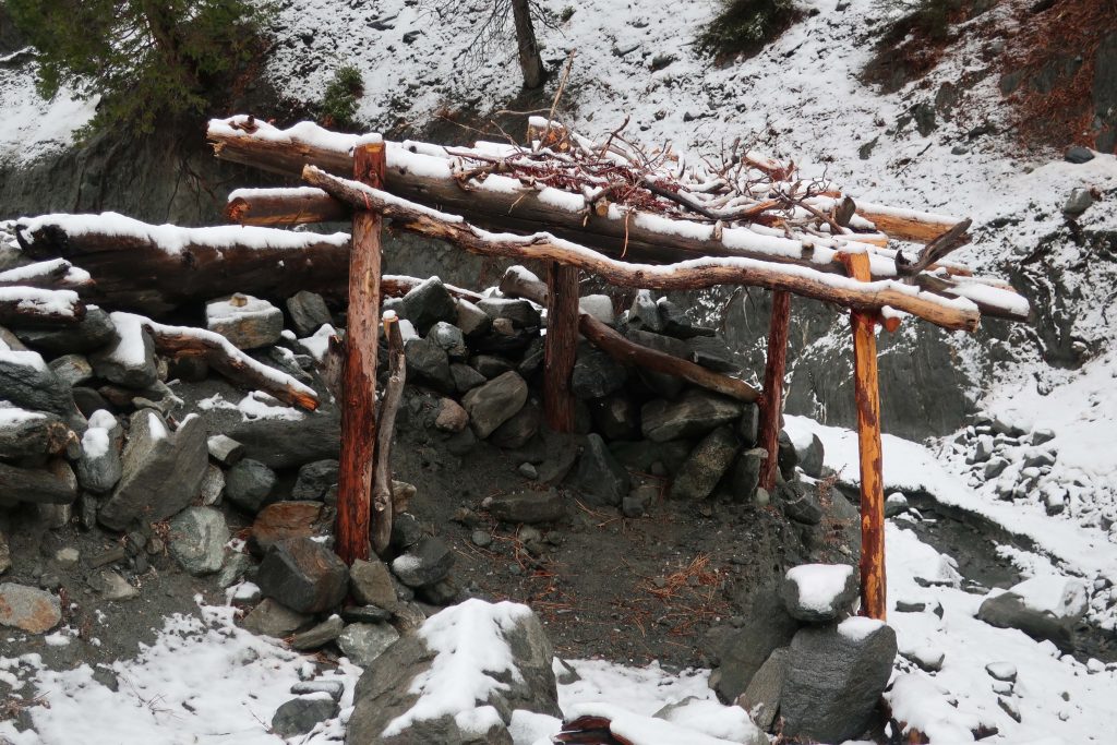
From upper gate to top end of old jeep road (abandoned) =400′. The top end of old road is where two canyons come together. There’s a forested canyon on the left side and small stream running between jagged walls on the right. The elevation here is 6,700′. Look for the little framework of limbs that have been lashed to some upright hand-hewn cedar poles.
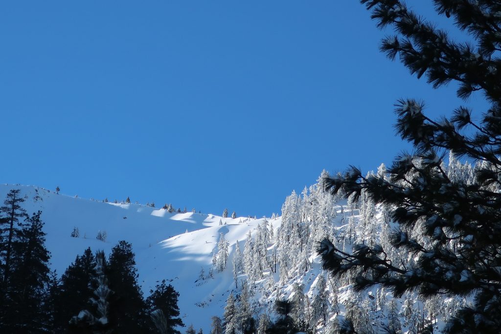
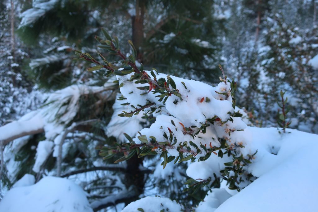
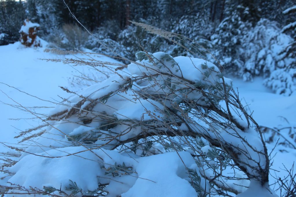
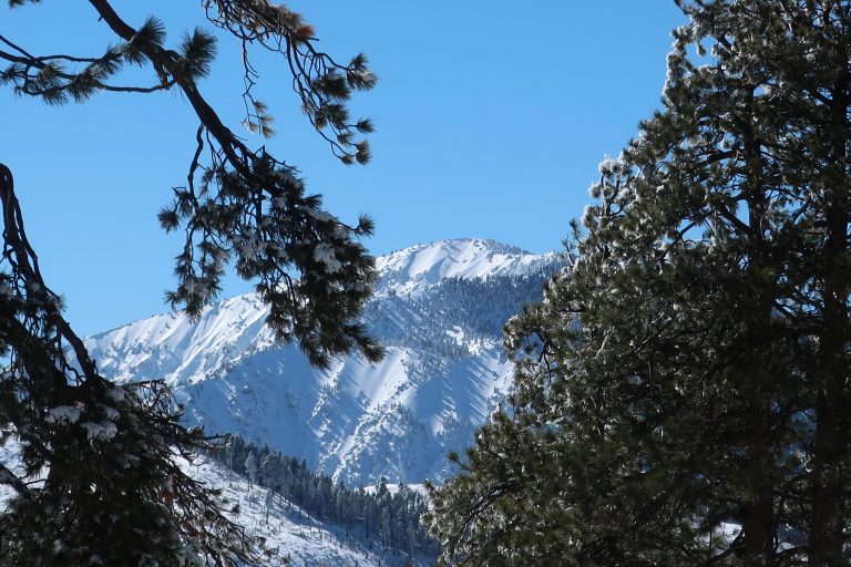
Looking directly up Wright Mountain’s slide from the canyon bottom. This is the same slide you can view toward the south from the Wrightwood Post Office. Wright Mountain’s summit is at top of ridge on far left of photo at an elevation of 8,500′. Photo was taken at elevation of 6,300′ near upper gate.Today, finally dragged out the dusty snow shoes!Looking over my shoulder, this is all that’s being left behind.Heath Creek, looking down canyon. That’s the Mojave Desert on the distant skyline.Snow covered mountain mahogany, Heath Creek.Snow bent Great Basin Sagebrush about a mile up Heath Canyon from Thrush Rd.This little structure of lashed together branches and poles is up at the end of the hike. It’s up above the rocky stream bed at confluence of the two canyons.
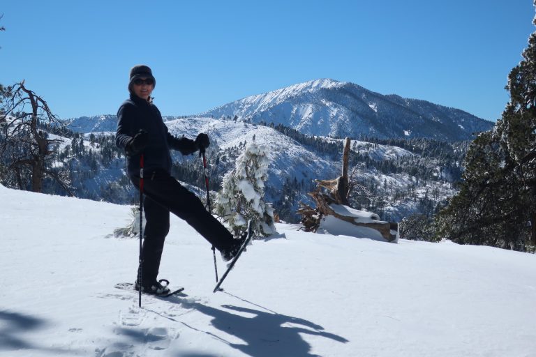
9,399′ high Mt. Baden-Powell’s massif dominates the southwest skyline from Table Mountain.
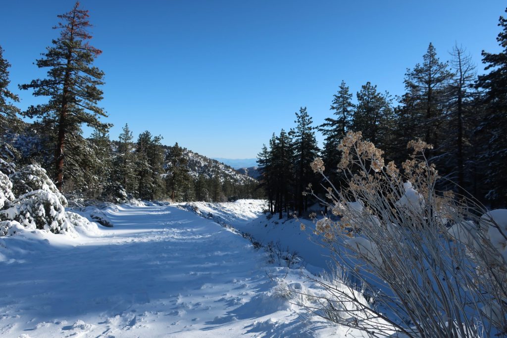
Joanie and I got out for a great afternoon of snowshoeing up on Wrightwood’s Table Mountain about a week and a half ago. Since then, more storms have dropped even more of the precious powder on our local mountains. Whether you like to cross-country ski or snowshoe, it’s a fantastic time to be out amongst our high country peaks, canyons and forests!
Inset of the Trails of Wrightwood – Big Pines map. The area we went snowshoeing is depicted as Table Mountain (with campground symbol) at an elevation of 7,200′. The west end of Wrightwood appears in the lower right corner of image.
Table Mountain is 7,516′ high and super easy to get to from Wrightwood. Just drive. You’re only looking at four miles from our village center. Make sure to turn off to the right on Table Mountain Road when you arrive at the three way split in the roads at Big Pines. Table Mountain Campground is where we did our snowshoeing on a quiet Friday, where we seemed to have the place to ourselves. The wind had sculpted the snow into pristine dunes along the gently sloping ridge top that the extensive campground straddles.
Joanie seems to almost float atop the powder on the sunny slopes of Table Mountain!
All the campsites were, of course, hidden under the snowy mantle, with just the picnic tabletops presenting themselves as a bit of a depth gauge. Most of the time, snow depth was around 24″ and in places well over three feet. The windward sides of the mammoth white fir and Ponderosas were coated in sparkling icicles that fell like shards of glass in the wind gusts that came out of the southwest. Mt. Baden-Powell kept constant watch over us from across the great gulf of the East Fork of the San Gabriel River. The Mojave Desert off to the north was a mosaic of tans, yellow sands and the right-angled patchwork of green winter crops scattered here and there. It looked and felt warmer down there. And high up on Table Mountain, that day was to be one of cobalt blue skies, bright white snows, wind and evergreens.
A small wind-bent snowy pine and Chris have a little visit amongst Table Mountain’s frozen forest.
Distance and elevation gain / loss: Approximately one mile (one way) with 400′ of elevation gain.
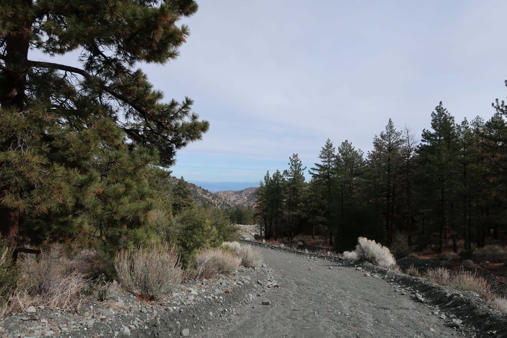
Follow the gated dirt road that runs atop levee on north side of Heath Creek stream bed.
Hike begins on Thrush Rd, just east of the tee intersection with Victorville St. Walk up the dirt road just west of Heath Creek bridge. There’s a silver-colored pipe gate just a short distance above Thrush.
Looking toward the desert on the levee road. This spot is about half-way between the lower and upper pipe gates.
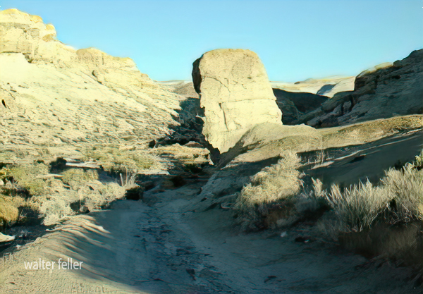
One of the major canyons dropping into Wrightwood’s Swarthout Valley is Heath Creek. It’s the canyon that begins as the large, conspicuous slide on Wright Mountain’s north side. The slide, dropping straight down from the summit is especially prominent from downtown Wrightwood. If you’re outside the post office or Mountain Hardware and looking southward, there’s a really good view of the slide, with Wright Mountain’s pine covered summit just to the left of it (elev. 8,505′). The canyon is named after Harry Heath who homesteaded the east end of the Swarthout Valley, near present day Pacific Crest Estates, back in 1886. Back then, Heath Ranch (circa 1900-1919) had a dairy, as well as boasting an orchard of apple and pear trees irrigated with water conveyed from a stream intake in the watercourse that today bears his name.
Outline of the former Heath Ranch. Purchased from Sumner Wright in 1902, Harry Heath received his deed for the land in 1910. You can see that some of Heath’s most suitable ranch land was in the area now known as Pacific Crest Estates. Oddly, his 160 acres do not extend to the watershed that bears his name. Map image courtesy of Wrightwood Historical Society.
Pat Krig, a long-time Wrightwood pioneer and historian, wrote down some notes about the Heath Ranch which she visited on horseback as a young girl. The Wrightwood Historical Society generously provided me a copy of her notes from 2006 which portrays what little is known of Harry Heath’s ranch. Unfortunately, there were no photos of either Heath or his ranch. One paragraph in Pat’s reminiscences that in particular stood out to me, was this: “A few of the gnarled apple trees still stand, bearing fruit and bringing memories of hot apple pies for tired travelers, and offers of a pitcher of fresh milk, thick cream for coffee, and butter to spread on warm, fragrant bread then slathered with pumpkin butter.” Pat wrote this back in 2006. Sadly, Pat passed away just this last year, taking with her memories of an earlier time in the mountains that we can only faintly imagine.
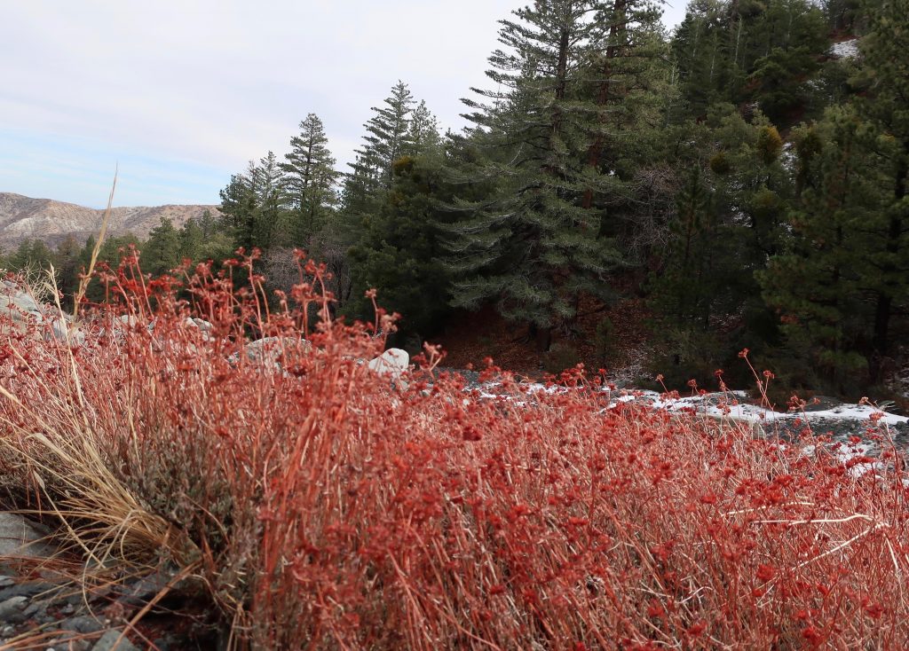
Last year’s dried flower stalks still draw your attention to clumps of buckwheat growing along Heath Creek.
Pearl Comfort Fisher, who wrote “The Mountaineers” back in 1972, provides a brief glimpse into a cowboy’s visit to the Heath Ranch back in 1907. The cowboy was Harvey Cheesman, hired to round up stray cattle from the nearby Lovejoy Springs Ranch. “So it happened that as I came over the divide from Lone Pine Canyon one cold February late afternoon I found the ranch or homestead of Harry Heath at the head of Sheep Creek. Upon knocking at the door I was met by a lady with a small baby in her arms. It was Mrs. Heath. She said, “‘My, am I glad to see some one. A mountain lion has been prowling around here for three nights and my husband is away working, and I am afraid the lion will get some of our pigs and chickens. “No lion showed up that night and I had to go on my way the next day.”
Today, it’s hard to imagine Wrightwood as wild and isolated as it must have been 112 years ago. The upper half of this hike will give you a taste of a quieter more forested Swarthout Valley.
Here’s a small section of the Wrightwood – Big Pines map depicting part of Heath Creek. Access this hike by taking the dirt road that departs south, climbing upslope from Thrush Rd. between Victorville Street and Heath Creek Rd.
This walk is a great one if you just have a little time, say less than an hour and you’d like to get some hill climbing in, too. You’re walking on a flood control levee road. The beginning of your trip is a bit exposed to the sun and completely devoid of trees, much of the landscape down in the wash to your left has a sterile, bleak look due to constant grading from county bulldozers. Not that great at first. . . Hang in there, the bleakness soon ends. Your route soon encounters black oaks, Jeffrey and Ponderosa pines on both sides of the levee road. An enticing flat makes its’ presence across the stream on your left. On your right is a gentle, expansive alluvial slope covered in a healthy pine forest. Mostly private, undeveloped land, this terrain gives you a sense of what Wrightwood must have been like in the 19th century. On a warm day, the air is fragrant with pine and amazingly quiet, save the occasional song bird or acorn woodpecker tapping high above the forest floor.
Trailhead for the Heath Creek hike is where Thrush crosses Heath Canyon. Thrush is the straight, east-west trending road just above (north) the “n” in Canyon. Notice that this U.S.G.S. topographic map section still shows Lone Pine Canyon Road crossing Heath Canyon, as it once did prior to the 1969 flood.
After a mile, you’ll encounter another silver painted pipe gate. This is your turnaround point. If you have the time, continue further up along the road to a set of four wooden benches set in a square configuration. Walk on past this gathering area, bearing left and staying with the canyon bottom. Follow a deeply eroded trace of a former jeep road. Essentially now a trail, continue on up the canyon for another 400′ feet of elevation to the trail’s end on a rocky berm above the stream bed. You will also see a little frame structure made from lashed together cedar trunks and limbs.
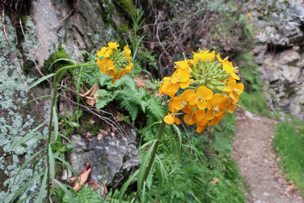
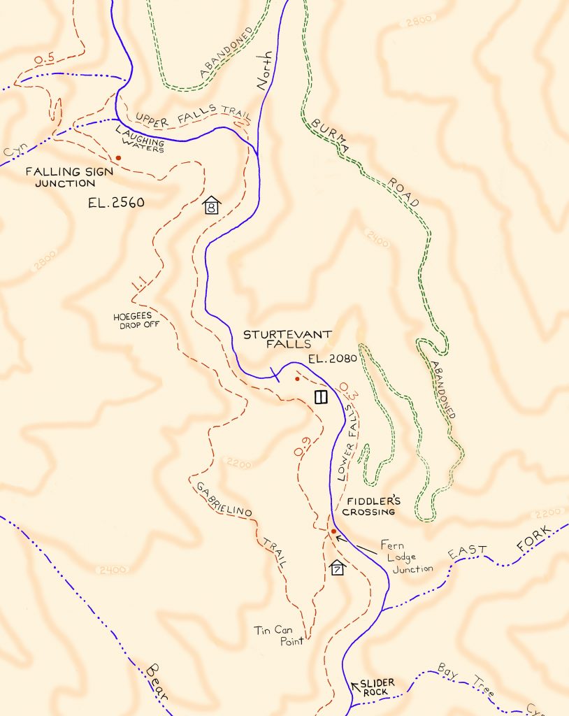
Here’s a Douglas Wallflower alongside the Upper Falls Trail, as seen this last Monday while hiking up the Big Santa Anita Canyon under cloudy skies. Our series of much-needed rain storms have brought back thick green grasses and the start to what’ll most likely be a colorful Spring of other wildflowers. Joanie and I hiked the two-mile Falling Sign Loop from Fern Lodge.
These Douglas Wallflowers (Erysimum capitatum) popped out at us just downstream from the double slot pools on the Upper Falls Trail. There’s also a nice grouping of wallflowers near the second bench up the road from Roberts’ Camp in San Olene Canyon.
Sturtevant Falls was tumbling down nicely. The scent of white sage peppered the cool air and the background surf-like sound of the stream followed us the whole way. We brought along an old shovel, cleaning off small slides here and there. Wild lilacs (buck brush) are still sending their mild lavender scent into the canyon breezes while the bright red orange of Indian paintbrush pokes up from the damp earth near Hoegee’s Drop-Off. And overarching along most of the route, the Laurel bay blossoms still cling to the dark green canopies. Look for the tender dark reddish purple leaves of the canyon big-leaf maples as their foliage begins to fill back in for a new season. Even the white alders are pushing out a myriad of their bright green leaflets, replacing that smokey look of dormancy with new life.
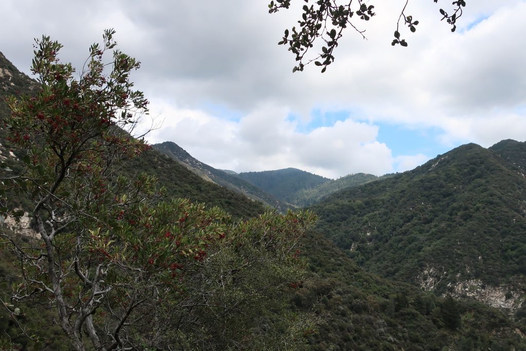
View looking east up into the East Fork of Big Santa Anita Canyon from Gabrielino Trail. Note the Toyon in the foreground, still hanging onto some of its’ red berries. That’s Rankin and Monrovia peaks in the most distant background. Clamshell Peak is barely captured on the right hand side of photo.
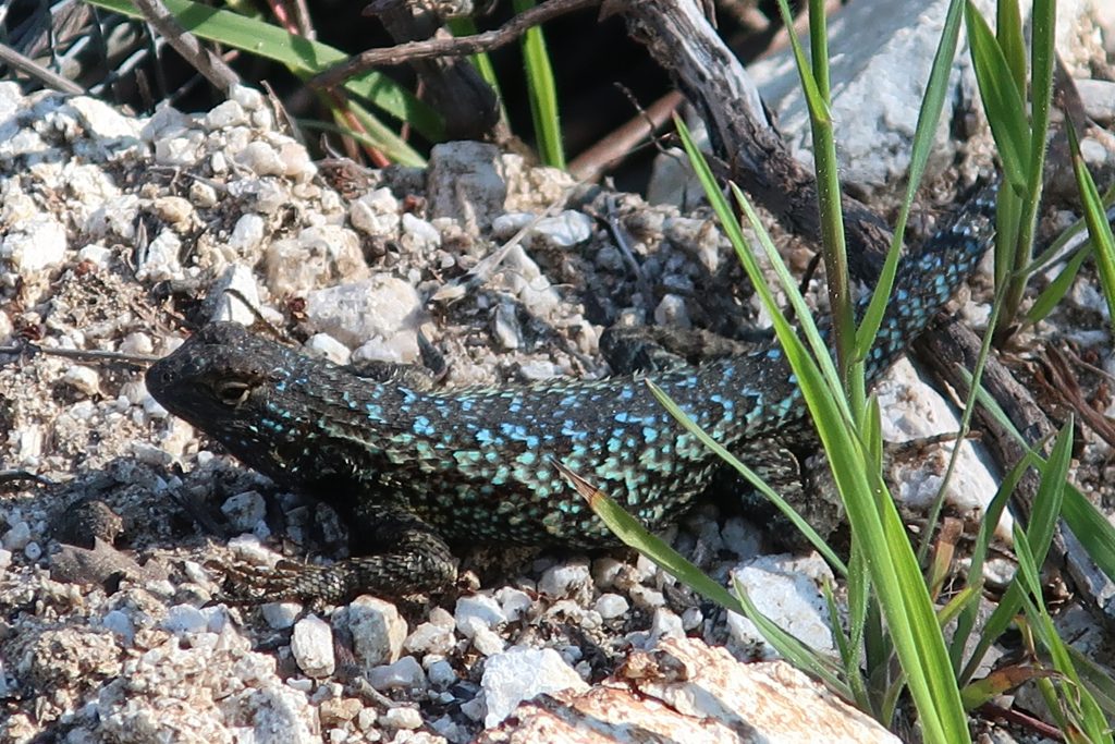
This turquoise colored fence lizard (Sceloporus occidentalis) was seen out in the warmth of early Spring at Tin Can Point. Tin Can Point is just up from Fern Lodge Junction on the Gabrielino Trail. It’s the first switchback you’d encounter after the trail passes through the canyon live oak forest and then enters the chaparral, just a few minutes up from the trail junction.
A beautiful fence lizard basks in the gentle warmth of early Spring at Tin Can Point. See inset of the Chantry Flat – Mt. Wilson Trails map, below, to see where this point is. As of this writing, a cold wet pacific storm is dropping nearly six days of chilly rain and snow in much of the San Gabriel mountains. Big Santa Anita Canyon dam has received over 5 1/2″ of rain in the last week. Something I just learned recently about these Western Fence lizards is that their populations have the effect of reducing the incidence of Lyme’s disease in the ticks that live in the chaparral, such as found covering much of the slopes of the Big Santa Anita Canyon! Apparently, a protein in the lizard’s blood kills the bacterium in the tick’s gut, which is good news for hikers and even their dogs during the spring and autumn months.
Like most reptiles, Western Fence lizards hibernate, at least for a little while each winter throughout their habitats which are wide-spread throughout California. As for food, these lizards eat spiders and various insects such as mosquitos, beetles and grasshoppers. The females lay several small clutches of eggs (3-17) in the spring, the young emerging in the summer.
Detail of Gabrielino Trail section, Chantry Flat – Mt. Wilson Trails map.
On your next hike out from Chantry Flats, watch for for lizards flitting about on the trails and sunning themselves on the myriad stretches of rock. As for the various types of reptiles to be found in the Big Santa Anita, Western Fence lizards are abundant and deserve a place in the sun!
The recent death of Wyatt Earp (Wyatt died January 13, 1929) recalls to mind the part he played in the claim jumping expedition to Searles Lake in October 1910. At the time I was Acting Receiver for the California Trona Company and was in charge of a group of placer mining claims covering some 40,000 acres. The party had been organized at Los Angeles by Henry E. Lee, an Oakland attorney and probably was the best equipped gang of claim jumpers ever assembled in the west. It consisted of three complete crews of surveyors, the necessary helpers and laborers and about 20 armed guards or gunmen under the command of Wyatt Berry Stapp.
The party of 44 in number, arrived at Searles Lake in seven touring cars and established a camp at the abandoned town of “Slate Range City” about eight miles southeast of the company’s headquarters. On the morning following their arrival we saw some of the surveyors across the lake and our foreman road over and ordered them off the property but they paid no attention to his protest an proceeded to do a very thorough job or surveying and staking.
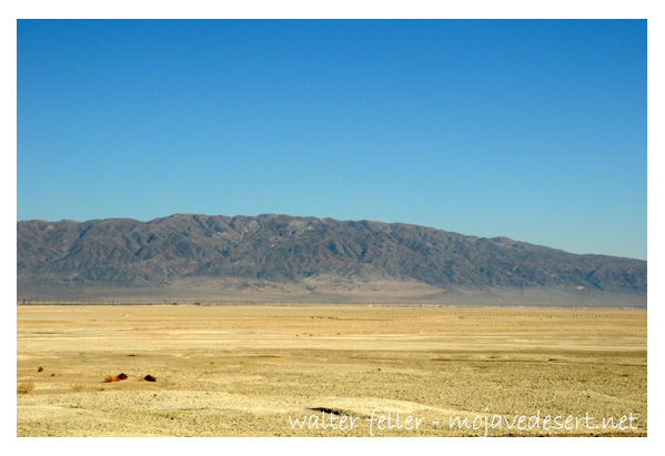
Searles Lake
As I considered it necessary to make some show of force in protecting our claims, I visited the enemy’s camp at sunrise the next day with our whole force of five men who were armed with all the weapons they could collect. It was a very critical moment when we jumped from our wagon and walked up in front of the mess house where the raiders were assembled for breakfast. I stood in the center with my boys on either side of me. There was a shout and men came running from all directions and fearing there might be trouble.
I started right off to explain to the surveyors present that I had only come over to give notice that I was officially and legally in possession of the claims and that they were trespassers.
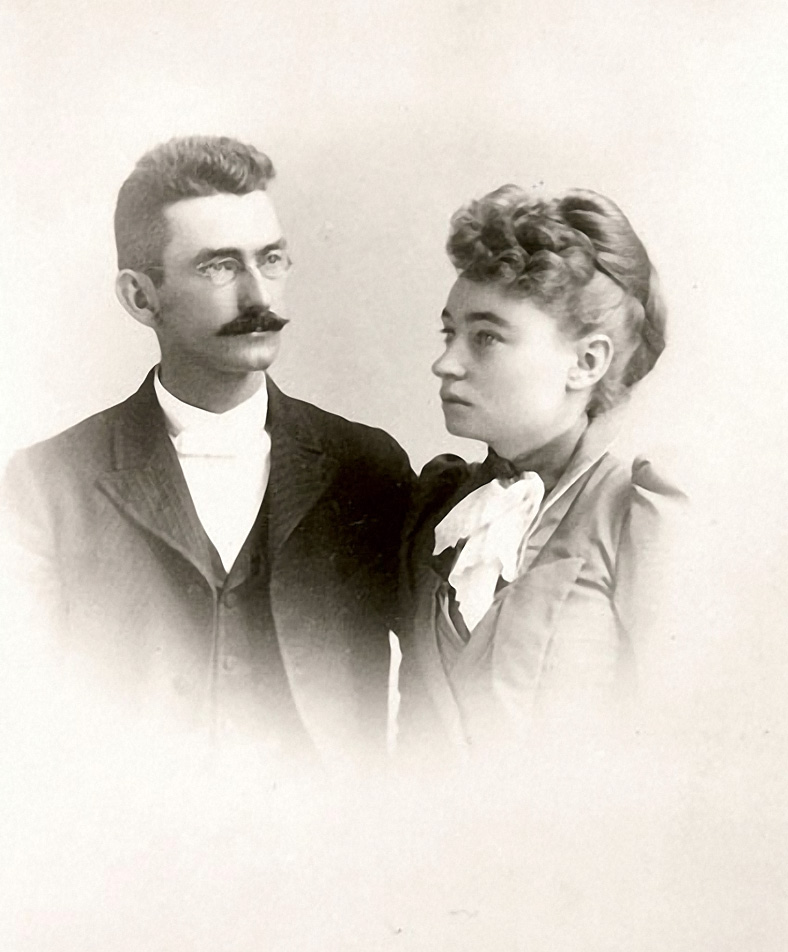
S. Wallace Austin & Mary Hunter Austin – 1891
Before I got very far a tall man with iron grey hair and a mustache pushed his way to the front and in a loud voice demanded why I had come into their camp with armed men. At the same time he grabbed hold of my shotgun held by the boy on my left and attempted to take it away from him. At this attack upon us I drew an automatic and ordered him to let go. He did so and then ran to a building nearby saying “I’ll fix you.” Before he could secure a rifle, however, the cooler headed members of the party surrounded him and calmed him down. Also, you may be sure every effort was made to prevent a fight, as, in spite of our bold being, we were pretty badly scared.
Just as things seemed to have quieted down, one of the excited jumpers accidentally discharged a gun. No one was hurt but, it was a very tense moment for all of us. Having failed to dislodge the enemy the following day I called for a US Marshall and when he arrive the claim jumpers were all arrested and sent home including “Wyatt Berry Stapp”, none other than the famous Marshall Wyatt Stapp Earp.
San Francisco Call, Volume 108, Number 151, 29 October 1910
SODA CLAIMS SEIZED BY BAND 0F ARMED MEN
United States Marshal, Elliott received a telegram yesterday from Deputy Marshal Fred Burling, in Los Angeles, stating that 24 armed-men had seized the properties of the California Trona Company near Johannesberg. A receiver has been placed in charge of the 40,000 acres of soda claims pending the decision of a suit by the Foreign Mines development company against the Trona Company for $200,000.
Deputy Marshal Burling was sent out to serve papers on certain persons alleged to be interfering with the receiver.
Los Angeles Herald, Volume 33, Number 28, 29 October 1910
GUNMEN PROTECT BORAX LAKE PROPERTY
Methods Used in Oil Fields Are Applied to Country Held by Borax Outfit
SEARLES, Cal., Oct. 28. — Borax Lake, located in the northwest corner of San Bernardino County, is again the scene of a claim jumping struggle. A party of armed men, thirty-five in number, with automobiles, led by a man named Splat, of Los Angeles, have entered the property of California Trona company and are surveying and locating over the locations of the Trona company which has just finished assessment work costing $25000.
This is the same property on which Charles Davidson of Oakland perished last June while leading a claim jumping expedition for the same property. The property is now in charge of a receiver of the United States court who notified the jumpers to desist. They replied by show of arms and refused. The United States marshal is now on his way to the scene of trouble.
The automobiles are in charge of Chauffeur M, C. Vorney and are numbered 24145, 32783, 36991, 37404 and 29487.
Names of locators are: H. C. Fursman, W. Hull, R. Wagmire, P. Perkins, H. A. Baker, E. Thompson, D. Smith, T. W. Pack. Witness, E. A. Rasor.
The Foreign Mines and Development company has a mortgage of $250,000 on this property. A sale is pending in |the east, said to be on a $1,000,000 basis.
The Mojave Desert, located in the southwestern United States, is a vast, arid region known for its unique and resilient ecosystems. Its natural history can be divided into several key aspects:
Geology and Geography: The Mojave Desert has varied topography, including valleys, dunes, and mountains. It is home to the famous Death Valley, the lowest and one of the hottest places in North America. The Mojave’s geological history includes volcanic activity, the formation of mountain ranges, and the erosion that created its present landscapes.
Climate: This desert is known for its extreme temperatures and aridity. Its high temperatures vary day and night due to the lack of humidity and sparse cloud cover. Rainfall is scarce and unpredictable, often leading to drought conditions.
Flora and Fauna: The Mojave Desert supports a range of life adapted to its harsh conditions. Notable plants include the Joshua tree (Yucca brevifolia), symbolic of the Mojave, and various cacti and shrubs adapted to survive with minimal water. Animal life includes reptiles like the desert tortoise, mammals such as the bighorn sheep, and numerous bird species that navigate the challenging environment.
Ecological Dynamics: The ecosystems of the Mojave are shaped by limited water resources and extreme temperatures, leading to unique interactions among species. Plants and animals have evolved various adaptations for survival, including water conservation mechanisms and nocturnal activity patterns.
Human Impact and Conservation: Human activity has significantly impacted the Mojave Desert. Issues include water resource extraction, urban expansion, and the development of renewable energy installations. Conservation efforts are ongoing to protect its biodiversity and landscape, with areas like the Mojave National Preserve established to safeguard habitats and natural features.
Cultural History: The desert has been inhabited by Native American tribes for thousands of years, each with rich cultural histories and connections to the land. More recently, it has played a role in American history through mining, military use, and as a site for artistic and literary inspiration.
The Mojave Desert’s natural history is a complex tapestry of geological, climatic, biological, and human factors, making it a fascinating subject for study and exploration.
The Berkeley Library, specifically the University of California, Berkeley Library, has extensive resources and collections that provide a comprehensive view of California’s history. Here are key aspects related to the history of California as reflected in the Berkeley Library’s collections:
Early History and Colonization: The library holds materials on the early exploration and colonization of California, including the impact of Spanish missions, the lives of Native Californian tribes, and the region’s integration into the Spanish empire and later Mexico.
Gold Rush and Statehood: There is a wealth of information on the California Gold Rush of 1849, which was a pivotal event in American history, drawing thousands to the state and leading to California’s rapid admission to the Union in 1850.
Economic and Social Development: The library’s collections cover the development of California’s economy, including the rise of the agricultural, entertainment, and technology sectors. It also houses materials on social movements, immigration, and the diverse cultures that have shaped California.
Environmental History: Given California’s diverse ecosystems, the Berkeley Library has significant resources on the environmental history of the state, including water use and management, conservation efforts, and the impact of human activities on the landscape.
Political History: The collections include materials on California’s political history, from its early days as a part of Mexico, through its statehood, and into its role as a trendsetter in American politics, including the Progressive Era, civil rights movements, and contemporary political issues.
University of California History: As part of the UC system, the Berkeley Library also has materials on the history of the University of California and its role in the educational and cultural development of the state.
These collections are used by researchers, students, and the public to study and understand the complex history of California. The Berkeley Library serves as a vital resource for those looking to explore the many facets of California’s past and its impact on the present and future.
The region’s earlier history includes the town of Carrara, established to support marble quarrying, which began in 1904. Despite initial optimism, the marble’s quality and economic factors led to the quarry and the town’s decline.
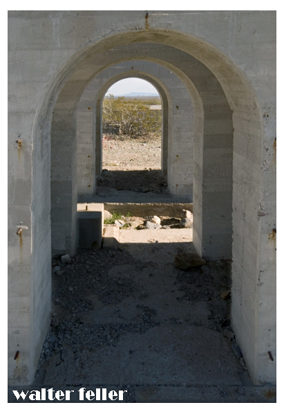
The “Elizalde Cement Plant” in Nevada has historical significance. It was established in the early 20th century to supply cement for Hoover Dam construction. The Elizalde Company built the plant and operated when the American Southwest underwent significant industrial and infrastructure development.
After the completion of the Hoover Dam, the demand for cement decreased, leading to the plant’s closure. The remnants of the Elizalde Cement Plant now stand as a testament to the region’s industrial history, attracting historians and enthusiasts interested in the area’s development and the broader story of American industrialization.
The Elizalde Cement Plant, located in Nevada, has a history tied to industrial ambitions and unforeseen setbacks. Incorporated in November 1940 as the Carrara Portland Cement Company, it aimed to produce standard gray and special white cement, utilizing crushed marble from the nearby Carrara quarry.
Incorporated in November 1940 as the Carrara Portland Cement Company, it aimed to produce standard gray and special white cement, utilizing crushed marble from the nearby Carrara quarry. By April 1941, construction was in full swing, with an estimated daily output planned for 80 tons of cement. However, a devastating fire in July 1941 destroyed significant parts of the plant, halting progress. Despite efforts to rebuild and expand, World War II’s fuel rationing ultimately doomed the plant, which never became operational.
By April 1941, construction was in full swing, with an estimated daily output planned for 80 tons of cement. However, a devastating fire in July 1941 destroyed significant parts of the plant, halting progress. Despite efforts to rebuild and expand, World War II’s fuel rationing ultimately doomed the plant, which never became operational.
The Elizalde Cement Plant was supposed to mark a new industrial phase, but it became a relic of unfulfilled industrial aspirations, now an intriguing ruin in the desert landscape.
OpenAI. (2024). ChatGPT (4) [Large language model]. https://chat.openai.comhttps://www.nvexpeditions.com/nye/elizalde.php https://nvtami.com/2023/05/09/ghost-towns-of-beatty/