Cajon Pass
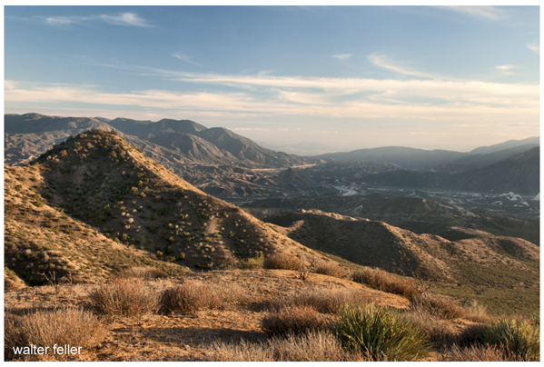
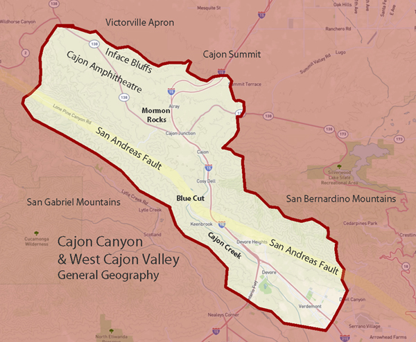
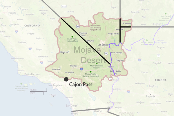
Cajon Pass, a natural gateway between the Mojave Desert and Southern California, has served as a vital travel and trade corridor for centuries. Shaped by the San Andreas Fault, it provided water, shelter, and routes for Native peoples long before Mexican land grants like Rancho Muscupiabe marked early settlement. In the 19th century, Mormon pioneers, stagecoaches, and toll roads threaded through its rugged canyons, followed by the California Southern Railroad in the 1880s. The early 20th century brought automobile routes such as the National Old Trails Road, Arrowhead Highway, and eventually Route 66, making the pass a landmark for travelers. Today, Interstate 15, modern rail lines, and scenic trails like the Pacific Crest Trail continue its legacy. Alongside its transportation history, Cajon Pass boasts striking geology, landmarks like Mormon Rocks and Blue Cut, and preserved cultural sites that tell the story of movement, settlement, and connection across generations.
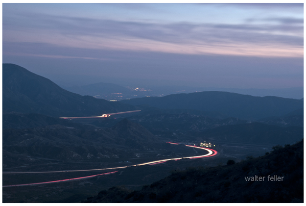
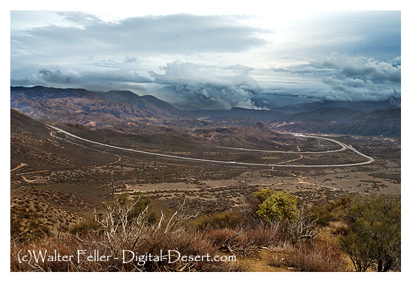
Looking south down the Cajon Pass
1. History & Settlements
- Rancho Muscupiabe: Historic Mexican land grant and early settlement site at the base of Cajon Pass.- Devore/Keenbrook – Alice Hall: Early communities near Cajon Pass with roots in local development and hospitality.
- Cajon Junction, CA: A roadside stop and service area at the confluence of key roads through the pass.
- Cozy Dell: A lesser-known canyon or area near Cajon Pass with a history tied to early travelers.
- Oakdale Nudist Camp: A mid-20th century nudist resort once located near Cajon Pass.
- Cajon Summit: A small settlement at the top of Cajon Pass, historically a key point for travelers.
- Posts at San Bernardino: Military or settler outposts that supported early development through the region.
- Camp Cajon: A roadside rest stop and picnic area created in the 1920s to welcome travelers to Southern California.
- Glen Helen: A regional park and historical ranch area near the mouth of Cajon Pass, known for its natural amphitheater, rodeo grounds, and roots in early settlement history.
2. Natural & Physical Resources
- Heritage Resources: Cultural and historical features preserved in the Cajon Pass region.- Physical Resources: Natural features such as water, minerals, and terrain vital to the pass.
- Plants & Wildlife: Native species found throughout Cajon Pass, including chaparral and riparian habitats.
- San Andreas Fault: Major fault line running through Cajon Pass, influencing its topography and seismic activity.
- Cajon Pass Geology: Specific details about the formations and movements in the pass area.
- Cajon Creek: A seasonal stream draining the pass, important to early settlements.
- Lost Lake: A sag pond formed along the San Andreas Fault, often holding water year-round.
- Sycamore Grove: A shaded area with native sycamore trees, possibly used as a campsite or picnic area.
- Lone Pine Canyon: A side canyon on the eastern slope of the pass, often used as a backcountry route.
3. Trails, Roads & Highways
- Sanford Pass: Historic route over the ridge of the Cajon Pass.- Mormon Hogback: A narrow ridge road used by Mormon settlers in the 19th century.
- Toll Road: Privately constructed road through Cajon Pass, charging travelers in the 1800s.
- Toll Road through the Pass: The specific route used for toll collection in early transportation.
- National Old Trails Road: Early transcontinental auto route through Cajon Pass.
- Interstate 15 Freeway: Modern highway built through the pass, replacing older roads.
- State Highway 138: East-west route intersecting I-15 through Cajon Pass.
- Arrowhead Highway (US 91): Historic auto trail that predated Route 66 in the area.
Route 66 Map: Mapping of the famous highway as it passed through the region.
-
Route 66 - 1953
: A look at the alignment of Route 66 in the early 1950s through Cajon Pass.4. Railroads & Rail History
California Southern Railroad: The original railroad line built through the pass in the 1880s.- Railroads: General reference to the many lines and upgrades made through Cajon Pass.
- Cajon Summit: High point for road traffic;
- Summit, CA.: High point for rail and road traffic; a key spot for railfanning and history.
- Hill 582: A popular railfan site with a scenic overlook and historic importance.
- Sullivan's Curve: A wide, photogenic bend in the rail line named after photographer Charles H. Sullivan. Famous for panoramic views of freight trains curving through Cajon Pass.
5. Hiking & Interpretive Areas
- Mormon Rocks Interpretive Trail: Trail showcasing dramatic sandstone formations and local history.- Pacific Crest Trail: National scenic trail that crosses Cajon Pass on its way from Mexico to Canada.
- Crowder Canyon: Historic wagon route and hiking trail through a narrow canyon of the pass.
6. Landmarks & Geologic Features
- Mormon Rocks: Iconic sandstone formations shaped by wind and water along the San Andreas Fault.- Blue Cut: Narrow passage carved by floodwaters; a historic and scenic spot in Cajon Pass.