Mormon Rocks Interpretive Trail
Adapted from USDA brochure at trailhead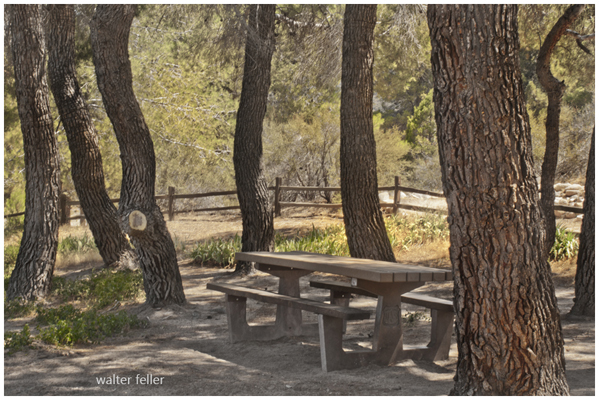
Picnic table at the beginning/end of the loop trail
The land around you is rich in “heritage resources.” As you walk the trail, pause to read the section of the brochure that corresponds to the numbered post. At each stop, take a look into the history of Cajon Pass, which has made a large contribution to our culture.
Most of the land in this area is owned by the citizens of the United States, and is managed today by the USDA Forest Service.
Station 1: Mormon Rocks
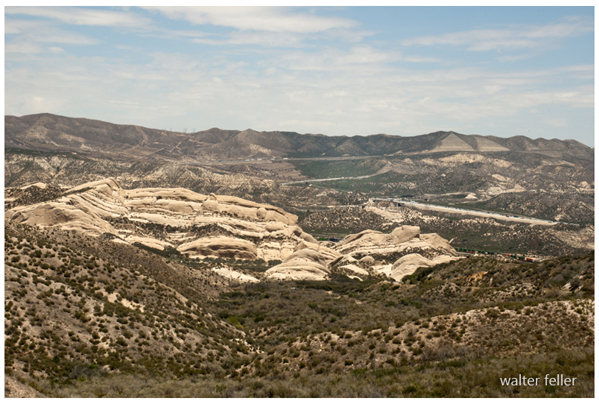
Mormon Rocks topography
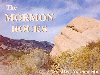
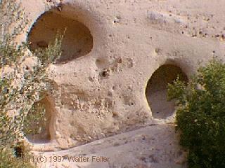
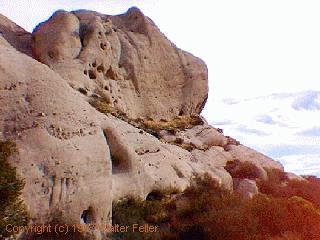
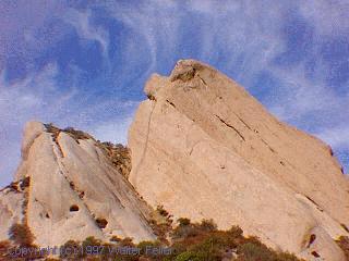
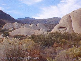
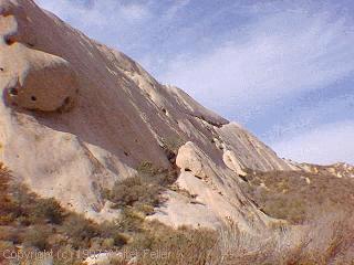
This area is called “Mormon Rocks,” but perhaps a more fitting title would be “Serrano Rocks.” The name refers to the jutting sandstone formations that provided brief shelter for Mormon colonists who crossed this area in 1851 and founded the city of San Bernardino. Prior to the arrival of Spanish and Anglo pioneers, the Mormon Rocks area was the heartland of the Serrano people. Originally from the eastern Great Basin area, the Serrano had occupied this area from about A.D. 1200 to the mid 1800s (about 700-800 years). Before the Serrano, archaic hunters and gatherers lived in the area for thousands of years.
Station 2: The Serrano
“Serrano” is a Spanish word meaning “mountaineer.” The Serrano probably referred to themselves as “the people,” or “Takhtam” in their language. Numerous Serrano villages surrounded the Mormon Rocks area. About a mile to the southeast, near the truck scales on Interstate 15, was the village of Muscupiabit. Several village sites were in nearby Crowder Canyon to the northeast. A large village named Guapiabit was to the east in Summit Valley. From these villages, seasonal forays were made into the surrounding hills and mountains.Station 3: Living Wild
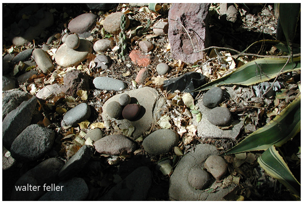
The Serrano lived in domed brush houses. Acorns, plentiful in the region, were made edible by grinding them with a mortar and pestle and washing the flour with water to remove the bitter tannic acid. This process left behind the many mortar holes that can be found throughout the region. The neighborhood also provided pine nuts, yucca hearts, numerous seeds, and a variety of game animals.
Serrano men wore breechclouts and buckskin leggings. Women wore two-piece skin skirts. Clothing was adorned with beadwork of seashells, stones, bone, and seeds. Sandals were made from woven fiber from yucca leaves. Like other groups of the region, they tattooed the upper portions of their bodies.
Station 4: The Early Traders
The Serrano were a part of an extensive trading network, dealing in shell beads, otter skins and soapstone from the coast, and obsidian, chert, and other trade items from the northeast. The Serrano contributed primarily baskets, pottery, and various products of the mountain forests.Station 5: Trails
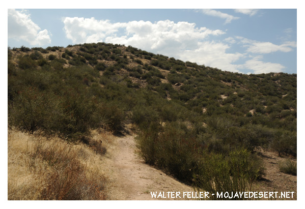
Routes repeatedly traveled by Native Americans in the course of their hunting and gathering lifestyle became well defined trails. Those that followed incorporated these trails into important trade routes.
The Mojave Trail was used primarily by the Mojave Indians that made the Colorado River their home. This foot trail climbed over the steep mountain ranges and was the most direct route to the coast from the desert regions.
Beginning in 1830, the Spanish Trail connected Santa Fe with the west coast through the Cajon Pass. Caravans of mules with loads of trade goods made the yearly trip to California in the fall, and returned east the following spring.
Today, the San Manuel Band of Mission Indians (Serrano) have a one mile square reservation on the edge of the San Bernardino Mountains just north of the city of Highland, from where they have developed a multifaceted and expanding business enterprise. They are also working with the San Bernardino National Forest at the Big Bear Discovery Center to educate Forest visitors about their traditional culture.
Station 6: The Mojaves
The Mojave Indians were said to be able to travel up to 100 miles a day at a trot without stopping to eat or drink. They were excellent traders, and traveled to distant locations along the coast of California and all the way to New Mexico to trade with other Native American Tribes.They were outstanding potters, and their pottery was a major part of their trading.
The Mojave were known for their distinctive facial tattoos.
Station 7: The Gateway
The shortest, fastest, easiest way to escape the inhospitable high desert to find relief in coastal California was through the gap between the rugged San Bernardino and San Gabriel mountain ranges: Cajon Pass. Travel to the north through Walker Pass was longer and harder. Travel to the south through the Sonoran Desert was awful. Trails, roads, railroads, and finally highways connected the American southwest through the pass to California. The same route, for the same reasons, is also used as a utility corridor for power lines, telegraph (then telephone) lines, and pipe lines carrying water, natural gas, and even jet fuel.Station 8: Spanish Pathfinders
While the British Empire still ruled the American colonies, the Spanish were traveling through Cajon Pass. Pedro Fages, a Spanish military commander, explored the pass in 1772 while looking for deserters. Francisco Garcéscame over the pass via the Mojave Trail in 1776 on his way to the San Gabriel Mission from the Colorado River.
In 1806, Jose Zalvidea made a trek through the pass looking for a site for a mission to link the coastal missions with the inland areas.
Gabriel Moraga and a band of 35 soldiers crossed the pass in 1819. Moraga’s diary complained of bitter cold weather and scarce feed for their horses. Moraga’s party was the first to use the word cajon (box) for the Pass, Cajon de Amuscupiabit.
Station 9: Jedediah Smith
In 1822, California became the territory of Mexico, and the authorities were wary of American expansion.Jedediah Smith, 27 years old, and a group of 18 trappers made a trip to California in 1826 in search of beavers. They made their way from the Colorado River and reached the San Bernardino Valley, via the Mojave Trail, on November 26. They stayed in the Southern California area until February 1, when they headed back over the Mojave Trail. Smith and his mountain men were the first Americans to enter California overland. Smith was treated with courtesy by a suspicious Governor, and with generous hospitality by the Californians.
A year later Smith returned with 18 trappers. It was a rough trip. Ten of Smith’s men were killed and two were seriously injured in an ambush by Mojaves, who were seeking revenge following provocations by another band of trappers. Smith’s party lost all of their horses, traps, munitions, and most of their guns. The survivors crossed over the mountains by way of Cajon Pass, the first Anglo Americans to do so, and spent five days in the San Bernardino Valley, where they were able to restock their provisions before heading back over the pass. Two decided to stay behind in the verdant, sunny land. Smith never returned to Southern California.
Station 10: Horse Thieves
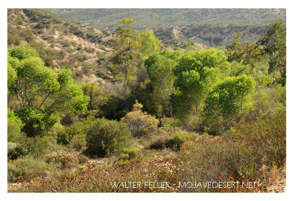
Crowder Canyon
The huge California rancheros had vast herds of horses. New Mexico, Colorado, and points east needed horses, and people there were willing to pay a high price for them. Horse thieves went to work to fill the need. By the 1830s, large organized raids on the rancheros in the valleys below became common. When thousands of horses thundered through Cajon Pass, they created a cloud of dust that could be seen for 30 miles. The thieves often hid the horses in what today is called Horsethief Canyon, three miles east of here, only to discover that water and feed were in short supply. Hundreds of horses died of thirst and hunger, a sad loss to both thieves and rightful owners. The horse drive east from there could not have been much easier.
Station 11: Walkara
One noted leader of the horse raids was a Paiute chief known as Walkara, the “Hawk of the Mountains.” Walkara was both an excellent horseman and skillful with weapons. During the 1840s, Walkara allied himself with mountain men Thomas “Pegleg” Smith and Jim Beckwourth to pull off some of the largest horse-stealing raids of all times. They hid thousands of horses in Cajon Pass. Livestock raids continued for many years, until increased settlement of the valleys below put an end to them.Station 12: Mormons
In 1848, a small group of Mormon men came through Cajon Pass on military duties. They were so impressed with the valley below that they decided to return with their families to establish a colony. In 1851, almost 500 Mormons set out from Utah to make San Bernardino their home. The caravan mostly followed the Old Spanish Trail, crossing the pass in early June.Their 150 wagons used considerable livestock, making feed and water an important consideration when stopping in the pass. They camped at Willow Springs, the location of the Serrano Village of Amuscopiabit, before making their way to a grove of sycamore trees about two miles west of present day Devore.
Station 13: Serrano: An era of change
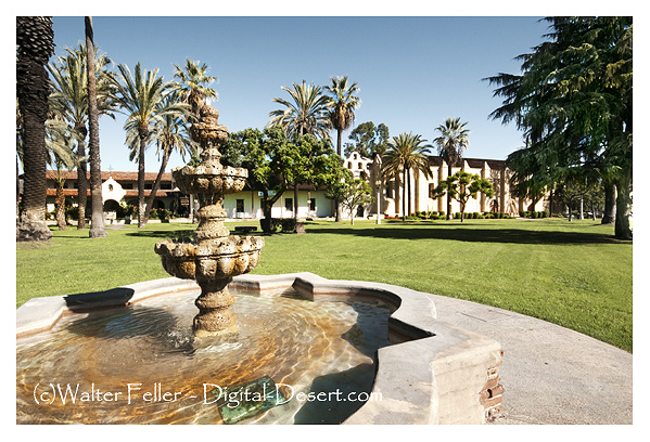
Mission San Gabriel
Compared to neighboring tribes, the Serrano remained relatively isolated from Spanish and later Mexican intrusions. Traditional Serrano life came to a sudden halt in the early 1860s, at the time of the American Civil War. Major conflicts with encroaching ranchers, extended periods of draught, and the onslaught of foreign diseases, from which they had little immunity, all took their toll.
Station 14: Mining
Gold finds in Cajon Pass were modest. However, this did not stop the prospectors. In the late 1800s, small amounts of gold were found, and each find brought a hundred others who were hopeful of making a strike. Silver was found in somewhat larger amounts, but small scale operations were the rule, with one or two miners on a claim. There were a number of coal mines developed in the pass, beginning in 1879. The Black Prince Mine in the canyon between Swarthout and Cajon had a fifty foot shaft to reach the coal. There were also the Cajon Canyon and Summit Coal Mines that hauled their coal down to San Bernardino for home use.A limestone mill and quarry was built in 1924 along Highway 138 about a mile down the canyon from here. Limestone was trucked to the mill from mines in Lone Pine, Swarthout, and Cajon Canyons.
Station 15: Roads
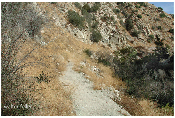
Toll road in Crowder Canyon
When mining activity in the San Bernardino Mountains began in the 1850s, wagon traffic increased significantly through Cajon Pass. John Brown was granted a 20 year franchise by the California State Legislature to construct a toll road. From the top of the toll road, miners and their supplies could get into the mountains through the desert on the newly built public Van Dusen-Coxey Road. In 1882, the toll road was deeded back to San Bernardino County. The National Old Trails Road was built in 1915 as part of the transcontinental road system that later became part of the US Highway System. This paved two lane road was built to serve a ‘new-fangled’ contraption; the automobile. It became Route 66 in 1926, a popular highway that author John Steinbeck dubbed the “Mother Road”.
Interstate 15, which replaced Route 66 in 1970, can be seen from here to the east.
Station 16: Railroads
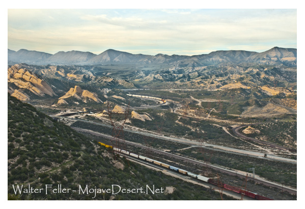
As early as 1853 the US Government had surveyed Cajon Pass as a possible location for railroad lines to tie the Mississippi Valley to the Pacific coast. Over the subsequent years several attempts were made to lay track, but it wasn’t until 1885 that the California Southern Railroad was able to complete a single track through the pass. CSR later merged to become part of the Santa Fe Railroad. It added a second line in 1913. Southern Pacific laid their lines in 1967. Devore, Keenbrook and Cajon were places to stop and fill the steam engine tenders with water. If you look east towards Interstate 15 you are likely to see one of the 50 to 100 freight trains that are crossing the pass daily.
Station 17: Chinese Railroad Workers
Castle Rock - Cajon Pass
When the first railroad was built through Cajon Pass, most of the labor was provided by Chinese workers. In 1883, 2,500 Chinese men replaced the predominantly Mexican crew that had been building the line. The Chinese laborers did most of the extensive cut and fill work in Cajon Pass, entirely by hand, moving the tons of material with hand carts. After the track was completed, a few Chinese came back to Cajon Pass to work small gold and silver mines. Some settled in San Bernardino as it had a well developed “Chinatown” at approximately 3rd and Arrowhead Avenue.
Station 18: Utilities
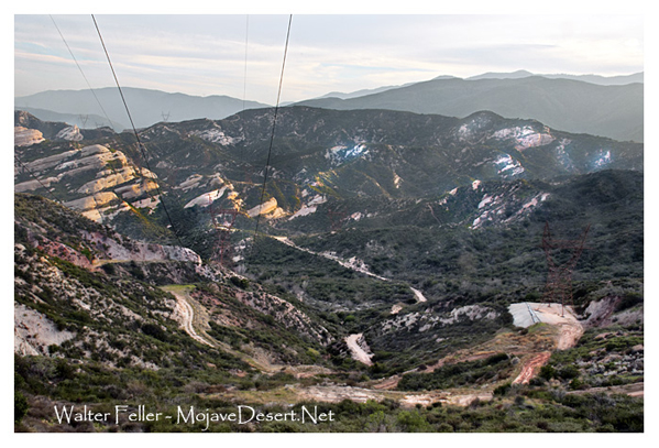
Most of the major utilities on which Southern Californians depend are routed through Cajon Pass
Telegraph lines arrived with the railroad in 1885. These were eventually replaced by telephone lines. Looking towards the east you can see tall towers that carry electrical lines from Hoover Dam to Southern California. These lines were the first of their kind in the world. (They weren’t sure at the time if it would work!) This set a precedent for future projects. Two natural gas lines were laid through Cajon Pass by Southern Counties Gas Company in the 1960s. The California-Nevada Corporation routed its jet fuel line from Edwards Air Force Base to Colton. Pacific Telephone put in underground communications cables in the 1960s. Recently, two fiber optic lines were laid.
Station 19: Forest Service
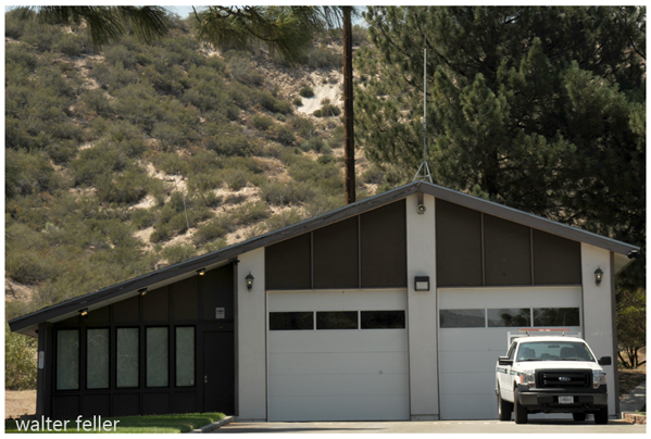
Towards the end of the 1880s, citizens of San Bernardino County sought protection for the forests in the San Gabriel and San Bernardino Mountains by the Federal Government. Watershed protection was a major concern. Water for the valley below was dependent on the mountains above. The forests were over cut and overgrazed by vast sheep herds, turning the once lush mountains to barren devastation. Wildfires burned unchecked.
On February 14, 1893, President Benjamin Harrison set aside the San Bernardino Forest Reserve in an early attempt to address these problems. Reforestation, fire prevention, and watershed protection became the major focus for the San Bernardino National Forest. Today, this Forest is also a major recreational resource for southern California’s huge population.
Station 20: Fire!
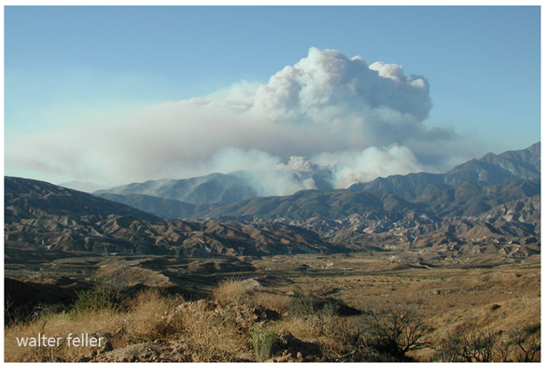
Numerous fires started by sparks from steam locomotives traversing the pass caused severe damage to the watershed, which the local communities depended on. In 1914, the first fire lookout tower in the San Bernardino mountains was erected in Cajon Pass on land owned by Victor Ver Bryck, in a cooperative effort between the Forest Service and local ranchers. The Ver Bryck lookout was located just below the summit, about three miles northeast of here. The Forest Service was very successful at preventing and fighting wildfires. However, Mother Nature must be dealt with very carefully. Heavy vegetation that had built up over many years without fires was a threat to the Mormon Rocks Fire Station, which was built in 1967. In 1996, firefighters from this Ranger District conducted a “controlled burn” to reduce the fuel load. That helped to save the station when the Louisiana Fire swept through here in late June of 2002.
Station 21: Special Uses

Cajon Junction
All of the human-made facilities seen from this location, other than the fire station, are under “special use permits” from the Forest Service, including roads, railroads and utilities. A special use permit is a license for an encroachment on public land that is beneficial to the public. The public benefits in two ways: from the use of the land, and from fees paid by the permit holders to the national treasury that are assessed on income from that use.
Decisions on whether to issue new special use permits have been made under the regulations of the National Environmental Policy Act (NEPA) since 1969. Would the view be somewhat different today if that Act had been passed in 1869?
Station 22: Modern Times
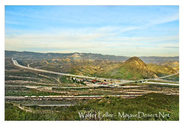
Cajon Junction
Today, the Mormon Rocks formation is popular for rock climbing. Equestrians ride the trails on Baldy Mesa, which you can see along the skyline to the north. Hikers pass through on the Pacific Crest Trail, which crosses Interstate 15 and traverses the ridgeline to the south. The National Forests accommodate some unusual recreational activities. A club holds a big radio controlled glider event on the mesa every spring where the winds are just right.
This area has provided the background for filming of numerous movies, television shows and commercials. Captain Kirk and Spock visited this part of the galaxy for the early “Star Trek” TV series.
Over 46 million vehicles travel through the pass annually.
Adapted from: MORMON ROCKS INTERPRETIVE TRAIL - CAJON PASS: A HERITAGE RESOURCE
