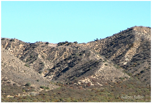
|
Digital-Desert :
Mojave Desert
|
| Intro:: Nature:: Map:: Parks:: Points of Interest:: Ghosts & Gold:: Communities:: Roads & Trails:: People & History:: BLOG:: Weather:: :?:: glossary |
Historic Roads & Trails - Cajon Pass History
Mormon Hogback![]() The trail between the summit and the mouth of Coyote Canyon was troublesome for wagons as they would have to be disassembled and portaged through the upper narrows of the canyon. It did not take long for pioneers to find another route several miles to the west. ![]() 
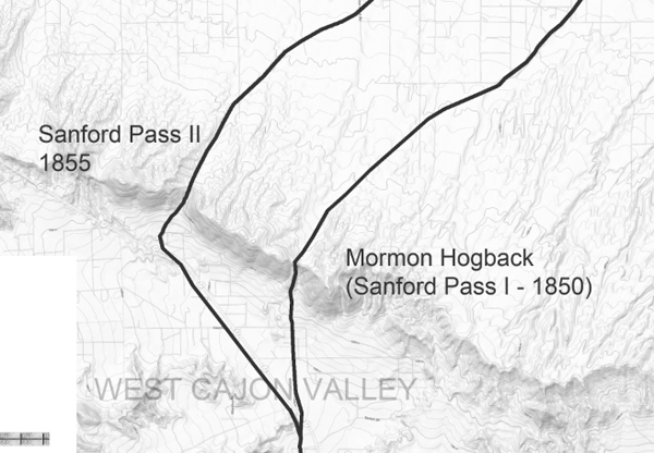
In 1850 the road shifted to a hogback ridge that added several miles to the trail and was only marginally better as the slopes were steep and dangerous. ![]() A cut into the side of the mountain improved the road, however, there was much to be desired and a third route, the Sanford Pass, was developed in 1855.
|
HOGBACK - An eroded, steep ridge of resistant rocks produced by erosion of the broken edges of highly tilted strata. Sanford PassSanford's Road |
| Intro:: Nature:: Map:: Parks:: Points of Interest:: Ghosts & Gold:: Communities:: Roads & Trails:: People & History:: BLOG:: Weather:: :?:: glossary |
|
Digital-Desert :
Mojave Desert
|
|
Country Life Realty Wrightwood, Ca. |
Mountain Hardware Wrightwood, Ca. |
Canyon Cartography |
G.A. Mercantile |
Grizzly Cafe Family Dining |
|
Abraxas Engineering privacy |
Disclaimer: Some portions of this project were developed with assistance from AI tools to help reconstruct historical contexts and fill informational gaps. All materials have been reviewed and fact-checked to ensure accuracy and reliability, though complete precision cannot be guaranteed. The aim is to provide dependable starting points and distinctive perspectives for further study, exploration, and research. These materials are historical in nature and intended for educational use only; they are not designed as travel guides or planning resources. Copyright - Walter Feller. 1995-2025. All rights reserved. |