Exploration and Settlement
Due to the inhospitable character of the region, the Beatty area was usually bypassed by the early explorers of the American West. Typically, early explorers followed seacoasts and lakefronts, rivers, and Indian trails when entering a new area. Attracted to verdant valleys and well-watered mountain ranges, which offered potential for abundance of wild game (especially beaver), they tended to follow naturally existing transportation corridors that minimized distances and were more likely to provide water, food for them and their animals, and shelter. The great barren region that was made of rugged mountain ranges, separated by dry desert valleys stretching for 100 or more miles in any direction from Beatty, offered none of these advantages. What Indian trails there were led only from one small water hole to another. Consequently, early explorers took more hospitable routes that led around the Beatty region. Entry into the vast desert area was justifiably viewed with considerable fear, holding the prospect of at least extreme hardship and perhaps even death, until well after the 1850s.Ogden's 1829-1830 Expedition
It is possible that the famous Canadian explorer-trapper, Peter Skene Ogden, passed through the area where Beatty is now located on his 1829-1830 Snake Country Expedition, which originated in the Columbia River region, moved south to the Humboldt River in northern Nevada, and eventually "followed the eastern foothills of the Sierra southward to Walker Lake" (Cline, 1974:91). After leaving Walker Lake, Ogden passed through some highly inhospitable country, "traveling parallel to what is now the boundary between California and Nevada," perhaps passing through what is now the Nellis Air Force Range. On that passage, Ogden and his men experienced great hardships; they suffered from cold and hunger and went days without water. Their horses became weak and some died; the men were reduced to satisfying their hunger on the horses' carcasses and quenching their thirst on their blood (Cline, 1974: 93). Ogden's expedition eventually ended at the Gulf of California; he might have traveled through the Beatty area, perhaps moving south down Oasis Valley. Certainly the water sources in Oasis Valley would have made this route a possibility. If Ogden did pass through the Beatty area, he and his men would have been the first whites known to set foot there.Fremont's Expeditions
On his second expedition (1843-1844), Colonel John C. Fremont returned to the East by way of the Old Spanish Trail; this route took him through the Pahrump Valley in southern Nye County and on to the Las Vegas Meadows in 1844 (Hulse, 1981:44). In 1845, on his third expedition, Fremont crossed the desert west of the Great Salt Lake and then split his party. One group followed the Humboldt River, while "Fremont and ten men crossed the Ruby Mountains, veering southward down the Big Smoky Valley and then northward to Walker Lake to rendezvous with the others" (Noren, 1982:7L). In 1848, Fremont published a map of the Great Basin, showing a grand "dividing range" running east and west across the Great Basin just north of the latitude of Beatty (Lingenfelter, 1986:37). Fremont claimed to have seen the mountain range from high points in the distance on his third expedition. This map with its imaginary mountain range was a major factor in the forty-niners' ill-fated decision to leave Captain Jefferson Hunt's wagon train on their way from Salt Lake to southern California; they then attempted to find a shortcut across the uncharted deserts of southcentral Nevada (Lingenfelter, 1986: 34). Though the forty-niners crossed the Amargosa Valley on their way to becoming "lost" in Death Valley, there is no evidence that any of the forty-niners entered Oasis Valley or the present site of Beatty prior to their descent into Death Valley in 1849.On his fifth and last expedition (1853-1854), Colonel Fremont passed to the north of the Beatty area on his way to California. Fremont, who was looking for a suitable railroad route across the southwest, left Cedar City, Utah, in late February 1854 and struck out across the unexplored Escalante Desert. Fremont's party had had a difficult time in Utah, attempting to cross some of the most rugged country in the American West in the middle of one of the coldest winters the Mormons had experienced in their decade there (Egan, 1985:502). They "entered Nevada south of present-day Pioche and kept moving [passing north of Beatty] through a series of snowstorms until they reached the granite barrier of the Sierra Nevada at the thirty-seventh parallel, a little south of present-day Bishop, California" (Egan, 1985:503).
Early Settlers: Lander and Stockton
The Oasis Valley and the Beatty vicinity remained isolated and unsettled by whites until the 1870s. The discovery of a few mines in the area eventually resulted in the establishment of some small ranching operations.Eugene Lander, a prospector from San Bernardino, is usually credited with being the first settler in the Beatty area. He was hard-working and industrious but never lucky; at least twice he was fairly close to the big bonanza, but he never struck it rich. Lander had two prospecting partners-August J. Franklin and a man named Hanson. High in the Funeral Mountains near Daylight Pass on the morning of August 13, 1871, Franklin spotted some promising float while he was killing a rattlesnake. (Float is a term for mineral-bearing rock that has broken free from an outcropping vein and rolled or been washed some distance from its spot of origin.) The next day, he and Hanson followed the float to its source on the crest of the range and found a great quartz belt laced with what they thought was silver chloride. Rough assays done in San Bernardino indicated the rock ran from $200 to $1000 a ton in silver. The three brought in friends as partners in the claim and formed the Chloride Cliff Mining Company. One of the friends, William M. Stockton, was an old partner of William Manly and Mabel Bennett of Death Valley forty-niner fame. They worked the ledge, which they named Chloride Cliff, until fall 1873. After they sank a 150-foot shaft, they took out over 100 tons of "ore" (Lingenfelter, 1986:136).
Soon they found that what they thought was silver chloride was really lead chloride, worth less than $28 a ton. The company folded in about 1873, but Franklin refused to believe that the mine would not pay; he worked it until his death in 1904. Franklin's son George continued to work the mine after his father's death and eventually sold it for $110,000. Ironically, the Chloride Cliff. Mine was about 3 mil east of the Keane Wonder Mine, which produced $1 million in gold (Lingenfelter, 1986:136).
Lander quit the Chloride Cliff Mine but continued to prospect in the hills surrounding the upper Amargosa for nearly a decade. About 15 miles northeast of Chloride Cliff, across the Amargosa Valley on Bare Mountain (about 5 miles east and a little south of present-day Beatty), he found a large ledge of "black metal" in November 1879. He called it the Blue Monster in an area he named the Bromide mining district. The assays were said to run as high as $25,000 a ton and rumors had it that the legendary Lost Gunsight Lode had been found. (However, it was not possible that the Blue Monster could have been the Lost Gunsight Lode, for Jim Martin and some of the other Georgians among the forty-niners who found the rich silver ore were camping on the west side of Death Valley in a spur of the Panamints at the time of the Lost Gunsight's discovery. Bare Mountain is part of the second mountain range east of Death Valley.) William M. Stockton and others again joined to form a new company. They sunk several shafts and built a couple of arrastras. They even constructed a small furnace on the banks of the Amargosa to heat and extract the ore. But the ore came in pockets and was difficult to treat, and by 1886 most of the partners had given up. Just a few miles away the gold of the Bullfrog district waited to be discovered (Lingenfelter, 1986:136-137).
While Lander worked the pockety ores of the Blue Monster, he started a small ranch in 1879 in Oasis Valley, just north of the present site of Beatty. He stayed for a few years; when he moved on, his old partner William M. Stockton acquired the ranch September 22,1882. Lander also held title to another ranch in Oasis Valley just 2 1/2 miles north of Stockton's (Brooks, 1970:41). Stockton used the ranch as a base of operations in his quest for the Lost Breyfogle and Lost Gunsight lodes (Lingenfelter, 1986:167).
In 1886, Thomas W. Brooks, a southern California resident, traveled from Los Angeles to Oasis Valley and wrote a series of newspaper articles about his journey. Brooks wrote of his arrival at Stockton's ranch in Oasis Valley and gives us a wonderful, detailed description of the terrain around the ranch.
Early on the morning of the 14th we broke camp, and having but 15 miles to make to reach our point of destination, we arrived at noon. Having reached the headquarters of Mr. W. M. Stockton, who is the owner of a large, well-built, stone house and ranch, I made a brief investigation of my geographical whereabouts and of the general resources of the surrounding country.
Mr. Stockton's ranch is situated two miles above the mouth of the canyon, on the northern border of the plains which we had just crossed, and in the lower southern end of the Oasis or upper valley of the Amargosa River, Nye County, Nevada. It is properly called Oasis (a fertile spot surrounded by barren waste or desert); innumerable springs of cold and hot water; a rich soil which will produce in large quantities any of the varieties of field or garden produce; and a never-failing meadow, densely covered with a good quality of grass.
Of minor matters I may mention that on Mr. Stockton's ranch there are twelve large springs of fine water, which appear in a half circular shape in a cove to the east of the ranch and just at the foot of an abrupt, craggy mountain hanging over the twelve springs and at such elevation as to command a view of many miles of the valley. The immense projecting parts of the mountain and their peculiar shape so excited my curiosity that I climbed the mountain to make an examination. Unacquainted with an easy and proper way to the cliffs, the route selected was difficult and hard, but I succeeded, and to my astonishment found them to be the dens-the homes-of many Indians, and that they had been frequented, possibly, for many thousands of years. From one to another I continued to climb and to search until I found thirteen immense [dens?] which could comfortably accommodate two or three hundred Indians. In some of these dens I found Indian stores, baskets, and broken crockery. The trail leading to these caverns was obscure and not visible from a natural point to ascend the mountain, but when found it was very distinct, and gave evidence of the great time it had been used. The solid rock was worn, not with the steel toed mule or horseshoes, but by sandals or human flesh-the bare feet of the aborigines.
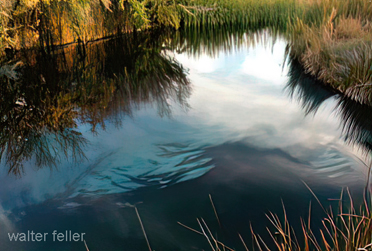
The extreme headwater of the Amargosa River-the last sixteen miles of the valley to the north-is appropriately called Oasis. It is situated just across the line, in Nye County, Nevada. In this extent of country there are innumerable large springs of hot and cold water. Their temperature varies, as does the properties of the water, and no doubt there are springs, when known, that contain great virtues or medical values. Many of the springs have a temperature of blood heat, while in the valley others go above and below and as low as the temperature of cool drinking water, which proved to be of superior quality. I would mention that I saw a spring that flowed at least one thousand inches of water; and another of less quantity which, by an attempt to test its depth with a long rope with a stone attached to the end, was ascertained to be over fifty feet deep.
Of that part of the valley known as the Oasis there is about 1,300 acres of beautiful meadow land densely covered with good quality of grass. The quality of the meadow land is superb and is composed of disintegrated or decomposed lava and decayed vegetation and is black as jet. The country far and near surrounding the Oasis Valley abounds with a variety of interest. The country for many miles in all directions is extremely dry, hence the attractions of grass and water, and the mutual ground upon which various tribes of Indians have congregated for many centuries (Brooks, 1970:17-20).
Other Settlers in the Beatty Area
When Nye County Deputy Sheriff George Nicholl rode out from the county seat at Belmont in the spring of 1890 on an exploratory foray into the "southern country," as the southern region of the county was sometimes called at that time, he passed six unnamed valleys (Zanjani, 1988:48). Though 1890 marks the traditional end of the American frontier, the southern country was still largely unsettled. The few prospectors and settlers who lived in the area were a different breed; more often than not, they seemed to prefer to be alone or with Indians. Their backgrounds were often a mystery because it was not polite in desert society to ask a person where he came from or why he was there. In 1892, one writer suggested that some residents of the Death Valley area had come to escape the Civil War draft. Others, he noted, may have been deserters from the army or wanted for arrest in other areas. Some, he said, had come "for the same reason that the old sailors drank whiskey-because they liked it" (Spears, 1892 [1977]:55-56).By 1890 George Lynch, George Davis and his family, John Howell, Jack Longstreet, and Montillus "Old Man" Beatty had settled in Oasis Valley. Not much is known about Lynch and Davis except that Lynch was not "at home" very much (Ritter, 1939 [1982]:1). In 1895 John Howell, the first known black resident of the Beatty area, tried his luck at ranching in Oasis Valley (Lingenfelter, 1986:168). Howell was no stranger at settling in the remote wilderness; with a partner, he had established the Spring Ranch at Las Vegas Springs as early as 1872 (Roske, 1986:38).
Andrew Jackson "Jack" Longstreet, a long-term resident of Nye County, was born in 1838, perhaps in Louisiana. Legend has it that Longstreet first showed up in the southern Nevada area in El Dorado on the Colorado River sometime prior to 1880 (Zanjani, 1988:12). He later owned a ranch in the Moapa Valley, and by 1890 had taken up a 160-acre homestead in the upper end of Oasis Valley. At that time he was one of three white men living in a 7000- square-mile area (Zanjani, 1988:48). Longstreet was said to have had five notches on his gun; and he wore long hair to cover his ears, both or one of which (sources differ) were said to have been cropped because of past indiscretions-perhaps horse thievery (Zanjani, 1988:12; 1987). Zanjani (1988:8) stated: "The men of Longstreet's day respected his extraordinary prowess with the long-barreled Colt .44 preferred by the old-time gunfighters, yet they distinguished him from that criminal underclass, often gamblers and sometimes thieves, to which many gunmen clearly belong. . . . Longstreet's killings were considered justified on grounds of self-defense." After leaving the Beatty area in the mid-1890s, Longstreet moved to Ash Meadows and later to sites in the Kawich and Monitor mountain ranges in northern Nye County.
"Old Man" Beatty (Montillus [Montillion] Murray Beatty), for whom Beatty is named, was a native of Iowa; he enlisted in the Union Army at Lyons, Iowa, on May 6,1861, and served in Company I, Second Iowa Infantry Regiment (Weight, 1972:13). He was discharged because of disability and came west after the Civil War. Beatty worked as a miner at Gold Mountain and in the Amargosa Valley. He acquired the Lander Ranch in spring 1896, not long after William Stockton's death. Beatty married a full-blooded Paiute woman and they had several children (Weight, 1972:13). He was described as a "generous, hardworking family man who made his ranch a welcome home to all who passed that way" (Lingenfelter, 1986:168).
Like many of his contemporaries in the area, Beatty chased tall tales of lost riches. There were legends that the forty-niners who had crossed the Amargosa were extremely wealthy and had buried as much as $200,000 in gold and jewels somewhere in the Amargosa Valley or Death Valley. When an Ash Meadows Paiute, Mary Scott, sold a prospector a solid gold watch that her father had found, it seemed proof of the legend. There were rumors that she also had a diamond bracelet and other fine jewelry. Prior to Beatty's acquisition of the Lander Ranch, he and Phi Lee searched for this treasure. They spent considerable time digging at old campsites, but found nothing except old wagon iron and broken china (Lingenfelter, 1986:171).
Beatty sold his ranch and its springs in 1906 to the bullfrog Water, Power, and Light Company for $10,000 (Weight, 1972:13) and began a new ranch at Cow Creek in Death Valley. He continued to dabble in mining until his death in December 1908 (Lingenfelter, 1986:168).
The Beatty Area at the Turn of the Century
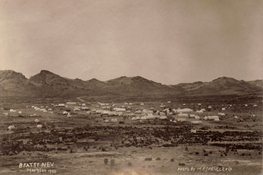
By early 1900, the area was still very much frontier. "Old Man" Beatty and his family occupied the stone house on his place at the lower end of Oasis Valley and John Howell was farther up the valley. Farther south there were a few settlers at Ash Meadows, with a couple of large ranches and a handful of smaller operations in both the Pahrump and Las Vegas valleys. There was a ranch at Indian Springs. More than 150 miles to the northeast as the crow flies, the mining town of Pioche, founded in the late 1860s, was past its prime as was Hiko, 100 miles from Beatty, at the north end of the Pahranagat Valley. A few ranchers were well established in the Pahranagat Valley. The first community east of Beatty that was more than a bar, a post office, and a one-room schoolhouse was Delamar, which was 50 miles south of Pioche. Belmont, 125 miles north of Beatty, was also past its prime and Tonopah's silver and Goldfield's gold had not yet been discovered. Across Death Valley, on the west side of the Panamints, the 1870s boom camp of Panamint had long since faded. The Harmony Borax Works in Death Valley were closed and the profitable days of mining playa borax had passed (Lingenfelter, 1986:186).A gold rush of some significance had begun in the last decade of the nineteenth century in the Death Valley area located to the west and south of Oasis Valley and the bullfrog Hills. Gold had been found in the hills separating the Amargosa and Pahrump valleys in the 1890s and there were several gold camps in the Panamints, the most important of which was Ballarat, named after the famous Australian gold rush camp of the 1850s. Nearly 300 men were working in the ballarat area by 1900 (Lingenfelter, 1986: 199-201). Miners and prospectors, always on the alert for new and better opportunities, left ballarat nearly deserted when news of Jim Butler's discovery at Tonopah got around; the town never really recovered (Lingenfelter, 1986:200). The Tonopah discovery set off a rush of excitement and led to a boom in southern Nevada. People flocked to the area; prospectors took to the hills. Hopes rose at the thought of new discoveries of gold that might be made and the wealth that would inevitably come through investing in mining in America's last frontier, where, with a little luck, an average person could get rich quick. Ultimately, the prospectors took their pleasures in finding the riches the earth held; the promotors of the prospectors' discoveries would be right behind the prospectors, heralding the importance of the discoveries, often as not taking their pleasures in the mining of the pockets of investors as much as the deposits of gold and silver.
https://creativecommons.org/licenses/by-nc-nd/3.0/legalcode https://ia800501.us.archive.org/11/items/AHistoryOfBeatty/beatty2.pdf
BEATTY, NEVADA
by Robert D. McCracken
Nye County Press
Tonopah NEVADA
The Land and Early Inhabitants
Exploration and Settlement
The Boom Is On
Beatty Beginnings
The Late 1920s to World War II
Ash Meadows
Skidoo - Death Valley
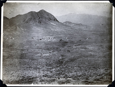
Beatty, Nv. 1905
Tidewater & Tonopah RR
Tonopah, Nevada (UNLV photo)
T&TRR bed - Silver Lake Jan. 2011
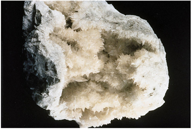
Colemanite (USGS photo)
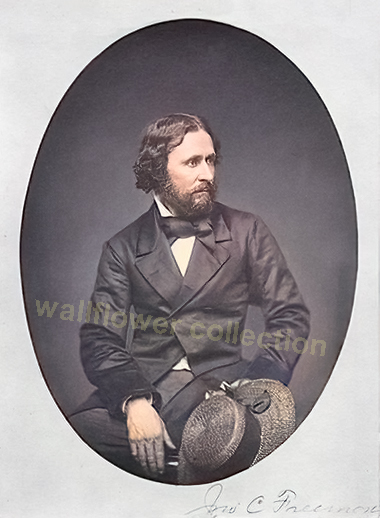
John C. Fremont
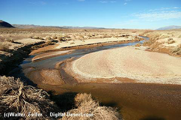
Amargosa River south of Death Valley Junction
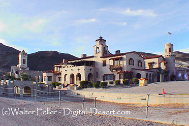
Scotty's Castle
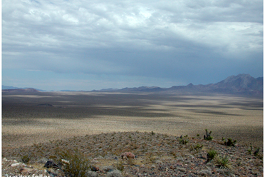
Emigrant Pass looking east