Introduction

Kelso Wash Mojave National Preserve
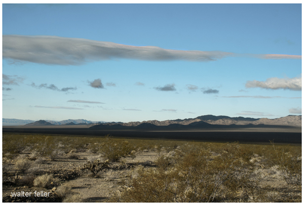
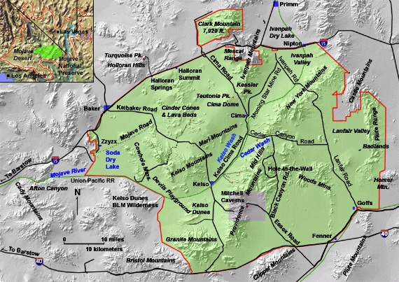
Hundreds of thousands of people drive on Interstate 15 between Los Angeles and Las Vegas every week, but less than one percent of these travelers leave the main road to see the desert scenery and give a thought to where it came from. Still, even a short stop will please the travelers with its wonderful desert landscapes. These pages try to supply introductory information on how several landscape features were formed in the Mojave National Preserve and surrounding regions. Figure 1 below shows locations for many of the landscape features discussed in the accompanying pages.

Map of Mojave National Preserve Map of the Mojave National Preserve and surrounding area.
Many natural factors and processes help shape landforms in deserts. This includes the characteristics of bedrock and the current and past weather conditions, as well as the changing plant communities. The landscape shows the combined effects of geological forces or events that have happened over millions of years. But faulting, volcanic activity, and erosion in the past million years, most of all due to changes in weather patterns over the last 20,000 years, have greatly altered the appearance of the Mojave Desert today. The following pages discuss how the climate interacts with the geological features and history of the Mojave Desert area, mainly looking at the Mojave National Preserve. Knowledge of the region's climate history, landforms, and physical features and processes impacting earth materials is important for knowing how the Mojave Desert landscape and the ecosystem that it supports are changing.
12-17-2024
CONTENTS
Introduction
Physiography
Weather Data
Geologic History
Changing Climates
Weathering & Erosion
Carbonate Rocks
Granitic Rocks
Volcanic Rocks
Faults
Pediments
Stream Channels
Stream Terraces
The Mojave River
Playas
Sand Dunes
Human Impacts
References
Next > Physiography
Related Pages/Indexes