Kiavah >> Map #45
Kiavah Wilderness
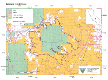
SIZE: 88,290 acres
LOCATION: Kern County; 15 miles west of Ridgecrest, California
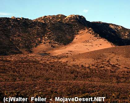
NATURAL RESOURCES: This wilderness encompasses the eroded hills,
canyons and bajadas of the Scodie Mountains Unit within the
Sequoia National Forest -- the southern extremity of the
Sierra Nevada Mountains. A unique mixing of several different species of
plants and animals occurs within the
ecosystem
transition between the
Mojave Desert and Sierra Nevada Mountains. Desert plants such as
creosote bush,
Joshua tree,
burro bush and shadescale may be found in close
association with
pinyon pine,
juniper, canyon oak and digger/grey pine.
The varied vegetation provides
habitat for a great diversity of
wildlife
over a small geographic area. Species of note include
raptors, the
yellow-eared pocket mouse, a
variety of lizards
and a number of
migrant and
resident bird species. This wilderness is part of a
National Cooperative Land and Wildlife Management Area and the
BLM Jawbone Butterbredt Area of Critical Environmental Concern, which
was designated to protect outstanding
wildlife and
Native American
values.
| GLOSSARY | > bajada, canyon, ecosystem, |
ACCESS: Access this wilderness from the north via Kelso Valley Road from State Highway 178 west of Inyokern; and from the east via State Highway 14 and numerous routes into Cow Heaven Canyon (SC5 1), Sage Canyon (SC56) and Horse Canyon (SC65), which are four-wheel drive only, and Bird Spring Pass Road (SC120).

Kiavah Wilderness
Ecosystem Sections
Sierra Nevada
Mojave Desert
Prehistory Culture
Kawaiisu
The Kawaiisu were of Shoshonean lineage who spoke the Southern Numic subgroup of the ...
